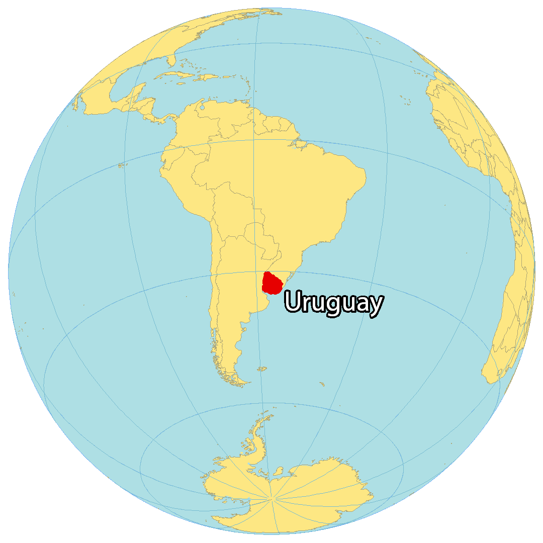
Covering an area of 176,000 sq.km (68,037 sq mi), Uruguay, located in Southern South America, is the 2nd smallest nation in South America.
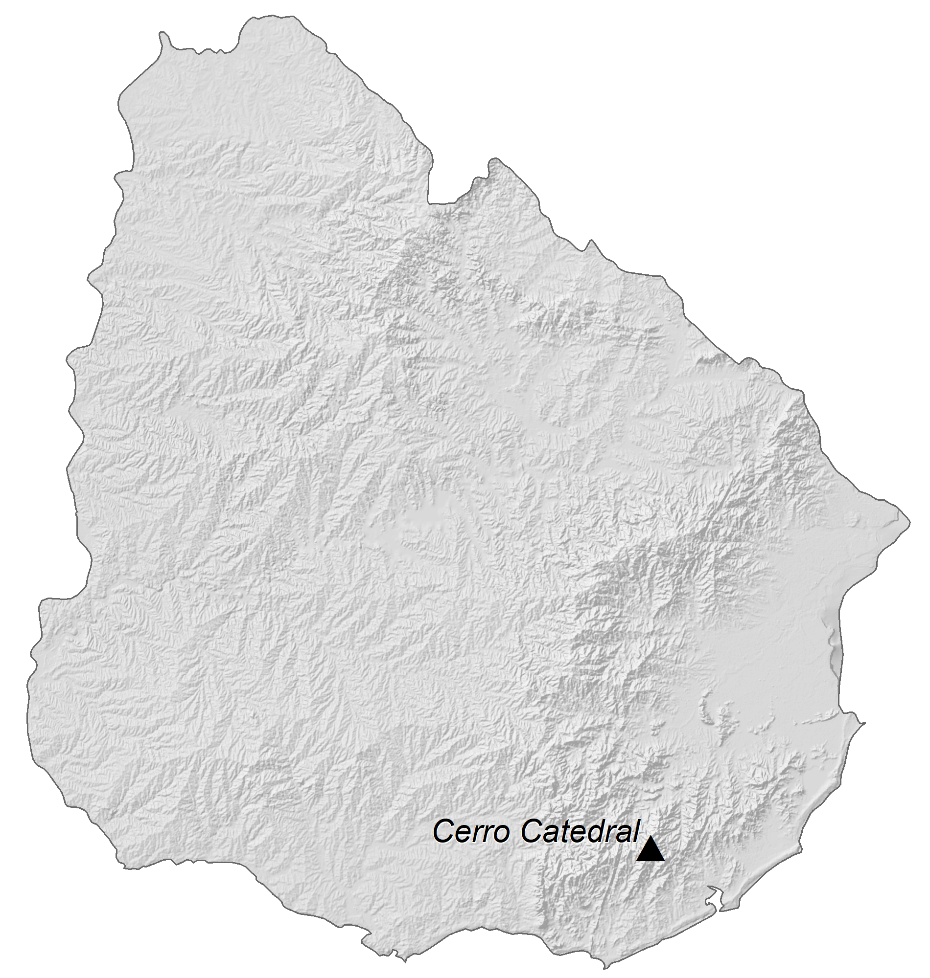
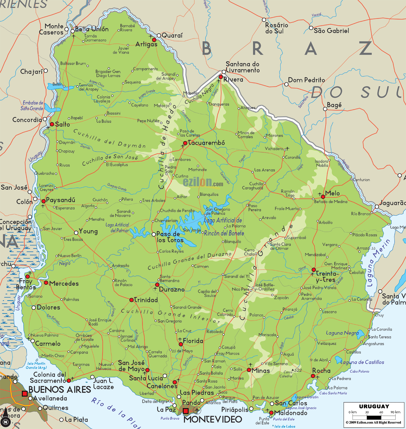
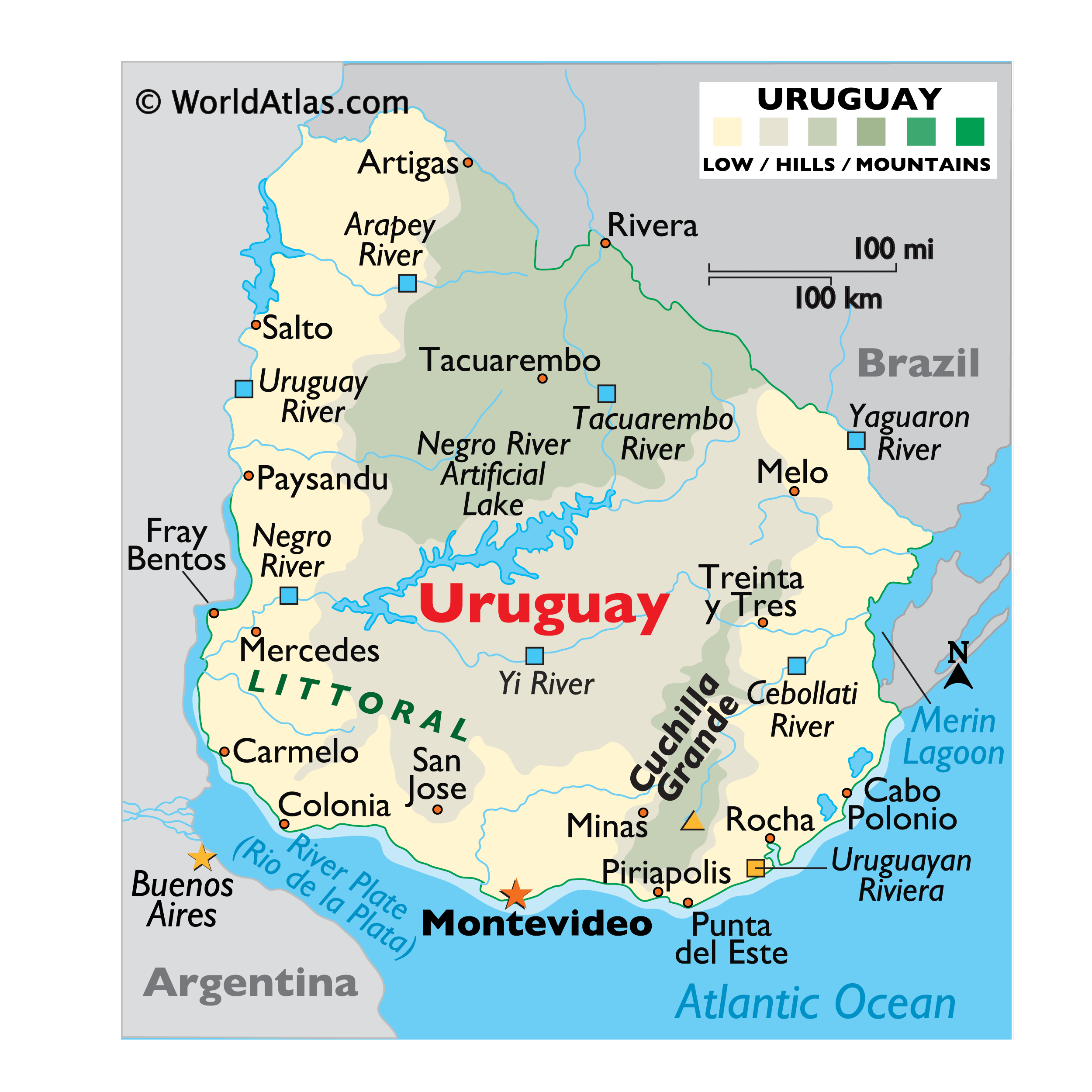
The eastern, southern and western plains in Uruguay eventually flow into the rolling hills and low mountains of the interior. In the southwest, the flat lowlands between the coastline and hills (Littoral) merge more gradually into the hilly interior.
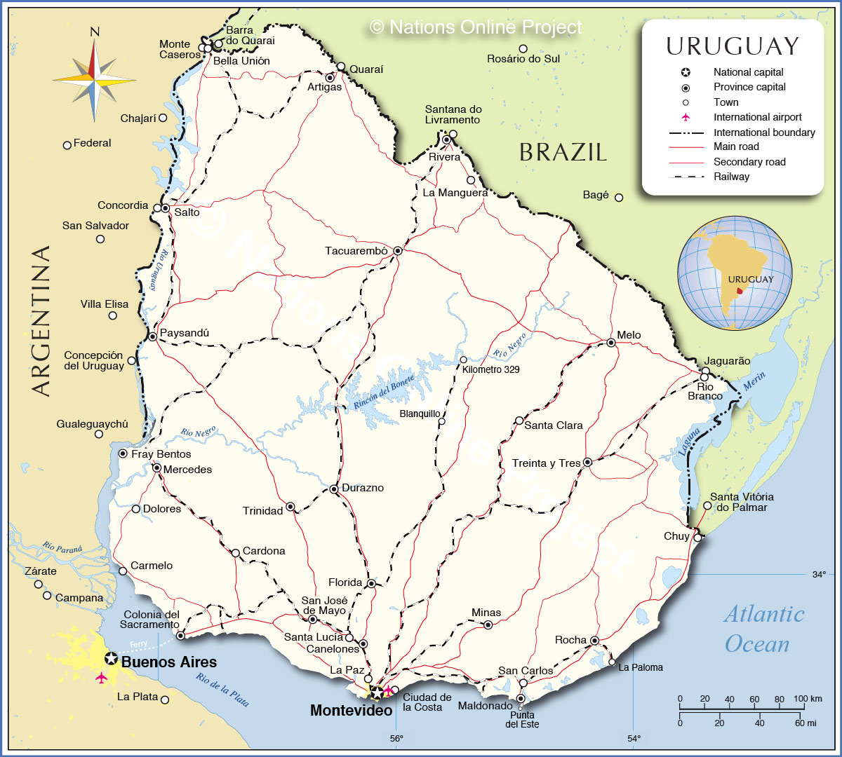
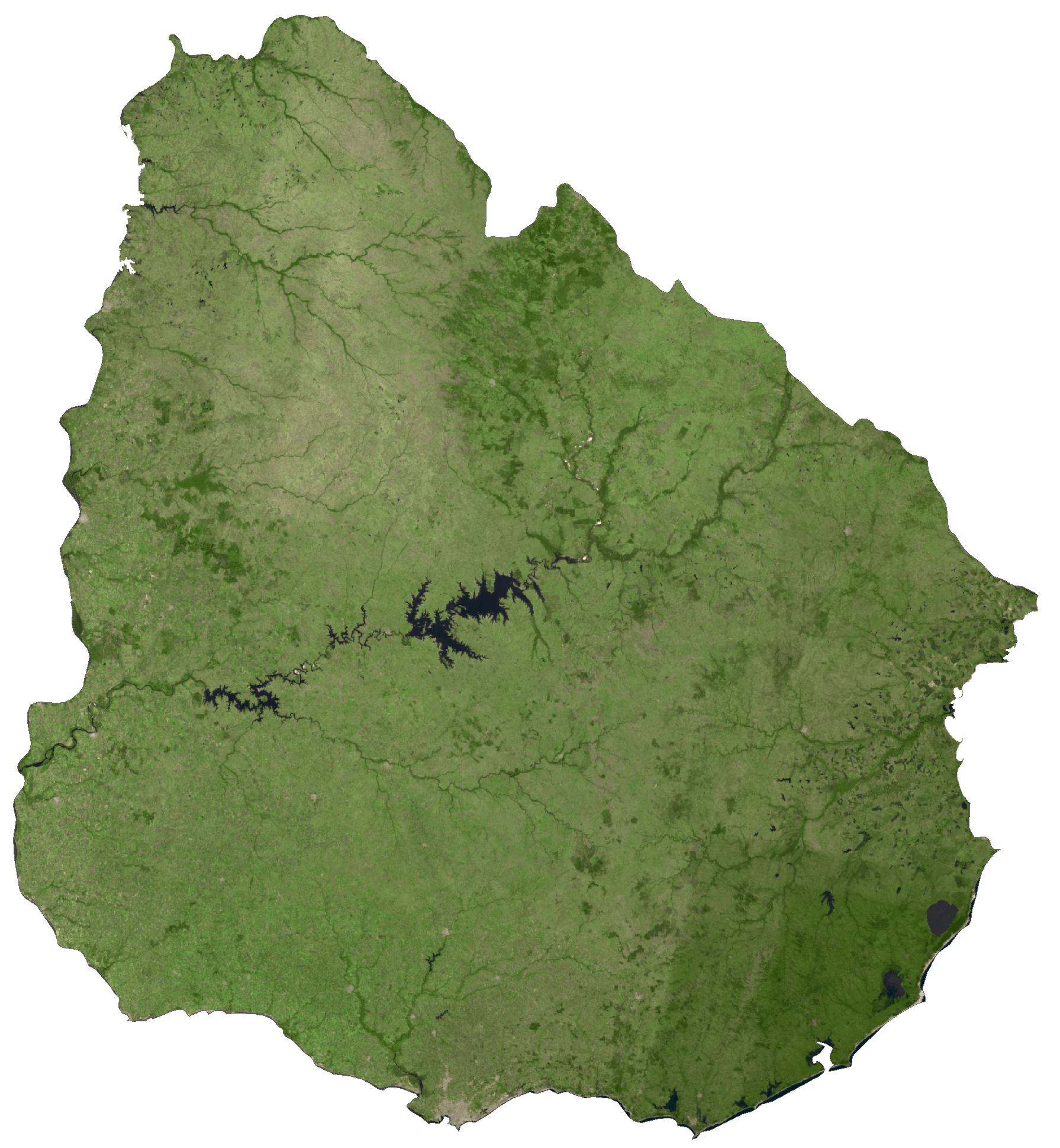
The country’s highest point – Cerro Catedral at 1,686 ft (514m) [as marked on the map as an upright yellow triangle], is situated in the Sierra Carape hill range.
Along the Atlantic, near Montevideo – the capital city, sandy beaches ring the coastline. In the east – from Punta del Este to Cabo Polonio – the coastal plain is sandy, marshy, and broken by a few bays and lagoons.
In the north, a series of low mountains run north into the highlands of Brazil. In the east, a narrow band of low mountains extends from the coastal areas through Treinta y Tres. In this land of rivers, major ones include the Uruguay, which flows south along its entire border with Argentina, into the River Plate (Rio de la Plata; the Negro, and the Yi (its largest tributary); the Cebollati, and the Yaguaron on the border with Brazil.
The Rio de la Plata – an estuary of the Uruguay River, forms the western border of the country. Formed by dams on the Negro, a huge artificial lake extends across the center of the country.
| Flag: |  |
|---|---|
| Legal Name: | Oriental Republic of Uruguay |
| Capital Value: | Montevideo |
| Largest City: |
Montevideo (1,752,388) |
| Demonym(s): | Uruguayan |
| Government: | Unitary presidential republic |
| Legislature: | General Assembly |
| Total Area: | 176,215 km² |
| Land Area: | 175,015 km² |
| Water Area: | 1,200 km² |
| Population: | 3,461,734 |
| Density: | 19.8/km (51.3/sq mi) (206th) |
| GDP: | $56.05 Billion |
| GDP Per Capita: | $16,190.13 |
| Currency Value: | Uruguayan pesos (UYU) |
| Driving side: | right |
| Calling code: | +598 |
| Internet TLD: | .uy |
Uruguay is a beautiful country located in South America along the Atlantic Ocean. From its stunning cities, towns, highways, roads, lakes, and rivers, it is a paradise for travelers. With satellite imagery and an elevation map, you can explore and appreciate the natural beauty of Uruguay.
Online Interactive Political Map
Click on ![]() to view map in "full screen" mode.
to view map in "full screen" mode.
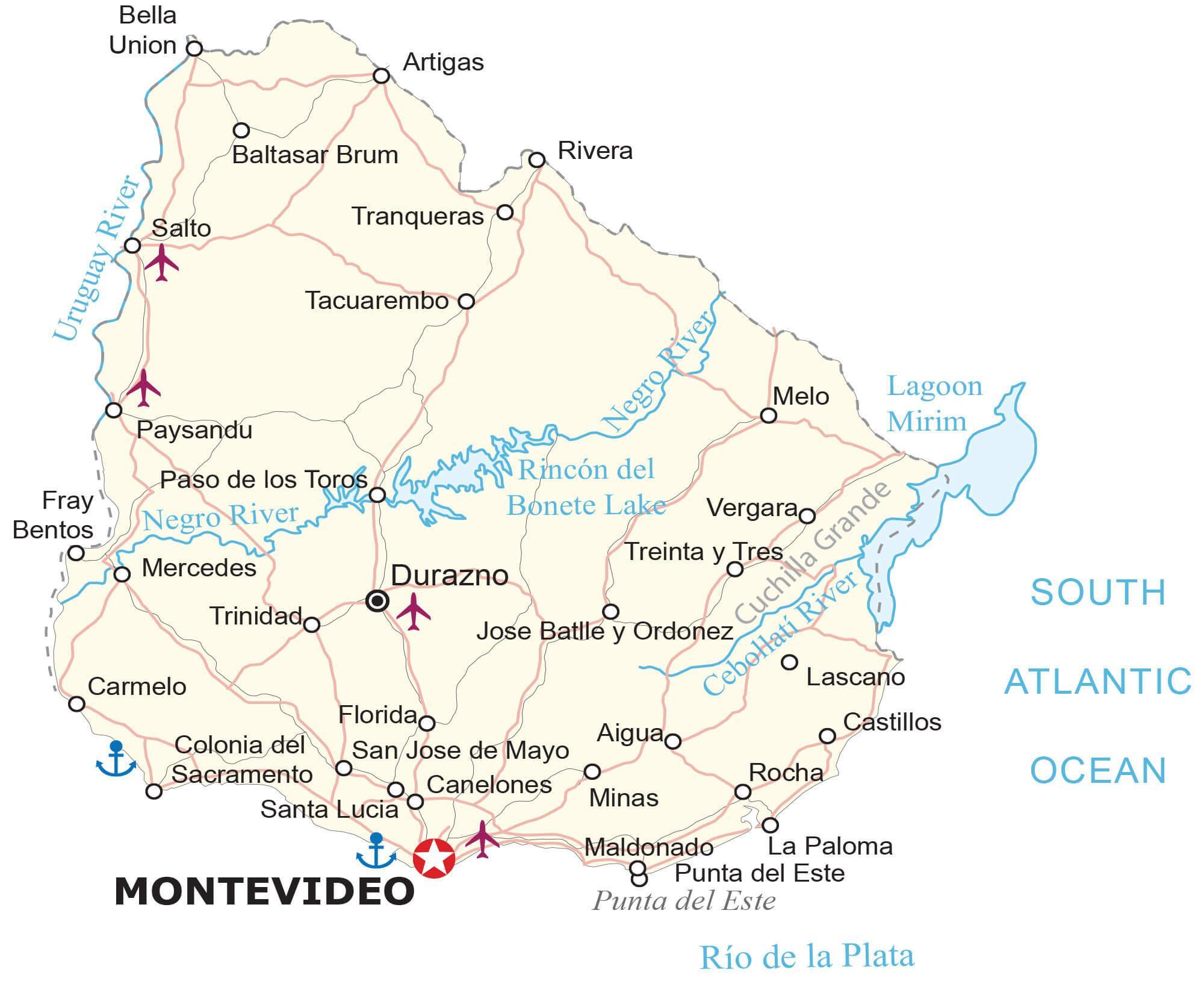
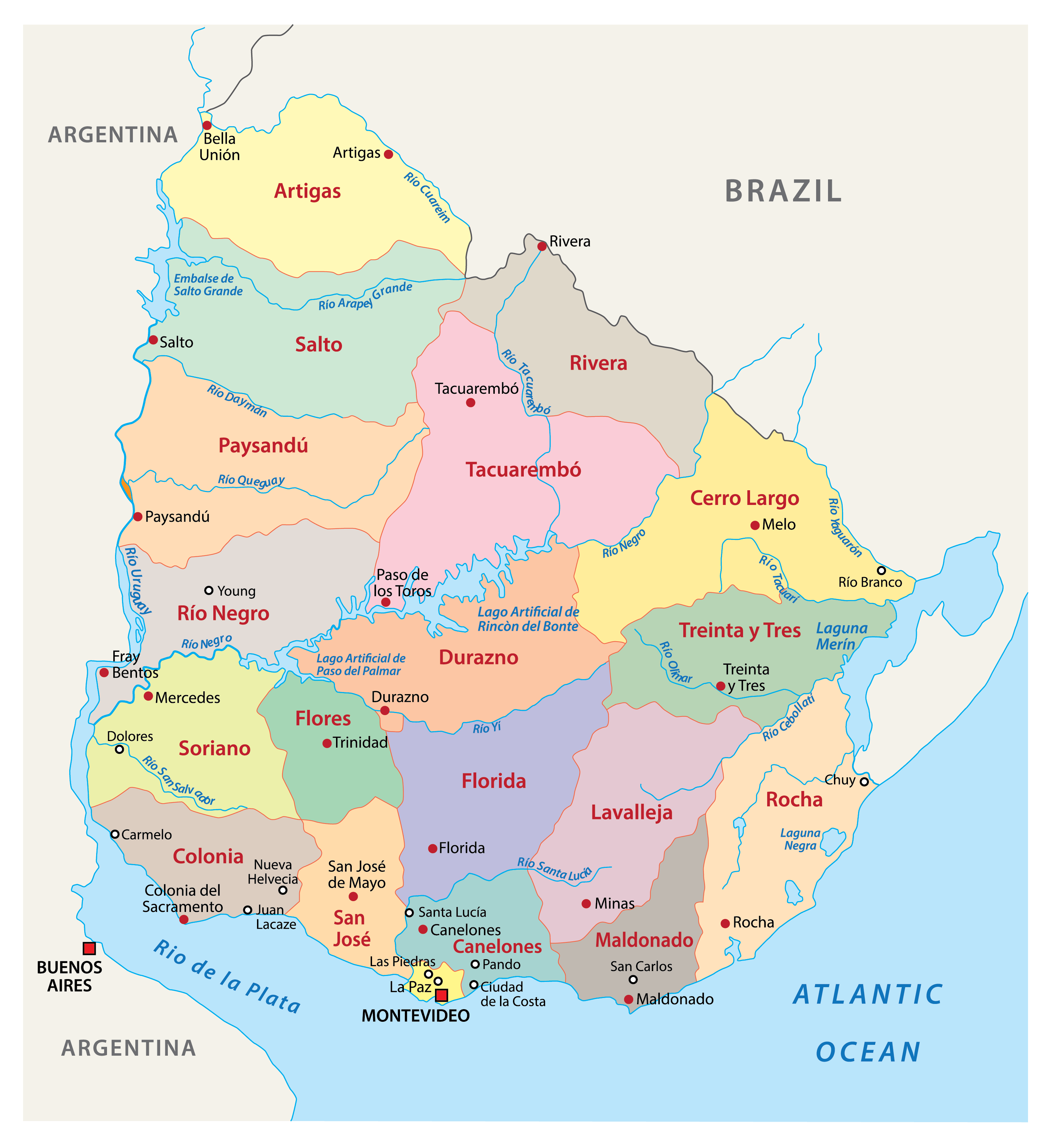
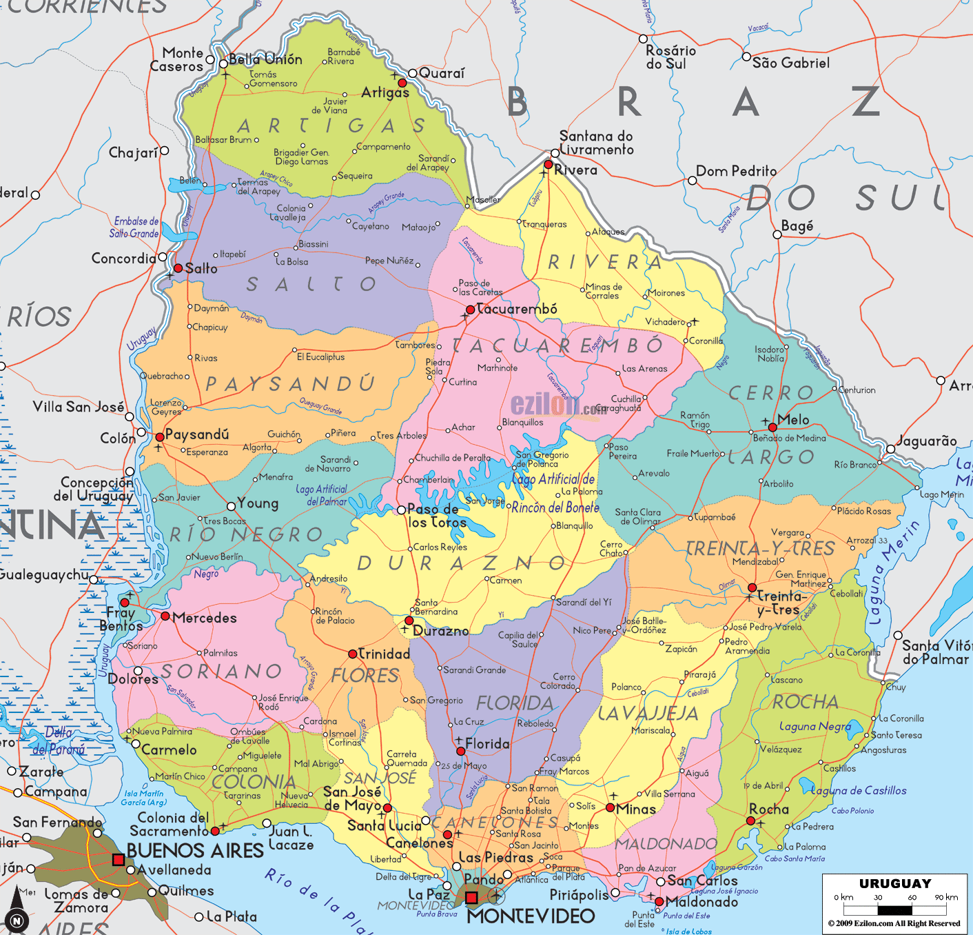
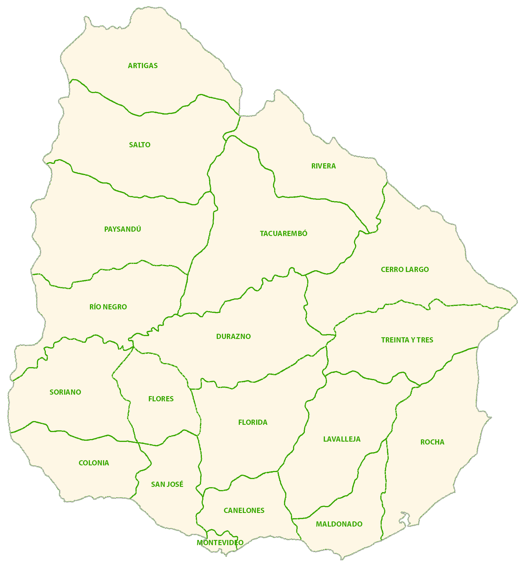
Uruguay (officially, the Oriental Republic of Uruguay) is divided into 19 departments (departamentos, singular – departamento). In alphabetical order, the departments are: Artigas, Canelones, Cerro Largo, Colonia, Durazno, Flores, Florida, Lavalleja, Maldonado, Montevideo, Paysandu, Rio Negro, Rivera, Rocha, Salto, San Jose, Soriano, Tacuarembo and Treinta y Tres. These departments are further subdivided into a total of 112 municipalities.
Covering an area of 176,000 sq.km, Uruguay is South America’s 2nd smallest nation. Located in the southern part of the country, on the northeastern shore of the Rio de la Plata estuary is, Montevideo – the capital, the largest and the most populous city of Uruguay. Montevideo is the southernmost capital city in the Americas and the chief port as well as the cultural, educational, commercial and financial center of Uruguay.
Location Maps
Where is Uruguay?
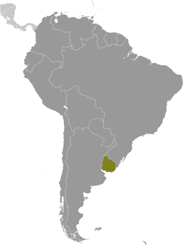
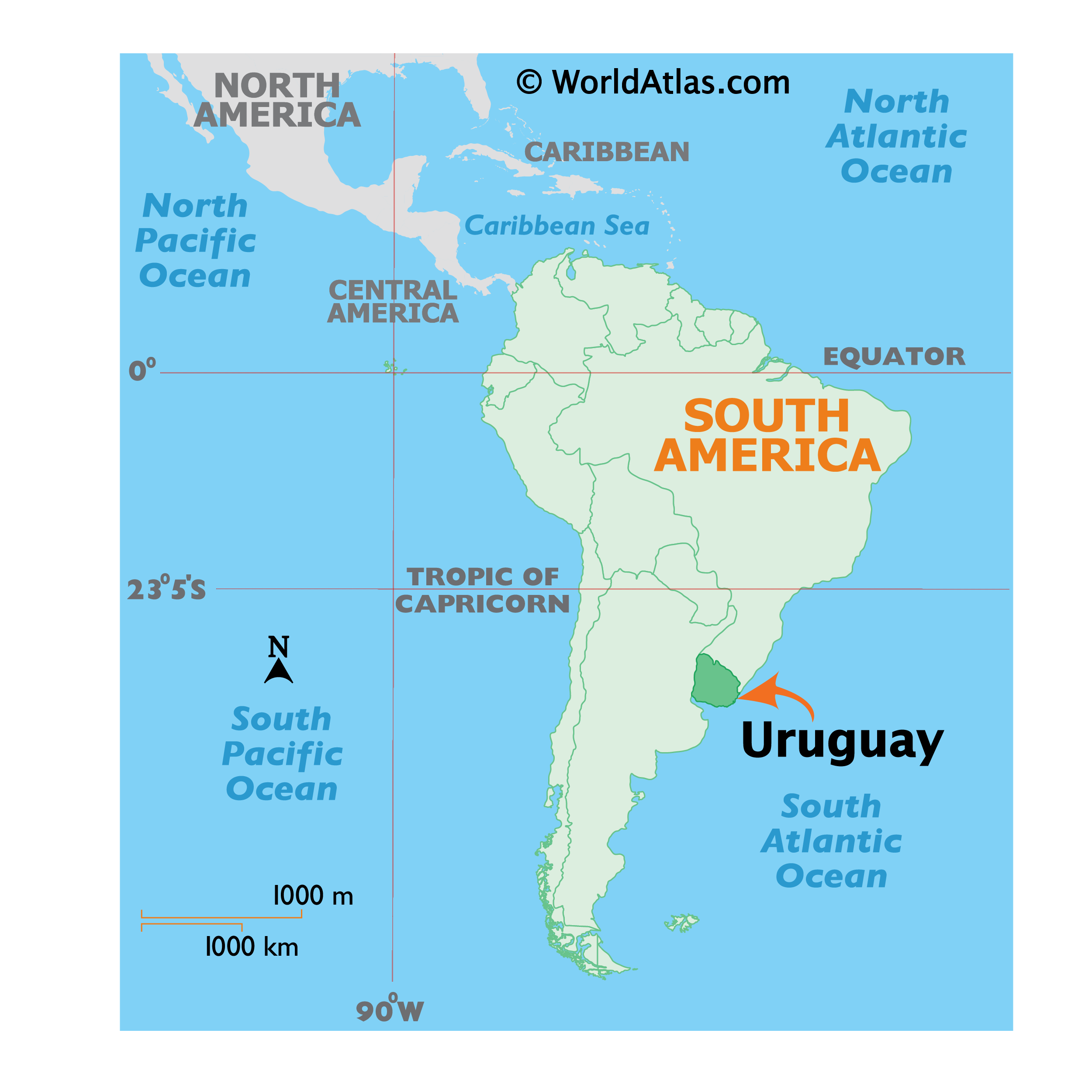
Uruguay is located in the southern hemisphere of South America, between Argentina to the west and Brazil to the north. It is situated along the Atlantic Ocean to the east, adjacent to the Rio de la Plata in the south. The country is renowned for its ranching, beaches, tango, soccer, beef, and high living standards. Montevideo, the capital and largest city of Uruguay, is the southernmost capital of South America. Other major cities include Salto, Paysandu, and Las Piedras.
High Definition Political Map of Uruguay
Uruguay Administrative Map
History
Pre-colonial
Uruguay was first inhabited around 13,000 years ago by hunter-gatherers. It is estimated that at the time of the first contact with Europeans in the 16th century there were about 9,000 Charrúa and 6,000 Chaná and some Guaraní island-settlements.
There is an extensive archeological collection of man-made tumuli known as “Cerritos de Indios” in the eastern part of the country, some of them dating back to 5,000 years ago. Very little is known about the people who built them as they left no written record, but evidence has been found in place of pre-Columbian agriculture and of extinct pre-Columbian dogs.
In 1831 Fructuoso Rivera, Uruguay’s first president, organized the final strike of the Charrua genocide, eradicating the last remnants of the Uruguayan native population in the Salsipuedes Massacre.
Early colonization
The Portuguese were the first Europeans to enter the region of present-day Uruguay in 1512. The Spanish arrived in present-day Uruguay in 1516. The indigenous peoples’ fierce resistance to conquest, combined with the absence of gold and silver, limited European settlement in the region during the 16th and 17th centuries. Uruguay then became a zone of contention between the Spanish and Portuguese empires. In 1603, the Spanish began to introduce cattle, which became a source of wealth in the region. The first permanent Spanish settlement was founded in 1624 at Soriano on the Río Negro. In 1669–71, the Portuguese built a fort at Colonia del Sacramento (Colônia do Sacramento).
Montevideo was founded by the Spanish in the early 18th century as a military stronghold in the country. Its natural harbor soon developed into a commercial area competing with Río de la Plata’s capital, Buenos Aires. Uruguay’s early 19th-century history was shaped by ongoing fights for dominance in the Platine region, between British, Spanish, Portuguese and other colonial forces. In 1806 and 1807, the British army attempted to seize Buenos Aires and Montevideo as part of the Napoleonic Wars. Montevideo was occupied by a British force from February to September 1807.
Independence struggle
In 1811, José Gervasio Artigas, who became Uruguay’s national hero, launched a successful revolt against the Spanish authorities, defeating them on 18 May at the Battle of Las Piedras.
In 1813, the new government in Buenos Aires convened a constituent assembly where Artigas emerged as a champion of federalism, demanding political and economic autonomy for each area, and for the Banda Oriental in particular. The assembly refused to seat the delegates from the Banda Oriental, however, and Buenos Aires pursued a system based on unitary centralism.
As a result, Artigas broke with Buenos Aires and besieged Montevideo, taking the city in early 1815. Once the troops from Buenos Aires had withdrawn, the Banda Oriental appointed its first autonomous government. Artigas organized the Federal League under his protection, consisting of six provinces, four of which later became part of Argentina.
In 1816, a force of 10,000 Portuguese troops invaded the Banda Oriental from Brazil; they took Montevideo in January 1817. After nearly four more years of struggle, the Portuguese Kingdom of Brazil annexed the Banda Oriental as a province under the name of “Cisplatina”. The Brazilian Empire became independent of Portugal in 1822. In response to the annexation, the Thirty-Three Orientals, led by Juan Antonio Lavalleja, declared independence on 25 August 1825 supported by the United Provinces of the Río de la Plata (present-day Argentina). This led to the 500-day-long Cisplatine War. Neither side gained the upper hand and in 1828 the Treaty of Montevideo, fostered by the United Kingdom through the diplomatic efforts of Viscount John Ponsonby, gave birth to Uruguay as an independent state. 25 August is celebrated as Independence Day, a national holiday. The nation’s first constitution was adopted on 18 July 1830.
19th century
At the time of independence, Uruguay had an estimated population of just under 75,000. The political scene in Uruguay became split between two parties: the conservative Blancos (Whites) headed by the second President Manuel Oribe, representing the agricultural interests of the countryside; and the liberal Colorados (Reds) led by the first President Fructuoso Rivera, representing the business interests of Montevideo. The Uruguayan parties received support from warring political factions in neighboring Argentina, which became involved in Uruguayan affairs.
The Colorados favored the exiled Argentine liberal Unitarios, many of whom had taken refuge in Montevideo while the Blanco president Manuel Oribe was a close friend of the Argentine ruler Manuel de Rosas. On 15 June 1838, an army led by the Colorado leader Rivera overthrew President Oribe, who fled to Argentina. Rivera declared war on Rosas in 1839. The conflict would last 13 years and become known as the Guerra Grande (the Great War).
In 1843, an Argentine army overran Uruguay on Oribe’s behalf but failed to take the capital. The siege of Montevideo, which began in February 1843, would last nine years. The besieged Uruguayans called on resident foreigners for help, which led to a French and an Italian legion being formed, the latter led by the exiled Giuseppe Garibaldi.
In 1845, Britain and France intervened against Rosas to restore commerce to normal levels in the region. Their efforts proved ineffective and, by 1849, tired of the war, both withdrew after signing a treaty favorable to Rosas. It appeared that Montevideo would finally fall when an uprising against Rosas, led by Justo José de Urquiza, governor of Argentina’s Entre Ríos Province, began. The Brazilian intervention in May 1851 on behalf of the Colorados, combined with the uprising, changed the situation and Oribe was defeated. The siege of Montevideo was lifted and the Guerra Grande finally came to an end. Montevideo rewarded Brazil’s support by signing treaties that confirmed Brazil’s right to intervene in Uruguay’s internal affairs.
In accordance with the 1851 treaties, Brazil intervened militarily in Uruguay as often as it deemed necessary. In 1865, the Triple Alliance was formed by the emperor of Brazil, the president of Argentina, and the Colorado general Venancio Flores, the Uruguayan head of government whom they both had helped to gain power. The Triple Alliance declared war on the Paraguayan leader Francisco Solano López and the resulting Paraguayan War ended with the invasion of Paraguay and its defeat by the armies of the three countries. Montevideo, which was used as a supply station by the Brazilian navy, experienced a period of prosperity and relative calm during the war.
The first railway line was assembled in Uruguay in 1867 with the opening of a branch consisting of a horse-drawn train. The present-day State Railways Administration of Uruguay maintains 2,900 kms of extendable railway network.
The constitutional government of General Lorenzo Batlle y Grau (1868–72) suppressed the Revolution of the Lances by the Blancos. After two years of struggle, a peace agreement was signed in 1872 that gave the Blancos a share in the emoluments and functions of government, through control of four of the departments of Uruguay.
This establishment of the policy of co-participation represented the search for a new formula of compromise, based on the coexistence of the party in power and the party in opposition.
Despite this agreement, Colorado rule was threatened by the failed Tricolor Revolution in 1875 and the Revolution of the Quebracho in 1886.
The Colorado effort to reduce Blancos to only three departments caused a Blanco uprising of 1897, which ended with the creation of 16 departments, of which the Blancos now had control over six. Blancos were given ⅓ of seats in Congress. This division of power lasted until the President Jose Batlle y Ordonez instituted his political reforms which caused the last uprising by Blancos in 1904 that ended with the Battle of Masoller and the death of Blanco leader Aparicio Saravia.
Between 1875 and 1890, the military became the center of power. During this authoritarian period, the government took steps toward the organization of the country as a modern state, encouraging its economic and social transformation. Pressure groups (consisting mainly of businessmen, hacendados, and industrialists) were organized and had a strong influence on government. A transition period (1886–90) followed, during which politicians began recovering lost ground and some civilian participation in government occurred.
After the Guerra Grande, there was a sharp rise in the number of immigrants, primarily from Italy and Spain. By 1879, the total population of the country was over 438,500. The economy reflected a steep upswing (if demonstrated graphically, above all other related economic determinants), in livestock raising and exports. Montevideo became a major economic center of the region and an entrepôt for goods from Argentina, Brazil and Paraguay.
20th century
The Colorado leader José Batlle y Ordóñez was elected president in 1903. The following year, the Blancos led a rural revolt and eight bloody months of fighting ensued before their leader, Aparicio Saravia, was killed in battle. Government forces emerged victorious, leading to the end of the co-participation politics that had begun in 1872. Batlle had two terms (1903–07 and 1911–15) during which, taking advantage of the nation’s stability and growing economic prosperity, he instituted major reforms, such as a welfare program, government participation in many facets of the economy, and a plural executive.
Gabriel Terra became president in March 1931. His inauguration coincided with the effects of the Great Depression, and the social climate became tense as a result of the lack of jobs. There were confrontations in which police and leftists died. In 1933, Terra organized a coup d’état, dissolving the General Assembly and governing by decree. A new constitution was promulgated in 1934, transferring powers to the president. In general, the Terra government weakened or neutralized economic nationalism and social reform.
In 1938, general elections were held and Terra’s brother-in-law, General Alfredo Baldomir, was elected president. Under pressure from organized labor and the National Party, Baldomir advocated free elections, freedom of the press, and a new constitution. Although Baldomir declared Uruguay neutral in 1939, British warships and the German ship Admiral Graf Spee fought a battle not far off Uruguay’s coast. The Admiral Graf Spee took refuge in Montevideo, claiming sanctuary in a neutral port, but was later ordered out.
In the late 1950s, partly because of a worldwide decrease in demand for Uruguyan agricultural products, Uruguayans suffered from a steep drop in their standard of living, which led to student militancy and labor unrest. An armed group, known as the Tupamaros emerged in the 1960s, engaging in activities such as bank robbery, kidnapping and assassination, in addition to attempting an overthrow of the government.
Civic-military and Dictatorship regime
President Jorge Pacheco declared a state of emergency in 1968, followed by a further suspension of civil liberties in 1972. In 1973, amid increasing economic and political turmoil, the armed forces, asked by the President Juan María Bordaberry, disbanded Parliament and established a civilian-military regime. The CIA-backed campaign of political repression and state terror involving intelligence operations and assassination of opponents was called Operation Condor. The media were censored or banned, the trade union movement was destroyed and tons of books were burned after the banning of some writers’ works. People on file as opponents of the regime were excluded from the civil service and from education. According to one source, around 180 Uruguayans are known to have been killed and disappeared, with thousands more illegally detained and tortured during the 12-year civil-military rule of 1973 to 1985. Most were killed in Argentina and other neighboring countries, with 36 of them having been killed in Uruguay. According to Edy Kaufman (cited by David Altman), Uruguay at the time had the highest per capita number of political prisoners in the world. “Kaufman, who spoke at the U.S. Congressional Hearings of 1976 on behalf of Amnesty International, estimated that one in every five Uruguayans went into exile, one in fifty were detained, and one in five hundred went to prison (most of them tortured).” Social spending was reduced and many state-owned companies were privatized. However, the economy did not improve and deteriorated after 1980, the GDP fell by 20% and unemployment rose to 17%. The state intervened by trying to bail out failing companies and banks.
Return to democracy (1984–present)
A new constitution, drafted by the military, was rejected in a November 1980 referendum. Following the referendum, the armed forces announced a plan for the return to civilian rule, and national elections were held in 1984. Colorado Party leader Julio María Sanguinetti won the presidency and served from 1985 to 1990. The first Sanguinetti administration implemented economic reforms and consolidated democracy following the country’s years under military rule.
The National Party’s Luis Alberto Lacalle won the 1989 presidential election and amnesty for human rights abusers was endorsed by referendum. Sanguinetti was then re-elected in 1994. Both presidents continued the economic structural reforms initiated after the reinstatement of democracy and other important reforms were aimed at improving the electoral system, social security, education, and public safety.
The 1999 national elections were held under a new electoral system established by a 1996 constitutional amendment. Colorado Party candidate Jorge Batlle, aided by the support of the National Party, defeated Broad Front candidate Tabaré Vázquez. The formal coalition ended in November 2002, when the Blancos withdrew their ministers from the cabinet, although the Blancos continued to support the Colorados on most issues. On the economic front, the Batlle government (2000–2005) began negotiations with the United States to create the “Free Trade Area of the Americas” (FTAA). The period marked the culmination of a process aimed at a neoliberal reorientation of the country’s economy: deindustrialization, pressure on wages, growth of informal work, etc. Low commodity prices and economic difficulties in Uruguay’s main export markets (starting in Brazil with the devaluation of the real, then in Argentina in 2002), caused a severe recession; the economy contracted by 11%, unemployment climbed to 21%, and the percentage of Uruguayans in poverty rose to over 30%.
In 2004, Uruguayans elected Tabaré Vázquez as president, while giving the Broad Front a majority in both houses of Parliament. Vázquez stuck to economic orthodoxy. As commodity prices soared and the economy recovered from the recession, he tripled foreign investment, cut poverty and unemployment, cut public debt from 79% of GDP to 60%, and kept inflation steady.
In 2009, José Mujica, a former left-wing guerrilla leader (Tupamaros) who spent almost 15 years in prison during the country’s military rule, emerged as the new president as the Broad Front won the election for a second time. Abortion was legalized in 2012, followed by same-sex marriage and cannabis in the following year.
In 2014, Tabaré Vázquez was elected to a non-consecutive second presidential term, which began on 1 March 2015. In 2020, he was succeeded by Luis Alberto Lacalle Pou, member of the conservative National Party, after 15 years of left-wing rule, as the 42nd President of Uruguay.
Physical Map of Uruguay
Uruguay Satellite Map
Elevation Map