Seguin (/sɪˈɡiːn/ sih-GEEN) is a city in and the county seat of Guadalupe County, Texas, United States; as of the 2020 census, its population was 29,433. Its economy is primarily supported by a regional hospital, as well as the Schertz-Seguin Local Government Corporation water-utility, that supplies the surrounding Greater San Antonio areas from nearby aquifers as far as Gonzales County. Several dams in the surrounding area are governed by the main offices of the Guadalupe-Blanco River Authority, headquartered in downtown Seguin.
Seguin, named in honor of Juan Seguín, a Tejano Texian freedom fighter and early supporter of the Republic of Texas, is one of the oldest towns in Texas, founded just 16 months after the Texas Revolution began. The frontier settlement was a cradle of the Texas Rangers and home to the celebrated Captain Jack Hays, perhaps the most famous Ranger of all. At this time, the Seguin area was a part of Gonzales County, the remaining portion known as present-day Belmont. The Rangers had found this was a good halfway stop between their patrol points. It had been maintained as a base camp by the Rangers since the early founding of the Dewitt Colony.
| Name: | Seguin city |
|---|---|
| LSAD Code: | 25 |
| LSAD Description: | city (suffix) |
| State: | Texas |
| County: | Guadalupe County |
| Elevation: | 522 ft (159 m) |
| Total Area: | 38.48 sq mi (99.65 km²) |
| Land Area: | 38.28 sq mi (99.14 km²) |
| Water Area: | 0.20 sq mi (0.51 km²) |
| Total Population: | 29,433 |
| Population Density: | 783.51/sq mi (302.51/km²) |
| Area code: | 830 |
| FIPS code: | 4866644 |
| GNISfeature ID: | 1346881 |
| Website: | www.seguintexas.gov |
Online Interactive Map
Click on ![]() to view map in "full screen" mode.
to view map in "full screen" mode.
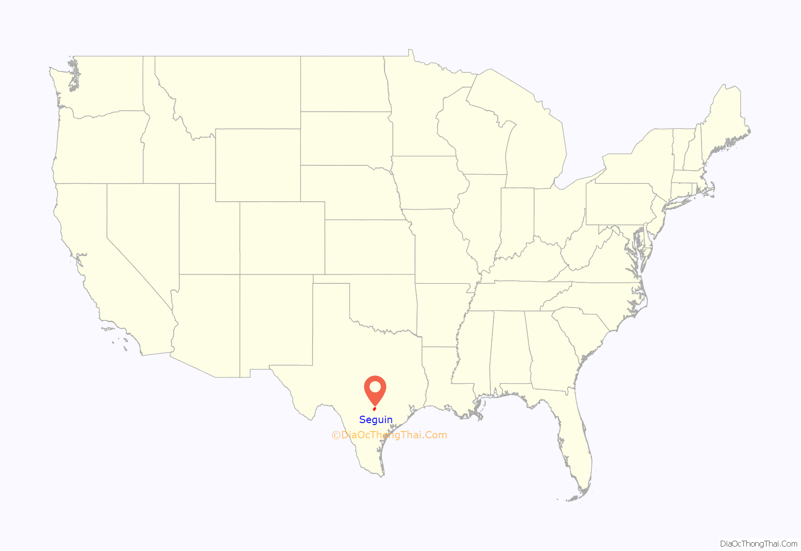
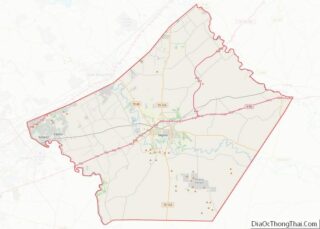
Seguin location map. Where is Seguin city?
History
Seguin was the home of Dr. John E. Park, who experimented in construction using concrete made from local materials. The nearly 100 structures—the courthouse, schools, churches, homes, cisterns, walls, etc.—made up the largest concentration of early 19th-century concrete buildings in the United States. About 20 of them remain standing.
The use of concrete largely ended when the railroad arrived in 1876, bringing cheap lumber and the equipment needed for brick-making. The town had five brickworks, and the wooden buildings of downtown were completely replaced with brick by the beginning of World War I.
For almost 100 years, the town was dependent on the rich surrounding farmland and ranches. Then, the Texas oil boom came just as the Great Depression was taking down other towns and cities. The town commemorated its centennial by opening Max Starcke Park, with a golf course, a pavilion, picnic tables, and BBQ pits along a scenic river drive, and a curving dam that created a waterfall.
To preserve some of the historic character of the town, Seguin became one of the state’s first Main Street cities, and the downtown district was placed on the National Register of Historic Places. Fine homes by leading architects J. Reily Gordon, Solon McAdoo, Leo M.J. Dielman, Atlee B. Ayers, and Marvin Eickenroht dating from the late 19th century and the first half of the 20th century can be found on many streets. However, the city does not have any officially designated historic residential districts.
The postwar era had industrial development, including a small mill that turned scrap metal into construction products.
In 1972 Motorola built a plant to manufacture automotive electronics. It was bought by Continental AG in 2006, became Vitesco Technologies in 2021, and is the city’s largest employer with 1,750 employees. Caterpillar opened a diesel engine assembly plant in 2008 which is the second largest employer.
Prehistory
The Seguin area was once inhabited by the native hunter-gatherer Native Americans of Texas. An ongoing archeological dig indicates campgrounds dating back 10,000 years or so, with trade items from Mexico and Arizona. The early visitors may have come to gather pecans, because the native trees bearing the tasty nut thrive in the river bottoms of the Guadalupe. By the time the first European explorers passed through, predominantly Tonkawas lived in the area, camping around the Guadalupe and other streams in the area. Eventually, Spanish, Mexican, and Anglo settlers started farms and ranches in the location that would become Seguin.
Early history
José Antonio Navarro, one of the earliest settlers and an important figure of Texas history, developed a ranch near Seguin. In 1831, land was granted to Umphries Branch by the Mexican government. The Branch and John Newton Sowell Sr. families settled in 1833 in the western part of Green DeWitt’s colony. Sowell was a farmer, and in 1833 he and his brothers became the first Anglo-American immigrants to raise corn in future Guadalupe County.
Between 1827 and 1835, 22 families came to the area as part of the DeWitt Colony; by 1833, 40 land titles were in the region, 14 of which received grants directly from the Mexican government. In 1836, John Gladden King lived near Seguin. His farm neighbored the Sowells on the northwest and Branch on the southeast. A son, William Philip King, reportedly was part of a cannon crew and was the youngest defender killed during the Battle of the Alamo. These homesteads were abandoned in the Runaway Scrape.
Old Seguin
The town of Seguin was founded August 12, 1838, 16 months after Texas won its independence at the Battle of San Jacinto, making it one of the oldest towns in Texas. Members of Mathew Caldwell’s Gonzales Rangers acquired land originally granted to Umphries Branch, who had departed during the Runaway Scrape and sold his land to Joseph S. Martin.
At this time, the Seguin area was a part of Gonzales County, the remaining portion known as present-day Belmont. The Rangers had found this was a good halfway stop between their patrol points. The big oaks and walnut groves along the Walnut Branch, had become a familiar and pleasant location. It had been maintained as a base camp by the rangers since the early founding of the Dewitt Colony.
19th century history
Under an ancient live oak, 33 Rangers signed the charter for the town. Many were surveyors who joined Joseph Martin in laying out the lots for the town. Its original name was Walnut Springs, but was changed just 6 months later to honor San Jacinto veteran and then a Senator of the Republic of Texas, Juan Seguín. The surveyors’ plan for the city included a main north–south street that ran straight and flat for a mile and more. The streets form a grid, around a central square of two blocks, today’s Courthouse Square and Central Park, formerly known as Market Square.
A tree called the Whipping Oak grows across from the courthouse. In the 19th century, runaway slaves and other criminals were bound to an iron ring embedded in the tree, then whipped as a punishment.
Manuel Flores, veteran of San Jacinto and brother-in-law of Juan Seguin, established a ranch just south of Seguin in 1838. It became a safe-haven for San Antonio families and a staging point for counterattack when Bexar was overrun in 1842 by Santa Anna’s forces under Ráfael Vásquez and Adrian Woll.
Leading the resistance forces from this location was Texas Ranger John Coffee “Jack” Hays. When duty allowed, Hays was a familiar resident of Seguin. In 1843, Hays set up a gathering point at the “Walnut Branch Ranger Station in Seguin, where the classic Ranger character was born. He met Susan Calvert, whose father owned the Magnolia Hotel, where they married in April 1847.
Serving under Hays were two other famous Ranger residents of Seguin: Henry and Ben McCulloch. Their home known as “Hardscramble” still stands and was designated a Texas State Centennial historic site in 1936. Colonel James Clinton Neill, commander of the Alamo, was known to be buried here. The site was also historically marked during the 1936 Texas Centennial Exposition.
Seguin was named the county seat, and Guadalupe County was organized, early in 1845, as Texas became a state. The first county judge was Michael H. Erskine. The town was incorporated in 1853, and a city government was organized under acting Mayor John R. King, until elections were held later that year and John D. Anderson became the first elected mayor.
A few years later, another town was laid out on the west side of Seguin, on land that had been titled by the Alamo defender Thomas R. Miller, and sold in 1840 to Ranger James Campbell in partnership with Arthur Swift and Andrew Neill. This area became part of Seguin within a few years, but 150 years later, the east–west streets still do not match up to cross through the old Guadalupe Street border.
When Prince Carl of Solms-Braunfels and his German colonists were making their way in 1845 to the land they had bought to settle, Calvin Turner and Asa Sowell from Seguin were hired to guide them. Later, Seguin became a stopping point and trade center for German immigrants along their route from the ports of Indianola and Galveston to the German settlements around New Braunfels and Fredericksburg. Many Germans en route heard of the hard times in those Hill Country settlements and decided instead to buy land and settle around Seguin.
After Texas became a state, many settlers arrived from the Old South, bringing in hundreds of slaves in total, though only a few plantation owners held more than a dozen slaves. Most of the slaves lived on small farms with their owners, who remained subsistence farmers for years after settling their land. The contributions of African Americans to building the community are all but ignored in local histories written during the period when slavery was still being excused as justifiable due to the alleged low development of those enslaved. In fact, for the first 50 years or so, and probably for the first 100 years of the town, blacks did most of the construction work, including the main concrete buildings such as Sebastopol.
Education was important to the town. By 1849, it chartered a school. The first schoolhouse was built in 1850; it burned and was soon replaced by a two-story limecrete building. This Guadalupe High School, now a part of the St James parochial school, was recognized by a historical marker in 1962 as the oldest continuously used school building in Texas.
Seguin was home to Dr. John E. Park’s concrete (limecrete). Called “the Mother of Concrete Cities” in the 1870s, the town once had nearly 100 structures made of limecrete, including the courthouse, schools, churches, houses, cisterns, and many walls. So many limecrete walls and corrals were built that Seguin gave the effect of being a walled city. This was the largest and most significant concentration of 19th-century concrete buildings in the U.S. About 20 of these vintage buildings survive today.
In 1857, Frederick Law Olmsted, later famous as the landscape architect of New York’s Central Park, toured Texas, writing dispatches to the New York Times. Olmsted exclaimed at the concrete structures he found here, almost on the edge of the frontier, and described the city as “the prettiest town in Texas.”
One surviving concrete home, the Sebastopol House; built in 1856, is a Texas Historical Commission landmark and is on the National Register of Historic Places due to its unusual limecrete construction and architectural style.
Stagecoaches began to serve the town in 1848, connecting coastal ports to San Antonio and points west. The Magnolia Hotel was an overnight stop for the exhausted, hungry, and dirt-covered riders. A young slave had the duty of standing on a stone to pull the bell rope alerting the community to the arrival of the stage, which brought visitors, the mail, newspapers, and special merchandise. Heading west from the Magnolia, the stage route went through town, passing the courthouse. Today, a mural commemorates its path. During the Great Depression, workers from the Civilian Conservation Corps traced part of the route with stone walls, showing how it moved downhill, crossed Walnut Branch (a spring-fed tributary of the Guadalupe River), and climbed the other side.
The historic Wilson Pottery site is on Capote Road, near Seguin. The pottery was the first successful business in Texas owned and operated by freed slaves, beginning in 1869.
During Reconstruction, the freed slaves in Seguin organized their own congregation, the Second Baptist Church, and in 1876, a school that came to be known as the Lincoln School. In 1887, they established Guadalupe College, comparable to a junior college today, with a heavy concentration on vocational education. These institutions were begun with the help of Rev. Leonard Ilsley, an abolitionist minister from Maine, but William Baton Ball, himself an ex-slave, Union soldier in the Civil War, and former Buffalo Soldier, became their leader. He was greatly assisted by his friend and benefactor George Brackenridge of San Antonio. (The main buildings of Guadalupe College burned due to a boiler malfunction during a bitterly cold night in 1936, and the college ended.)
The railroad reached Seguin in 1876 en route to San Antonio, when the oldest railway in Texas, the Galveston, Harrisburg and San Antonio Railroad, chartered on February 11, 1850, as the Buffalo Bayou, Brazos and Colorado Railway Company built the first Seguin depot. It became part of the Southern Pacific Railroad, and now the main southern line of the Union Pacific.
John Ireland was mayor of Seguin in 1858. Elected the 18th Governor of Texas 1883–1887, he had an important part in the construction of the Texas State Capitol—insisting on using native stone, red granite from the Hill Country, instead of limestone imported from Indiana. He also presided over the opening of the University of Texas at Austin.
20th century history
From before the Civil War until at least World War II, cotton was the money crop of the local farms, and the county had at least a dozen gins, with three in the town of Seguin, but agriculture was more diversified than in many counties where cotton was king, with corn, peanuts, hogs, and cattle, as well as wheat, oats, sugarcane, and most notably, pecans. The tiny but tasty native nuts were an early export. The crops improved as the bottomlands were converted to orchards, and eventually bigger varieties of nuts were grafted onto the local trees. This was one of the first counties to have a pecan growers’ association, and in 1921, its leader, P.K. DeLaney, helped start the Texas Pecan Growers Association. The county remains one of the state’s leading producers. Seguin has been called ‘a big orchard with a small town in it’ because almost every house is shaded by a pecan tree in the yard. A tribute to the nut’s importance is “the World’s Largest Pecan” erected on the courthouse lawn.
Small mills were put on the Guadalupe River even before the Civil War. William Saffold established a mill at what is today Max Starcke Park. Later, Henry Troell made major improvements there, and in 1894, used hydroelectric power to light the town. The City of Seguin took over the dam and electric plant in 1907. The supply of cheap and reliable electricity helped to make possible several gins, mills, silos, an ice plant and ice cream maker, a cold meat storage facility, and other types of agribusiness.
In 1912, citizens of Seguin lured a struggling church school to the city with cash, and 15 acres of land donated by Louis Fritz. It grew to a junior college and then into a four-year college to become today’s Texas Lutheran University, with some 1,400 students and boasting high rankings on the U.S. News & World Report comparisons of universities.
During this time, Texas State Architect, Atlee Ayres designed several commercial, public and residential buildings in Seguin. In 1912 he designed the Starcke Furniture Company, the Seguin High School building aka Mary B. Erskine School (1914), the Aumont Hotel (1916), Langner Hall at Texas Lutheran University and the Blumberg and Breustedt mansions.
During the 1920s, the county began to enjoy a foretaste of an oil boom. While the first fields were at the far edge of the county, near Luling, the paperwork of deeds and leases (as well as any resulting lawsuits) passed through the Guadalupe County Courthouse. Then in December 1929, the Darst Creek Field was opened, only 15 miles east of Seguin. (The creek had been named for colonist and landowner Jacob C. Darst. He was one of the original “Old Eighteen”, defenders of the Gonzales cannon and then a member of the Gonzales Ranging Company relief force to the Alamo during the siege in 1836.)
With the Darst Field, Seguin became a supply center, and residents were able to rent out rooms to oil field workers for cash even during the worst years of the depression of the 1930s. As a result, Seguin was able to collect taxes when other towns just had to give up. It used the money to match federal grants for what some derided as “make-work” projects. Under the leadership of the popular mayor, Max Starcke, Seguin was transformed, with a new post office, a new Art Deco City Hall, courthouse, jailhouse and fountain in Central Park, new storm sewers and sidewalks, and a small park along Walnut Branch, with rustic stone walls that protected the historic springs and traced the route of the stagecoach as it headed west through town. The little city had three swimming pools, one for whites, one for blacks at the segregated high school, and one for Spanish-speaking citizens at the Juan Seguin school.
Max Starcke’s biggest achievement was a large park along the Guadalupe River, designed by Robert H.H. Hugman, famous now as “the Father of the River Walk” in San Antonio. The park featured a handsome Art Deco recreation building designed by Hugman (now offices) with changing rooms for the swimming pool. The nine-hole course was designed by John Bredemus, a prolific course designer who has been called “the father of Texas golf”. The park offered picnic tables and bar-be-que pits between a scenic river drive and the river. Most of all, at a disused mill, Hugman and the young men of the National Youth Administration put a curving dam. As the 1938 dedication marker tells, funds were raised in part by public subscription. Dozens of groups and individuals made contributions to build the park that the town named for its popular mayor, who was moving on to, and soon to head, the Lower Colorado River Authority in Austin.
After World War II, entrepreneurs fresh out of the university used electric furnaces to melt scrap into reinforcing bars with a company then called Structural Metals. The minimill (now CMC Steel) has been joined by manufacturers including Alamo Group, building roadside mowing equipment; Continental Automotive Systems (was Motorola), making electronic powertrain control modules and emissions sensors; Hexcel, producing reinforcements for composites using glass fiber, carbon fiber, aramids, and specialty yarns; Minigrip, manufacturing re-closeable plastic bags for food and home storage; Tyson Foods, processing chicken. In 2009 Caterpillar opened a plant assembling diesel engines. Most recently Rave Gears, a make of precisions gears, opened a plant and headquarters.
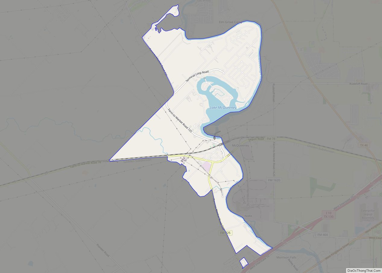
Seguin Road Map
Seguin city Satellite Map
Geography
Seguin is located in the center of Guadalupe County at 29°34′28″N 97°57′55″W / 29.57444°N 97.96528°W / 29.57444; -97.96528 (29.574329, −97.965332). It is 35 miles (56 km) east-by-northeast of downtown San Antonio, on Interstate 10, which serves Seguin with five exits. It is about 50 miles (80 km) south of Austin on Highway 123, via Interstate 35, or 62 miles (100 km) by Highway 130, a toll road.
According to the United States Census Bureau, Seguin has a total area of 34.7 square miles (89.8 km), of which 34.5 square miles (89.3 km) are land and 0.2 square miles (0.5 km), or 0.57%, are covered by water. The Guadalupe River flows through the southern side of the city, reaching the Gulf of Mexico south of Victoria.
The elevation at the courthouse is 522 feet (159 m) above mean sea level.
Weather and climate
On the northern edge of the South Texas Plains, Seguin enjoys a mild winter. The sunny days of spring bring on spectacular shows of wildflowers from March into June. Like most of Central Texas, it suffers very hot, humid summers from June into September. Then cold fronts pushing down from the north usually trigger precipitation and make October a rainy month, bringing “a second spring” of wildflowers. At their worst, fall and winter have “northers”, fast-moving cold fronts with wind, often rain, and rapid drops of temperature, frequently falling 30 °F (17 °C) or more during one day. Northers give way to warm spells, right through the winter.
State and federal districts
Seguin was represented in the Texas House of Representatives from 1983 to 2010 by the Republican Edmund Kuempel. He was noted for helping to get the State of Texas to restore the 19th century mansion called Sebastopol and operate it as a Historic Site for 25 years. A native of Austin, businessman Kuempel died in office two days after being unopposed for reelection. John Kuempel, Edmund Kuempel’s son, won the special election on December 14 of that year to succeed his father in the District 44 seat in the Texas House. He was reelected in 2012 and 2014.
Democrat Vicente Gonzalez has represented Guadalupe County in the U.S. House of Representatives as part of Texas’ 15th Congressional District, since 2017. One of the “fajita” districts, the 15th runs in a narrow strip from Seguin down to McAllen in the Lower Rio Grande Valley.
See also
Map of Texas State and its subdivision:- Anderson
- Andrews
- Angelina
- Aransas
- Archer
- Armstrong
- Atascosa
- Austin
- Bailey
- Bandera
- Bastrop
- Baylor
- Bee
- Bell
- Bexar
- Blanco
- Borden
- Bosque
- Bowie
- Brazoria
- Brazos
- Brewster
- Briscoe
- Brooks
- Brown
- Burleson
- Burnet
- Caldwell
- Calhoun
- Callahan
- Cameron
- Camp
- Carson
- Cass
- Castro
- Chambers
- Cherokee
- Childress
- Clay
- Cochran
- Coke
- Coleman
- Collin
- Collingsworth
- Colorado
- Comal
- Comanche
- Concho
- Cooke
- Coryell
- Cottle
- Crane
- Crockett
- Crosby
- Culberson
- Dallam
- Dallas
- Dawson
- Deaf Smith
- Delta
- Denton
- Dewitt
- Dickens
- Dimmit
- Donley
- Duval
- Eastland
- Ector
- Edwards
- El Paso
- Ellis
- Erath
- Falls
- Fannin
- Fayette
- Fisher
- Floyd
- Foard
- Fort Bend
- Franklin
- Freestone
- Frio
- Gaines
- Galveston
- Garza
- Gillespie
- Glasscock
- Goliad
- Gonzales
- Gray
- Grayson
- Gregg
- Grimes
- Guadalupe
- Hale
- Hall
- Hamilton
- Hansford
- Hardeman
- Hardin
- Harris
- Harrison
- Hartley
- Haskell
- Hays
- Hemphill
- Henderson
- Hidalgo
- Hill
- Hockley
- Hood
- Hopkins
- Houston
- Howard
- Hudspeth
- Hunt
- Hutchinson
- Irion
- Jack
- Jackson
- Jasper
- Jeff Davis
- Jefferson
- Jim Hogg
- Jim Wells
- Johnson
- Jones
- Karnes
- Kaufman
- Kendall
- Kenedy
- Kent
- Kerr
- Kimble
- King
- Kinney
- Kleberg
- Knox
- La Salle
- Lamar
- Lamb
- Lampasas
- Lavaca
- Lee
- Leon
- Liberty
- Limestone
- Lipscomb
- Live Oak
- Llano
- Loving
- Lubbock
- Lynn
- Madison
- Marion
- Martin
- Mason
- Matagorda
- Maverick
- McCulloch
- McLennan
- McMullen
- Medina
- Menard
- Midland
- Milam
- Mills
- Mitchell
- Montague
- Montgomery
- Moore
- Morris
- Motley
- Nacogdoches
- Navarro
- Newton
- Nolan
- Nueces
- Ochiltree
- Oldham
- Orange
- Palo Pinto
- Panola
- Parker
- Parmer
- Pecos
- Polk
- Potter
- Presidio
- Rains
- Randall
- Reagan
- Real
- Red River
- Reeves
- Refugio
- Roberts
- Robertson
- Rockwall
- Runnels
- Rusk
- Sabine
- San Augustine
- San Jacinto
- San Patricio
- San Saba
- Schleicher
- Scurry
- Shackelford
- Shelby
- Sherman
- Smith
- Somervell
- Starr
- Stephens
- Sterling
- Stonewall
- Sutton
- Swisher
- Tarrant
- Taylor
- Terrell
- Terry
- Throckmorton
- Titus
- Tom Green
- Travis
- Trinity
- Tyler
- Upshur
- Upton
- Uvalde
- Val Verde
- Van Zandt
- Victoria
- Walker
- Waller
- Ward
- Washington
- Webb
- Wharton
- Wheeler
- Wichita
- Wilbarger
- Willacy
- Williamson
- Wilson
- Winkler
- Wise
- Wood
- Yoakum
- Young
- Zapata
- Zavala
- Alabama
- Alaska
- Arizona
- Arkansas
- California
- Colorado
- Connecticut
- Delaware
- District of Columbia
- Florida
- Georgia
- Hawaii
- Idaho
- Illinois
- Indiana
- Iowa
- Kansas
- Kentucky
- Louisiana
- Maine
- Maryland
- Massachusetts
- Michigan
- Minnesota
- Mississippi
- Missouri
- Montana
- Nebraska
- Nevada
- New Hampshire
- New Jersey
- New Mexico
- New York
- North Carolina
- North Dakota
- Ohio
- Oklahoma
- Oregon
- Pennsylvania
- Rhode Island
- South Carolina
- South Dakota
- Tennessee
- Texas
- Utah
- Vermont
- Virginia
- Washington
- West Virginia
- Wisconsin
- Wyoming
