Botswana is a Southern African country covering an area of 581,730 sq. km.
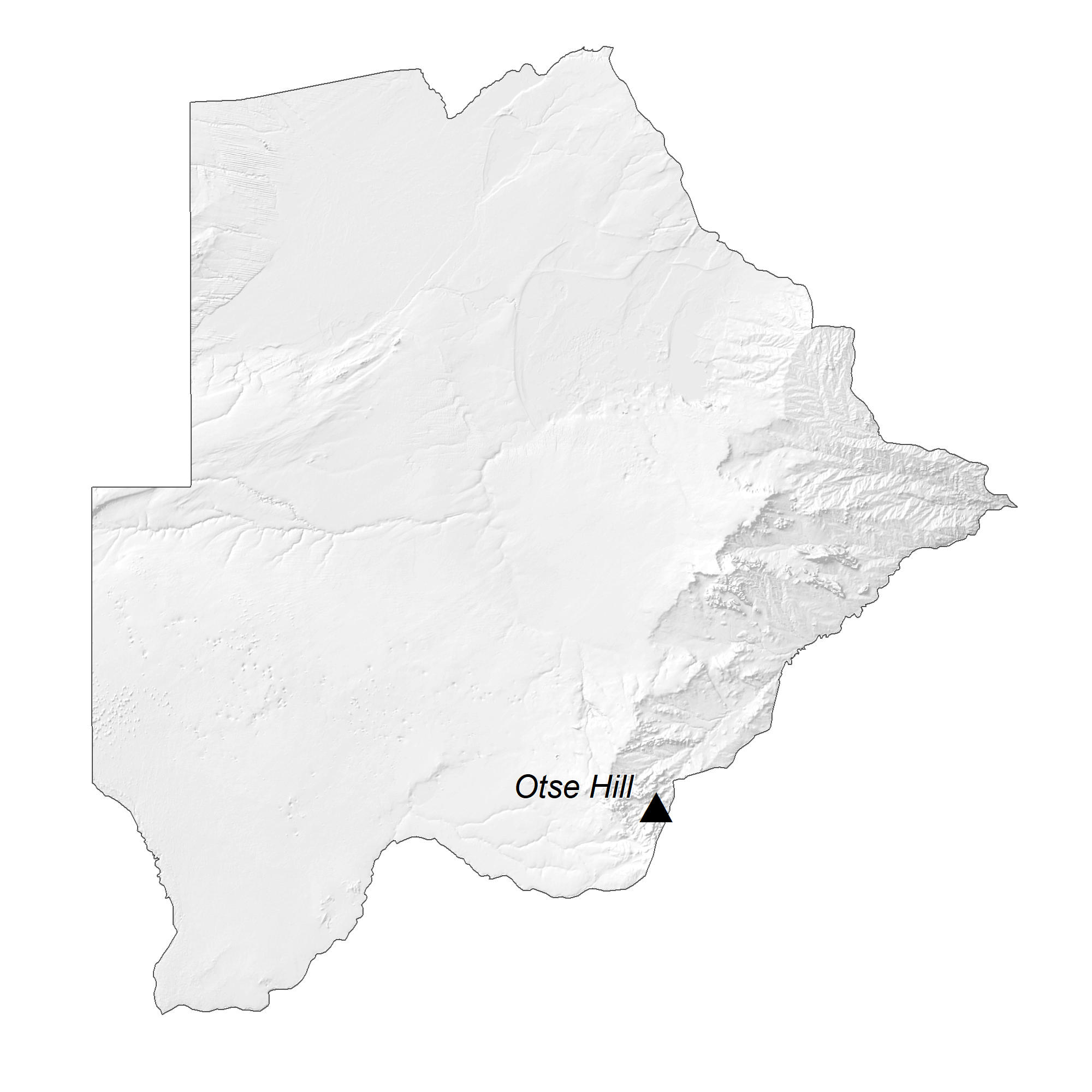
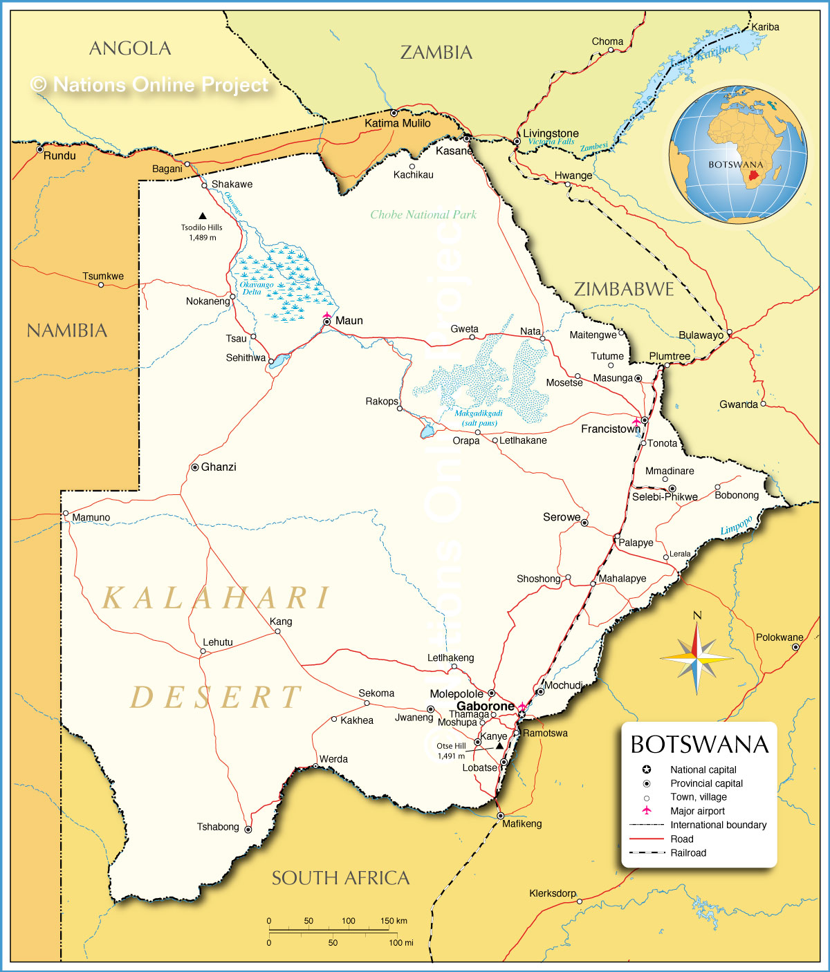
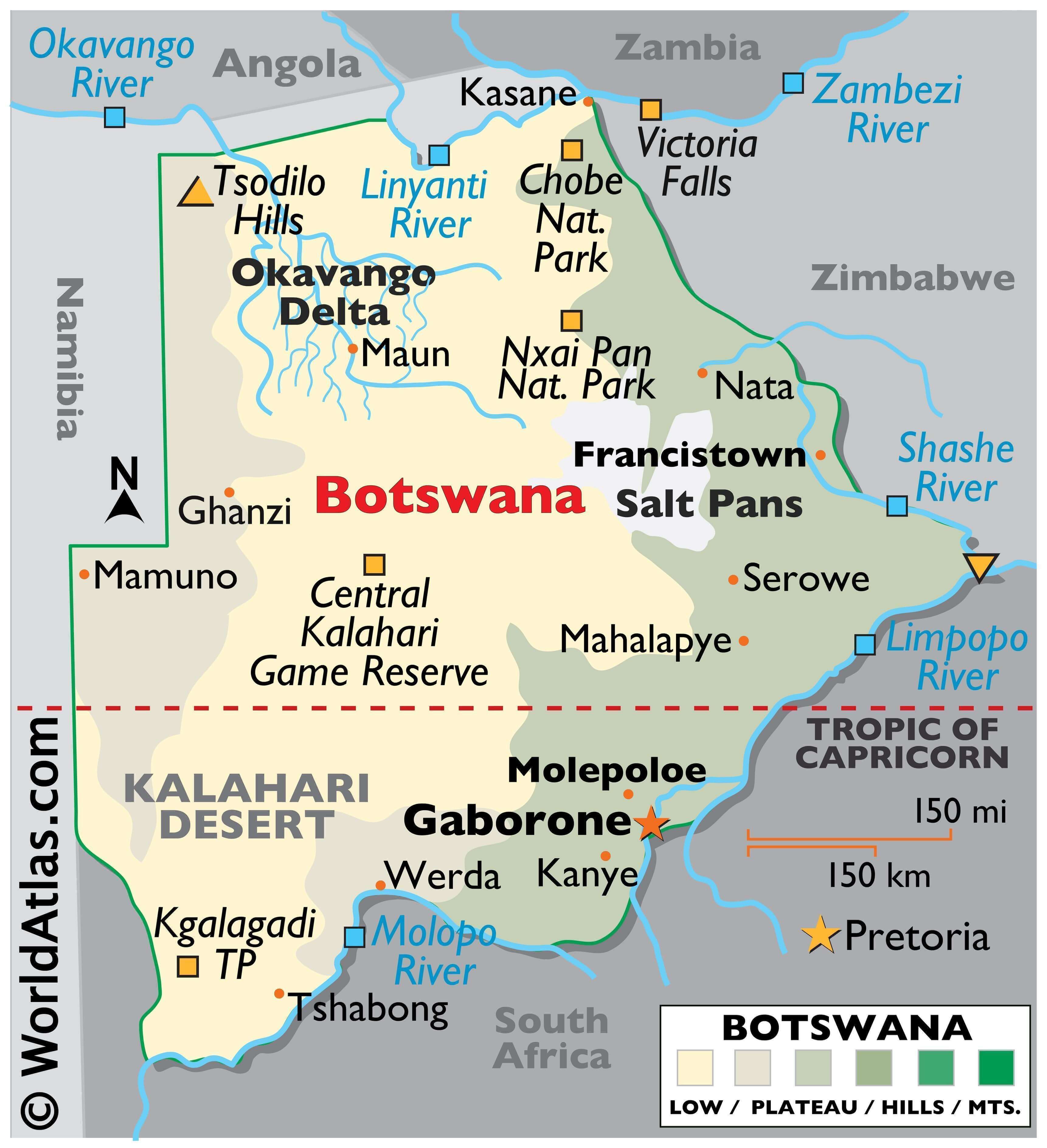
The physical map of Botswana illustrates the country’s physical characteristics. The country sits on a flat southern African plateau. The Kalahari Desert blankets the country to the center and southwest while in the north, the Okavango Delta provides a thriving oasis, with numerous salt lakes. The Makgadikgadi Pan is located in the middle of the dry savanna and additional landforms include savanna grasslands in the east and a dry scrub along the western border with Namibia.
Significant rivers as marked on the map include the Limpopo, Okavango, and Shashe with the Molopo River creating a geographical border between South Africa and Botswana. Botswana’s highest point is Tsodilo Hills at 1,489 m; the lowest point is a junction of the Limpopo and Shashe Rivers at 513 m.
| Flag: |  |
|---|---|
| Legal Name: | Republic of Botswana |
| Capital Value: | Gaborone |
| Official languages: | English |
| Demonym(s): |
|
| Government: | Unitary dominant-party parliamentary republic with an executive presidency |
| Legislature: | Parliament (National Assembly) |
| Total Area: | 581,730 km² |
| Land Area: | 566,730 km² |
| Water Area: | 15,000 km² |
| Population: | 2,303,697 |
| Density: | 4.1/km (10.6/sq mi) (231st) |
| GDP: | $18.34 Billion |
| GDP Per Capita: | $7,961.34 |
| Currency Value: | Pulas (BWP) |
| Driving side: | left |
| Calling code: | +267 |
| Internet TLD: | .bw |
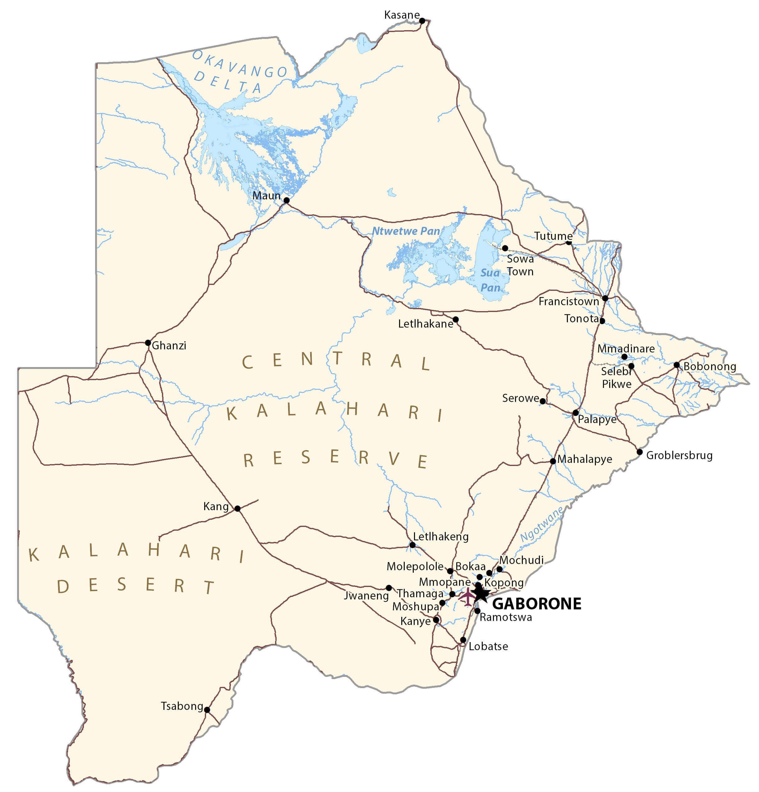
Explore Botswana’s varied geography with this interactive map. It includes major cities, towns, rivers, lakes, and the Kalahari Desert and Okavango Delta. Satellite imagery and an elevation map provide more detail and context to this beautiful landscape.
Online Interactive Political Map
Click on ![]() to view map in "full screen" mode.
to view map in "full screen" mode.
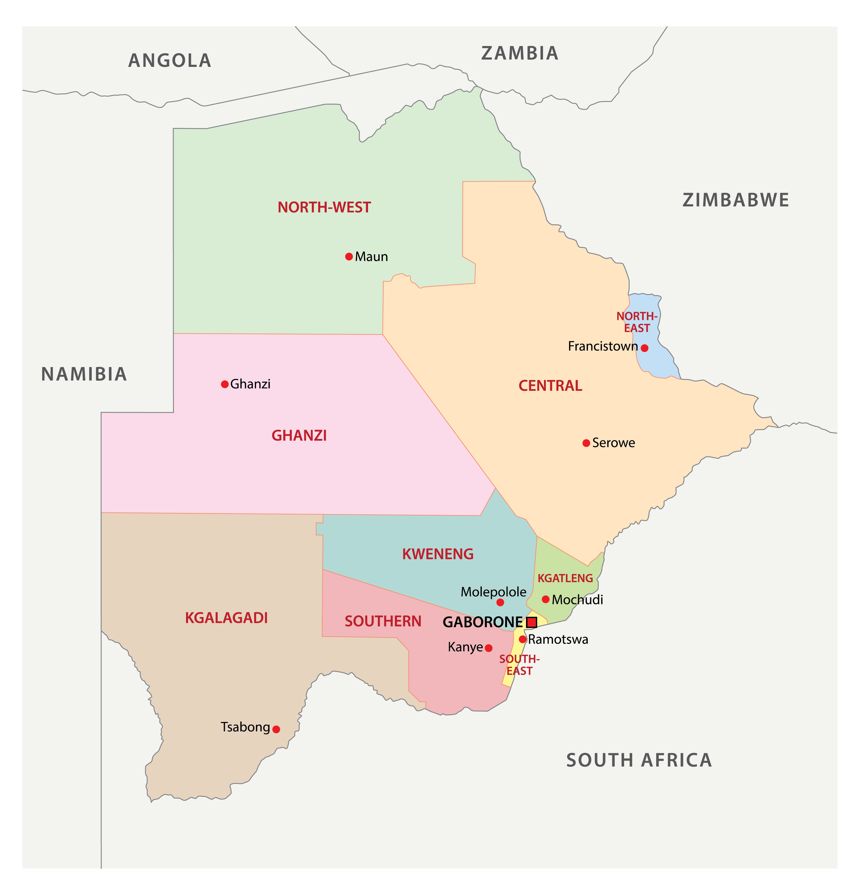
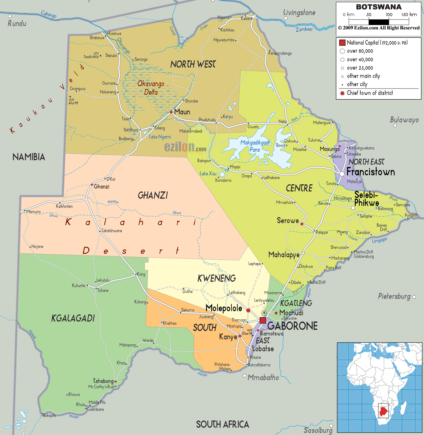
Botswana is divided into 17 administrative divisions called districts. It includes 10 rural and 7 urban districts. These districts are further subdivided into sub-districts.
In alphabetical order, the districts are as follows: Central, Chobe, Francistown, Gaborone, Ghanzi, Jwaneng, Kgalagadi, Kgatleng, Kweneng, Lobatse, North East, North West, Orapa, Selebi-Phikwe, South East, Southern, Sowa Town
With an area of 142,076 sq. km, Central District is the largest by area and also the most populous one.
The capital and largest city of Gaborone is located in the district of the same name.
Location Maps
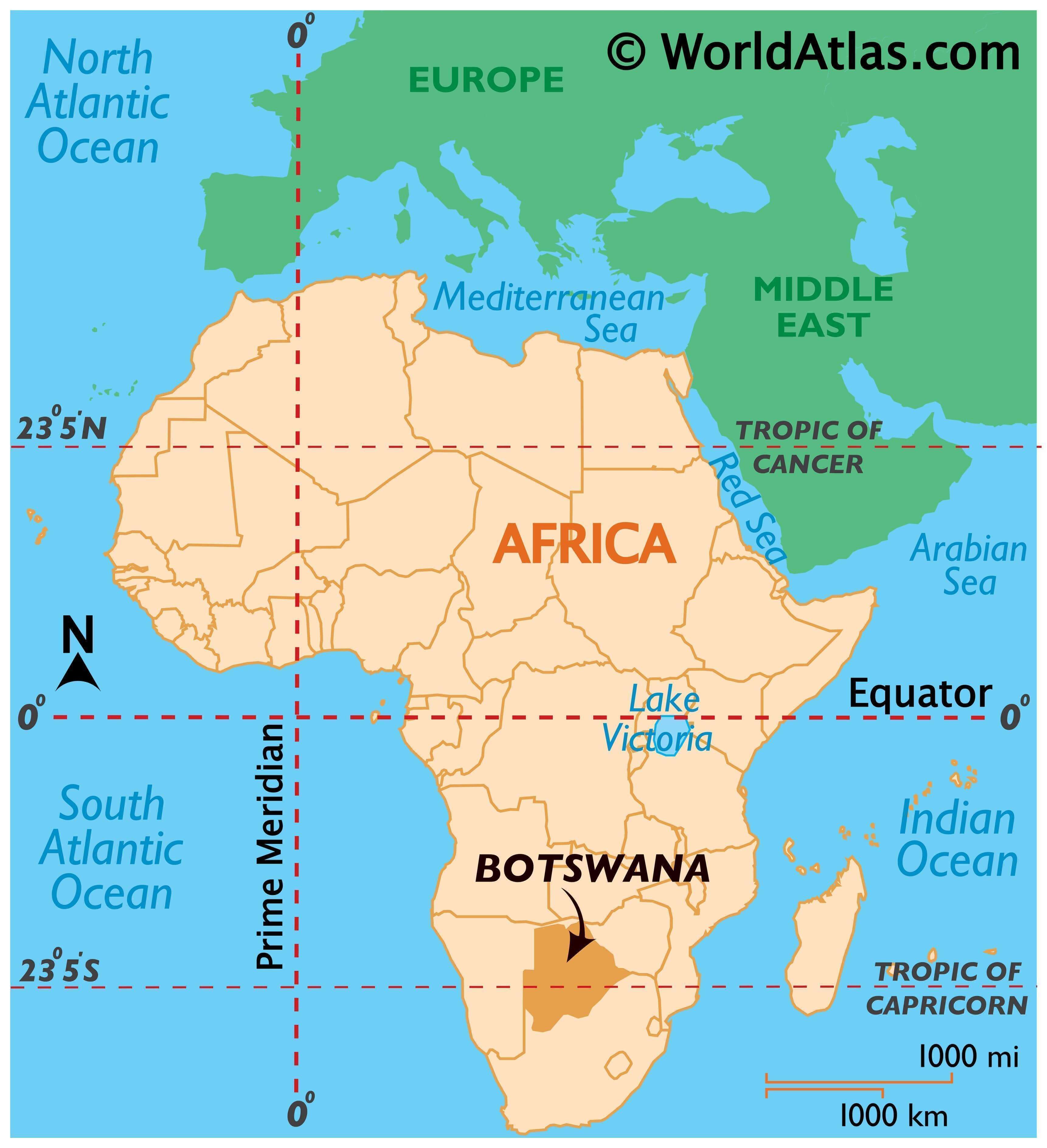
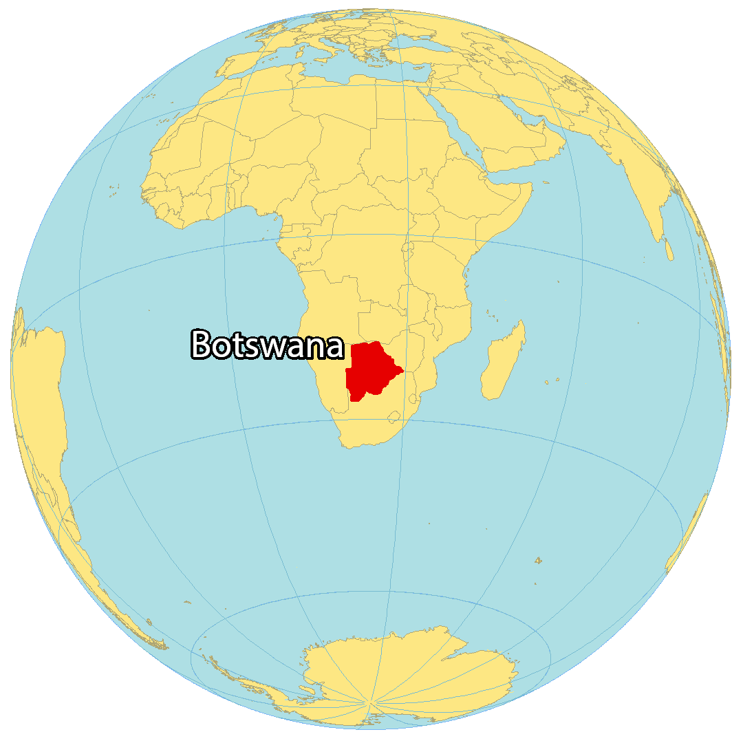
Where is Botswana?
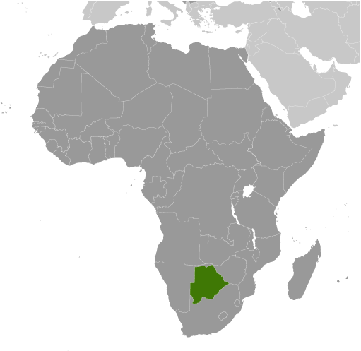
Botswana is a landlocked country located in the southern part of Africa and shares its borders with four other countries. To the west and north lies Namibia, to the northeast is Zimbabwe and to the southwest is South Africa. At the northeast tip of Botswana, it connects to Zambia across the Zambezi River from the Kazungula Bridge. Gaborone is the capital and largest city of Botswana.
High Definition Political Map of Botswana
History
Early history
Archaeological digs demonstrate that hominids lived in Botswana for around two million years. Stone tools and fauna remains have shown that all areas of the country were inhabited at least 400,000 years ago. In October 2019 researchers reported that Botswana was the birthplace of all modern humans about 200,000 years ago.
Evidence left by modern humans, such as cave paintings, is about 73,000 years old. The earliest known inhabitants of southern Africa are thought to have been the forebears of present-day San (“Bushmen”) and Khoi peoples. Both groups speak click languages from the small Khoe-Kwadi, Kx’a and Tuu families whose members hunted, gathered, and traded over long distances. When cattle were first introduced about 2000 years ago into southern Africa, pastoralism became a major feature of the economy, since the region had large grasslands free of tsetse fly.
It is unclear when Bantu-speaking peoples first moved into the country from the north, although AD 600 seems to be a consensus estimate. In that era the ancestors of the modern-day Kalanga moved into what is now the north-eastern areas of the country. These proto-Kalanga were closely connected to states in Zimbabwe as well as to the Mapungubwe state and the notable of these was Domboshaba ruins, a cultural and heritage site in Botswana originally occupied towards the end of the Great Zimbabwe period (1250–1450 AD), with stone walls that have an average height of 1.8 metres. The site is a respected place for the people living in the region and it is believed that the chief lived on the top of the hill together with his helpers or assistants. These states, located outside of current Botswana’s borders, appear to have kept massive herds of cattle in what is now the Central District—apparently at numbers approaching modern cattle density. This massive cattle-raising complex prospered until 1300 AD or so and seems to have regressed following the collapse of Mapungubwe. During this era the first Tswana-speaking groups, the Bakgalagadi, moved into the southern areas of the Kalahari. All these various peoples were connected to trade routes that ran via the Limpopo River to the Indian Ocean, and trade goods from Asia such as beads made their way to Botswana, most likely in exchange for ivory, gold and rhinoceros horn.
Toutswemogala Hill Iron Age Settlement’s radio-carbon dates for this settlement range from 7th to late 19th century AD indicating occupation of more than one thousand years. The hill was part of the formation of early states in Southern Africa with cattle keeping as major source of economy. Toutswe settlement include house-floors, large heaps of vitrified cow-dung and burials while the outstanding structure is the stone wall. There are large tracts of centaurs ciliaris, a type of grass which has come to be associated with cattle-keeping settlements in South, Central Africa. Around 700 A.D., the Toutswe people moved westward into Botswana and began an agricultural and pastoral land tenure system based on sorghum and millet, and domesticated stock, respectively. The site was situated in the centre of a broader cultural area in Eastern Botswana and shares many commonalities with other archaeological sites of this region, in both ceramic production styles and also time frames inhabited. Large structures were observed that contained vitrified remains of animal dung, leading to the theory that these were animal enclosures and that Toutswemogala Hill was thus a major centre of animal husbandry in the region. However, agriculture also played a vital role in the longevity of Toutswemogala Hill’s extended occupation, as many grain storage structures have also been found on the site. Many different stratified layers of housing floors further signal continuous occupation over hundreds of years.
The arrival of the ancestors of the Tswana-speakers who came to control the region has yet to be dated precisely. Members of the Bakwena, a chieftaincy under a legendary leader named Kgabo II, made their way into the southern Kalahari by AD 1500, at the latest, and his people drove the Bakgalagadi inhabitants west into the desert. Over the years, several offshoots of the Bakwena moved into adjoining territories. The Bangwaketse occupied areas to the west, while the Bangwato moved northeast into formerly Kalanga areas. Not long afterwards, a Bangwato offshoot known as the Batawana migrated into the Okavango Delta, probably in the 1790s.
Effects of the Mfecane and Batswana-Boer Wars
The first written records relating to modern-day Botswana appear in 1824. What these records show is that the Bangwaketse had become the predominant power in the region. Under the rule of Makaba II, the Bangwaketse kept vast herds of cattle in well-protected desert areas, and used their military prowess to raid their neighbours. Other chiefdoms in the area, by this time, had capitals of 10,000 or so and were fairly prosperous. This equilibrium came to end during the Mfecane period, 1823–1843, when a succession of invading peoples from South Africa entered the country. Although the Bangwaketse were able to defeat the invading Bakololo in 1826, over time all the major chiefdoms in Botswana were attacked, weakened, and impoverished. The Bakololo and AmaNdebele raided repeatedly and took large numbers of cattle, women, and children from the Batswana—most of whom were driven into the desert or sanctuary areas such as hilltops and caves. Only after 1843, when the Amandebele moved into western Zimbabwe, did this threat subside.
During the 1840s and 1850s trade with Cape Colony-based merchants opened up and enabled the Batswana chiefdoms to rebuild. The Bakwena, Bangwaketse, Bangwato and Batawana cooperated to control the lucrative ivory trade and then used the proceeds to import horses and guns, which in turn enabled them to establish control over what is now Botswana. This process was largely complete by 1880, and thus the Bushmen, the Kalanga, the Bakgalagadi, and other current minorities were subjugated by the Batswana.
Following the Great Trek, Afrikaners from the Cape Colony established themselves on the borders of Botswana in the Transvaal. In 1852 a coalition of Tswana chiefdoms led by Sechele I defeated Afrikaner incursions at the Battle of Dimawe and, after about eight years of intermittent tensions and hostilities, eventually came to a peace agreement in Potchefstroom in 1860. From that point on, the modern-day border between South Africa and Botswana was agreed on, and the Afrikaners and Batswana traded and worked together comparatively peacefully.
In 1884 Batawana, a northern based Tswana clan’s cavalry under the command of Kgosi Moremi fought and defeated the Ndebele’s invasion of northern Botswana at the Battle of Khutiyabasadi. This blow to the larger invading Ndebele force signalled the start of the collapse of the Ndebele Kingdom in Zimbabwe and helped galvanise Tswana speaking authority of the area now making part of northern Botswana.
Due to newly peaceful conditions, trade thrived between 1860 and 1880. Taking advantage of this were Christian missionaries. The Lutherans and the London Missionary Society both became established in the country by 1856. By 1880 every major village had a resident missionary, and their influence slowly became felt. Khama III (reigned 1875–1923) was the first of the Tswana chiefs to make Christianity a state religion and changed a great deal of Tswana customary law as a result. Christianity became the de facto official religion in all the chiefdoms by World War I.
Colonialism and the Bechuanaland Protectorate
During the Scramble for Africa the territory of Botswana was coveted by both the German Empire and Britain. During the Berlin Conference, Britain decided to annex Botswana in order to safeguard the Road to the North and thus connect the Cape Colony to its territories further north. It unilaterally annexed Tswana territories in January 1885 and then sent the Warren Expedition north to consolidate control over the area and convince the chiefs to accept British overrule. Despite their misgivings, they eventually acquiesced to this fait accompli.
In 1890 areas north of 22 degrees were added to the new Bechuanaland Protectorate. During the 1890s the new territory was divided into eight different reserves, with fairly small amounts of land being left as freehold for white settlers. During the early 1890s, the British government decided to hand over the Bechuanaland Protectorate to the British South Africa Company. This plan, which was well on its way to fruition despite the entreaties of Tswana leaders who toured England in protest, was eventually foiled by the failure of the Jameson Raid in January 1896.
When the Union of South Africa was formed in 1910 from the main British colonies in the region, the High Commission Territories—the Bechuanaland Protectorate, Basutoland (now Lesotho), and Swaziland (now Eswatini)—were not included, but provision was made for their later incorporation. However, the UK began to consult with their inhabitants as to their wishes. Although successive South African governments sought to have the territories transferred to their jurisdiction, the UK kept delaying; subsequently, it never occurred. The election of the Nationalist government in 1948, which instituted apartheid, and South Africa’s withdrawal from the Commonwealth in 1961, ended any prospect of the UK or these territories agreeing to incorporation into South Africa.
An expansion of British central authority and the evolution of native government resulted in the 1920 establishment of two advisory councils to represent both Africans and Europeans. The African Council consisted of the eight heads of the Tswana tribes and some elected members. Proclamations in 1934 regulated tribal rule and powers. A European-African advisory council was formed in 1951, and the 1961 constitution established a consultative legislative council.
Independence
In June 1964, the United Kingdom accepted proposals for a democratic self-government in Botswana. An independence conference was held in London in February 1966. The seat of government was moved in 1965 from Mahikeng in South Africa, to the newly established Gaborone, which is located near Botswana’s border with South Africa. Based on the 1965 constitution, the country held its first general elections under universal suffrage and gained independence on 30 September 1966. Seretse Khama, a leader in the independence movement and the legitimate claimant to the Ngwato chiefship, was elected as the first president, and subsequently re-elected twice.
Queen Elizabeth II, accompanied by Prince Philip, Duke of Edinburgh and her son Prince Andrew, Duke of York, arrived in Botswana during the fourth-leg tour of Africa on 25-27 July 1979. During their visit, they were greeted by tribal dancers and a 21-gun salute.
The presidency passed to the sitting vice-president, Quett Masire, who was elected in his own right in 1984 and re-elected in 1989 and 1994. Masire retired from office in 1998. He was succeeded by Festus Mogae, who was elected in his own right in 1999 and re-elected in 2004. The presidency passed in 2008 to Ian Khama (son of the first president), who had been serving as Mogae’s vice-president since resigning his position in 1998 as Commander of the Botswana Defence Force to take up this civilian role. On 1 April 2018 Mokgweetsi Eric Keabetswe Masisi was sworn in as the fifth president of Botswana, succeeding Ian Khama. He represents the Botswana Democratic Party, which has also won a majority in every parliamentary election since independence. All the previous presidents have also represented the same party.
A long-running dispute over the northern border with Namibia‘s Caprivi Strip was the subject of a ruling by the International Court of Justice in December 1999. It ruled that Kasikili Island belongs to Botswana.
In the 1970s, Botswana held a reputation of being one the world’s principal producers of diamonds. This reputation has held into the modern day as Botswana’s diamond mining industry is among the world’s largest. Botswana’s Jwaneng mine in particular is the world’s richest.
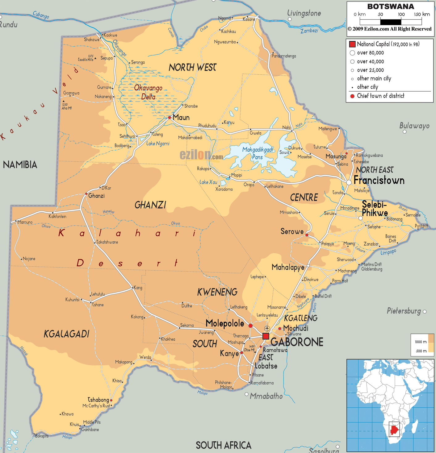
Physical Map of Botswana
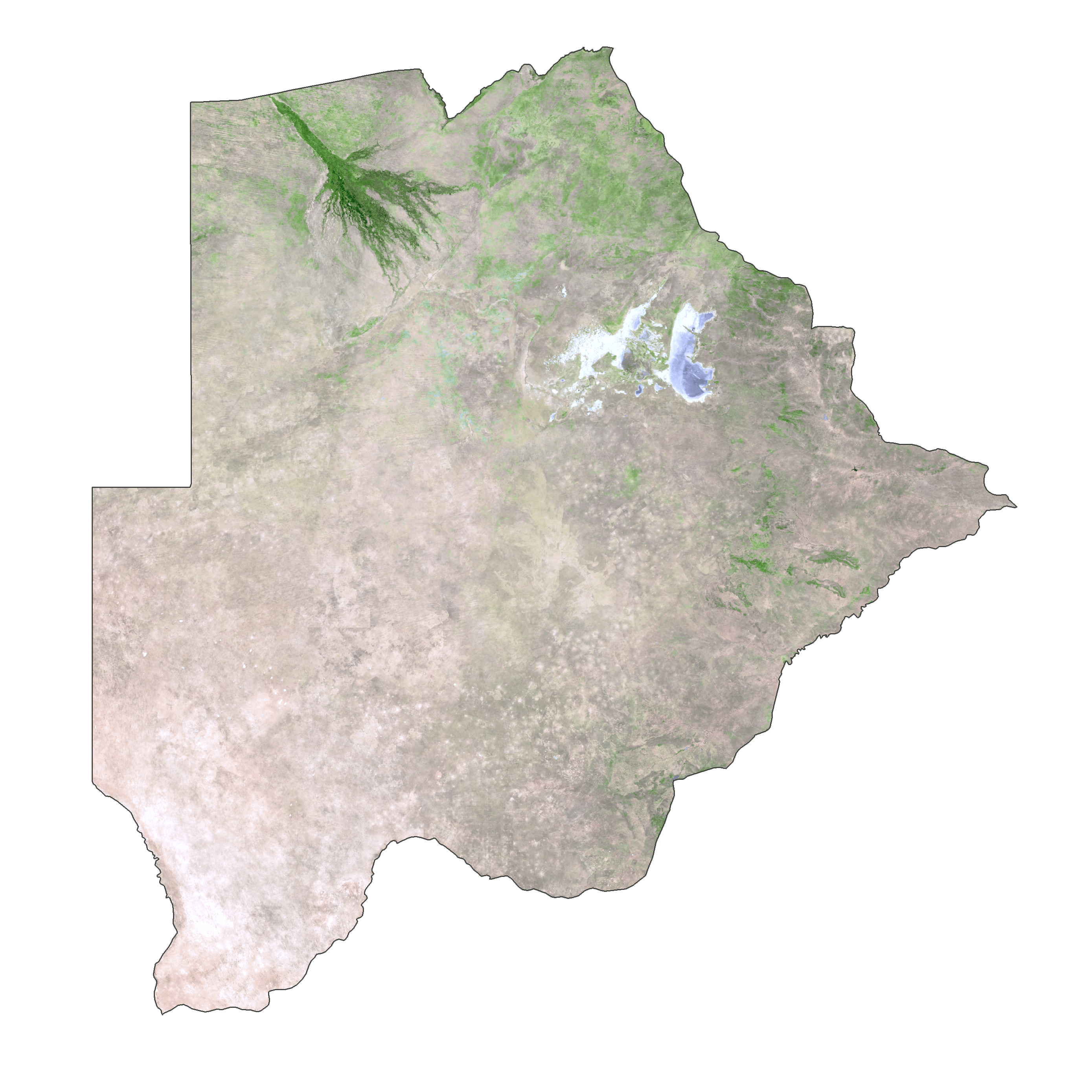
Botswana Satellite Map
Elevation Map