Kazakhstan is a country that stretches from Central Asia to Eastern Europe and occupies an area of 2,724,900 sq. km.
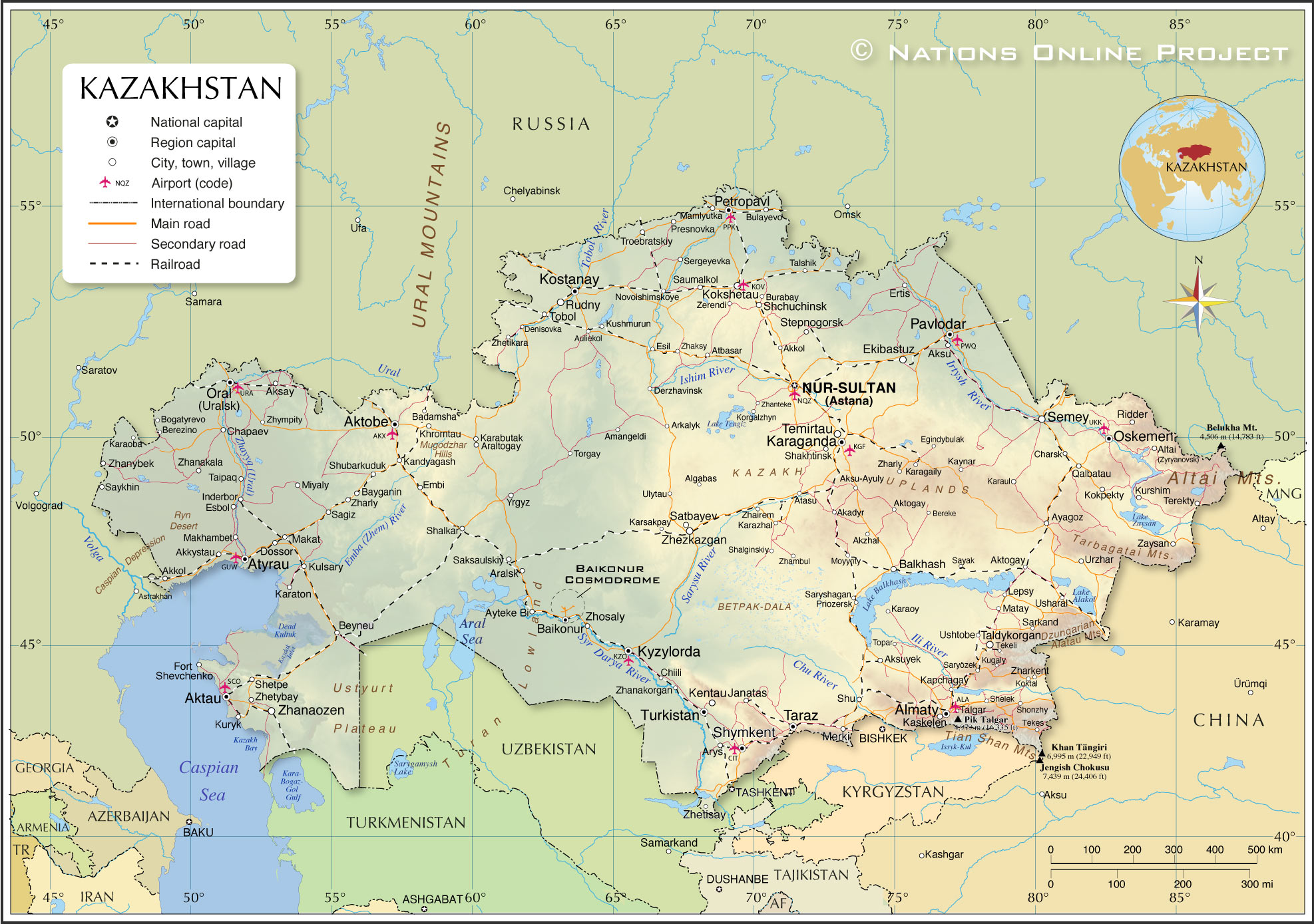
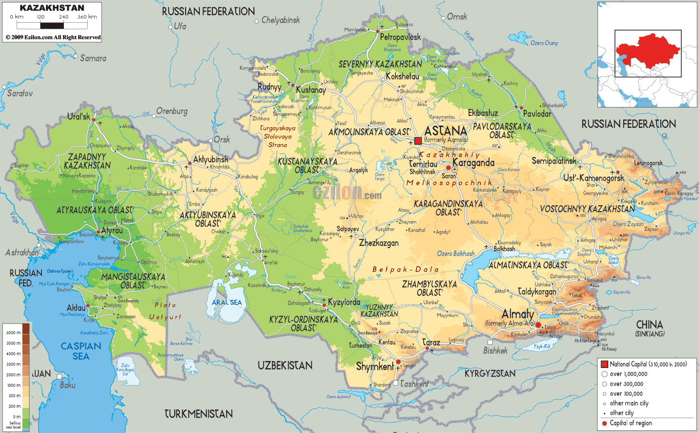
As seen on the physical map of Kazakhstan above, the country extends from the Caspian Sea in the west to the Altay Mountains in the east.
A vast stretch of land accounting for nearly one-third of the country’s area is the Kazakh Steppe. It is the largest dry steppe area in the world covering 804,500 sq. km.
Kazakhstan is mountainous along its far eastern and southeastern borders, where much of the forested Altai and the Tian Shan ranges remain snowcapped throughout the year and with many elevated peaks exceeding 6,500 meters.
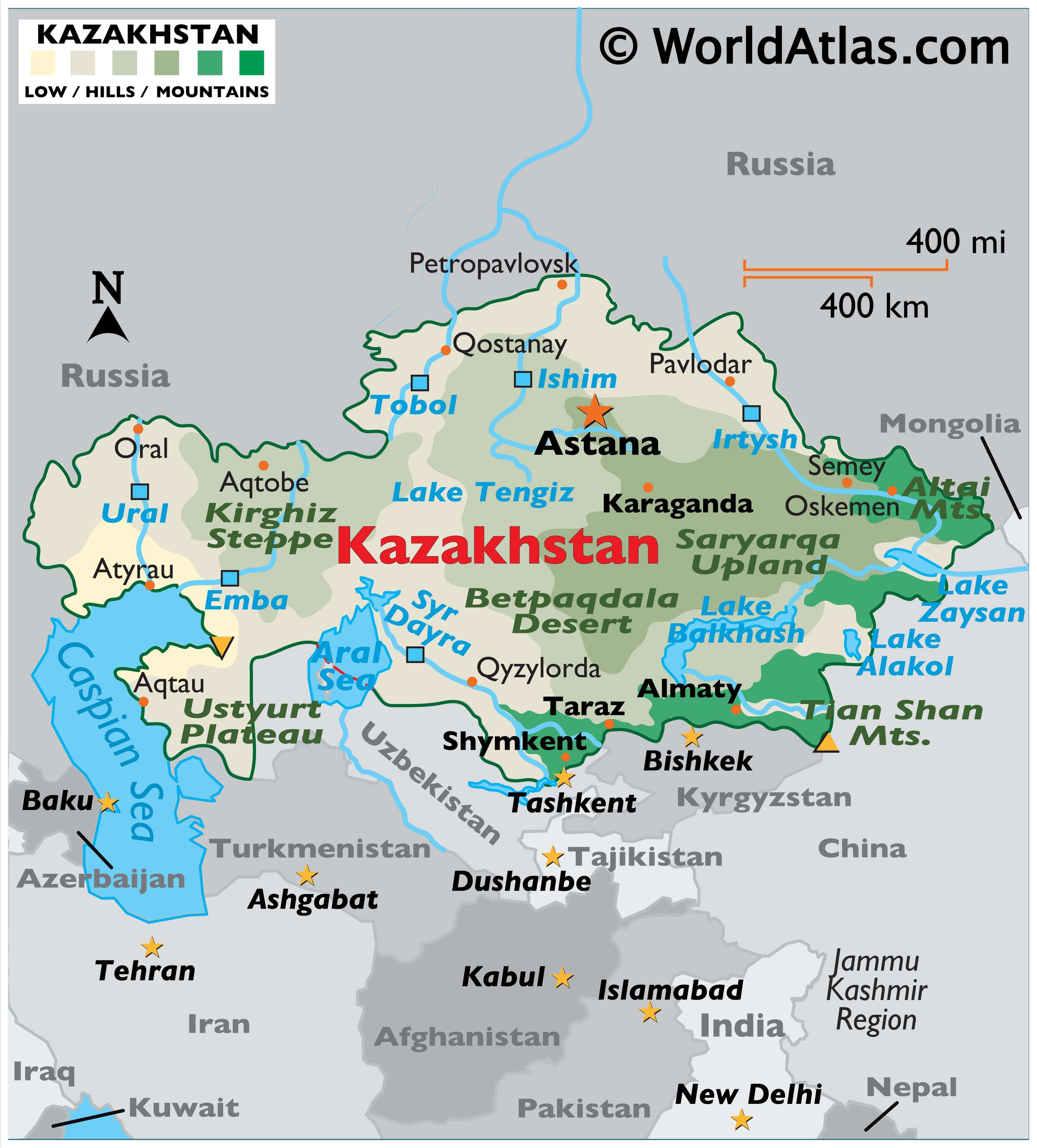
Kazakhstan’s highest peak is Khan Tengri (marked on the map by a yellow upright triangle), whose summit reaches 22,949 ft. (6,995 m).
Along the edges of the landlocked Caspian Sea, the land dips way below sea level in some areas. In the west along its border with the Russian Federation, rolling prairies and forests dominate the landscape.
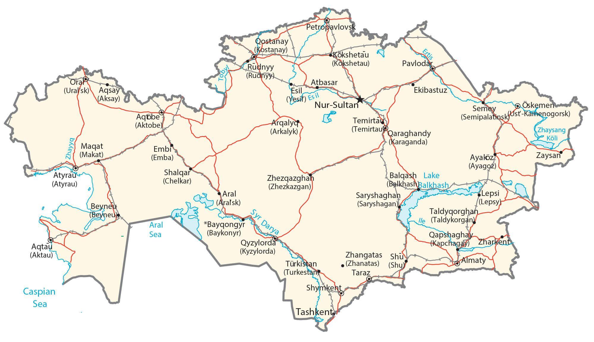
The most important rivers include the Ishim, Irtush, Syr Dayra, Tobol, and Ural. The Caspian Sea and the Aral Sea, and lakes Alakal, Balkhash, Tengiz, and Zaysan are the largest bodies of water.
The lowest point of Kazakhstan (marked by a yellow inverted triangle on the map) is the deepest point of the Karagiye depression at 132 m (433 ft) below sea level.
| Flag: |  |
|---|---|
| Legal Name: | Republic of Kazakhstan |
| Capital Value: | Astana |
| Official languages: |
|
| Demonym(s): | Kazakhstani |
| Government: | Unitary dominant-party presidential republic |
| Legislature: | Parliament |
| Total Area: | 2,724,900 km² |
| Land Area: | 2,699,700 km² |
| Water Area: | 25,200 km² |
| Population: | 18,513,930 |
| Density: | 7/km (18.1/sq mi) (236th) |
| GDP: | $180.16 Billion |
| GDP Per Capita: | $9,731.15 |
| Currency Value: | Tenge (KZT) |
| Driving side: | right |
| Calling code: | +997 (Permissive dialling with +7-6xx, +7-7xx until 2025.) |
| Internet TLD: |
|
Explore Kazakhstan’s incredible landscape with this interactive map. Learn about its major cities, towns, roads, lakes, rivers, mountains, depressions, deserts, and grasslands. Zoom in to get a closer look or switch to satellite imagery to see the country in its full beauty.
Online Interactive Political Map
Click on ![]() to view map in "full screen" mode.
to view map in "full screen" mode.
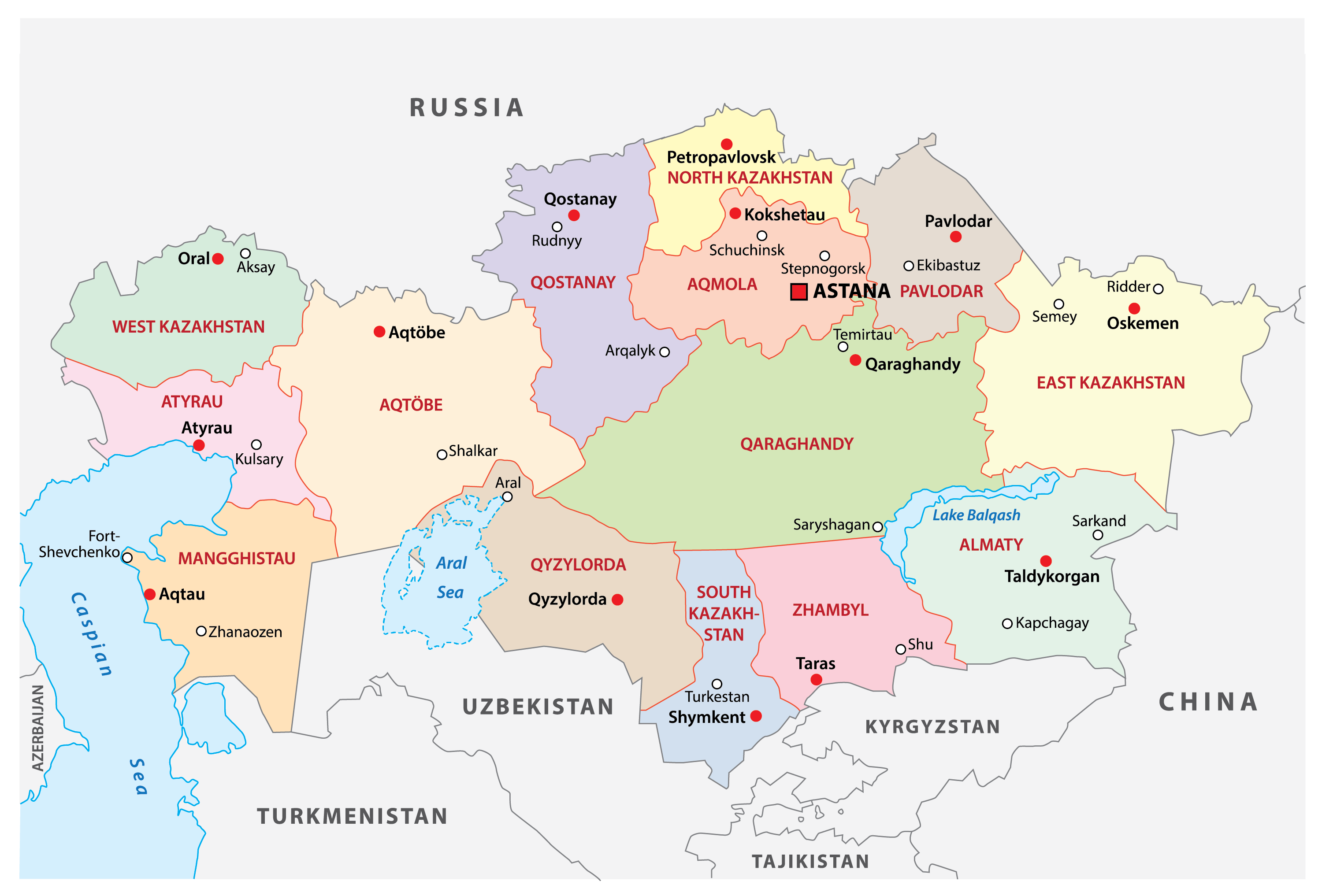
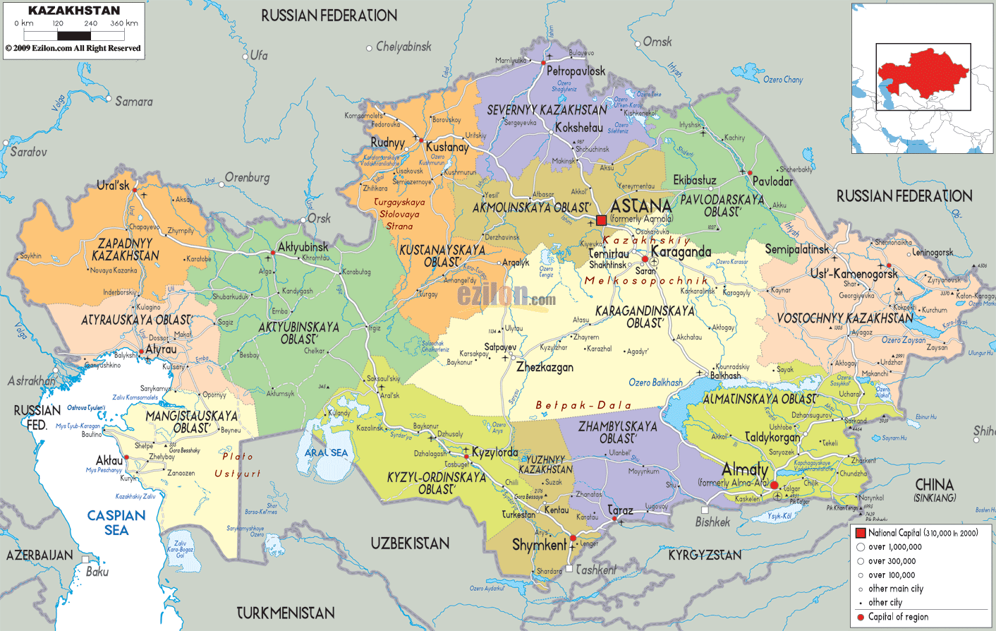
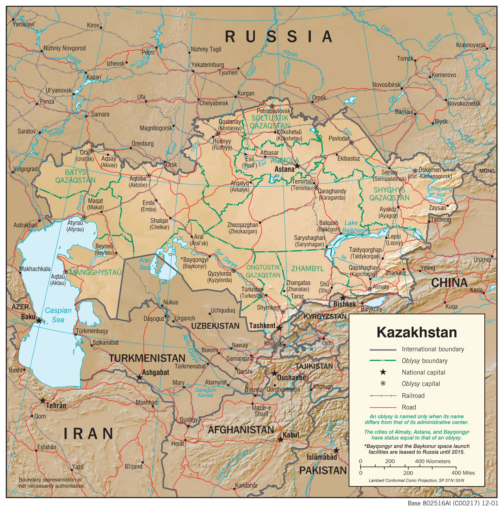
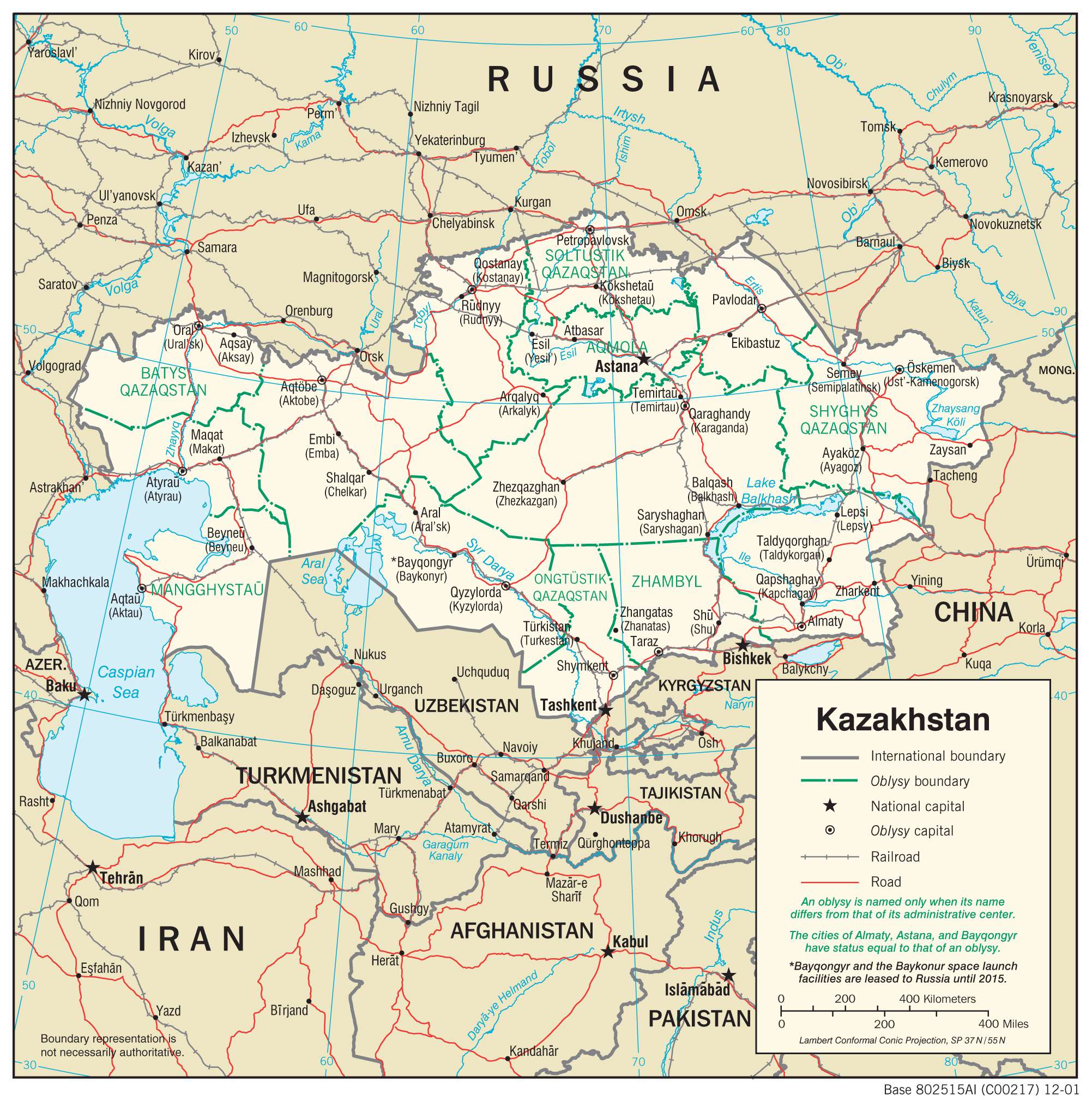
Kazakhstan (officially, Republic of Kazakhstan) is divided into 14 administrative regions (Kazakh: oblystar/oblys) and 4 cities. In alphabetical order, the regions are: Akmola, Aktobe, Almaty, Atyrau, East Kazakhstan, Jambyl, Karaganda, Kostanay, Kyzylorda, Mangystau, North Kazakhstan, Pavlodar, Turkistan and West Kazakhstan. The cities are: Almaty, Baikonur, Nur-Sultan, Shymkent. The regions are further subdivided into districts (Kazakh: aỷdan).
With an area of 2,724,900 sq. km, Kazakhstan is the world’s largest landlocked country and the ninth largest country in the world. It is also the most economic dominant Nation of Central Asia. Nur-Sultan (known as Astana between 1998 and 2019) is the capital city and is located on the banks of the Ishim River in the country’s northern part. With a population of over a million inhabitants, it is the second largest city in Kazakhstan. Almaty located in the mountainous region of southern Kazakhstan, is the largest city in the country, with a population of over two million inhabitants. Almaty is the major commercial and cultural centre, as well as the most populous and cosmopolitan city of Kazakhstan.
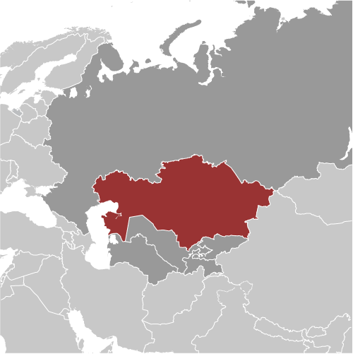
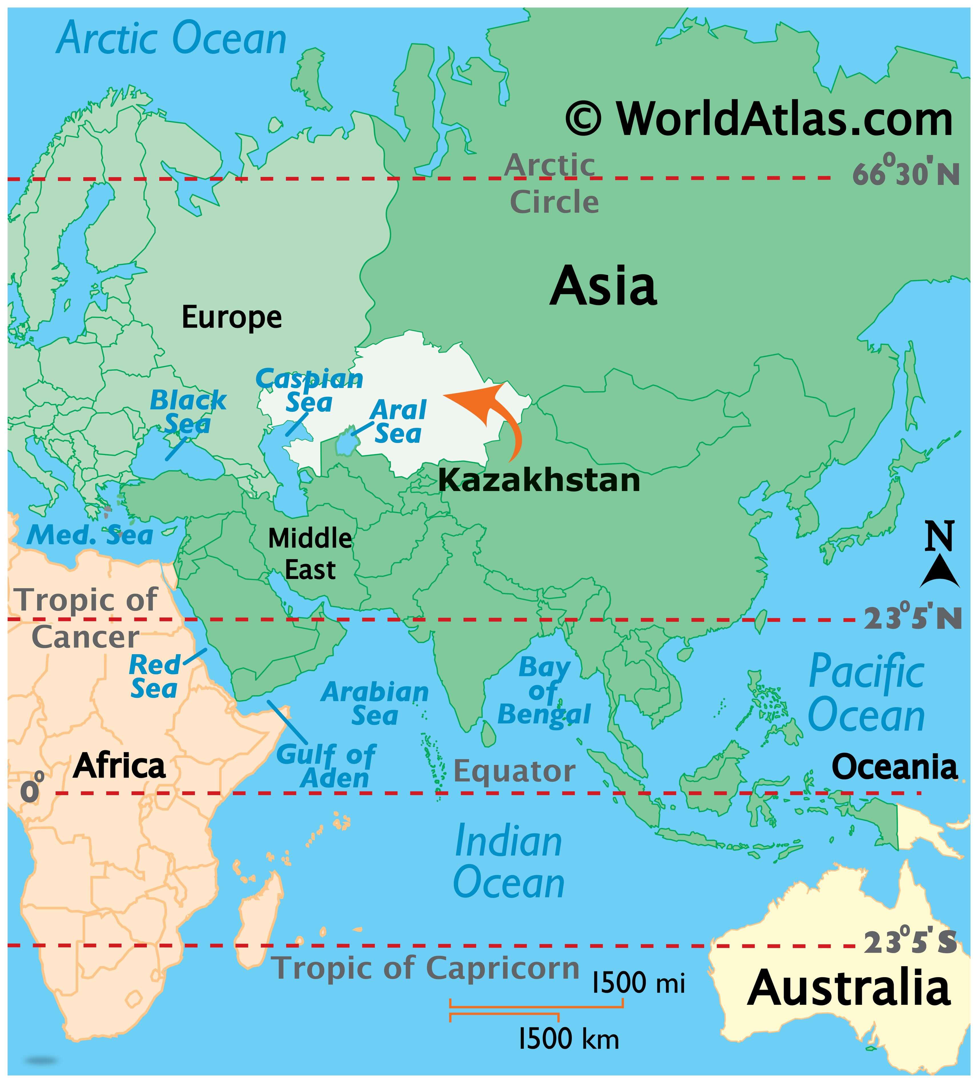
Location Maps
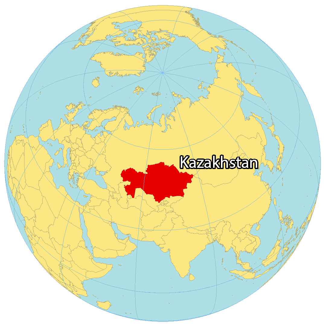
Where is Kazakhstan?
Kazakhstan is a vast country, covering an area of 2,724,900 square kilometers (1,052,100 sq mi). It is the 9th largest country in the world and is home to two major geographic features: the Kazakh Steppe (Great Dala) and the Betpaqdala Desert. The Kazakh Steppe is a vast expanse of open grassland that covers 800,000 square kilometers of the northern region. The Betpaqdala Desert is a mostly flat desert in eastern Kazakhstan. Forests make up anywhere from 1 to 5% of Kazakhstan, making it one of the least forested countries in terms of area. The longest river in this country is the Irtysh River while the largest lake is the Caspian Sea.
High Definition Political Map of Kazakhstan
Physical Map of Kazakhstan
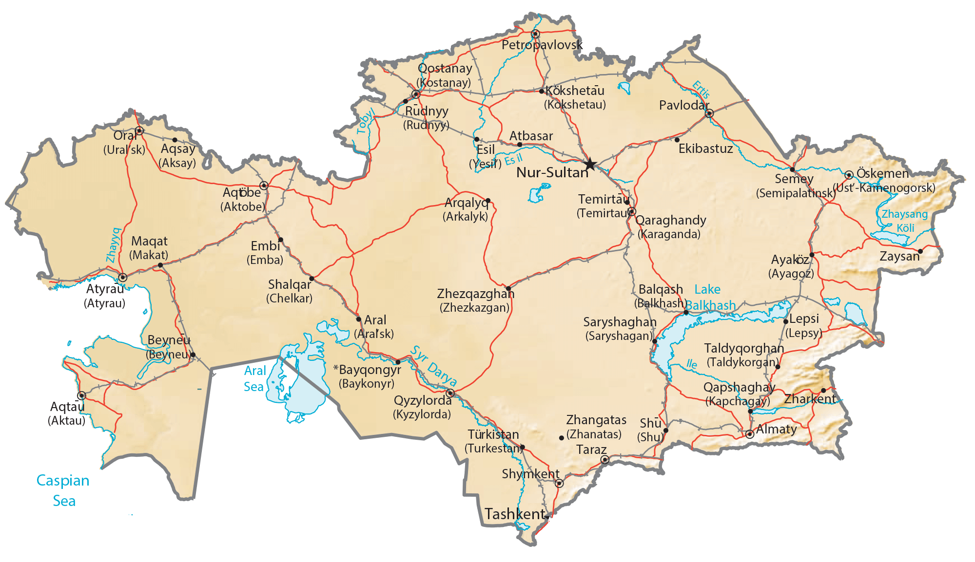
Transportation Map of Kazakhstan
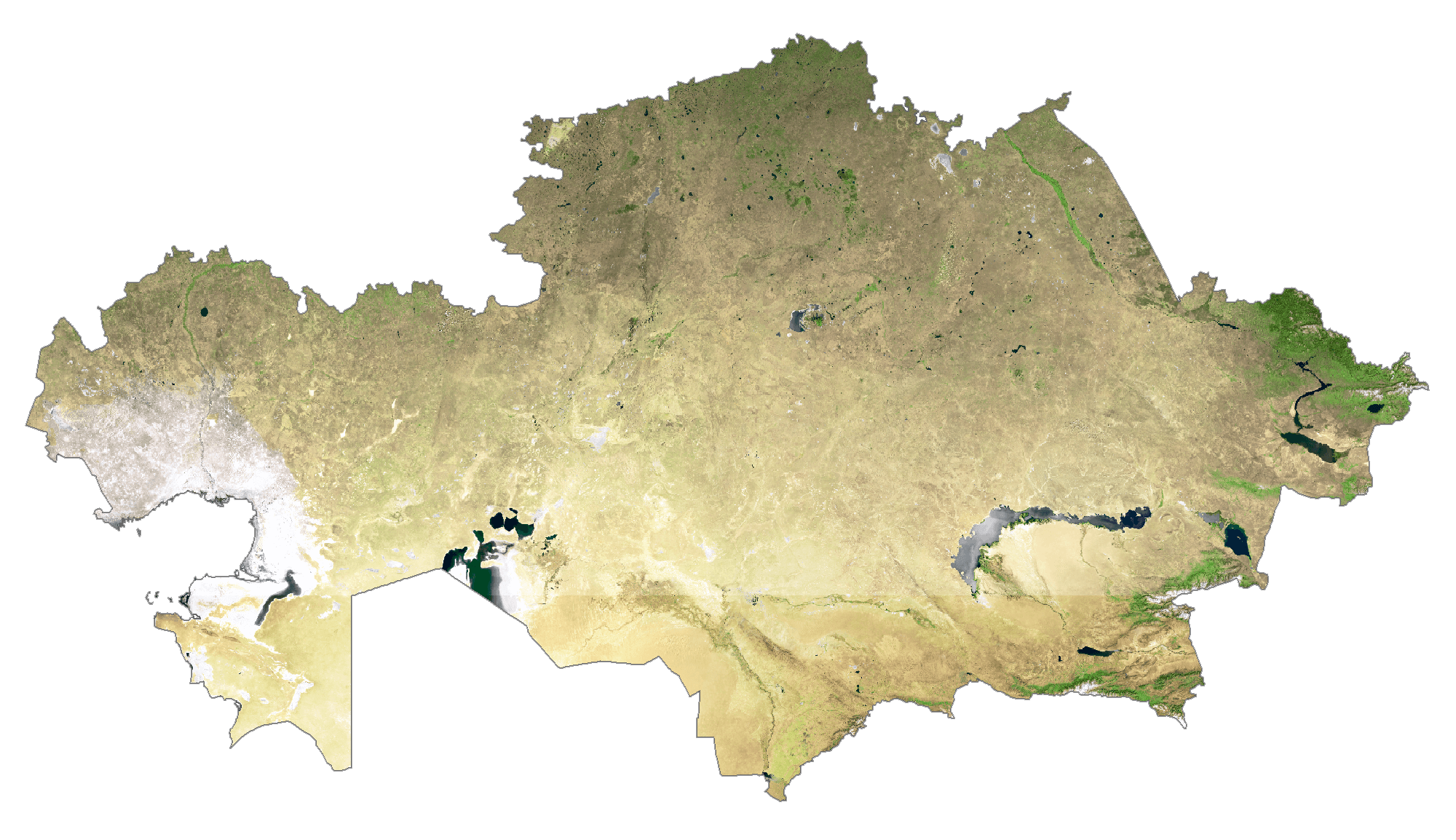
Kazakhstan Satellite Map