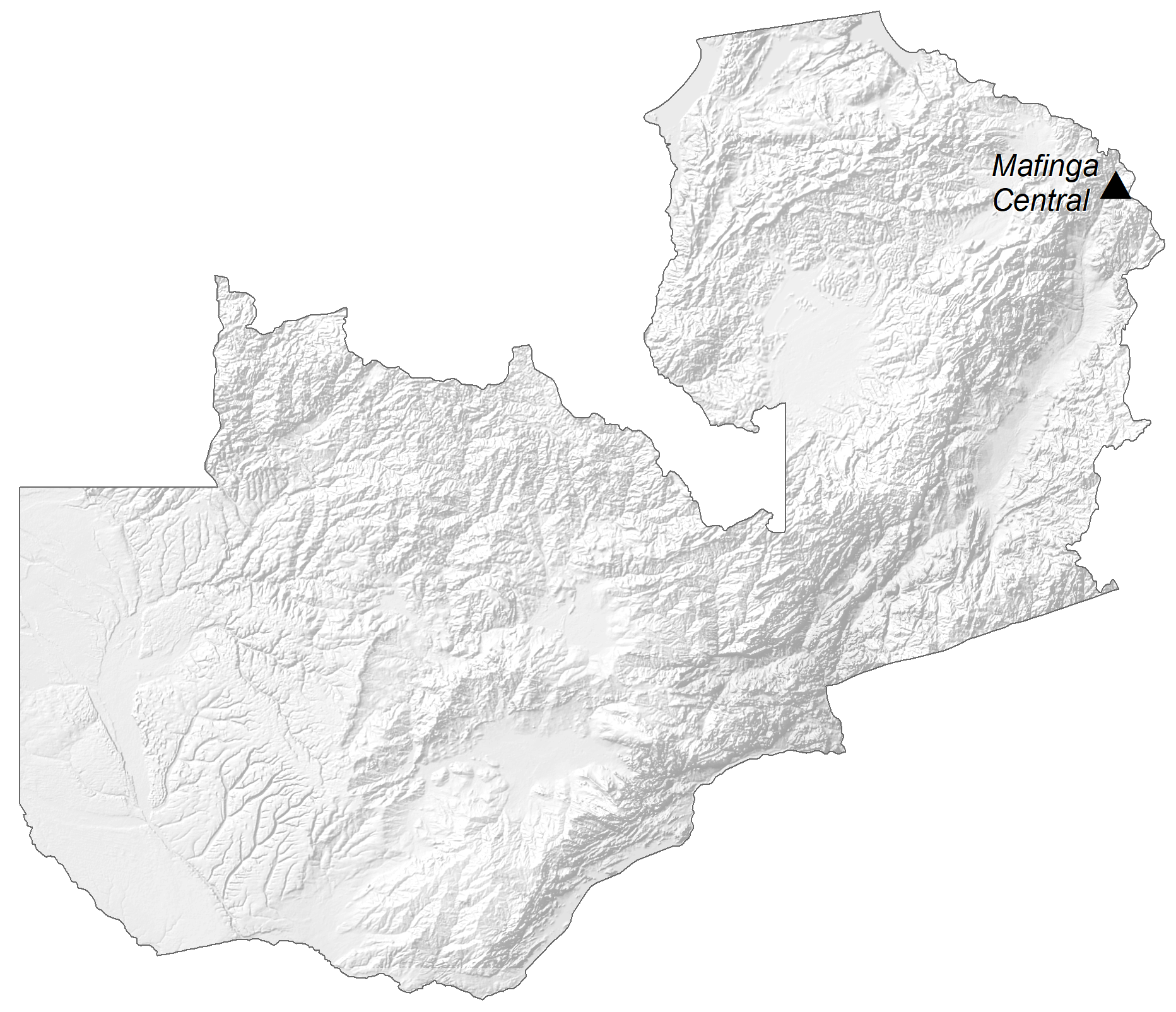
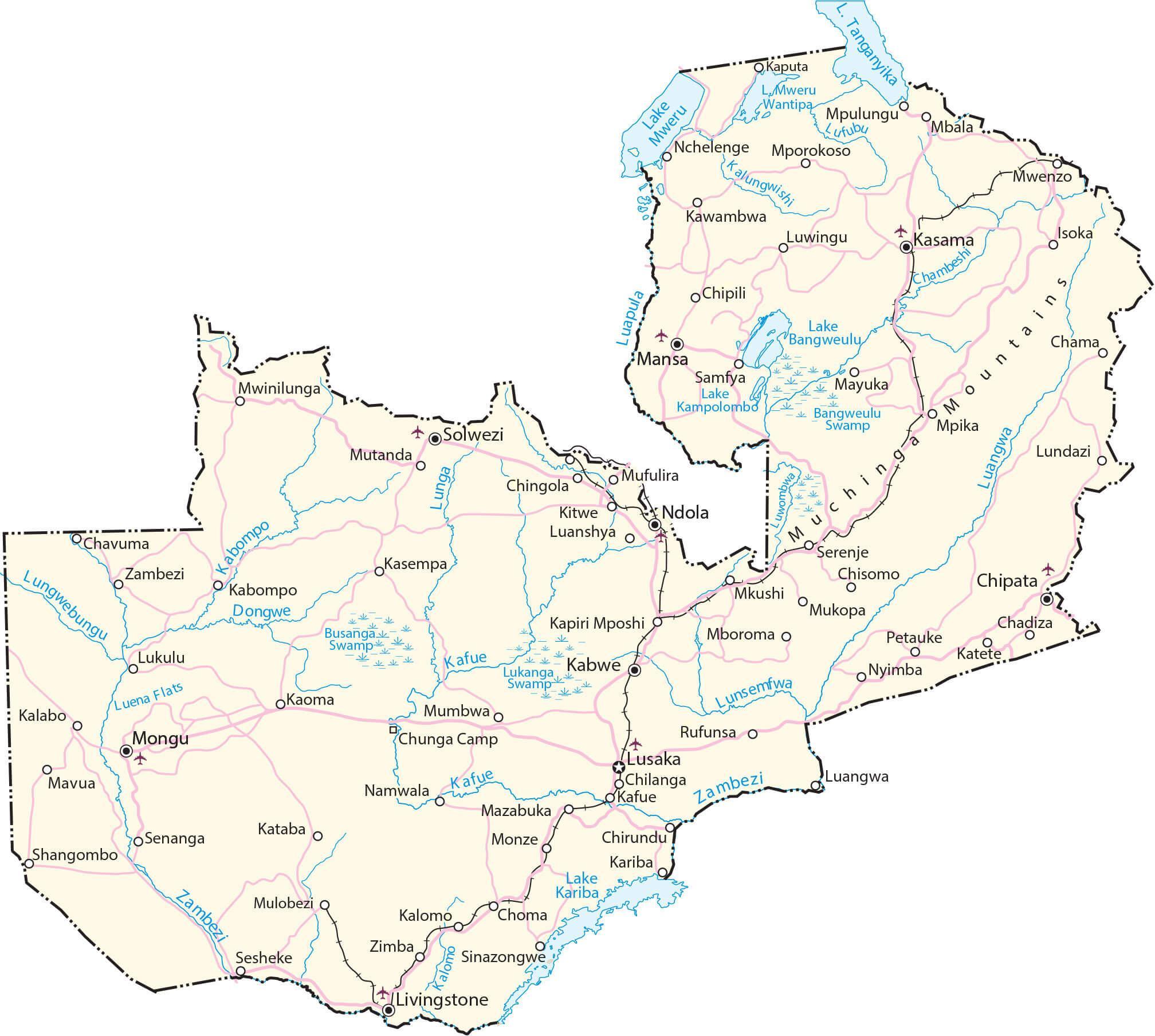
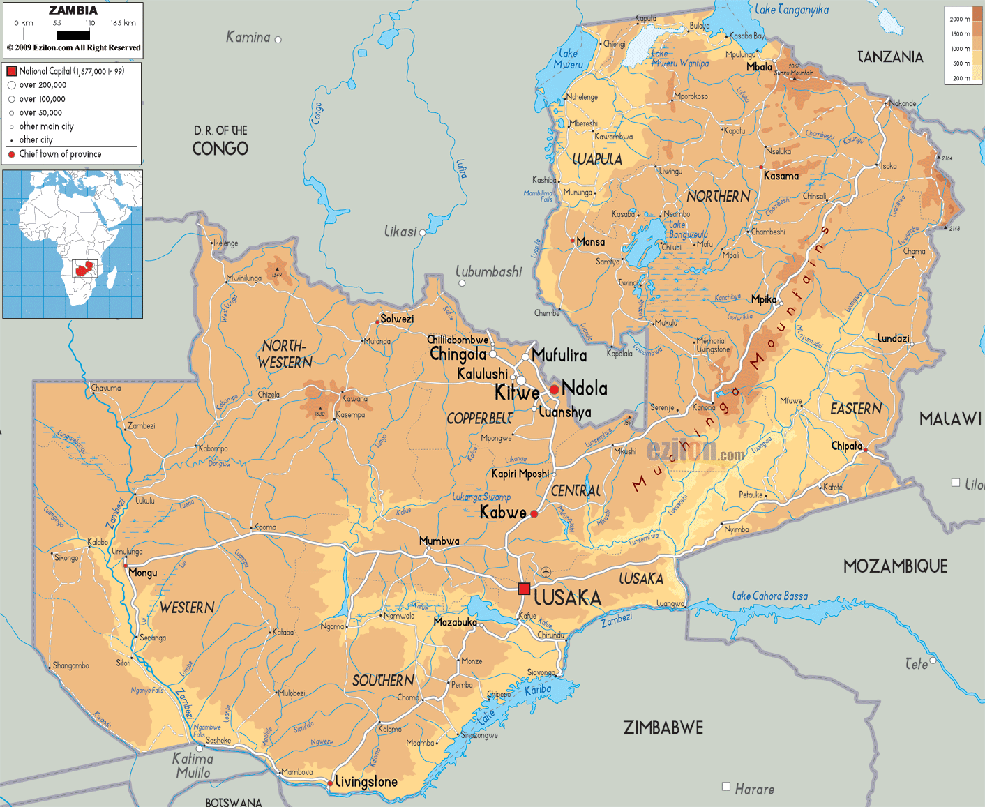
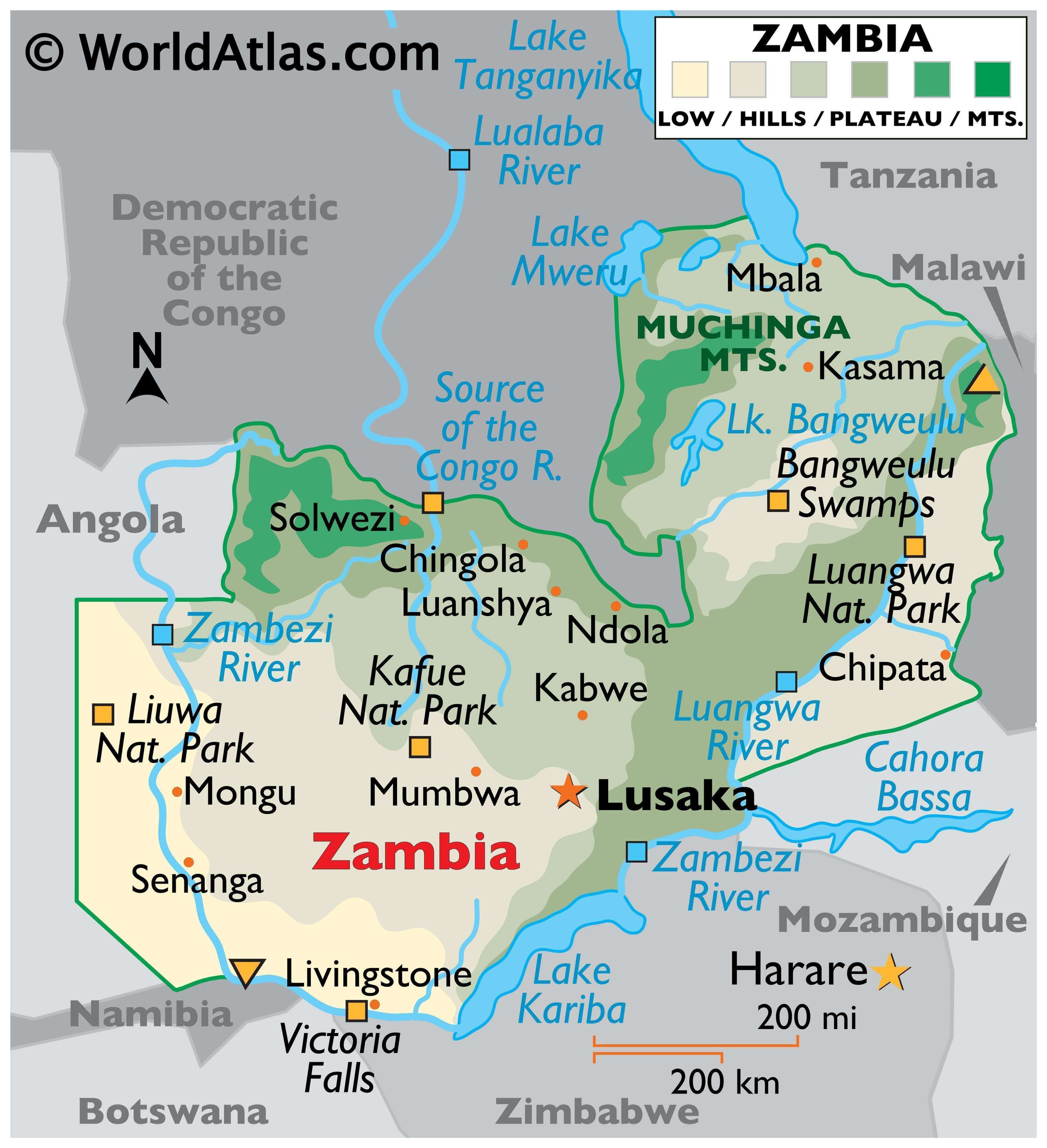
As can be observed on the physical map of Zambia, most of the country consists of a wide plateau, with some scattered mountains (Muchinga) north and central.
The major river system, formed by the Zambezi and its tributaries – the Luangwa and Kafue Rivers – cuts into the plateau forming deep valleys and waterfalls such as Victoria Falls on the southern border with Zimbabwe. Victoria Falls, although neither the highest nor widest of waterfalls in the world, lays claim as the largest in the world based on a width of 5,604 ft. (1,708 m) and height of 354 ft. (108 m).
As marked on the map, a swamp basin surrounds Lake Bangweulu and the savanna grasslands, with woodlands and Rhodesian teak forests covering a large part of the southwest (though they are decreasing in size as the growing population demands more land).
Major lakes of Zambia include Bangweulu, Mweru and Tanganyika.
Zambia’s highest point is an unnamed elevation within the Mafinga Mountains (Hills) at 8,503 ft. (2,301m); the lowest point of the country is the Zambezi River.
Like most of Southern Africa, Zambia also has rich biodiversity that is conserved in its many protected areas. National Parks of the country like the Luangwa National Park, Kafue National Park, etc., act as wildlife havens.
| Flag: |  |
|---|---|
| Legal Name: | Republic of Zambia |
| Capital Value: | Lusaka; note – a proposal to build a new capital city in Ngabwe was announced in May 2017 |
| Official languages: | English, Nyanja and Icibemba (Bemba) |
| Demonym(s): | Zambian |
| Government: | Unitary presidential republic |
| Legislature: | National Assembly |
| Total Area: | 752,618 km² |
| Land Area: | 743,398 km² |
| Water Area: | 9,220 km² |
| Population: | 17,861,030 |
| Density: | 26.1/km (67.6/sq mi) |
| GDP: | $23.06 Billion |
| GDP Per Capita: | $1,291.34 |
| Currency Value: | Zambian kwacha (ZMK) |
| Driving side: | left |
| Calling code: | +260 |
| Internet TLD: | .zm |
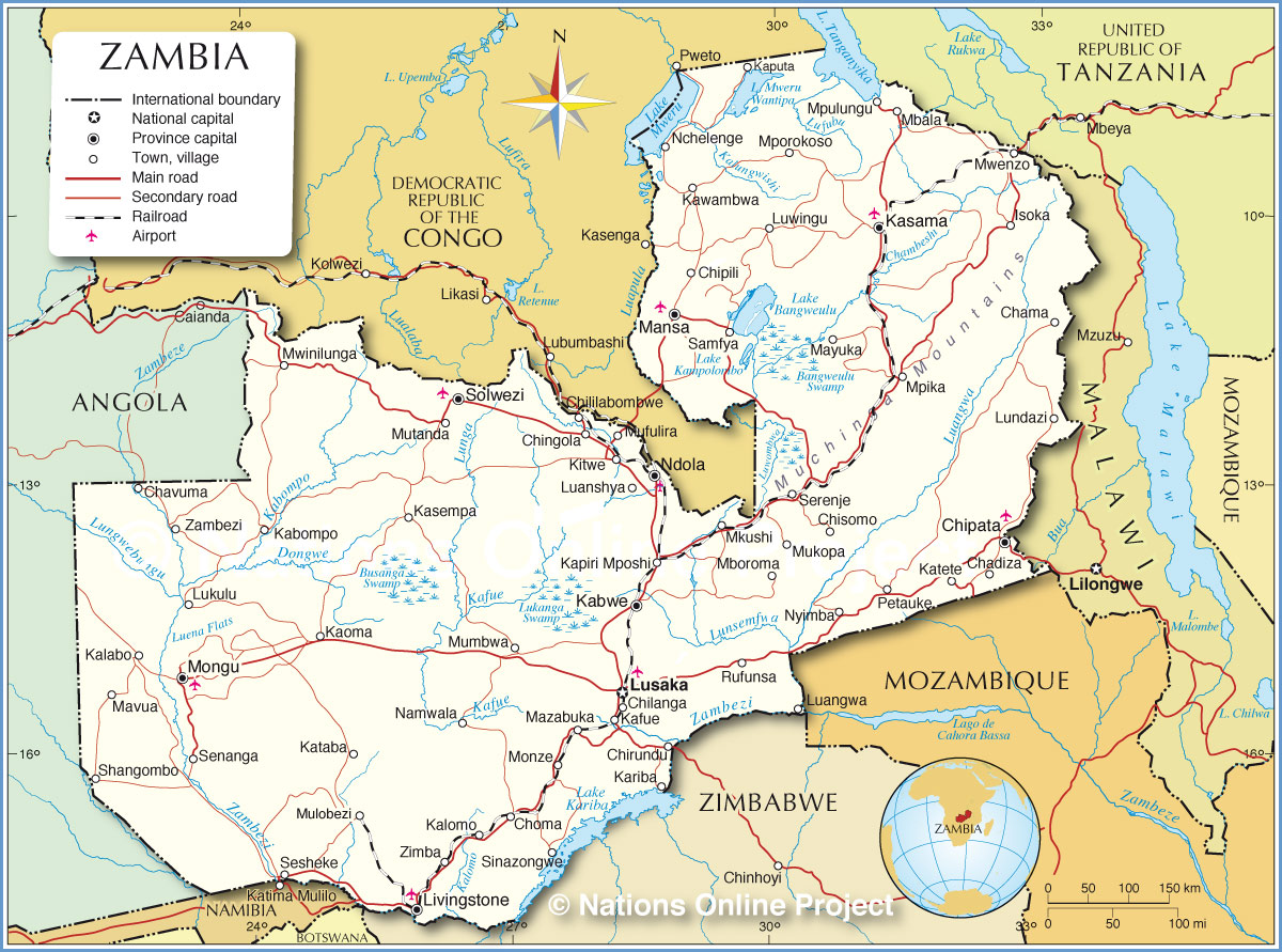
Explore the beauty of Zambia with this detailed map. See the cities, towns, highways, roads, lakes, and rivers of the country. Marvel at the stunning satellite imagery and elevation map of the Muchinga Mountains. Discover Zambia with this amazing map!
Online Interactive Political Map
Click on ![]() to view map in "full screen" mode.
to view map in "full screen" mode.
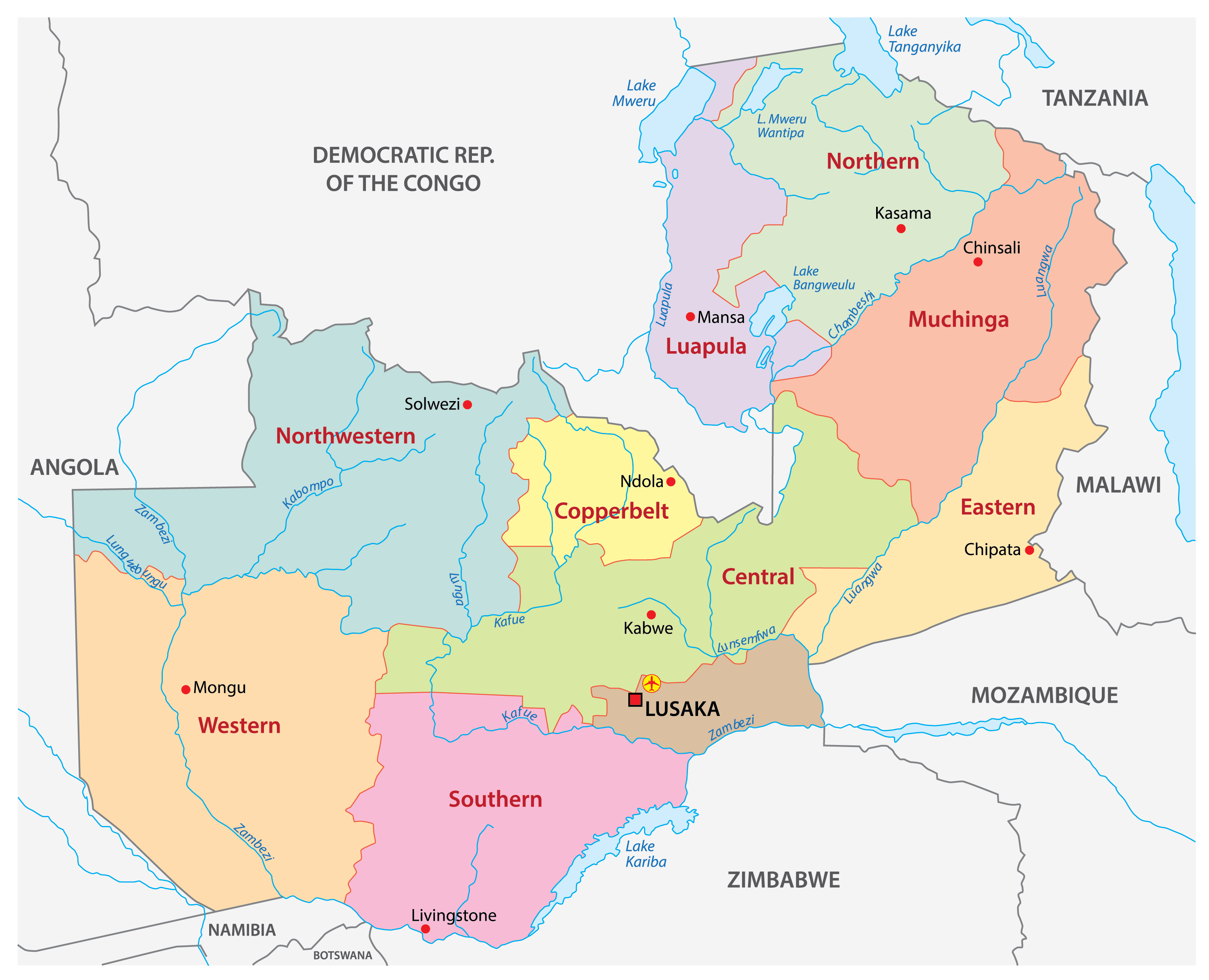
Zambia is divided into 10 provinces. These are Central, Copperbelt, Eastern, Luapula, Lusaka, Muchinga, Northern, North-Western, Southern, and Western. These provinces are further subdivided into districts. With an area of 126,386 sq. km Western Province is the largest by area. Lusaka, which is the smallest province with an area of 21,896 sq. km, hosts the national capital city of Lusaka. It is also the most populous and the most densely populated province in the country.
Location Maps
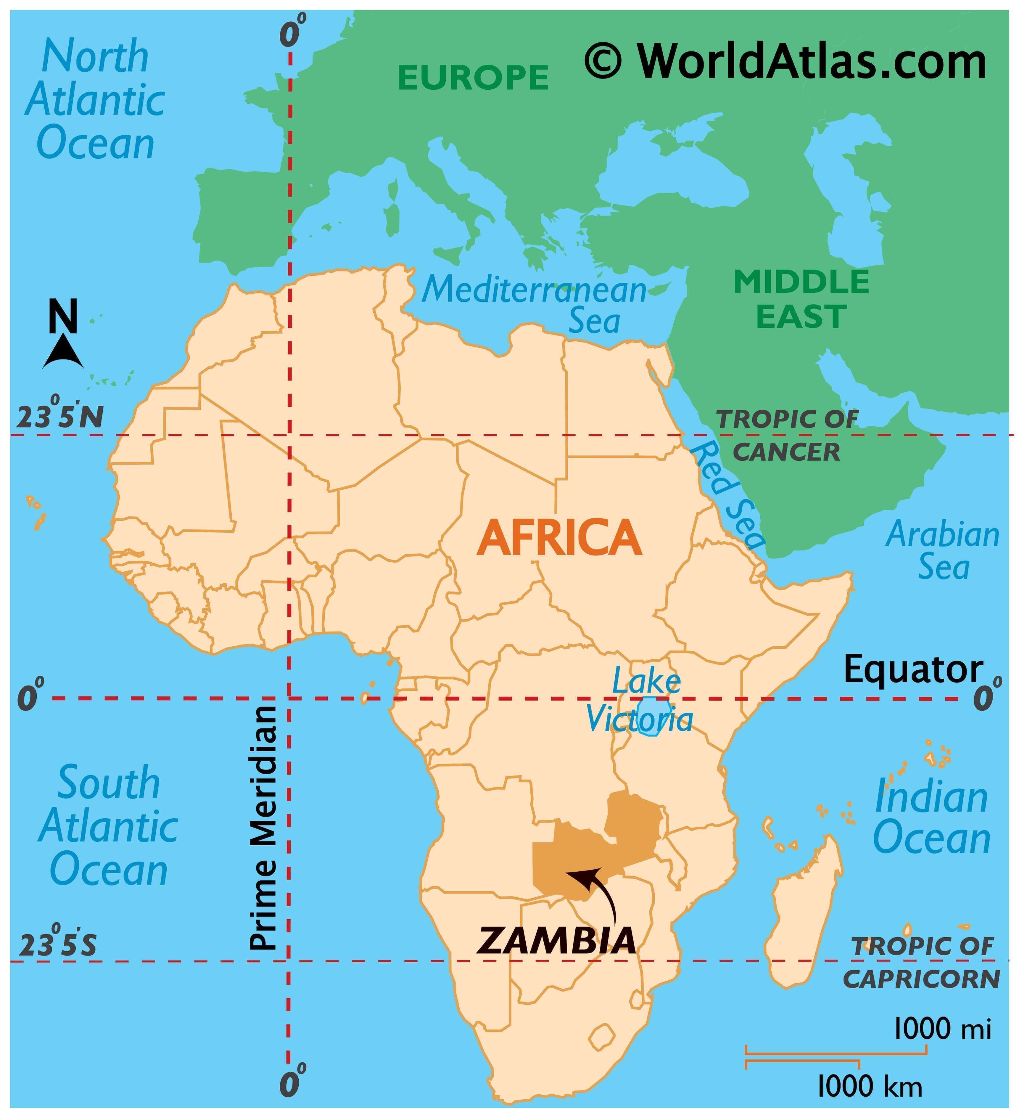
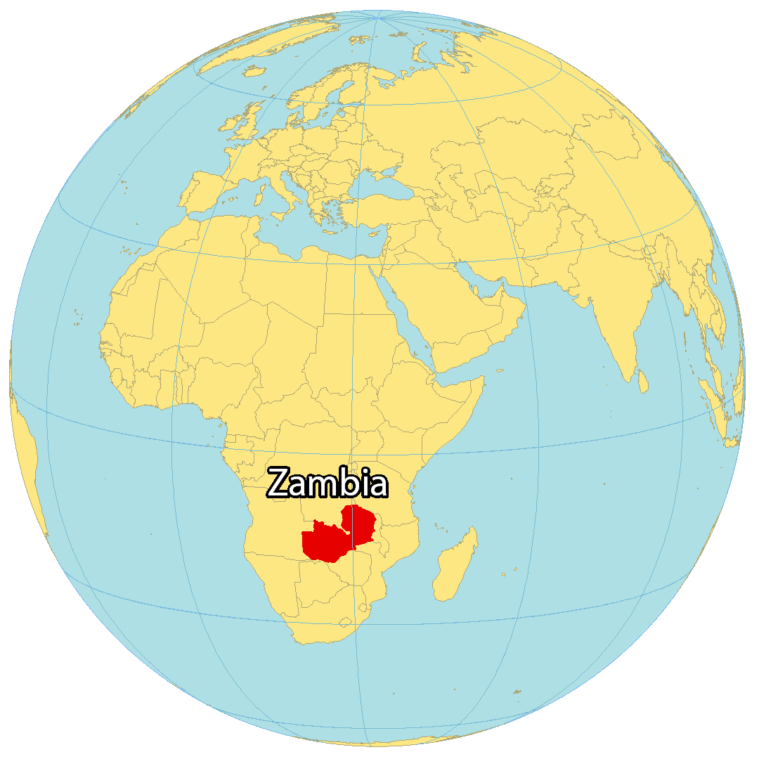
Where is Zambia?
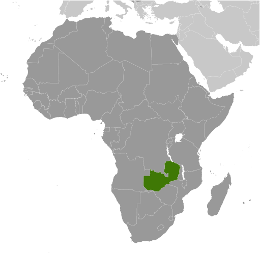
Zambia is located in the divide between Central and Eastern Africa. The country is renowned for its spectacular scenery, safaris, big five wildlife reserves, and the world’s largest waterfall, Victoria Falls. The country’s name is derived from the Zambezi River, which forms its southern boundary.
Zambia is bordered by the Democratic Republic of the Congo to the north, Tanzania to the northeast, Malawi to the east, Mozambique to the southeast, Zimbabwe and Botswana to the south, Namibia to the southwest, and Angola to the west. Lusaka is the capital and largest city of Zambia, with other major cities being Kitwe, Ndola, and Kabwe.
High Definition Political Map of Zambia

Physical Map of Zambia
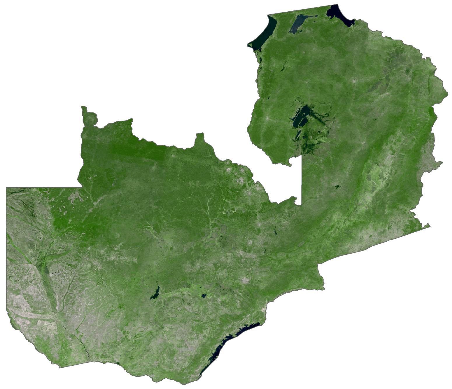
Zambia Satellite Map
Elevation Map