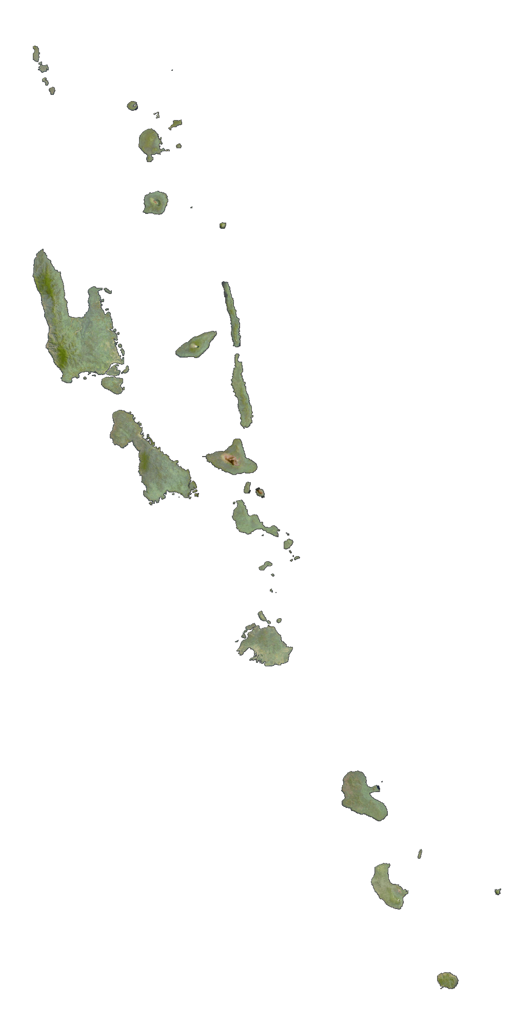
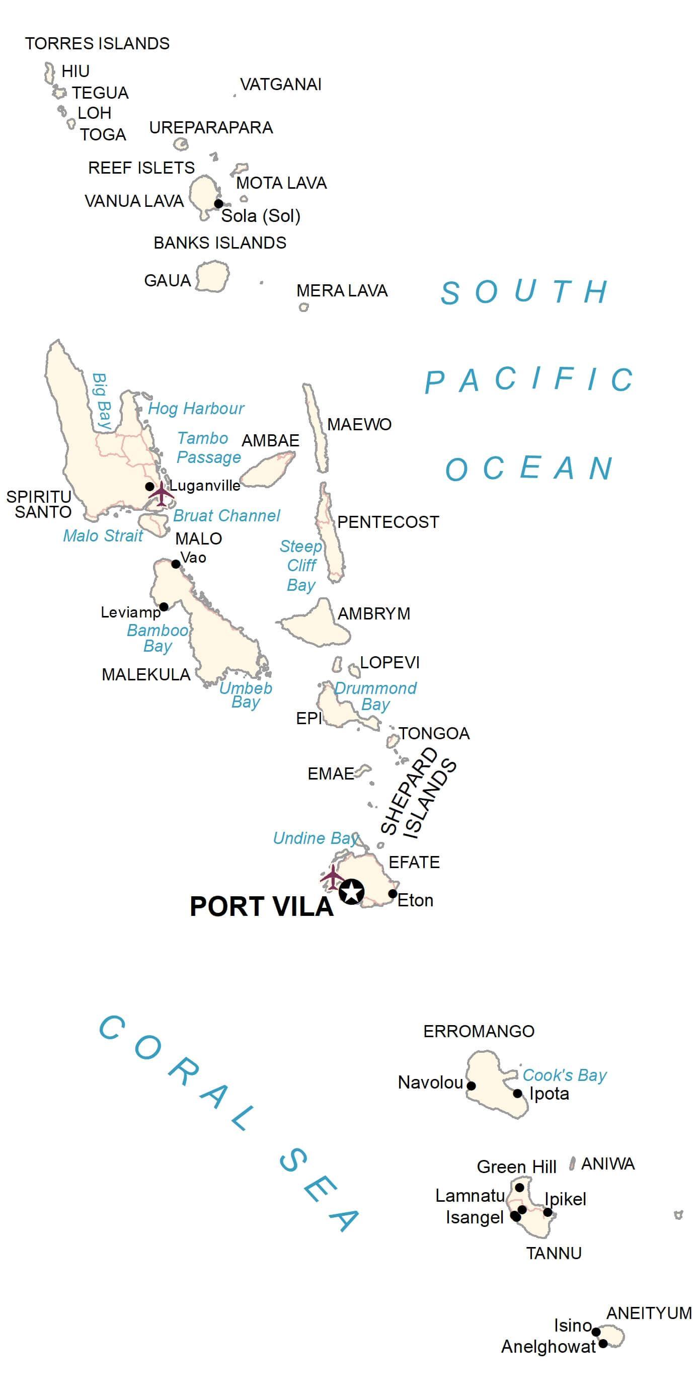
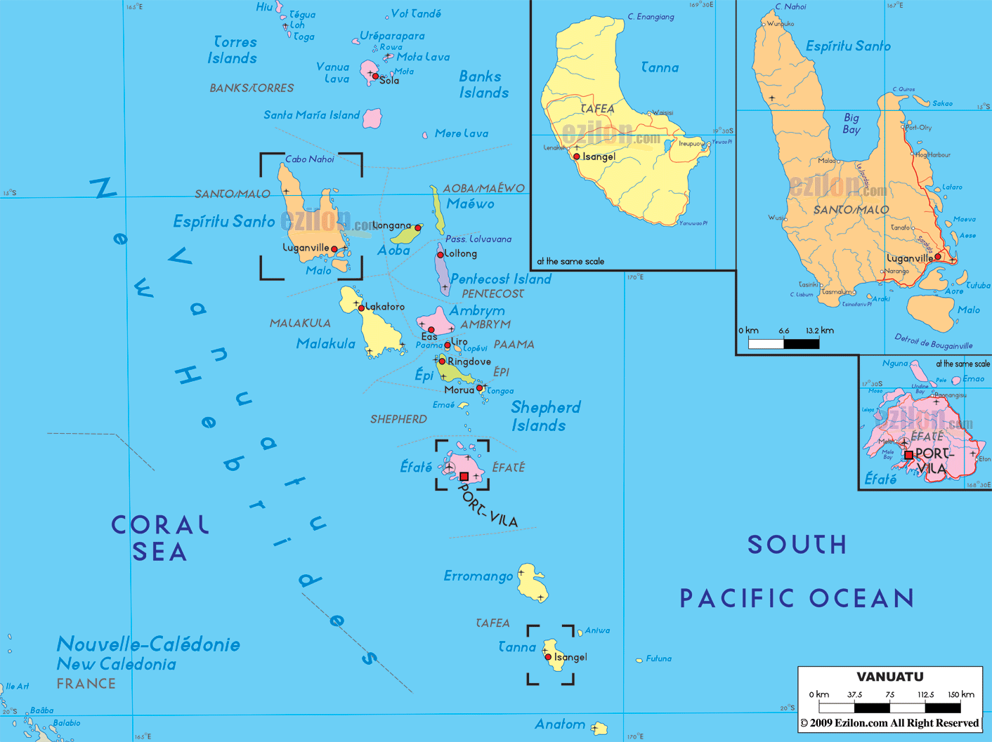
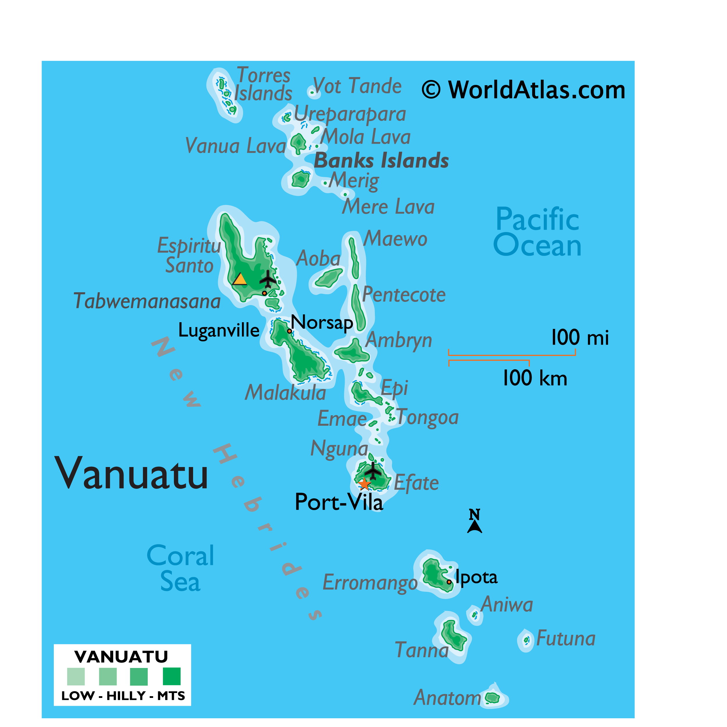
Covering a total land area of 12,189 sq.km (4,706 sq mi), Vanuatu is a Melanesian archipelago comprising of a double chain of 13 principal (larger islands) and about 70 smaller islands located in the South Pacific Ocean as observed on the physical map of Vanuatu above.
The terrain of Vanuatu is diverse and is famed for its gorgeous islands and active volcanoes. Most islands have rugged mountains and are volcanic in origin (some active), mainly covered in lush dense rainforests. Many islands are protected by offshore coral reefs. The highest point is Tabwémasana, located on Espiritu Santo – the largest island, at an elevation of 6,165ft (1,879m). The point is marked on the map above by a yellow triangle. The lowest point is the South Pacific Ocean (0m).
| Flag: |  |
|---|---|
| Legal Name: | Republic of Vanuatu |
| Capital Value: | Port-Vila (on Efate) |
| Official languages: |
|
| Demonym(s): | Ni-Vanuatu and Vanuatuan |
| Government: | Unitary parliamentary republic |
| Legislature: | Parliament |
| Total Area: | 12,189 km² |
| Land Area: | 12,189 km² |
| Population: | 299,882 |
| Density: | 19.7/km (51.0/sq mi) (188th) |
| GDP: | $917.06 Million |
| GDP Per Capita: | $3,058.07 |
| Currency Value: | Vatu (VUV) |
| Driving side: | right |
| Calling code: | +678 |
| Internet TLD: | .vu |
Explore the beauty of Vanuatu with this amazing Vanuatu map collection. See the populated places, roads, islands, and atolls with stunning satellite imagery and an elevation map. Discover the hidden gems of this South Pacific country and plan your next adventure in Vanuatu.
Online Interactive Political Map
Click on ![]() to view map in "full screen" mode.
to view map in "full screen" mode.
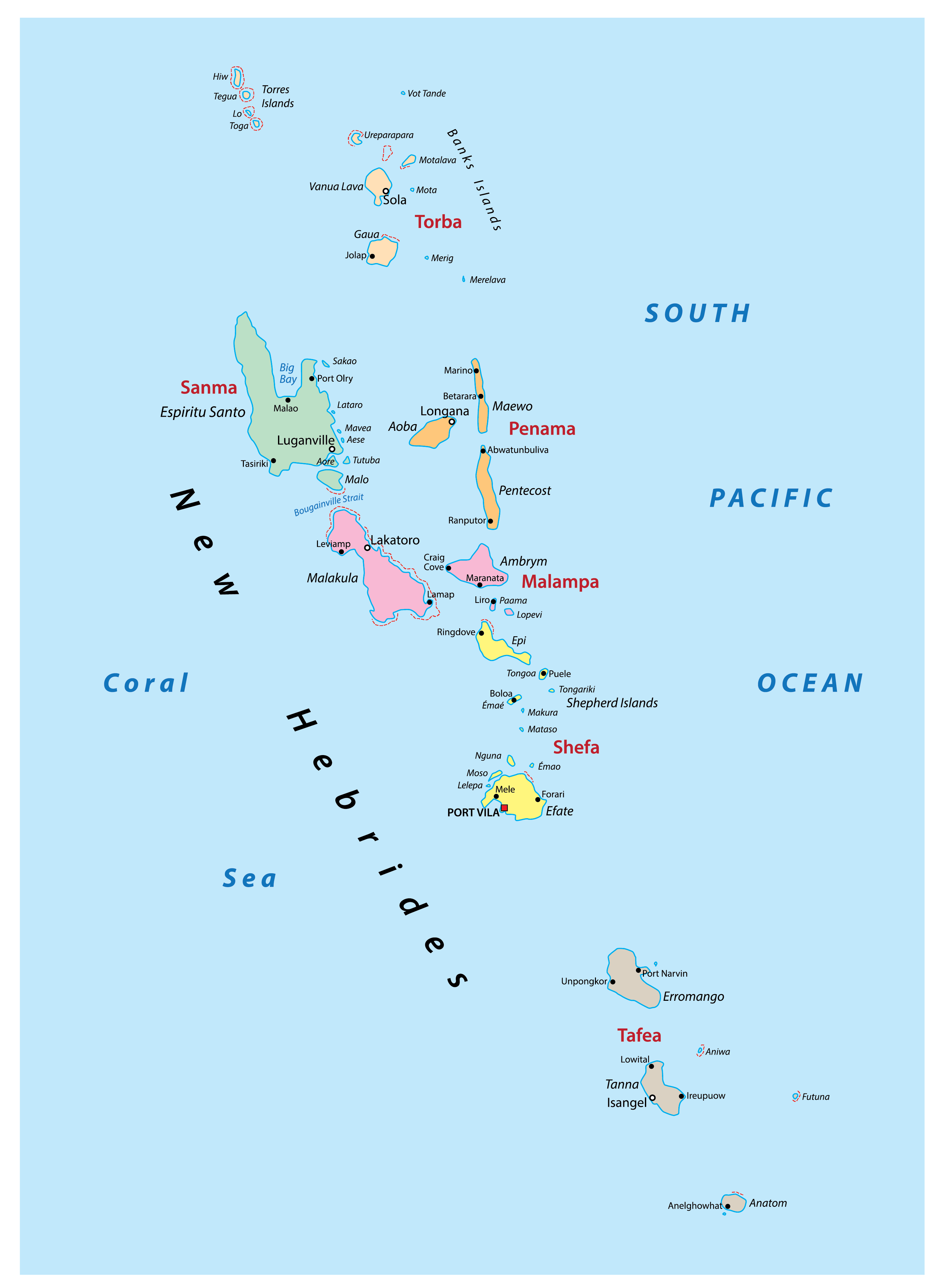
Vanuatu (officially, the Republic of Vanuatu) is divided into 6 provinces. These provinces are: Malampa, Penama, Sanma, Shefa, Tafea and Torba. These provinces are further subdivided into municipalities.
Covering a total land area of 12,189 sq.km, Vanuatu is a Melanesian archipelago comprising of a double chain of 13 principal (larger islands) and about 70 smaller islands located in the South Pacific Ocean. Located on the southern coast of Efate Island in the Shefa province is Port Vila – the capital and the largest city of Vanuatu. It is the administrative, commercial and economic center of Vanuatu. Port Vila also serves as an active commercial port of the island country.
Location Maps
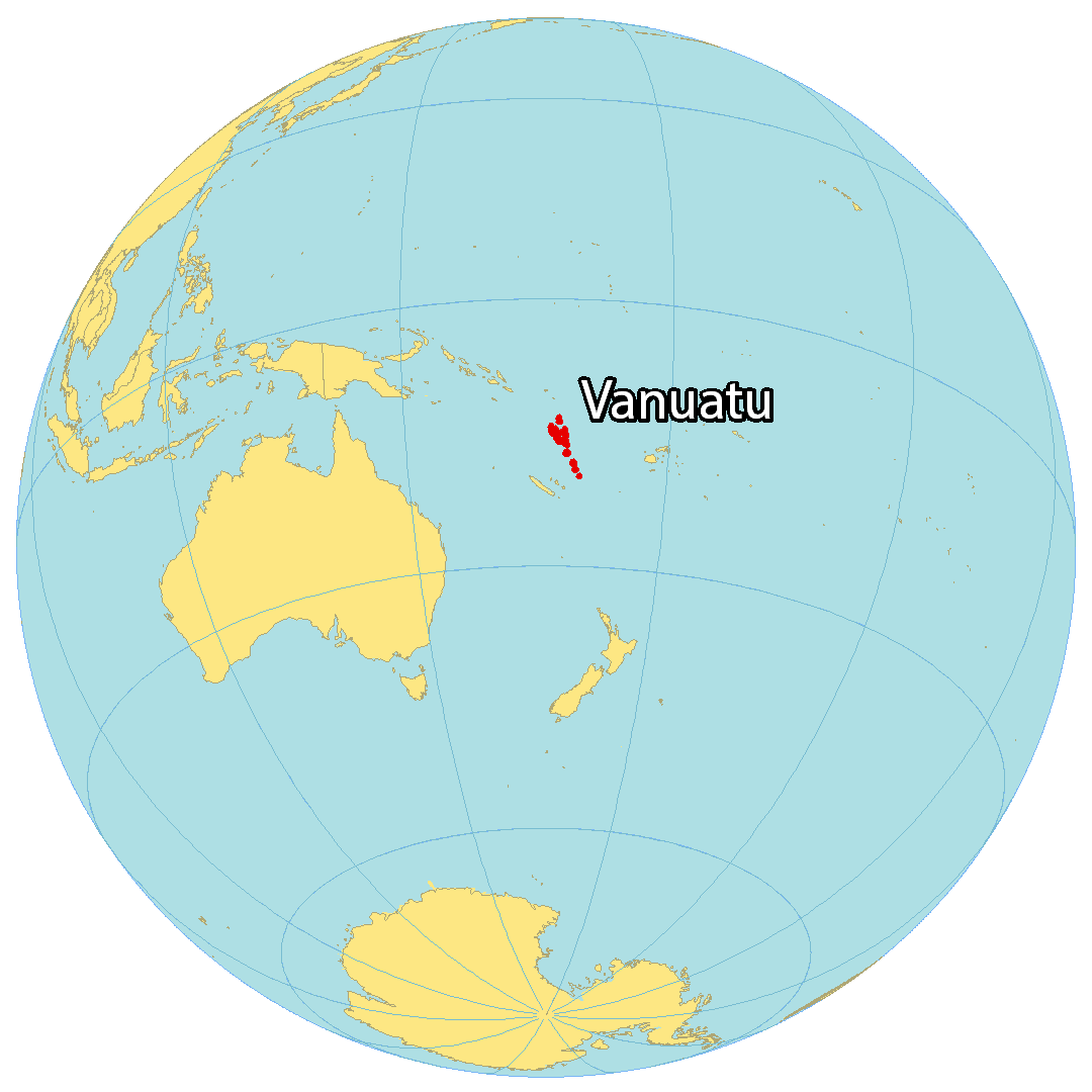
Where is Vanuatu?
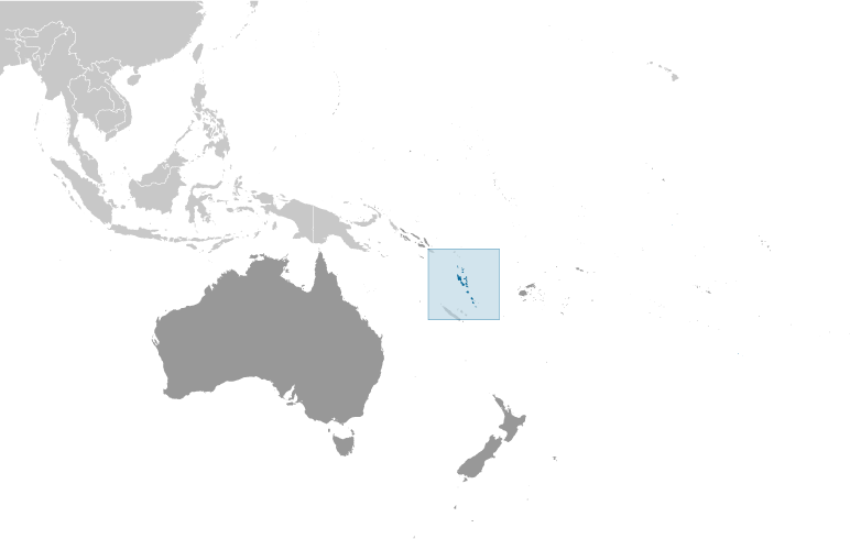
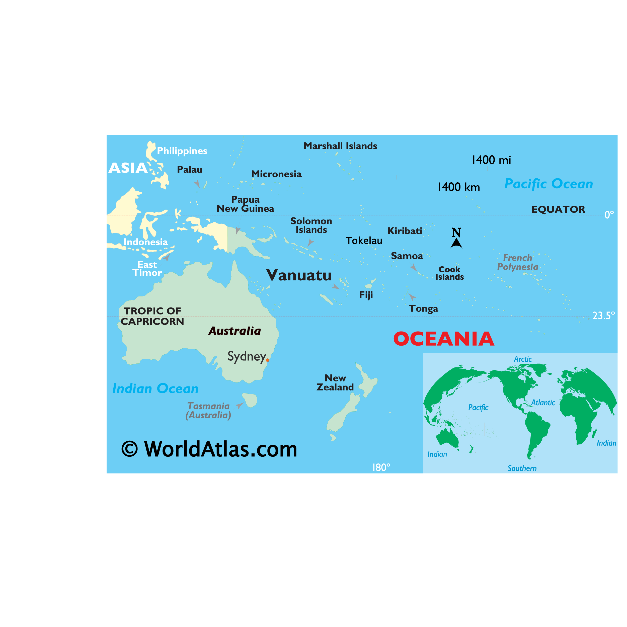
Vanuatu is an archipelago of roughly 83 islands and atolls (65 of them uninhabited) located in the South Pacific Ocean and the Coral Sea. It is situated east of Australia, northeast of New Caledonia, east of Papua New Guinea, southeast of the Solomon Islands, and west of the Fiji Islands. The total area of Vanuatu is 12,189 square kilometers (4,706 sq mi), making it similar in size to the Falkland Islands or the Bahamas. The population is sparse with just over 300,000 people, and the capital and largest city is Port Vila. Vanuatu is shaped roughly like the letter “Y”, and lies in the southern hemisphere between latitudes 13°S and 21°S. The climate is tropical and wet, and the country is part of the Vanuatu Rainforest region recognized for its intact montane and lowland rainforest, mangroves, seasonal forest, and scrub.
High Definition Political Map of Vanuatu
Physical Map of Vanuatu

Vanuatu Satellite Map