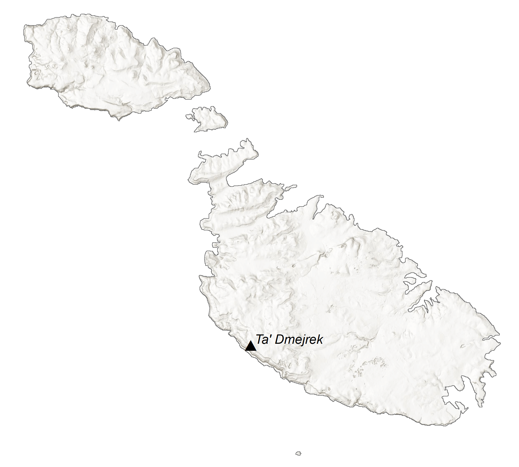
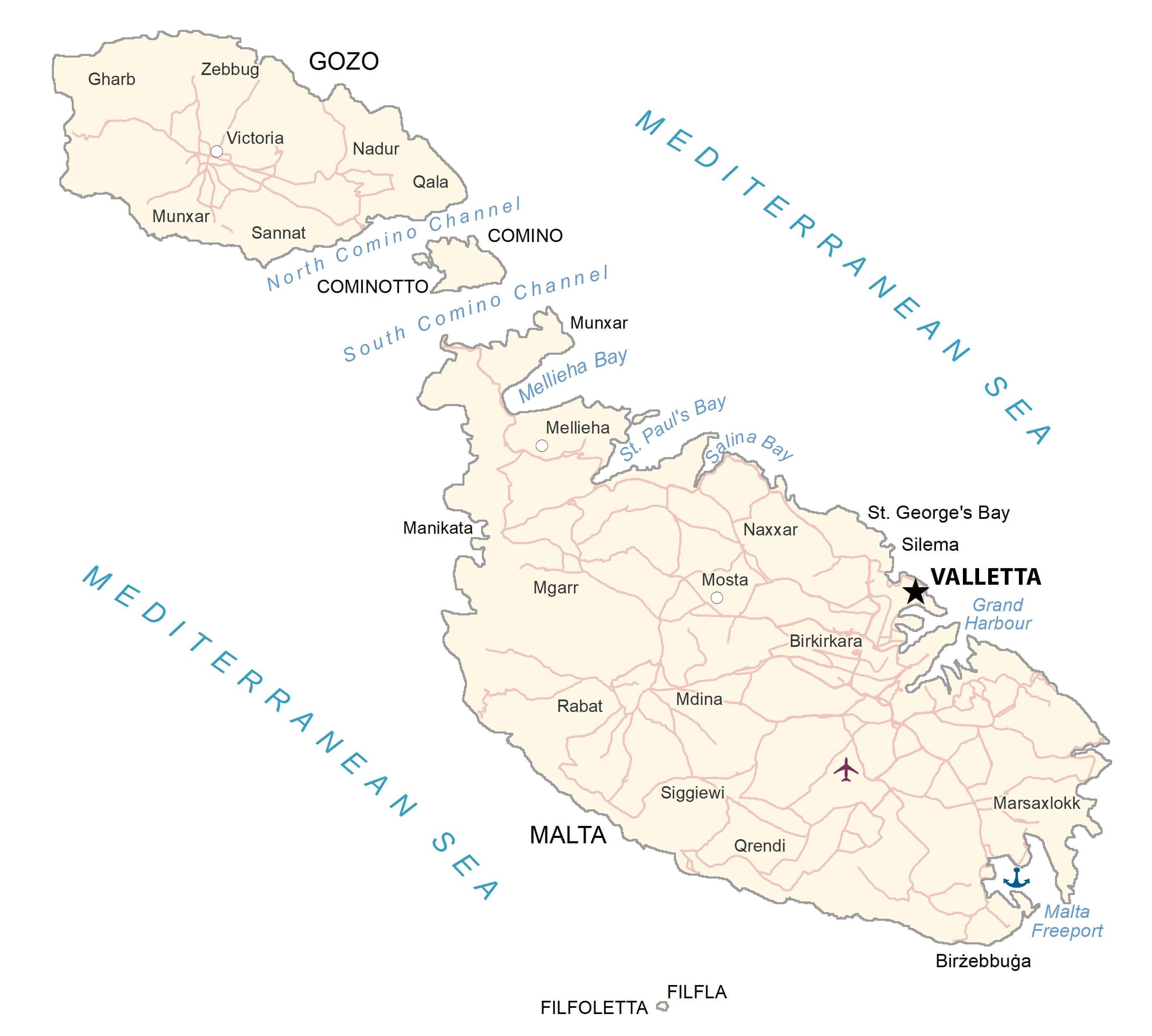
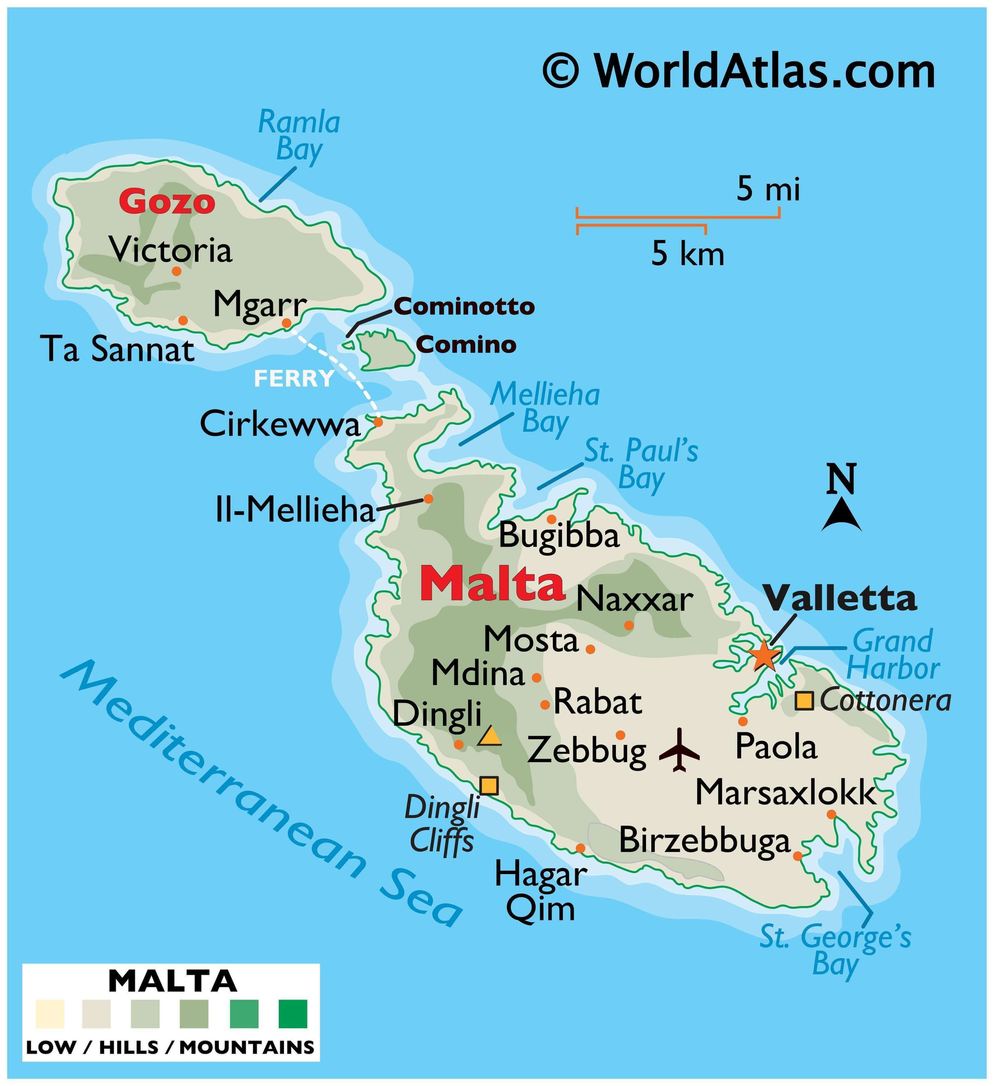
Malta, one of the world’s smallest nations, occupies an area of 316 sq. km in the Mediterranean Sea. As observed on the physical map of Malta, the country is a cluster of small islands. These islands are composed of coralline limestone.
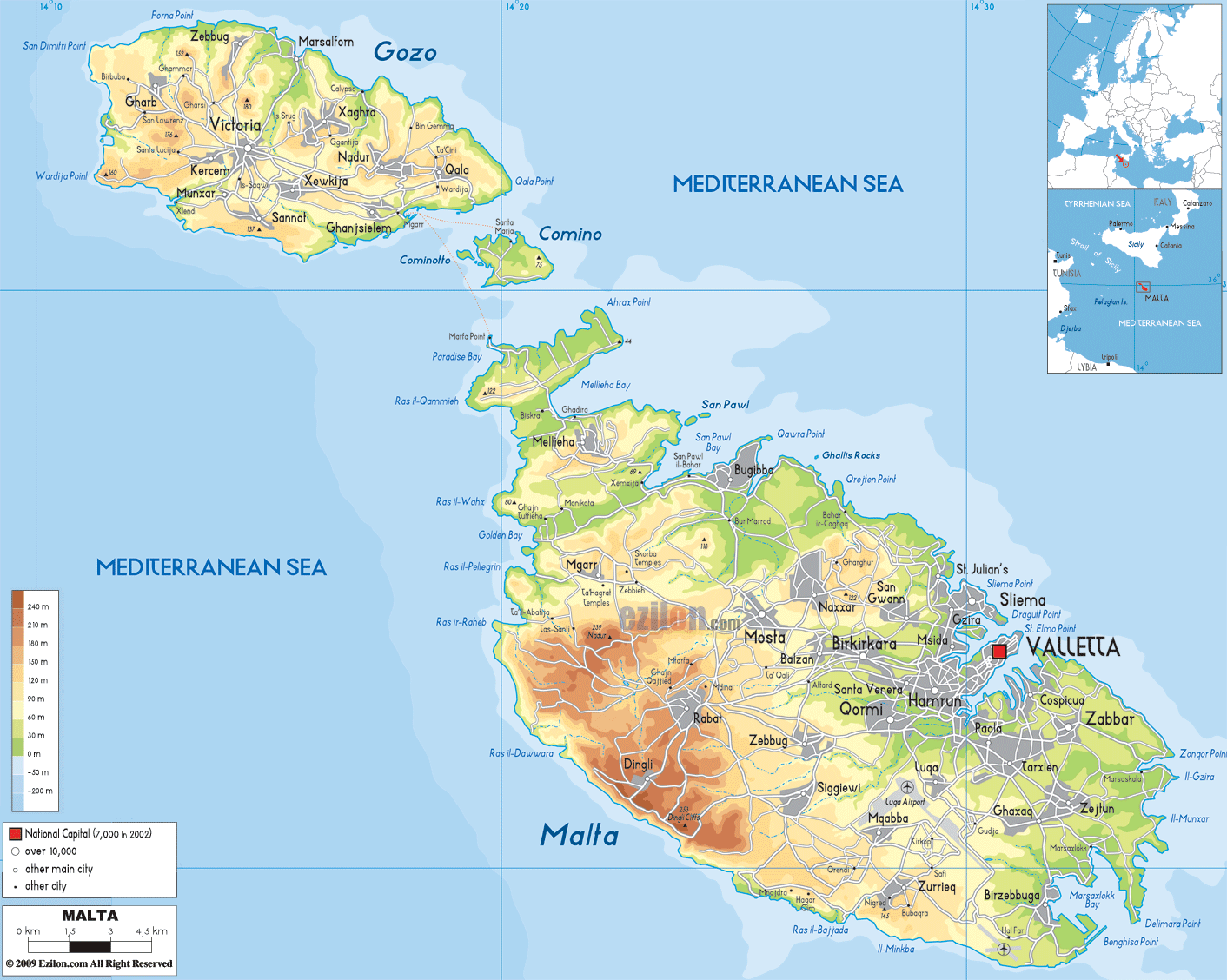
The three largest islands in the archipelago are Malta, Comino, and Gozo. Only these three are inhabited. Each of these islands is mostly low, rocky islands with rugged, steep coastal cliffs.The highest point is located within the triangular plateau Ta’Zuta, and rises to 830 feet (253 m). A yellow triangle marks the position of this point on the map above. The famous Blue Lagoon of Malta is located in the Comino island.
Malta does not have any permanent natural lakes or rivers, though during periods of intense rainfall small rivers are known to form.
| Flag: |  |
|---|---|
| Legal Name: | Republic of Malta |
| Capital Value: | Valletta |
| Official languages: |
|
| Demonym(s): | Maltese |
| Government: | Unitary parliamentary republic |
| Legislature: | Parliament of Malta |
| Total Area: | 316 km² |
| Land Area: | 316 km² |
| Population: | 502,653 |
| Density: | 1,649/km (4,270.9/sq mi) (5th) |
| GDP: | $14.79 Billion |
| GDP Per Capita: | $29,416.23 |
| Currency Value: | Euros (EUR) |
| Driving side: | left |
| Calling code: | +356 |
| Internet TLD: | .mt |
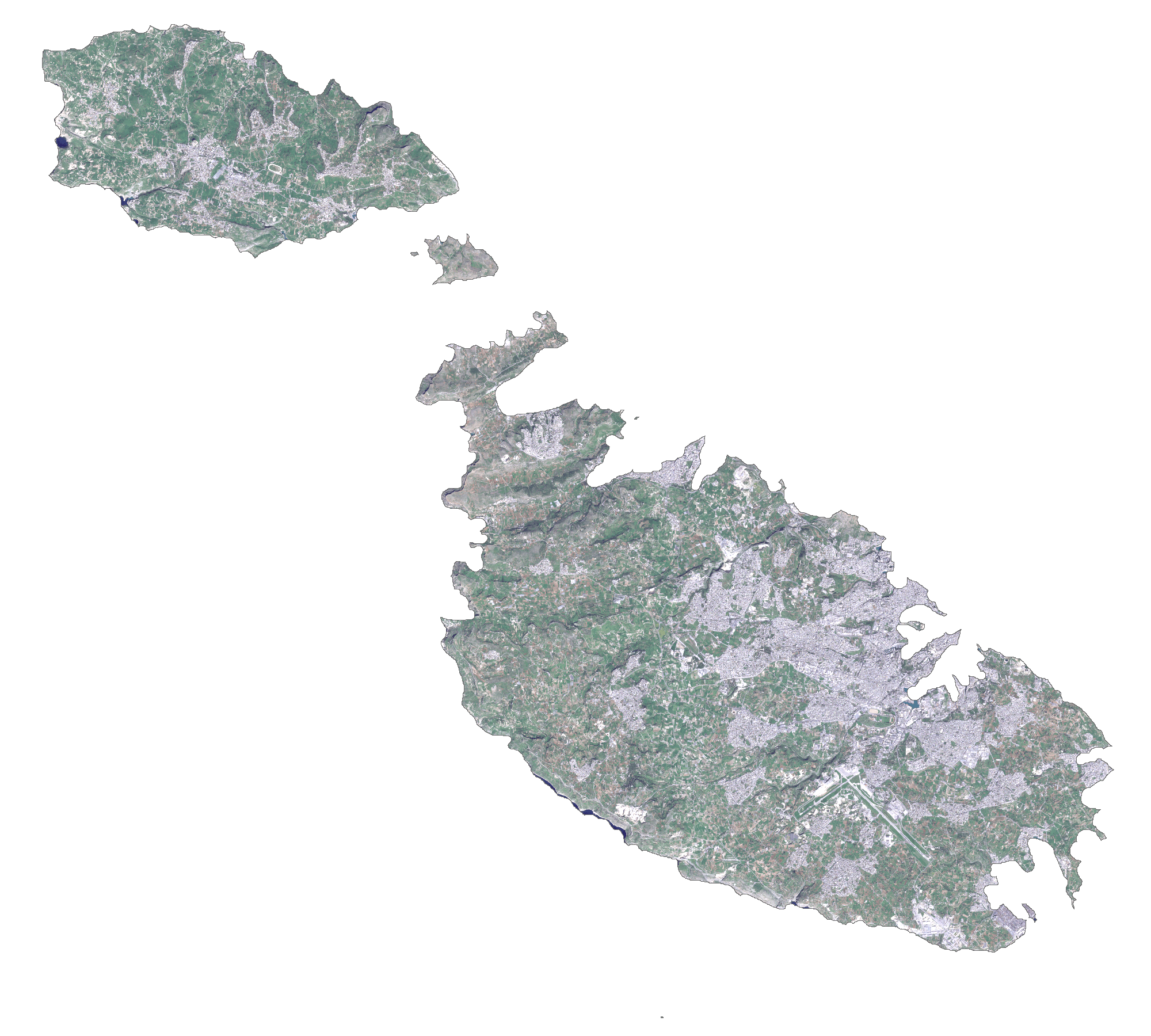
Explore the captivating beauty of Malta with this interactive map. Discover its rugged and indented coastline of harbors and bays, populated places, and islands. Take a virtual tour of the country with satellite imagery and an elevation map.
Online Interactive Political Map
Click on ![]() to view map in "full screen" mode.
to view map in "full screen" mode.
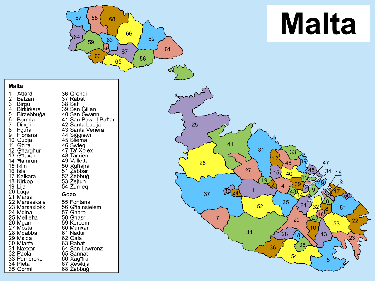
Malta (officially, the Republic of Malta) comprises of the main island of Malta and the smaller islands of Gozo and Comino. Malta is subdivided into 68 localities. In alphabetical order, the 68 localities (Il-lokalita) are: Attard, Balzan, Birgu, Birkirkara, Birzebbuga, Bormla, Dingli, Fgura, Floriana, Fontana, Ghajnsielem, Gharb, Gharghur, Ghasri, Ghaxaq, Gudja, Gzira, Hamrun, Iklin, Imdina, Imgarr, Imqabba, Imsida, Imtarfa, Isla, Kalkara, Kercem, Kirkop, Lija, Luqa, Marsa, Marsaskala, Marsaxlokk, Mellieha, Mosta, Munxar, Nadur, Naxxar, Paola, Pembroke, Pieta, Qala, Qormi, Qrendi, Rabat, Rabat (Ghawdex), Safi, San Giljan/Saint Julian, San Gwann/Saint John, San Lawrenz/Saint Lawrence, Sannat, San Pawl il-Bahar/Saint Paul’s Bay, Santa Lucija/Saint Lucia, Santa Venera/Saint Venera, Siggiewi, Sliema, Swieqi, Tarxien, Ta’ Xbiex, Valletta, Xaghra, Xewkija, Xghajra, Zabbar, Zebbug, Zebbug (Ghawdex), Zejtun and Zurrieq.
With an area of 316 sq. km, Malta is the 10th smallest country in the world. With a population of about 5.15 lakhs people, Malta is the 4th most densely populated country in the world.
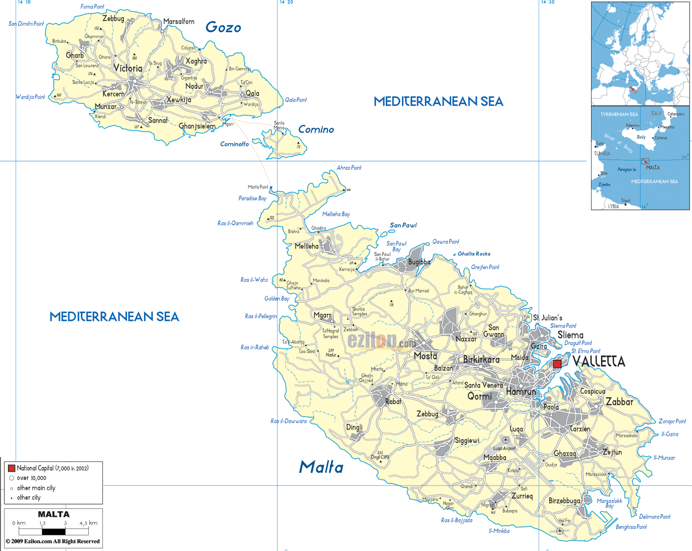
Located on a peninsula between two natural harbours, in the south-eastern part of the island nation, is Valletta – the capital city of Malta. With an area of 0.61 sq. km, it is the southernmost capital of Europe and the smallest capital city of EU. Valletta is Malta’s chief cultural center and also the country’s administrative and commercial hub. Valletta has the island’s largest harbour – Grand Harbour.
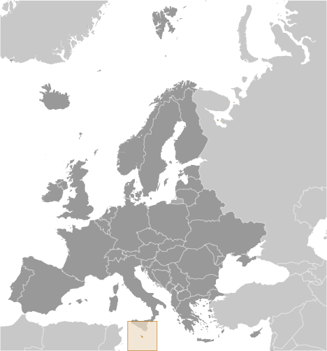
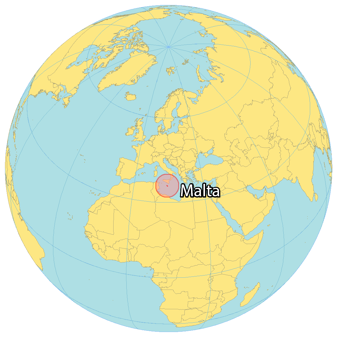
Location Maps
Where is Malta?
Malta is an island country located in the Mediterranean Sea, approximately 81 kilometers (50 mi) south of Italy and 300 kilometers (186 mi) to the southwest of Tunisia. With a population of just over 500,000, it’s one of the smallest countries in Europe and the tenth smallest in the world. Malta is known for its close historic connection to both Europe and North Africa, and its capital and largest city is Valletta.

High Definition Political Map of Malta
Physical Map of Malta
Malta Satellite Map
Elevation Map