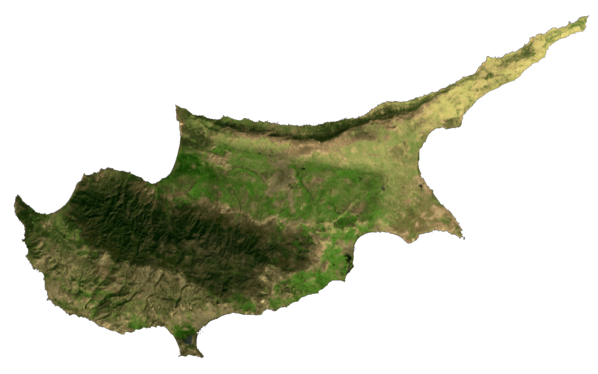
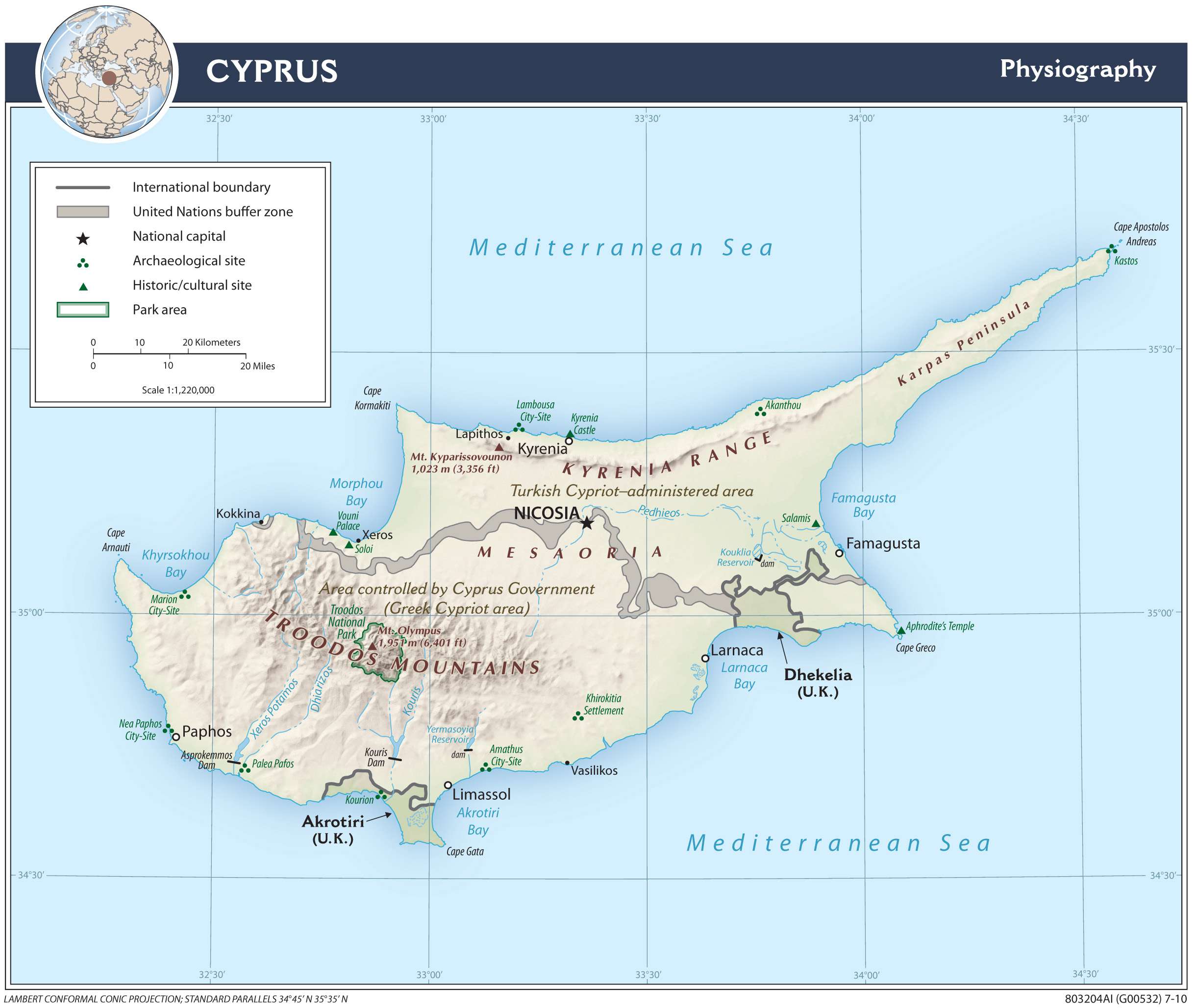
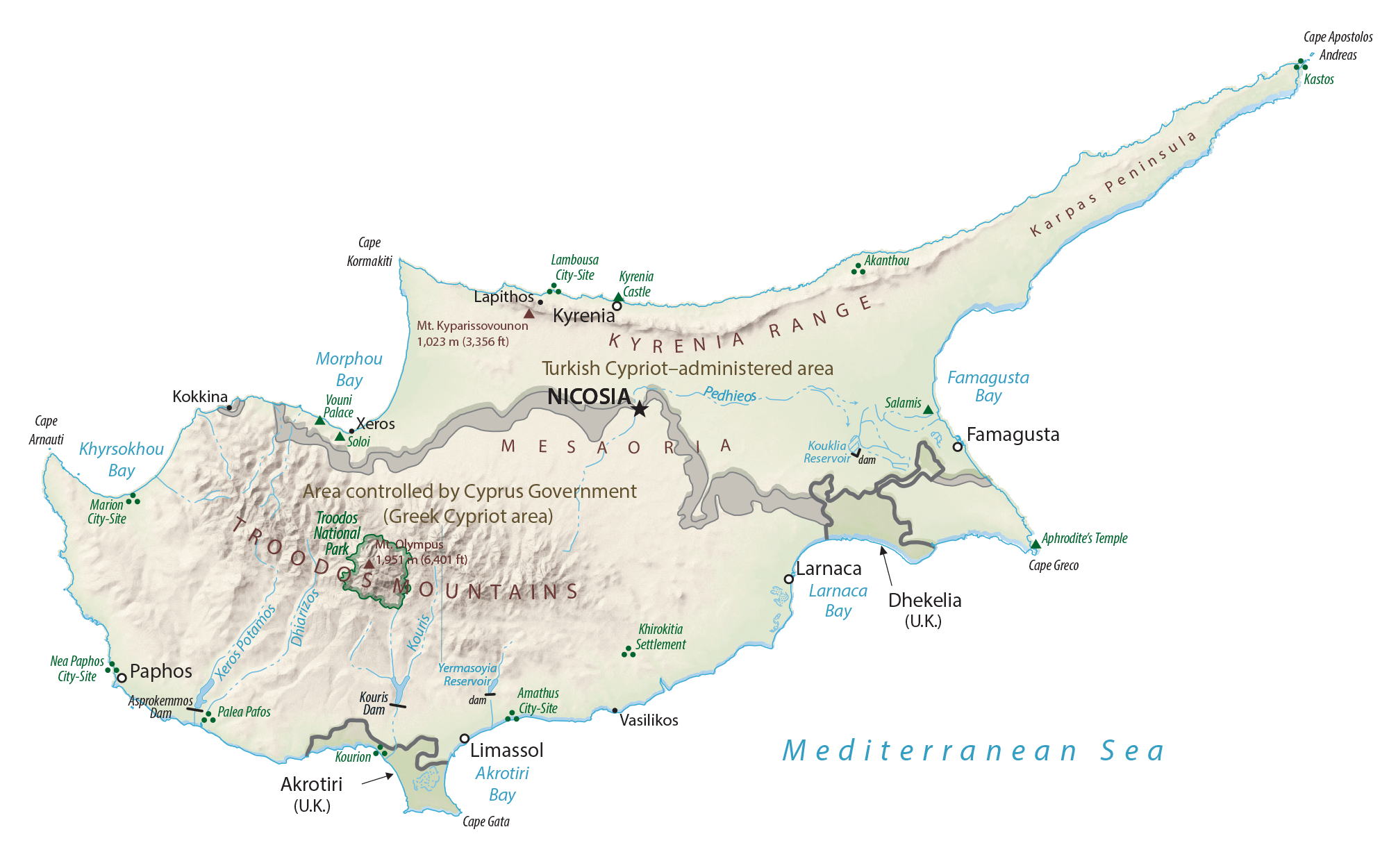
With an area of 9,251 sq. km, Cyprus is the third largest Mediterranean Island.
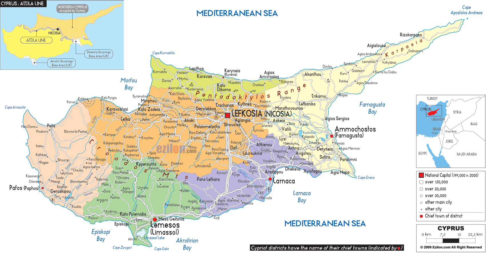
As observed on the physical map above, a very narrow band of mountains (the Kyrenia) slices across the northern edge of Cyprus. That low range of mountains reaches a maximum of 1,024 m (3,360 ft) in elevation.
In the south and western portions of the island the Troodos Mountains dominate. The highest point on Cyprus, located in the center of the Troodos range, is Mount Olympus at 1,952 m (6,404 ft). It has been marked on the map.
To the north of Nicosia is a somewhat fertile plain called the Mesaoria, it crosses the island from west to east. There are a number of rivers crossing that plain, but none of them have water year round.
Rivers are seasonal and only flow after heavy rain, and under those conditions the Pedieos is the longest river in Cyprus. It rises in the Troodos Mountains, flowing northeast through the capital city of Nicosia. It then steers east, meeting the sea at Famagusta Bay. The river has a total length of approximately 100 km.
Cyprus has over 100 dams and reservoirs, and all are the island’s principal source of water for both agricultural and domestic use.
The lowest point in Cyprus is the Mediterranean Sea at 0 m.
| Flag: |  |
|---|---|
| Legal Name: | Republic of Cyprus |
| Capital Value: | Nicosia (Lefkosia/Lefkosa) |
| Official languages: |
|
| Demonym(s): | Cypriot |
| Government: | Unitary presidential republic |
| Legislature: | House of Representatives |
| Total Area: | 9,251 km² |
| Land Area: | 9,241 km² |
| Water Area: | 10 km² |
| Population: | 1,198,575 |
| Density: | 123.4/km (319.6/sq mi) (82nd) |
| GDP: | $24.56 Billion |
| GDP Per Capita: | $27,858.37 |
| Currency Value: | Euros (EUR) |
| Driving side: | left |
| Calling code: | +357 |
| Internet TLD: | .cy |
Cyprus is an enchanting Mediterranean island nation located in the Eastern Mediterranean Sea. With its stunning coastline, stunning beaches, and stunning mountain ranges, it’s no wonder why Cyprus is a popular tourist destination. From its ancient ruins to its vibrant culture and cuisine, Cyprus offers something for everyone. This map collection gives you a comprehensive overview of the country, featuring a reference, satellite, physical, and administration map of Cyprus. Each map highlights major cities, highways, and the United Nations Buffer Zone between the Republic of Cyprus and the Turkish Republic of Northern Cyprus. Whether you’re looking for a detailed overview of the country or just want to get a better sense of its geography, this map collection is an invaluable resource.
Online Interactive Political Map
Click on ![]() to view map in "full screen" mode.
to view map in "full screen" mode.
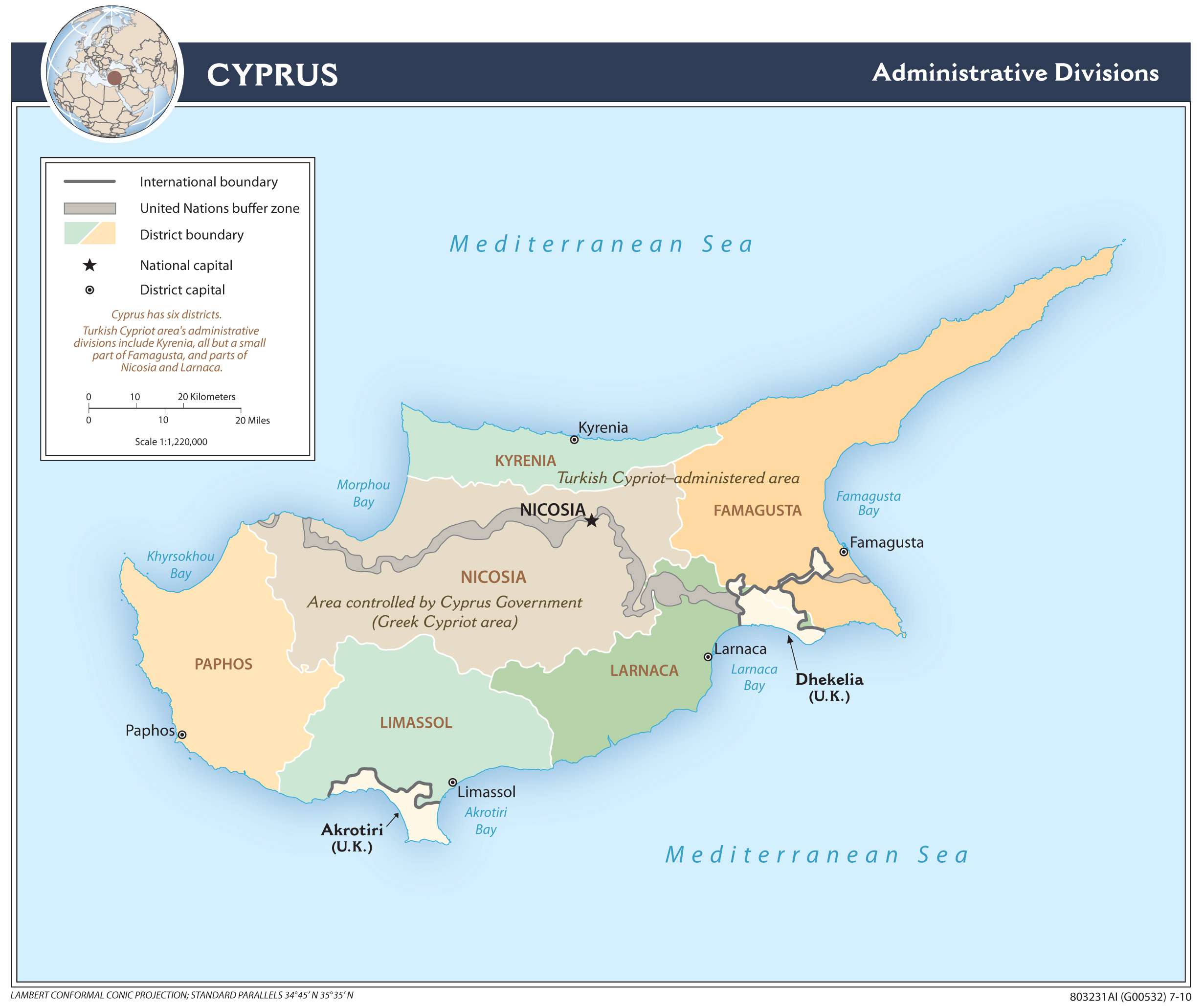
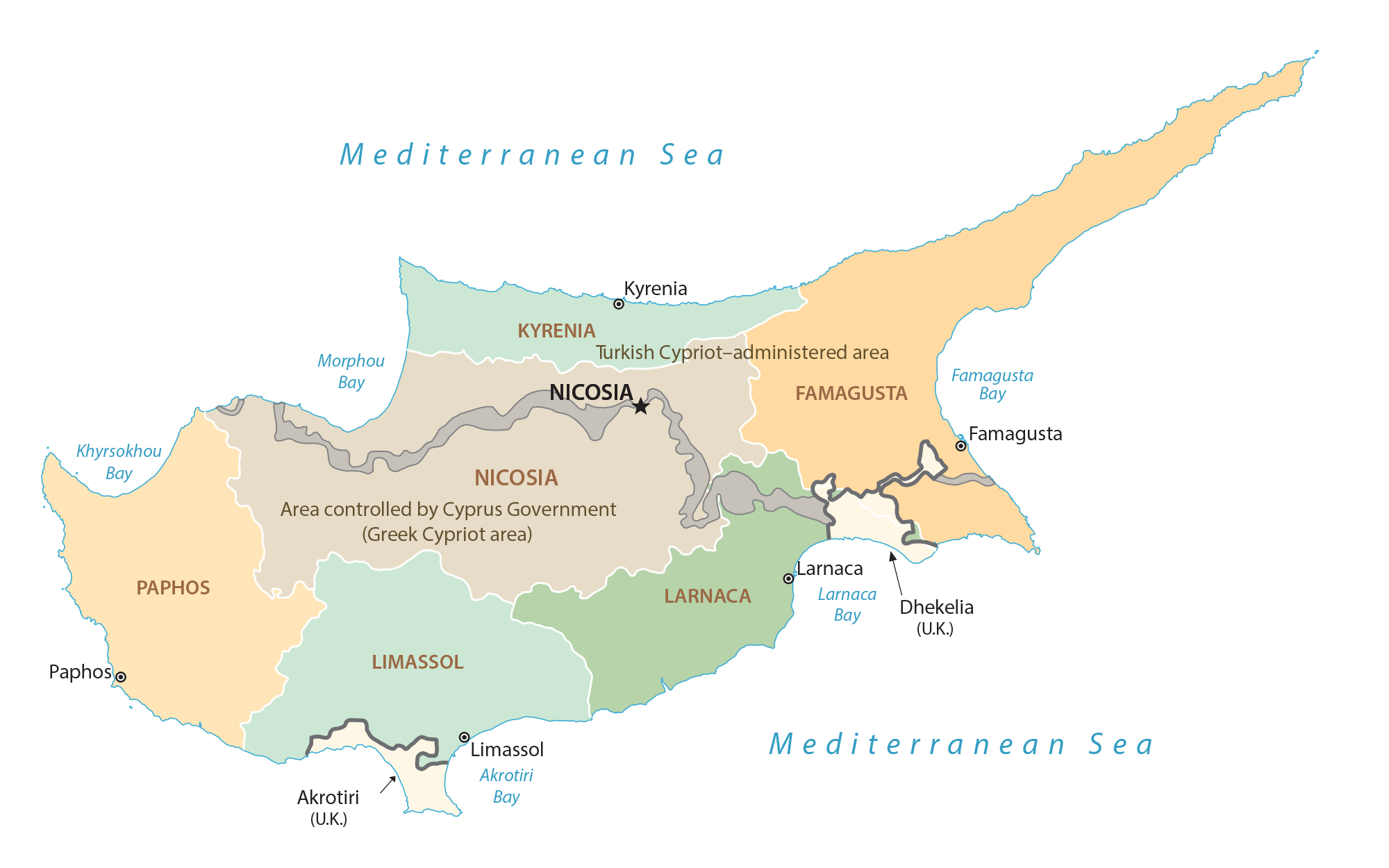
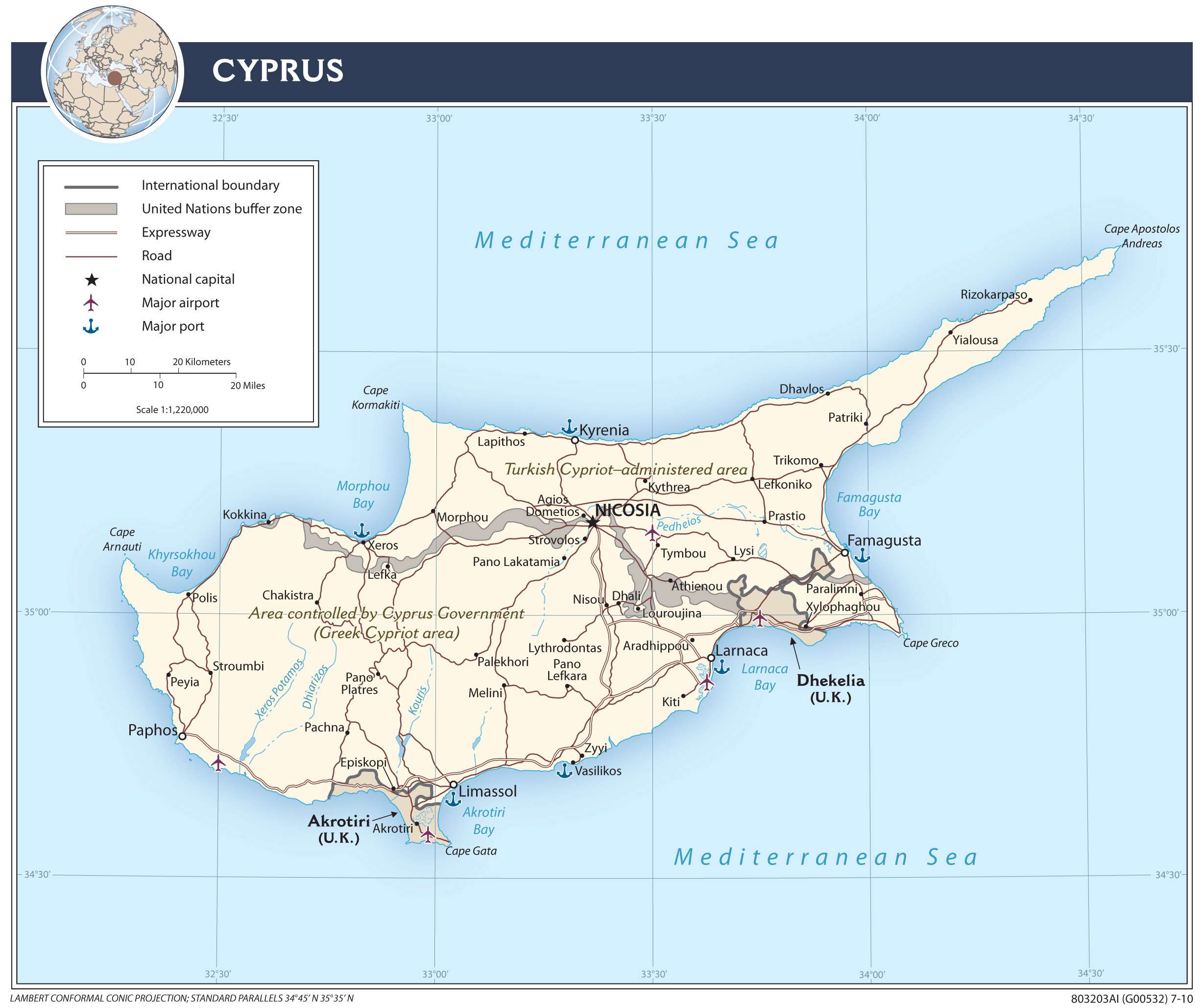
Cyprus (officially, Republic of Cyprus) is divided into 6 administrative districts (kaza). In alphabetical order, these districts are: Famagusta, Kyrenia, Larnaca, Limassol, Nicosia and Paphos. The districts are subdivided into municipalities and communities.
Situated almost in the center of the Mesaoria Plains, on the banks of the Pedieos River, is Nicosia – the administrative capital and the largest city of Cyprus. Nicosia is also the financial and chief economic center of Cyprus. Cyprus is the 3rd most populous Mediterranean island.
Location Maps
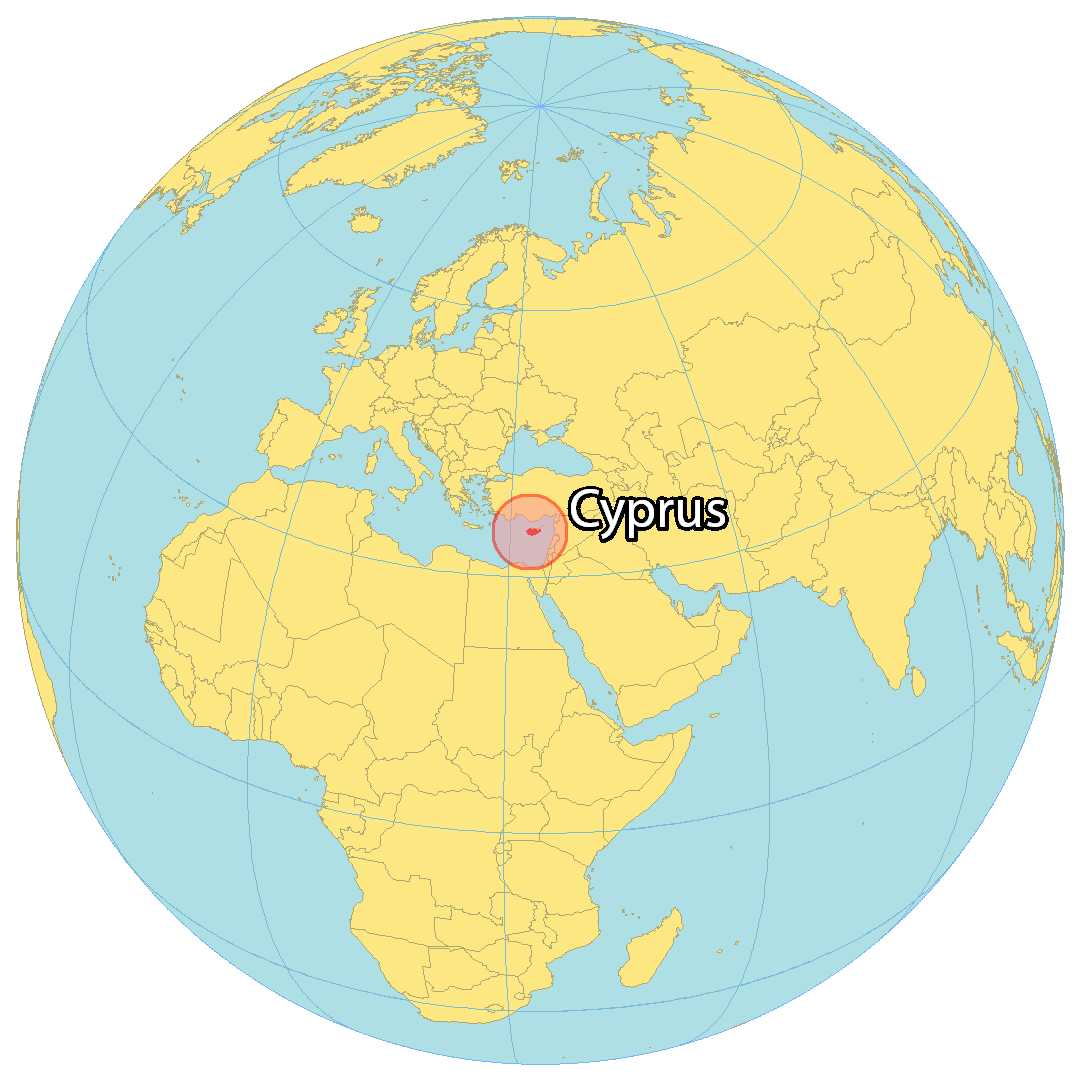
Where is Cyprus?
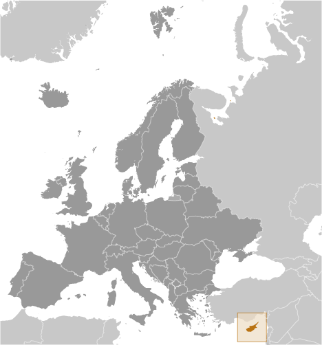
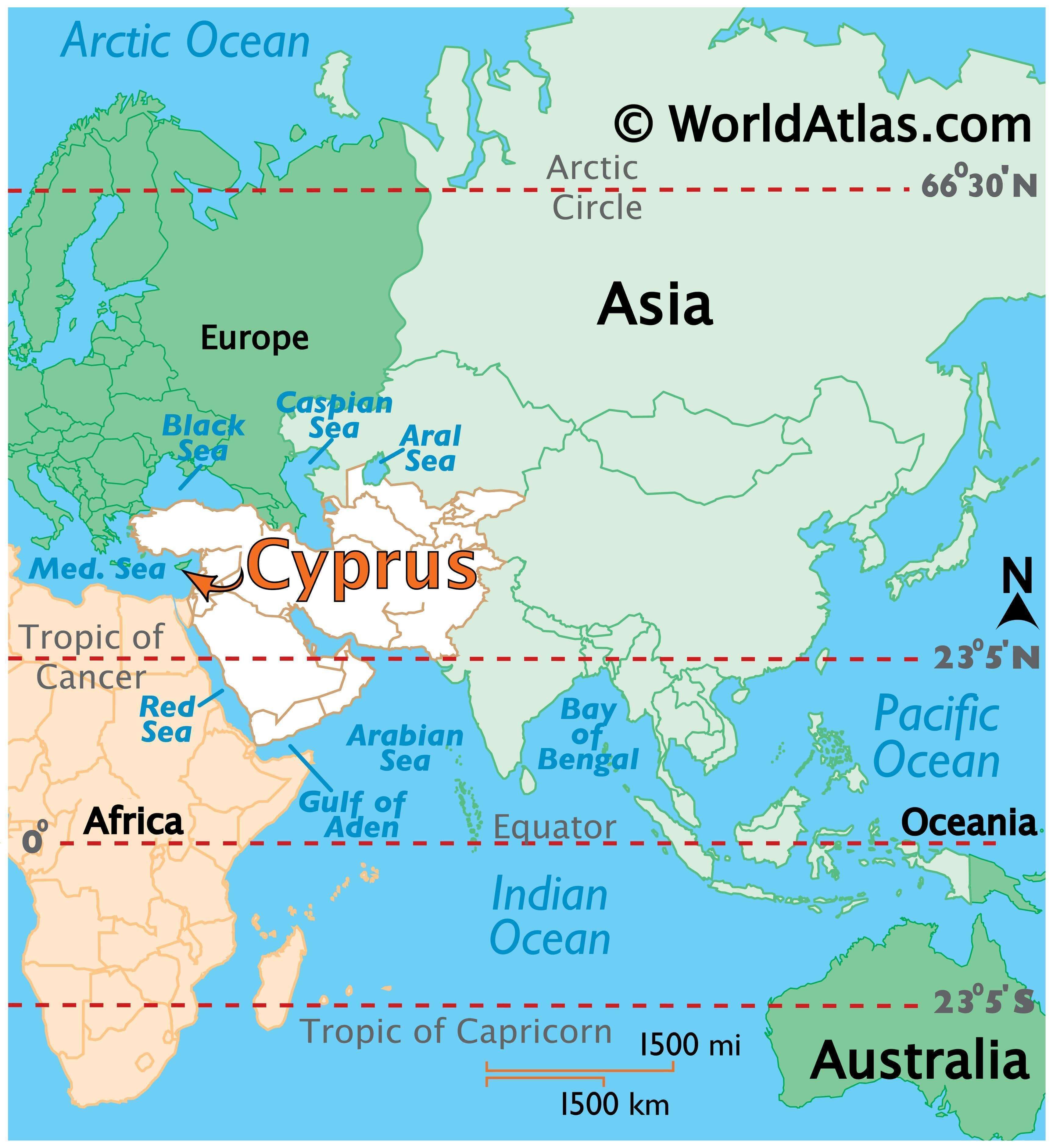
Cyprus is an island country located in the Mediterranean Sea, part of the Middle East and geopolitically in Europe. It is situated south of Turkey, southeast of Greece, west of Syria, and northwest of Lebanon. The third largest island in the Mediterranean Sea, it is smaller than Sicily and Sardinia.
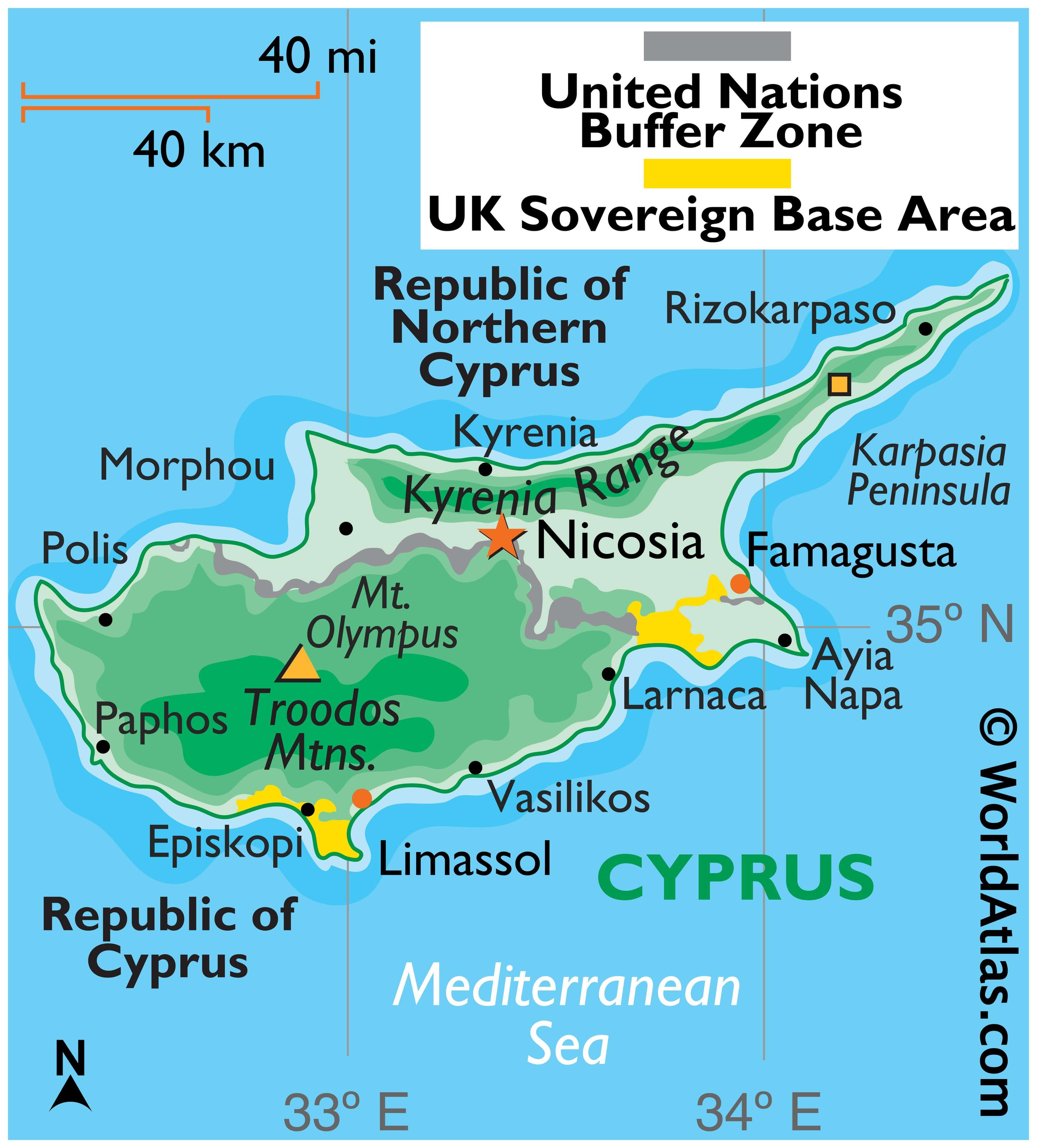
Since the 1970s, the country has been divided into two by a 180 km (120 mi) U.N. Buffer Zone. The Greek Cypriot Side in the south occupies about 60% of the territory, while the Turkish Cypriot Side claims about 38%. Cyprus is filled with exclaves and abandoned areas due to the division between the two sides.
Within Cyprus, the United Kingdom administers two regions – Akrotiri in the south-central and Dhekelia in the southeast. Nicosia is the capital and largest city of Cyprus, while other major cities include Limassol, Larnaca, and Stróvolos.
High Definition Political Map of Cyprus

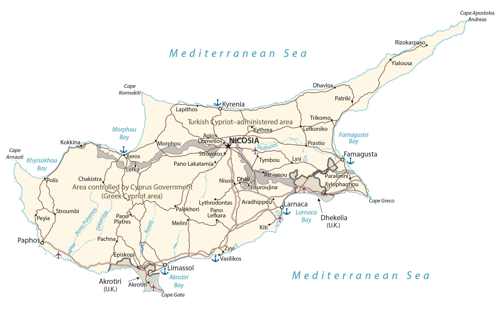
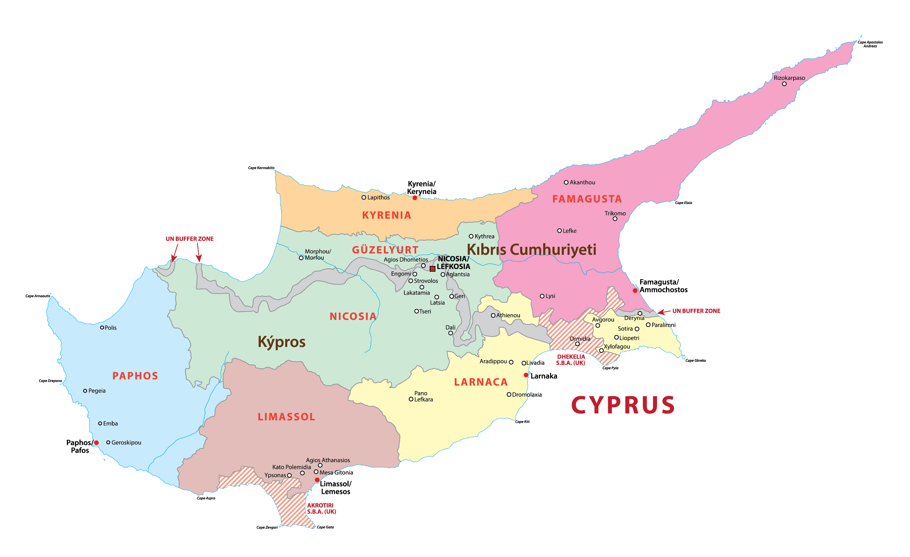
Cyprus Administrative Map
Physical Map of Cyprus

Transportation Map of Cyprus
Cyprus Satellite Map