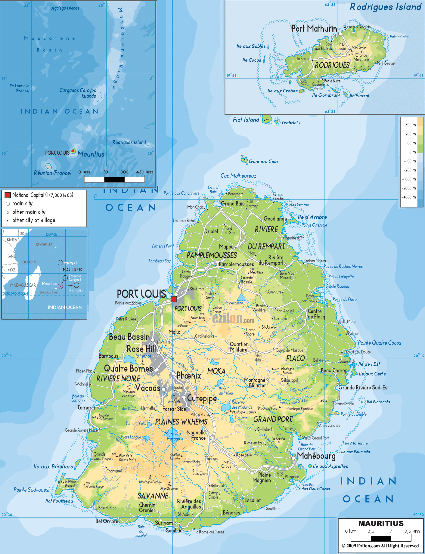
Mauritius occupies a total area of 2,040 sq. km in the Indian Ocean. It is made up of the main island of Mauritius and several outlying islands like the Ambre Island, Est Island, Cerfs Island, Benitiers Island, etc., as marked on the map.
The island of Mauritius is a volcanic island formed by volcanic activity around 8 million years ago. However, no volcanic activity has been recorded on the island for over 100,000 years.
Coral reefs surround the island protecting the land from storms and high waves.
The spectacular white sand beaches of the Mauritius Island give way to a broken ring of coastal mountain ranges. A plain covers the northern part of Mauritius gradually giving way to a central plateau with elevations ranging from 270 to 730 m. Bordering the plateau are low mountains. The highest peak in Mauritius, the 828 m tall Mount Piton, is located in the southwest of the plateau.
Off the coast of mainland Mauritius, there are nearly a hundred islets and rocks without any human habitation.
Lake Vacoas, marked on the map, is the primary source of water for the islanders. Important rivers include the Grand River South East and the Black River.
| Flag: |  |
|---|---|
| Legal Name: | Republic of Mauritius |
| Capital Value: | Port Louis |
| Official languages: | None (de jure)
|
| Demonym(s): | Mauritian |
| Government: | Unitary parliamentary republic |
| Legislature: | National Assembly |
| Total Area: | 2,040 km² |
| Land Area: | 2,030 km² |
| Water Area: | 10 km² |
| Population: | 1,265,711 |
| Density: | 618.24/km (1,601.2/sq mi) (21st) |
| GDP: | $14.18 Billion |
| GDP Per Capita: | $11,203.54 |
| Currency Value: | Mauritian rupees (MUR) |
| Driving side: | left |
| Calling code: | +230 |
| Internet TLD: | .mu |
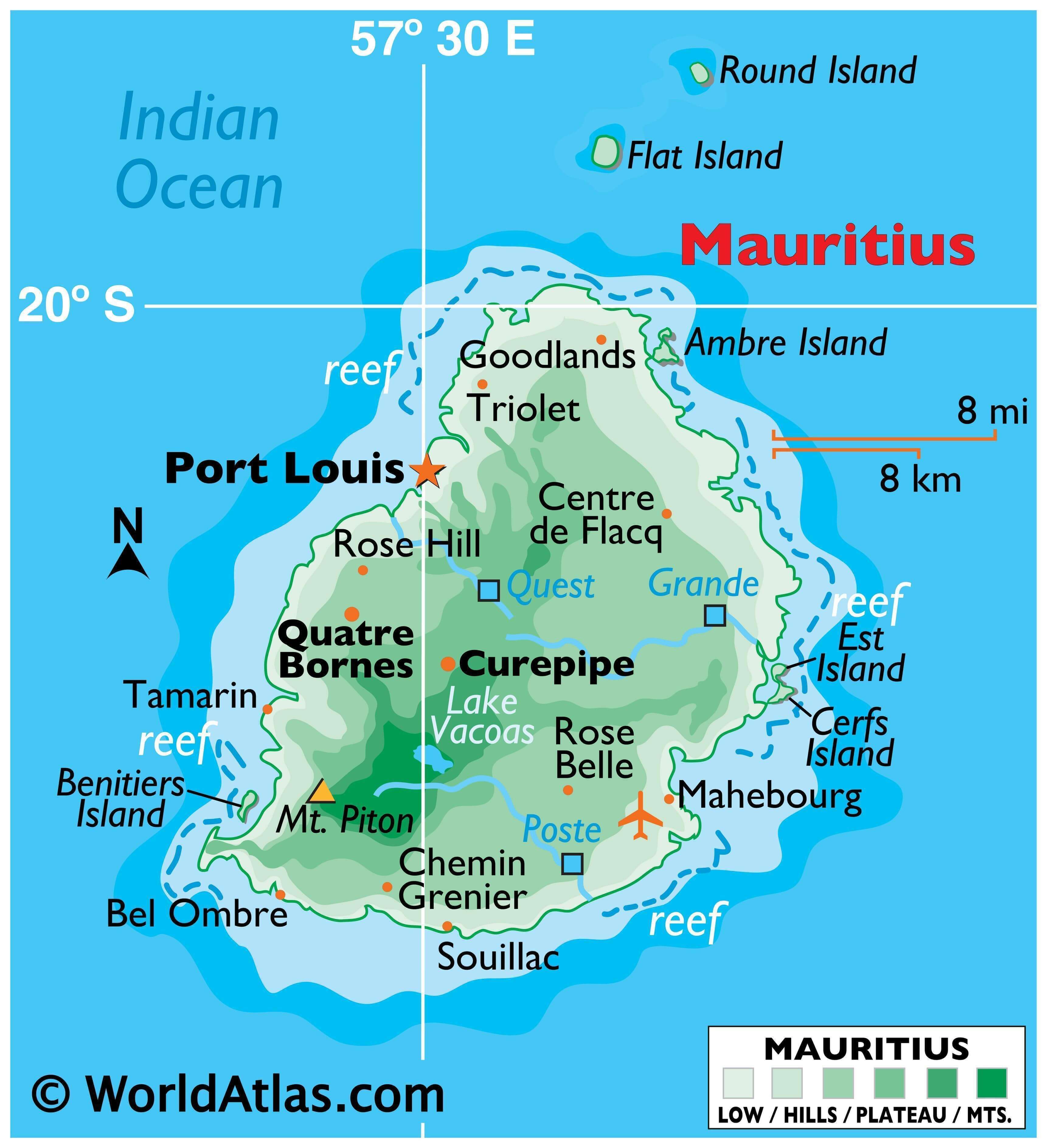
Mauritius is an island nation located in the southeast of Africa in the Indian Ocean. This map showcases the country, displaying its cities, towns, and roads. Satellite imagery and a terrain map give viewers a better understanding of the geography of the island nation and its nearby islands, including Rodrigues. With this map, one can explore the wonders of Mauritius, from its lush tropical forests to its crystal clear beaches.
Online Interactive Political Map
Click on ![]() to view map in "full screen" mode.
to view map in "full screen" mode.
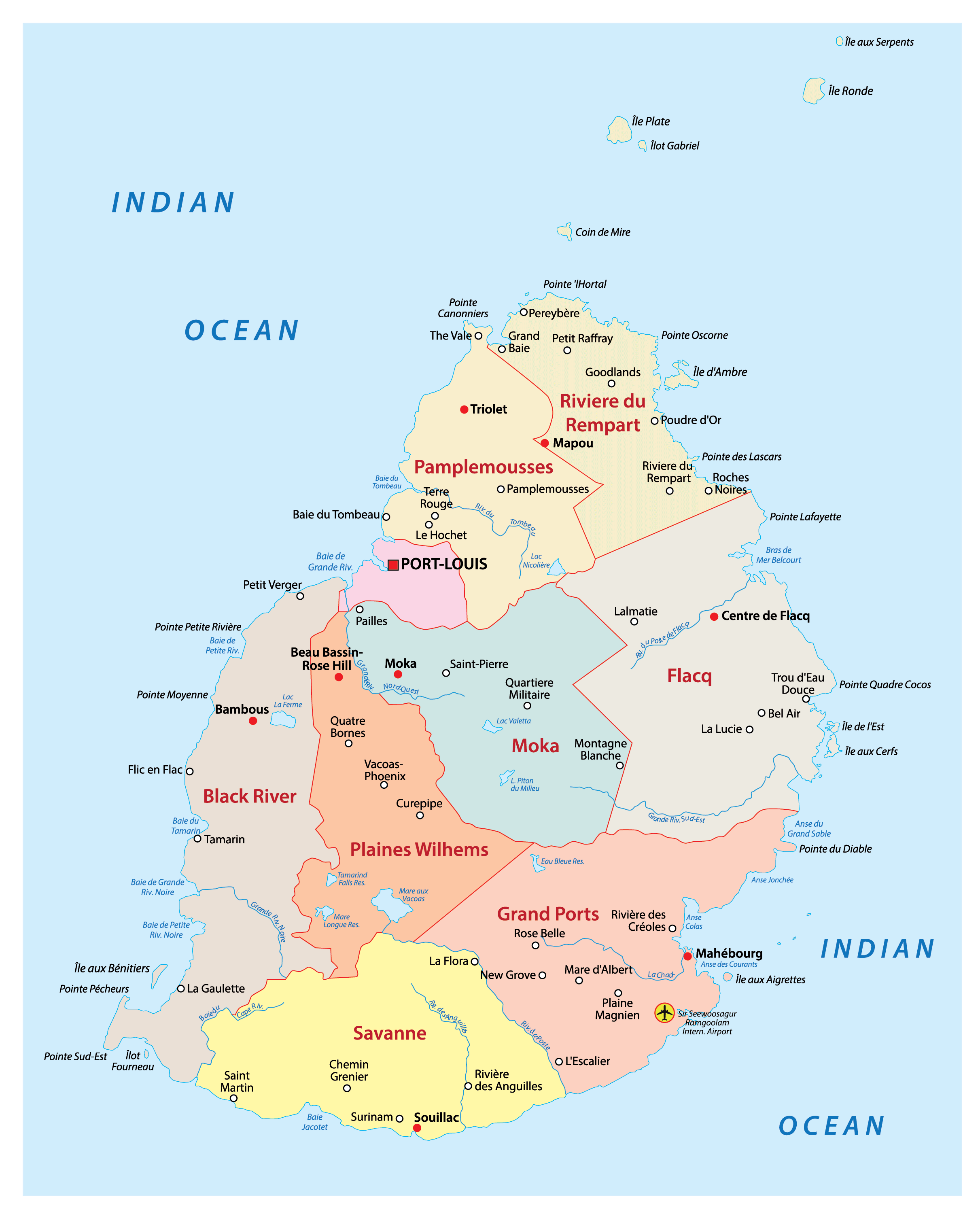
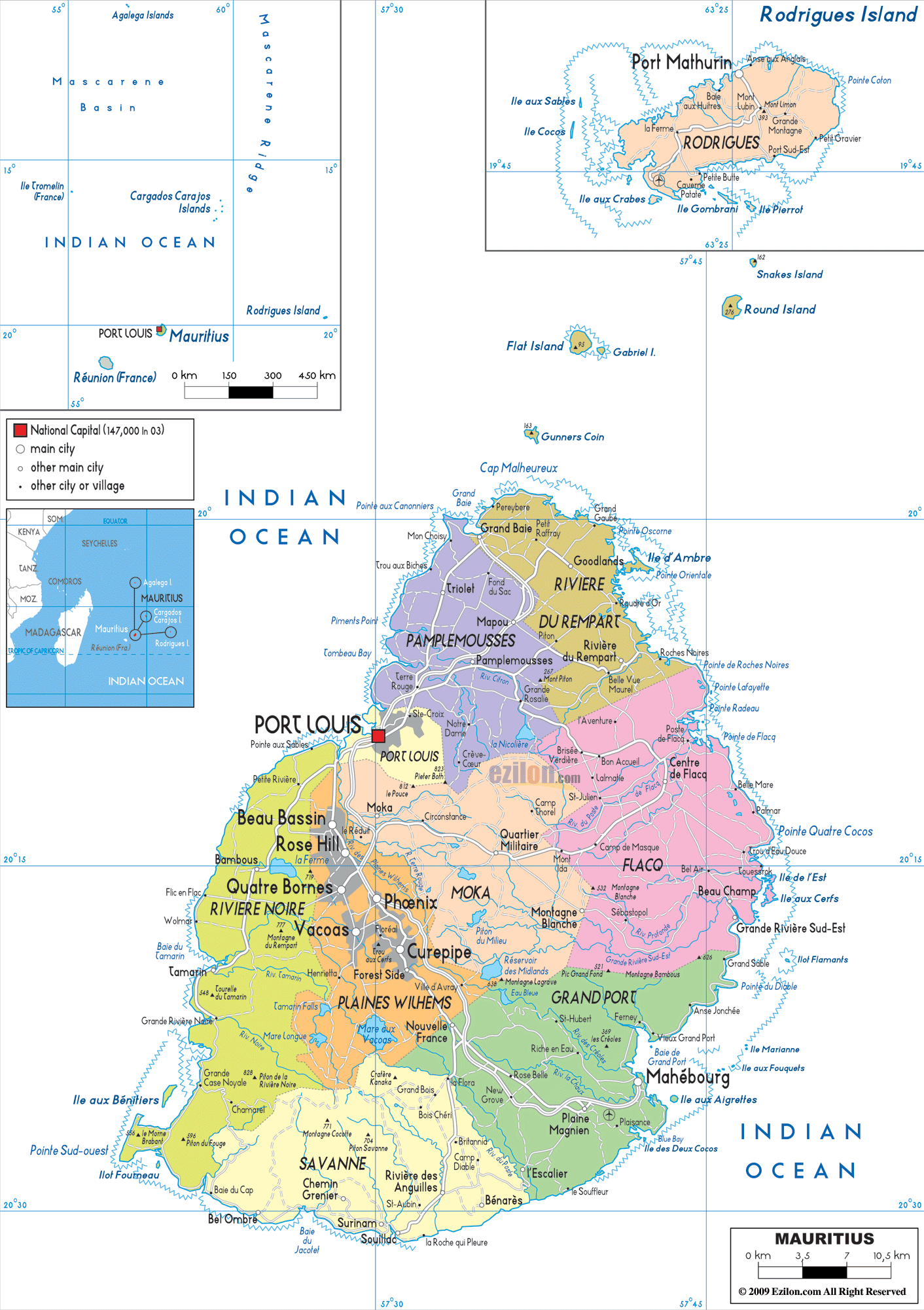
Mauritius is composed of nine districts. In alphabetical order, these are Black River, Flacq, Grand Port, Moka, Pamplemousses, Plaines Wilhems, Port Louis, Riviere du Rempart, Savanne.
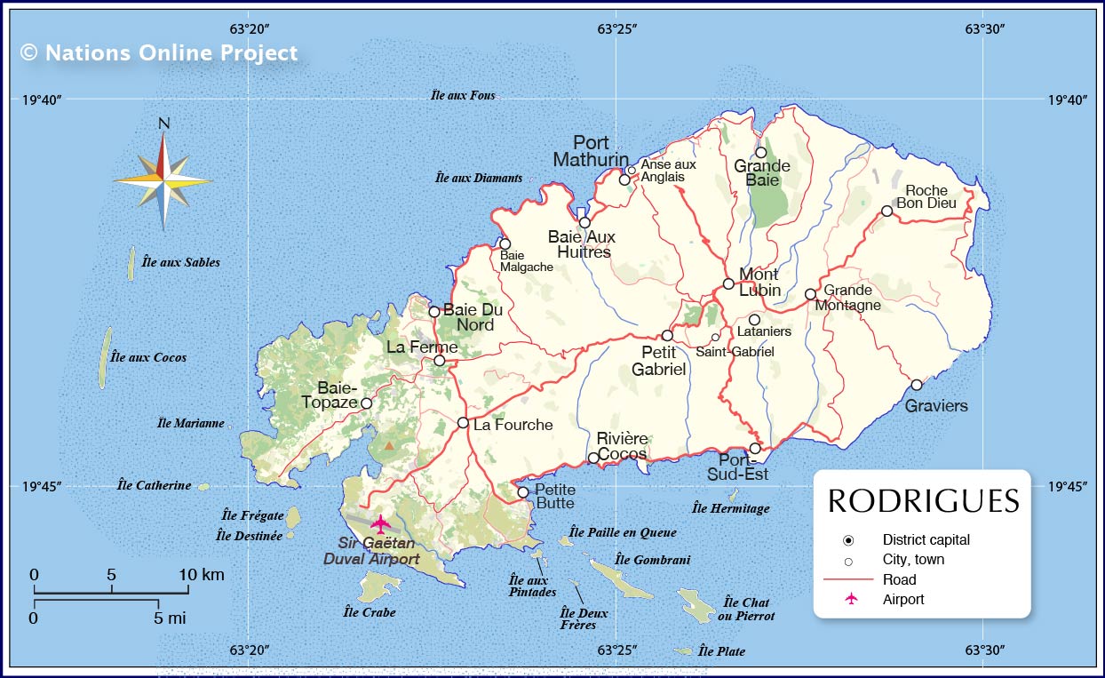
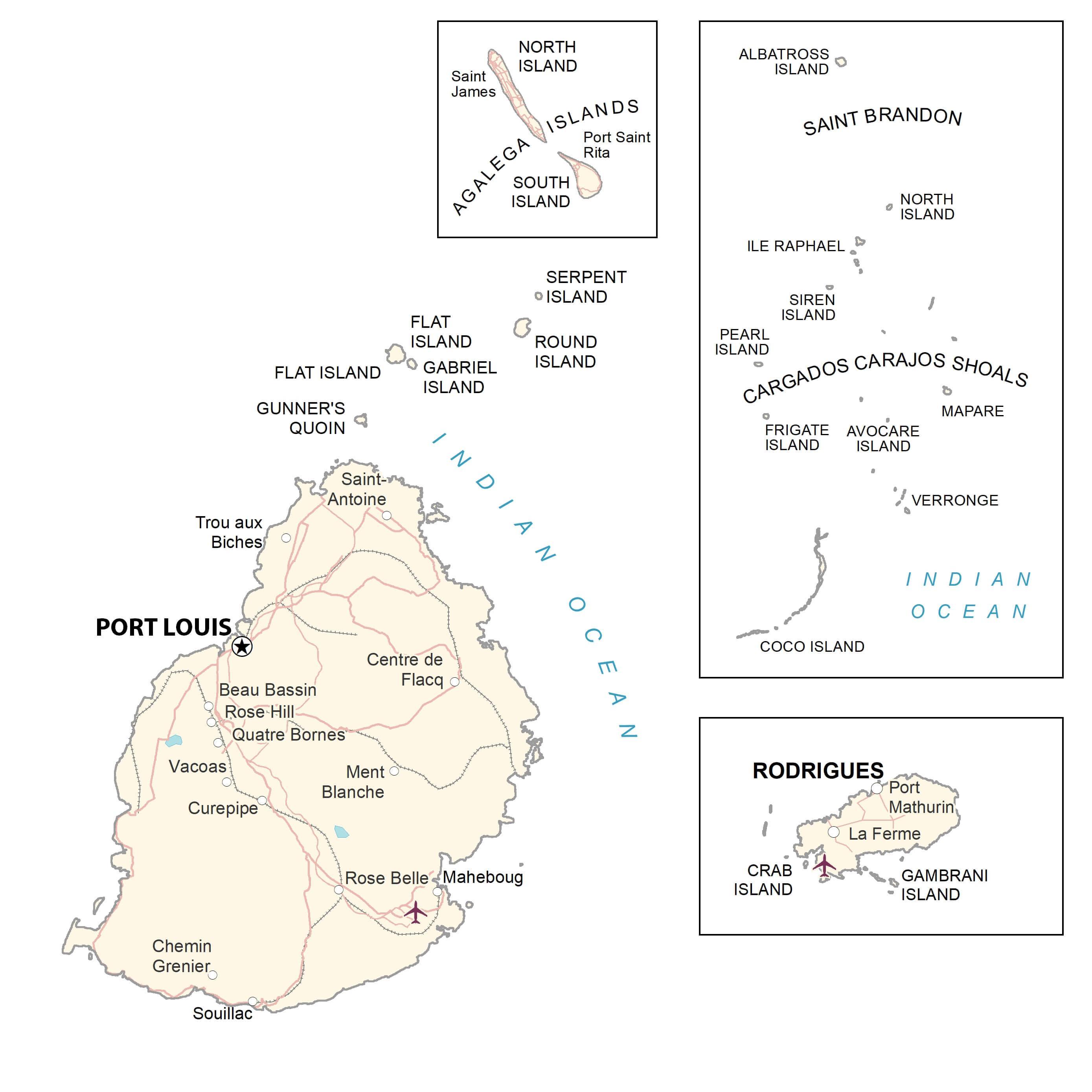
The country also has three dependencies. These are Cargados Carajos Shoals, Rodrigues, and Agalega Islands.
The districts of Mauritius are further subdivided into one city, four towns, and 130 villages. Port Louis is the capital of the country.
With an area of 297.9 sq. km, Flacq is the largest district in Mauritius while Plaines Wilhelms is the largest by population.
Location Maps
Where is Mauritius?
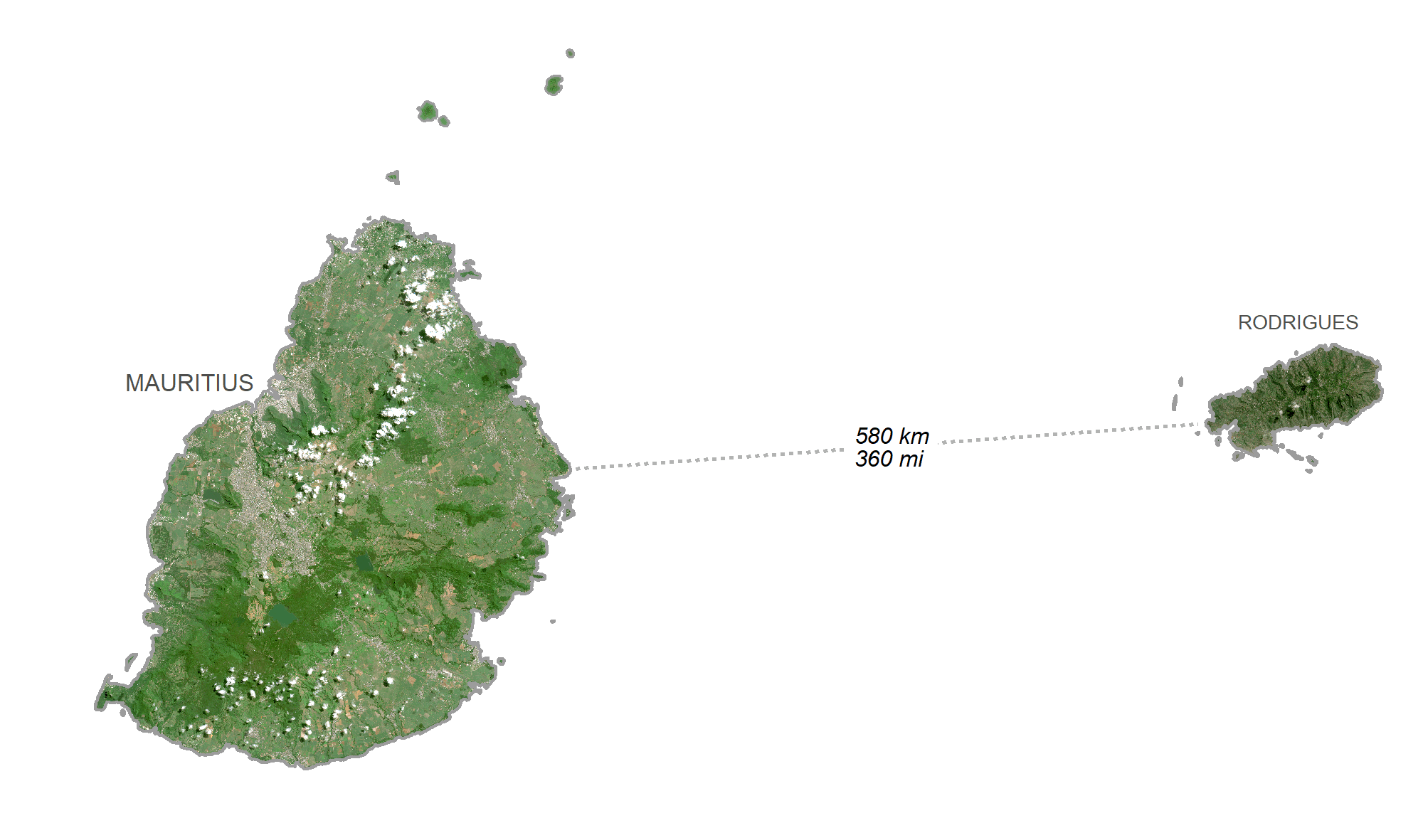
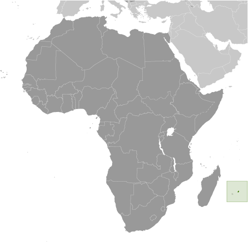
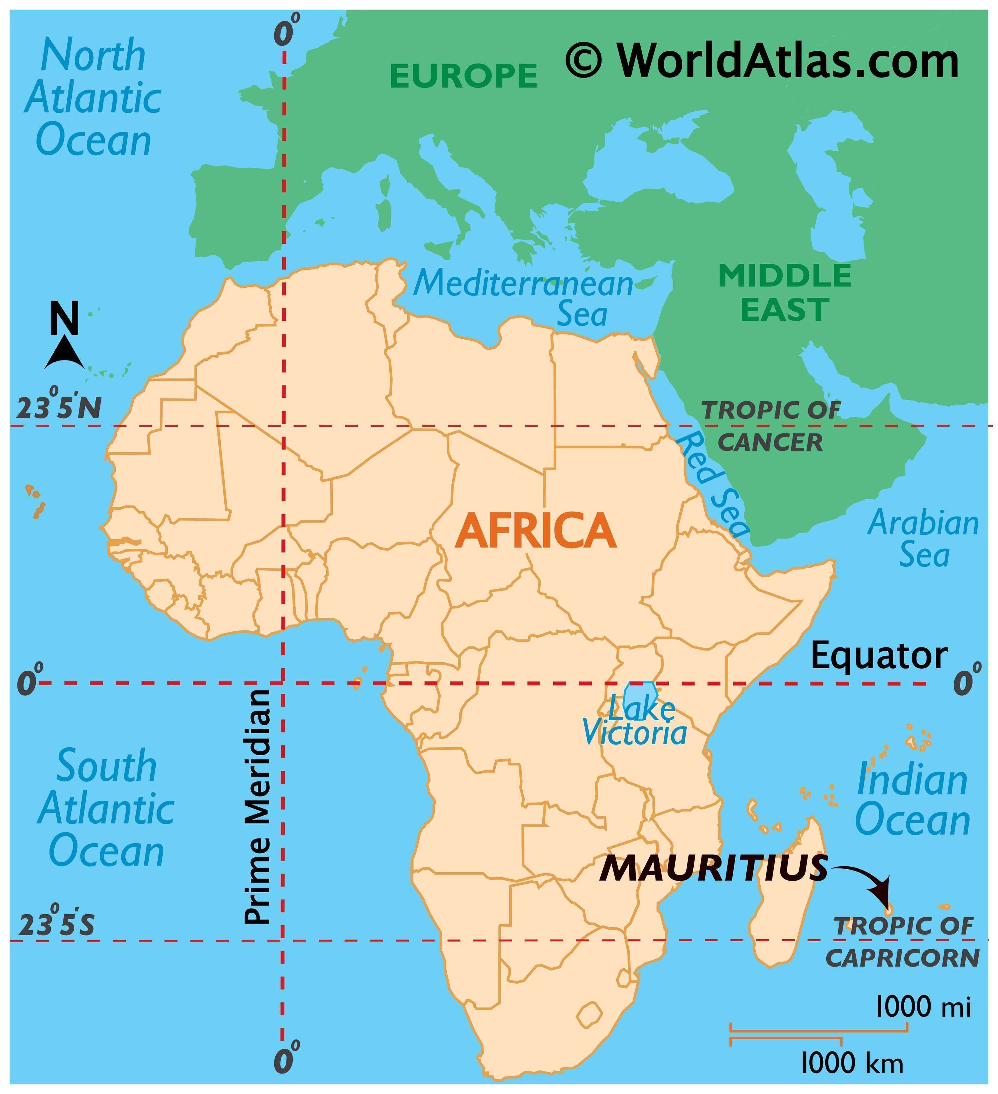
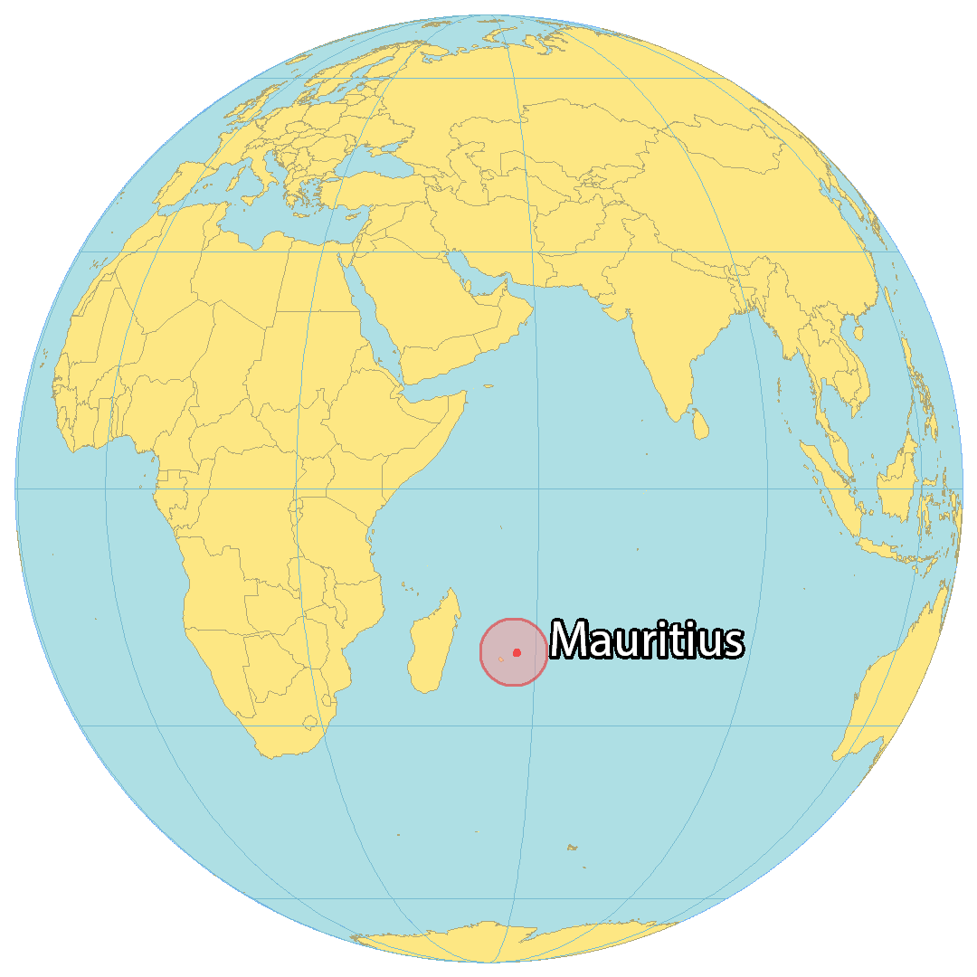
Mauritius is an African island country located in the Indian Ocean, 2,000 kilometers (1,200 mi) from the southeast coast of the mainland African continent. It consists of the main island of Mauritius, Rodrigues to the east, the Agalega Islands to the north, and St. Brandon to the northeast. The population of the country is estimated to be around 1.265 million people and the capital city is Port Louis.
High Definition Political Map of Mauritius
Physical Map of Mauritius
Mauritius Satellite Map