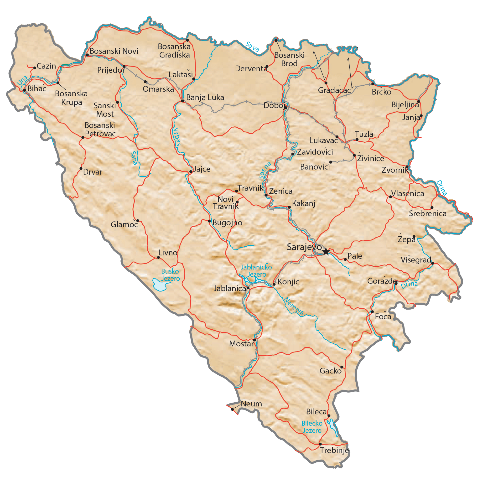
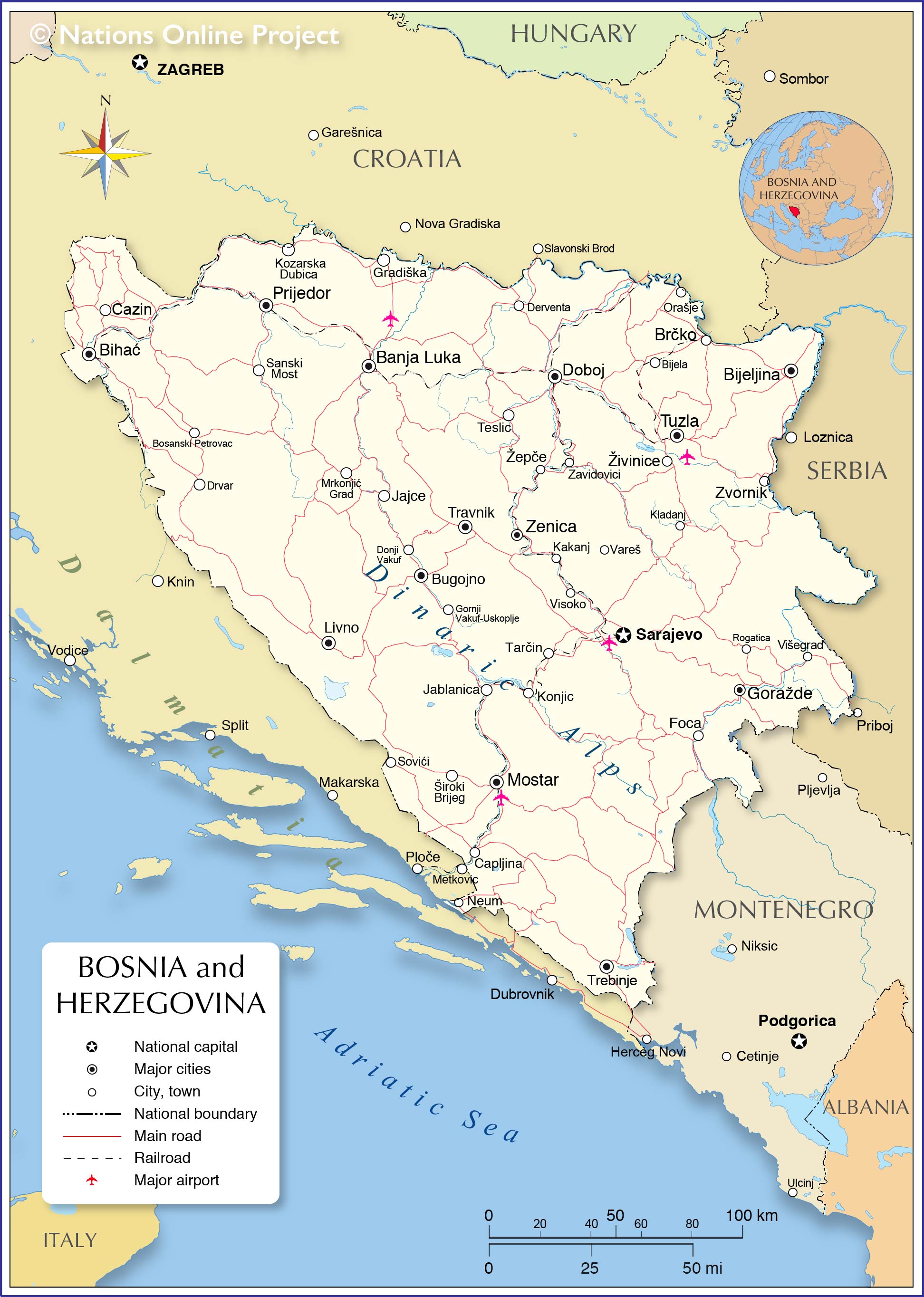
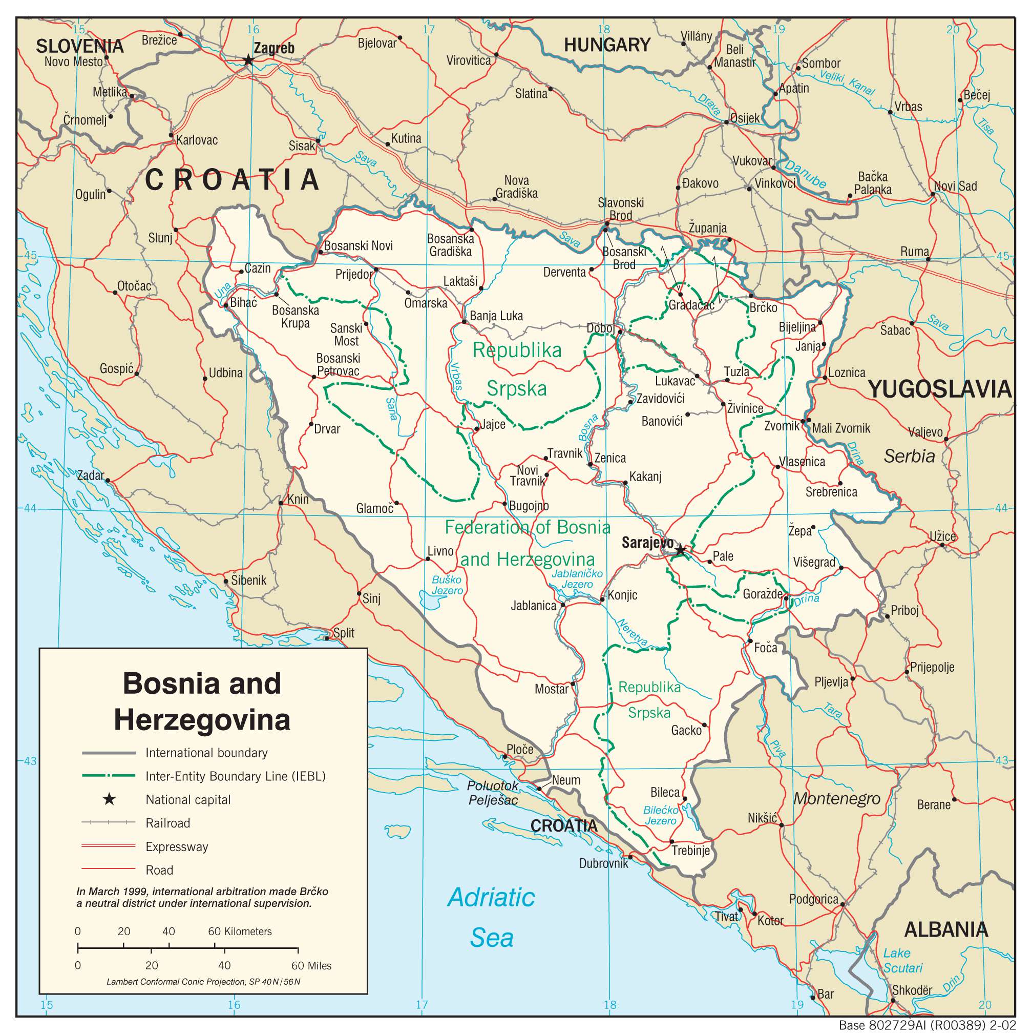
Covering an area of 51, 129 sq. km, Bosnia and Herzegovina is located in the western part of the Balkan Peninsula, in the southeastern region of the European continent.
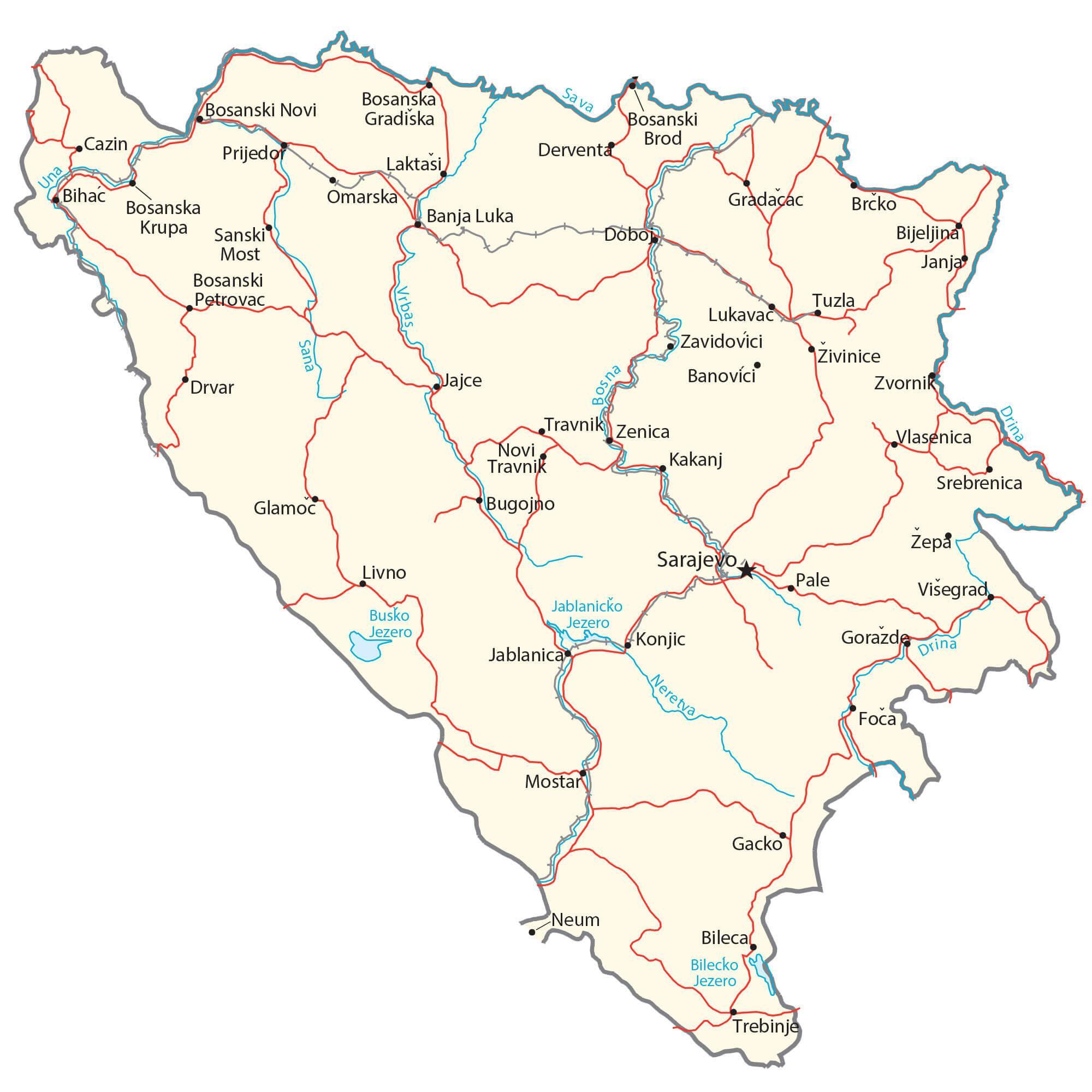
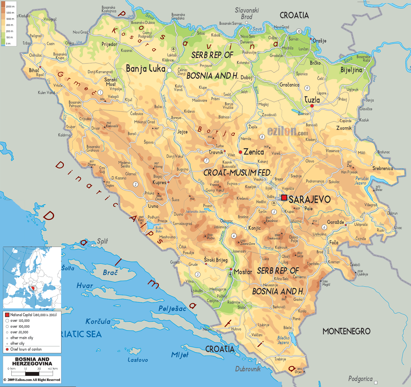
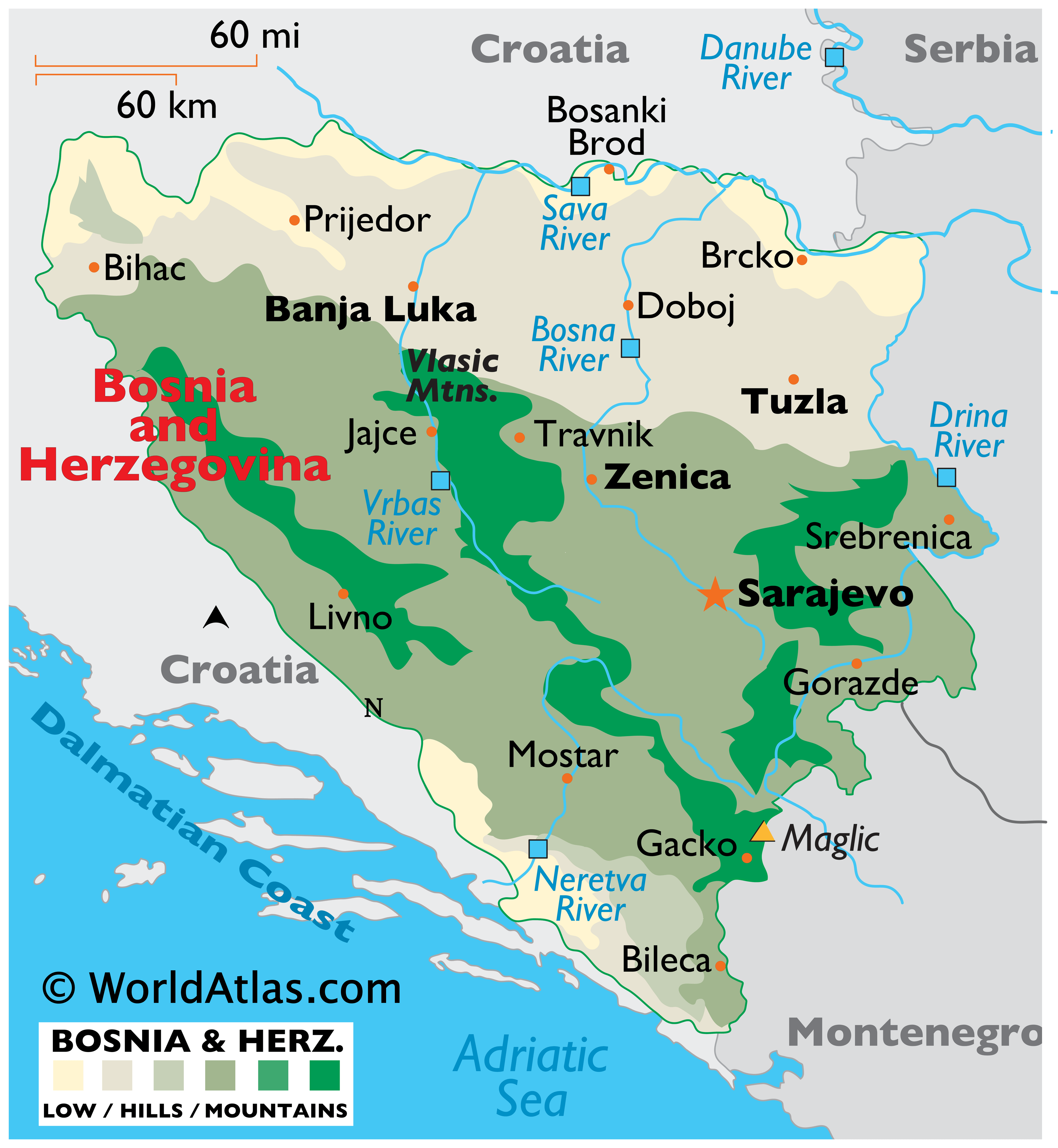
As observed on the map, Bosnia and Herzegovina is a very hilly country, with the Dinaric Alps dominating the landscape. Situated near the country’s border with Montenegro is Mount Maglic – the country’s highest point, which rises to an elevation of 7,828ft (2,386m). Thick forests cover almost 50% of the country’s land. In the northern part of Bosnia along the Sava River valley is the Pannonian Plain – a hilly, fertile plain that stretches from east to west. The country has limited access to the Adriatic Sea through a small strip of land, about 12 miles (20km) wide in the far-southwest. The significant rivers include Neretva, Sava, Vrbas, Drina, Una, and Bosna rivers.
| Flag: |  |
|---|---|
| Legal Name: | Bosnia and Herzegovina |
| Capital Value: | Sarajevo |
| Largest City: |
Sarajevo (343,089) |
| Official languages: |
|
| Demonym(s): | Bosnian, Herzegovinian |
| Government: | Federal parliamentary directorial republic |
| Legislature: | Parliamentary Assembly |
| Total Area: | 51,197 km² |
| Land Area: | 51,187 km² |
| Water Area: | 10 km² |
| Population: | 3,301,000 |
| Density: | 69/km (178.7/sq mi) |
| GDP: | $20.05 Billion |
| GDP Per Capita: | $6,073.27 |
| Currency Value: | Konvertibilna markas (BAM) |
| Driving side: | right |
| Calling code: | +387 |
| Internet TLD: | .ba |
Discover Bosnia and Herzegovina’s stunning landscapes through this interactive map. Explore its major cities, towns, roads, and rivers and get a glimpse of its diverse topography like the Dinaric Alps.
Online Interactive Political Map
Click on ![]() to view map in "full screen" mode.
to view map in "full screen" mode.
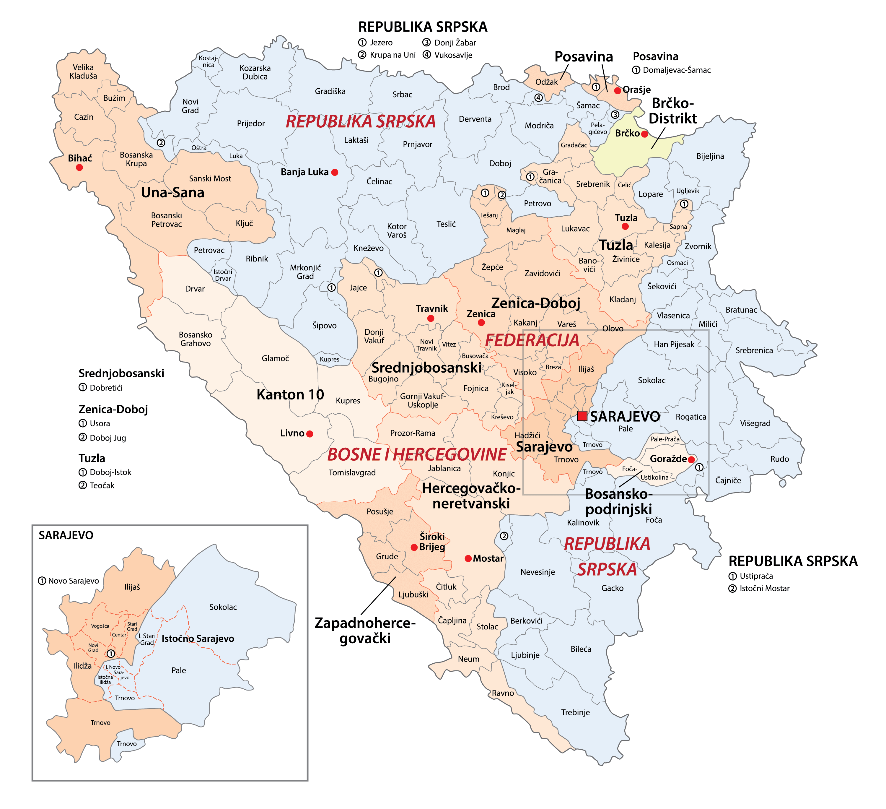
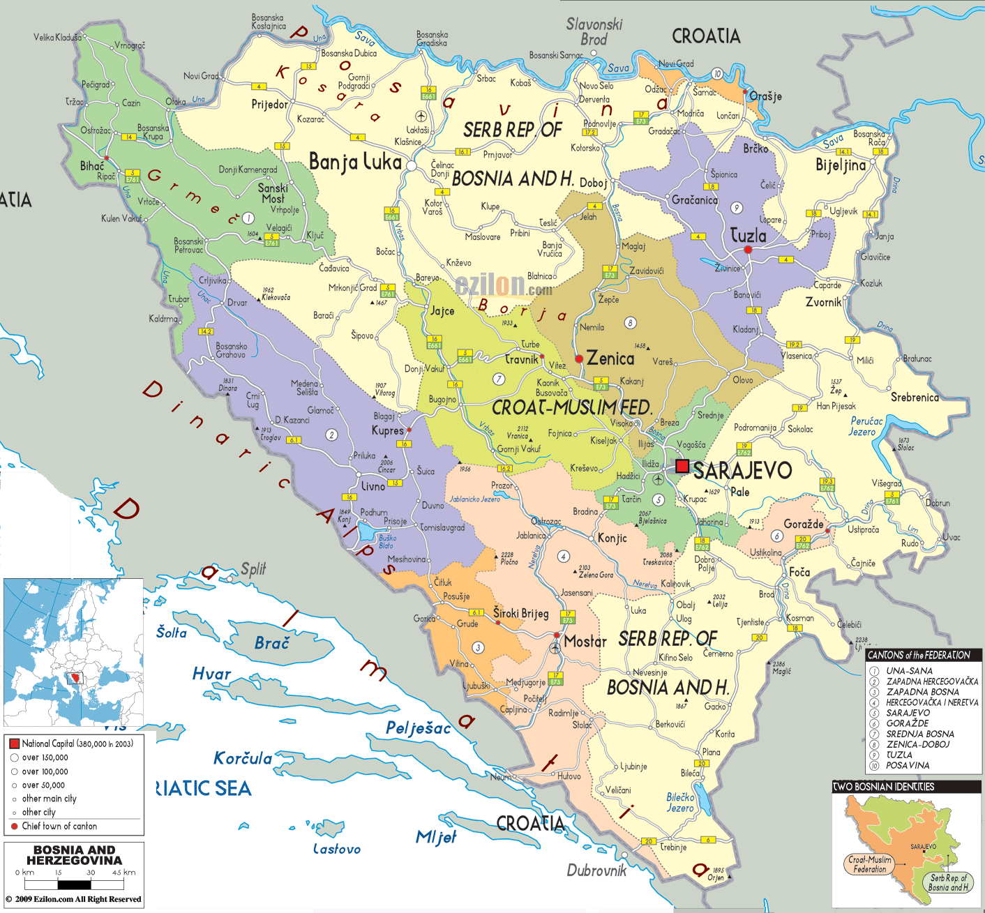
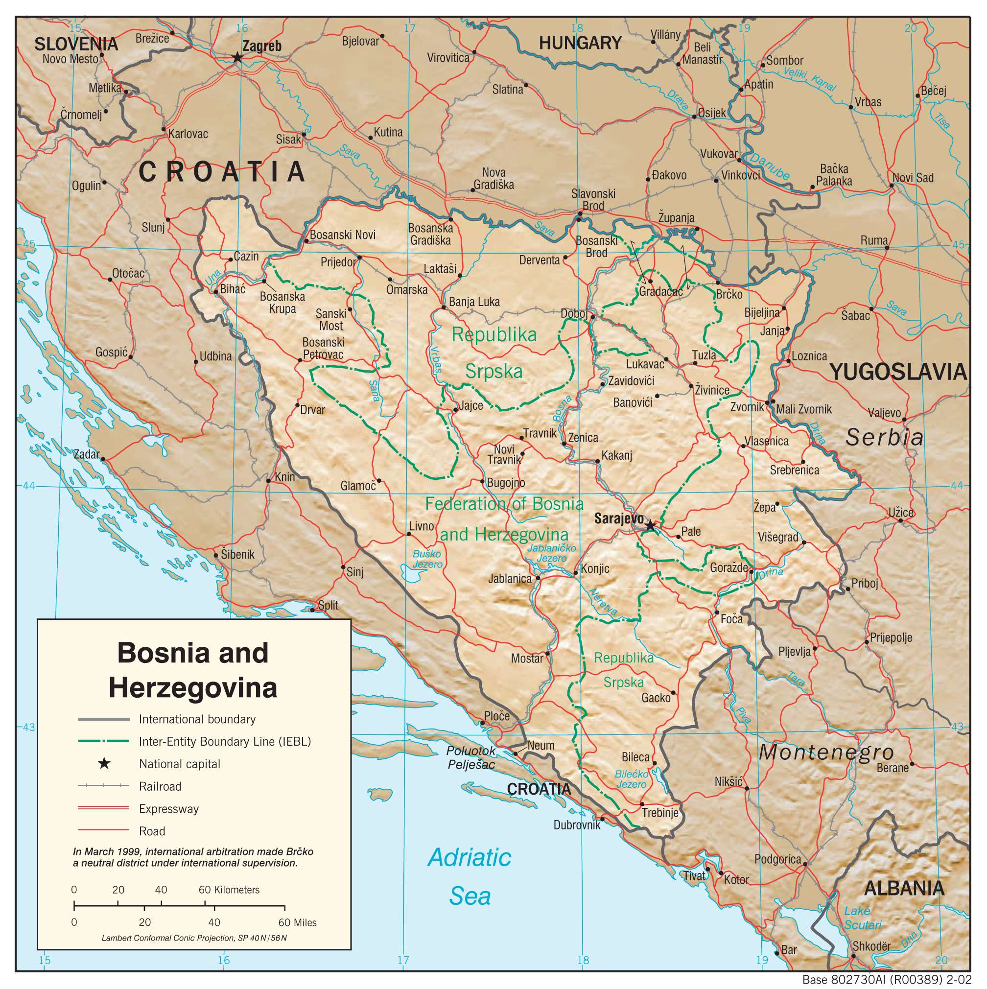
Bosnia and Herzegovina consist of 2 first-order administrative divisions and 1 internationally supervised district. The two administrative divisions are The Federation of Bosnia and Herzegovina and the Republika Srpska. The country is also divided into 10 cantons. The Federation of Bosnia and Herzegovina is further subdivided into 74 municipalities and the Republika Srpska is further subdivided into 63 municipalities.
Brcko district located in the northeastern part of Bosnia, is a self-governing administrative unit under the sovereignty of Bosnia and Herzegovina which is formally held in a condominium between the two entities. The District remains under international supervision.
In addition to these divisions, Bosnia and Herzegovina have four “official cities”, namely Sarajevo, Banja Luka, Mostar, and East Sarajevo.
Covering an area of 51, 129 sq. km, Bosnia and Herzegovina is located in the western part of the Balkan Peninsula, in the southeastern region of the European continent. Located in the narrow Miljacka River valley at the foot of Mount Trebecic is Sarajevo – the capital and the largest city of Bosnia and Herzegovina. It serves as an administrative, commercial, social, and cultural center of Bosnia and Herzegovina.
Location Maps
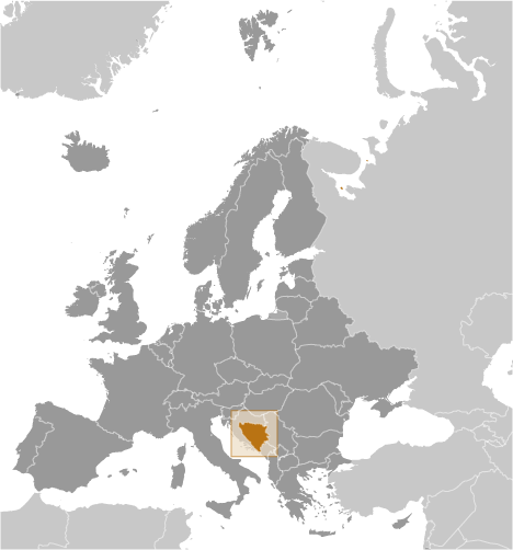
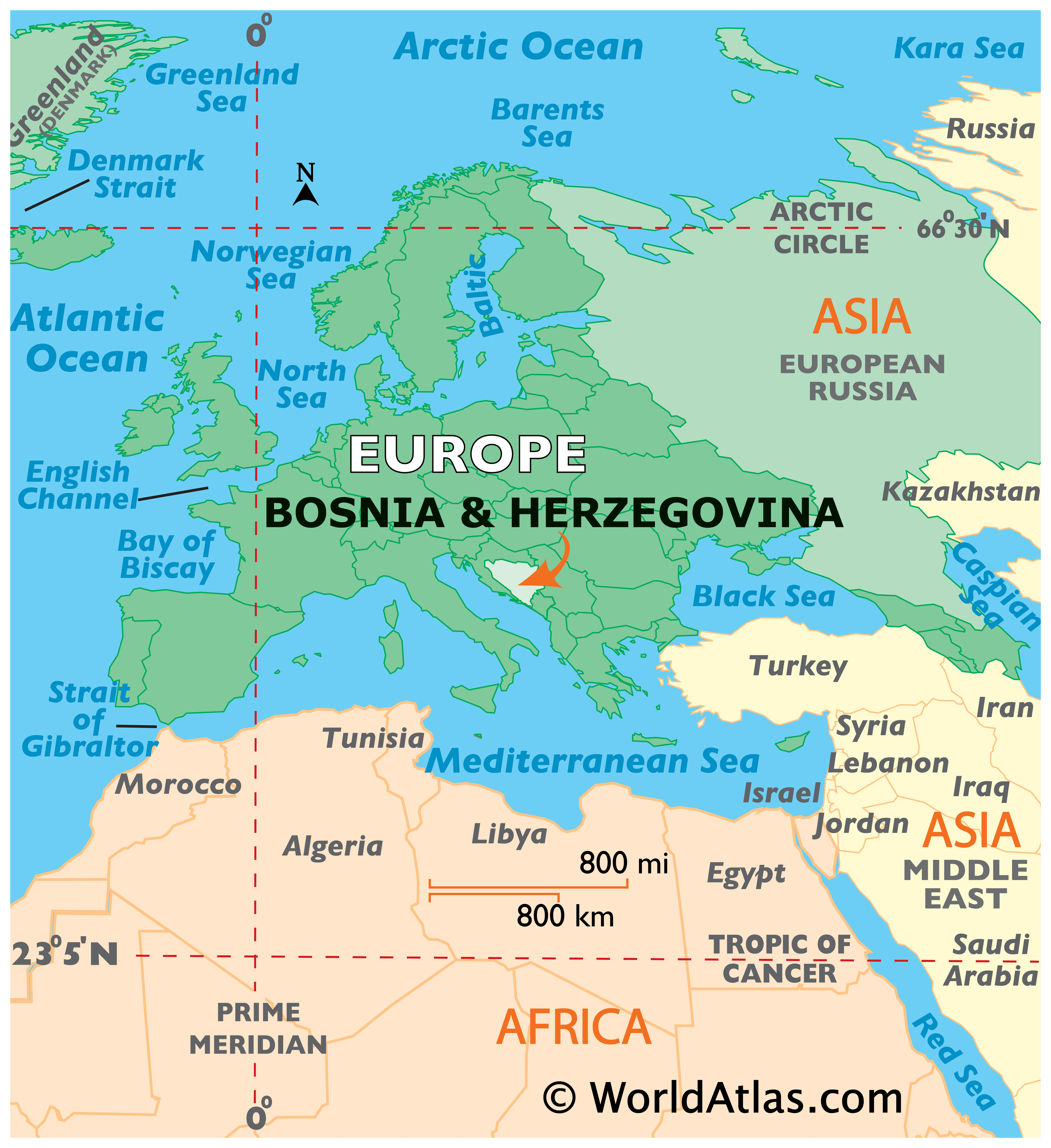
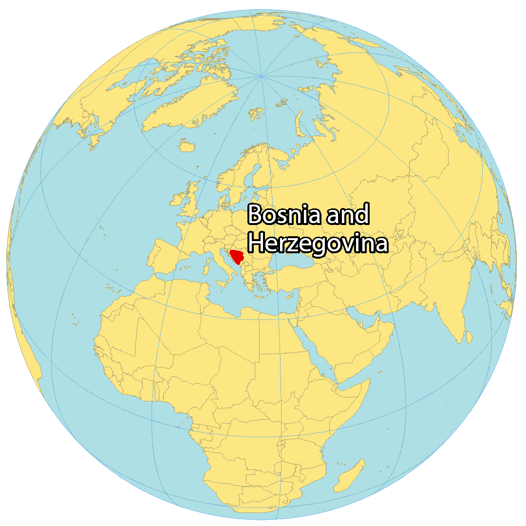
Where is Bosnia & Herz?
Bosnia and Herzegovina is located in Southeast Europe within the Balkans. It borders 3 other European countries: Croatia from the west to the north, Serbia from the east, and Montenegro from the east as well. Bosnia and Herzegovina has a 20 kilometer coastline at the town of Neum, reaching the Adriatic Sea in the west. It is a relatively new country, having been founded in 1992, and Sarajevo is its capital and largest city.
High Definition Political Map of Bosnia & Herz
Physical Map of Bosnia & Herz
Transportation Map of Bosnia & Herz
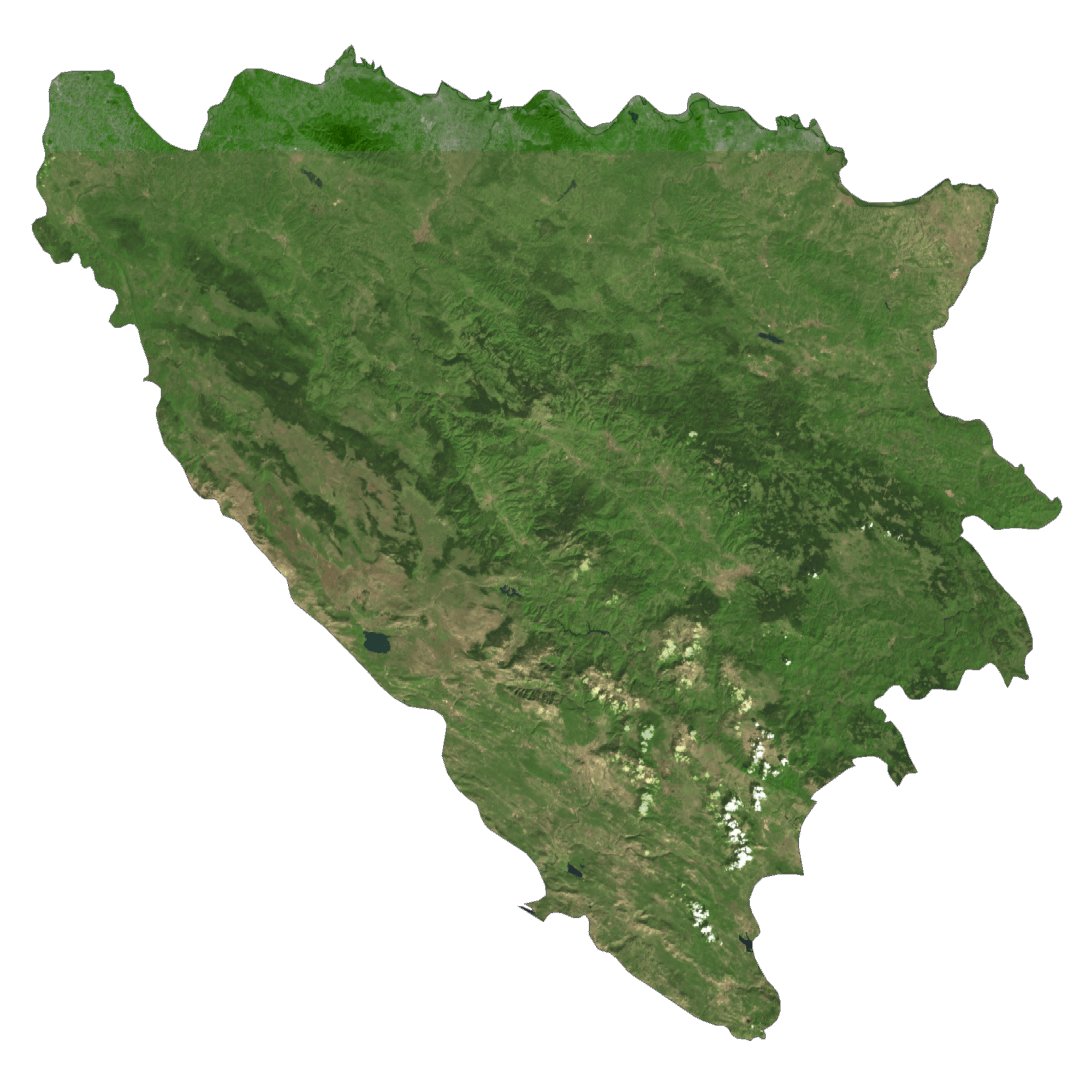
Bosnia & Herz Satellite Map
Elevation Map