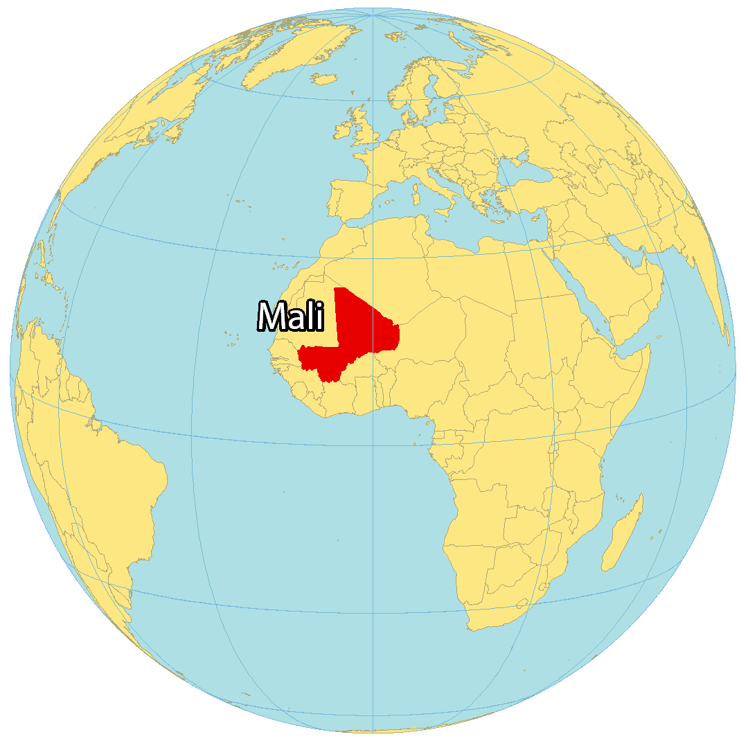
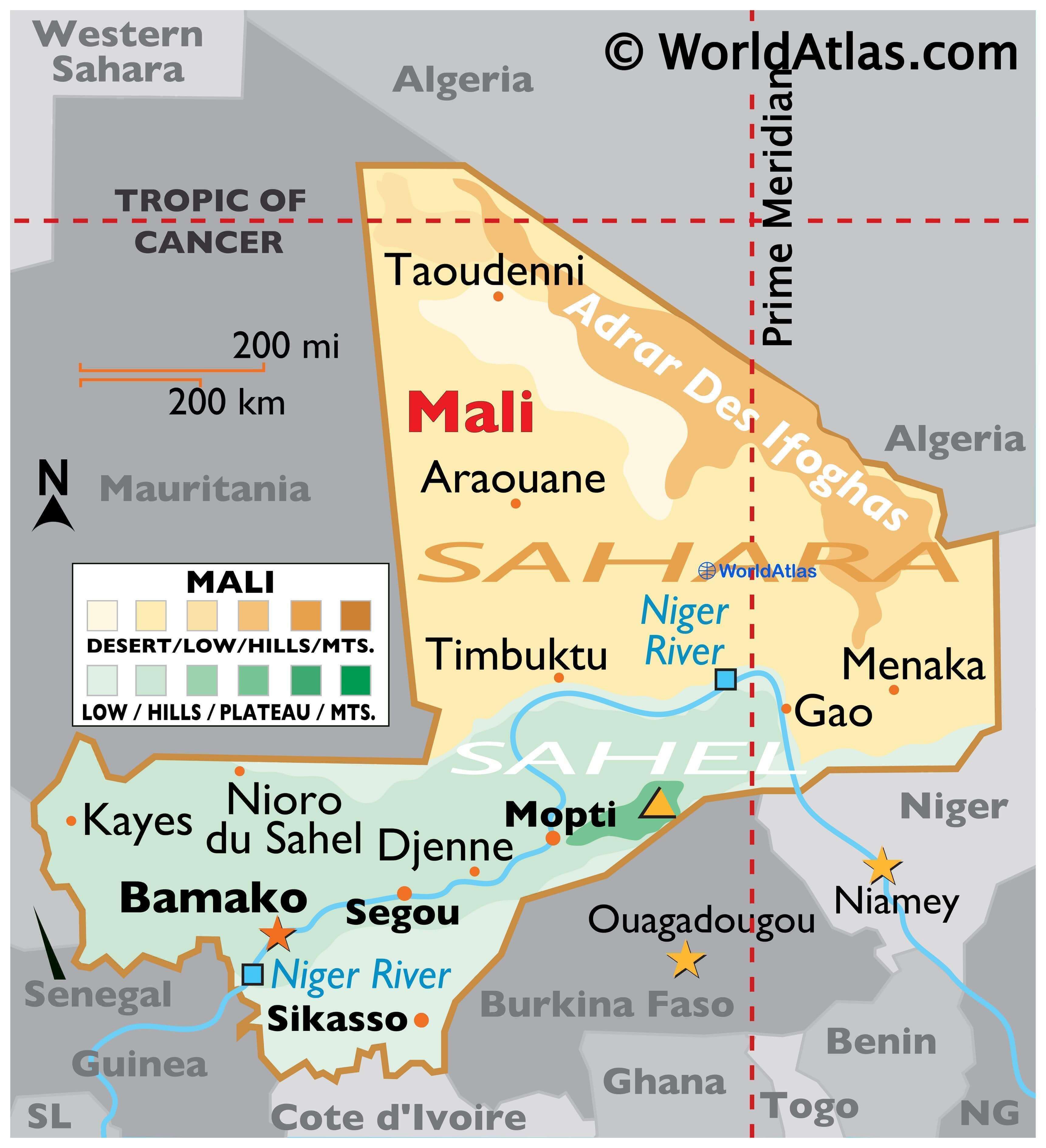
Mali is a landlocked country in West Africa with an area of 1,240,192 sq. km.
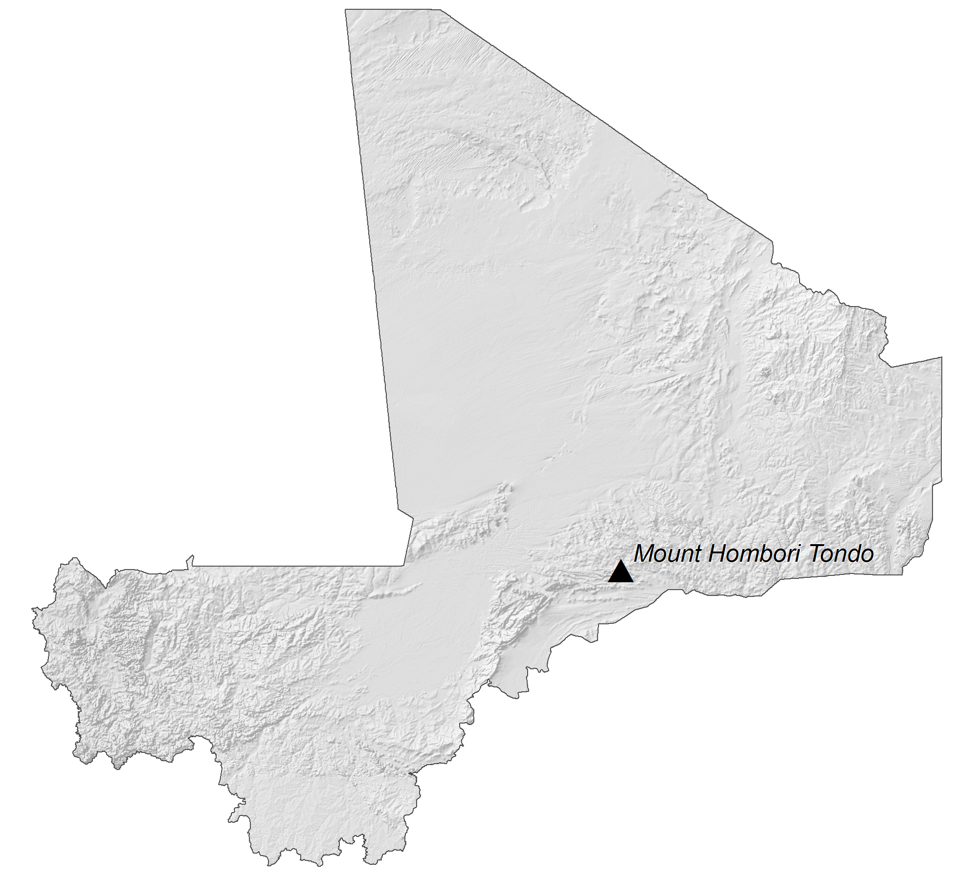
As observed on the physical map above, Mali has a monotonous landscape with plains and plateaus dominating the country topgraphy. The landscape transitions from Sahara Desert in the north through the Sahel to the zone of Sudanian savanna in the south.
Approximately 65% of the country is covered by desert or semi-desert.
Mali’s landscape is mostly a savanna grassland that rolls into higher plateaus as you move north. Rugged hills with elevations that reach upwards of 1,000 m dot the northeast.
The lowest point of the country is the Senegal River at 75 ft (23 m); the highest point of Mali is Hombori Tondo at 3,789 ft (1,155 m).
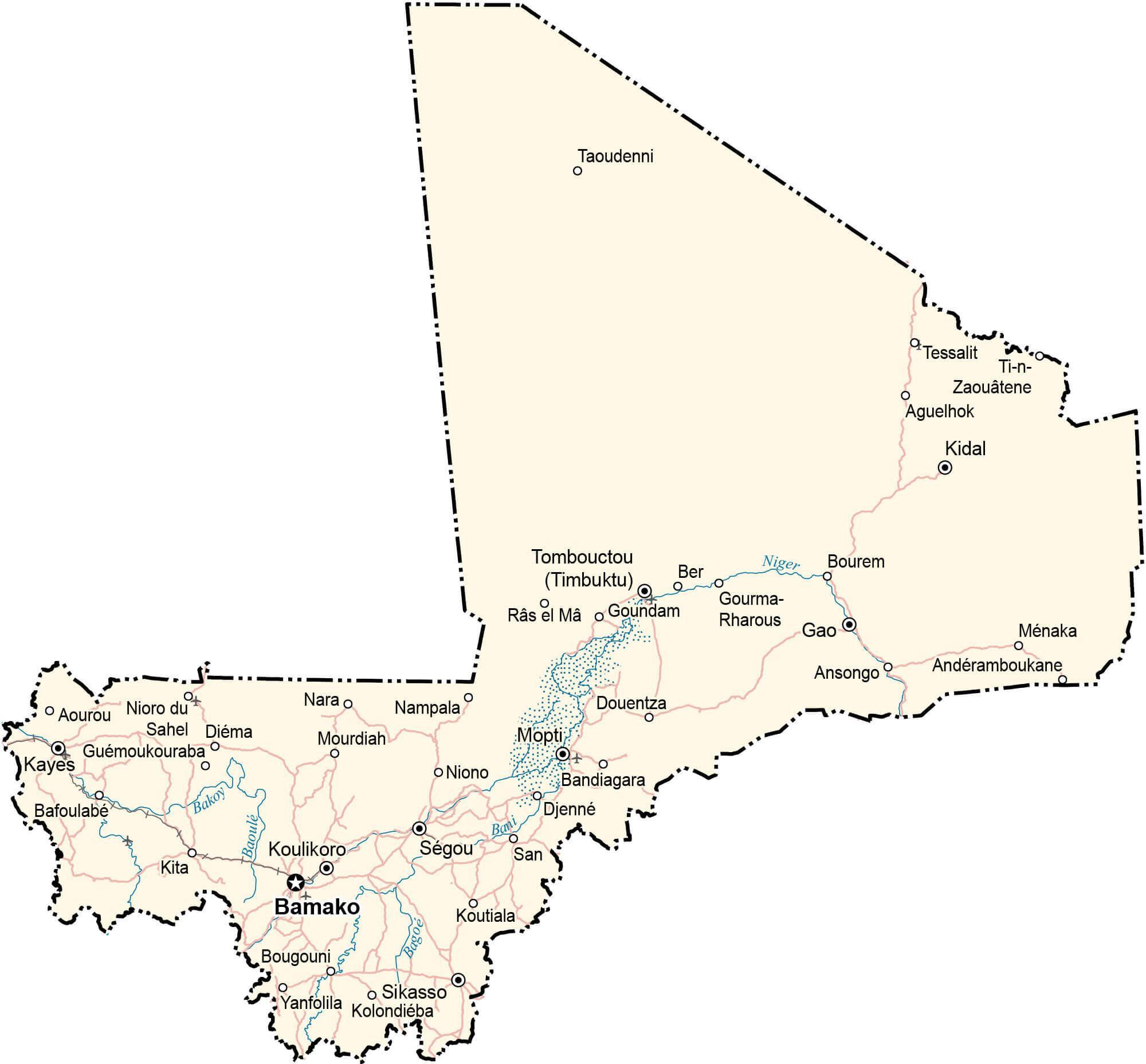
The largest rivers in Mali are the Niger and Senegal. Considered to be Mali’s lifeblood (its source of food, drinking water, irrigation and transportation) the Niger River snakes through roughly 4,180 km of western Africa.
| Flag: |  |
|---|---|
| Legal Name: | Republic of Mali |
| Capital Value: | Bamako |
| Official languages: | French |
| Demonym(s): | Malian |
| Government: | Unitary semi-presidential republic under a military junta |
| Legislature: | National Assembly |
| Total Area: | 1,240,192 km² |
| Land Area: | 1,220,190 km² |
| Water Area: | 20,002 km² |
| Population: | 19,658,031 |
| Density: | 11.7/km (30.3/sq mi) (215th) |
| GDP: | $17.51 Billion |
| GDP Per Capita: | $890.74 |
| Currency Value: | Communaute Financiere Africaine francs (XOF) |
| Driving side: | right |
| Calling code: | +223 |
| Internet TLD: | .ml |
This interactive map of Mali gives you an insight into the country’s geography and culture. It features cities and towns, lakes, and rivers, as well as satellite imagery and an elevation map. Explore the lifeblood of Mali, the Niger River, and its general topography with this interactive map.
Online Interactive Political Map
Click on ![]() to view map in "full screen" mode.
to view map in "full screen" mode.
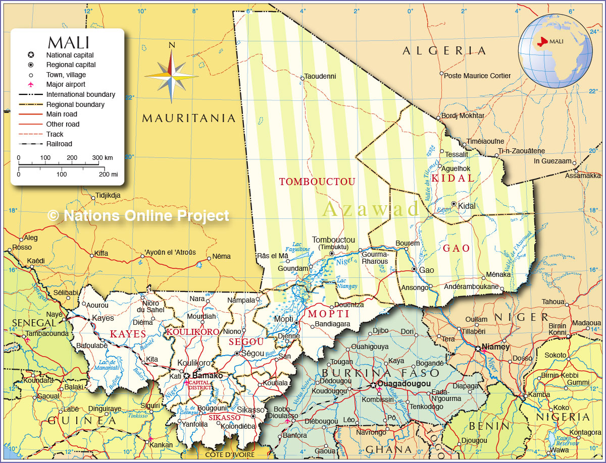
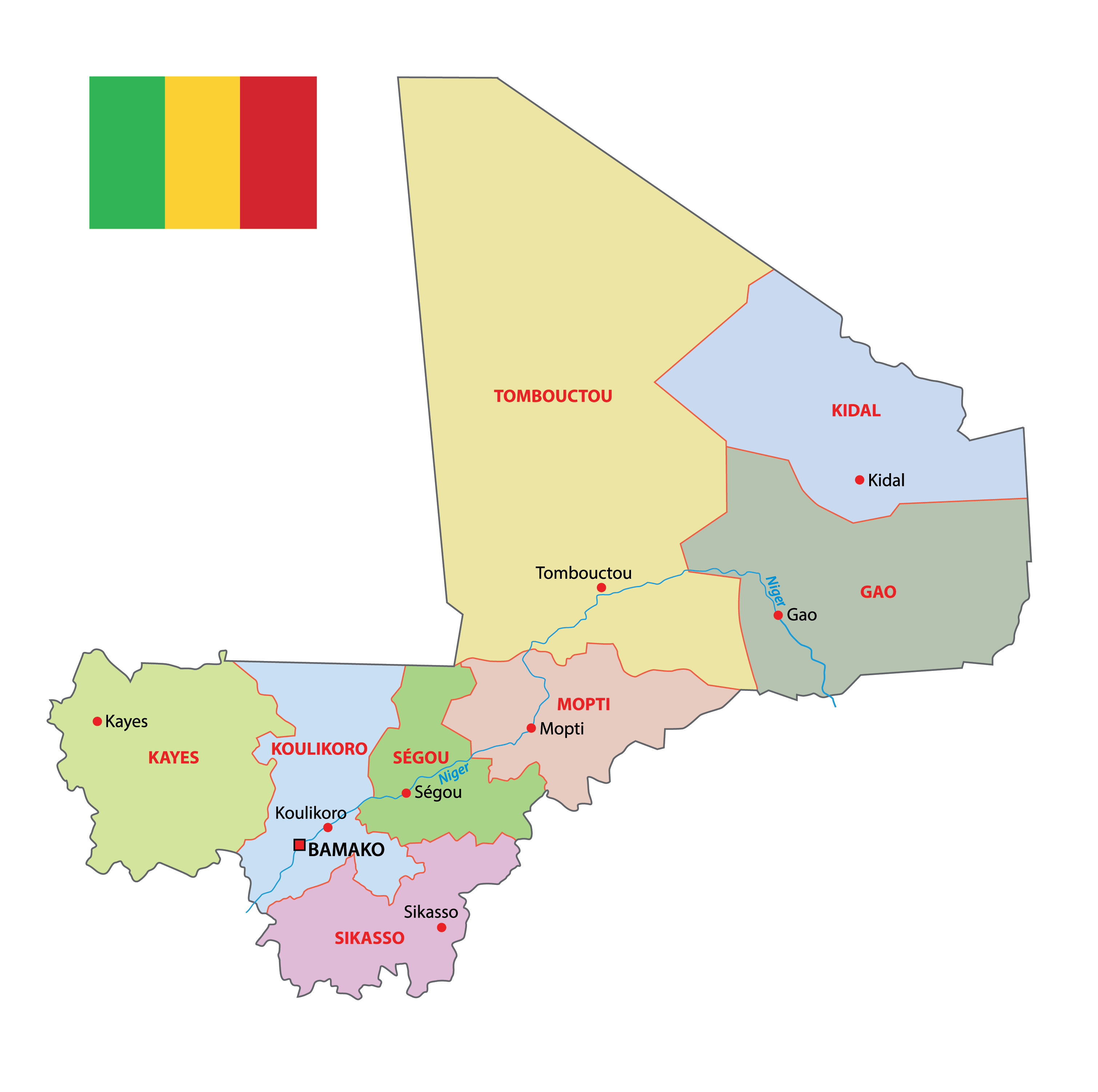
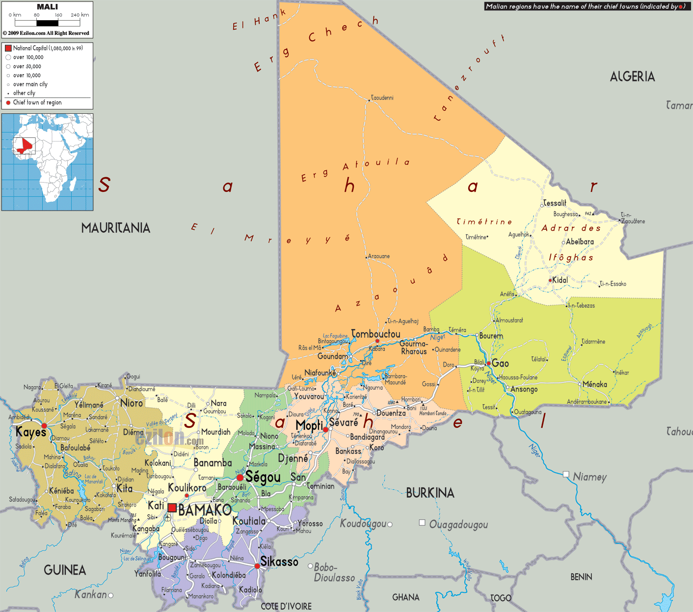
Mali has been divided into 10 administrative regions. In alphabetical order, these are as follows: Gao, Kayes, Kidal, Koulikoro, Menaka, Mopti, Segou, Sikasso, Taoudenni, Tombouctou (Timbuktu); note – Menaka and Taoudenni were legislated in 2016, but implementation has not been confirmed by the US Board on Geographic Names
The country also has one capital district, Bamako. It is the capital and largest city of Mali.
With an area of 496,611 sq. km Tombouctou is the largest region of Mali by area and Sikasso is the most populous one.
Location Maps
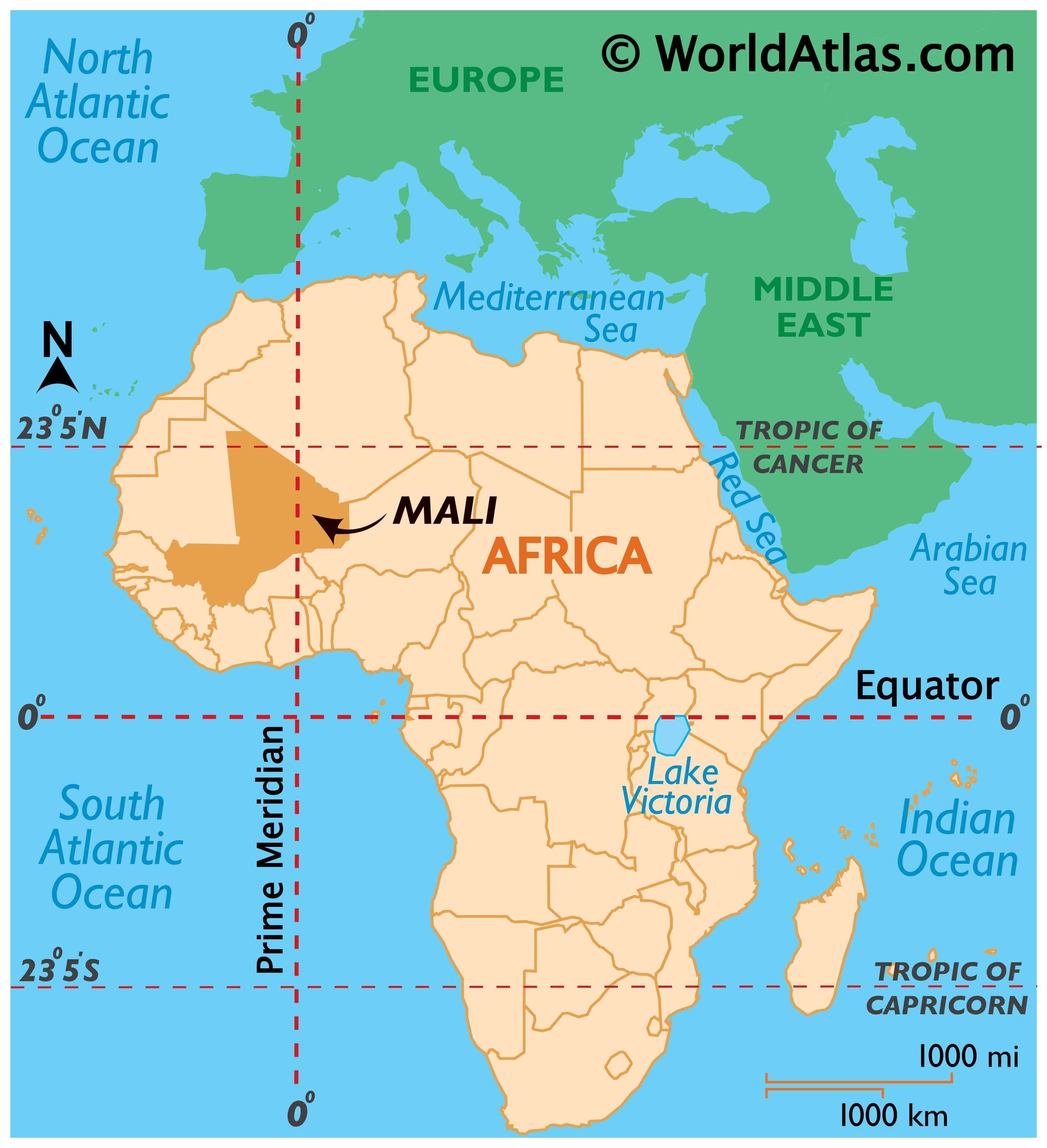
Where is Mali?
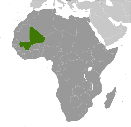
Mali is a landlocked country located in Western Africa, with a population of 19.1 million. It borders seven other countries: Algeria, Mauritania, Niger, Burkina Faso, Ivory Coast, Guinea, and Senegal. Bamako is the capital and largest city in the country, situated in the southwestern region. Other major cities include Sikasso, Mopti, and Koutiala. The primary exported resources of Mali are gold, agriculture, and salt.
High Definition Political Map of Mali
History
Rock paintings and carvings indicate that northern Mali has been inhabited since prehistoric times when the Sahara was fertile grassland. Farming took place by 5000 BC and iron was used around 500 BC.
The rock art in the Sahara suggests that northern Mali has been inhabited since 10,000 BC, when the Sahara was fertile and rich in wildlife. Early ceramics have been discovered at the central Malian site of Ounjougou dating to about 9,400 BC, and are believed to represent an instance of the independent invention of pottery in the region.
In the first millennium BC, early cities and towns were created by Mande peoples related to the Soninke people, along the middle Niger River in central Mali, including Dia which began from around 900 BC, and reached its peak around 600 BC, and Djenne-Djenno, which lasted from around 300 BC to 900 AD. By the sixth century AD, the lucrative trans-Saharan trade in gold, salt and slaves had begun, facilitating the rise of West Africa’s great empires.
There are a few references to Mali in early Islamic literature. Among these are references to “Pene” and “Malal” in the work of al-Bakri in 1068, the story of the conversion of an early ruler, known to Ibn Khaldun (by 1397) as Barmandana, and a few geographical details in the work of al-Idrisi.
Mali was once part of three famed West African empires which controlled trans-Saharan trade in gold, salt, other precious commodities, and slaves majorly during the reign of Mansa Musa from c. 1312 – c. 1337. These Sahelian kingdoms had neither rigid geopolitical boundaries nor rigid ethnic identities. The earliest of these empires was the Ghana Empire, which was dominated by the Soninke, a Mande-speaking people. The empire expanded throughout West Africa from the eighth century until 1078, when it was conquered by the Almoravids.
The Battle of Kirina in 1235, culminated in a victory for the Mandinka under the command of the exiled prince Sundiata Keita, which led to the downfall of the Sosso Empire.
The Mali Empire later formed on the upper Niger River, and reached the height of power in the 14th century. Under the Mali Empire, the ancient cities of Djenné and Timbuktu were centers of both trade and Islamic learning. The empire later declined as a result of internal intrigue, ultimately being supplanted by the Songhai Empire. The Songhai people originated in current northwestern Nigeria. The Songhai had long been a major power in West Africa subject to the Mali Empire’s rule.
In the late 14th century, the Songhai gradually gained independence from the Mali Empire and expanded, ultimately subsuming the entire eastern portion of the Mali Empire. The Songhai Empire’s eventual collapse was largely the result of a Moroccan invasion in 1591, under the command of Judar Pasha. The fall of the Songhai Empire marked the end of the region’s role as a trading crossroads. Following the establishment of sea routes by the European powers, the trans-Saharan trade routes lost significance. At that time, the Mali Empire’s abundance in wealth expanded its commercial assets of salt and gold.
One of the worst famines in the region’s recorded history occurred in the 18th century. According to John Iliffe, “The worst crises were in the 1680s, when famine extended from the Senegambian coast to the Upper Nile and ‘many sold themselves for slaves, only to get a sustenance’, and especially in 1738–1756, when West Africa’s greatest recorded subsistence crisis, due to drought and locusts, reportedly killed half the population of Timbuktu.”
French colonial rule
Mali fell under the control of France during the late 19th century. By 1905, most of the area was under firm French control as a part of French Sudan. On 24 November 1958, French Sudan (which changed its name to the Sudanese Republic) became an autonomous republic within the French Community. In January 1959, Mali and Senegal united to become the Mali Federation. The Mali Federation gained independence from France on 20 June 1960.
Senegal withdrew from the federation in August 1960, which allowed the Sudanese Republic to become the independent Republic of Mali on 22 September 1960, and that date is now the country’s Independence Day. Modibo Keïta was elected the first president. Keïta quickly established a one-party state, adopted an independent African and socialist orientation with close ties to the East, and implemented extensive nationalization of economic resources. In 1960, the population of Mali was reported to be about 4.1 million.
Moussa Traoré
On 19 November 1968, following progressive economic decline, the Keïta regime was overthrown in a bloodless military coup led by Moussa Traoré, a day which is now commemorated as Liberation Day. The subsequent military-led regime, with Traoré as president, attempted to reform the economy. His efforts were frustrated by political turmoil and a devastating drought between 1968 and 1974, in which famine killed thousands of people. The Traoré regime faced student unrest beginning in the late 1970s and three coup attempts. The Traoré regime repressed all dissenters until the late 1980s.
The government continued to attempt economic reforms, and the populace became increasingly dissatisfied. In response to growing demands for multi-party democracy, the Traoré regime allowed some limited political liberalization. They refused to usher in a full-fledged democratic system. In 1990, cohesive opposition movements began to emerge, and was complicated by the turbulent rise of ethnic violence in the north following the return of many Tuaregs to Mali.
Anti-government protests in 1991 led to a coup, a transitional government, and a new constitution. Opposition to the corrupt and dictatorial regime of General Moussa Traoré grew during the 1980s. During this time strict programs, imposed to satisfy demands of the International Monetary Fund, brought increased hardship upon the country’s population, while elites close to the government supposedly lived in growing wealth. Peaceful student protests in January 1991 were brutally suppressed, with mass arrests and torture of leaders and participants. Scattered acts of rioting and vandalism of public buildings followed, but most actions by the dissidents remained nonviolent.
From 22 March through 26 March 1991, mass pro-democracy rallies and a nationwide strike was held in both urban and rural communities, which became known as les évenements (“the events”) or the March Revolution. In Bamako, in response to mass demonstrations organized by university students and later joined by trade unionists and others, soldiers opened fire indiscriminately on the nonviolent demonstrators. Riots broke out briefly following the shootings. Barricades as well as roadblocks were erected and Traoré declared a state of emergency and imposed a nightly curfew. Despite an estimated loss of 300 lives over the course of four days, nonviolent protesters continued to return to Bamako each day demanding the resignation of the dictatorial president and the implementation of democratic policies.
26 March 1991 is the day that marks the clash between military soldiers and peaceful demonstrating students which climaxed in the massacre of dozens under the orders of then President Moussa Traoré. He and three associates were later tried and convicted and received the death sentence for their part in the decision-making of that day. Nowadays, the day is a national holiday in order to remember the tragic events and the people who were killed. The coup is remembered as Mali’s March Revolution of 1991.
By 26 March, the growing refusal of soldiers to fire into the largely nonviolent protesting crowds turned into a full-scale tumult, and resulted in thousands of soldiers putting down their arms and joining the pro-democracy movement. That afternoon, Lieutenant Colonel Amadou Toumani Touré announced on the radio that he had arrested the dictatorial president, Moussa Traoré. As a consequence, opposition parties were legalized and a national congress of civil and political groups met to draft a new democratic constitution to be approved by a national referendum.
Amadou Toumani Touré presidency
In 1992, Alpha Oumar Konaré won Mali’s first democratic, multi-party presidential election, before being re-elected for a second term in 1997, which was the last allowed under the constitution. Amadou Toumani Touré, a retired general who had been the leader of the military aspect of the 1991 democratic uprising, was elected in 2002. During this democratic period Mali was regarded as one of the most politically and socially stable countries in Africa.
Slavery persists in Mali today with as many as 200,000 people held in direct servitude to a master. In the Tuareg Rebellion of 2012, ex-slaves were a vulnerable population with reports of some slaves being recaptured by their former masters.
Northern Mali conflict
In January 2012 a Tuareg rebellion began in Northern Mali, led by the National Movement for the Liberation of Azawad (MNLA). In March, military officer Amadou Sanogo seized power in a coup d’état, citing Touré’s failures in quelling the rebellion, and leading to sanctions and an embargo by the Economic Community of West African States. The MNLA quickly took control of the north, declaring independence as Azawad. However, Islamist groups including Ansar Dine and Al-Qaeda in the Islamic Maghreb (AQIM), who had helped the MNLA defeat the government, turned on the Tuareg and took control of the North with the goal of implementing sharia in Mali.
On 11 January 2013, the French Armed Forces intervened at the request of the interim government. On 30 January, the coordinated advance of the French and Malian troops claimed to have retaken the last remaining Islamist stronghold of Kidal, which was also the last of three northern provincial capitals. On 2 February, French president François Hollande joined Mali’s interim president Dioncounda Traoré in a public appearance in recently recaptured Timbuktu.
In August 2013, Ibrahim Boubacar Keita was elected as the new president of Mali after his rival admitted defeat in the second round of the election.
Conflict in Central Mali
In the central Mali province of Mopti, conflict has escalated since 2015 between agricultural communities like the Dogon and the Bambara, and the pastoral Fula (or Fulani) people. Historically, the two sides have fought over access to land and water, factors which have been exacerbated by climate change as the Fula move into new areas. The Dogon and the Bambara communities have formed militias, or “self-defense groups”, to fight the Fula. They accuse the Fula of working with armed Islamists linked to al-Qaeda. While some Fula have joined Islamist groups, Human Rights Watch reports that the links have been “exaggerated and instrumentalized by different actors for opportunistic ends”.
Added a top Mali military commander:
The conflict has seen the creation and growth of Dogon and Bambara militias. The government of Mali is suspected of supporting some of these groups under the guise of they being proxies in the war against Islamists in the Northern Mali conflict. The government denies this. One such militia is the Dogon group Dan Na Ambassagou, created in 2016.
Presidential elections were held in Mali on 29 July 2018. In July 2018, the Constitutional Court approved the nomination of a total of 24 candidates in the election. As no candidate received more than 50% of the vote in the first round, a runoff was held on 12 August 2018 between the top two candidates, incumbent president Ibrahim Boubacar Keïta of the Rally for Mali and Soumaïla Cissé of the Union for the Republic and Democracy. Keïta was subsequently re-elected with 67% of the vote.
In September 2018, the Centre for Humanitarian Dialogue negotiated a unilateral ceasefire with Dan Na Ambassagou “in the context of the conflict which opposes the group to other community armed groups in central Mali”. However, the group has been blamed for the 24 March 2019 massacre of 160 Fula villagers. The group denied the attack, but afterwards Malian president Keita ordered the group to disband.
The UN Special Adviser on the Prevention of Genocide, Adama Dieng, warned of a growing ethnicization of the conflict.
The United Nations reported that the number of children killed in the conflict in the first six months of 2019 was twice as many for the entire year of 2018. Many of the children have been killed in intercommunal attacks attributed to ethnic militias, with the majority of attacks occurring around Mopti. It is reported that around 900 schools have closed down and that armed militias are recruiting children.
During the first week of October 2019, two jihadist attacks in the towns of Boulikessi and Mondoro killed more than 25 Mali soldiers near the border with Burkina Faso. President Keïta declared that “no military coup will prevail in Mali”, continuing by saying that he doesn’t think it “is on the agenda at all and cannot worry us”.
2020 coup d’état and aftermath
Popular unrest began on 5 June 2020 following irregularities in the March and April parliamentary elections, including outrage against the kidnapping of opposition leader Soumaïla Cissé. Between 11 and 23 deaths followed protests that took place from 10 to 13 June. In July, President Keïta dissolved the constitutional court.
Members of the military led by Colonel Assimi Goïta and Colonel-Major Ismaël Wagué in Kati, Koulikoro Region, began a mutiny on 18 August 2020. President Ibrahim Boubacar Keïta and Prime Minister Boubou Cissé were arrested, and shortly after midnight Keïta announced his resignation, saying he did not want to see any bloodshed. Wagué announced the formation of the National Committee for the Salvation of the People (CNSP) and promised elections in the future. A curfew was begun and the streets of Bamako were quiet.
The Economic Community of West African States (ECOWAS) condemned the coup and demanded the reinstallation of President Keïta.
On 12 September 2020, the National Committee for the Salvation of the People (CNSP) agreed to an 18-month political transition to civilian rule. Shortly after, Bah N’daw was named interim president by a group of 17 electors, with Goïta being appointed vice president. The government was inaugurated on 25 September 2020.
On 18 January 2021, the transitional government announced that the CNSP had been disbanded, almost four months after had been promised under the initial agreement.
2021 coup d’état
Tensions have been high between the civilian transitional government and the military since the handover of power in September 2020.
On 24 May, tensions came to a head after a cabinet reshuffle, where two leaders of the 2020 military coup – Sadio Camara and Modibo Kone – were replaced by N’daw’s administration. Later that day, journalists reported that three key civilian leaders – President N’daw, Prime Minister Moctar Ouane and Defence Minister Souleymane Doucouré, were being detained in a military base in Kati, outside Bamako. On 7 June 2021, Mali’s military commander Assimi Goita was sworn into office as the new interim president.
2022
On 10 January, Mali announced the closure of its borders and recalled several ambassadors to ECOWAS countries, in response to sanctions placed on Mali for deferring elections for four years. On 4 February, France’s ambassador was expelled. According to Human Rights Watch (HRW) Malian troops and suspected Russian mercenaries from the Wagner group executed around 300 civilian men in central Mali in March 2022. France had withdrawn French troops from Mali in February 2022. On 2 May, the military government announced breaking its defence accords concluded in 2013 with France, constituting an additional step in the deterioration of Malian-French relations. This latest announcement has been criticized by French authorities and considered as “illegitimate”. A UN panel reported that in the first three months of 2022, 543 civilians were killed and 269 wounded, warning the 2015 peace agreement between the government and pro-independence groups was threatened by a potential risk of confrontation for the first time in five years. The report also noted a sharp increase in the number of people needing humanitarian assistance over the previous year.
2023
Sergey Lavrov, the Russian foreign minister, visited Bamako, Mali, on Tuesday February 7 and said that Moscow would continue to help Bamako improve its military capabilities. On February 23, Mali became one of seven countries to vote against the UN General Assembly motion calling for Russia to withdraw from Ukraine.
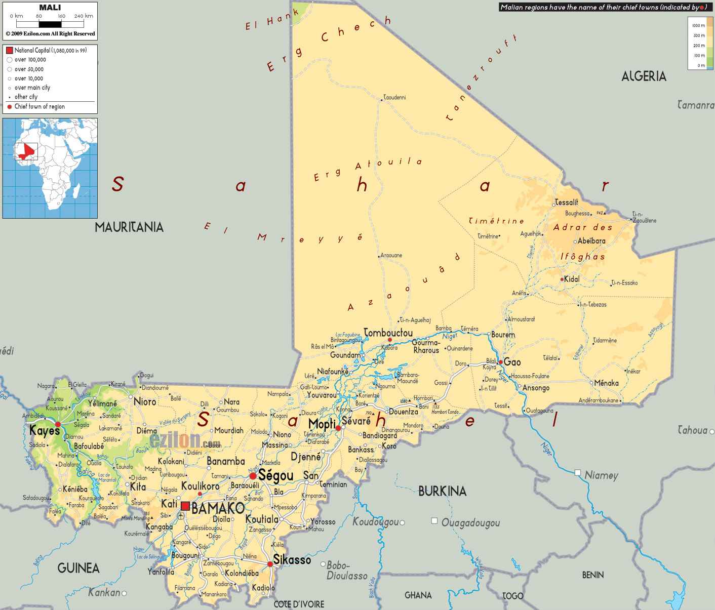
Physical Map of Mali
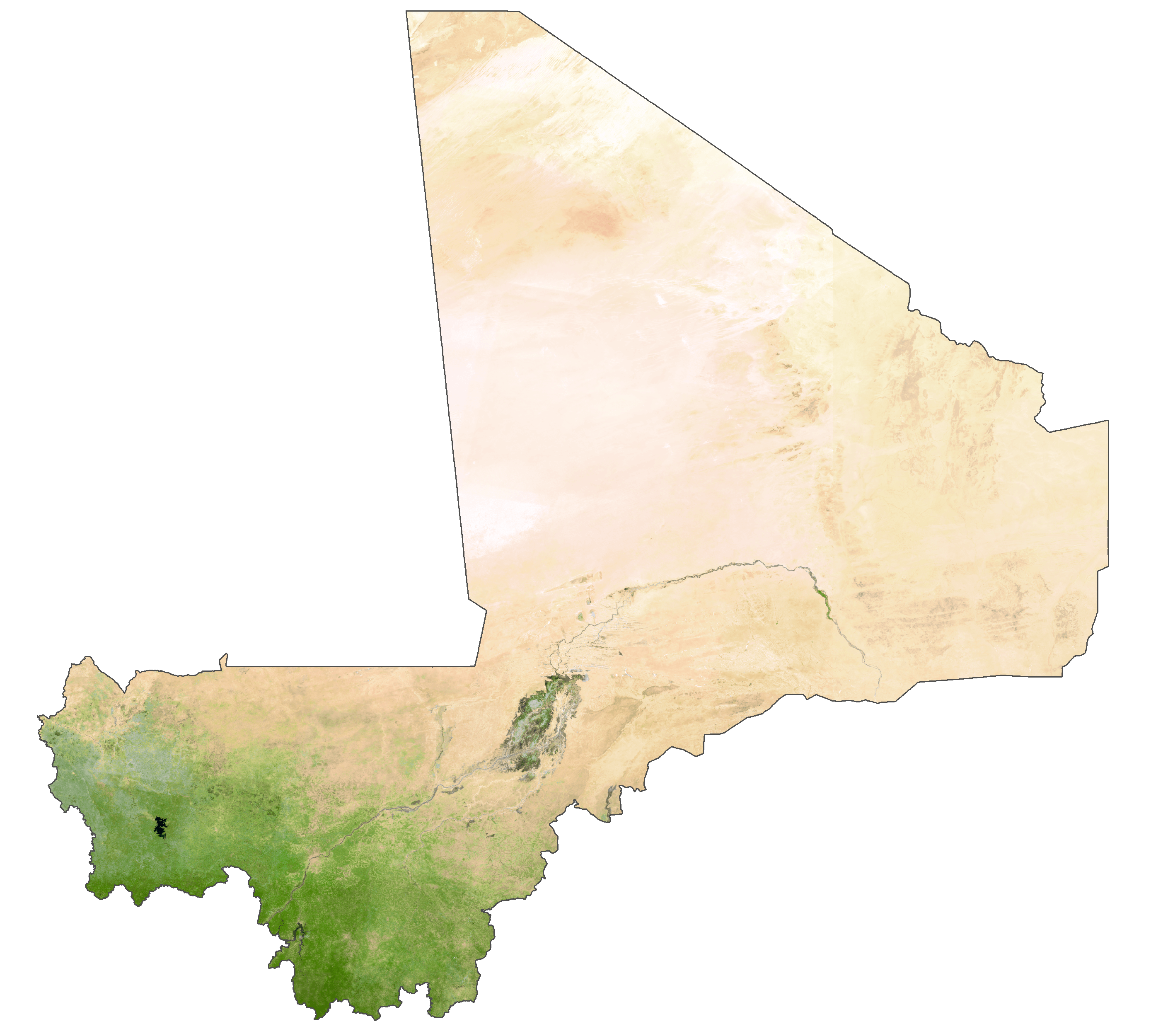
Mali Satellite Map
Elevation Map