Covering a total land area of only 180 sq.km (70.05 sq mi), Marshall Islands consist of 29 low-lying coral atolls comprising 1,156 individual islands and islets; scattered over a wide area in central Pacific Ocean. Marshall Islands are composed of coral islands and islets which have accumulated on its atoll reefs and are formed on top of ancient volcanoes submerged below sea level. The general landscape is sandy as most of these islands rise only a few feet above sea level, with the highest point being an unnamed hill on Likiep which peaks at only 32ft (10m). The Kwajalein Atoll, with a huge central lagoon is the largest coral atoll on the planet.
| Flag: | 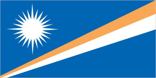 |
|---|---|
| Legal Name: | Republic of the Marshall Islands |
| Capital Value: | Majuro; note – the capital is an atoll of 64 islands; governmental buildings are housed on three fused islands: Djarrit, Uliga, and Delap |
| Official languages: |
|
| Demonym(s): | Marshallese |
| Government: | Unitary parliamentary republic with an executive presidency |
| Legislature: | Nitijela |
| Total Area: | 181 km² |
| Land Area: | 181 km² |
| Population: | 58,791 |
| Density: | 293.0/km (758.9/sq mi) (28th) |
| GDP: | $221.28 Million |
| GDP Per Capita: | $3,788.16 |
| Currency Value: | US Dollar (USD) |
| Driving side: | right |
| Calling code: | +692 |
| Internet TLD: | .mh |
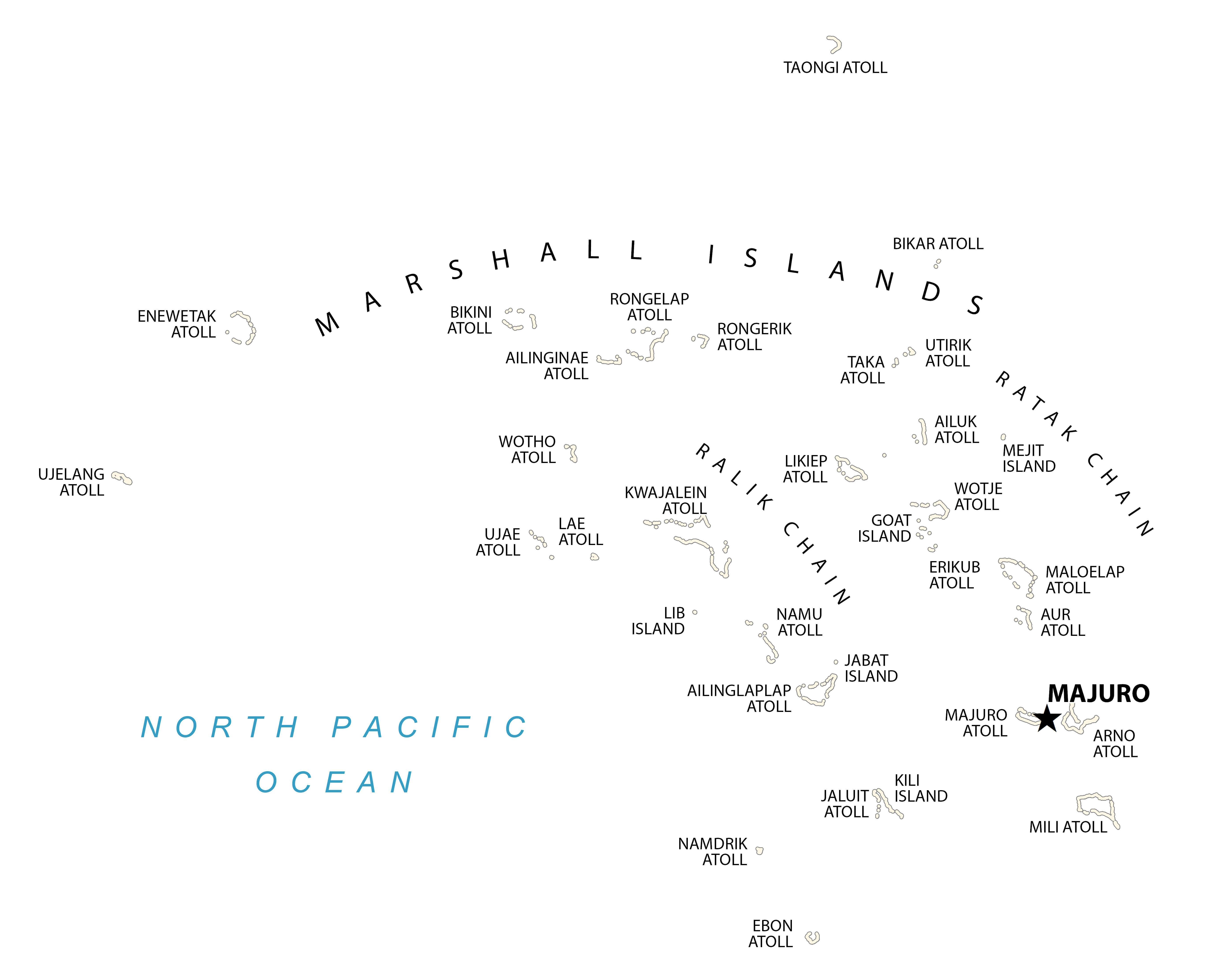
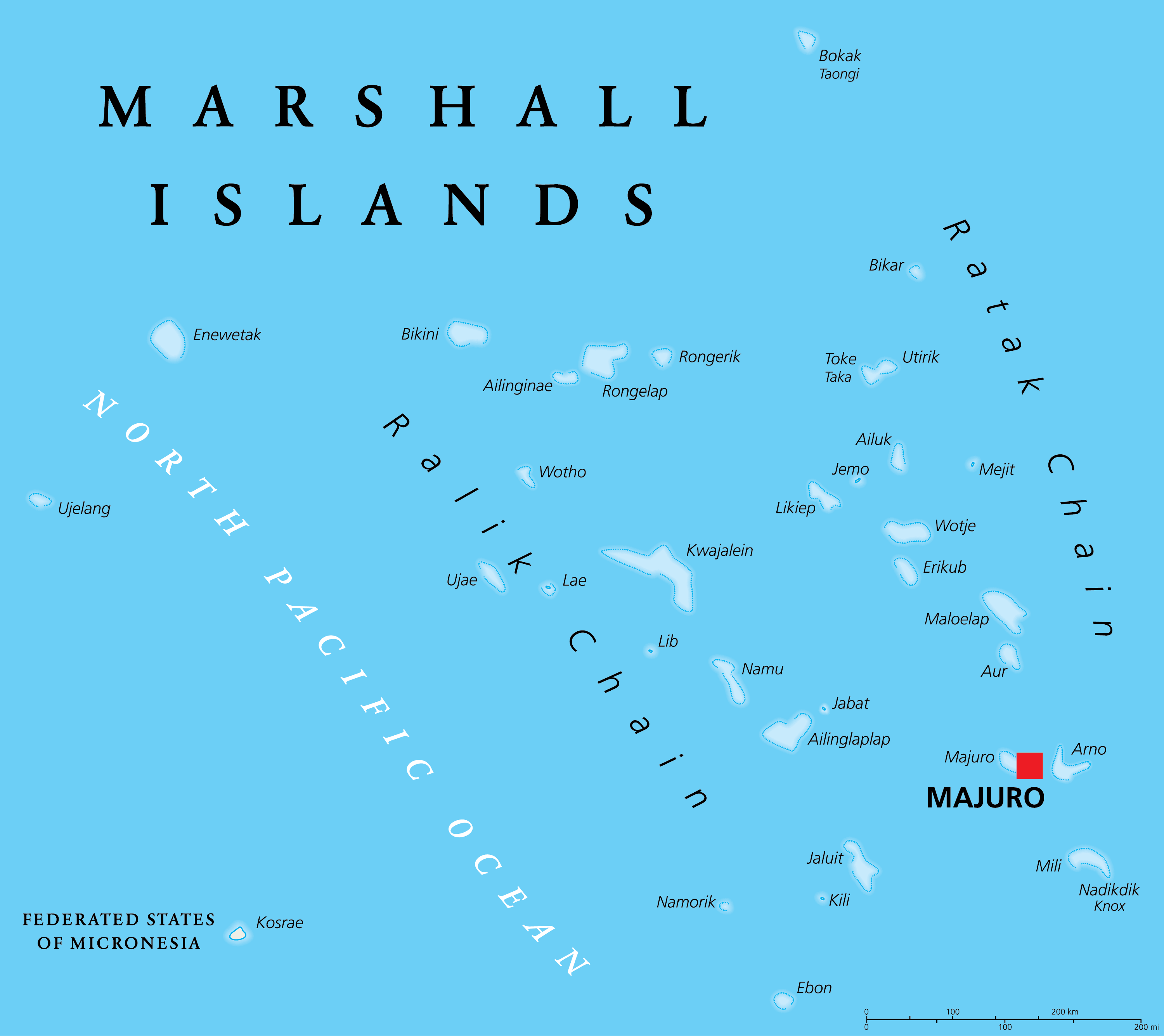
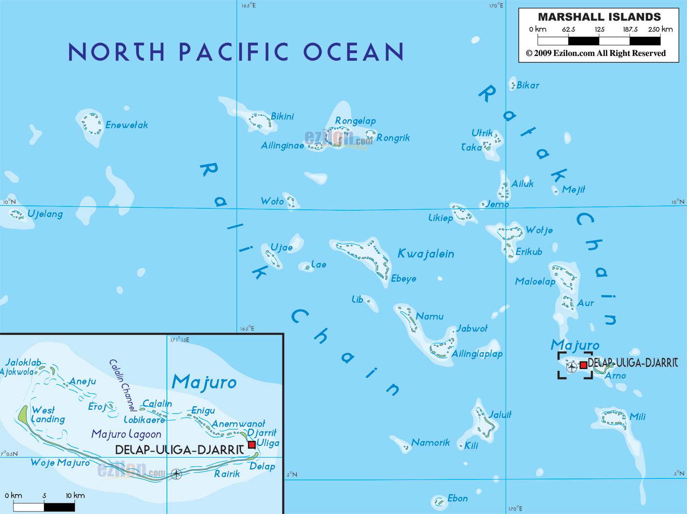
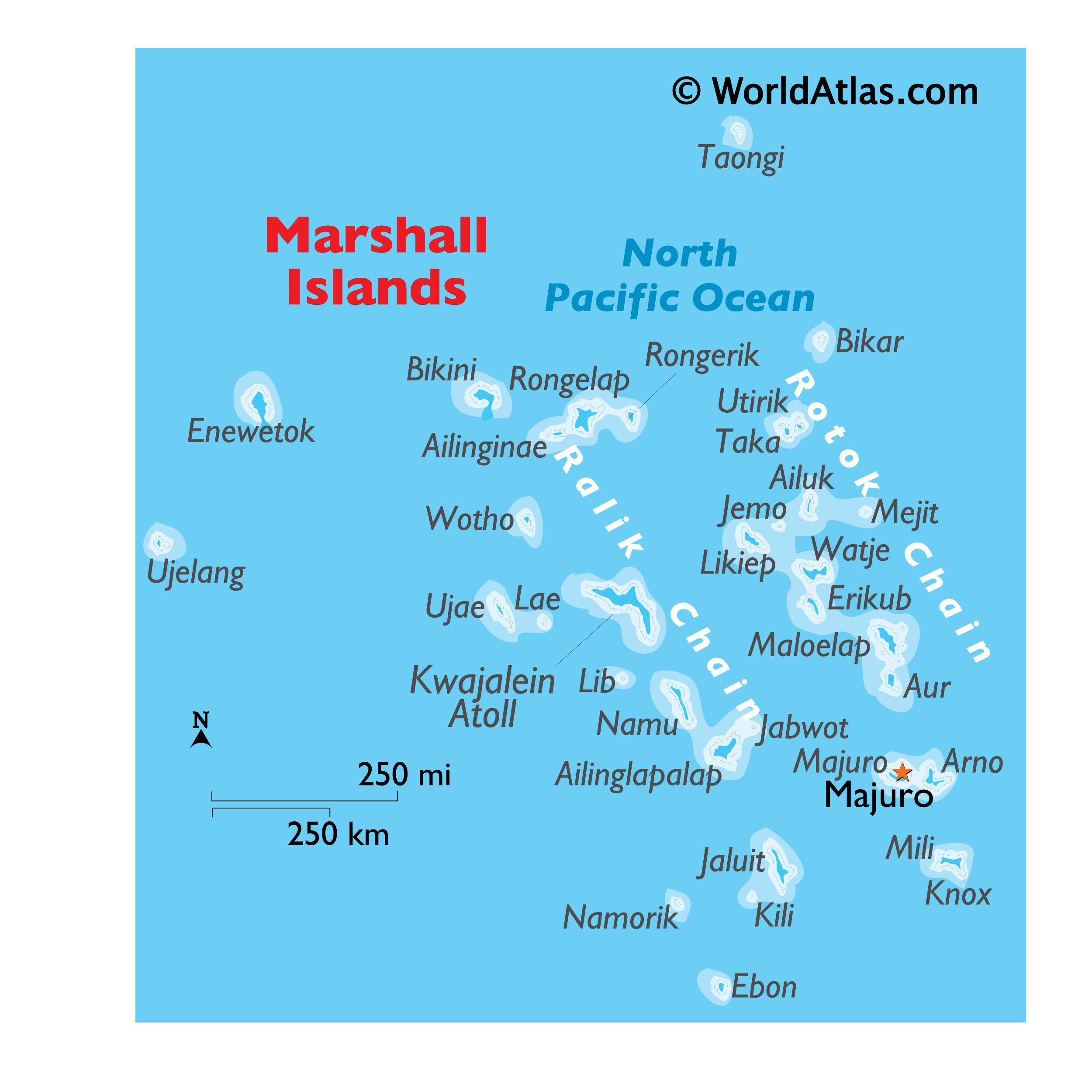
Explore the Wonders of the Marshall Islands with this Detailed Map
Discover the beauty of the Marshall Islands with this detailed map. See the atolls, islands, and water features that make the Marshall Islands so special. Get to know the capital city of Majuro, which forms a legislative district of the Ratak Chain of the Marshall Islands.
Location Maps
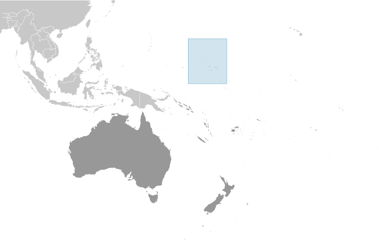
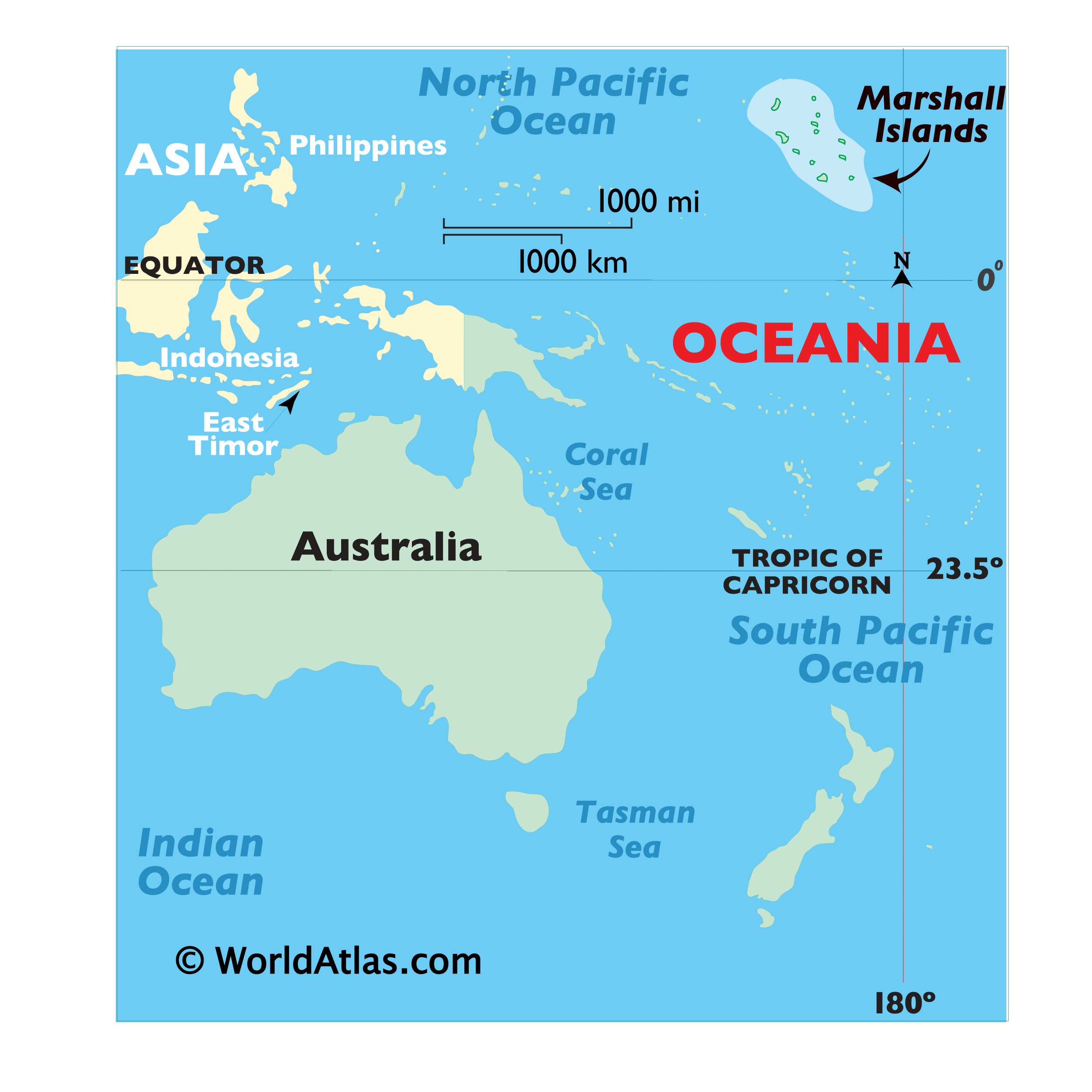
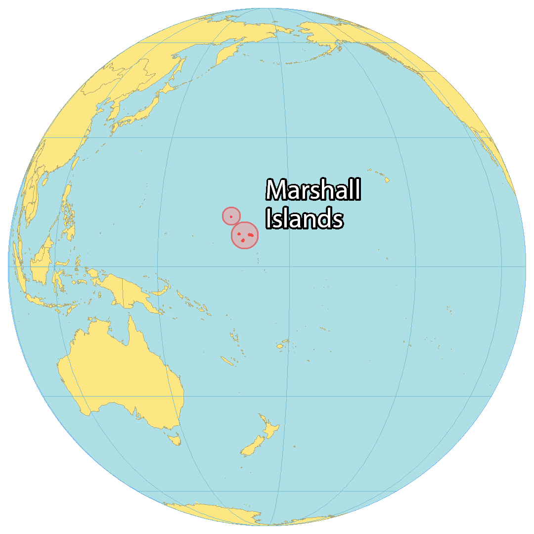
Where is Marshall Islands?
The Marshall Islands is a string of volcanic islands located in the central Pacific Ocean. It is northeast of Papua New Guinea and Australia, and northwest of Kiribati. The Marshall Islands consists of 5 main islands and 29 atolls, and is 181.43 square kilometers in area. The population is 58,400, and the capital and largest city is Majuro. The Marshall Islands is one of the newest nations, gaining independence in 1986. It is a popular diving destination, featuring Bikini Atoll’s World War II ship graveyard site and its many underwater marine life.
High Definition Political Map of Marshall Islands
History
Evidence suggests that around 3,000 years ago successive waves of human migrants from Southeast Asia spread across the Western Pacific Ocean, populating its many small islands. The Marshall Islands were settled by Micronesians in the 2nd millennium BC. Little is known of the islands’ early history. Marshall Islanders, among the many great Oceanic voyagers, designed stick charts to map ocean swells and navigate between the islands. Present-day seafaring, however, has remained an extension of maritime culture across the archipelago.
The Spanish explorer Alonso de Salazar landed there in 1526, and the archipelago came to be known as “Los Pintados” (“The Painted (Ones)”, possibly referring to the indigenous people first found there), “Las Hermanas” (“The Sisters”) and “Los Jardines” (“The Gardens”) within the Spanish Empire. It first fell within the jurisdiction of the Viceroyalty of New Spain, and was then administered by Madrid, through the Captaincy General of the Philippines, upon the independence of Latin America and the dissolution of New Spain starting in 1821.
American whaling ships visited the islands in the 19th century. The first on record was the Awashonks in 1835 and last was the Andrews Hicks in 1905.
The islands were only formally possessed by Spain for much of their colonial history, and on European maps were grouped with the Caroline Islands which today make up Palau and the Federated States of Micronesia, or alternatively the “Nuevas Filipinas” (“New Philippines”). The islands were mostly left to their own affairs except for short-lived religious missions (documented in 1668 and 1731) during the 16th and 17th centuries. They were largely ignored by European powers except for cartographic demarcation treaties between the Iberian Empires (Portugal and Castilian Spain) in 1529, 1750 and 1777. The archipelago corresponding to the present-day country was independently named by Krusenstern, after British explorer John Marshall, who visited them together with Thomas Gilbert in 1788, en route from Botany Bay to Canton with two ships of the First Fleet, and started to establish German and British trading posts, which were not formally contested by Spain.
The Marshall Islands were formally claimed by Spain in 1874 through its capital in the East Indies, Manila. This marked the start of several strategic moves by the German Empire during the 1870s and 80s to annex them (claiming them to be “by chance unoccupied”). This policy culminated in a tense naval episode in 1885, which did not degenerate into a conflict due to the poor readiness of Spain’s naval forces and the unwillingness for open military action from the German side.
Following papal mediation and German compensation of $4.5 million, Spain reached an agreement with Germany in 1885: the 1885 Hispano-German Protocol of Rome. This accord established a protectorate and set up trading stations on the islands of Jaluit (Joló) and Ebon to carry out the flourishing copra (dried coconut meat) trade. Marshallese Iroij (high chiefs) continued to rule under indirect colonial German administration, rendered tacitly effective by the wording in the 1885 Protocol, which demarcated an area subject to Spanish sovereignty (0–11ºN, 133–164ºE) omitting the Eastern Carolines, that is, the Marshall and Gilbert archipelagos, where most of the German trading posts were located. The disputes were rendered moot after the selling of the whole Caroline archipelago to Germany 13 years later.
At the beginning of World War I, Japan assumed control of the Marshall Islands. The Japanese headquarters was established at the German center of administration, Jaluit. On January 31, 1944, American forces landed on Kwajalein atoll and U.S. Marines and Army troops later took control of the islands from the Japanese on February 3, following intense fighting on Kwajalein and Enewetak atolls. In 1947, the United States, as the occupying power, entered into an agreement with the UN Security Council to administer much of Micronesia, including the Marshall Islands, as the Trust Territory of the Pacific Islands.
From 1946 to 1958, it served as the Pacific Proving Grounds for the United States and was the site of 67 nuclear tests on various atolls. The world’s first hydrogen bomb, codenamed “Mike”, was tested at the Enewetak atoll in the Marshall Islands on November 1 (local date) in 1952, by the United States.
Nuclear testing began in 1946 on Bikini Atoll after residents were evacuated. Over the years, 67 weapon tests were conducted, including the 15-megaton Castle Bravo hydrogen bomb test, which produced significant fallout in the region. The testing concluded in 1958. Over the years, just one of over 60 islands was cleaned by the U.S. government, and the inhabitants are still waiting for the 2 billion dollars in compensation assessed by the Nuclear Claims Tribunal. Many of the islanders and their descendants still live in exile, as the islands remain contaminated with high levels of radiation.
A significant radar installation was constructed on Kwajalein atoll.
On May 1, 1979, in recognition of the evolving political status of the Marshall Islands, the United States recognized the constitution of the Marshall Islands and the establishment of the Government of the Republic of the Marshall Islands. The constitution incorporates both American and British constitutional concepts.
There have been a number of local and national elections since the Republic of the Marshall Islands was founded. The United Democratic Party, running on a reform platform, won the 1999 parliamentary election, taking control of the presidency and cabinet.
The islands signed a Compact of Free Association with the United States in 1986. Trusteeship was ended under United Nations Security Council Resolution 683 of December 22, 1990. Until 1999 the islanders received US$180M for continued American use of Kwajalein atoll, US$250M in compensation for nuclear testing, and US$600M in other payments under the compact.
Despite the constitution, the government was largely controlled by Iroij. It was not until 1999, following political corruption allegations, that the aristocratic government was overthrown, with Imata Kabua replaced by the commoner Kessai Note.
The Runit Dome was built on Runit Island to deposit U.S.-produced radioactive soil and debris, including lethal amounts of plutonium. There are ongoing concerns about deterioration of the waste site and a potential radioactive spill.
In February 2018, the Marshall Islands became the first country in the world to the recognise its cryptocurrency as its own legal tender for digital currency.
In January 2020, David Kabua, son of founding president Amata Kabua, was elected as the new President of the Marshall Islands. His predecessor Hilda Heine lost the position after a vote.
Since the late 1980s, Marshallese have migrated to the US, with over 4,000 in Arkansas and over 7,000 in Hawaii in the 2010 US Census.
Physical Map of Marshall Islands
Geography
The Marshall Islands sit atop ancient submerged volcanoes rising from the ocean floor, about halfway between Hawaii and Australia, north of Nauru and Kiribati, east of the Federated States of Micronesia, and south of the disputed U.S. territory of Wake Island, to which it also lays claim. The atolls and islands form two groups: the Ratak (sunrise) and the Ralik (sunset). The two island chains lie approximately parallel to one another, running northwest to southeast, comprising about 750,000 square miles (1,900,000 km) of ocean but only about 70 square miles (180 km) of land mass. Each includes 15 to 18 islands and atolls.
The country consists of a total of 29 atolls and five individual islands situated in about 180,000 square miles (470,000 km) of the Pacific. The largest atoll with a land area of 6 square miles (16 km) is Kwajalein. It surrounds a 655-square-mile (1,700 km) lagoon.
Twenty-four of the atolls and islands are inhabited. The remaining atolls are uninhabited due to poor living conditions, lack of rain, or nuclear contamination. The uninhabited atolls are:
- Ailinginae Atoll
- Bikar (Bikaar) Atoll
- Bikini Atoll
- Bokak Atoll
- Erikub Atoll
- Jemo Island
- Nadikdik Atoll
- Rongerik Atoll
- Toke Atoll
- Ujelang Atoll
The average altitude above sea level for the entire country is 7 feet (2.1 m).
Shark sanctuary
In October 2011, the government declared that an area covering nearly 2,000,000 square kilometers (772,000 sq mi) of ocean shall be reserved as a shark sanctuary. This is the world’s largest shark sanctuary, extending the worldwide ocean area in which sharks are protected from 2,700,000 to 4,600,000 square kilometers (1,042,000 to 1,776,000 sq mi). In protected waters, all shark fishing is banned and all by-catch must be released. However, some have questioned the ability of the Marshall Islands to enforce this zone.
Territorial claim on Wake Island
The Marshall Islands also lays claim to Wake Island based on oral legends. While Wake island has been administered by the United States since 1899, the Marshallese government refers to it by the name Ānen Kio (new orthography) or Enen-kio (old orthography). The United States does not recognize this claim.
Climate
The climate has a relatively dry season from December to April and a wet season from May to November. Many Pacific typhoons begin as tropical storms in the Marshall Islands region, and grow stronger as they move west toward the Mariana Islands and the Philippines.
Population has outstripped the supply of fresh water, usually from rainfall. The northern atolls get 50 inches (1,300 mm) of rainfall annually; the southern atolls about twice that. The threat of drought is commonplace throughout the island chains.
Climate change is a serious threat to the Marshall Islands, with typhoons becoming stronger and sea levels rising. The sea around the Pacific islands has risen 0.28 inches (7 mm) a year since 1993, which is more than twice the rate of the worldwide average. In Kwajalein, there is a high risk of permanent flooding; when sea level rises to 3.3 feet (1 m), 37% of buildings will be permanently flooded in that scenario. In Ebeye, the risk of sea level rise is even higher, with 50% of buildings being permanently flooded in the same scenario. With 3.3 feet (1 m) of sea level rise, parts of the Majuro atoll will be permanently flooded and other parts are having a high risk of flooding especially the eastern part of the atoll would be significantly at risk. With 6.6 feet (2 m) sea level rise all the buildings of Majuro will be permanently flooded or would be at a high risk to be flooded.
The per capita CO2 emissions were 2.56t in 2020. The government of Marshall Islands pledged to be net zero in 2050, with a decrease of 32% decrease of GHGs in 2025, 45% decrease in 2030 and a 58% decrease in 2035 all compared to 2010 levels.
Fauna
Most birds found in the Marshall Islands, with the exception of those few introduced by man, are either sea birds or a migratory species. There are about 70 species of birds, including 31 seabirds. 15 of these species actually nest locally. Sea birds include the black noddy and the white tern. The only land bird is the house sparrow, introduced by humans.
There are about 300 species of fish, 250 of which are reef fish.
- Turtles: green turtles, hawksbill, Leatherback sea turtles, and Olive ridley sea turtles.
- Sharks: There are at least 22 shark species including: Blue shark, Silky shark, Bigeye thresher shark, Pelagic thresher shark, Oceanic whitetip shark, and Tawny nurse shark.
- Scorpions: dwarf wood scorpion, and Common house scorpion. Pseudoscorpions are occasionally found.
- Spiders: Two: a scytodes, Dictis striatipes; and Jaluiticola a genus of jumping spiders endemic to the Marshall Islands. Its only species is Jaluiticola hesslei.
- Amphipod: One – Talorchestia spinipalma.
- Orthoptera: cockroaches, American cockroaches, short-horned grasshopper, crickets.
- Crabs include hermit crabs, and coconut crabs.