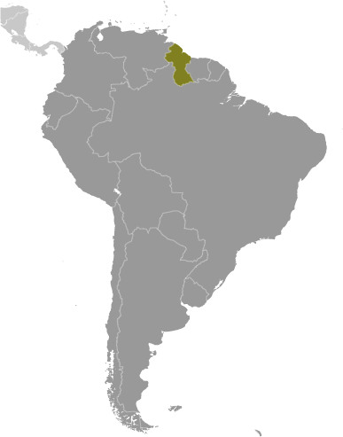
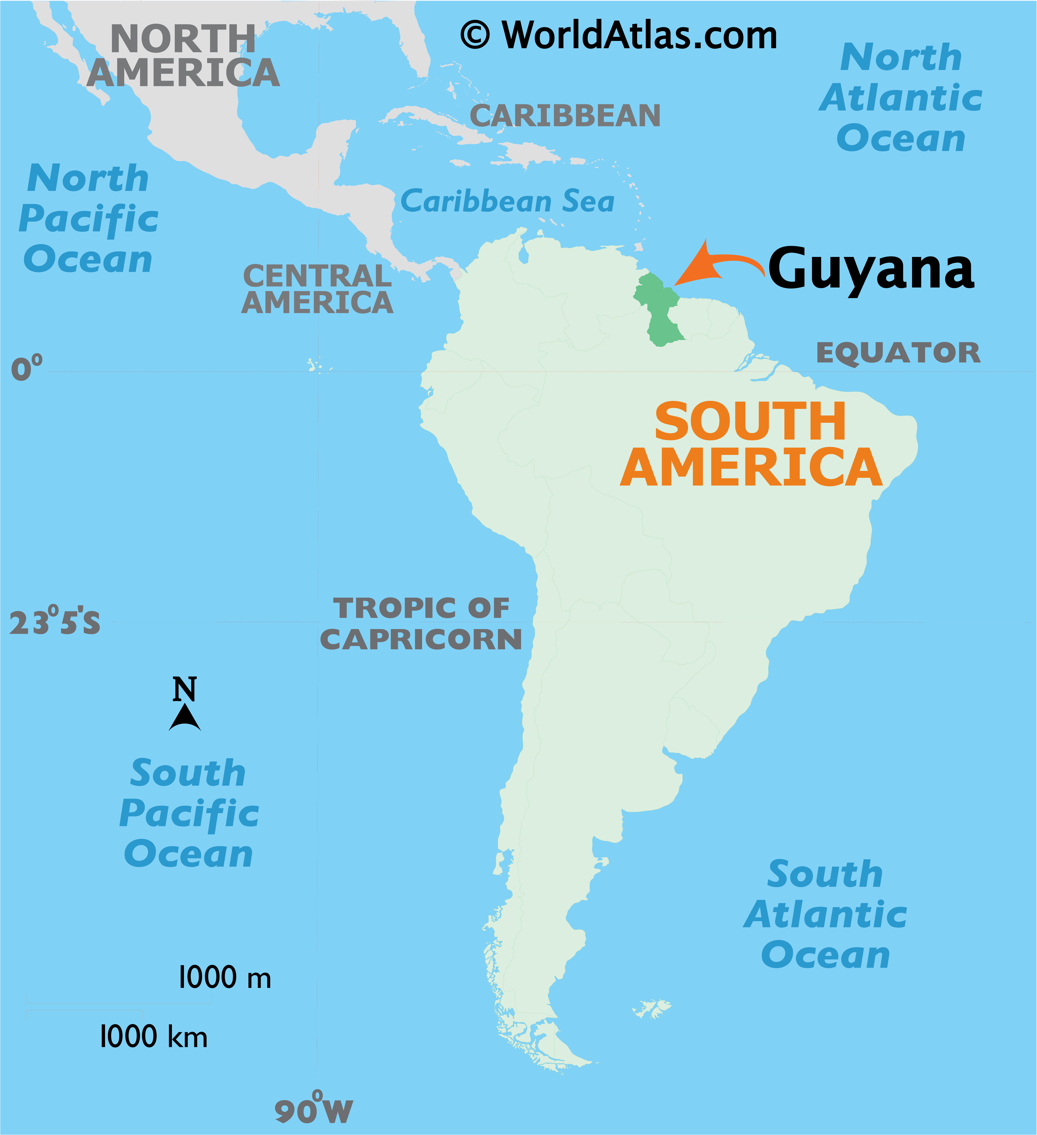
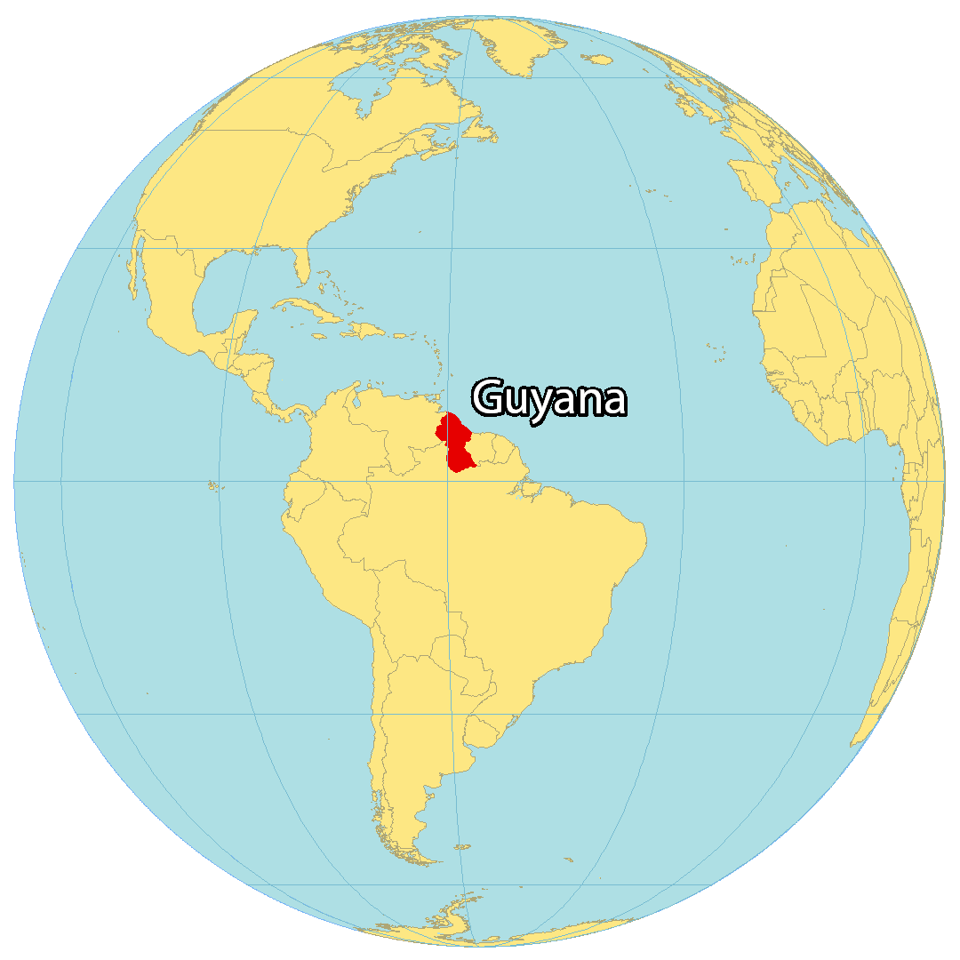
Covering an area of 215,000 sq. km, Guyana, located on the northern edge of South America, is the 3rd smallest nation in South America.
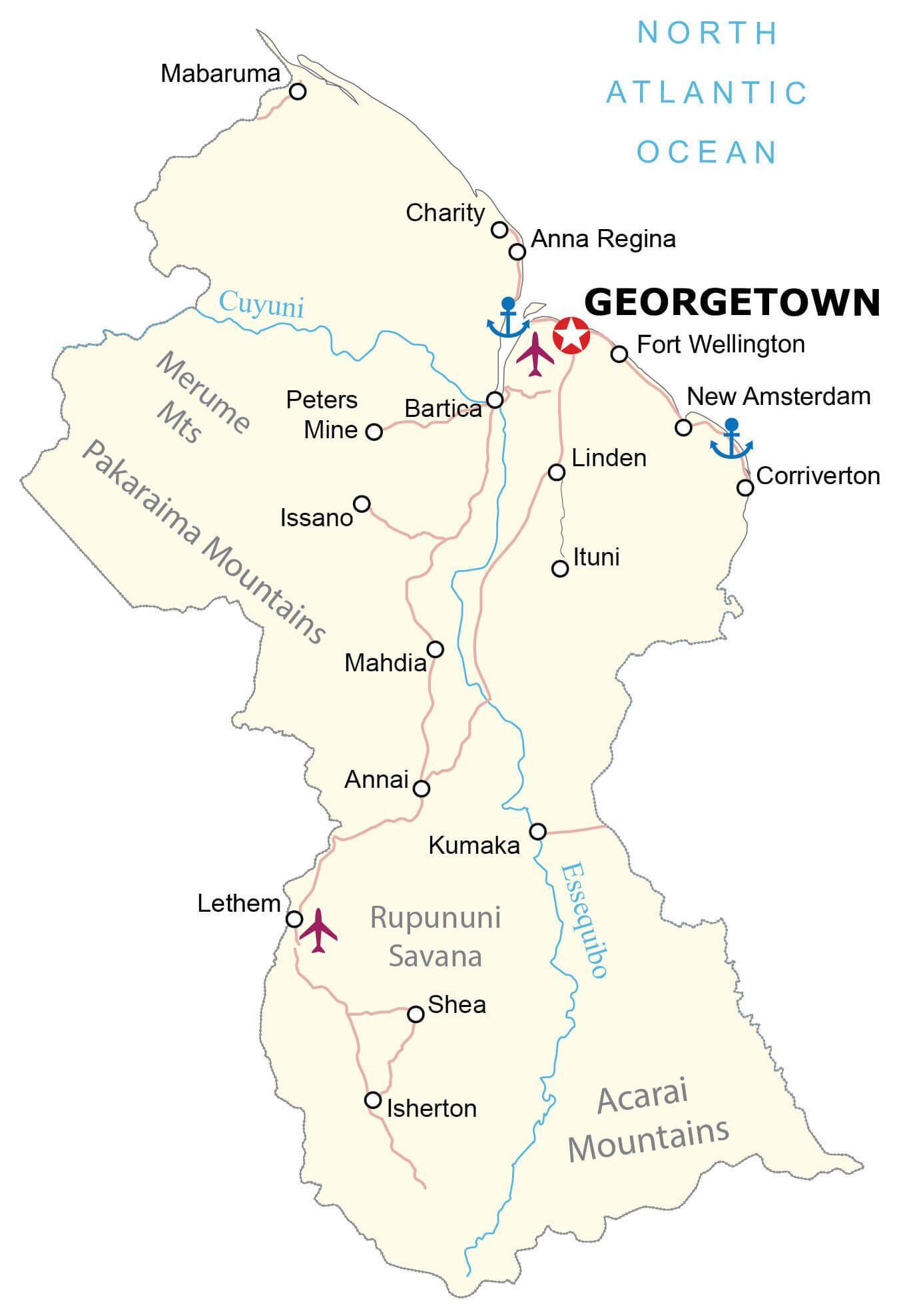
Guyana can be divided into four main geographical regions: there’s a narrow and swampy coastal plain, a hillier sandy region in the east, the (15,000 sq. km) Rupununi Savannah of the south; and the tropical rain forests and interior highlands – central and west.
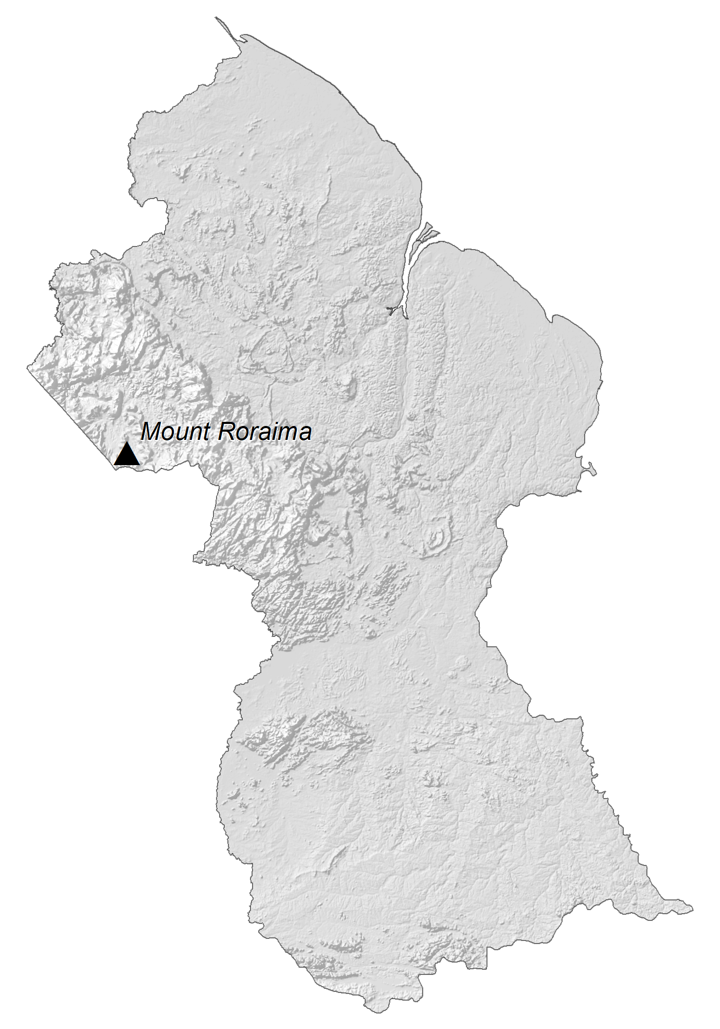
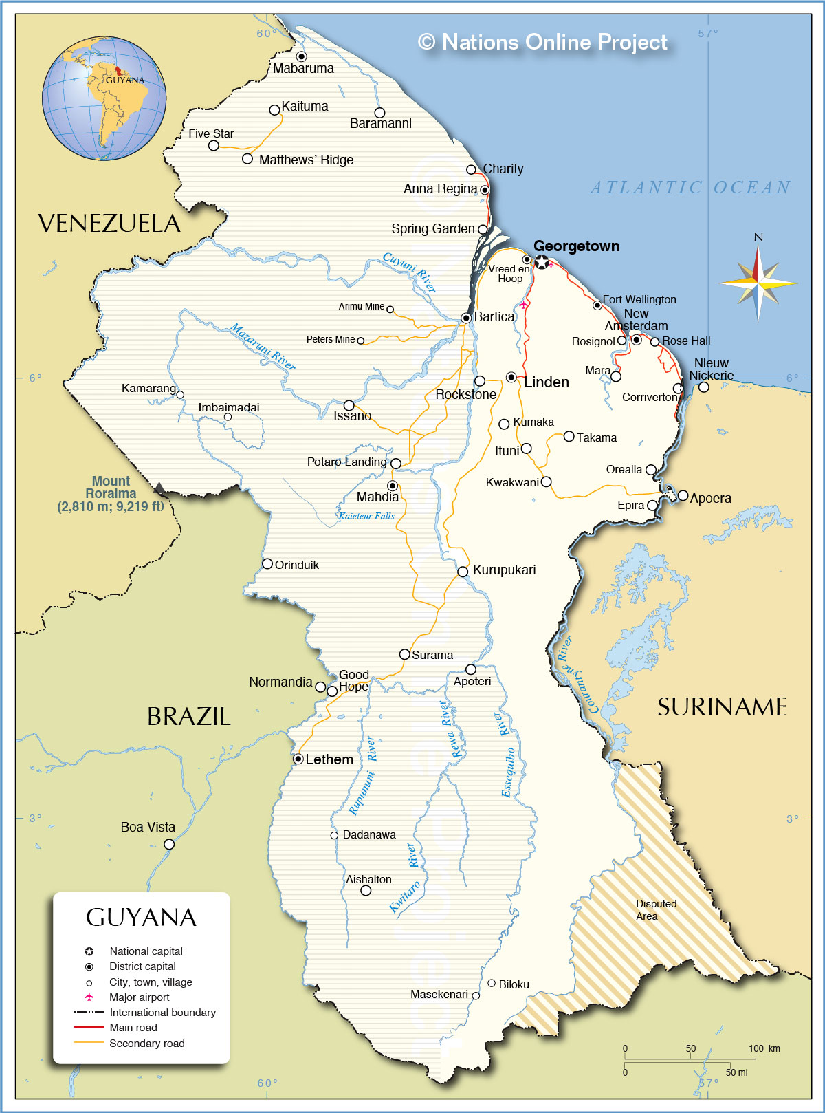
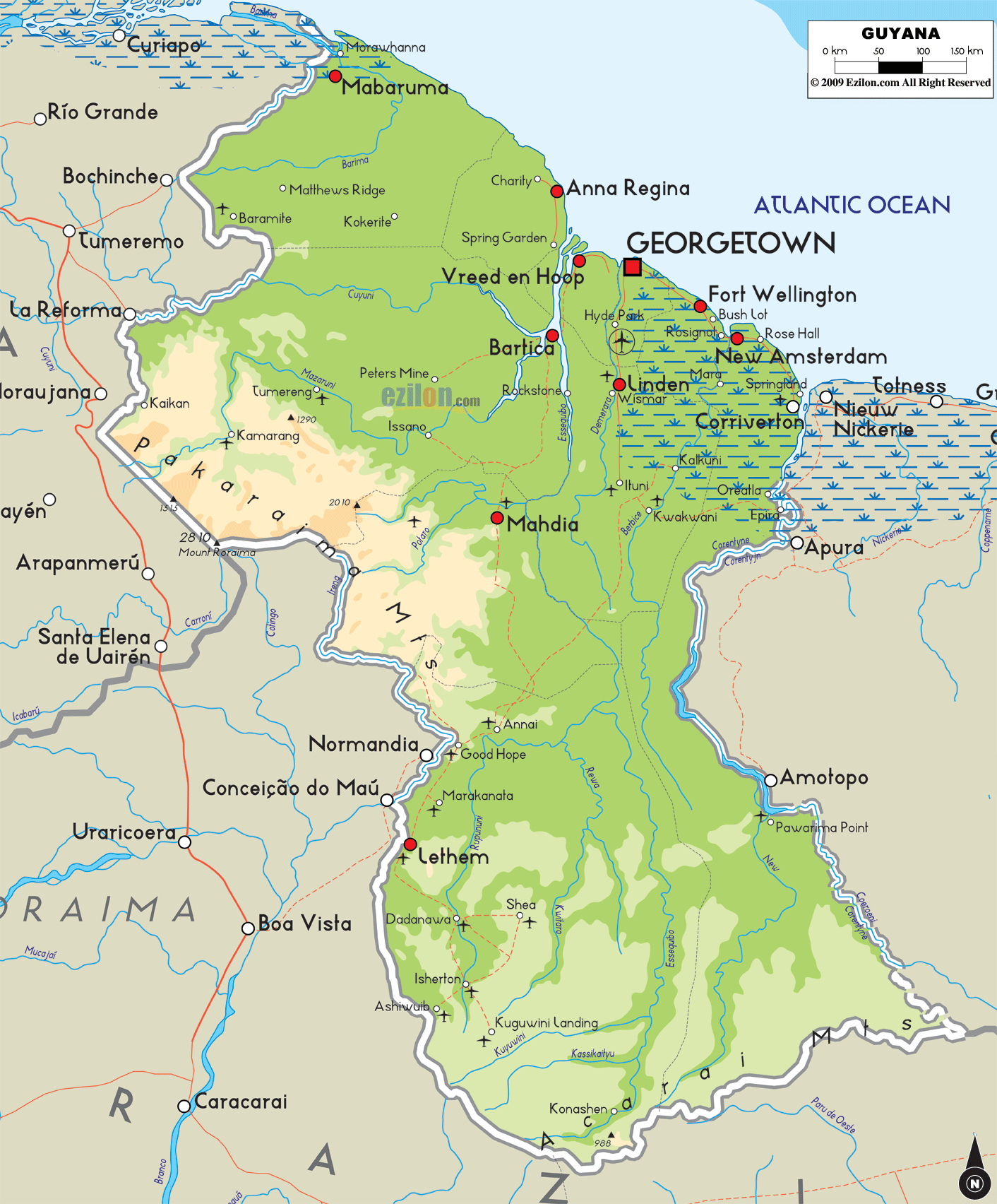
As can be observed on the map above, the mountain ranges of Guyana include the Pakaraima Mountains, Kanuku Mountains, and Acarai Mountains. Many of these relatively low mountains are fronted by steep cliffs and include several waterfalls. The massive spectacular Kaieteur Falls is 251 meters (822 ft) in height and is one of the most powerful waterfalls in the world. It is about five times higher than Niagara Falls, and about two times the height of Victoria Falls. Situated in the Pakaraima Mountains, at the tripoint border of Brazil-Guyana-Venezuela is – Mount Roraima at 2835m, which is the highest point in Guyana (as marked on the map by an upright yellow triangle). The lowest point is the Atlantic Ocean (0m).
Guyana is a country replete with rivers and its four main rivers are the Essequibo, Berbice, Courantyne, and Demerara. Some of these rivers flow in a northerly direction and drain into the Atlantic Ocean, while those in the western parts of the country generally flow east into the Essequibo. The country also possesses some of South America’s largest rainforests, most of which are still unspoiled and inaccessible by humans.
| Flag: |  |
|---|---|
| Legal Name: | Cooperative Republic of Guyana |
| Capital Value: | Georgetown |
| Official languages: | English |
| Demonym(s): | Guyanese |
| Government: | Unitary assembly-independent republic |
| Legislature: | National Assembly |
| Total Area: | 214,969 km² |
| Land Area: | 196,849 km² |
| Water Area: | 18,120 km² |
| Population: | 782,766 |
| Density: | 3.502/km (9.1/sq mi) (232nd) |
| GDP: | $4.28 Billion |
| GDP Per Capita: | $5,468.36 |
| Currency Value: | Guyanese dollars (GYD) |
| Driving side: | left |
| Calling code: | +592 |
| Internet TLD: | .gy |
Discover the beauty of Guyana with this interactive map! From its major cities and highways to its rivers and forests, you can explore the terrain of this South American country from the comfort of your own home. The map also features satellite imagery to show the lush green landscapes that cover most of the country, as well as an elevation map to explore its mountains and savannas. Whether you’re a tourist or a resident, this map can help you better understand the geography of Guyana.
Online Interactive Political Map
Click on ![]() to view map in "full screen" mode.
to view map in "full screen" mode.
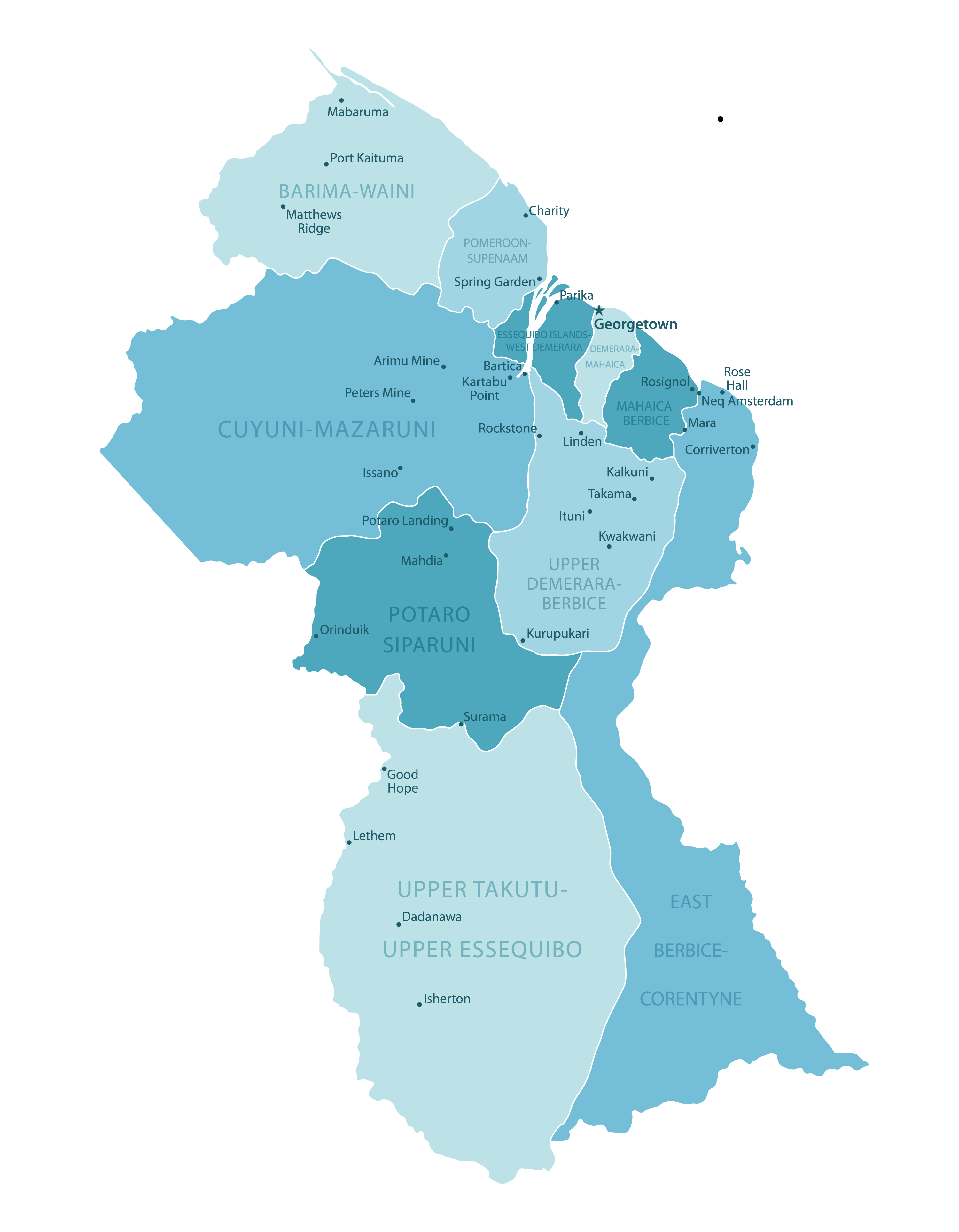
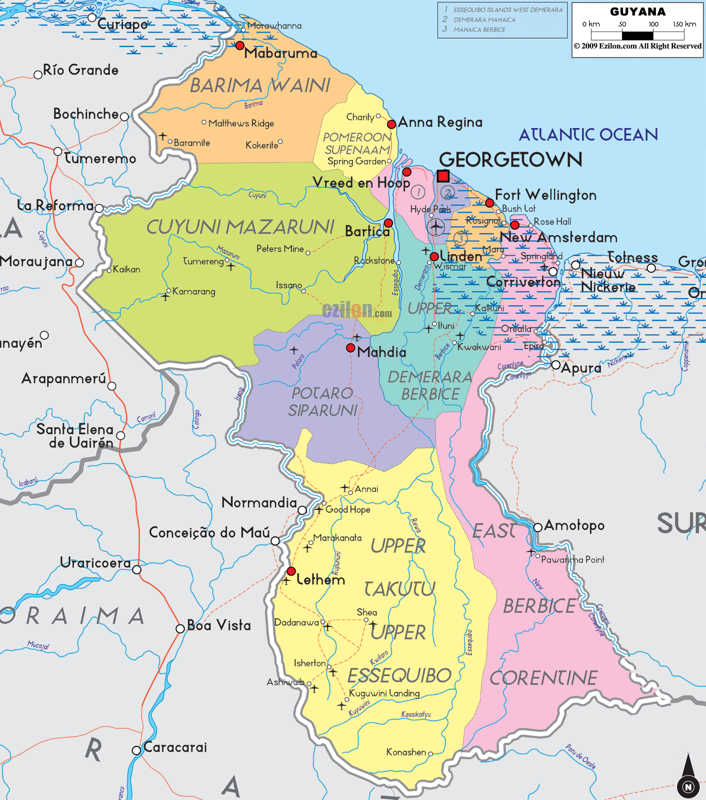
Guyana (Officially, the Co-operative Republic of Guyana) is divided into 10 administrative regions: Barima-Waini, Cuyuni-Mazaruni, Demerara-Mahaica, East Berbice-Corentyne, Essequibo Islands-West Demerara, Mahaica-Berbice, Pomeroon-Supenaam, Potaro-Siparuni, Upper Demerara-Berbice, and Upper Takutu-Upper Essequibo. These regions are further subdivided into a total of 27 neighborhood councils.
Covering an area of 215,000 sq. km, Guyana is South America’s 3rd smallest nation. Located in the Demerara-Mahaica region, at the mouth of the Demerara River on the Atlantic coast is Georgetown – the capital and largest city of Guyana. It is the principal administrative center and also serves as the chief seaport and the main commercial and manufacturing centers of Guyana.
Location Maps
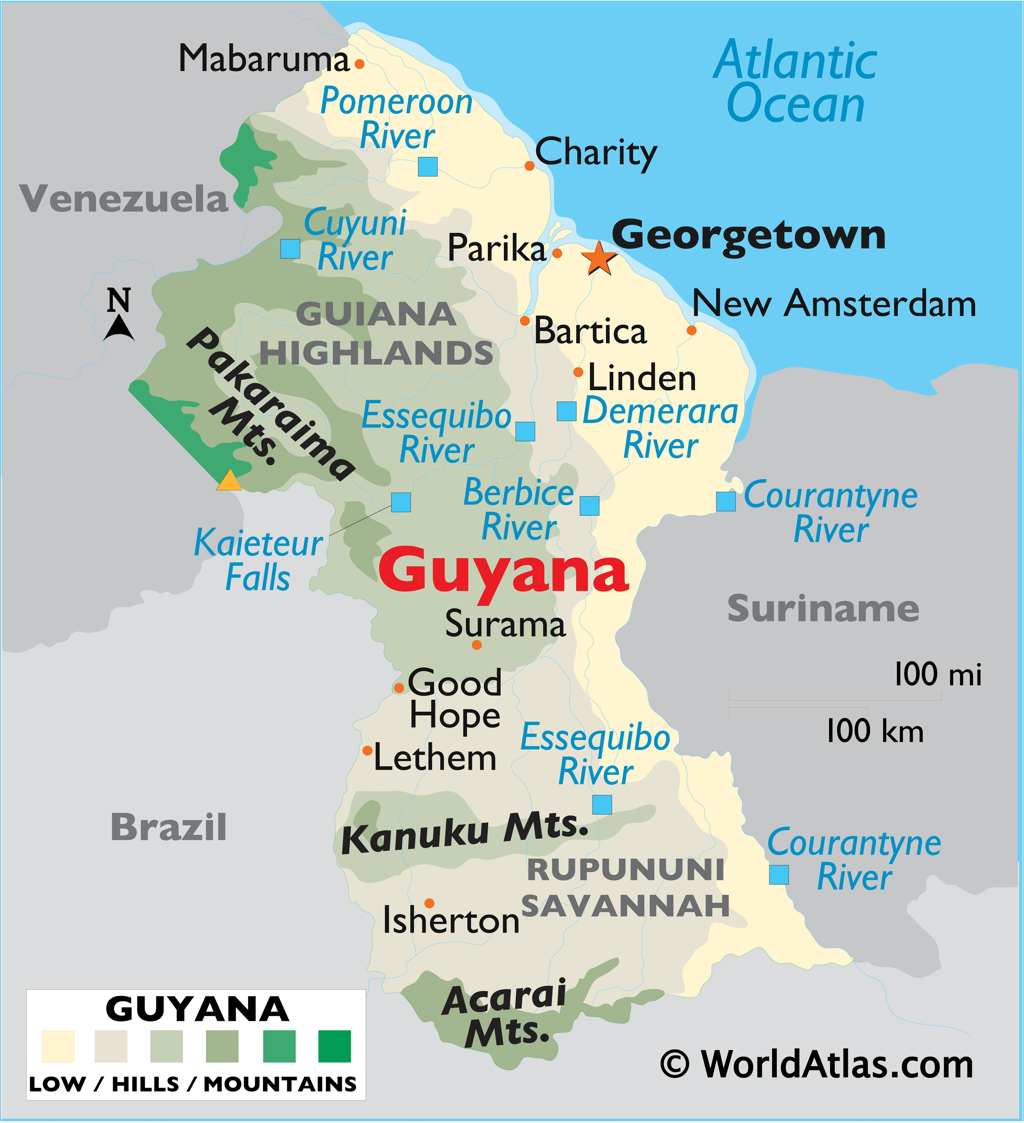
Where is Guyana?
Guyana is situated on the northeast coast of South America and is the only English-speaking country in the region. Its culture has been shaped by its British colonial architecture, as well as its Caribbean neighbors. It is bordered by Venezuela to the west, Suriname to the east and Brazil to the south. Guyana’s population is estimated to be around 750,000, with the majority living in the capital city of Georgetown.
Guyana is also a country of disputed territories. The Courantyne Headwaters is a disputed area between Guyana and Suriname, and Venezuela has asserted a claim over the West of the Essequibo River. Both of these areas remain unresolved, leaving the borders of Guyana in flux.
High Definition Political Map of Guyana
History
Before colonisation
Nine indigenous tribes reside in Guyana: the Wai Wai; Macushi; Patamona; Lokono; Kalina; Wapishana; Pemon; Akawaio; and Warao.
Historically, the Lokono and Kalina tribes dominated Guyana.
Colonial period
Although Christopher Columbus was the first European to sight Guyana during his third voyage (in 1498), and Sir Walter Raleigh wrote an account in 1596, the Dutch were the first Europeans to establish colonies: Pomeroon (1581), Essequibo (1616), Berbice (1627), and Demerara (1752). After the British assumed control in 1796, the Dutch formally ceded the area in 1814.
In 1831, the united colonies of Demerara-Essequibo and separate colony of Berbice together became a single British colony known as British Guiana.
Since its independence in 1824, Venezuela has claimed the area of land to the west of the Essequibo River. Simón Bolívar wrote to the British government warning against the Berbice and Demerara settlers settling on land which the Venezuelans, as assumed heirs of Spanish claims on the area dating to the 16th century, claimed was theirs. In 1899, an international tribunal ruled that the land belonged to Great Britain. The British territorial claim stemmed from Dutch involvement and colonisation of the area also dating to the 16th century, which was ceded to the British.
Independence
Guyana achieved independence from the United Kingdom as a dominion on 26 May 1966 and became a republic on 23 February 1970, remaining a member of the Commonwealth. Shortly after independence, Venezuela began to take diplomatic, economic and military action against Guyana in order to enforce its territorial claim to the Guayana Esequiba. The US State Department and the US Central Intelligence Agency (CIA), along with the British government, also played a strong role in influencing political control in Guyana during this time. The American government supported Forbes Burnham during the early years of independence because Cheddi Jagan was identified as a Marxist. They provided secret financial support and political campaign advice to Burnham’s People’s National Congress, to the detriment of the Jagan-led People’s Progressive Party, which was mostly supported by Guyanese of Indian background.
Guyana was elected twice as member of the UN Security Council in 1975–76 and later 1982–83.
In 1978, a total of 918 people died at the Jonestown mass murder-suicide led by cult leader Jim Jones.
In May 2008, President Bharrat Jagdeo was a signatory to the UNASUR Constitutive Treaty of the Union of South American Nations. The Guyanese government officially ratified the treaty in 2010.
In March 2020, President David A. Granger narrowly lost the snap elections, following Granger’s government loss of a vote of no confidence back in 2018. Granger refused to accept the results, but eventually five months later, Irfaan Ali of the People’s Progressive Party/Civic was sworn in as the new president because of allegations of fraud and irregularities.
Physical Map of Guyana
Geography
The territory controlled by Guyana lies between latitudes 1° and 9°N, and longitudes 56° and 62°W; it is one of the world’s most sparsely populated countries.
The country can be divided into five natural regions: a narrow and fertile marshy plain along the Atlantic coast (low coastal plain) where most of the population lives; a white sand belt further inland (hilly sand and clay region), containing most of Guyana’s mineral deposits; the dense rain forests (Forested Highland Region) in the southern part of the country; the drier savannah areas in the south-west; and the smallest interior lowlands (interior savannah) consisting mostly of mountains that gradually rise to the Brazilian border.
Some of Guyana’s highest mountains are Mount Ayanganna (2,042 m or 6,699 ft), Monte Caburaí (1,465 m or 4,806 ft) and Mount Roraima (2,772 m or 9,094 ft – the highest mountain in Guyana) on the Brazil-Guyana-Venezuela tripoint border, part of the Pakaraima range. Mount Roraima and Guyana’s table-top mountains (tepuis) are said to have been the inspiration for Sir Arthur Conan Doyle’s 1912 novel The Lost World. There are also many volcanic escarpments and waterfalls, including Kaieteur Falls which is believed to be the largest single-drop waterfall in the world by volume. North of the Rupununi River lies the Rupununi savannah, south of which lie the Kanuku Mountains.
The four longest rivers are the Essequibo at 1,010 km (628 mi) long, the Courentyne River at 724 km (450 mi), the Berbice at 595 km (370 mi), and the Demerara at 346 km (215 mi). The Courentyne river forms the border with Suriname. At the mouth of the Essequibo are several large islands, including the 145 km (90 mi) wide Shell Beach along the northwest coast, which is also a major breeding area for sea turtles (mainly leatherbacks) and other wildlife.
The climate is tropical and generally hot and humid, though moderated by northeast trade winds along the coast. There are two rainy seasons, the first from May to mid-August, the second from mid-November to mid-January.
Guyana has one of the largest unspoiled rainforests in South America, some parts of which are almost inaccessible by humans. The rich natural history of Guyana was described by early explorers Sir Walter Raleigh and Charles Waterton and later by naturalists Sir David Attenborough and Gerald Durrell. In 2008, the BBC broadcast a three-part programme called Lost Land of the Jaguar which highlighted the huge diversity of wildlife, including undiscovered species and rare species such as the giant otter and harpy eagle.
In 2012, Guyana received a $45 million reward from Norway for its rainforest protection efforts. This stems from a 2009 agreement between the nations for a total of $250 million for protecting and maintaining the natural habitat. Thus far, the country has received $115 million of the total grant.
Biodiversity and conservation
Guyana is home to more than 900 species of birds; 225 species of mammals; 880 species of reptiles and more than 6,500 different species of plants. Among these wildlife categories the most notably famous are the Arapaima, which is the world’s largest scaled freshwater fish; the giant anteater, the largest anteater; the giant otter, the world’s largest and rarest river otter; and the cock-of-the-rock (Rupicola rupicola).
The following habitats have been categorised for Guyana: coastal, marine, littoral, estuarine palustrine, mangrove, riverine, lacustrine, swamp, savanna, white sand forest, brown sand forest, montane, cloud forest, moist lowland and dry evergreen scrub forests (NBAP, 1999). About 14 areas of biological interest have been identified as possible hotspots for a National Protected Area System. More than 80% of Guyana is still covered by forests, which also contain the world’s rarest orchids, ranging from dry evergreen and seasonal forests to montane and lowland evergreen rain forests. These forests are home to more than a thousand species of trees. Guyana’s tropical climate, unique geology, and relatively undisturbed ecosystems support extensive areas of species-rich rain forests and natural habitats with high levels of endemism. There are about 8000 species of plants in Guyana, half of which are found nowhere else.
Guyana has one of the highest levels of biodiversity in the world. With 1,168 vertebrate species and 814 bird species, it boasts one of the richest mammalian fauna assemblages of any comparably sized area in the world. Guyana is home to six ecoregions: Guayanan Highlands moist forests, Guianan moist forests, Orinoco Delta swamp forests, Tepuis, Guianan savanna, and Guianan mangroves. The Guiana Shield region is little known and extremely rich biologically. Unlike other areas of South America, over 70% of the natural habitat remains pristine. Guyana ranks third in the world with a 2019 Forest Landscape Integrity Index mean score of 9.58/10.
The rich natural history of British Guiana was described by early explorers Sir Walter Raleigh and Charles Waterton and later by naturalists Sir David Attenborough and Gerald Durrell.
Southern Guyana is host to some of the most pristine expanses of evergreen forests in the northern part of South America. Most of the forests found are tall, evergreen hill-land and lower montane forests, with large expanses of flooded forest along major rivers. Thanks to the very low human population density of the area, most of these forests are still intact. The Smithsonian Institution has identified nearly 2,700 species of plants from this region, representing 239 distinct families, and there are certainly additional species still to be recorded. The diversity of plants supports diverse animal life, recently documented by a biological survey organised by Conservation International. The reportedly clean, unpolluted waters of the Essequibo watershed support a remarkable diversity of fish and aquatic invertebrates, and are home to giant otters, capybaras, and several species of caimans.
On land, large mammals, such as jaguars, tapirs, bush dogs, giant anteaters, and saki monkeys are still common. Over 800 species of birds have been reported from the region, and the reptile and amphibian faunas are similarly rich.
In February 2004, the Government of Guyana issued a title to more than 4,000 km (1×10 acres) of land in the Konashen Indigenous District as the Kanashen Community-Owned Conservation Area, managed by the Wai Wai, and the world’s largest community-owned conservation Area. The Iwokrama International Centre for Rain Forest Conservation and Development was also created for the protection and sustainable use of the Iwokrama forest area. Since 2009, Guyana and Norway have collaborated to promote green development in Guyana while keeping deforestation at low levels
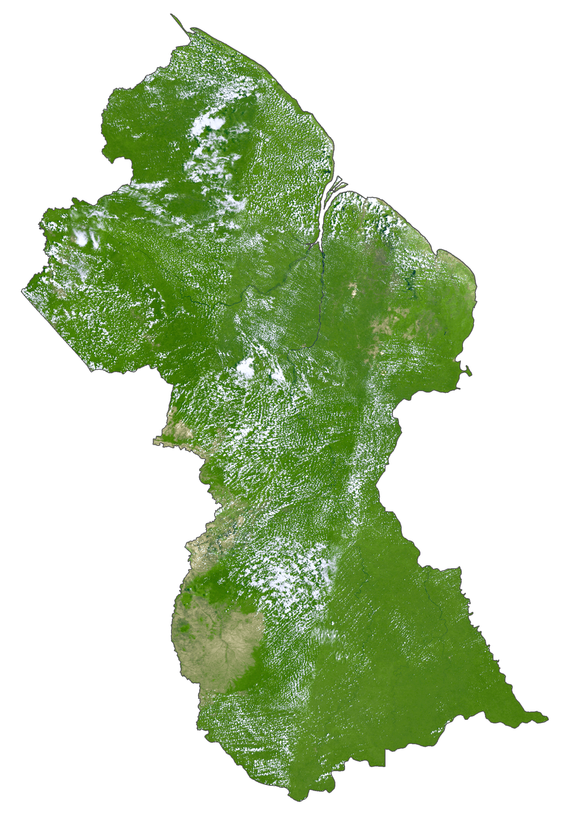
Guyana Satellite Map
Elevation Map