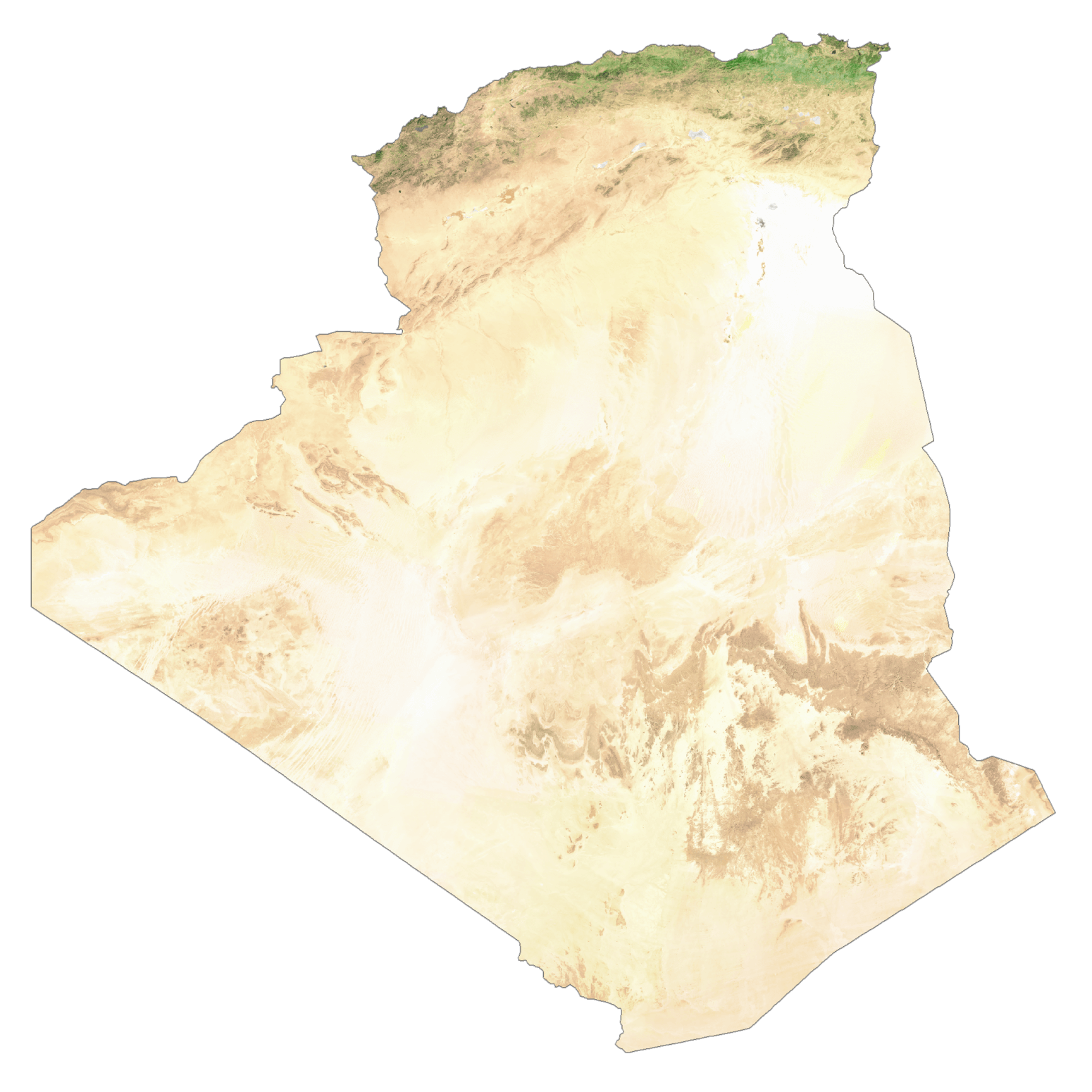
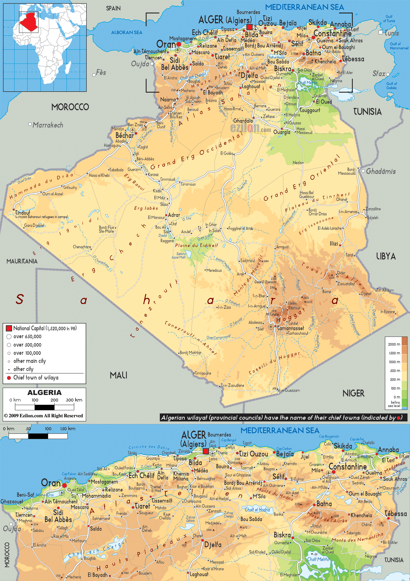
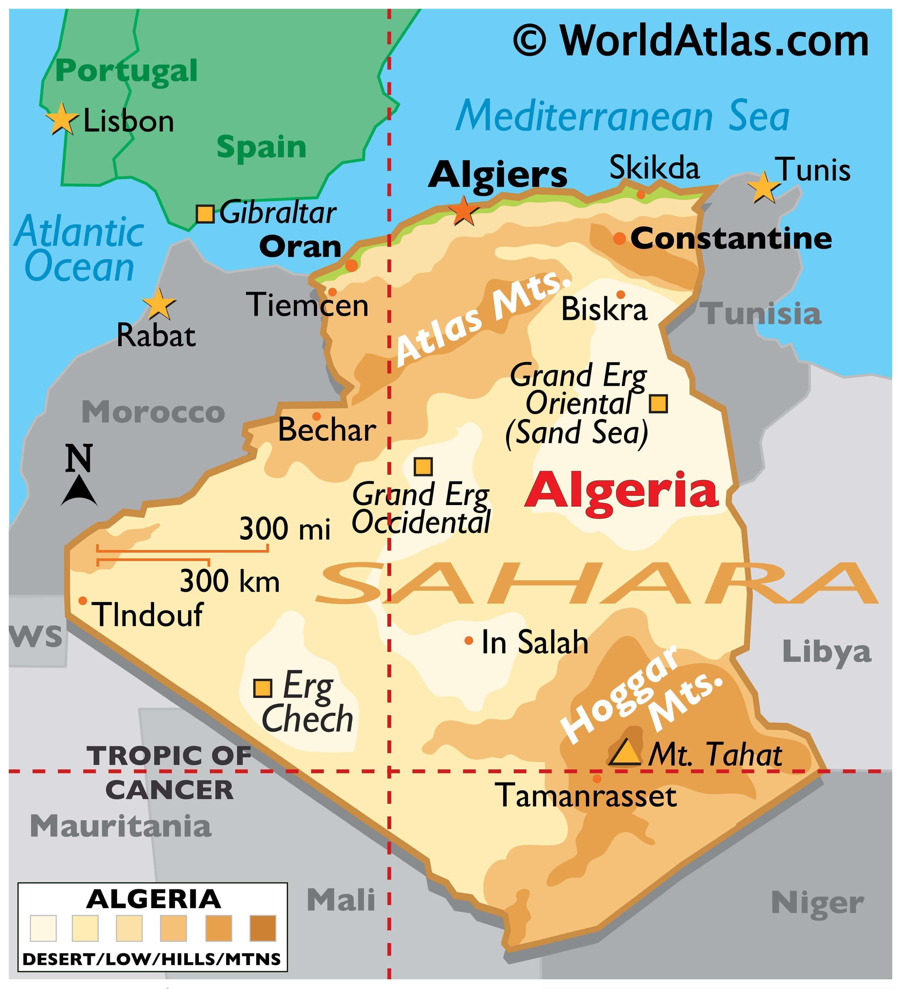
The map illustrates Algeria’s landscape which consists mostly of high plateaus and the Sahara Desert.
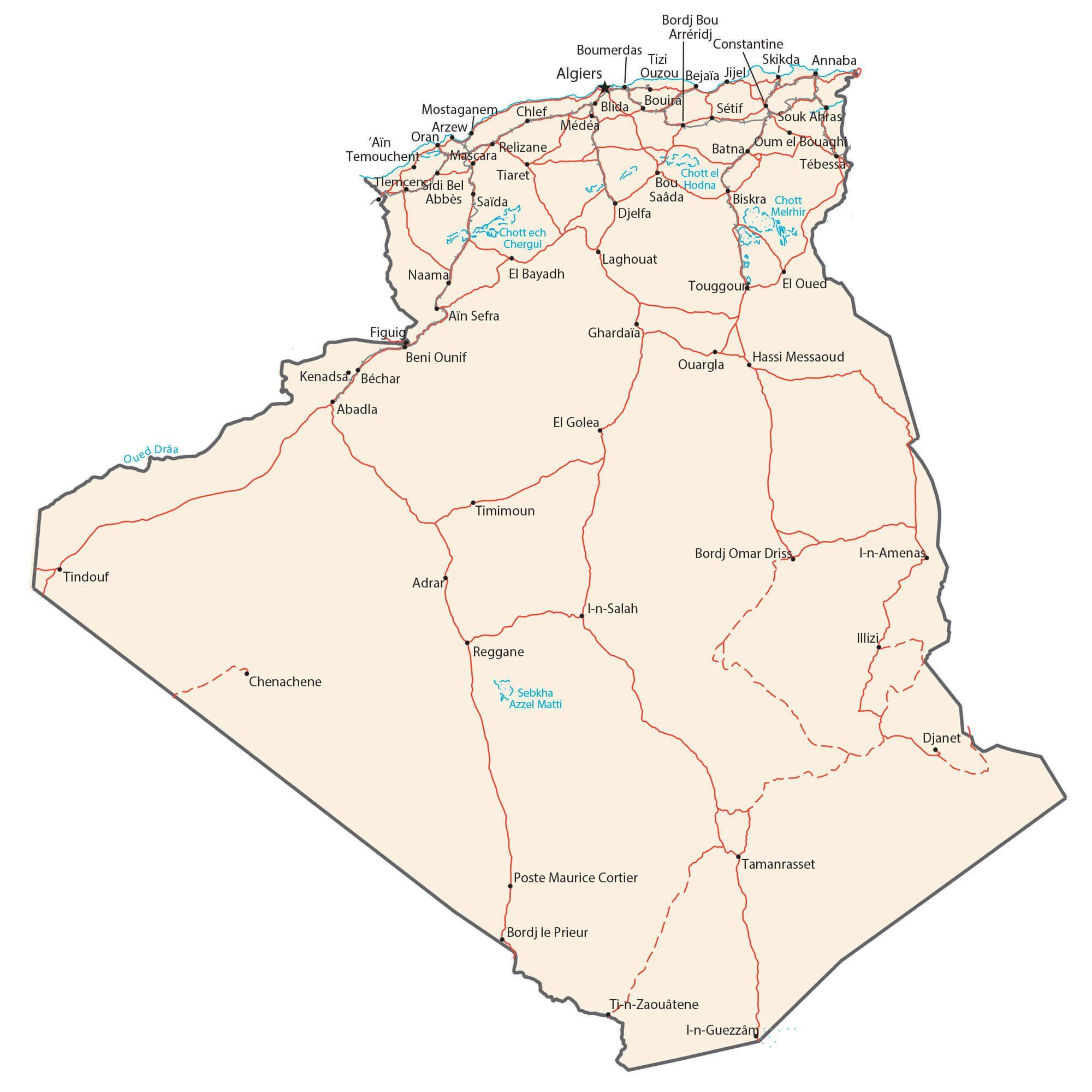
The Atlas mountains sit to the north, and the Ahaggar Massif is southeast. The high plateaus stretch for more than 372 miles (600 km) and consist of undulating, steppe-like plains averaging 3,608 – 4,265 ft (1,100 – 1,300 m) and dropping to 1,312 ft (400 m) as you move east. The highest point of the country is Mt. Tahat at 9,850 ft. (3,003 m); the lowest point is Lake Chott Melrhir at -131 ft. (-40 m). Lake Chott Melrhir is an endorheic (closed basin) salt lake whose size varies throughout the year, yet is the largest lake in Algeria with its maximum area about 2,600 sq. miles (6,700 sq km). To the north is a hilly and narrow coastal plain along the Mediterranean Sea with a few small rivers.
| Flag: |  |
|---|---|
| Legal Name: | People’s Democratic Republic of Algeria |
| Capital Value: | Algiers |
| Official languages: |
|
| Demonym(s): | Algerian |
| Government: | Unitary semi-presidential republic |
| Legislature: | Parliament |
| Total Area: | 2,381,740 km² |
| Land Area: | 2,381,740 km² |
| Population: | 43,053,054 |
| Density: | 17.7/km (45.8/sq mi) (168th) |
| GDP: | $169.99 Billion |
| GDP Per Capita: | $3,948.34 |
| Currency Value: | Algerian dinars (DZD) |
| Driving side: | right |
| Calling code: | +213 |
| Internet TLD: | .dz الجزائر. |
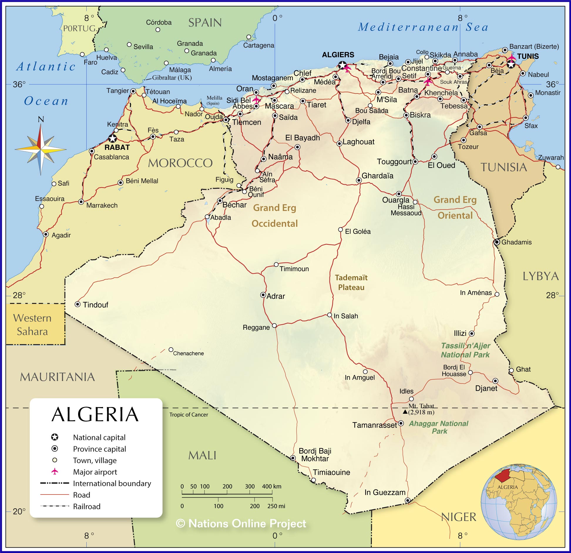
Explore the mysterious and captivating landscape of Algeria with this interactive map. From the vast Sahara Desert to the Ahaggar Mountains, discover the largest country in Africa. This map of Algeria displays the major cities, towns, roads, and rivers. View the topography of Algeria with a satellite and physical map.
Online Interactive Political Map
Click on ![]() to view map in "full screen" mode.
to view map in "full screen" mode.
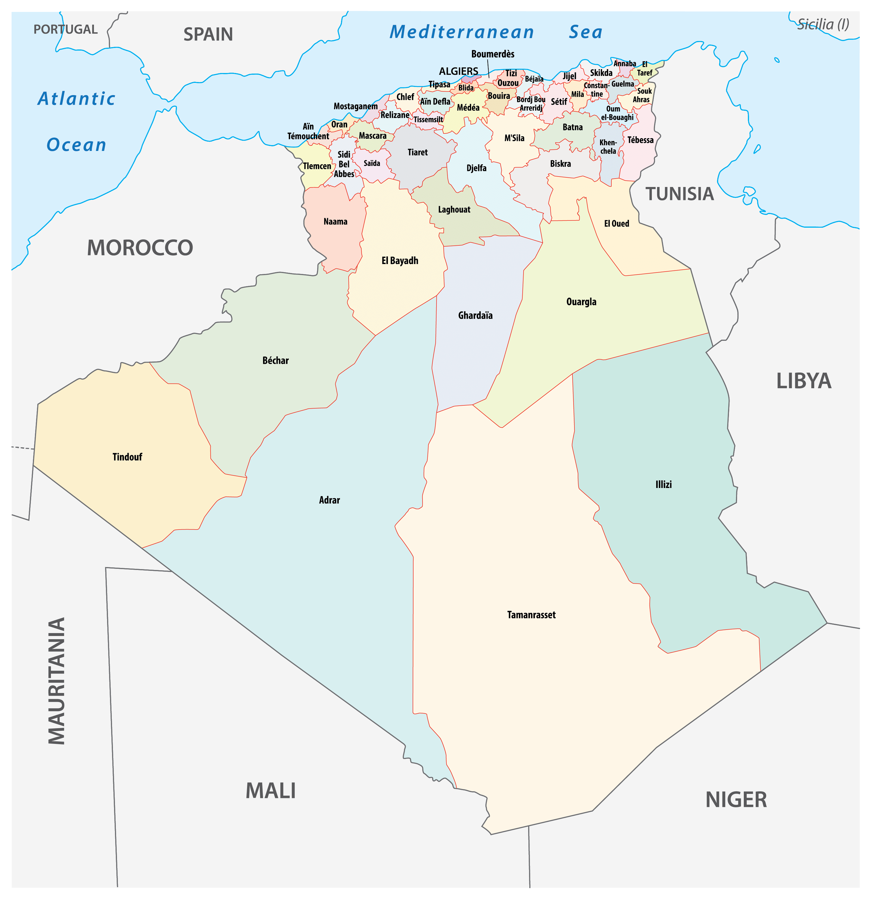
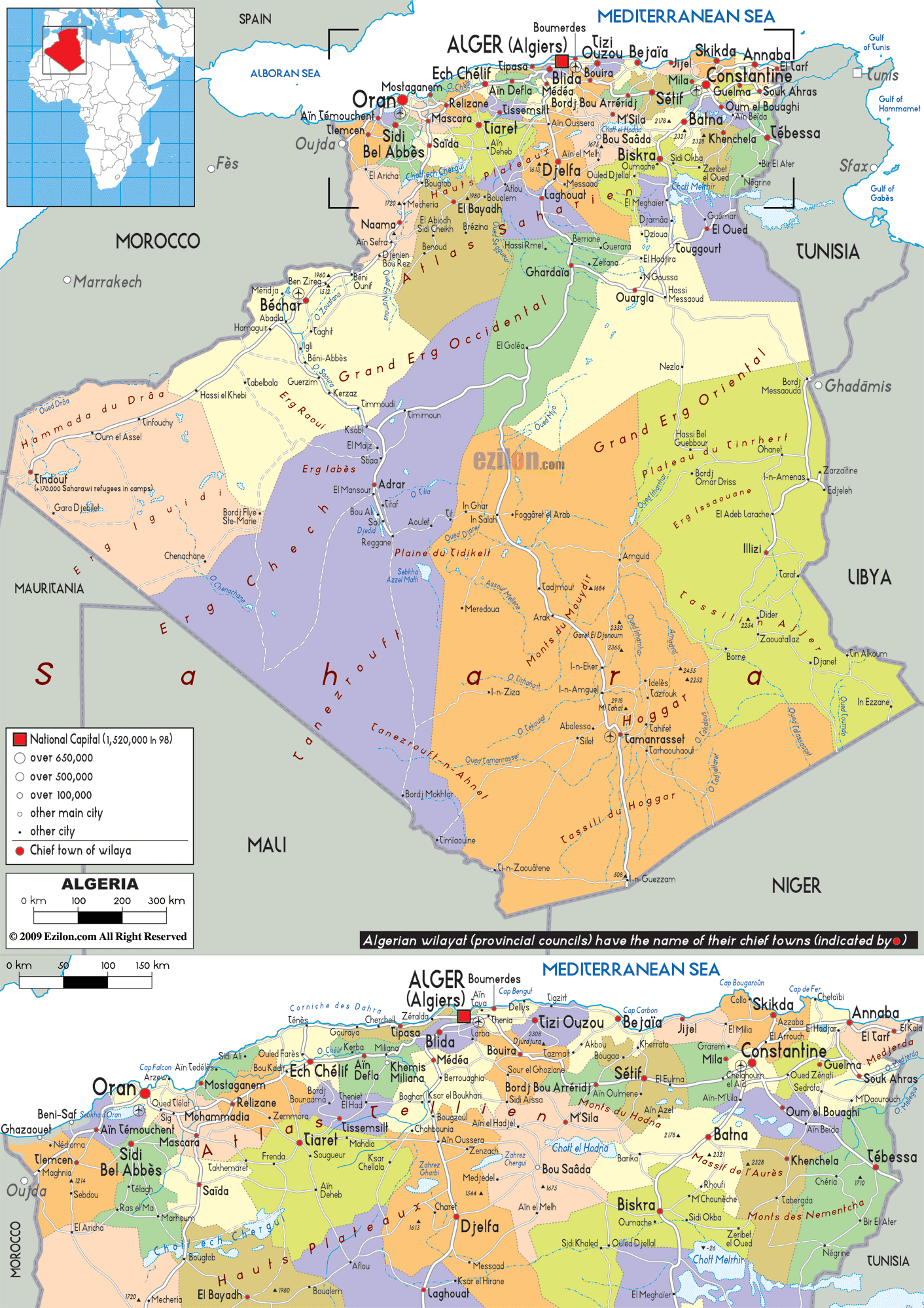
Algeria has 58 wilayas (provinces) :
Prior to December, 2019: Adrar, Aïn Defla, Ain Temouchent, Algiers, Annaba, Batna, Bechar, Bejaia, Biskra, Blida, Bordj Bou Arreridj, Bouira, Boumerdes, Chlef, Constantine, Djelfa, El Bayadh, El Oued, El Tarf, Ghardaia, Guelma, Illizi, Jijel, Khenchela, Laghouat, Mascara, Medea, Mila, Mostaganem, M’Sila, Naama, Oran, Ouargla, Oum el Bouaghi, Relizane, Saida, Setif, Sidi Bel Abbes, Skikda, Souk Ahras, Tamanghasset, Tebessa, Tiaret, Tindouf, Tipaza, Tissemsilt, Tizi Ouzou, Tlemcen.
Ten new provinces were added as of December 2019 : Timimoune, Bordj Badji Mokhtar, Ouled Djellal, Beni Abbes, In Salah, In Guezzam, Touggourt, Djanet, El-Meghaier and El-Menia.
With an area of 336,839 sq. km, Tamanghasset is the largest province. Algiers is the most populous one and hosts the national capital of Algiers.
Location Maps
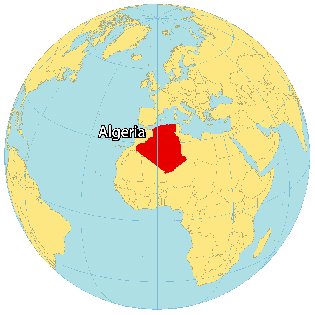
Where is Algeria?
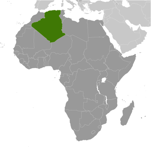
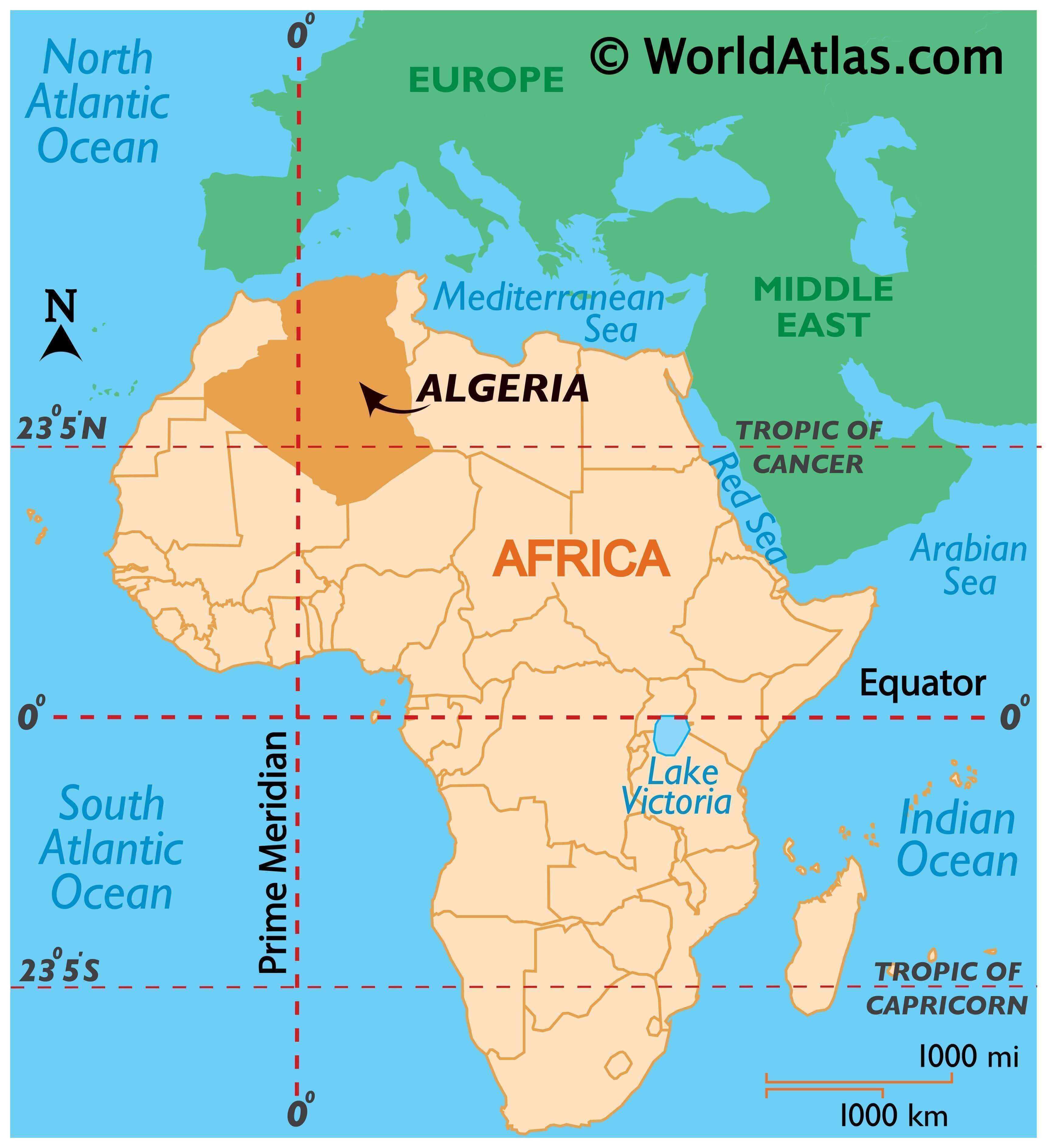
Algeria is the largest country in Africa by landmass. It is located in the northern part of the continent, along the Mediterranean Sea. Algeria borders Morocco to the northwest and Tunisia to the northeast, Libya and Niger to the east, and Mali, Mauritania and the Western Sahara region to the southwest. The country is mostly covered by the Sahara Desert, with Algiers being the capital and largest city in the north.
High Definition Political Map of Algeria
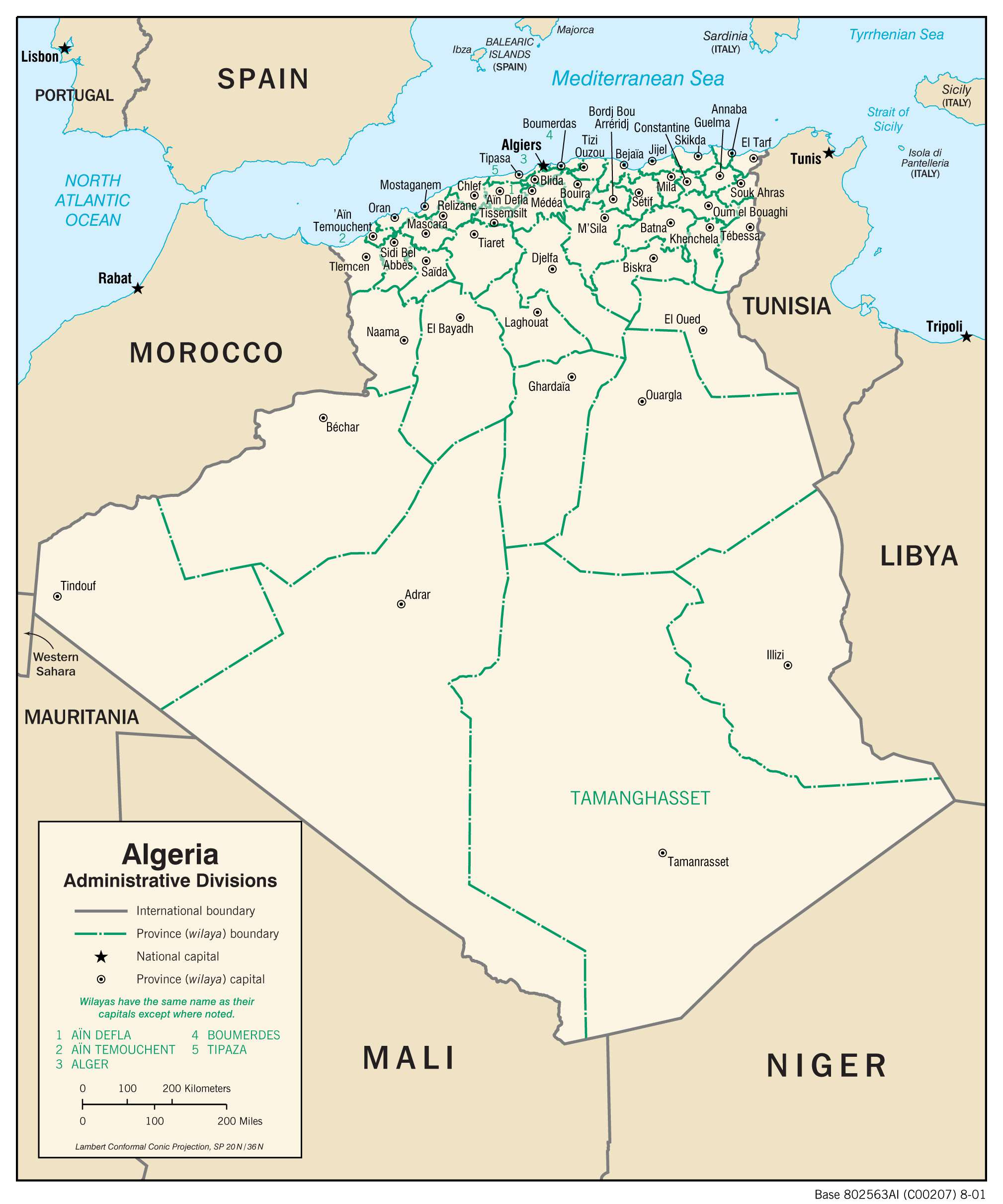
Algeria Administrative Map
Physical Map of Algeria
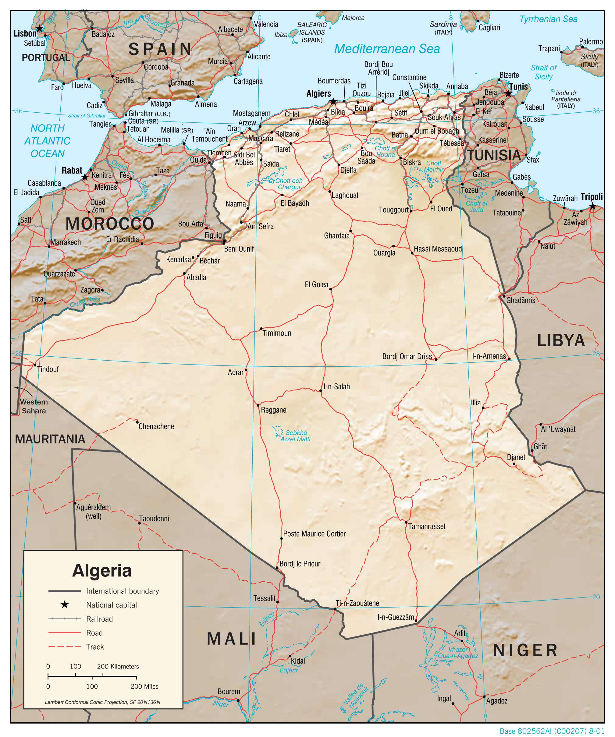
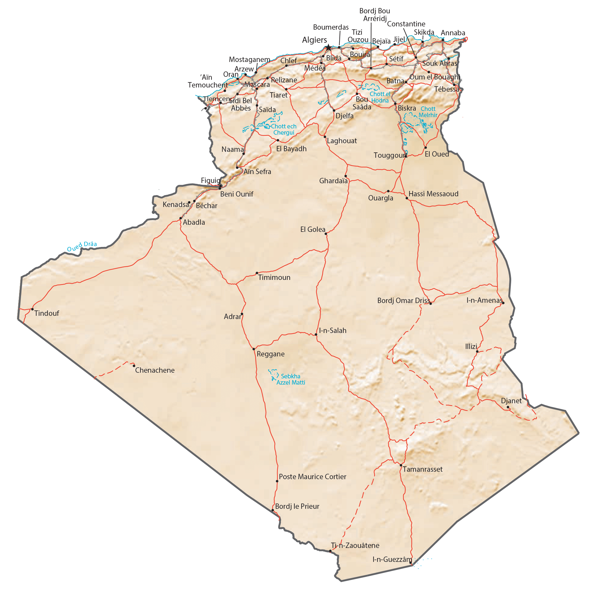
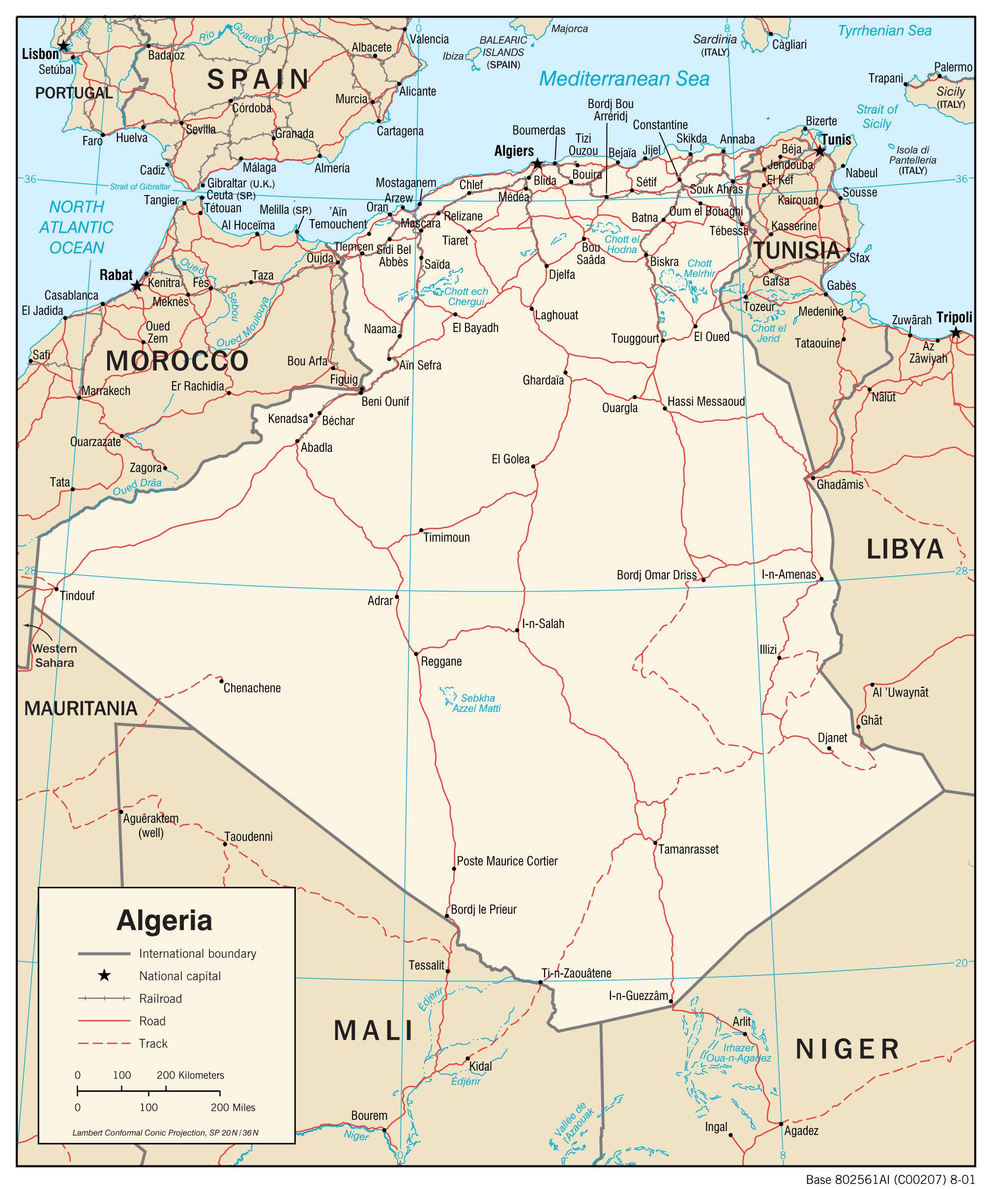
Transportation Map of Algeria
Algeria Satellite Map