Laos occupies an area of 237,955 sq. km in the Indochinese Peninsula in Southeast Asia.
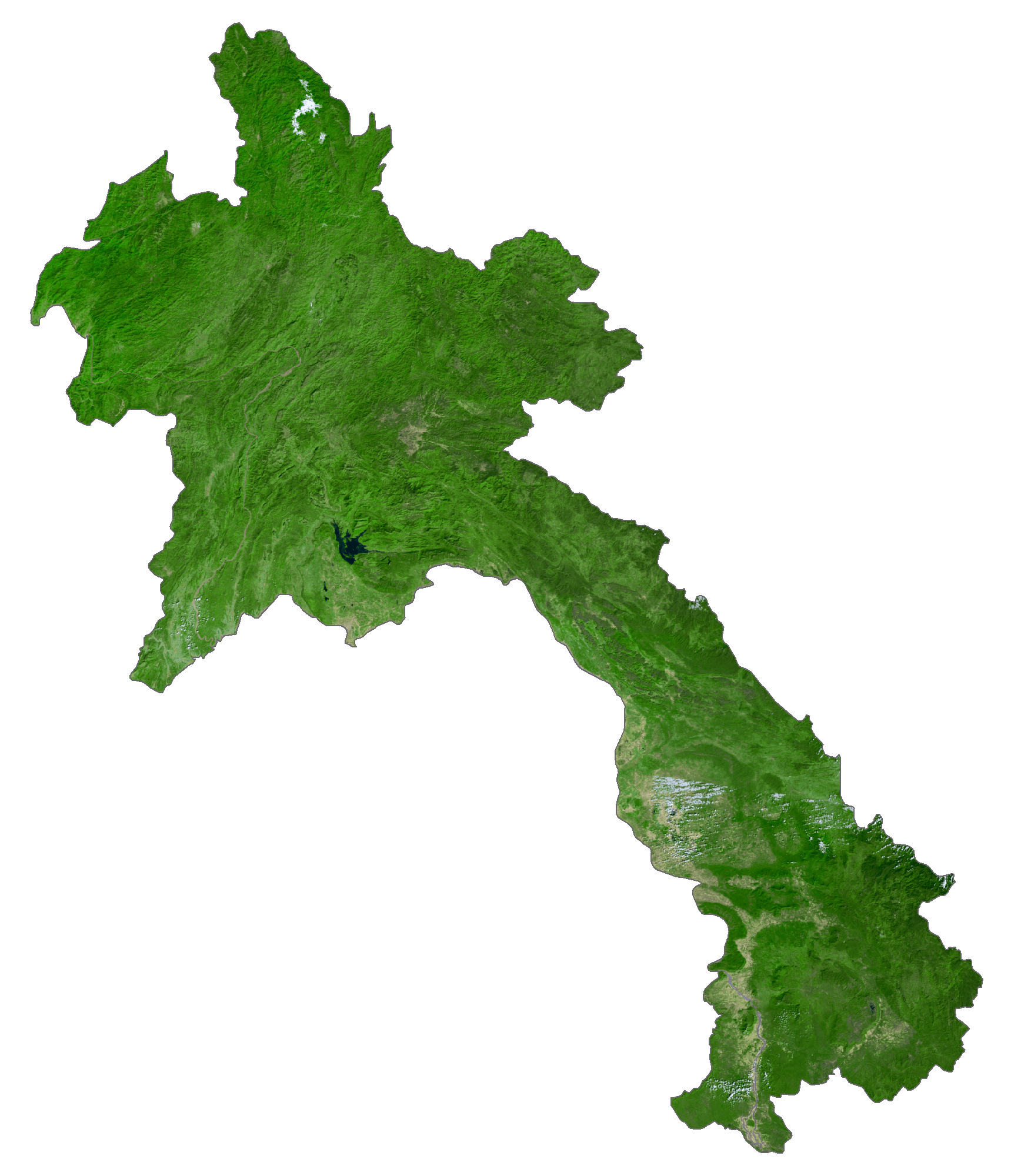
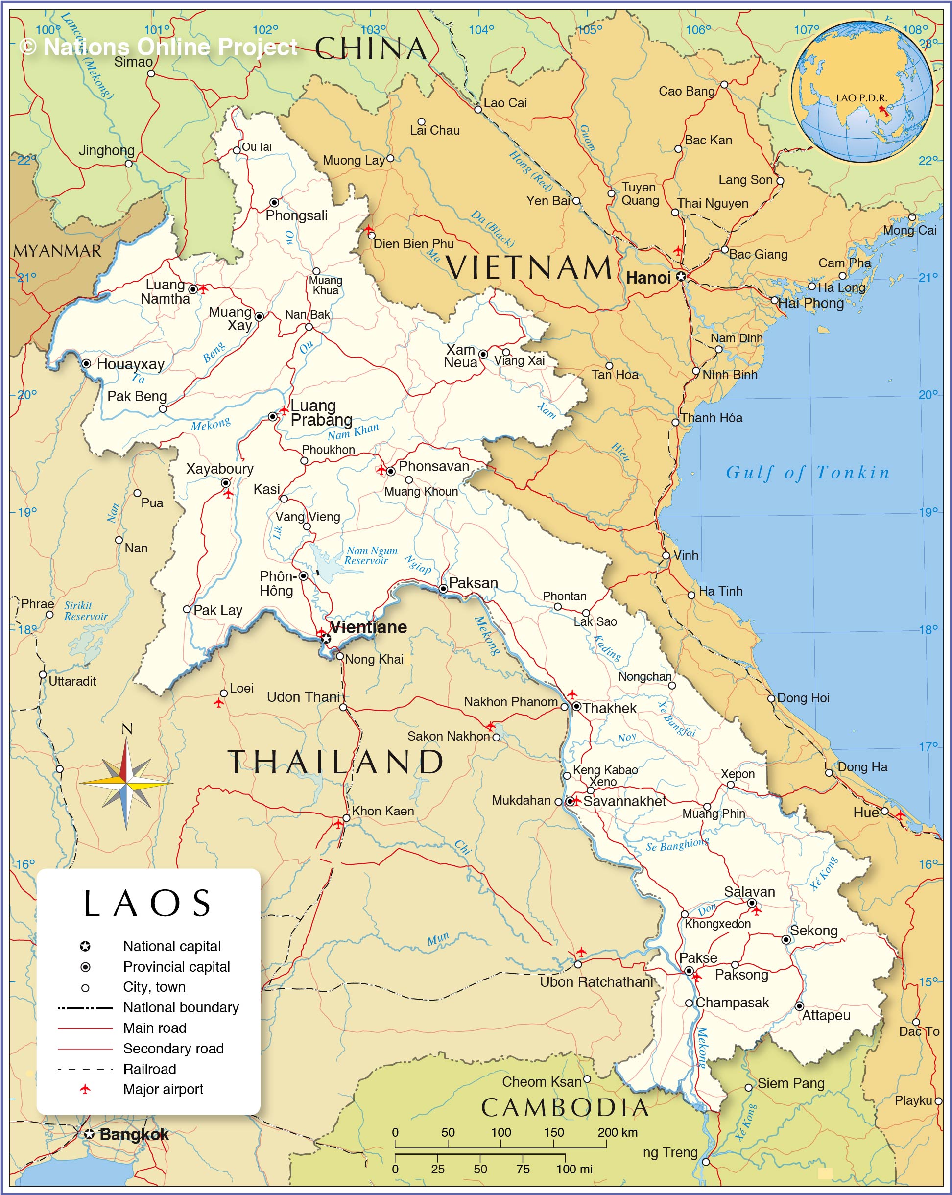
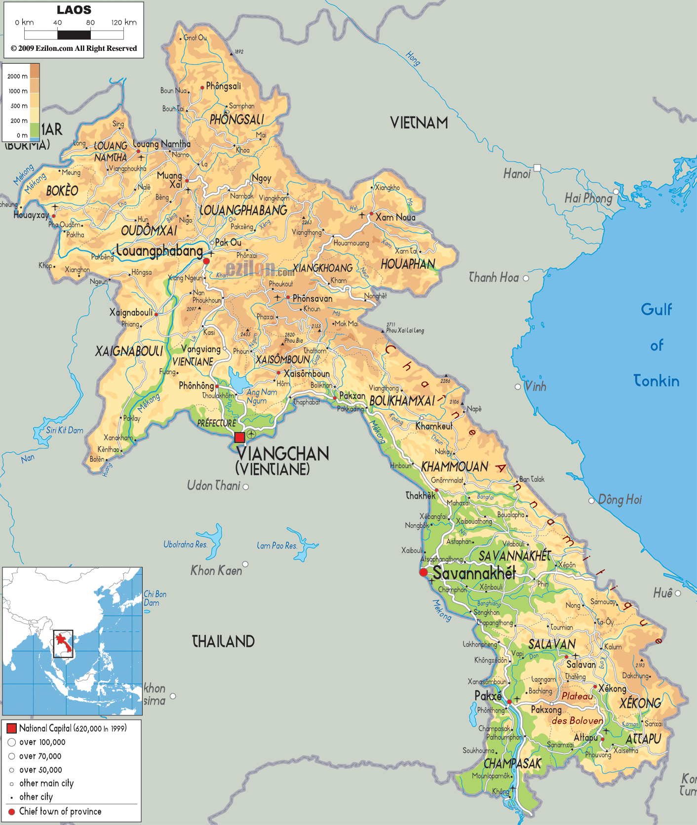
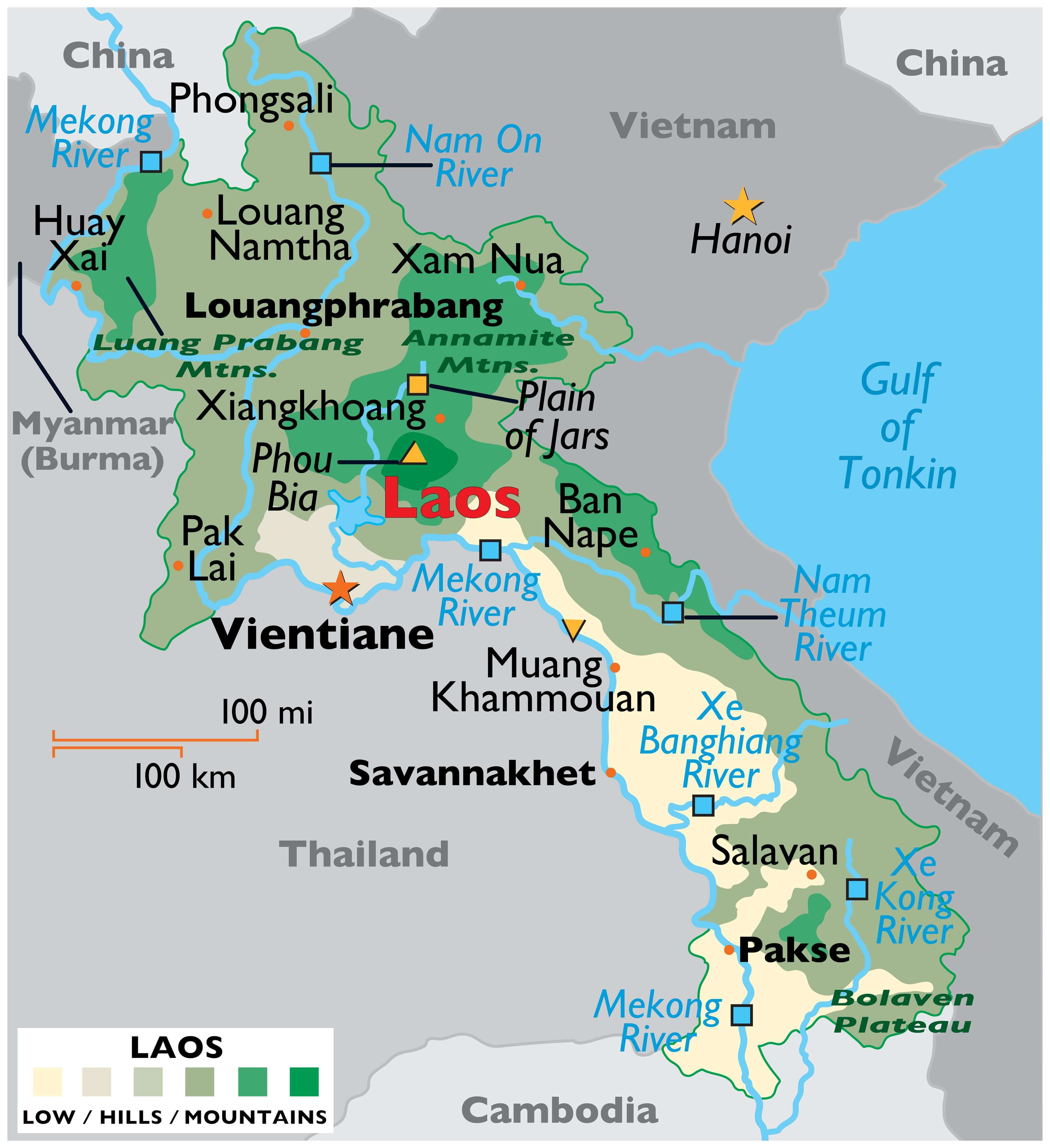
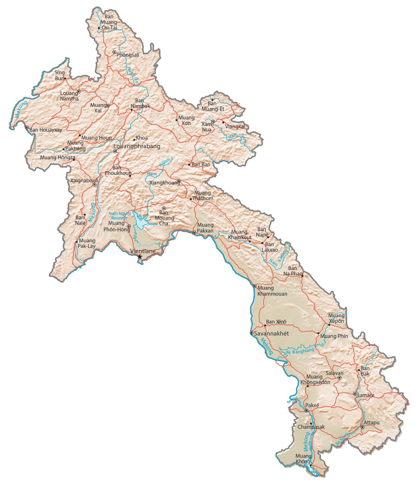
As observed on the physical map of Laos above, the overall topography of Laos is hilly and mountainous with thick green forests. River valleys and an increasingly steep terrain front the mountainous landscape. The Annamite Mountains and Luang Prabang Mountains are two of the important mountain chains in the country.
The highest point of Laos is Phou Bia whose summit peaks at 9,242 ft. (2,817 m). The lowest point is along the Mekong River at 229 ft. (70 m).
A very small percentage of Laos is farmable, and the limited flat areas (lower lands) are found in the south and along the Mekong River border with Thailand.
As can be seen on the map above, dozens of rivers flow from the upper reaches of the mountains as tributaries of the Mekong, Southeast Asia’s most significant river.
The Mekong is the world’s 12th-longest river and the 7th-longest in Asia. Its estimated length is 4,350 km (2,703 mi), and it drains an area of 795,000 km2 (307,000 sq mi).
| Flag: |  |
|---|---|
| Legal Name: | Lao People’s Democratic Republic |
| Capital Value: | Vientiane (Viangchan) |
| Largest City: |
Vientiane (682,542) |
| Official languages: | Lao |
| Demonym(s): | Lao Laotian |
| Government: | Unitary Marxist–Leninist one-party socialist republic |
| Legislature: | National Assembly |
| Total Area: | 236,800 km² |
| Land Area: | 230,800 km² |
| Water Area: | 6,000 km² |
| Population: | 7,169,455 |
| Density: | 26.7/km (69.2/sq mi) |
| GDP: | $18.17 Billion |
| GDP Per Capita: | $2,534.90 |
| Currency Value: | Kips (LAK) |
| Driving side: | right |
| Calling code: | +856 |
| Internet TLD: | .la |
Laos is a country of stunning natural beauty, with its majestic mountains, lush plains, and the majestic Mekong River. Satellite imagery and an elevation map of the region show its topography in all its glory. Its major cities, towns, roads, lakes, and rivers are all clearly visible. The Mekong River is the twelfth-longest river in the world and its course can be seen winding through the country.
From the majestic mountains of the north to the lush plains of the south, Laos is a country of incredible diversity. With its vast array of landscapes, it is a paradise for nature lovers and adventurers alike. Its major cities, towns, roads, lakes, and rivers are a testament to the country’s history and culture, and the Mekong River is a symbol of its power and strength.
Online Interactive Political Map
Click on ![]() to view map in "full screen" mode.
to view map in "full screen" mode.
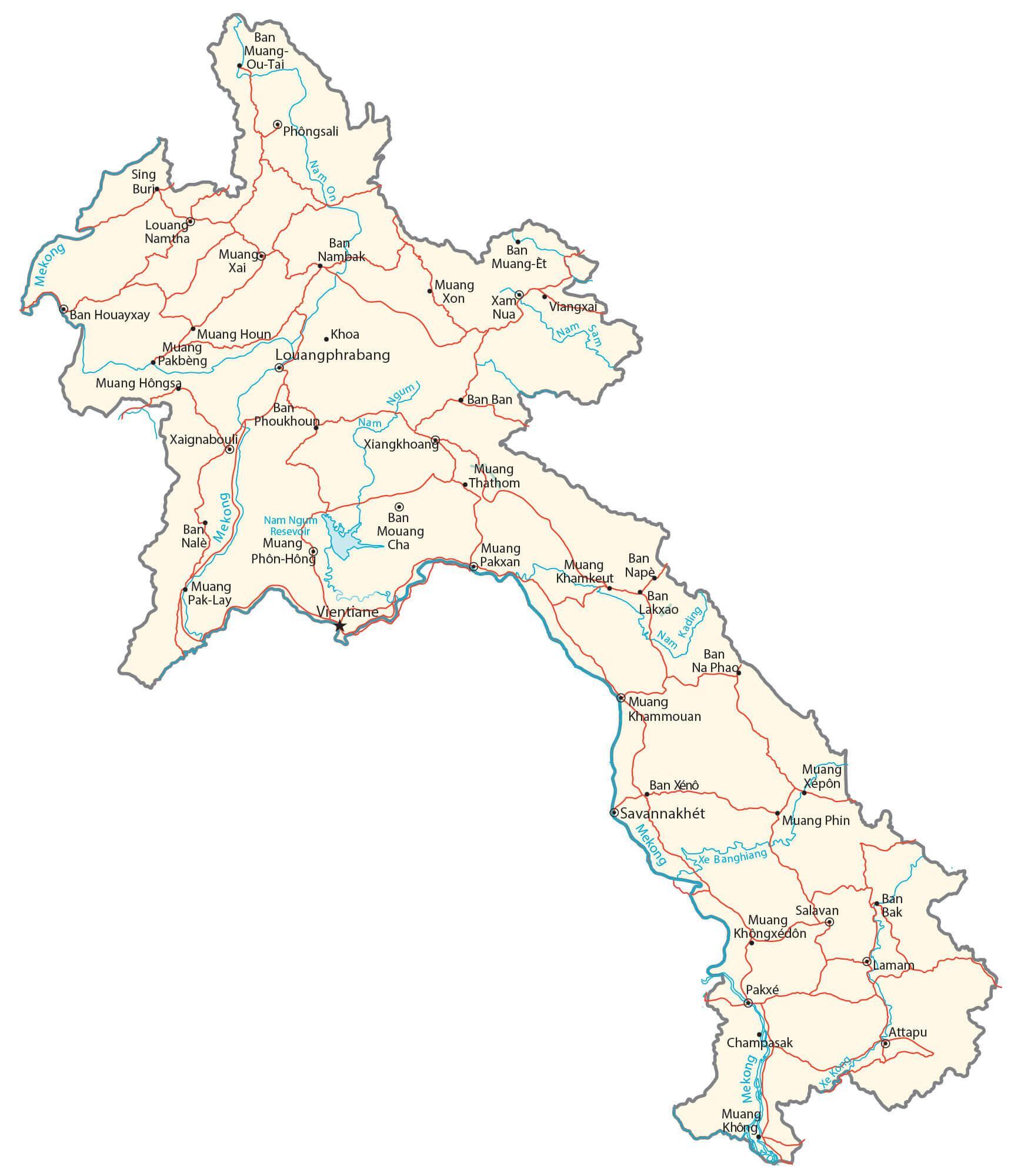
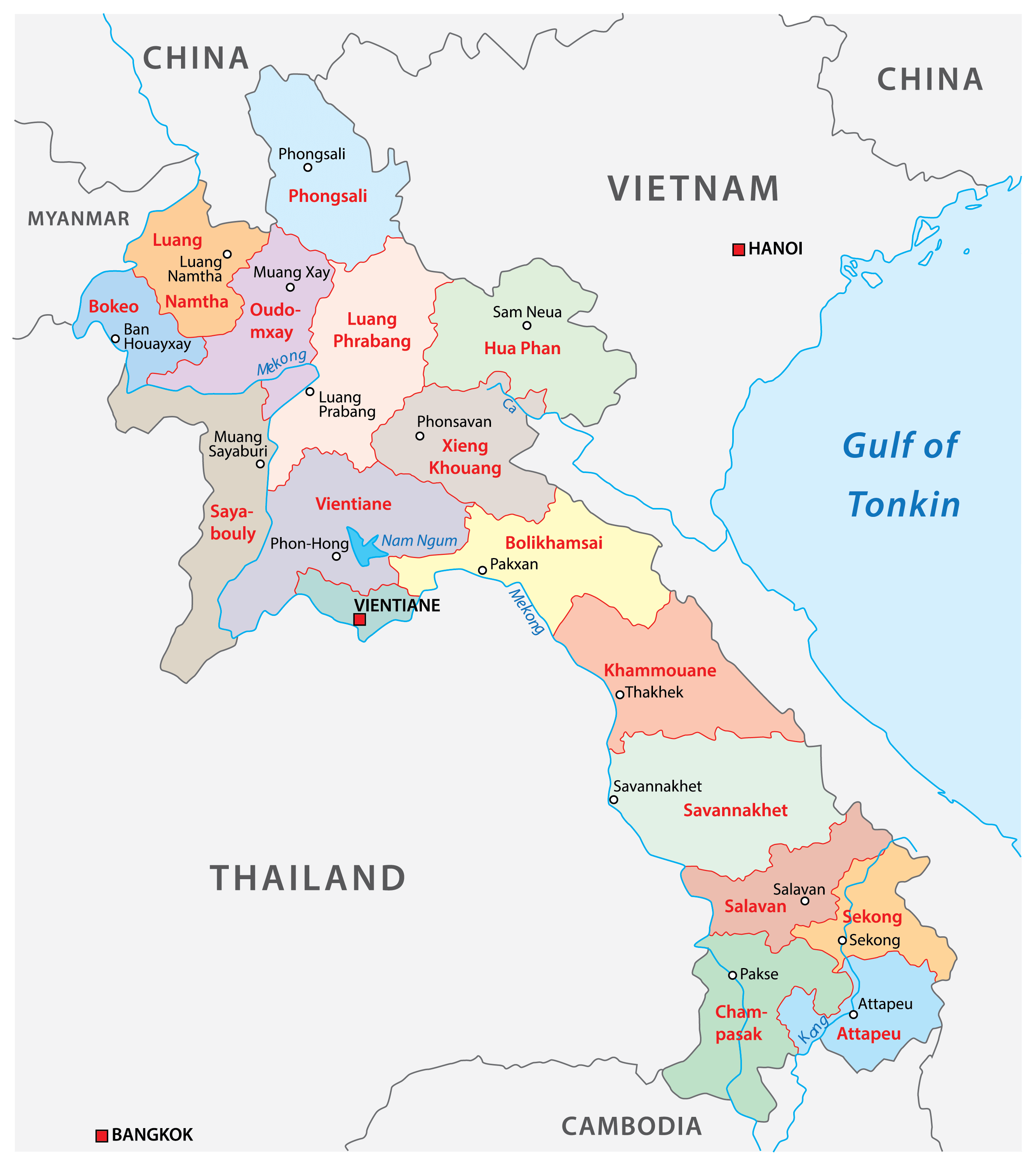
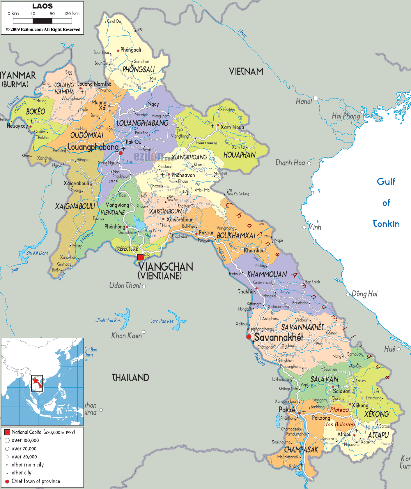
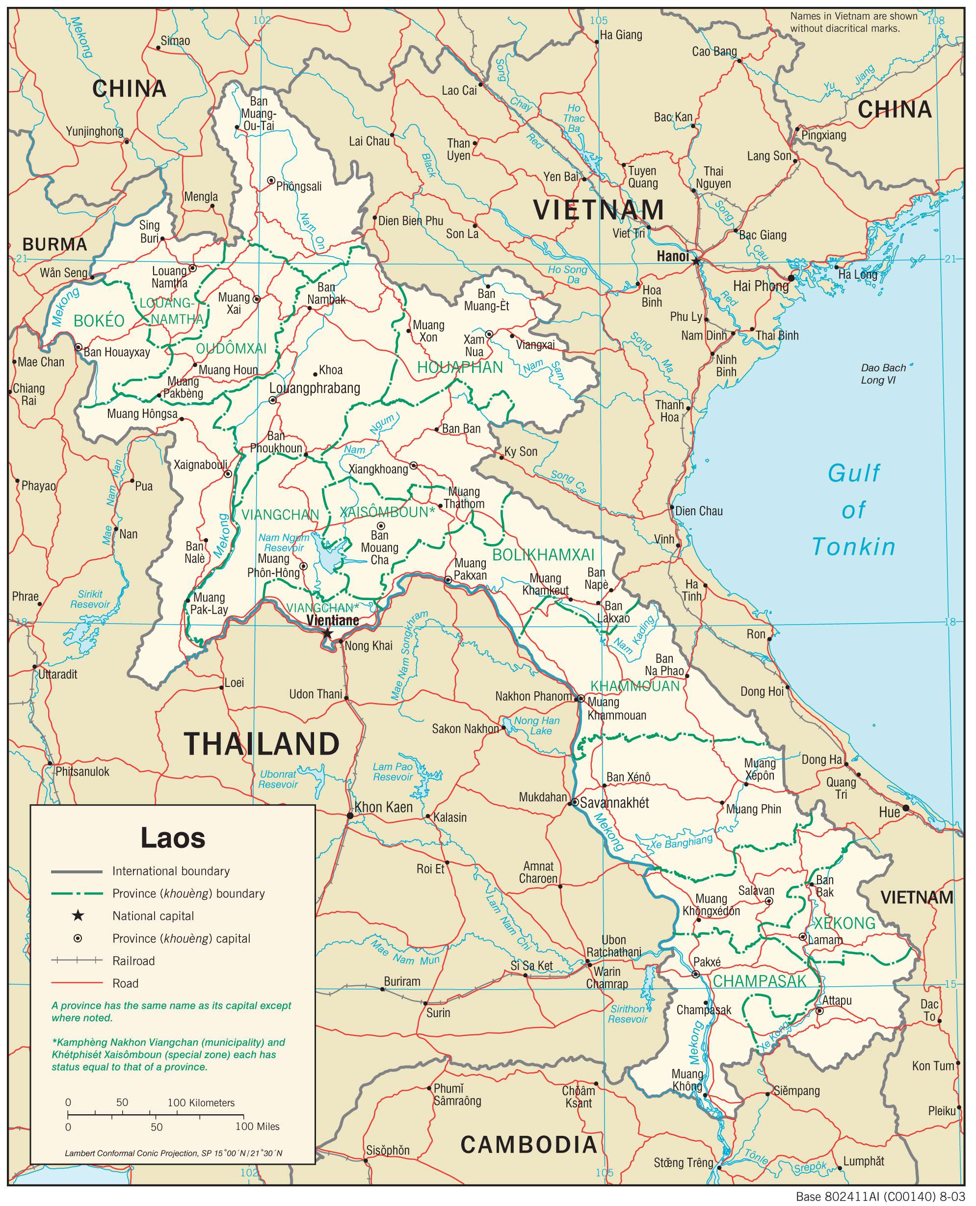
Laos (officially, the Lao People’s Democratic Republic) is divided into 17 administrative provinces (Khoueng) and 1 prefecture (Kampheng nakhon). In alphabetical order, the administrative provinces are: attapu, Bokeo, Bolikhamxai, Champasak, Houaphan, Khammouan, Louangnamtha, Louangphabang, Oudomxai, Phongsali, Salavan, Savannakhet, Sainyabuli, Sekong, Vientiane Province, Xiengkhouang and Xaisomboun. Vientiane Prefecture comprises of the capital city of Laos. These provinces are further subdivided into districts and smaller subdivisions.
Located along the banks of the Mekong River, is Vientiane –the capital, the largest and the most populous city of Laos. Vientiane serves as the administrative and economic center of Laos.
Location Maps
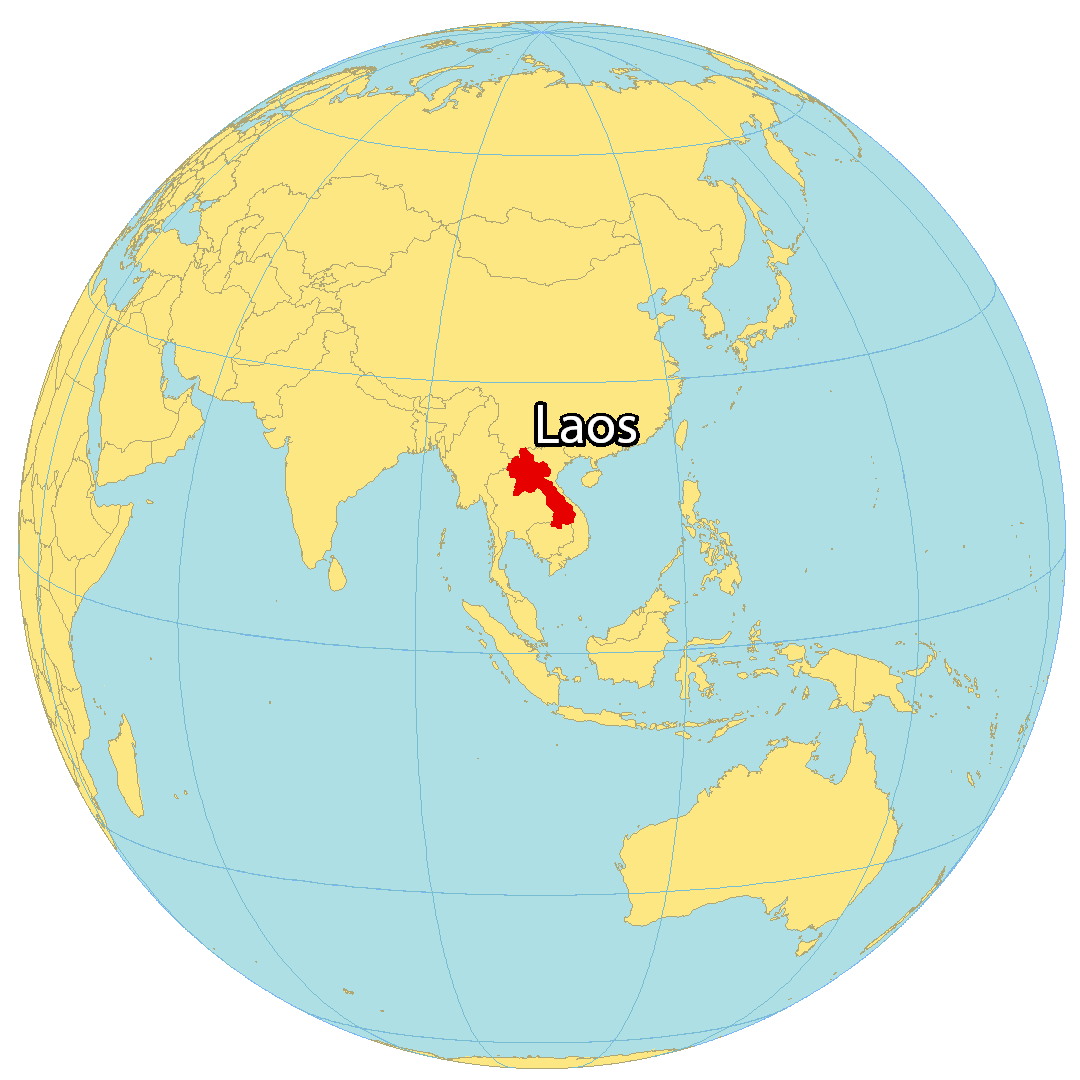
Where is Laos?
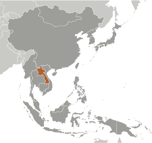
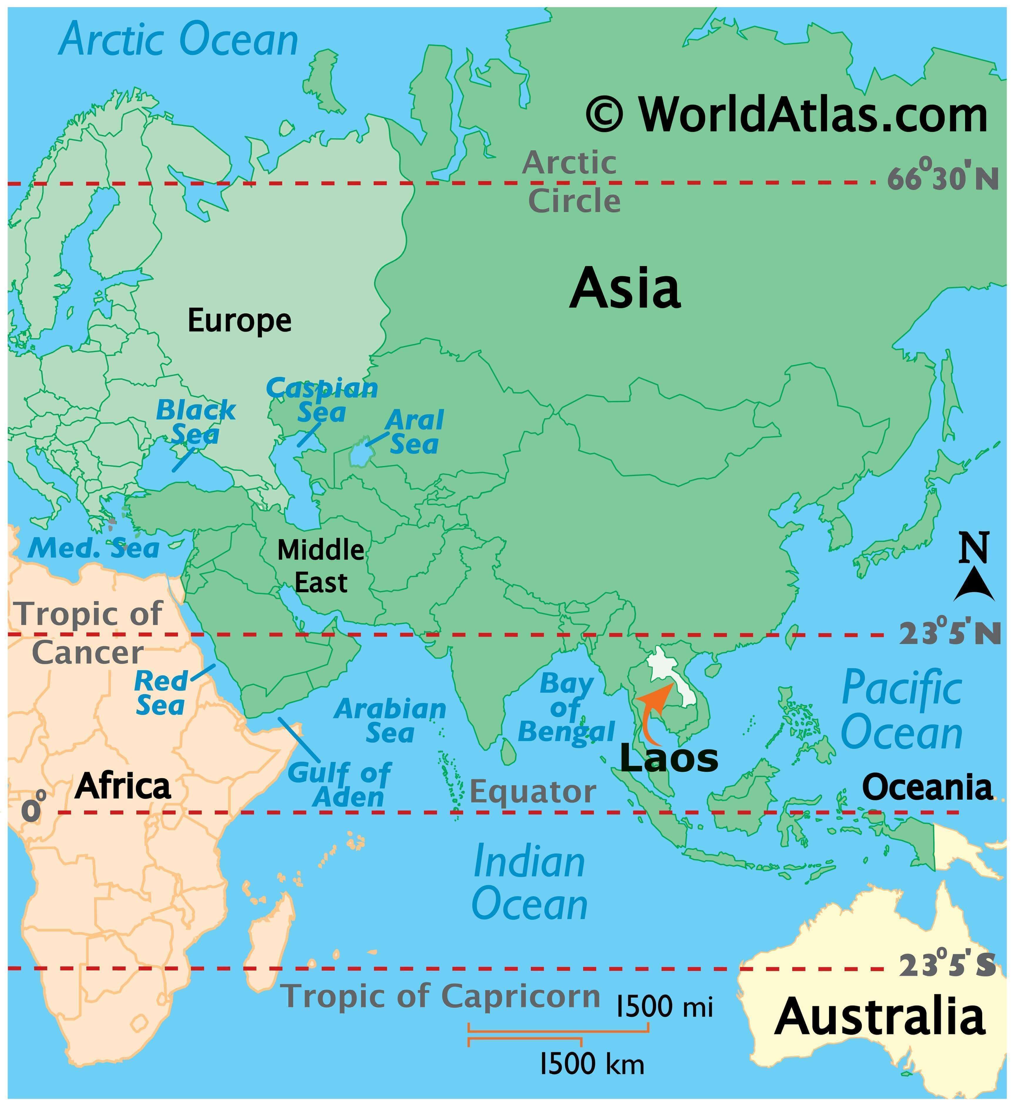
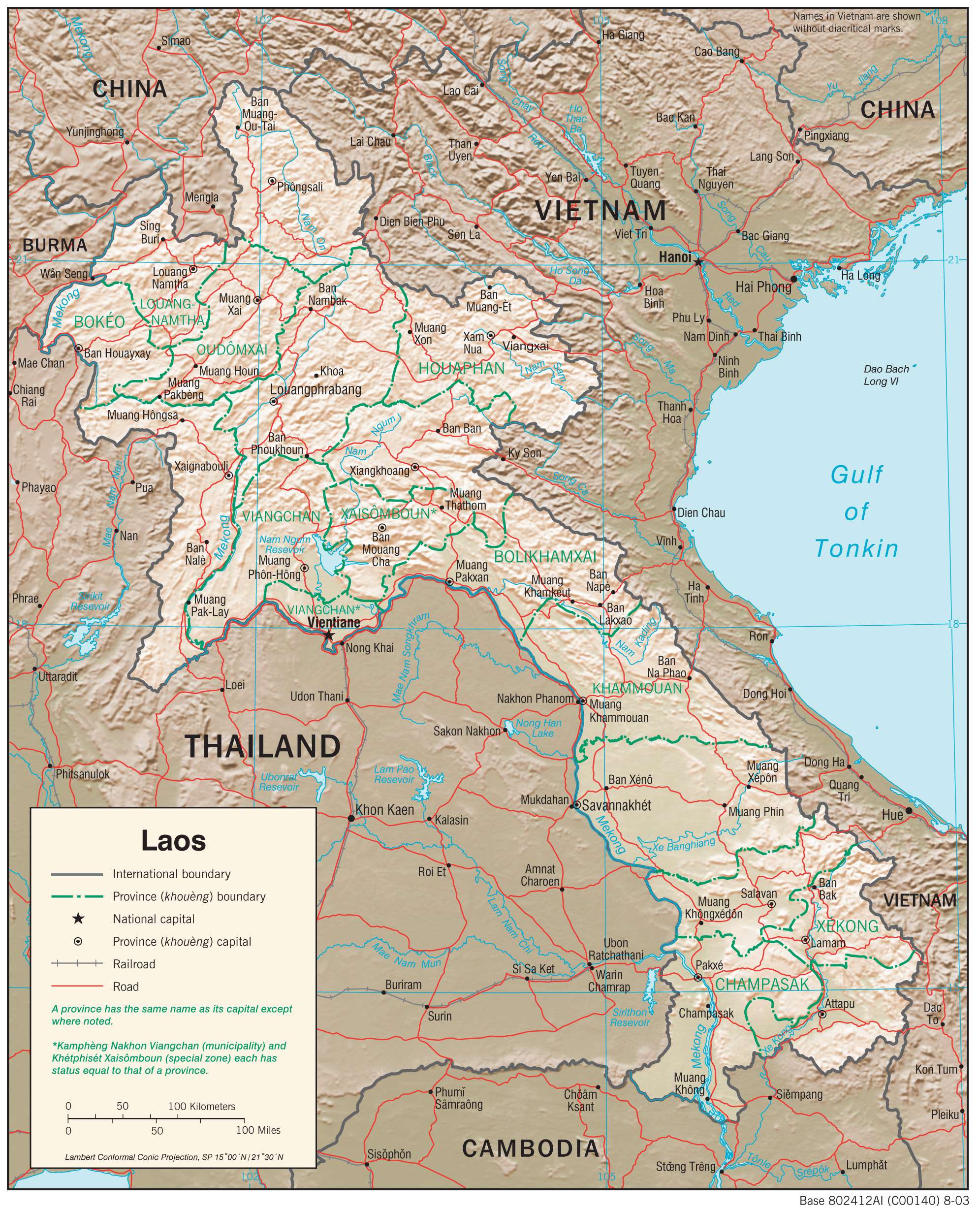
Laos is a landlocked nation found in Southeastern Asia. Despite being adjacent to the South China Sea, the country has no coastline to the east. It is situated northeast of Thailand, west of Vietnam, north of Cambodia, and south of China and Burma. Its capital and largest city is Vientiane, while its other major cities are Pakse, Thakhek, and Savannakhet. The terrain of Laos is hilly, with the Annamite Mountains running through the country. The Mekong River runs through the nation from north to south.
High Definition Political Map of Laos
History
Prehistory and early history
An ancient human skull was recovered in 2009 from the Tam Pa Ling Cave in the Annamite Mountains in northern Laos; the skull is at least 46,000 years old, making it the oldest modern human fossil found to date in Southeast Asia. Stone artefacts including Hoabinhian types have been found at sites dating to the Late Pleistocene in northern Laos. Archaeological evidence suggests an agriculturist society developed during the 4th millennium BC. Burial jars and other kinds of sepulchers suggest a complex society in which bronze objects appeared around 1500 BC, and iron tools were known from 700 BC. The proto-historic period is characterised by contact with Chinese and Indian civilisations. According to linguistic and other historical evidence, Tai-speaking tribes migrated southwestward to the modern territories of Laos and Thailand from Guangxi sometime between the 8th and 10th centuries.
Lan Xang
Laos traces its history to the kingdom of Lan Xang (‘million elephants’), which was founded in the 13th century by a Lao prince, Fa Ngum, whose father had his family exiled from the Khmer Empire. Fa Ngum, with 10,000 Khmer troops, conquered many Lao principalities in the Mekong river basin, culminating in the capture of Vientiane. Ngum was descended from a long line of Lao kings that traced back to Khoun Boulom. He made Theravada Buddhism the state religion, and Lan Xang prospered. His ministers, unable to tolerate his ruthlessness, forced him into exile to the present-day Thai province of Nan in 1373, where he died. Fa Ngum’s eldest son, Oun Heuan, ascended to the throne under the name Samsenethai and reigned for 43 years. Lan Xang became an important trade centre during Samsenthai’s reign, but after his death in 1421 it collapsed into warring factions for nearly a century.
In 1520, Photisarath came to the throne and moved the capital from Luang Prabang to Vientiane to avoid a Burmese invasion. Setthathirath became king in 1548, after his father was killed, and ordered the construction of what became the symbol of Laos, That Luang. Settathirath disappeared in the mountains on his way back from a military expedition into Cambodia, and Lan Xang fell into more than seventy years of instability, involving both Burmese invasion and civil war.
In 1637, when Sourigna Vongsa ascended the throne, Lan Xang further expanded its frontiers. His reign is often regarded as Laos’s golden age. When he died without an heir, the kingdom split into three principalities. Between 1763 and 1769, Burmese armies overran northern Laos and annexed Luang Prabang, while Champasak eventually came under Siamese suzerainty.
Chao Anouvong was installed as a vassal king of Vientiane by the Siamese. He encouraged a renaissance of Lao fine arts and literature and improved relations with Luang Phrabang. Under Vietnamese pressure, he rebelled against the Siamese in 1826. The rebellion failed, and Vientiane was ransacked. Anouvong was taken to Bangkok as a prisoner, where he died.
In a time period where the acquisition of humans was a priority over the ownership of land, the warfare of pre-modern Southeast Asia revolved around the seizing of people and resources from its enemies. A Siamese military campaign in Laos in 1876 was described by a British observer as having been “transformed into slave-hunting raids on a large scale”.
French Laos (1893–1953)
In the late 19th century, Luang Prabang was ransacked by the Chinese Black Flag Army. France rescued King Oun Kham and added Luang Phrabang to the protectorate of French Indochina. Shortly after, the Kingdom of Champasak and the territory of Vientiane were added to the protectorate. King Sisavang Vong of Luang Phrabang became ruler of a unified Laos, and Vientiane once again became the capital. Laos never held any importance for France other than as a buffer state between Thailand and the more economically important Annam and Tonkin.
Laos produced tin, rubber, and coffee, but never accounted for more than one percent of French Indochina’s exports. By 1940, around 600 French citizens lived in Laos. Under French rule, the Vietnamese were encouraged to migrate to Laos, which was seen by the French colonists as a rational solution to a labour shortage within the confines of an Indochina-wide colonial space. By 1943, the Vietnamese population stood at nearly 40,000, forming the majority in the largest cities of Laos and enjoying the right to elect its own leaders. As a result, 53% of the population of Vientiane, 85% of Thakhek, and 62% of Pakse were Vietnamese, with only the exception of Luang Prabang where the population was predominantly Lao. As late as 1945, the French drew up an ambitious plan to move massive Vietnamese population to three key areas, i.e., the Vientiane Plain, Savannakhet region, and the Bolaven Plateau, which was only derailed by the Japanese invasion of Indochina. Otherwise, according to Martin Stuart-Fox, the Lao might well have lost control over their own country.
During World War II in Laos, Vichy France, Thailand, Imperial Japan and Free France occupied Laos. On 9 March 1945, a nationalist group declared Laos once more independent, with Luang Prabang as its capital, but on 7 April 1945 two battalions of Japanese troops occupied the city. The Japanese attempted to force Sisavang Vong (the King of Luang Phrabang) to declare Laotian independence, but on 8 April he instead simply declared an end to Laos’s status as a French protectorate. The king then secretly sent Prince Kindavong to represent Laos to the Allied forces and Prince Sisavang as representative to the Japanese. When Japan surrendered, some Lao nationalists (including Prince Phetsarath) declared Laotian independence, but by early-1946, French troops had reoccupied the country and conferred limited autonomy on Laos.
During the First Indochina War, the Indochinese Communist Party formed the Pathet Lao independence organisation. The Pathet Lao began a war against the French colonial forces with the aid of the Vietnamese independence organisation, the Viet Minh. In 1950, the French were forced to give Laos semi-autonomy as an “associated state” within the French Union. France remained in de facto control until 22 October 1953, when Laos gained full independence as a constitutional monarchy.
Independence and Communist rule (1953–present)
The First Indochina War took place across French Indochina and eventually led to French defeat and the signing of a peace accord for Laos at the Geneva Conference of 1954. In 1960, amidst a series of rebellions in the Kingdom of Laos, fighting broke out between the Royal Lao Army (RLA) and the communist North Vietnamese and Soviet Union-backed Pathet Lao guerillas. A second Provisional Government of National Unity formed by Prince Souvanna Phouma in 1962 was unsuccessful, and the situation steadily deteriorated into large scale civil war between the Royal Laotian government and the Pathet Lao. The Pathet Lao were backed militarily by the People’s Army of Vietnam (PAVN) and the Viet Cong.
Laos was a key part of the Vietnam War since parts of Laos were invaded and occupied by North Vietnam since 1958 for use as a supply route for its war against South Vietnam. In response, the United States initiated a bombing campaign against the PAVN positions, supported regular and irregular anti-communist forces in Laos, and supported Army of the Republic of Vietnam incursions into Laos.
In 1968, the PAVN launched a multi-division attack to help the Pathet Lao fight the RLA. The attack resulted in the RLA largely demobilising, leaving the conflict to irregular ethnic Hmong forces of the “Secret Army” backed by the United States and Thailand, and led by General Vang Pao.
Massive aerial bombardments against the PAVN/Pathet Lao forces were carried out by the United States to prevent the collapse of the Kingdom of Laos central government, and to deny the use of the Ho Chi Minh Trail to attack US forces in South Vietnam. Between 1964 and 1973, the US dropped two million tons of bombs on Laos, nearly equal to the 2.1 million tons of bombs the US dropped on Europe and Asia during all of World War II, making Laos the most heavily bombed country in history relative to the size of its population; The New York Times notes this was “nearly a ton for every person in Laos”.
Some 80 million bombs failed to explode and remain scattered throughout the country, rendering vast swaths of land impossible to cultivate. Currently unexploded ordnance (UXO), including cluster munitions and mines, kill or maim approximately 50 Laotians every year. Due to the particularly heavy impact of cluster bombs during this war, Laos was a strong advocate of the Convention on Cluster Munitions to ban the weapons and was host to the First Meeting of States Parties to the convention in November 2010.
In 1975 the Pathet Lao overthrew the royalist government, forcing King Savang Vatthana to abdicate on 2 December 1975. He later died under suspicious circumstances in a re-education camp. Between 20,000 and 62,000 Laotians died during the civil war. The royalists set up a government in exile in the United States.
On 2 December 1975, after taking control of the country, the Pathet Lao government under Kaysone Phomvihane renamed the country as the Lao People’s Democratic Republic and signed agreements giving Vietnam the right to station armed forces and to appoint advisers to assist in overseeing the country. The close ties between Laos and Vietnam were formalised via a treaty signed in 1977, which has since provided direction for Lao foreign policy, and provides the basis for Vietnamese involvement at all levels of Lao political and economic life. Laos was requested in 1979 by Vietnam to end relations with the People’s Republic of China, leading to isolation in trade by China, the United States, and other countries. In 1979, there were 50,000 PAVN troops stationed in Laos and as many as 6,000 civilian Vietnamese officials including 1,000 directly attached to the ministries in Vientiane.
The conflict between Hmong rebels and Laos continued in key areas of Laos, including in Saysaboune Closed Military Zone, Xaisamboune Closed Military Zone near Vientiane Province and Xiangkhouang Province. From 1975 to 1996, the United States resettled some 250,000 Lao refugees from Thailand, including 130,000 Hmong.
On 3 December 2021, the 422-kilometre Boten-Vientiane railway, a flagship of the Belt and Road Initiative (BRI) was opened.
Physical Map of Laos
Geography
Laos is the only landlocked country in Southeast Asia, and it lies mostly between latitudes 14° and 23°N (a small area is south of 14°), and longitudes 100° and 108°E. Its thickly forested landscape consists mostly of rugged mountains, the highest of which is Phou Bia at 2,818 metres (9,245 ft), with some plains and plateaus. The Mekong River forms a large part of the western boundary with Thailand, where the mountains of the Annamite Range form most of the eastern border with Vietnam and the Luang Prabang Range the northwestern border with the Thai highlands. There are two plateaux, the Xiangkhoang in the north and the Bolaven Plateau at the southern end. Laos can be considered to consist of three geographical areas: north, central, and south. Laos had a 2019 Forest Landscape Integrity Index mean score of 5.59/10, ranking it 98th globally out of 172 countries.
In 1993 the Laos government set aside 21% of the nation’s land area for habitat conservation preservation. The country is one of four in the opium poppy growing region known as the “Golden Triangle”. According to the October 2007 UNODC fact book Opium Poppy Cultivation in South East Asia, the poppy cultivation area was 15 square kilometres (5.8 sq mi), down from 18 square kilometres (6.9 sq mi) in 2006.
Climate
The climate is mostly tropical savanna and influenced by the monsoon pattern. There is a distinct rainy season from May to October, followed by a dry season from November to April. Local tradition holds that there are three seasons (rainy, cool and hot) as the latter two months of the climatologically defined dry season are noticeably hotter than the earlier four months.
Transportation Map of Laos
Laos Satellite Map