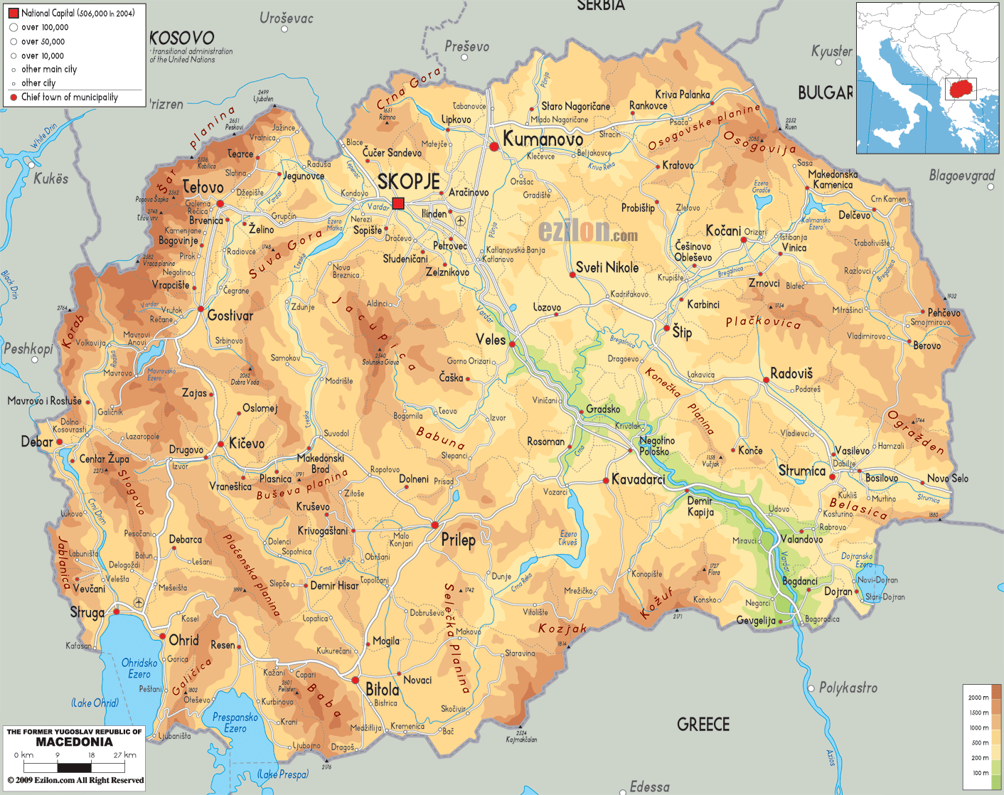
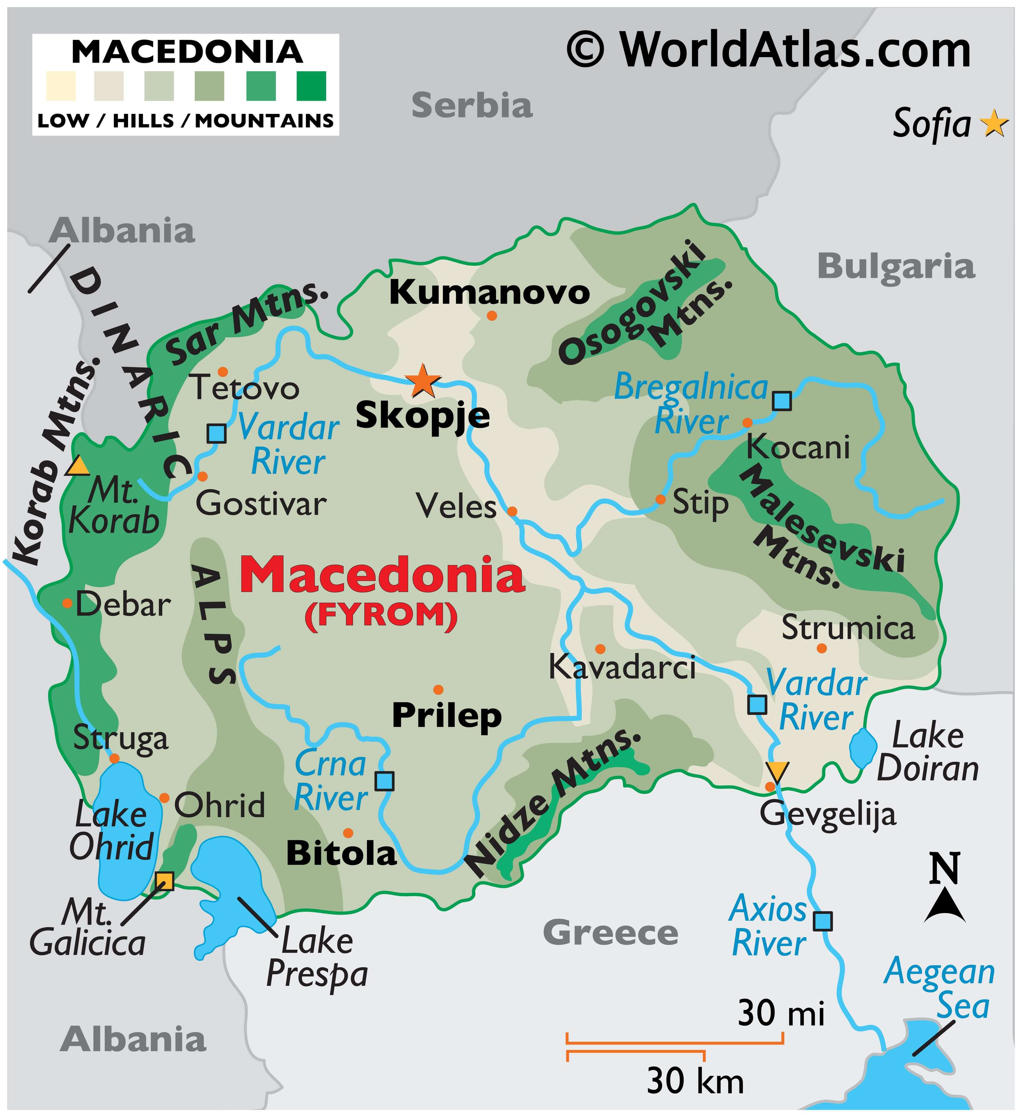
North Macedonia covers an area of 25,713 sq. km in Southeast Europe.
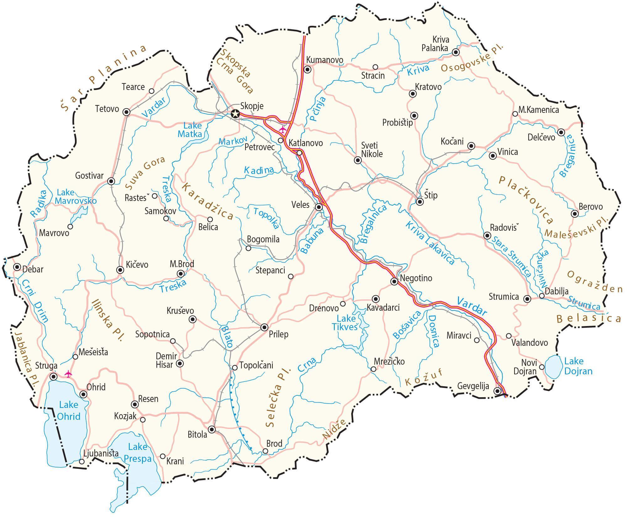
As observed on the physical map of the country above, Macedonia is an elevated plateau of large, rolling hills and deep valleys, completely dissected and surrounded by mountains like the Sar Mountains, Osogovski Mountains, Malesevski Mountains, Nidze Mountains and others.
The Dinaric Alps extend down into the country, and the highest point is in the Korab Mountain range, at 9,066 ft (2,764m). The yellow upright triangle marks the position of the highest peak on the map above.
Although a landlocked country, Macedonia is home to 1,100 considerably sized water sources. Major lakes include Ohrid, Prespa (both shared with Albania) and Doiran. Lake Ohrid is the deepest lake in the Balkans (935 ft.), and is regarded as the oldest in the world.
As shown on the map, the Vardar River divides the country, flowing on through Greece, and is a major river for Macedonia. Other rivers of note include the Bregalnica and Crna.
At 50 m above sea level, the Vardar River has the lowest point in the country.
| Flag: | 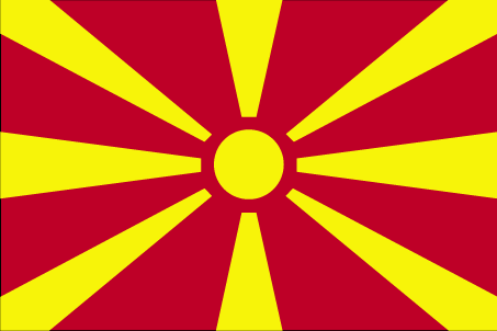 |
|---|---|
| Legal Name: | Republic of North Macedonia |
| Capital Value: | Skopje |
| Largest City: |
Skopje (595,275) |
| Official languages: |
|
| Demonym(s): |
|
| Government: | Unitary parliamentary republic |
| Legislature: | Assembly |
| Total Area: | 25,713 km² |
| Land Area: | 25,433 km² |
| Water Area: | 280 km² |
| Population: | 2,083,459 |
| Density: | 80.1/km (207.5/sq mi) (122nd) |
| GDP: | $12.69 Billion |
| GDP Per Capita: | $6,093.15 |
| Currency Value: | Macedonian denars (MKD) |
| Driving side: | right |
| Calling code: | +389 |
| Internet TLD: |
|
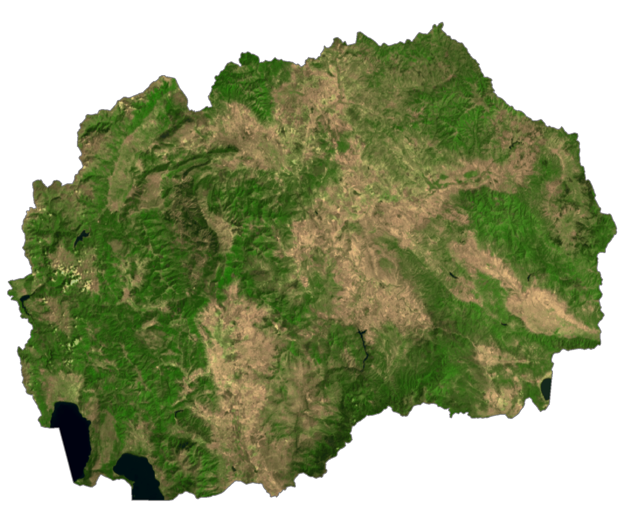
North Macedonia is a country of stunning natural beauty, with its major cities, towns, lakes, rivers, highways, and roads easily visible on a map. From the majestic mountains of the Mavrovo National Park to the vast stretch of lakes, North Macedonia’s landscape is truly breathtaking. Satellite imagery shows the stunning terrain of the country, while an elevation map reveals the many hills and valleys that make up the North Macedonian landscape.
Whether you are interested in exploring the country’s cultural attractions or its wild and rugged scenery, North Macedonia has something for everyone. The country’s map is the perfect way to start planning your next adventure, so take a look and start exploring!
Online Interactive Political Map
Click on ![]() to view map in "full screen" mode.
to view map in "full screen" mode.
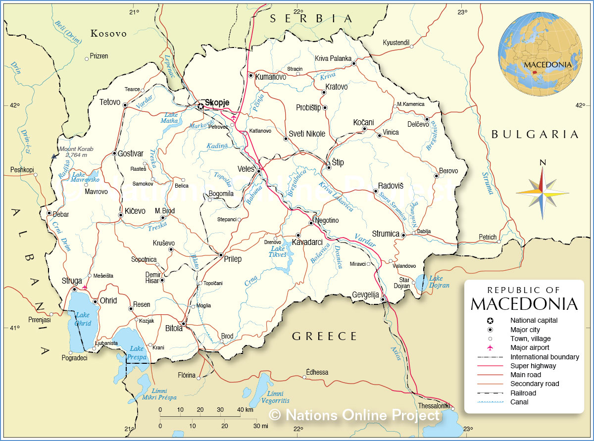
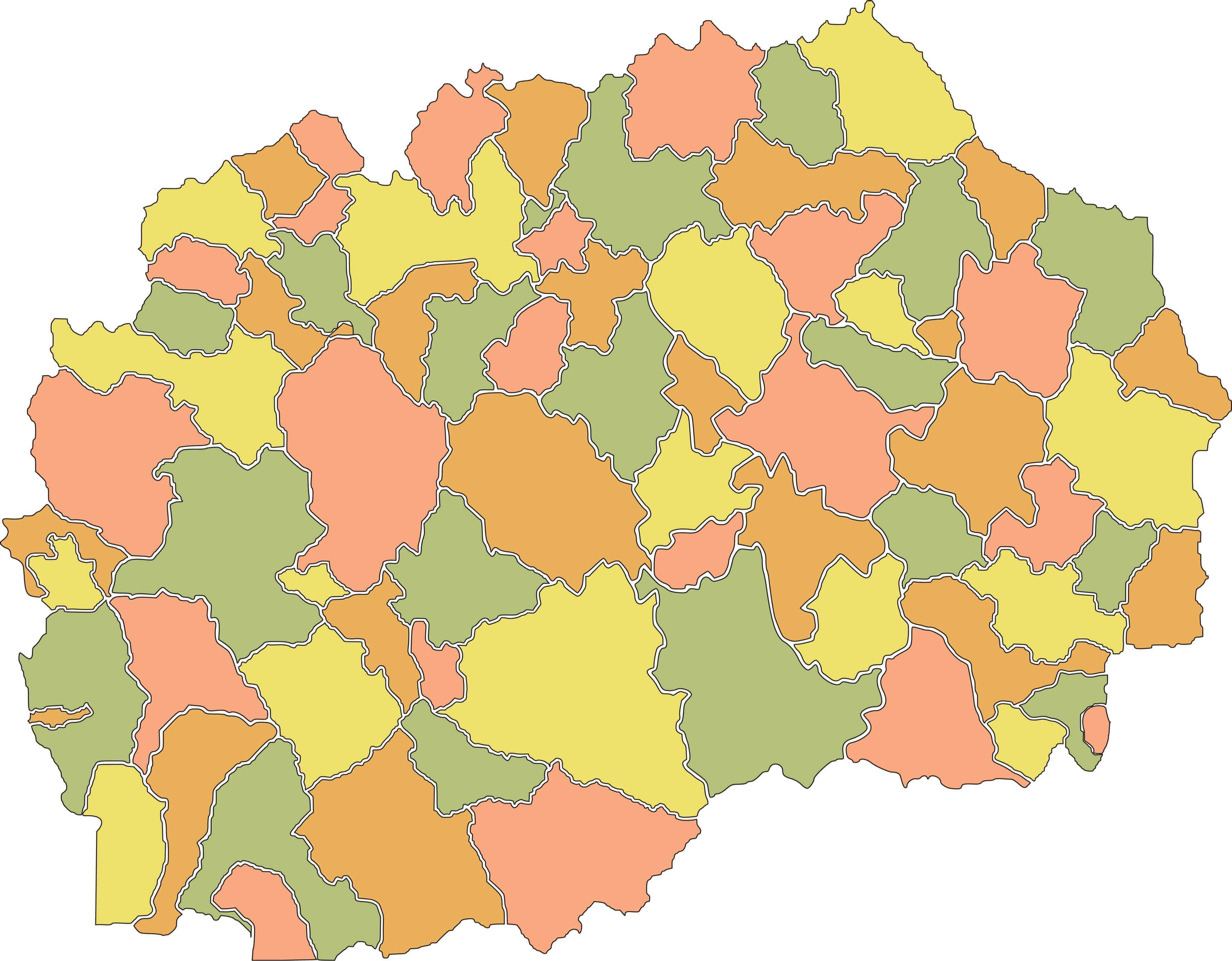
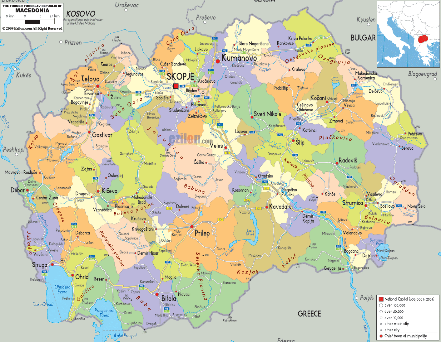
North Macedonia (officially, the Republic of North Macedonia) is divided into 80 municipalities (opstini, singular – opstina) and 1 city (grad).
Situated in the northern part of the country in the heart of the Balkan Peninsula is, Skopje – the capital, the largest and the most populous city of North Macedonia. It is also the chief administrative, cultural, educational and economic center of the country.
Location Maps
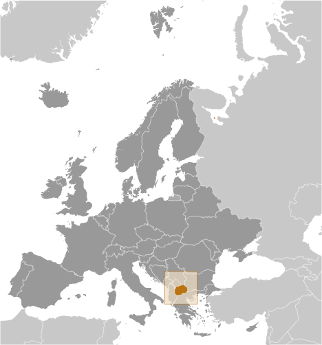
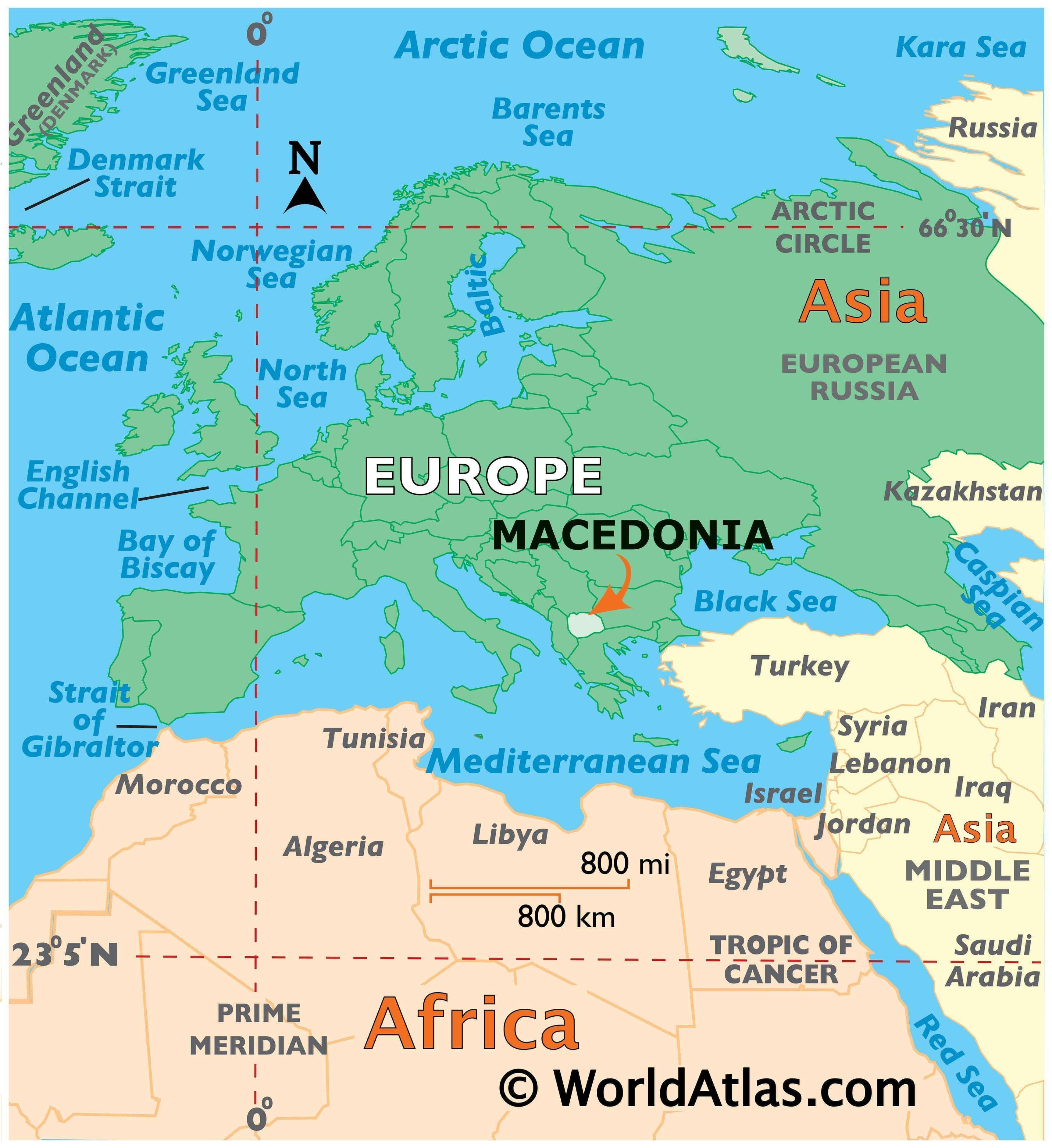
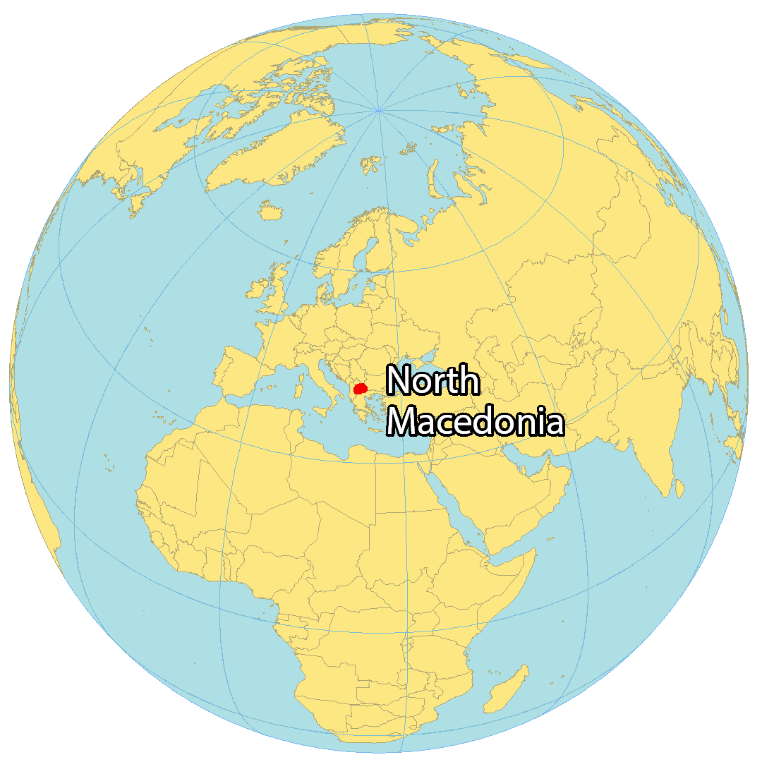
Where is North Macedonia?
North Macedonia is a landlocked country located in Southeast Europe. It is bordered by five other countries: Kosovo to the northwest, Serbia to the north, Bulgaria to the east, Greece to the south, and Albania to the west.
The capital and largest city of North Macedonia is Skopje. Other major cities include Bitola, Kumanovo, Prilep, and Tetovo.
Gaining independence from Yugoslavia in 1991, North Macedonia is part of the northern Macedonian region. The country is renowned for its majestic mountains, tranquil lakes, and ancient civilizations.
High Definition Political Map of North Macedonia
Physical Map of North Macedonia
North Macedonia Satellite Map
Elevation Map
