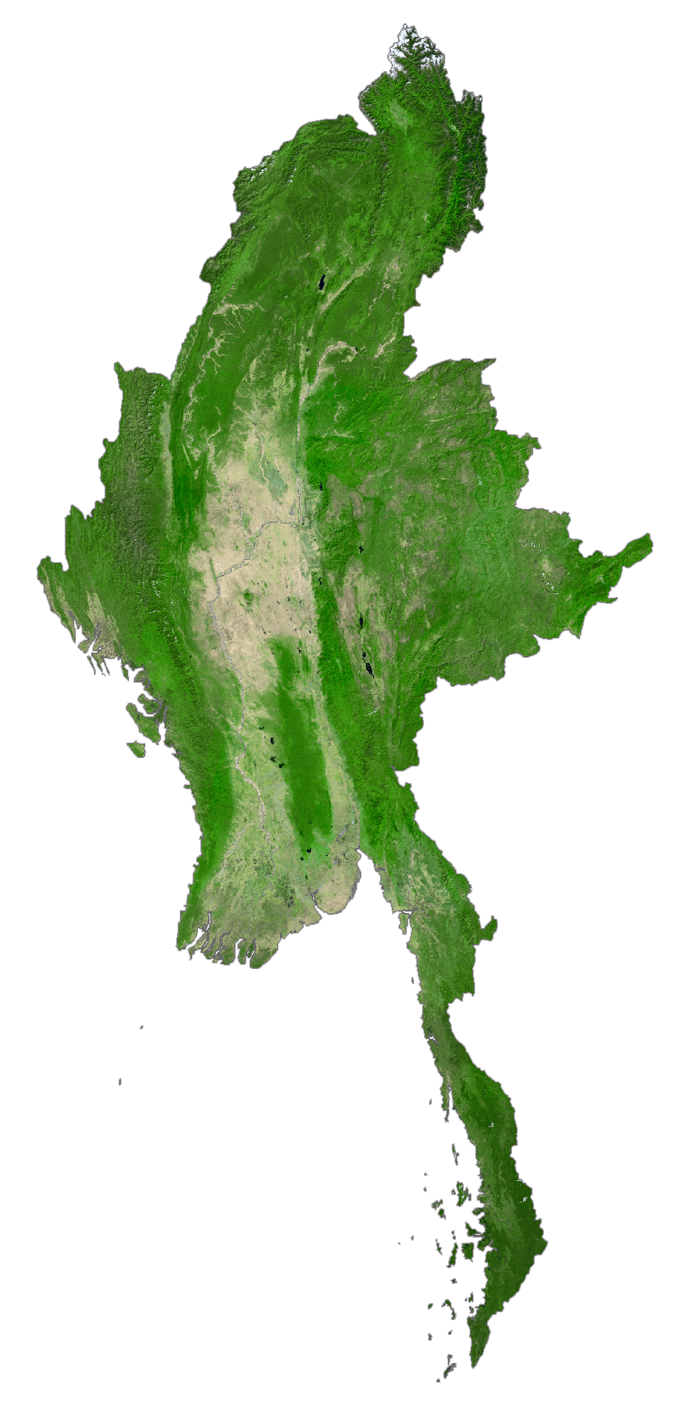
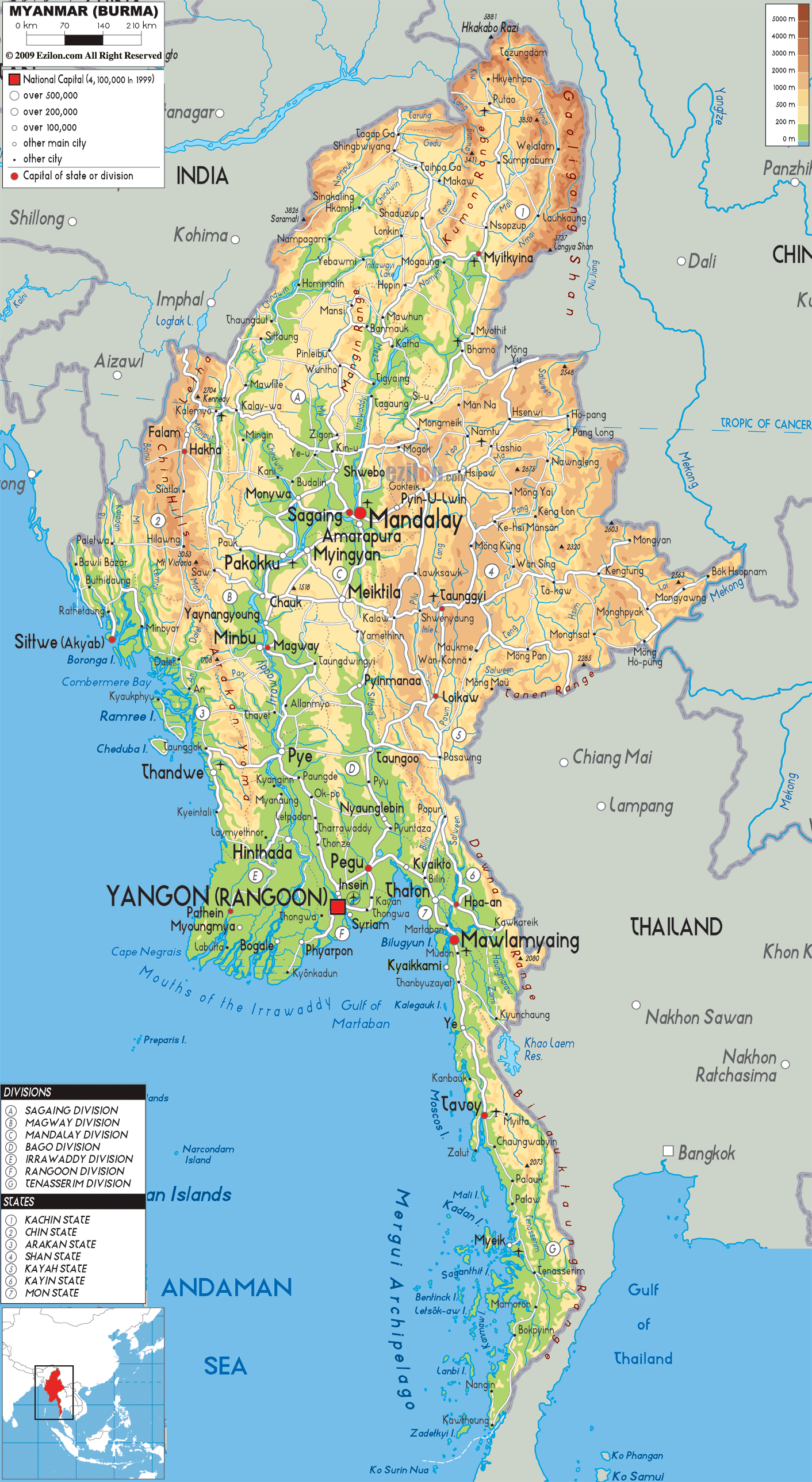
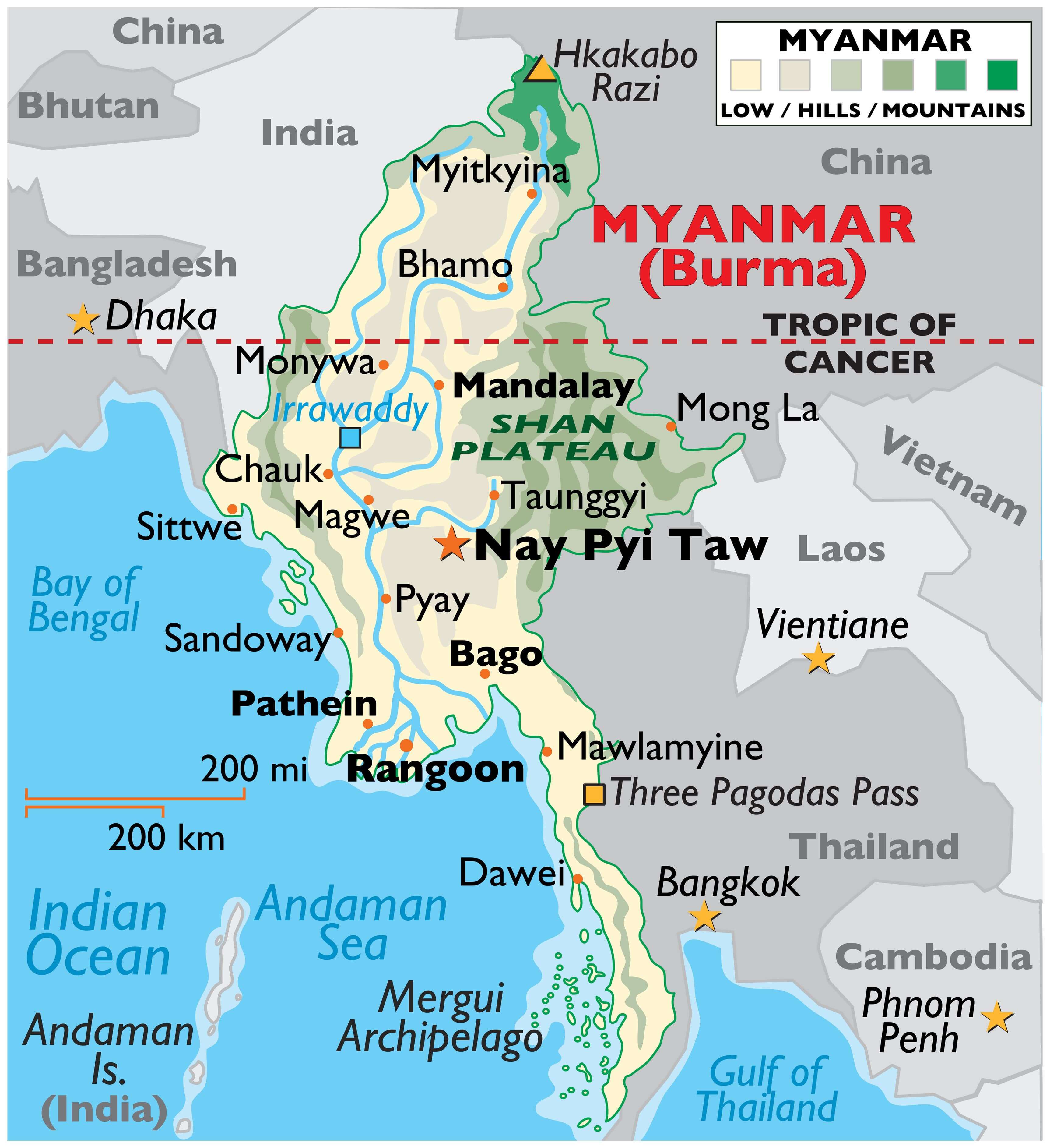
Myanmar (formerly Burma) occupies an area of 676,578 sq. km in the northwesternmost part of mainland Southeast Asia.
The elevation of the country gradually rises from the sea level at the river deltas of the Irrawaddy and Sittang river systems to Mount Kkakabo in the north.
The country can be roughly divided into 5 physiographic regions. The mountains in the north as already mentioned above. There are also the eastern plateau, coastal plains, western mountains, and central lowlands and basin.
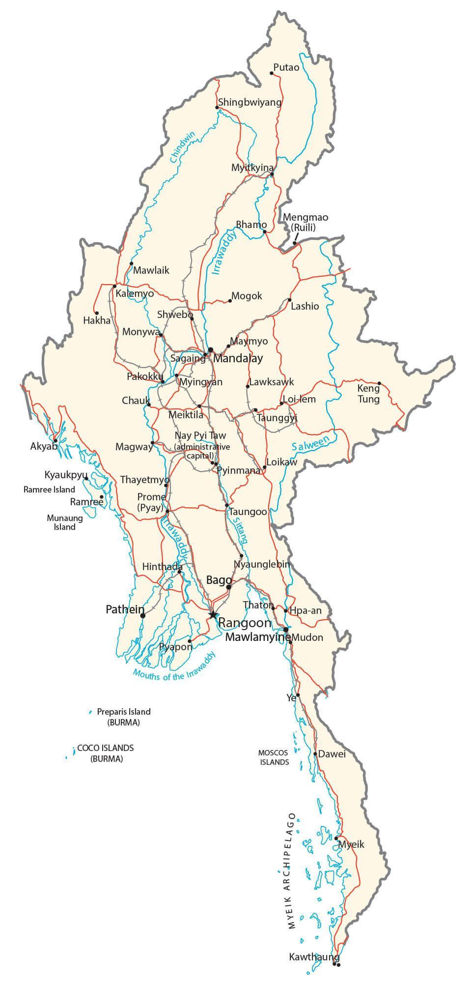
The most dominant feature of the country is the Irrawaddy River system, the surrounding valleys and the river’s massive delta in the south. The course of the Irrawaddy Rive can be observed on the map above.
In the far south, the Mergui Archipelago contains over 800 islands, most of them completely uninhabited.
The land rises gently into the Shan Plateau in the east, where the average elevation is near 3,200 ft. (1,000 m).
In the far north, the land rises sharply into a southern branch of the Himalayan mountain system. Marked on the physical map above by a yellow triangle, is the country’s highest point, the Hkakabo Razi at 19,296 feet (5,881 m). The mountain ranges of the north mostly run in the north-south direction.
| Flag: |  |
|---|---|
| Legal Name: | Republic of the Union of Myanmar |
| Capital Value: | Rangoon (Yangon); note – Nay Pyi Taw is the administrative capital |
| Demonym(s): | Burmese / Myanma |
| Government: | Unitary assembly-independent republic under a military junta |
| Legislature: | State Administration Council |
| Total Area: | 676,578 km² |
| Land Area: | 653,508 km² |
| Water Area: | 23,070 km² |
| Population: | 54,045,420 |
| Density: | 196.8/sq mi (76.0/km) (125th) |
| GDP: | $76.09 Billion |
| GDP Per Capita: | $1,407.81 |
| Currency Value: | Kyats (MMK) |
| Driving side: | right |
| Calling code: | +95 |
| Internet TLD: | .mm |
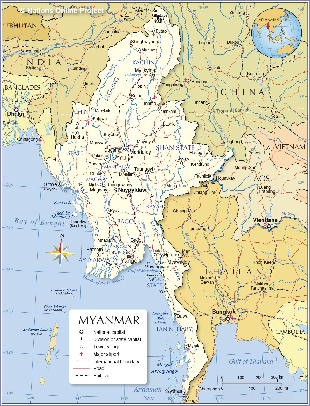
Explore the beauty of Myanmar with this detailed map! Discover the country’s major cities, towns, roads, and rivers, as well as its stunning mountain ranges displayed in topographic map and satellite imagery.
Online Interactive Political Map
Click on ![]() to view map in "full screen" mode.
to view map in "full screen" mode.
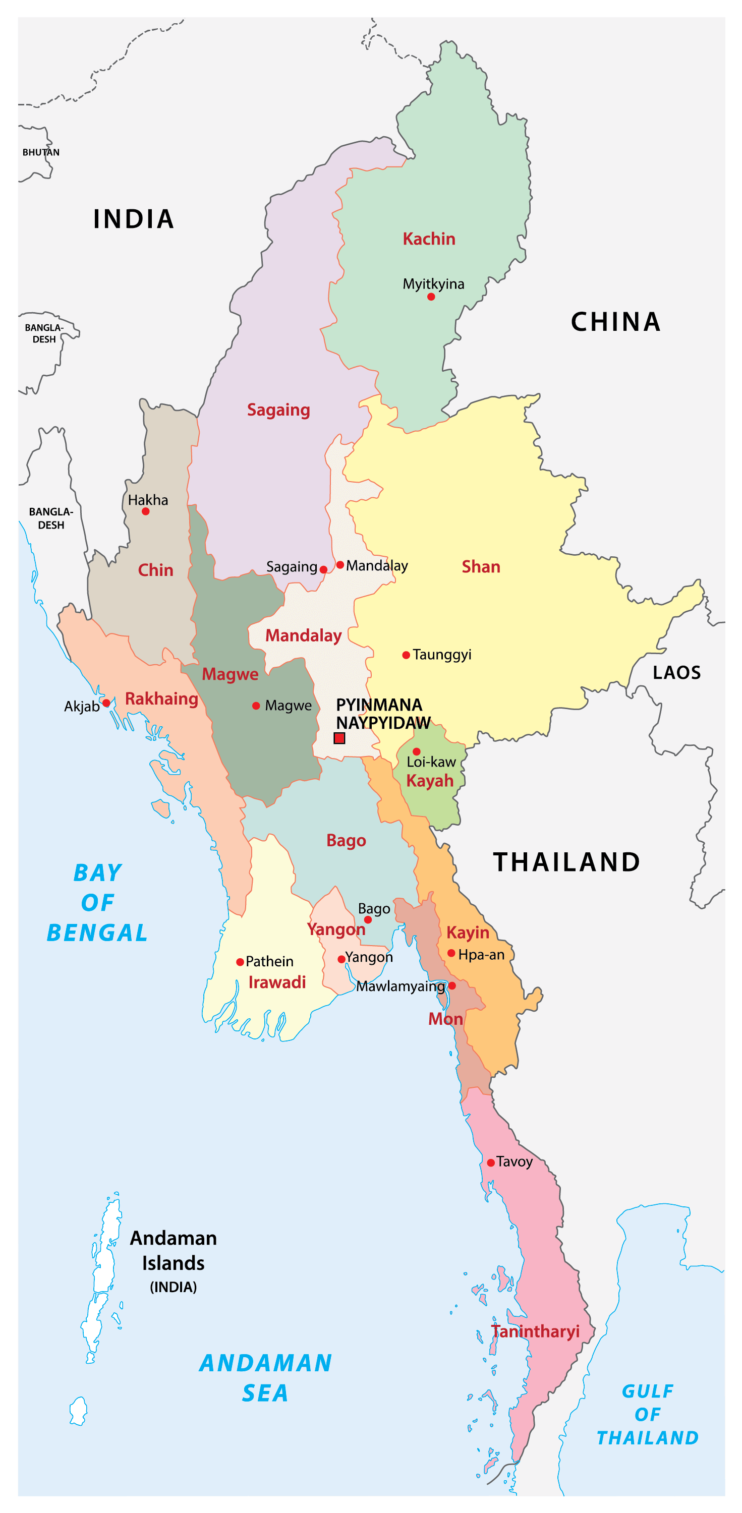
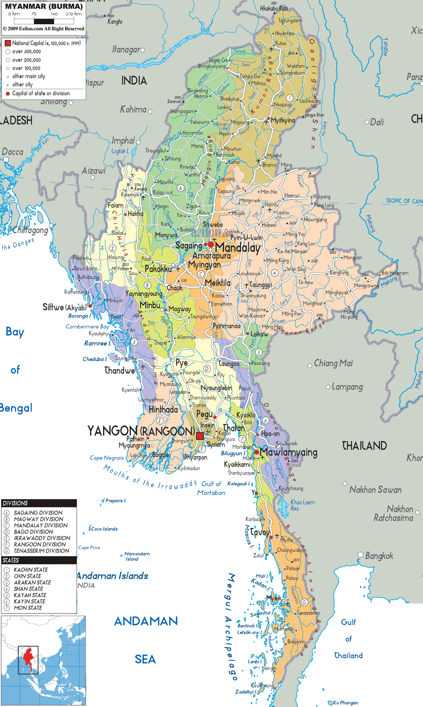
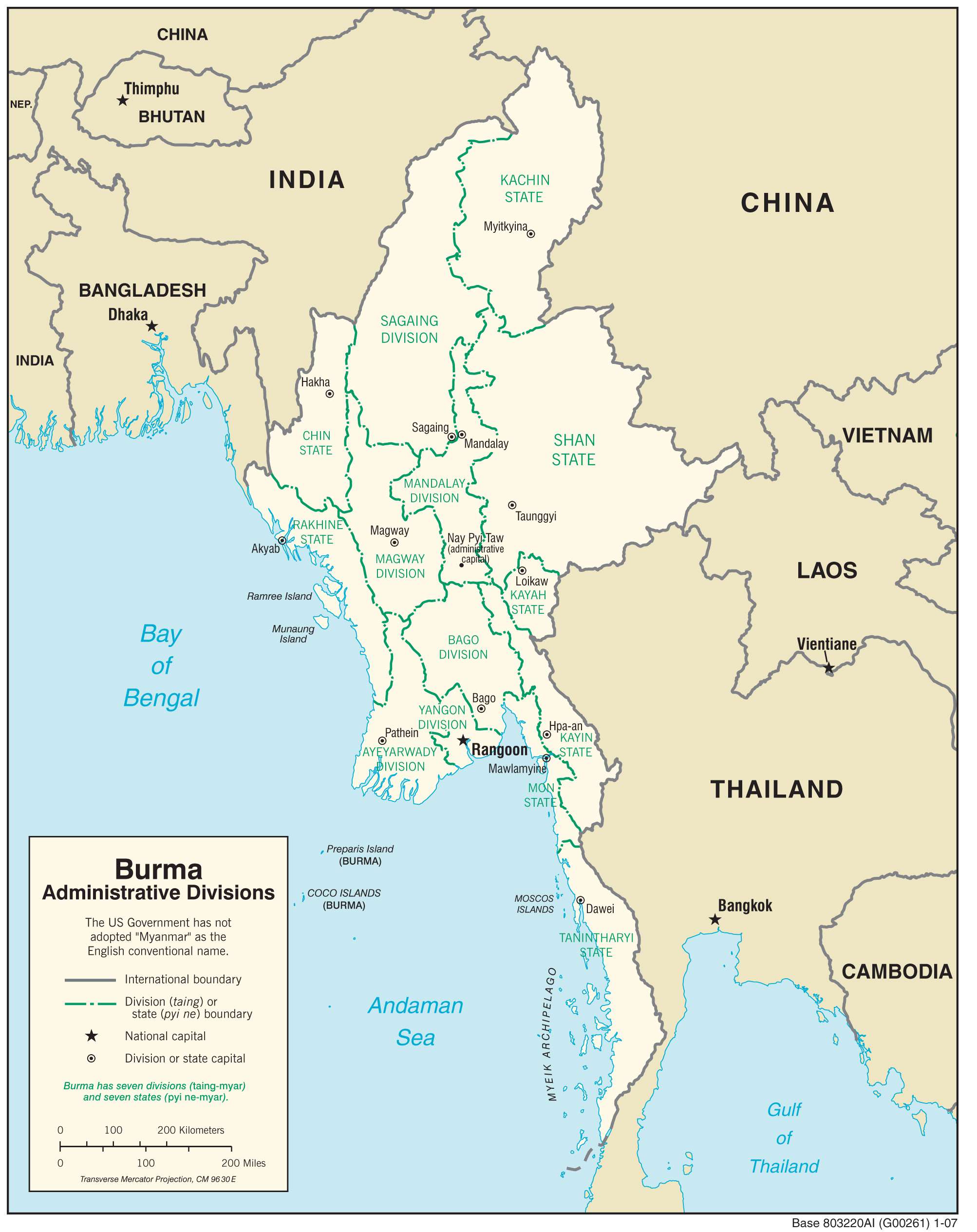
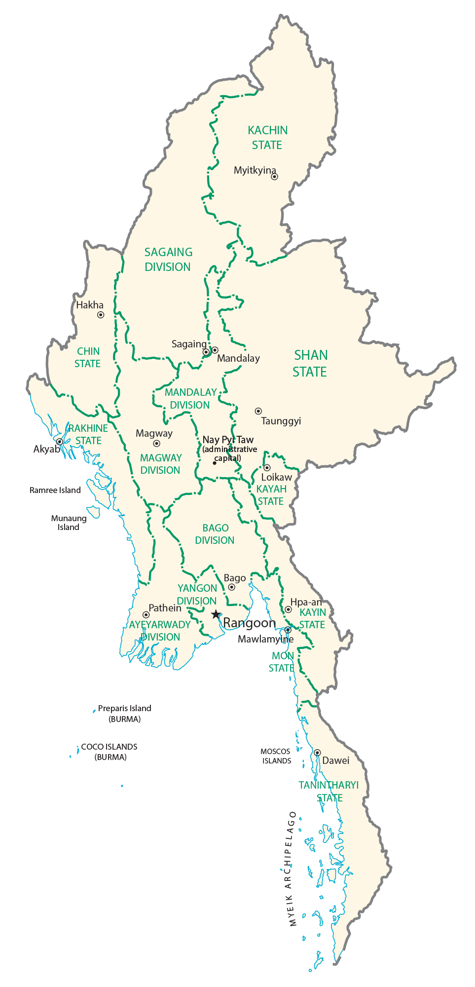
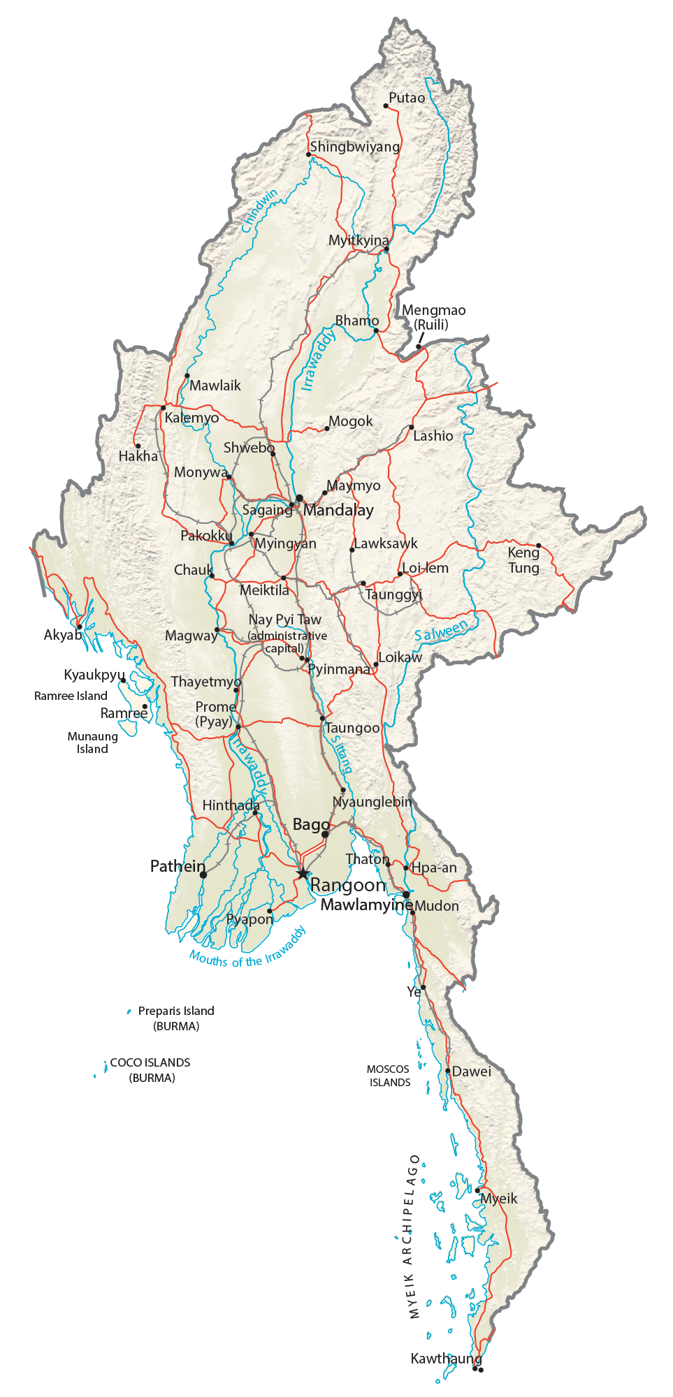
Myanmar (officially, the Republic of the Union of Myanmar) is divided into 7 regions (taing), 7 states (pyine) and 1 union territory. In alphabetical order, the regions of Myanmar are: Ayeyarwady (Irrawaddy), Bago, Magway, Mandalay, Sagaing, Tanintharyi and Yangon (Rangoon). The states are: Chin, Kachin, Kayah, Kayin, Mon, Rakhine and Shan. Nay Pyi Taw (Naypyidaw) is the union territory in Myanmar.
With an area of 676,578 sq. km, Myanmar is the 10th largest country in the Asian continent and the largest country in Southeast Asia. Located in a mountain-framed spot in north-central Myanmar is Naypyidaw – the capital and the third-largest city of Myanmar. Located in southern Myanmar, Yangon (Rangoon) is the largest city of Myanmar. With over a population of 5 million people, Yangon is the most populous city as well as an important commercial center of Myanmar.
Location Maps
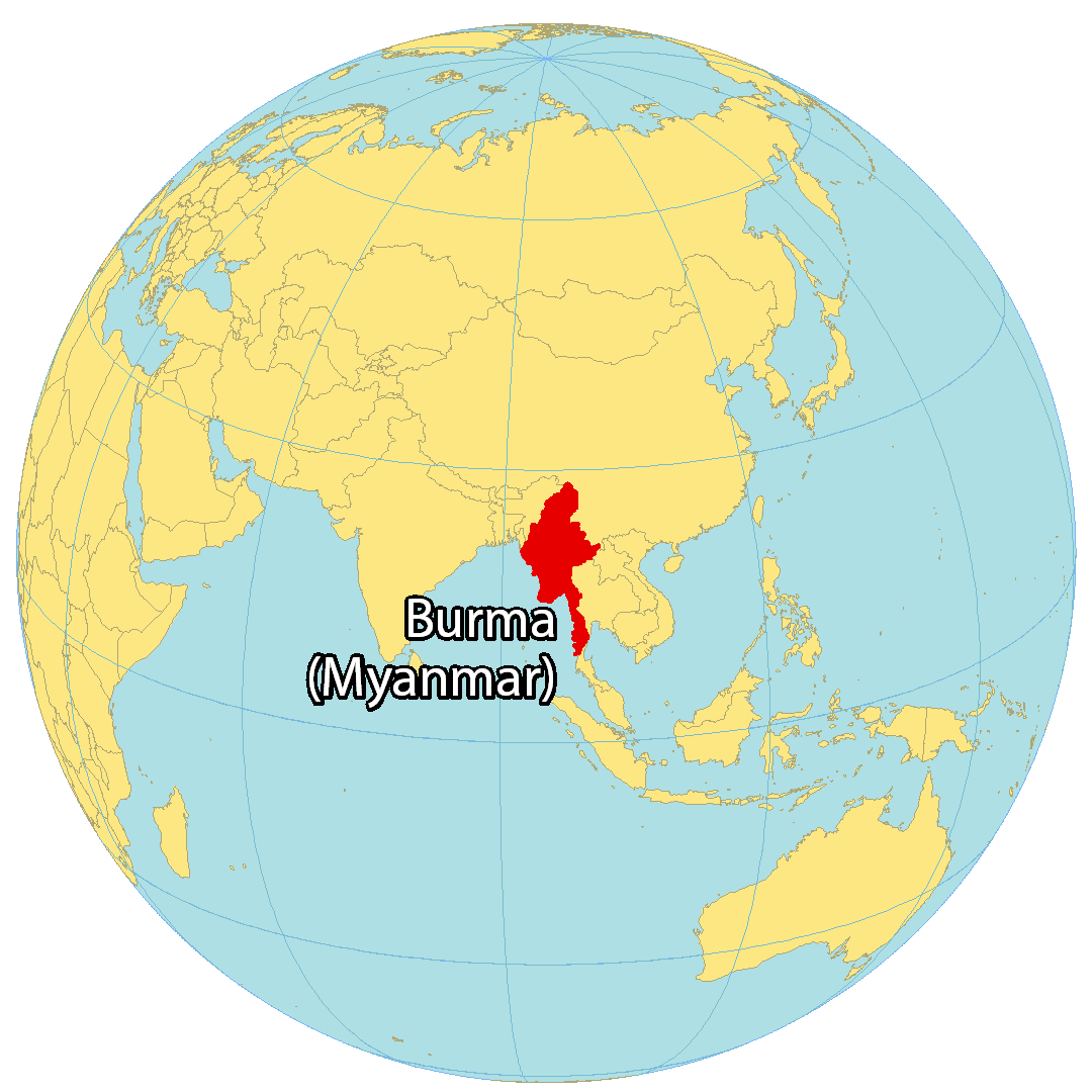
Where is Myanmar?
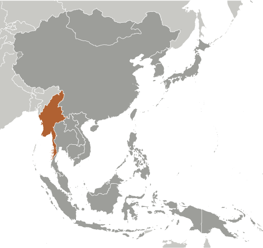
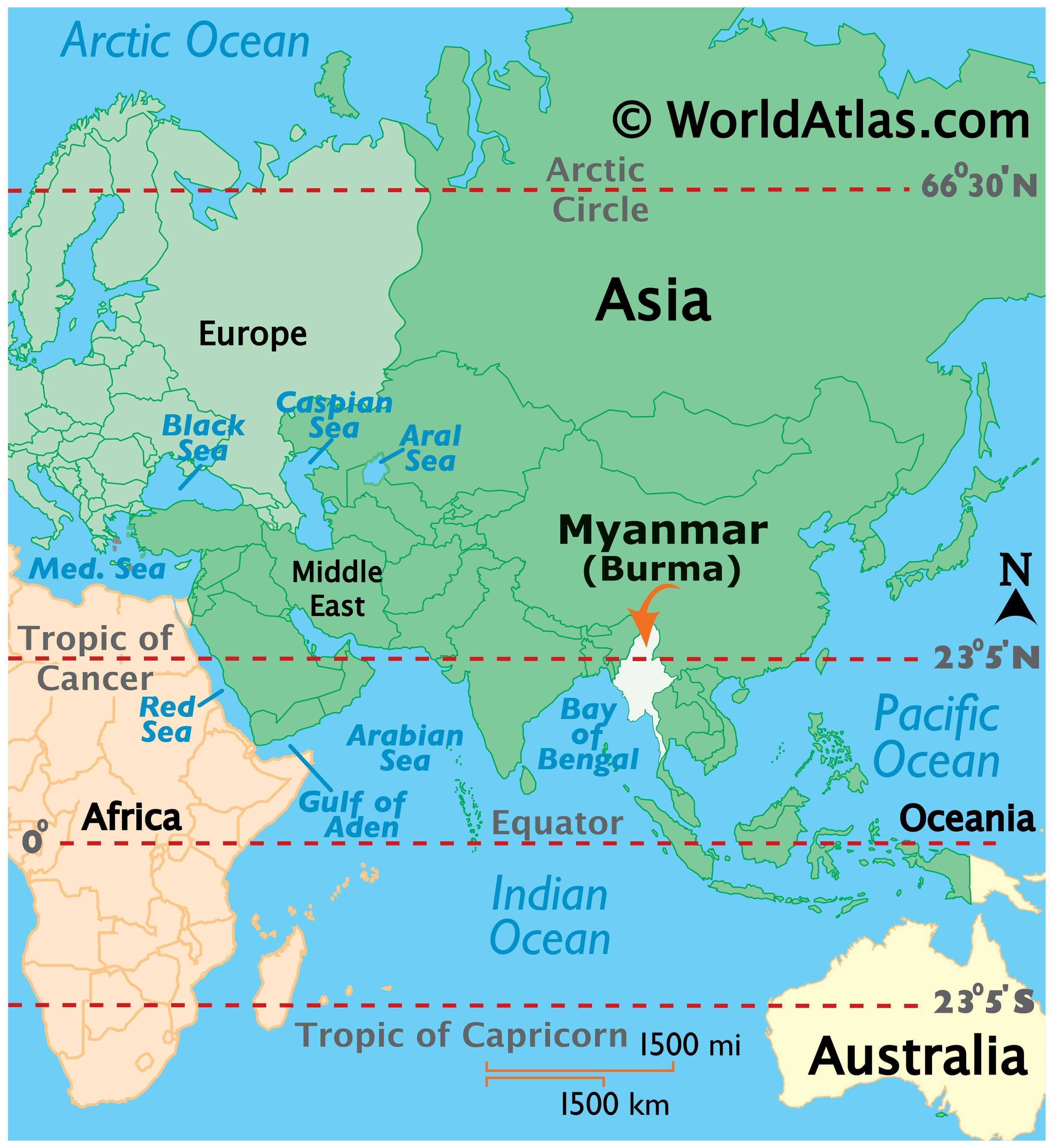
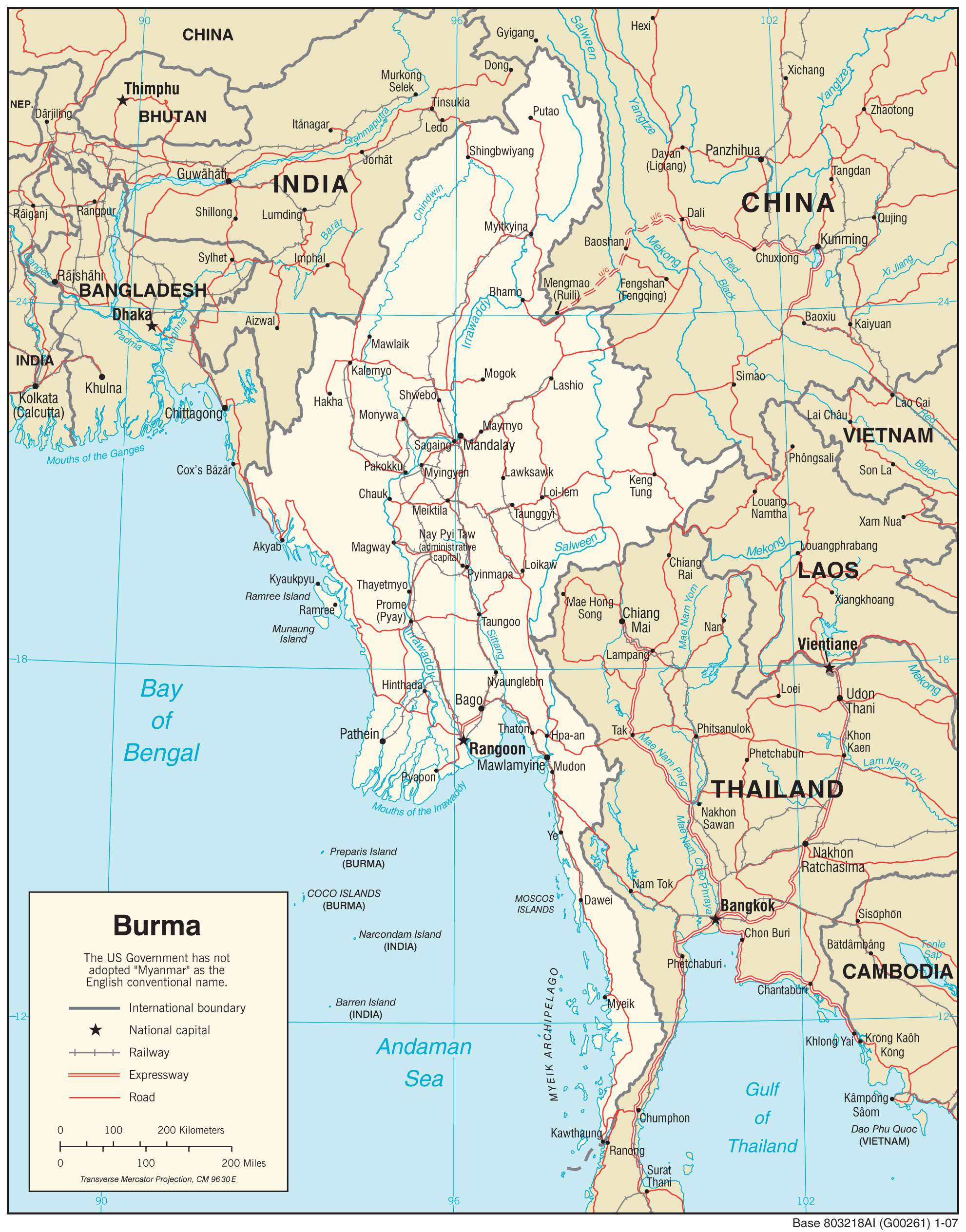
Myanmar is a country situated in Southeastern Asia, bordering 5 other countries – China to the northeast, Laos and Thailand to the southeast, and Bangladesh and India to the northwest. It also has a 1,930 km (1,200 mi) long coastline with the Andaman Sea and the Bay of Bengal. The capital of Myanmar is Naypyidaw, while the largest city is Yangon (Rangoon), followed by Mandalay. The country has a total area of 676,578 square kilometers (261,228 sq mi), making it the tenth-largest in Asia. It is larger than the area of Afghanistan, but smaller than the size of Turkey. The Mergui Archipelago in the southwest of the Andaman Sea is also part of Myanmar.
High Definition Political Map of Myanmar
Myanmar Administrative Map
Physical Map of Myanmar

Transportation Map of Myanmar
Myanmar Satellite Map