Armenia covers an area of 29,743 sq. km (11,484 sq mi) in Eurasia’s South Caucasus region. It is a landlocked country.
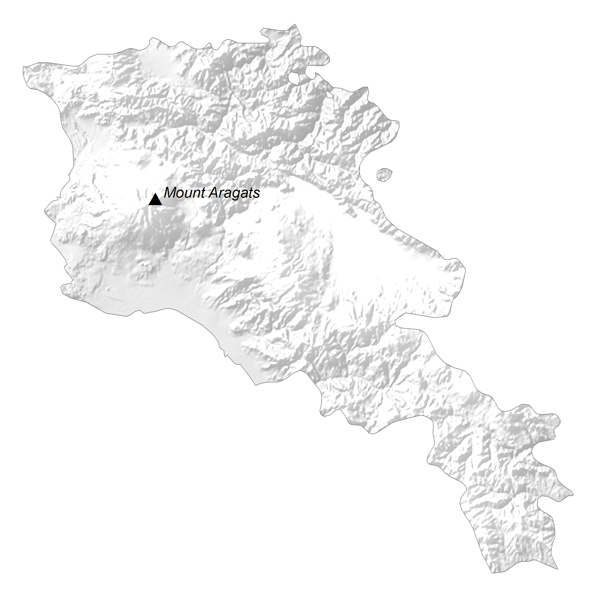
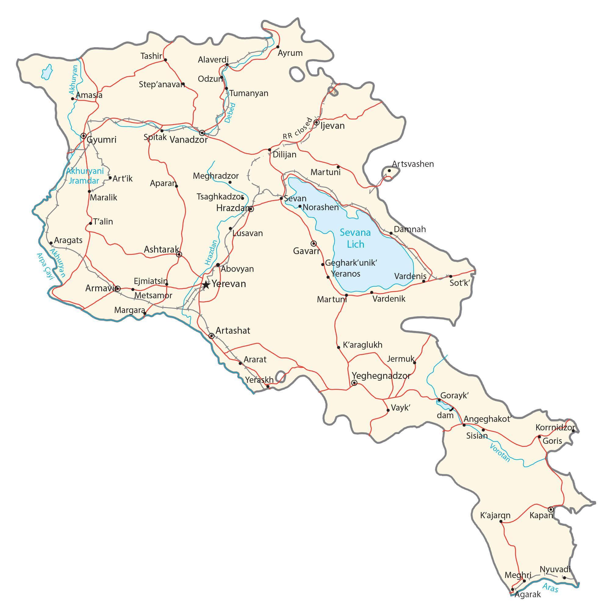
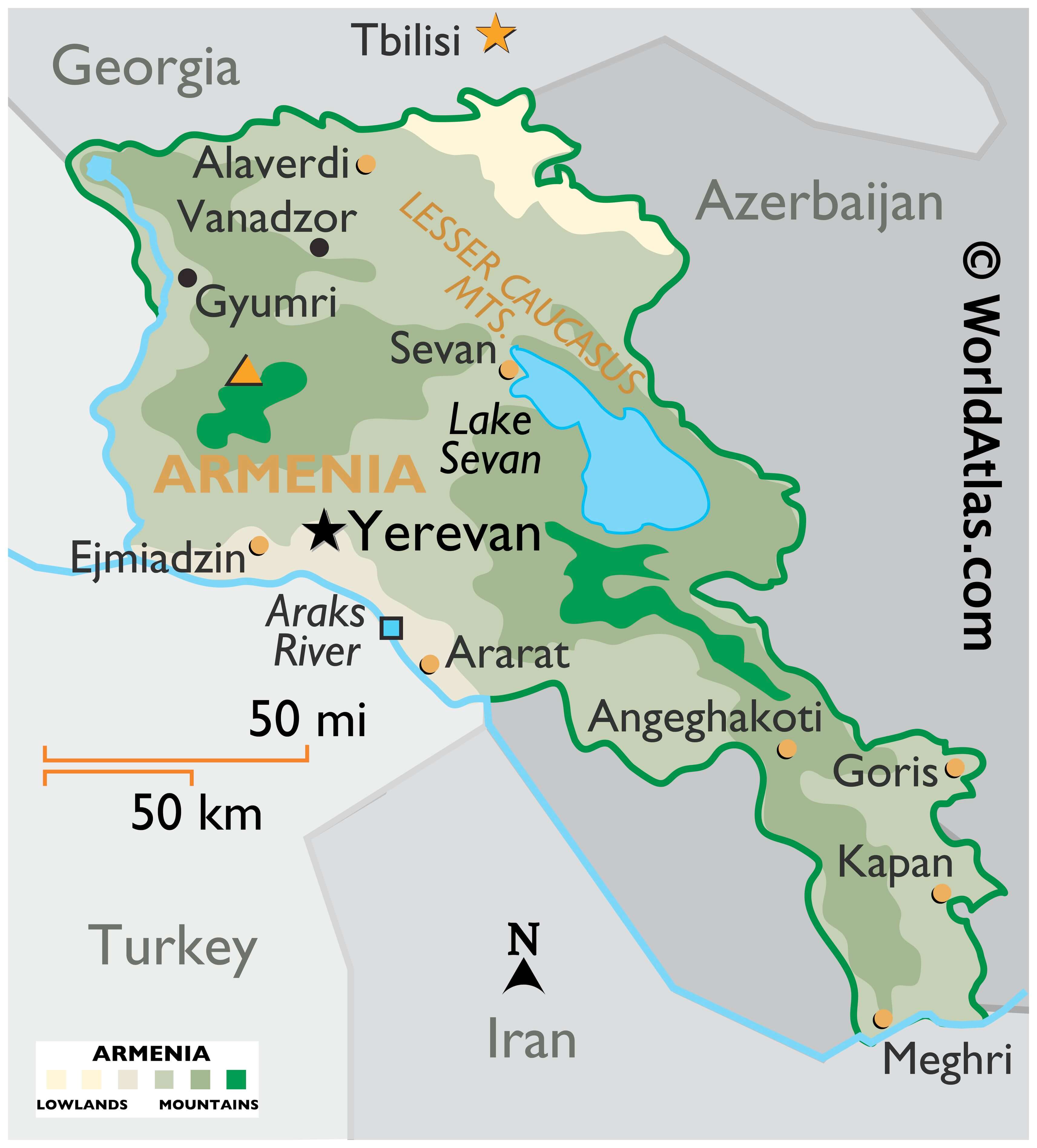
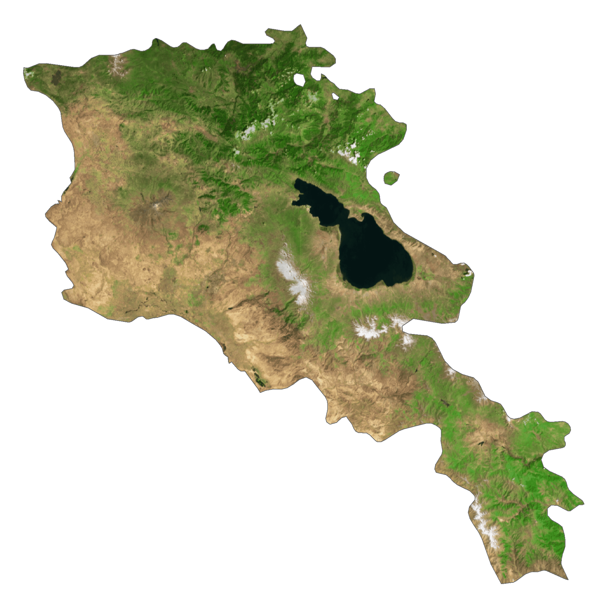
As observed on the physical map of Armenia above, the topography of the country is very rugged and mountainous. Nearly the entire land is covered by the Lesser (or Little) Caucasus Mountains. The highest point is Mt. Aragats at 13,418 ft. (4,090m). A yellow triangle marks the highest point on the map.
Rivers flow fast down through the mountains, and although much of Armenia’s land remains at or above 6,562 ft (2,000 m) at least 3% form the valleys of the Araks and Debet rivers.
Lake Sevan is the largest lake and it sits 6,000 ft, (2,000 m) above sea level. Significant rivers include the Aras, Debet and Razdan.
| Flag: |  |
|---|---|
| Legal Name: | Republic of Armenia |
| Capital Value: | Yerevan |
| Largest City: |
Yerevan (1,086,275) |
| Official languages: | Armenian |
| Demonym(s): | Armenian |
| Government: | Unitary parliamentary republic |
| Legislature: | National Assembly |
| Total Area: | 29,743 km² |
| Land Area: | 28,203 km² |
| Water Area: | 1,540 km² |
| Population: | 2,957,731 |
| Density: | 101.5/km (262.9/sq mi) |
| GDP: | $13.67 Billion |
| GDP Per Capita: | $4,622.73 |
| Currency Value: | Drams (AMD) |
| Driving side: | right |
| Calling code: | +374 |
| Internet TLD: |
|
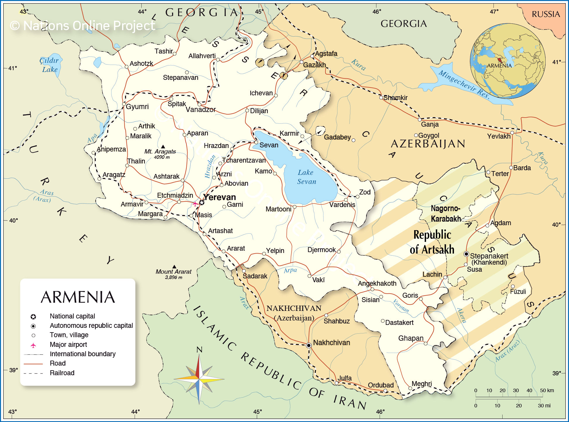
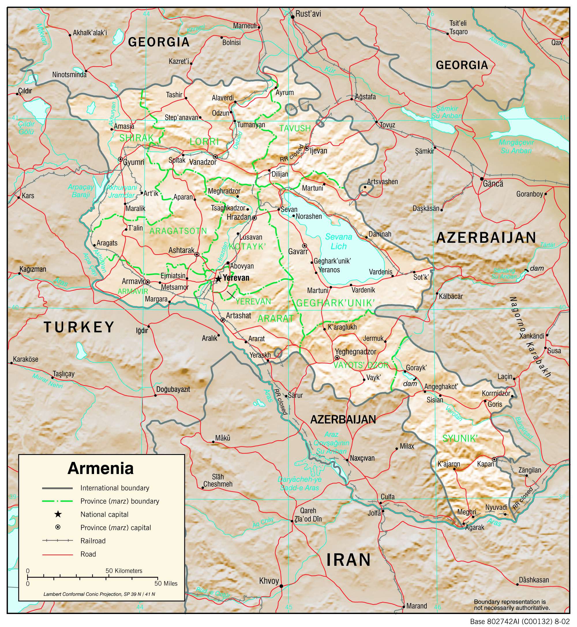
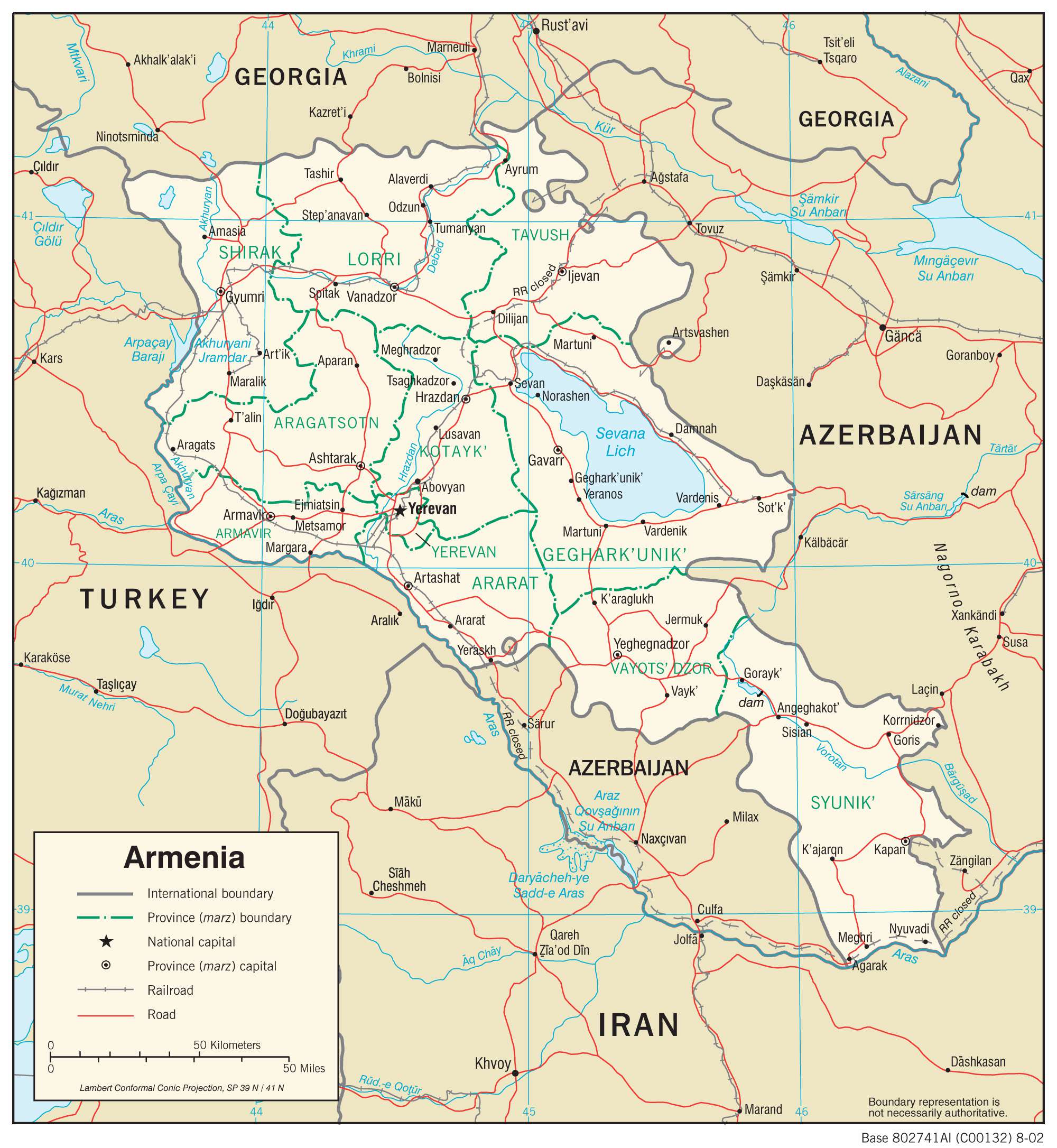
Armenia is a country situated in both Europe and Western Asia, known for its mountainous terrain and stunning landscapes. The Lesser Caucasus Mountains, or Armenian Highlands, are particularly prominent, and satellite imagery and elevation maps give us a great insight into the area. This map of Armenia shows cities, towns, rivers, and highways, giving us a detailed overview of the country.
Online Interactive Political Map
Click on ![]() to view map in "full screen" mode.
to view map in "full screen" mode.
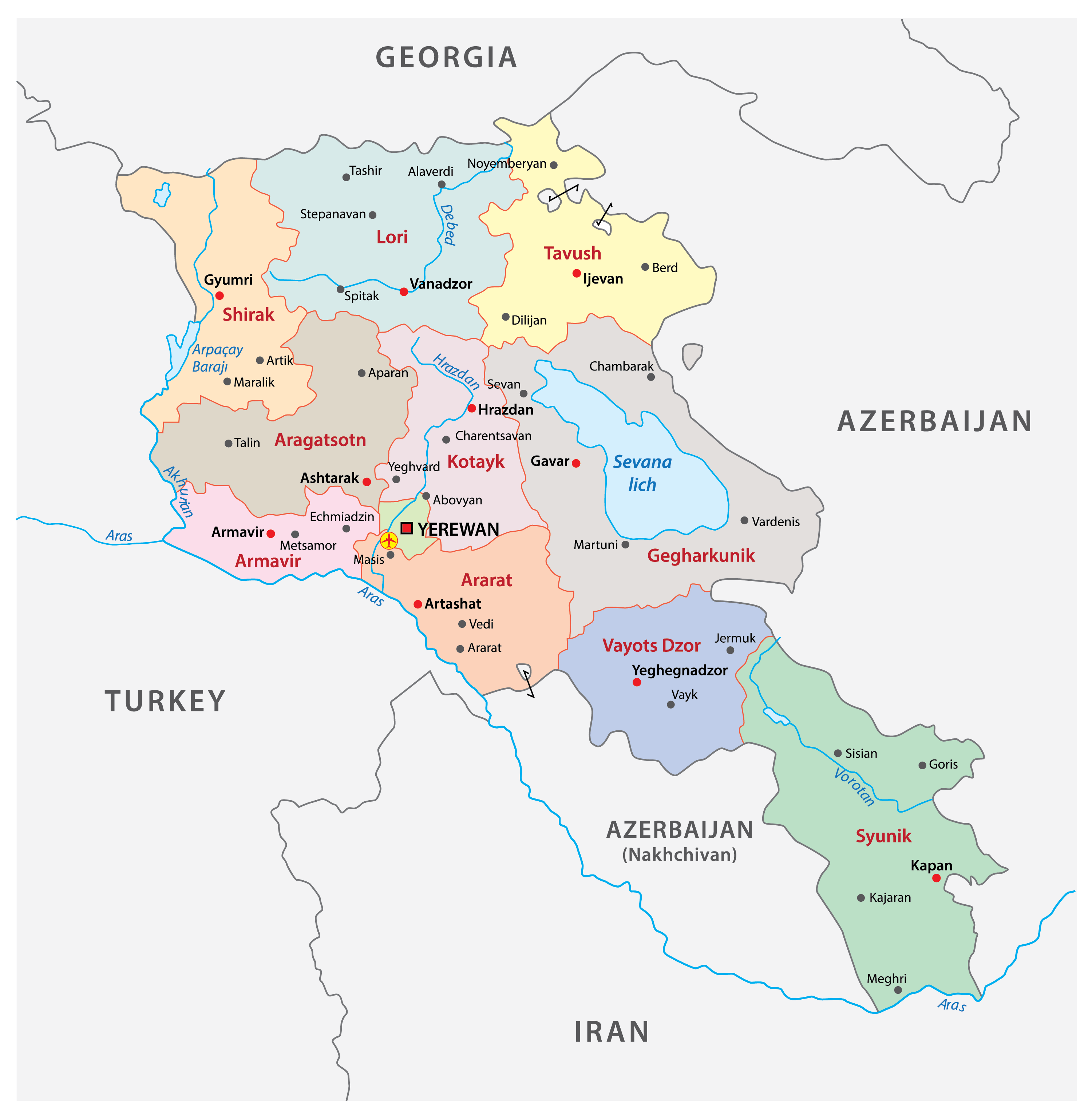
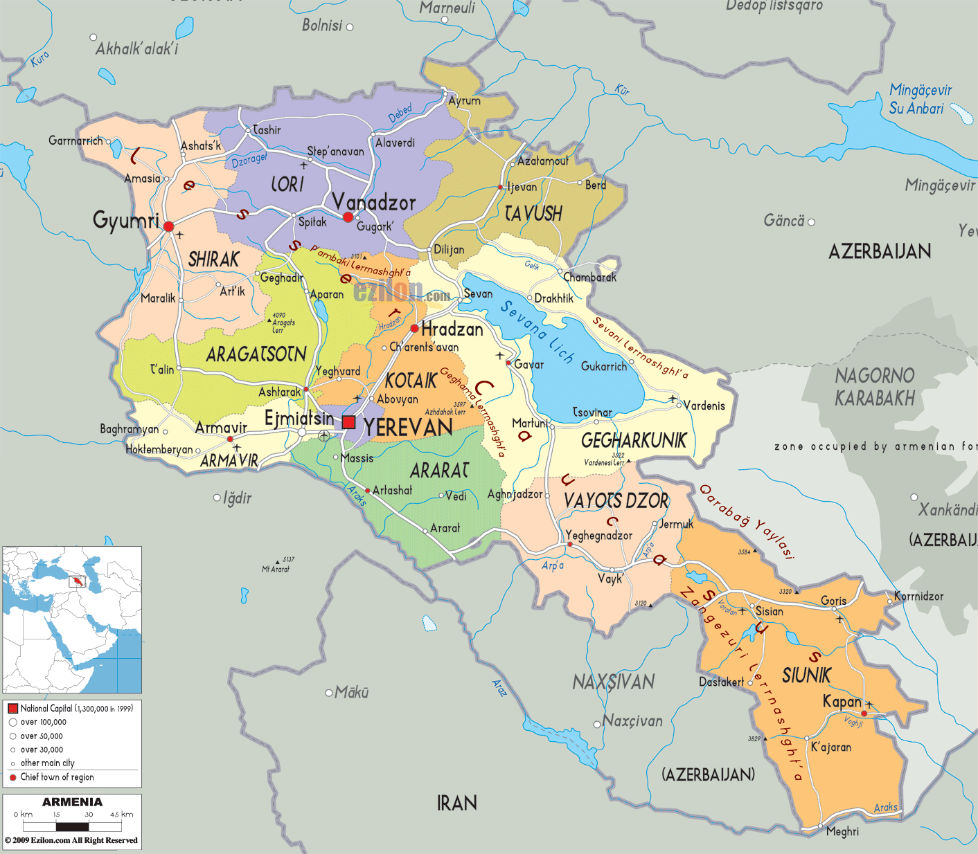
Armenia (officially, the Republic of Armenia) is divided into 11 provinces (marzer, sing. marz). In alphabetical order, these provinces are: Aragatsotn, Ararat, Armavir, Geghark’unik’, Kotayk’, Lorri, Shirak, Syunik’, Tavush, Vayots’Dzor and Yerevan. The Yerevan province has been granted special administrative status. The provinces are further subdivided into municipal communities.
Located at the center –west part of the country, along the Hrazdan River is, Yerevan – the capital and largest city of Armenia. It is also the political, cultural and economic center of Armenia.
Location Maps
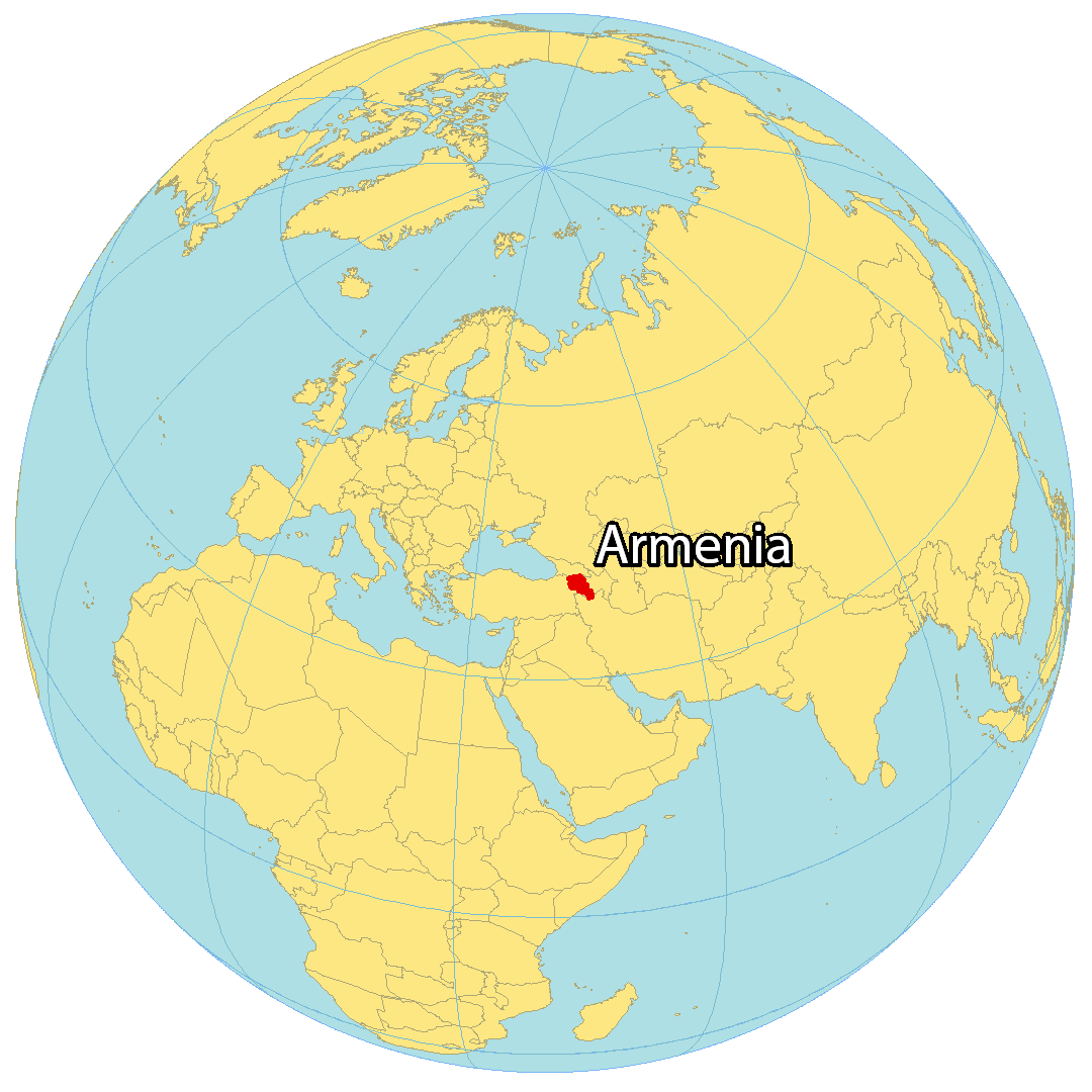
Where is Armenia?
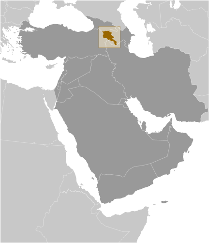
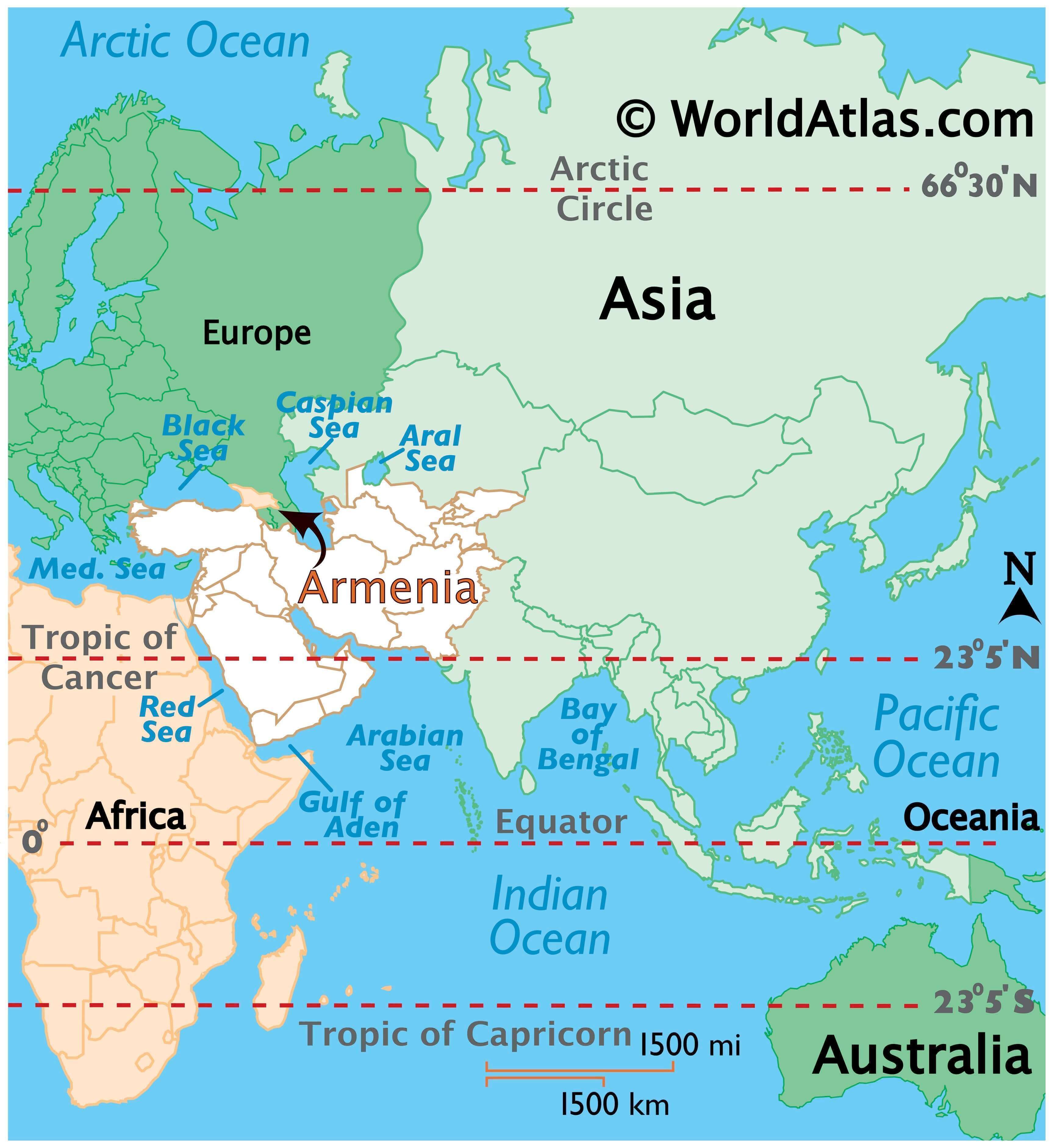
Armenia is a landlocked country situated in the Middle East, though it can also be considered part of Europe geopolitically. Yerevan, the largest city and the capital of Armenia, is surrounded by four countries – Turkey to the east, Azerbaijan to the east, Georgia to the north, and Iran to the south. The Armenia boundary line is one of the most complex in the world today.
The Nakhchivan Autonomous Republic is an exclave of Azerbaijan that borders Armenia to the southwest. Armenia claims two other enclaves within Azerbaijan – Artsvashen and Nagorno–Karabakh. On the other hand, Azerbaijan has four enclaves within Armenia, which are Yukhari Askipara, Yaradullu, Barxudarli, and Karki.
High Definition Political Map of Armenia
Physical Map of Armenia

Transportation Map of Armenia
Armenia Satellite Map
Elevation Map