With an area of 65,300 sq. km, a population of about 2.8 million people, Lithuania is the largest and the most populous of the three Baltic Republics.
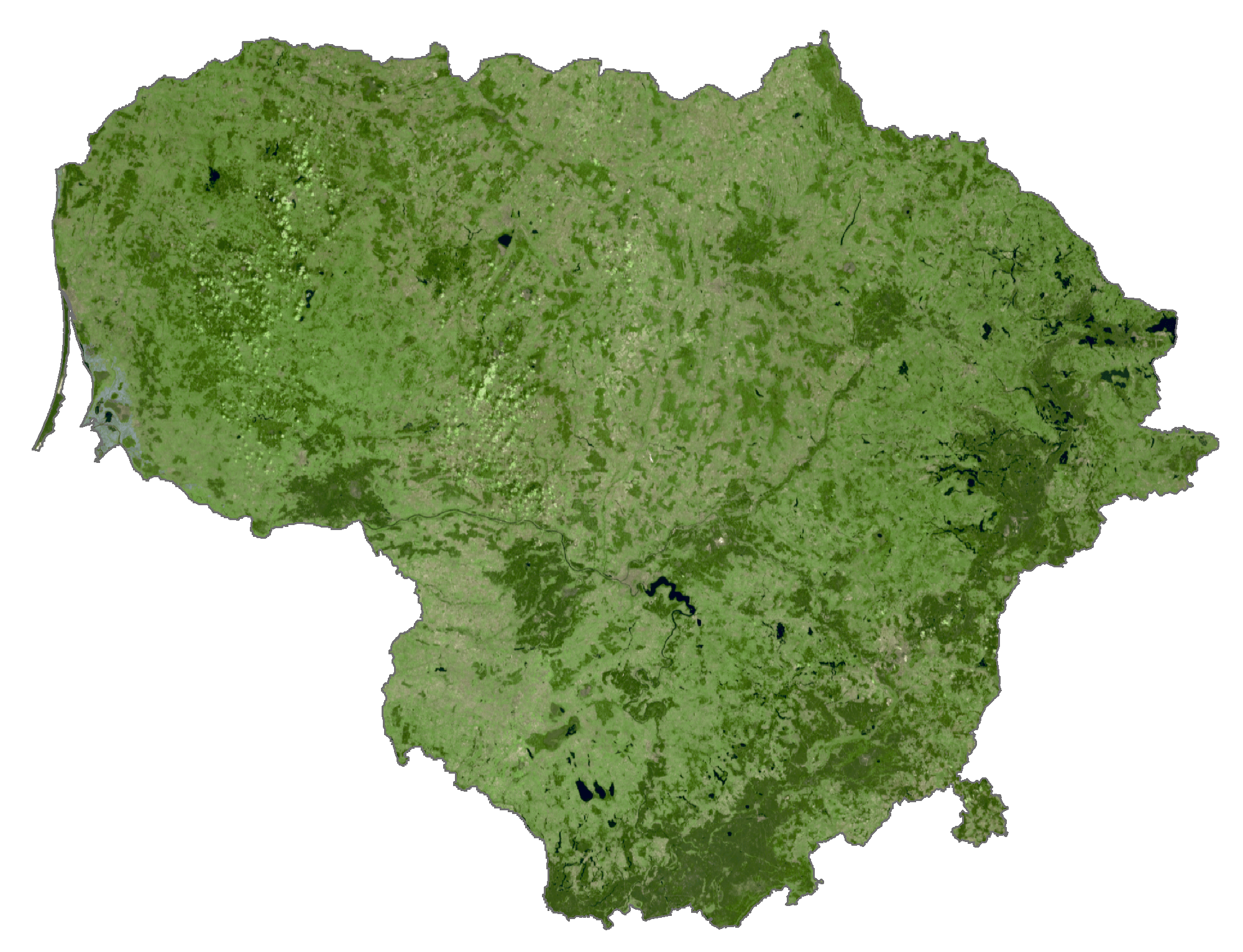
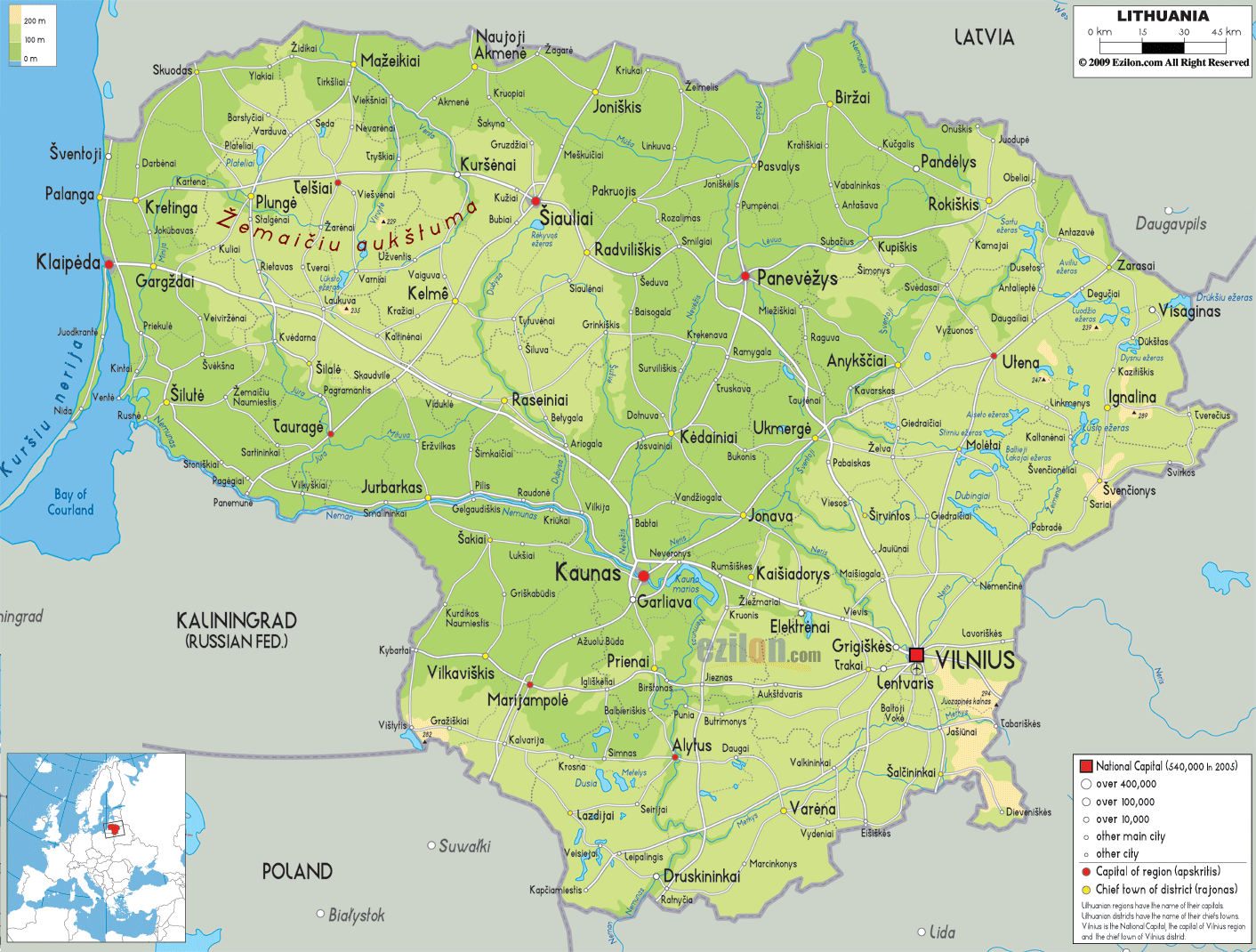
Smoothed by glacier retreat during the last Ice Age, Lithuania is mostly flat lowlands in the west, with some low hills.
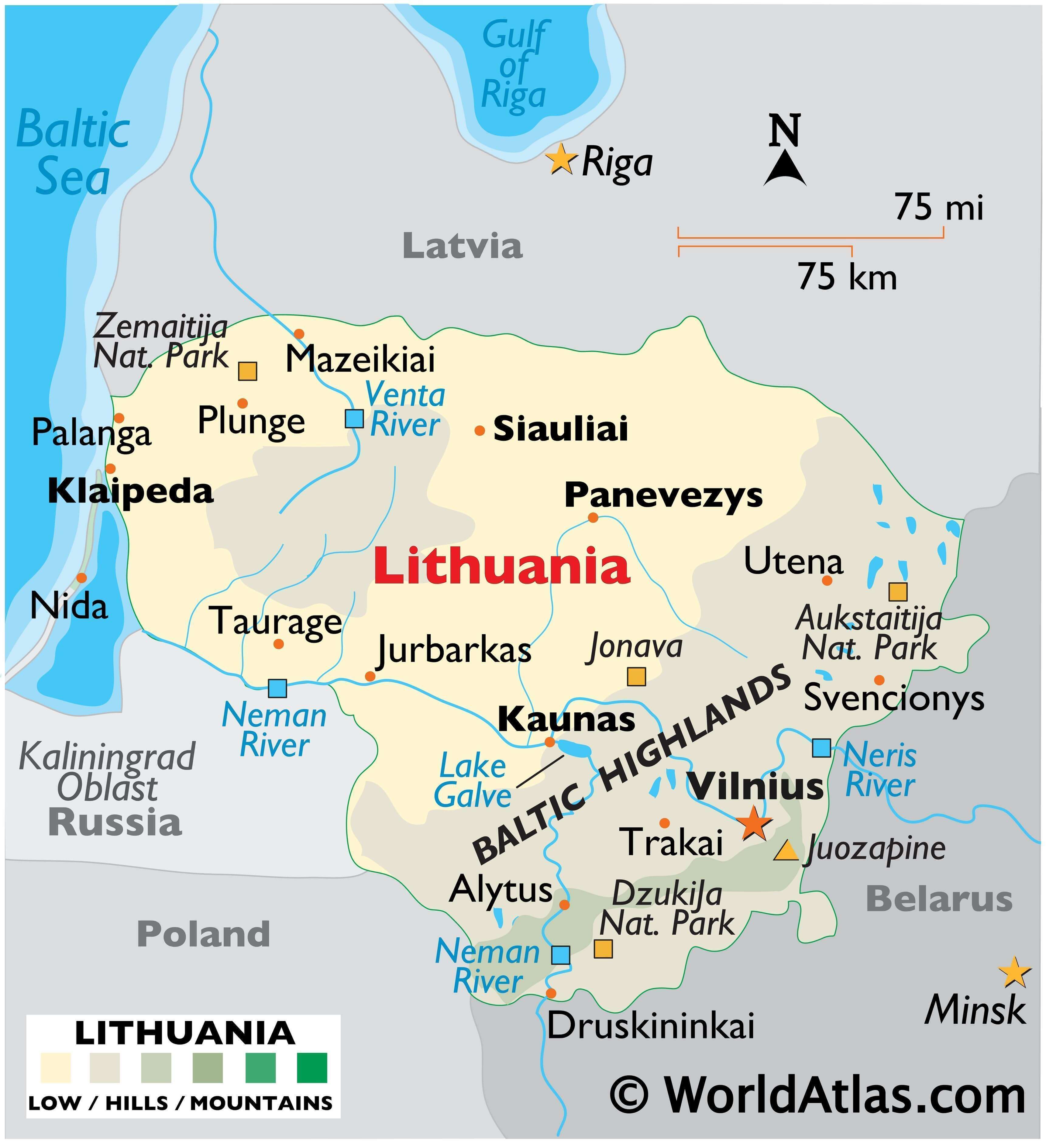
In the east and southeast, bogs, numerous small lakes, and the rolling hills of the Baltic Highlands dominate the landscape, where much of the land is covered by dense forest.
Its highest point is near the Belarus border where the Juozapine stands at 964 ft. (294m).
Important rivers include the Neman (Nemunas), Neris and Venta.
In the west along the Baltic Sea the shallow Curonian Lagoon extends south to Kaliningrad.
| Flag: |  |
|---|---|
| Legal Name: | Republic of Lithuania |
| Capital Value: | Vilnius |
| Largest City: |
Vilnius (538,894) |
| Official languages: | Lithuanian |
| Demonym(s): | Lithuanian |
| Government: | Unitary semi-presidential republic |
| Legislature: | Seimas |
| Total Area: | 65,300 km² |
| Land Area: | 62,680 km² |
| Water Area: | 2,620 km² |
| Population: | 2,786,844 |
| Density: | 43/km (111.4/sq mi) (138th) |
| GDP: | $54.22 Billion |
| GDP Per Capita: | $19,455.45 |
| Currency Value: | Litai (LTL) |
| Driving side: | right |
| Calling code: | +370 |
| Internet TLD: | .lt |
Lithuania is a beautiful country located in Eastern Europe, bordered by Latvia, Belarus, and Poland. It is a land of rolling hills, lush forests, and majestic lakes. With its diverse topography, it is easy to see why Lithuania is often referred to as the “Land of Lakes”.
Discover the beauty of Lithuania with this interactive map. It features its major cities, towns, roads, lakes, and rivers. Satellite imagery and an elevation map display its low-lying topography and its highland areas. Explore the different regions of the country and learn more about its history, culture, and attractions.
The map of Lithuania is the perfect way to explore this amazing country and plan your next vacation. Whether you are looking for a peaceful getaway or an adventure-filled journey, this map will help you find the best places to visit.
Explore Lithuania with this interactive map and discover its major cities, towns, roads, lakes, and rivers. Satellite imagery and an elevation map display its low-lying topography and its highland areas. Find the perfect spot to enjoy the beauty of Lithuania and plan your next vacation.
Online Interactive Political Map
Click on ![]() to view map in "full screen" mode.
to view map in "full screen" mode.
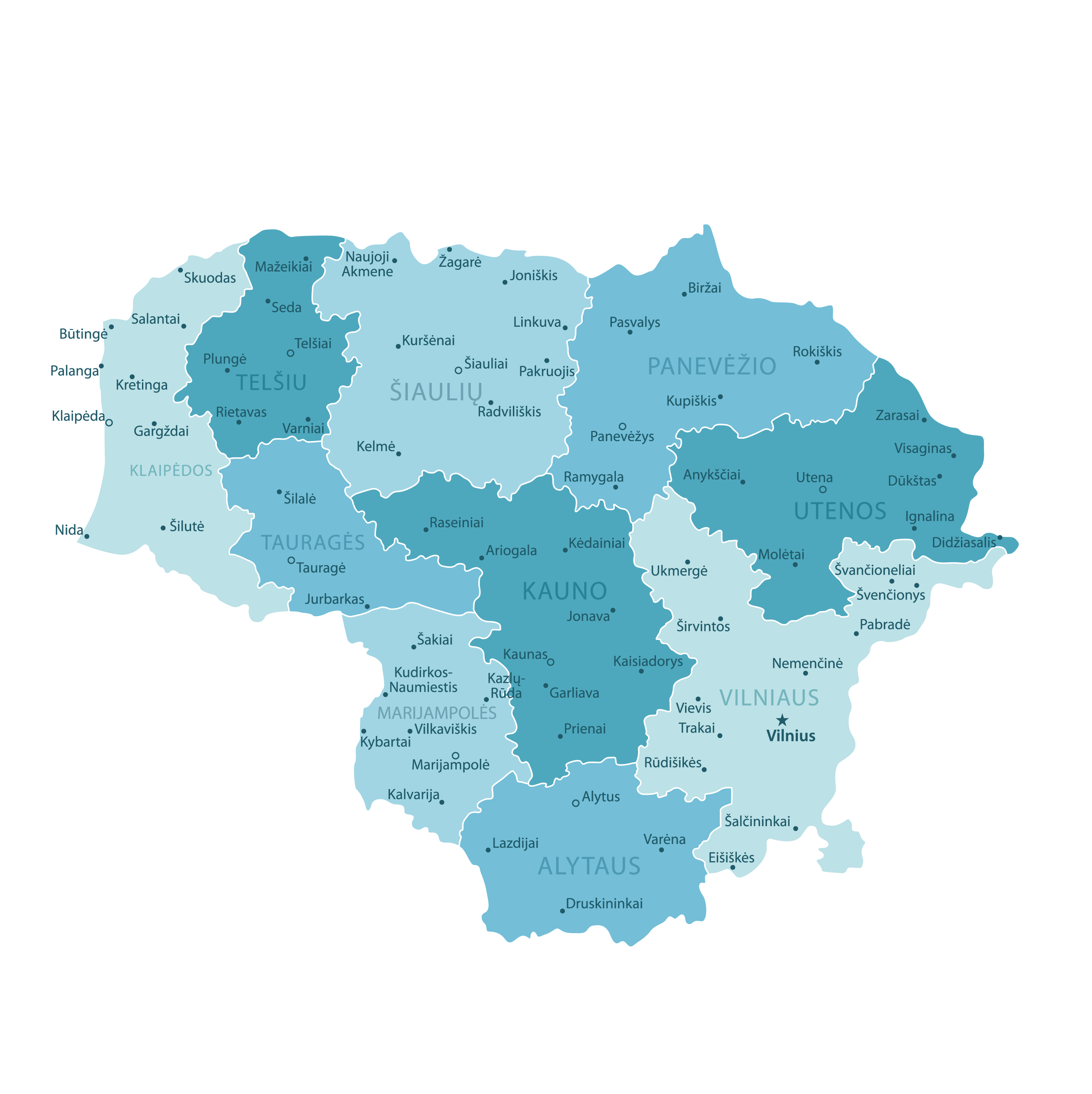
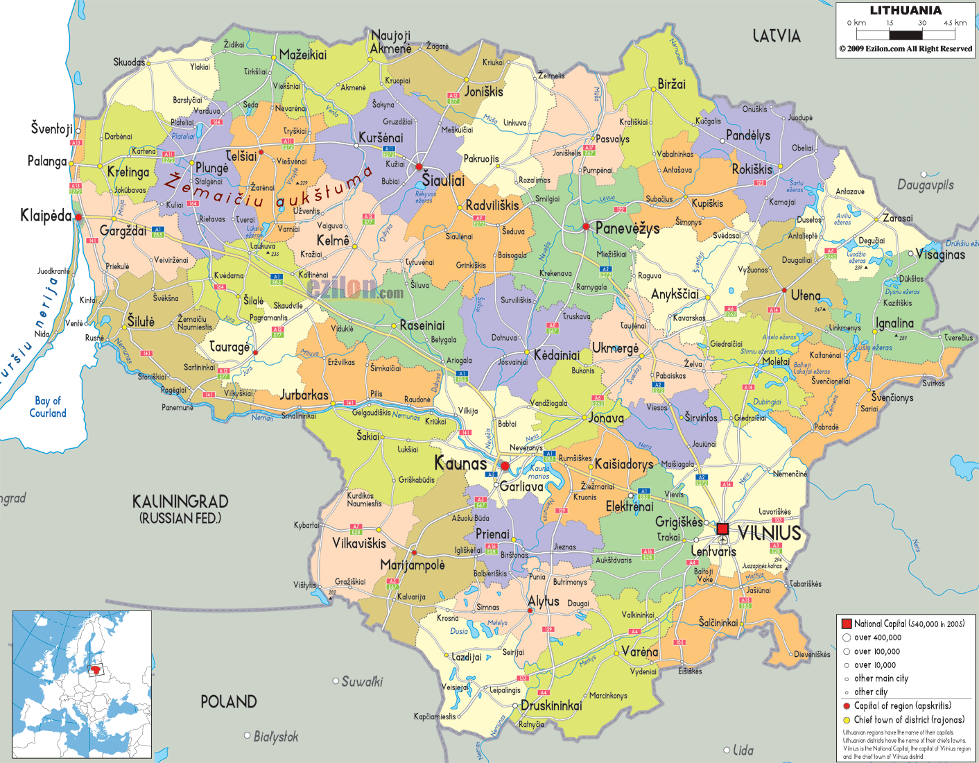
Although Lithuania was initially divided into 10 counties but the counties were abolished in 2010. They are currently used only for statistical and reporting purposes. The map above shows the county divisions with the 60 municipalities. The latter are the first level administrative division in the country.
In alphabetical order, these municipalities are: Akmene, Alytaus Miestas, Alytus, Anksciai, Birstono, Birzai, Druskininkai, Elektrenai, Ignalina, Jonava, Joniskis, Jurbarkas, Kaisiadorys, Kalvarijos, Kauno Miestas, Kaunas, Kazlu Rudos, Kedainiai, Kelme, Klaipedos Miestas, Klaipeda, Kretinga, Kupiskis, Lazdijai, Marijampole, Mazeikiai, Moletai, Neringa, Pagegiai, Pakruojis, Palangos Miestas, Panevezio Miestas, Panevezys, Pasvalys, Plunge, Prienai, Radviliskis, Raseiniai, Rietavo, Rokiskis, Sakiai, Salcininkai, Siauliu Miestas, Siauliai, Silale, Silute, Sirvintos, Skuodas, Svencionys, Taurage, Telsiai, Trakai, Ukmerge, Utena, Varena, Vilkaviskis, Vilniaus Miestas, Vilnius, Visaginas and Zarasai. These municipalities are further subdivided into 500 elderships (seniunija).
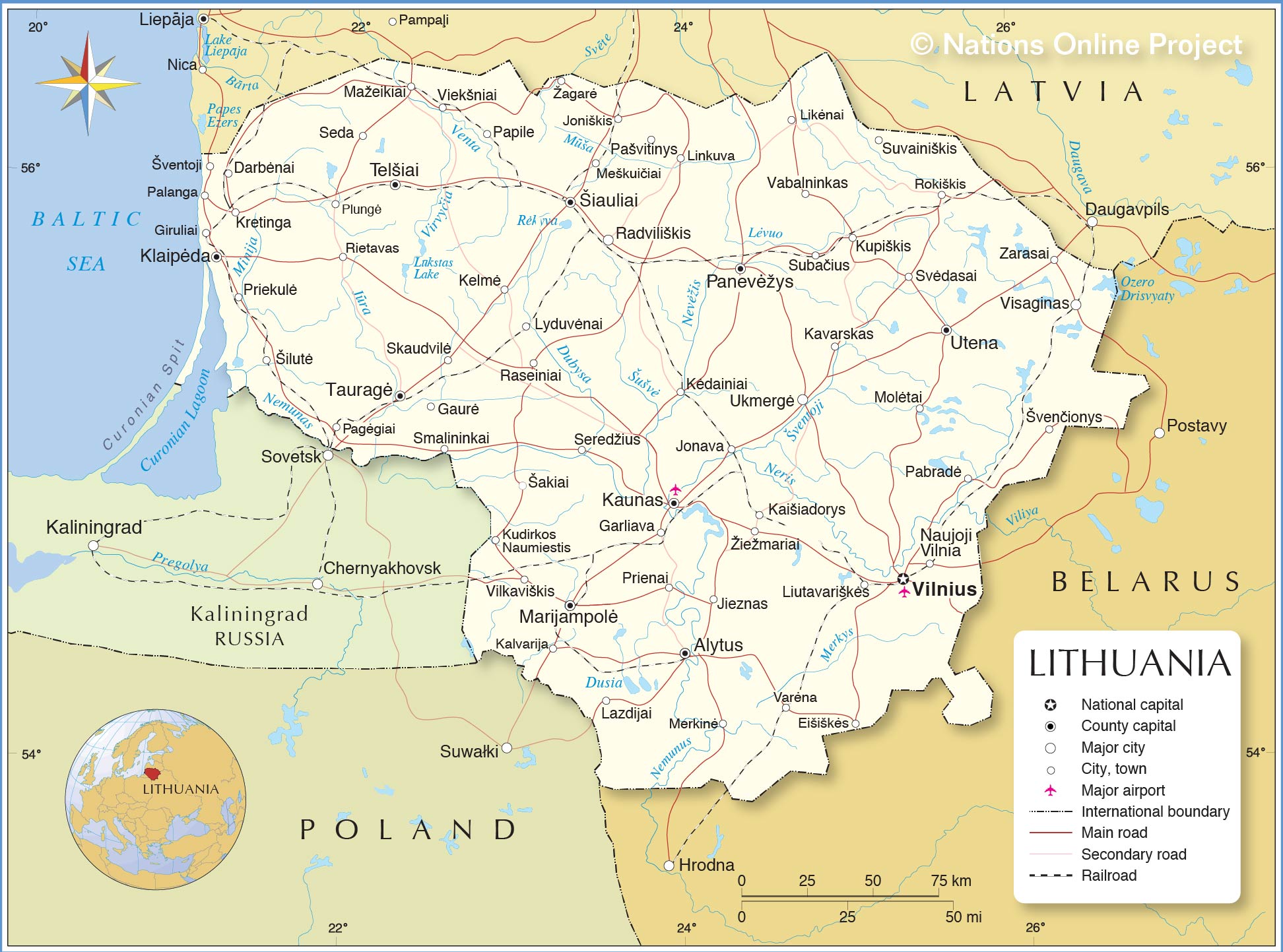
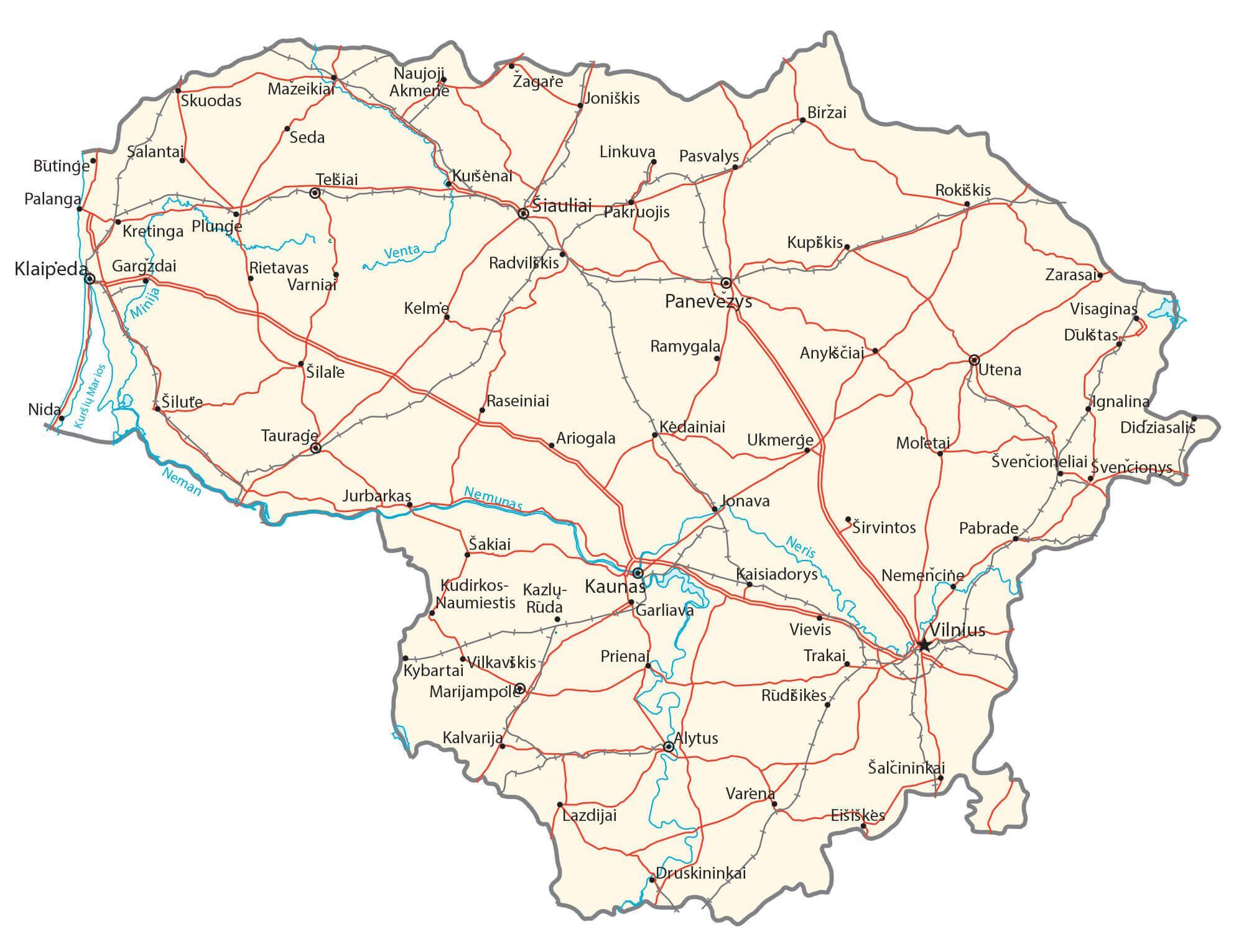
Located in the south eastern part of the country, at the confluence of Neris and Vilnia Rivers, Vilnius is the capital and the largest city of Lithuania. It is also the cultural, administrative and industrial center of Lithuania. Vilnius is the 2nd largest city in the Baltic States.
Location Maps
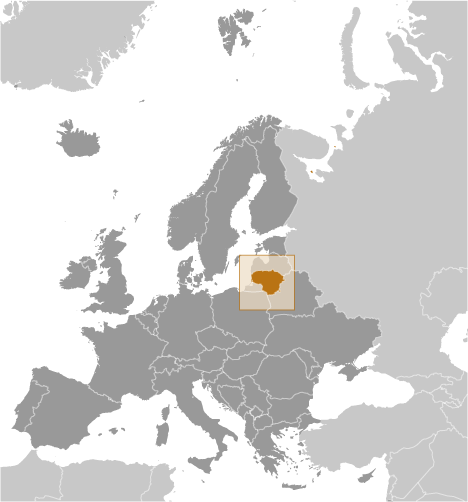
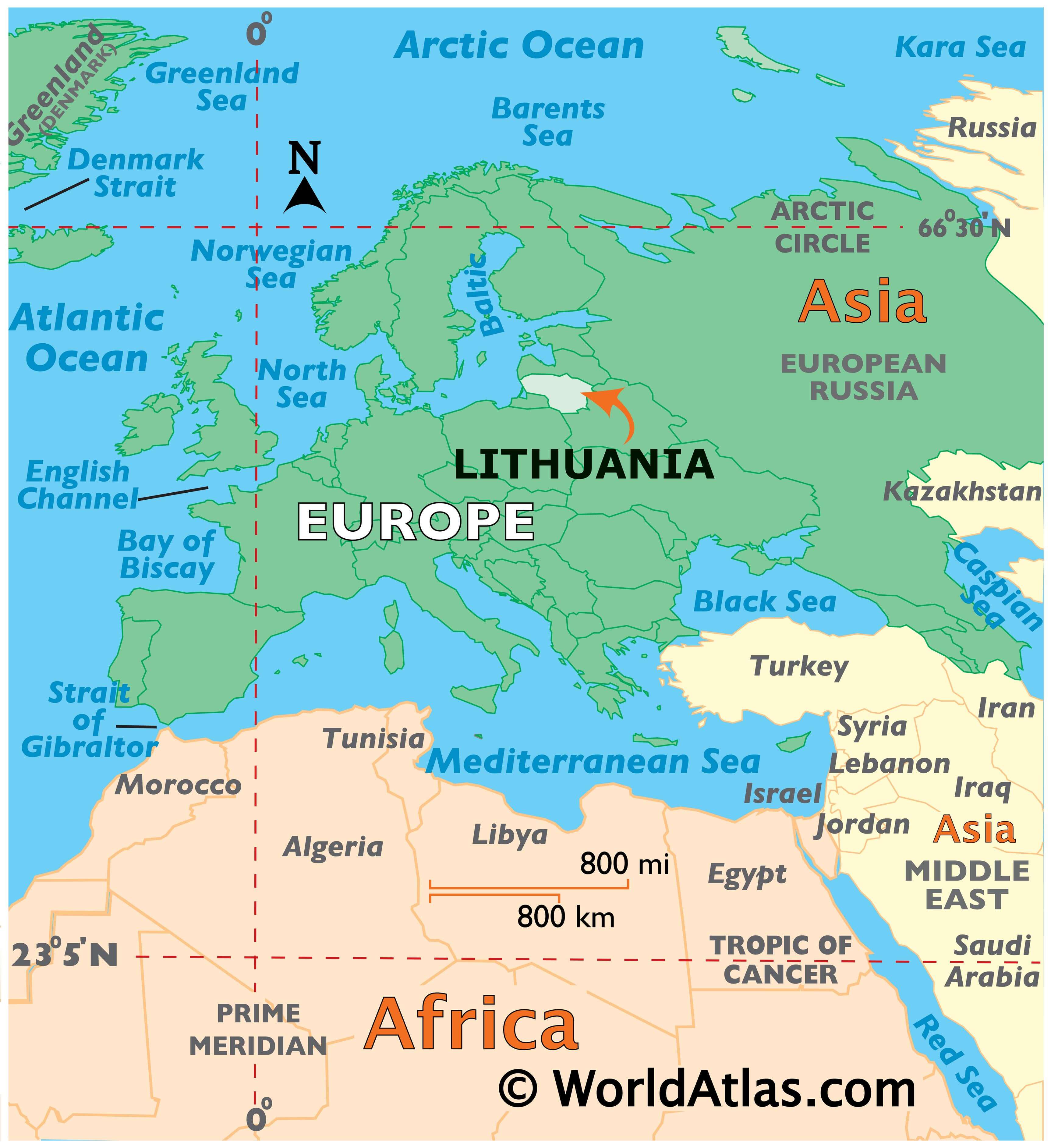
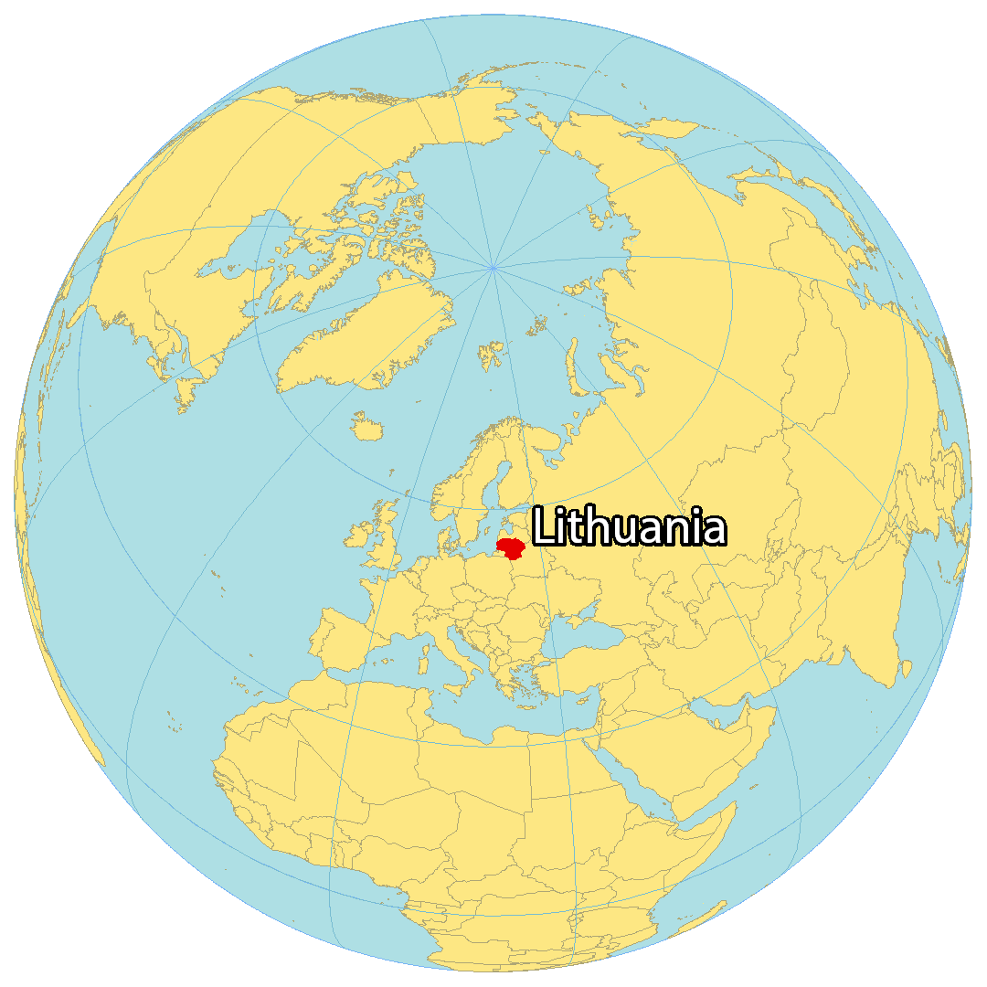
Where is Lithuania?
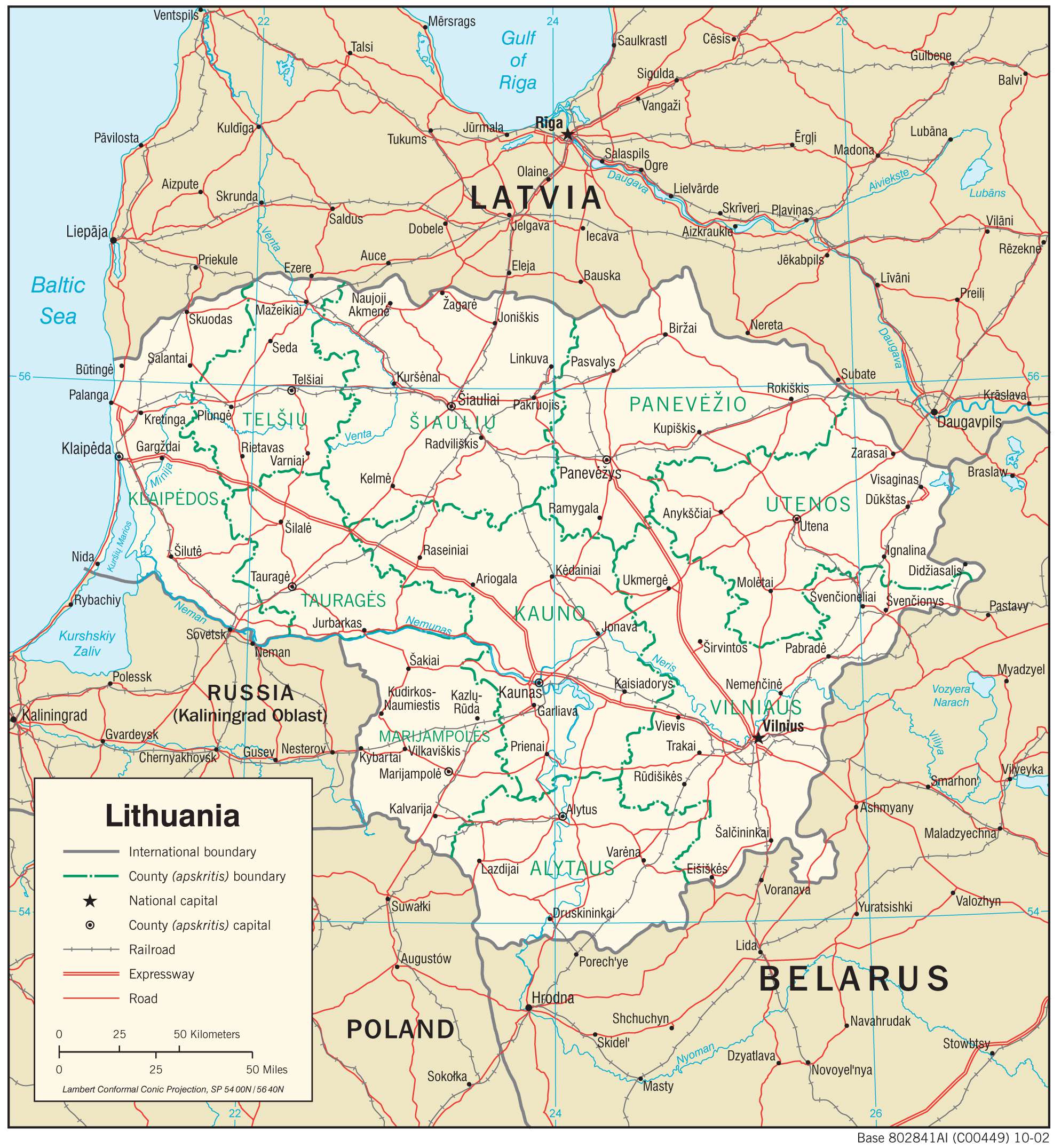
Lithuania is located in Eastern Europe, along the Baltic Sea. It is bordered by Latvia to the north, Belarus to the east and south, Poland to the south, and Russia to the southwest. Its coastline along the Baltic Sea is 92 kilometers (57 mi) in length.
Vilnius is the capital and largest city in Lithuania. Other populated cities include Kaunas, Klaipeda, and Siauliai. Lithuania is known for its nature such as storks, national parks, and its one of the oldest languages. Geographers consider Lithuania to be positioned in the geographical center of Europe, although this is still contested.
High Definition Political Map of Lithuania
Physical Map of Lithuania
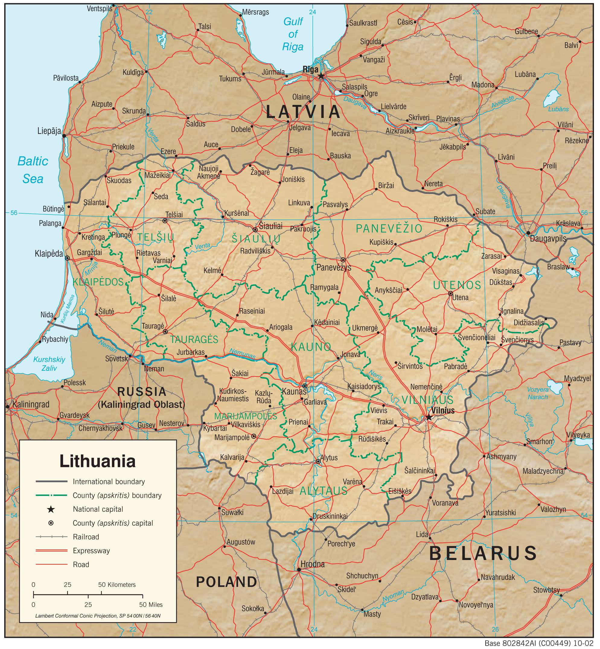
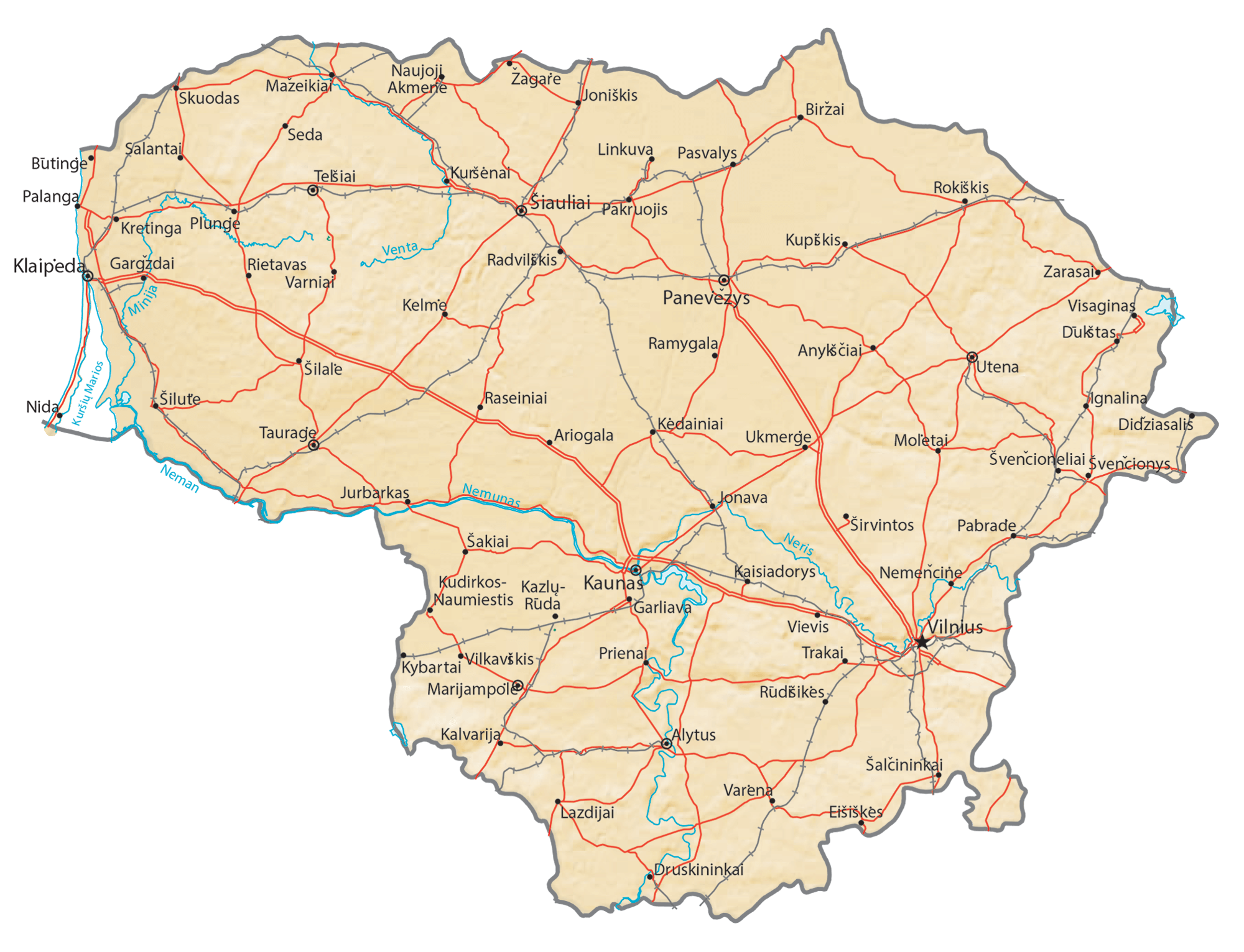
Transportation Map of Lithuania
Lithuania Satellite Map