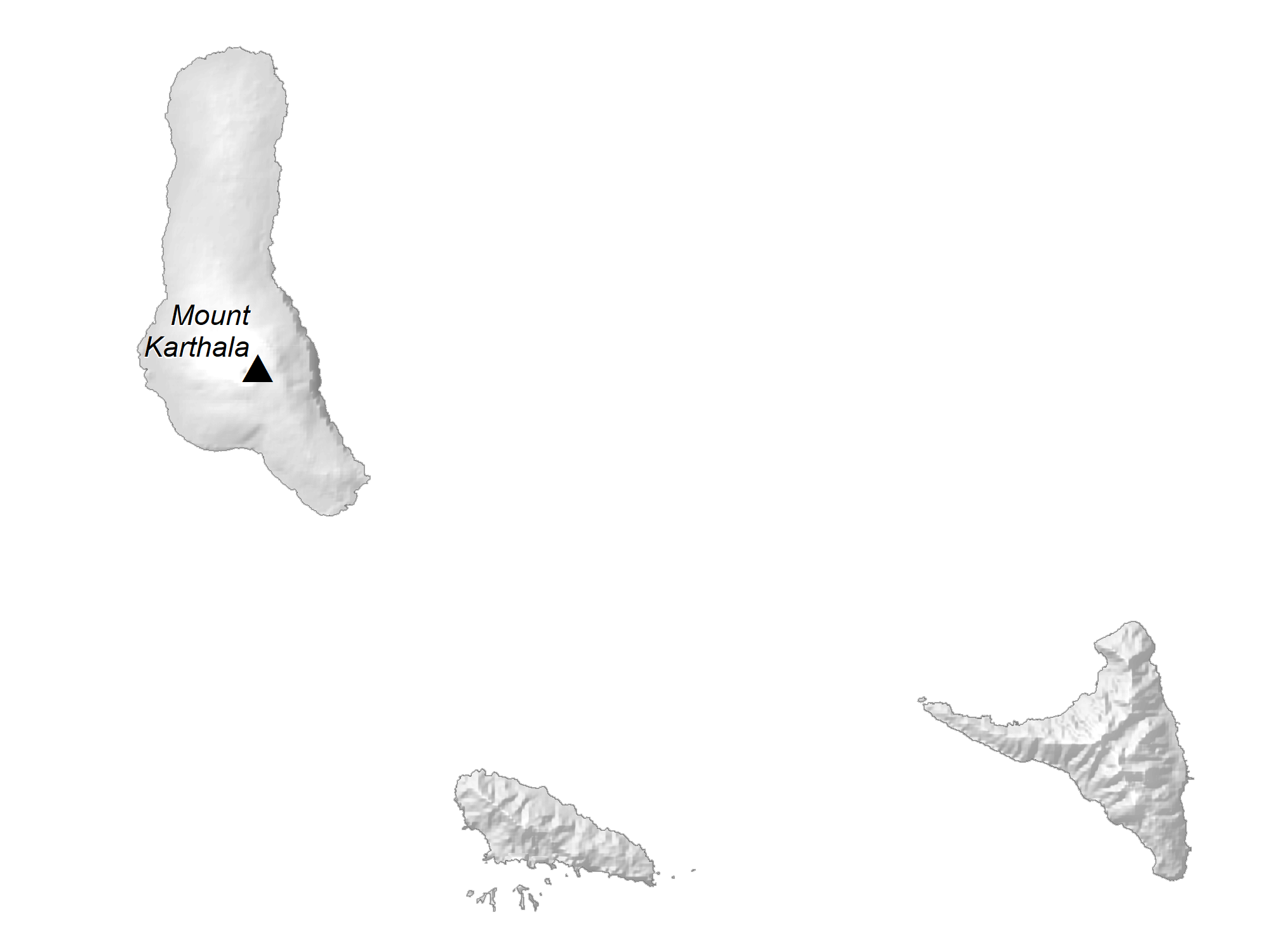
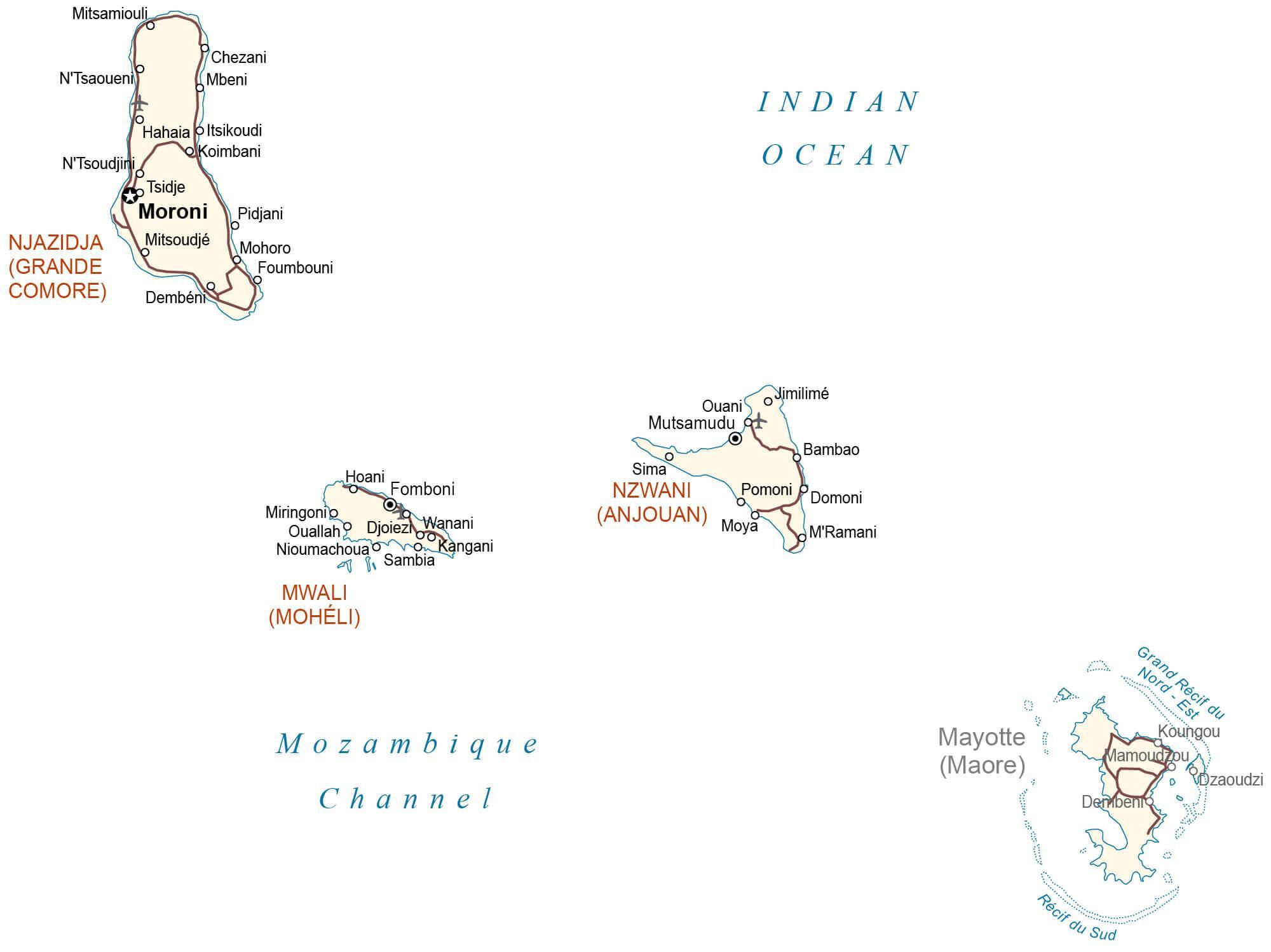
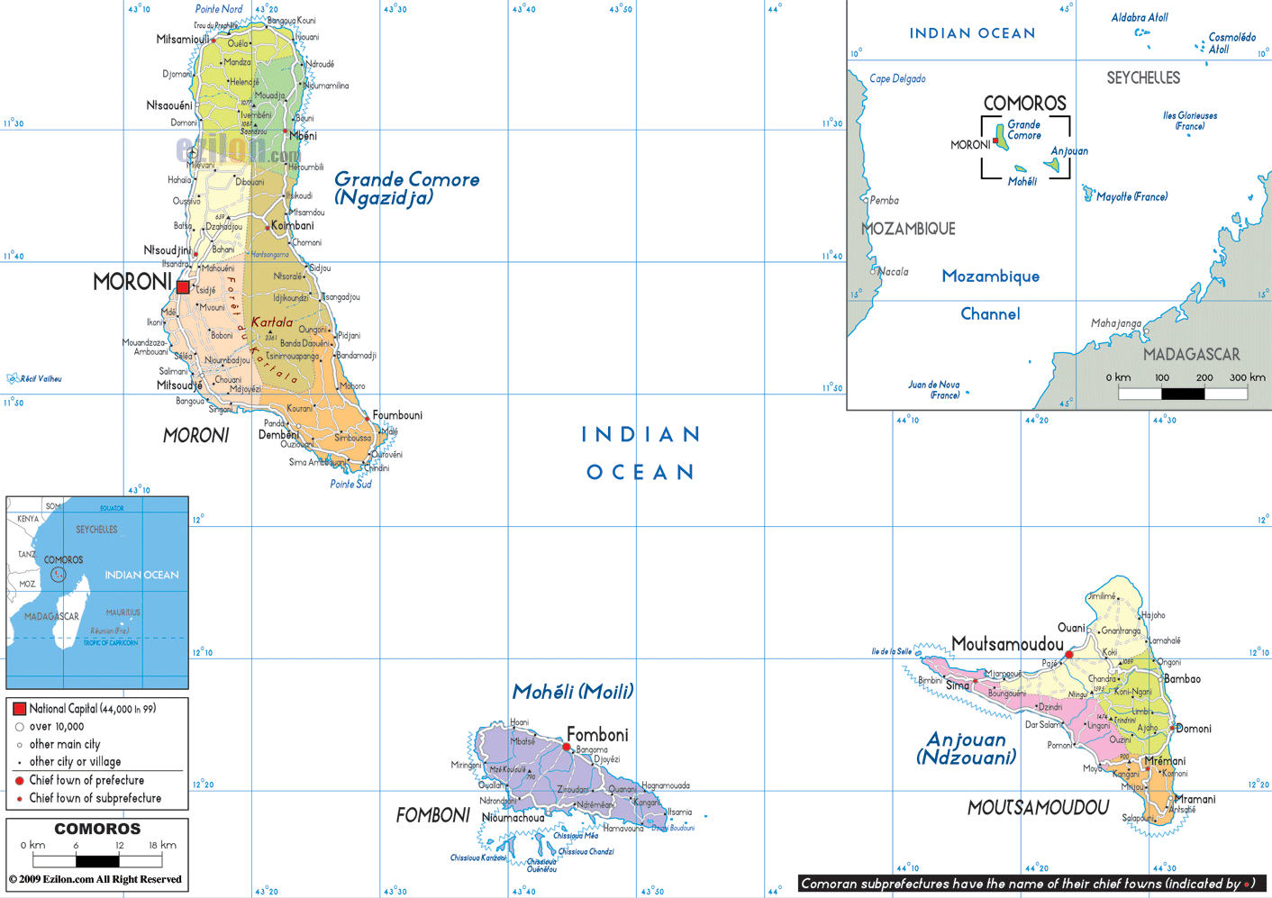
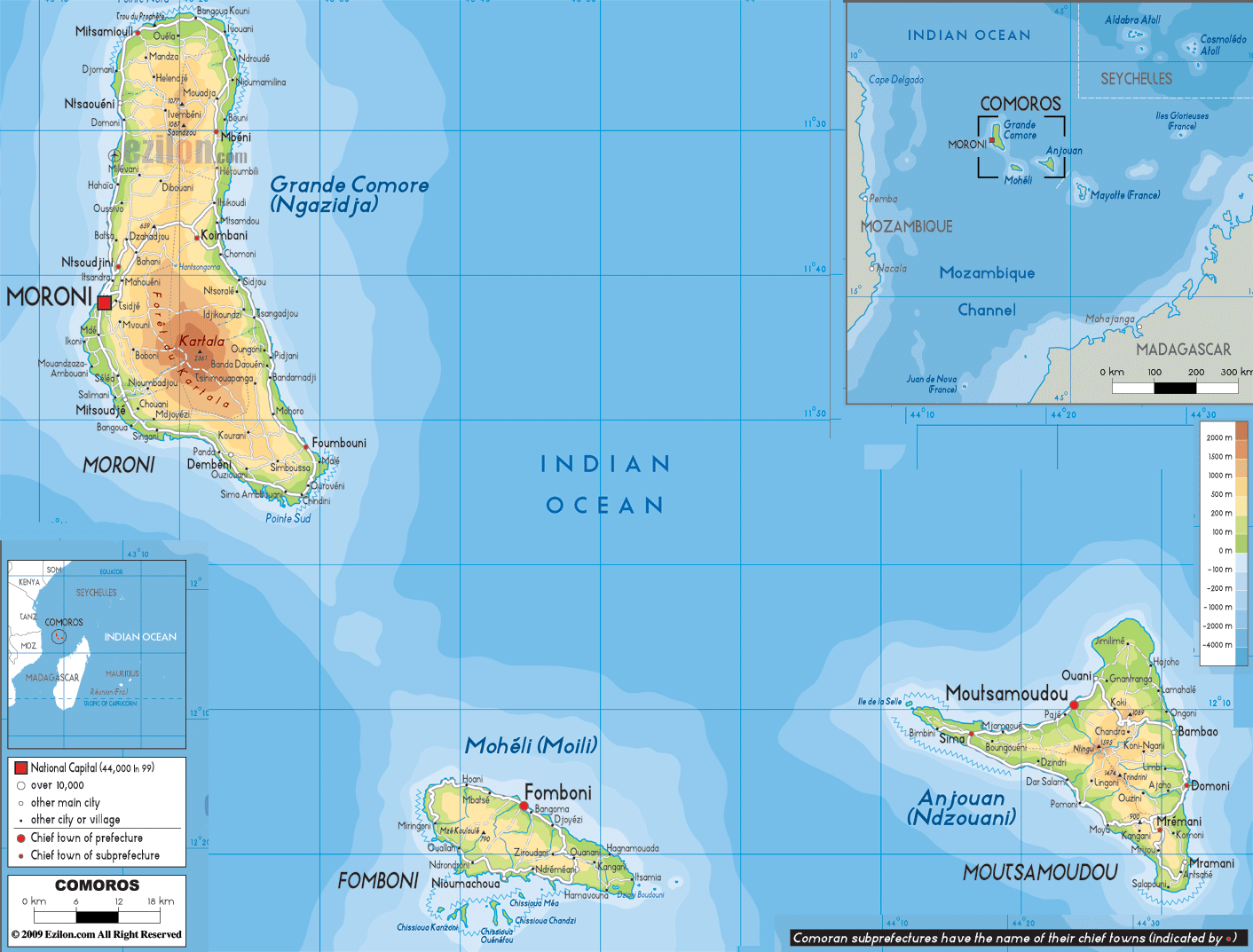
The physical map above illustrates the country of Comoros which is volcanic in origin. The islands occupy an area of 2,034 sq. km.
As observed on the map, four main islands comprise the archipelago of Comoros. These islands are arranged along a northwest-southeast axis at the Mozambique Channel’s northern end.
The Comoros islands evoke a rugged and windswept look. Broad sandy beaches with occasional groups of mangroves or coconut palms characterize the coastline here.
Grand Comore (Njazidja), the largest island, is an irregular plateau anchored by two volcanoes. The land rises to the island’s highest point – the active crater of Mount Kartala, a large, gently sloping volcano in the shape of a flattened dome, built almost exclusively of lava flows. It is 2,361 m tall and has been marked on the map with an upright triangle. The capital of Comoros, Moroni, is also located on this island’s west coast.
Anjouan (Nzwani,) the second-largest island is a similar lava plateau with three volcanic mountain chains. As observed on the map, it is triangular. The highest point here is the 1,580 m high Mount Ntingui.
Moheli (Mwali), the smallest of the four main islands, is largely a plateau with an average elevation of 300 m with the island ending in a ridge about 790 m above sea level. Dense forest covers the slopes of the hills on the island. The ancient lava flows eroded over time into a series of valleys, punctuated by small rivers (streams).
Mayotte, the oldest of the islands, has also dramatically eroded over time and is well-watered by a series of small streams.
The lowest point in Comoros is the Indian Ocean (0 m).
| Flag: |  |
|---|---|
| Legal Name: | Union of the Comoros |
| Capital Value: | Moroni |
| Official languages: |
|
| Demonym(s): | Comorian |
| Government: | Federal Islamic presidential republic |
| Legislature: | Assembly of the Union |
| Total Area: | 2,235 km² |
| Land Area: | 2,235 km² |
| Population: | 850,886 |
| Density: | 457/km (1,183.6/sq mi) (27th) |
| GDP: | $1.19 Billion |
| GDP Per Capita: | $1,393.52 |
| Currency Value: | Comoran francs (KMF) |
| Driving side: | right |
| Calling code: | +269 |
| Internet TLD: | .km |
Take a closer look at the beautiful country of Comoros with this interactive map. Discover the islands, populated places, airports, and roads that make up this volcanic archipelago. Zoom in to get a better view of the elevation map and satellite imagery of Comoros.
Online Interactive Political Map
Click on ![]() to view map in "full screen" mode.
to view map in "full screen" mode.
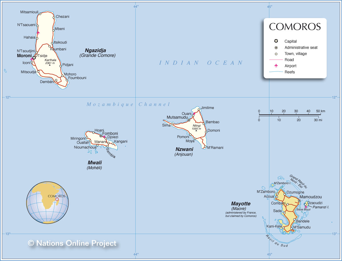
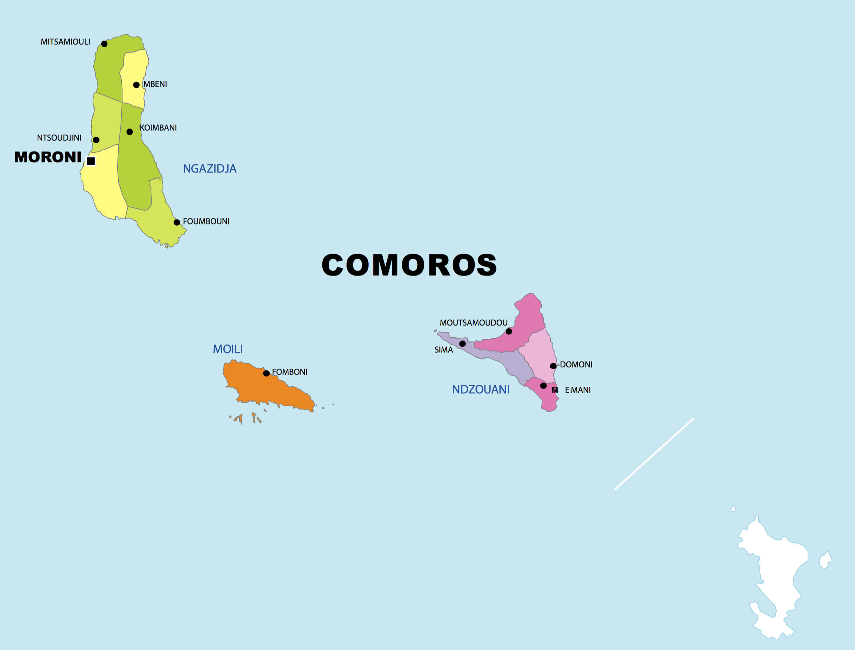
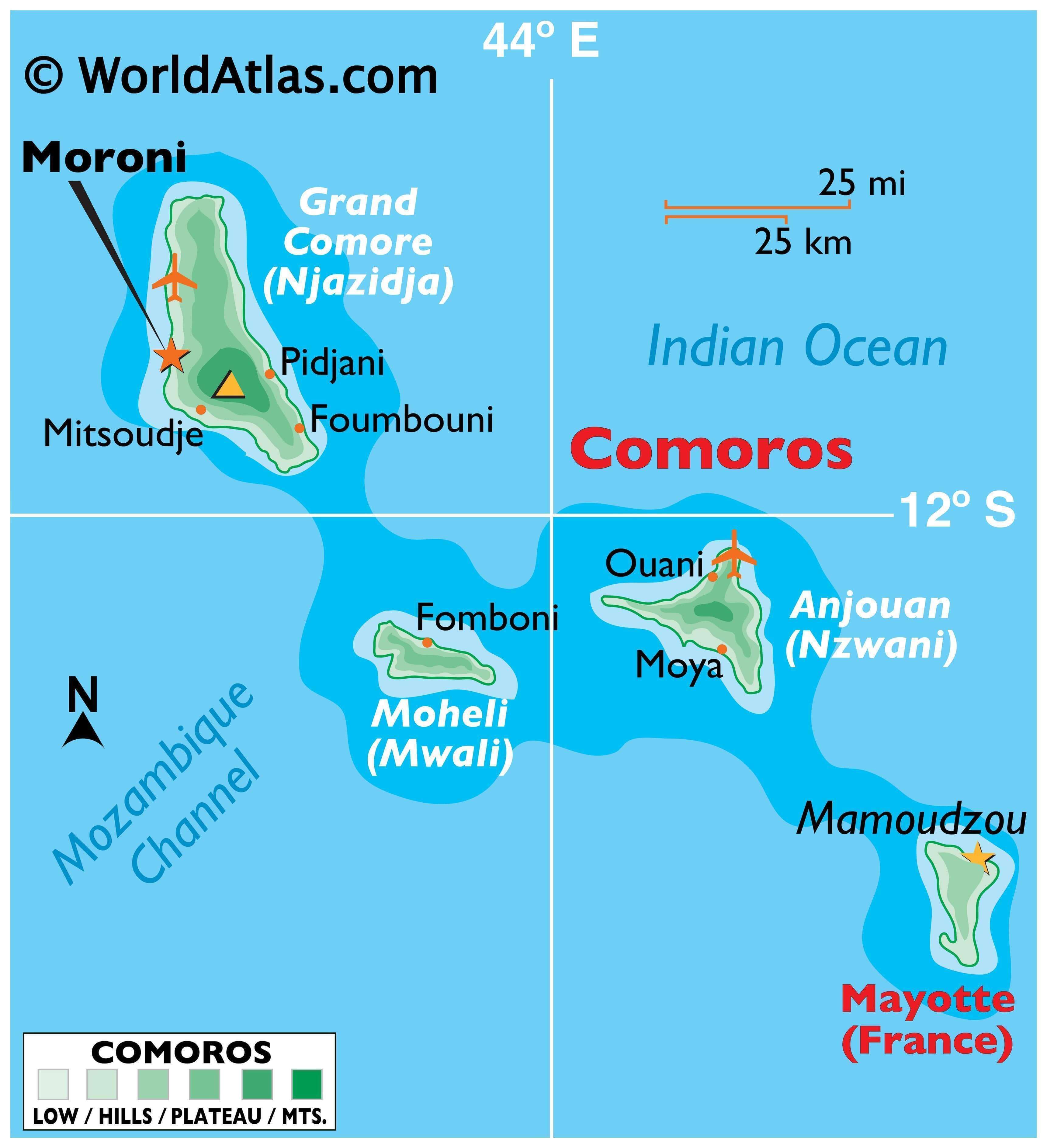
According to CIA World Factbook, Comoros can be divided into adminitrative divisions which are the 3 islands of Anjouan (Ndzuwani), Grande Comore (N’gazidja), Moheli (Moili) as marked on the map above. The national capital of Moroni is located in the Comore (N’gazidja) island.
Location Maps
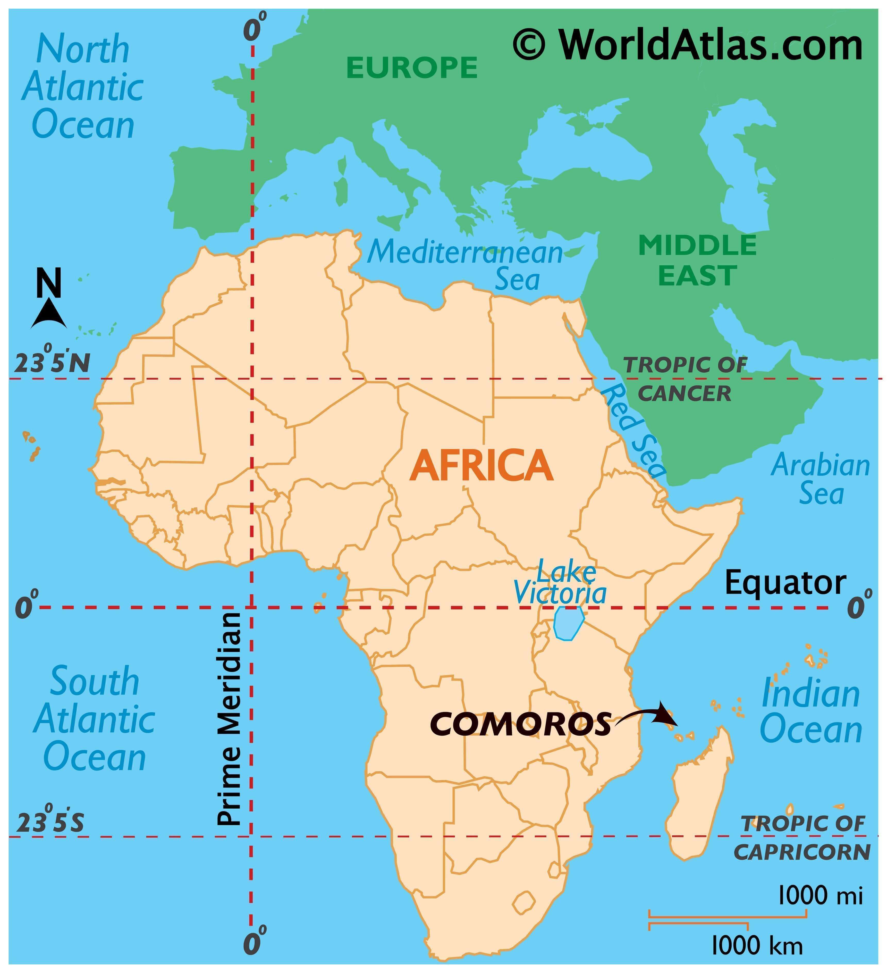
Where is Comoros?
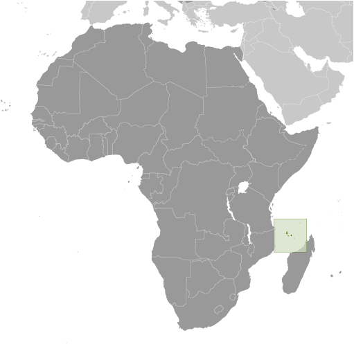
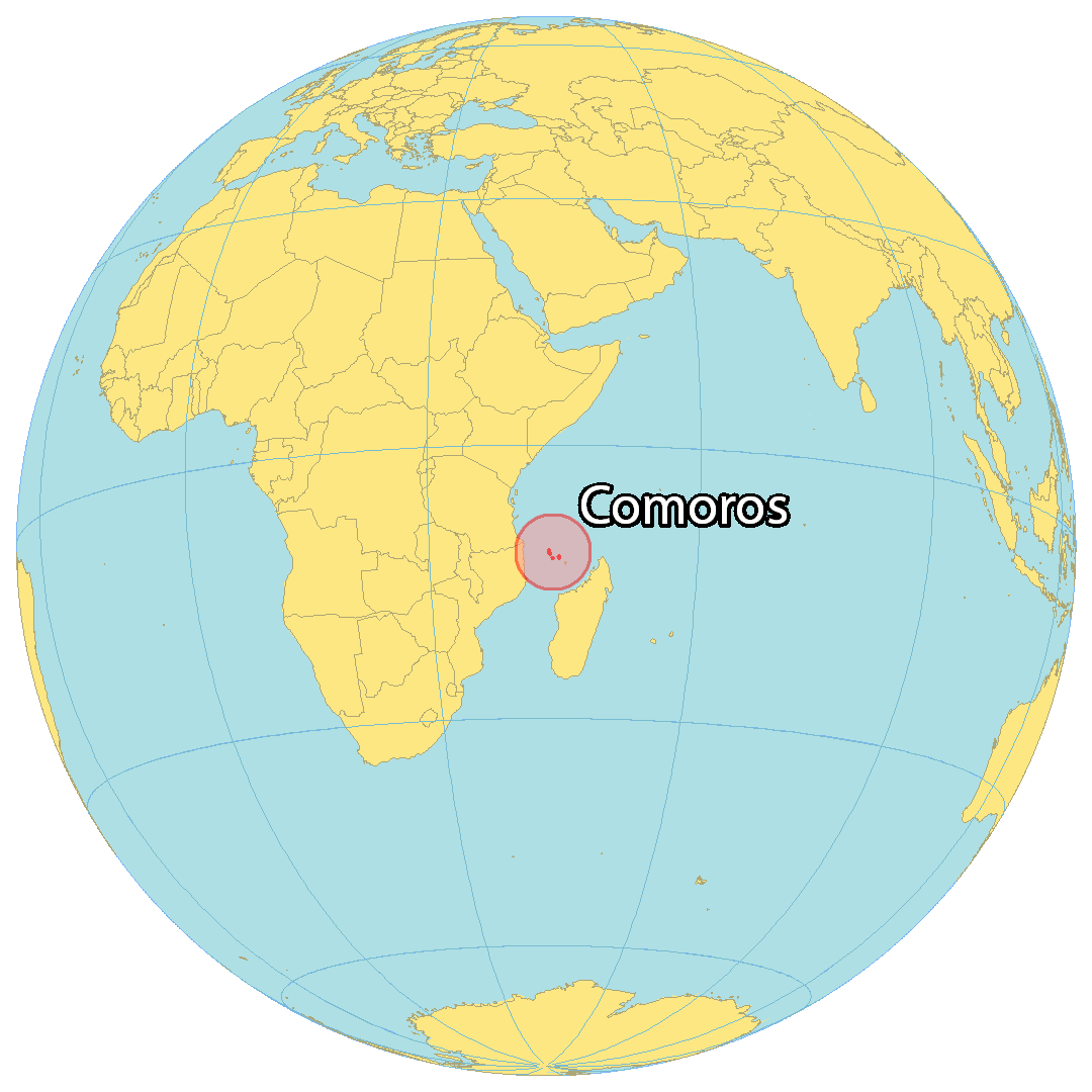
Comoros is an island country located off the southeast coast of Africa in the Indian Ocean. It is nestled between Madagascar to the east and Mozambique and Tanzania to the west. Comoros is comprised of various islets and three main islands, Ngazidja (Grande Comore), Ndzuani (Anjouan), and Mwali (Mohéli). It is the fourth smallest African nation with a size of 1,861 square kilometers (719 sq mi). The estimated population of Comoros is 850,000, with the majority of people living in the capital city of Moroni. Other major cities and towns include Moutsamoudou, Fomboni, and Domoni.
High Definition Political Map of Comoros
History
Settlement
According to mythology, a jinni (spirit) dropped a jewel, which formed a great circular inferno. This became the Karthala volcano, which created the island of Grande Comore. King Solomon is also said to have visited the island.
The first attested human inhabitants of the Comoro Islands are now thought to have been Austronesian settlers travelling by boat from islands in Southeast Asia. These people arrived no later than the eighth century AD, the date of the earliest known archaeological site, found on Mayotte, although settlement beginning as early as the first century has been postulated.
Subsequent settlers came from the east coast of Africa, the Arabian Peninsula and the Persian Gulf, the Malay Archipelago, and Madagascar. Bantu-speaking settlers were present on the islands from the beginnings of settlement, probably brought to the islands as slaves.
Development of the Comoros is divided into phases. The earliest reliably recorded phase is the Dembeni phase (eighth to tenth centuries), during which there were several small settlements on each island. From the eleventh to the fifteenth centuries, trade with the island of Madagascar and merchants from the Swahili coast and the Middle East flourished, more villages were founded and existing villages grew. Many Comorians can trace their genealogies to ancestors from the Arabian peninsula, particularly Hadhramaut, who arrived during this period.
Medieval Comoros
According to legend, in 632, upon hearing of Islam, islanders are said to have dispatched an emissary, Mtswa-Mwindza, to Mecca—but by the time he arrived there, the Muslim Prophet Muhammad had died. Nonetheless, after a stay in Mecca, he returned to Ngazidja and led the gradual conversion of his islanders to Islam.
In 933, the Comoros was referred to by Omani sailors as the Perfume Islands.
Among the earliest accounts of East Africa, the works of Al-Masudi describe early Islamic trade routes, and how the coast and islands were frequently visited by Muslims including Persian and Arab merchants and sailors in search of coral, ambergris, ivory, tortoiseshell, gold and slaves. They also brought Islam to the people of the Zanj including the Comoros. As the importance of the Comoros grew along the East African coast, both small and large mosques were constructed. The Comoros are part of the Swahili cultural and economic complex and the islands became a major hub of trade and an important location in a network of trading towns that included Kilwa, in present-day Tanzania, Sofala (an outlet for Zimbabwean gold), in Mozambique, and Mombasa in Kenya.
The Portuguese arrived in the Indian Ocean at the end of the 15th century and the first Portuguese visit to the islands seems to have been that of Vasco da Gama’s second fleet in 1503. For much of the 16th century the islands provided provisions to the Portuguese fort at Mozambique and although there was no formal attempt by the Portuguese crown to take possession, a number of Portuguese traders settled.
By the end of the 16th century the local rulers were beginning to push back and, with the support of the Omani Sultan Saif bin Sultan they began to defeat the Dutch and the Portuguese. His successor Said bin Sultan increased Omani Arab influence in the region, moving his administration to nearby Zanzibar, which came under Omani rule. Nevertheless, the Comoros remained independent, and although the three smaller islands were usually politically unified, the largest island, Ngazidja, was divided into a number of autonomous kingdoms (ntsi).
By the time Europeans showed interest in the Comoros, the islanders were well placed to take advantage of their needs, initially supplying ships on the route to India, particularly the English and, later, slaves to the plantation islands in the Mascarenes.
European contact and French colonisation
In the last decade of the 18th century, Malagasy warriors, mostly Betsimisaraka and Sakalava, started raiding the Comoros for slaves and the islands were devastated as crops were destroyed and the people were slaughtered, taken into captivity or fled to the African mainland: it is said that by the time the raids finally ended in the second decade of the 19th century only one man remained on Mwali. The islands were repopulated by slaves from the mainland, who were traded to the French in Mayotte and the Mascarenes. On the Comoros, it was estimated in 1865 that as much as 40% of the population consisted of slaves.
France first established colonial rule in the Comoros by taking possession of Mayotte in 1841 when the Sakalava usurper sultan Andriantsoly [fr] (also known as Tsy Levalo) signed the Treaty of April 1841, which ceded the island to the French authorities.
Meanwhile, Ndzwani (or Johanna as it was known to the British) continued to serve as a way station for English merchants sailing to India and the Far East, as well as American whalers, although the British gradually abandoned it following their possession of Mauritius in 1814, and by the time the Suez Canal opened in 1869 there was no longer any significant supply trade at Ndzwani. Local commodities exported by the Comoros were, in addition to slaves, coconuts, timber, cattle and tortoiseshell. French settlers, French-owned companies, and wealthy Arab merchants established a plantation-based economy that used about one-third of the land for export crops. After its annexation, France converted Mayotte into a sugar plantation colony. The other islands were soon transformed as well, and the major crops of ylang-ylang, vanilla, cloves, perfume plants, coffee, cocoa beans, and sisal were introduced.
In 1886, Mwali was placed under French protection by its Sultan Mardjani Abdou Cheikh. That same year, Sultan Said Ali of Bambao, one of the sultanates on Ngazidja, placed the island under French protection in exchange for French support of his claim to the entire island, which he retained until his abdication in 1910. In 1908 the islands were unified under a single administration (Colonie de Mayotte et dépendances) and placed under the authority of the French colonial Governor-General of Madagascar. In 1909, Sultan Said Muhamed of Ndzwani abdicated in favour of French rule. In 1912 the colony and the protectorates were abolished and the islands became a province of the colony of Madagascar.
Agreement was reached with France in 1973 for the Comoros to become independent in 1978, despite the deputies of Mayotte voting for increased integration with France. A referendum was held on all four of the islands. Three voted for independence by large margins, while Mayotte voted against, and remains under French administration. On 6 July 1975, however, the Comorian parliament passed a unilateral resolution declaring independence. Ahmed Abdallah proclaimed the independence of the Comorian State (État comorien; دولة القمر) and became its first president. The French recognised the new state.
Independence (1975)
The next 30 years were a period of political turmoil. On 3 August 1975, less than one month after independence, president Ahmed Abdallah was removed from office in an armed coup and replaced with United National Front of the Comoros (FNUK) member Said Mohamed Jaffar. Months later, in January 1976, Jaffar was ousted in favour of his Minister of Defence Ali Soilih.
The population of Mayotte voted against independence from France in three referendums during this period. The first, held on all the islands on 22 December 1974, won 63.8% support for maintaining ties with France on Mayotte; the second, held in February 1976, confirmed that vote with an overwhelming 99.4%, while the third, in April 1976, confirmed that the people of Mayotte wished to remain a French territory. The three remaining islands, ruled by President Soilih, instituted a number of socialist and isolationist policies that soon strained relations with France. On 13 May 1978, Bob Denard, once again commissioned by the French intelligence service (SDECE), returned to overthrow President Soilih and reinstate Abdallah with the support of the French, Rhodesian and South African governments. Ali Soilih was captured and executed a few weeks later.
In contrast to Soilih, Abdallah’s presidency was marked by authoritarian rule and increased adherence to traditional Islam and the country was renamed the Federal Islamic Republic of the Comoros (République Fédérale Islamique des Comores; جمهورية القمر الإتحادية الإسلامية). Bob Denard served as Abdallah Abderamane’s first advisor; nicknamed the “Viceroy of the Comoros,” he was sometimes considered the real strongman of the regime. Very close to South Africa, which financed his “presidential guard,” he allowed Paris to circumvent the international embargo on the apartheid regime via Moroni. He also set up from the archipelago a permanent mercenary corps, called upon to intervene at the request of Paris or Pretoria in conflicts in Africa. Abdallah continued as president until 1989 when, fearing a probable coup, he signed a decree ordering the Presidential Guard, led by Bob Denard, to disarm the armed forces. Shortly after the signing of the decree, Abdallah was allegedly shot dead in his office by a disgruntled military officer, though later sources claim an antitank missile was launched into his bedroom and killed him. Although Denard was also injured, it is suspected that Abdallah’s killer was a soldier under his command.
A few days later, Bob Denard was evacuated to South Africa by French paratroopers. Said Mohamed Djohar, Soilih’s older half-brother, then became president, and served until September 1995, when Bob Denard returned and attempted another coup. This time France intervened with paratroopers and forced Denard to surrender. The French removed Djohar to Reunion, and the Paris-backed Mohamed Taki Abdoulkarim became president by election. He led the country from 1996, during a time of labour crises, government suppression, and secessionist conflicts, until his death in November 1998. He was succeeded by Interim President Tadjidine Ben Said Massounde.
The islands of Ndzwani and Mwali declared their independence from the Comoros in 1997, in an attempt to restore French rule. But France rejected their request, leading to bloody confrontations between federal troops and rebels. In April 1999, Colonel Azali Assoumani, Army Chief of Staff, seized power in a bloodless coup, overthrowing the Interim President Massounde, citing weak leadership in the face of the crisis. This was the Comoros’ 18th coup, or attempted coup d’état since independence in 1975.
Azali failed to consolidate power and reestablish control over the islands, which was the subject of international criticism. The African Union, under the auspices of President Thabo Mbeki of South Africa, imposed sanctions on Ndzwani to help broker negotiations and effect reconciliation. Under the terms of the Fomboni Accords, signed in December 2001 by the leaders of all three islands, the official name of the country was changed to the Union of the Comoros; the new state was to be highly decentralised and the central union government would devolve most powers to the new island governments, each led by a president. The Union president, although elected by national elections, would be chosen in rotation from each of the islands every five years.
Azali stepped down in 2002 to run in the democratic election of the President of the Comoros, which he won. Under ongoing international pressure, as a military ruler who had originally come to power by force, and was not always democratic while in office, Azali led the Comoros through constitutional changes that enabled new elections. A Loi des compétences law was passed in early 2005 that defines the responsibilities of each governmental body, and is in the process of implementation. The elections in 2006 were won by Ahmed Abdallah Mohamed Sambi, a Sunni Muslim cleric nicknamed the “Ayatollah” for his time spent studying Islam in Iran. Azali honoured the election results, thus allowing the first peaceful and democratic exchange of power for the archipelago.
Colonel Mohammed Bacar, a French-trained former gendarme elected President of Ndzwani in 2001, refused to step down at the end of his five-year mandate. He staged a vote in June 2007 to confirm his leadership that was rejected as illegal by the Comoros federal government and the African Union. On 25 March 2008 hundreds of soldiers from the African Union and the Comoros seized rebel-held Ndzwani, generally welcomed by the population: there have been reports of hundreds, if not thousands, of people tortured during Bacar’s tenure. Some rebels were killed and injured, but there are no official figures. At least 11 civilians were wounded. Some officials were imprisoned. Bacar fled in a speedboat to Mayotte to seek asylum. Anti-French protests followed in the Comoros (see 2008 invasion of Anjouan). Bacar was eventually granted asylum in Benin.
Since independence from France, the Comoros experienced more than 20 coups or attempted coups.
Following elections in late 2010, former Vice-president Ikililou Dhoinine was inaugurated as president on 26 May 2011. A member of the ruling party, Dhoinine was supported in the election by the incumbent President Ahmed Abdallah Mohamed Sambi. Dhoinine, a pharmacist by training, is the first President of the Comoros from the island of Mwali. Following the 2016 elections, Azali Assoumani, from Ngazidja, became president for a third term. In 2018 Azali held a referendum on constitutional reform that would permit a president to serve two terms. The amendments passed, although the vote was widely contested and boycotted by the opposition, and in April 2019, and to widespread opposition, Azali was re-elected president to serve the first of potentially two five-year terms.
In January 2020, the legislative elections in Comoros were dominated by President Azali Assoumani’s party, the Convention for the Renewal of the Comoros, CRC. It took an overwhelming majority in the parliament, meaning his hold on power strengthened. CRC took 17 out of 24 seats of the parliament.
In 2021, Comoros signed and ratified the Treaty on the Prohibition of Nuclear Weapons, making it a nuclear-weapon-free state.
Physical Map of Comoros
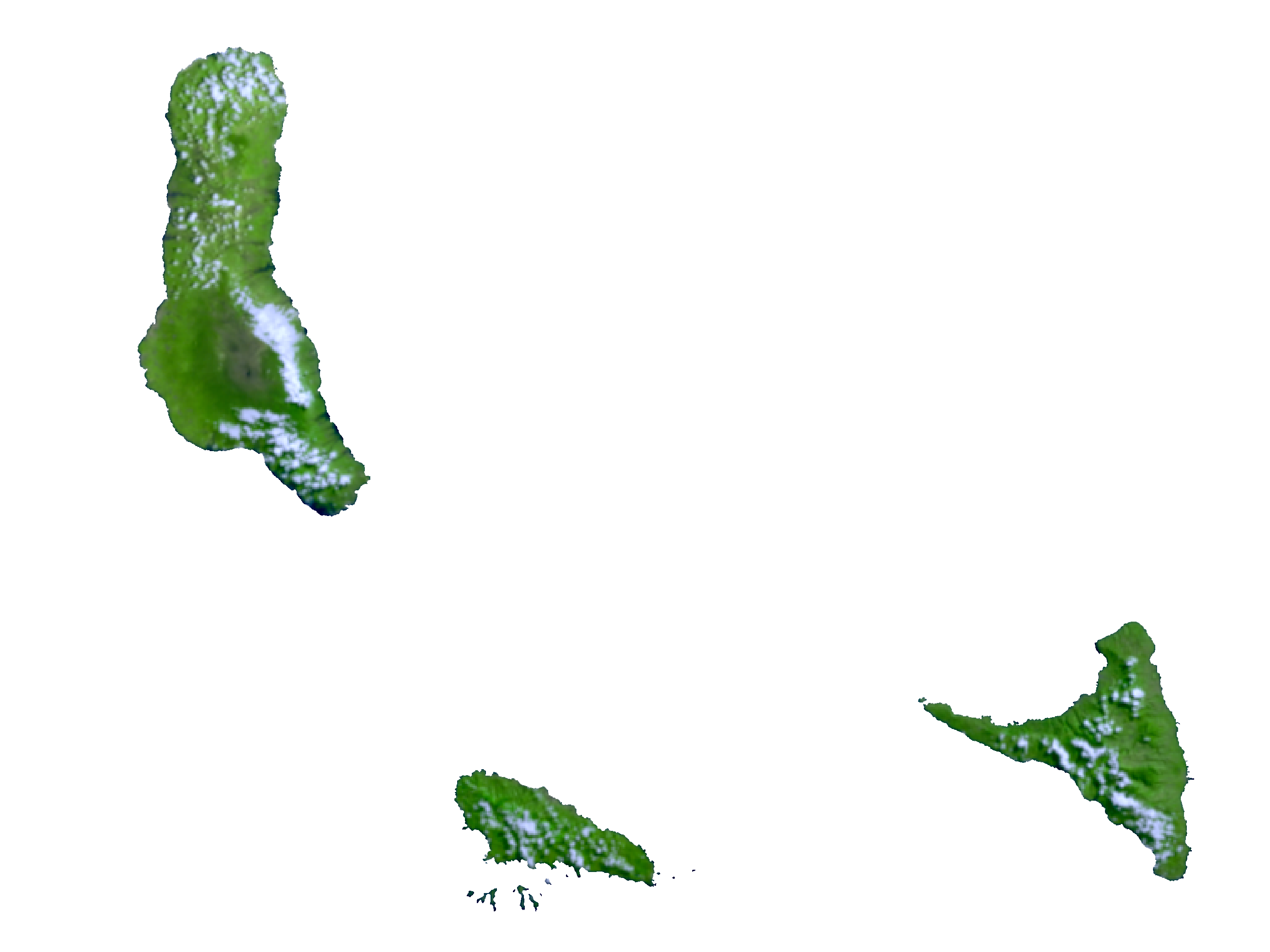
Comoros Satellite Map
Elevation Map