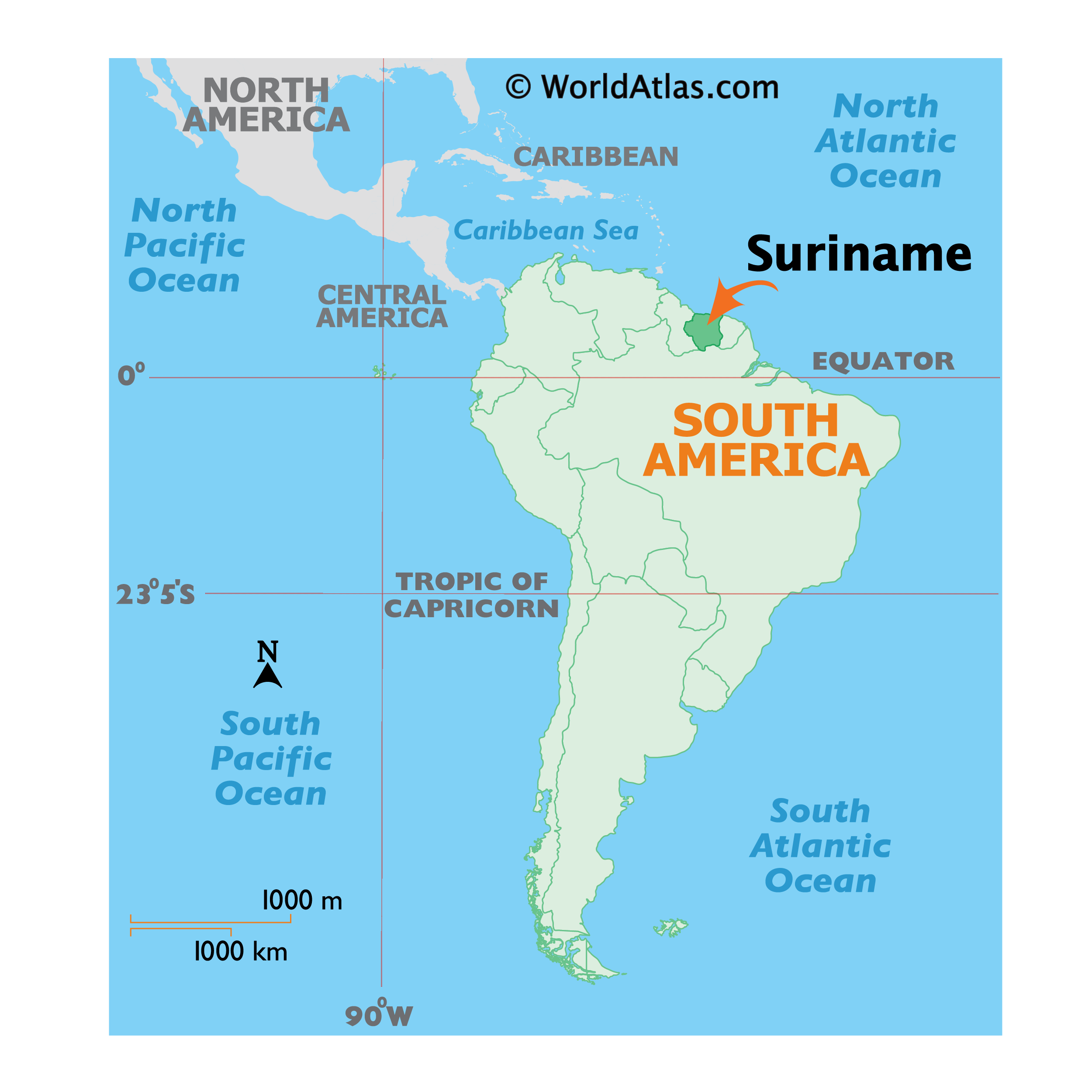
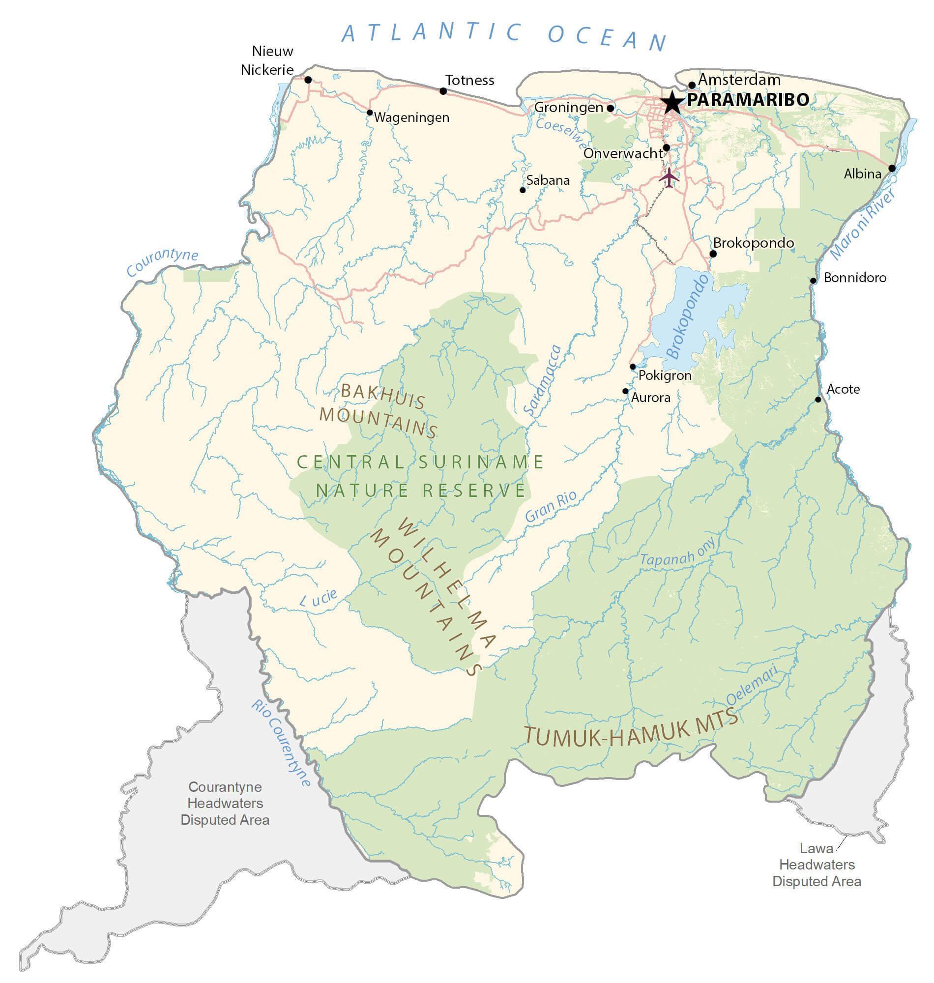
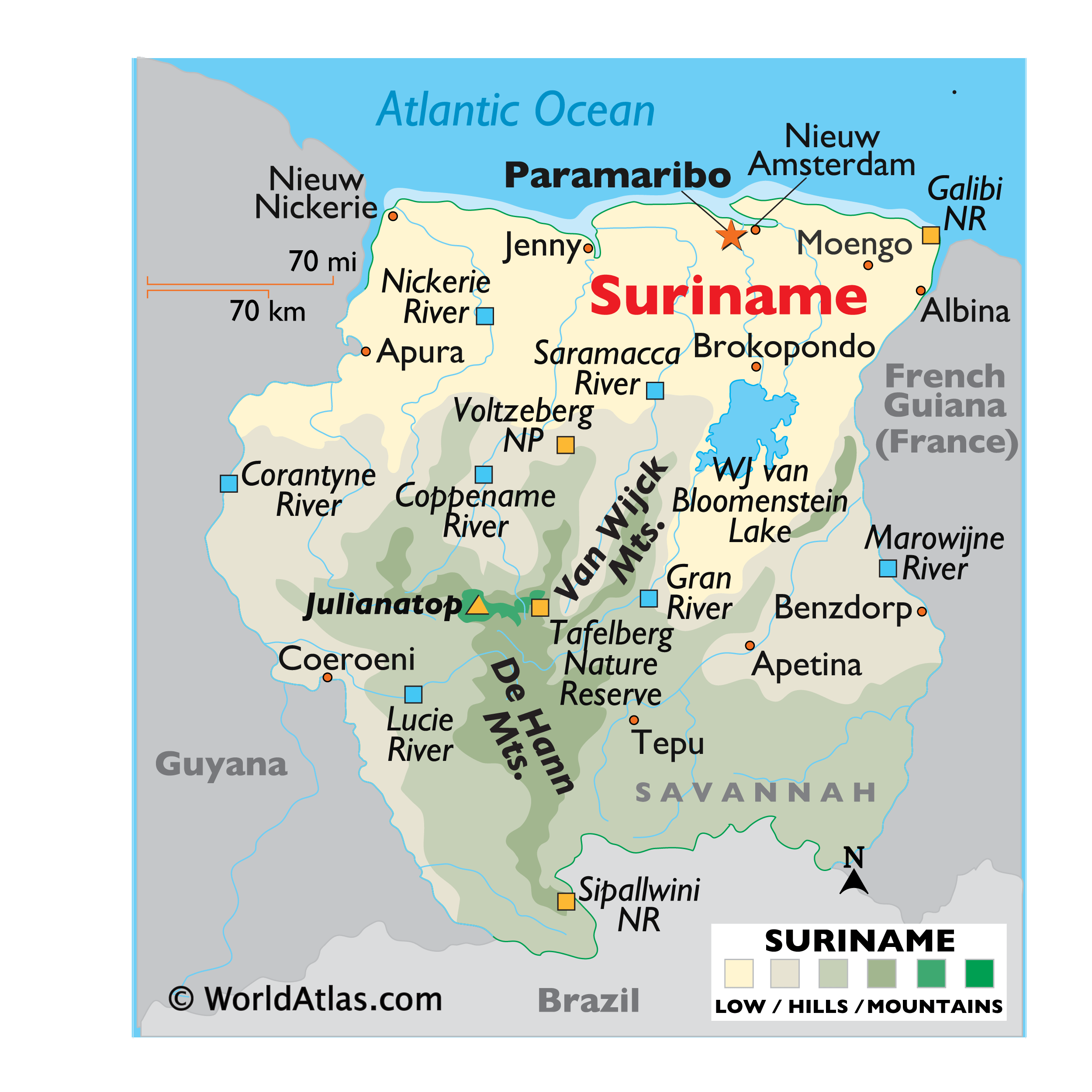
Covering an area of 163,820 sq.km (63,252 sq mi), Suriname is one of the smallest sovereign nations, located on the northern edge of South America. Suriname can be divided into two main geographic regions; the coastal lowlands of the north and the tropical rainforests and savanna of the west and south.
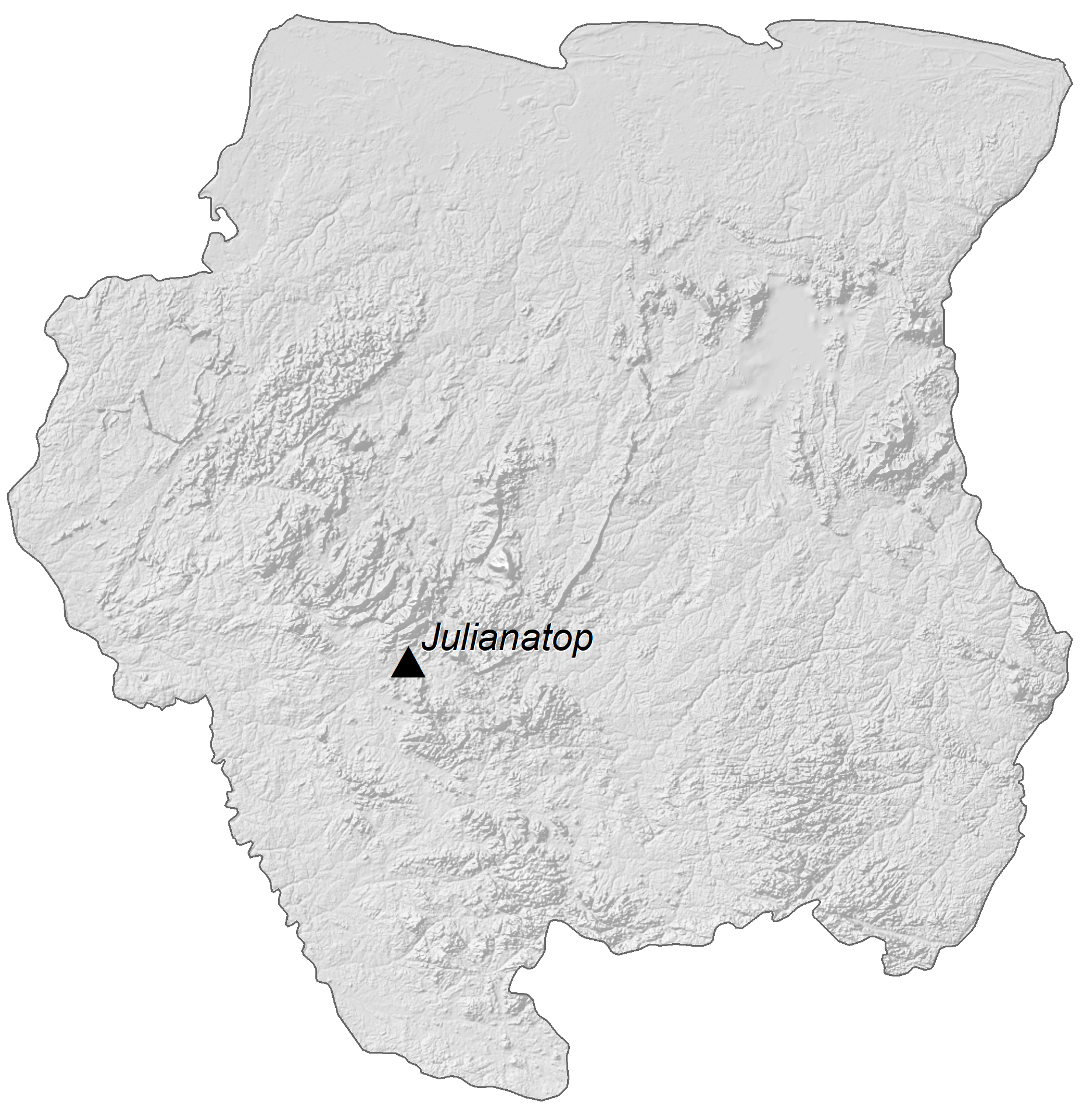
As observed on the physical map of Suriname above, a few small mountain ranges disect the fertile land with the De Hann and Van Asch Van Wijck being the most significant ones. The country’s highest point is Julianatop, at an elevation of 4,035ft (1,230m). The lowest point is an unnamed location along the coastal plain at -6.5ft (-2m) below the sea level.
Suriname is home to the WJ van Bloomenstein Lake (marked on the map above in the eastern part of the country), one of the largest reservoir lakes on the planet; created by a river dam, it provides hydro power for many of the country’s industries.
About 14% of Suriname is allocated to a series of National Parks (NP) and Nature Reserves (NR). Suriname is a land of rivers, and the major ones include the Coppename, Corantyne, Gran, Lucie, Marowijne, Nickerie and Saramacca.
| Flag: |  |
|---|---|
| Legal Name: | Republic of Suriname |
| Capital Value: | Paramaribo |
| Official languages: | Dutch |
| Demonym(s): | Surinamese |
| Government: | Unitary assembly-independent republic |
| Legislature: | National Assembly |
| Total Area: | 163,820 km² |
| Land Area: | 156,000 km² |
| Water Area: | 7,820 km² |
| Population: | 581,372 |
| Density: | 3.9/km (10.1/sq mi) (231st) |
| GDP: | $3.99 Billion |
| GDP Per Capita: | $6,854.91 |
| Currency Value: | Surinamese dollars (SRD) |
| Driving side: | left |
| Calling code: | +597 |
| Internet TLD: | .sr |
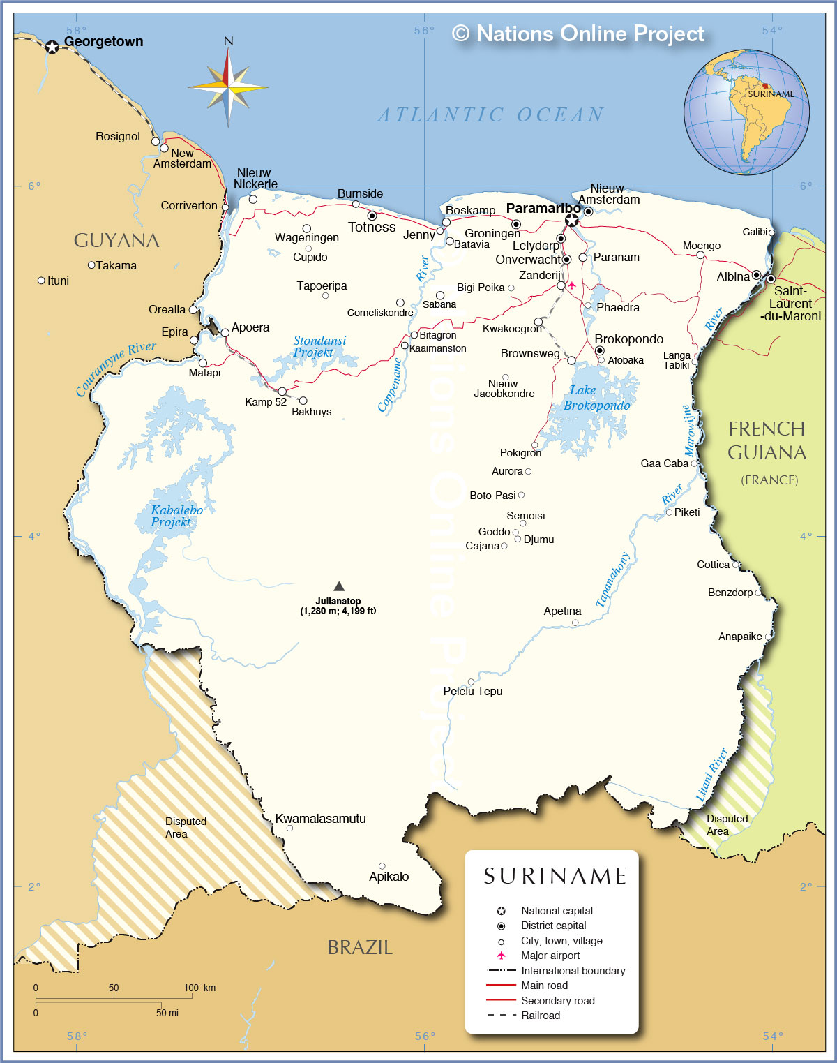
Suriname is a beautiful country situated in the northeast of South America. With its lush green forests, rivers and lakes, Suriname is a paradise for nature lovers. The country is home to a diverse range of wildlife, from monkeys and sloths to jaguars and toucans. This map of Suriname allows travelers to explore the country’s geography and get to know the different cities, towns, highways, roads, lakes and rivers. It also shows disputed areas, making it a great tool for travelers who want to explore the country in more depth.
Online Interactive Political Map
Click on ![]() to view map in "full screen" mode.
to view map in "full screen" mode.
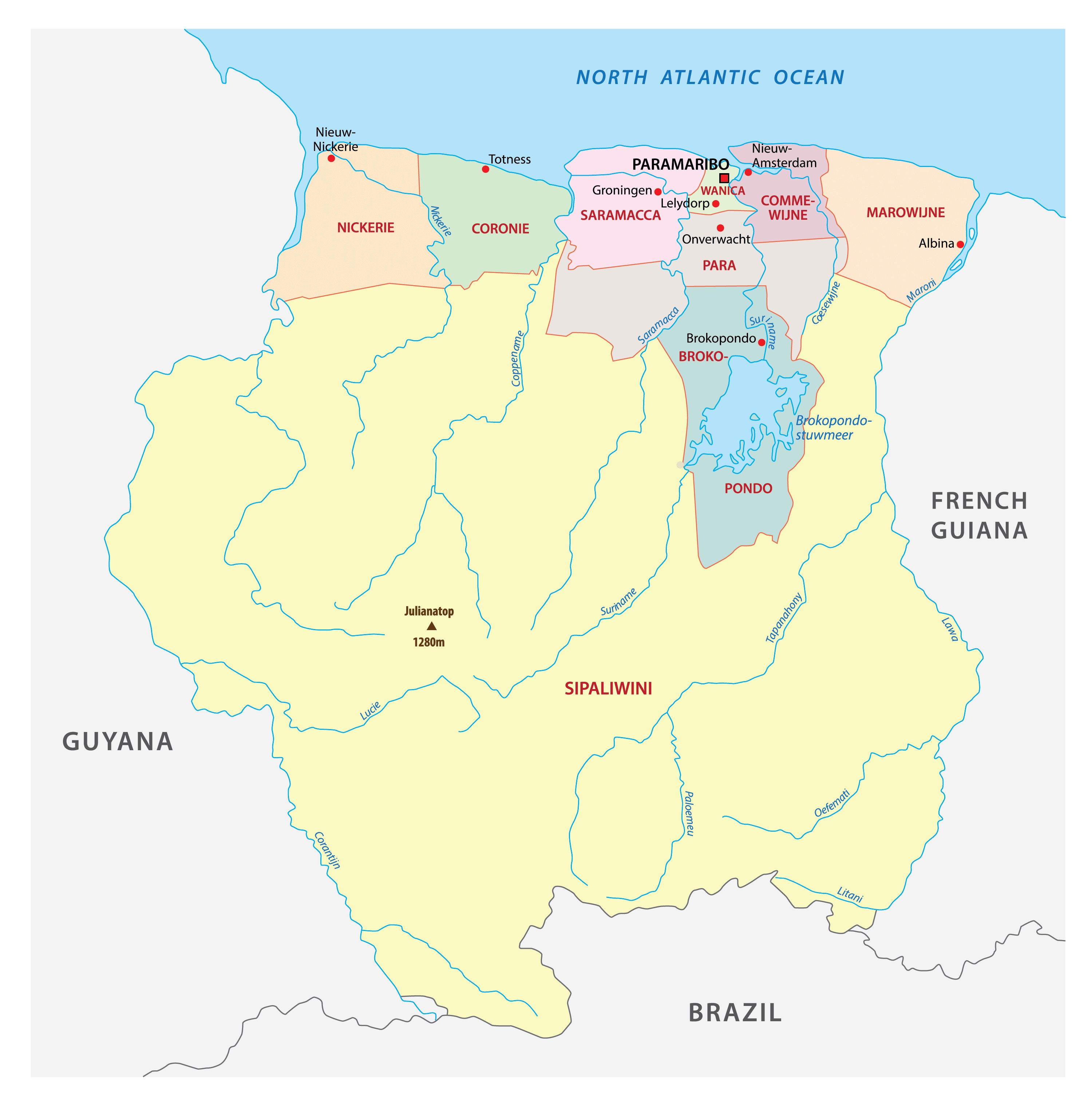
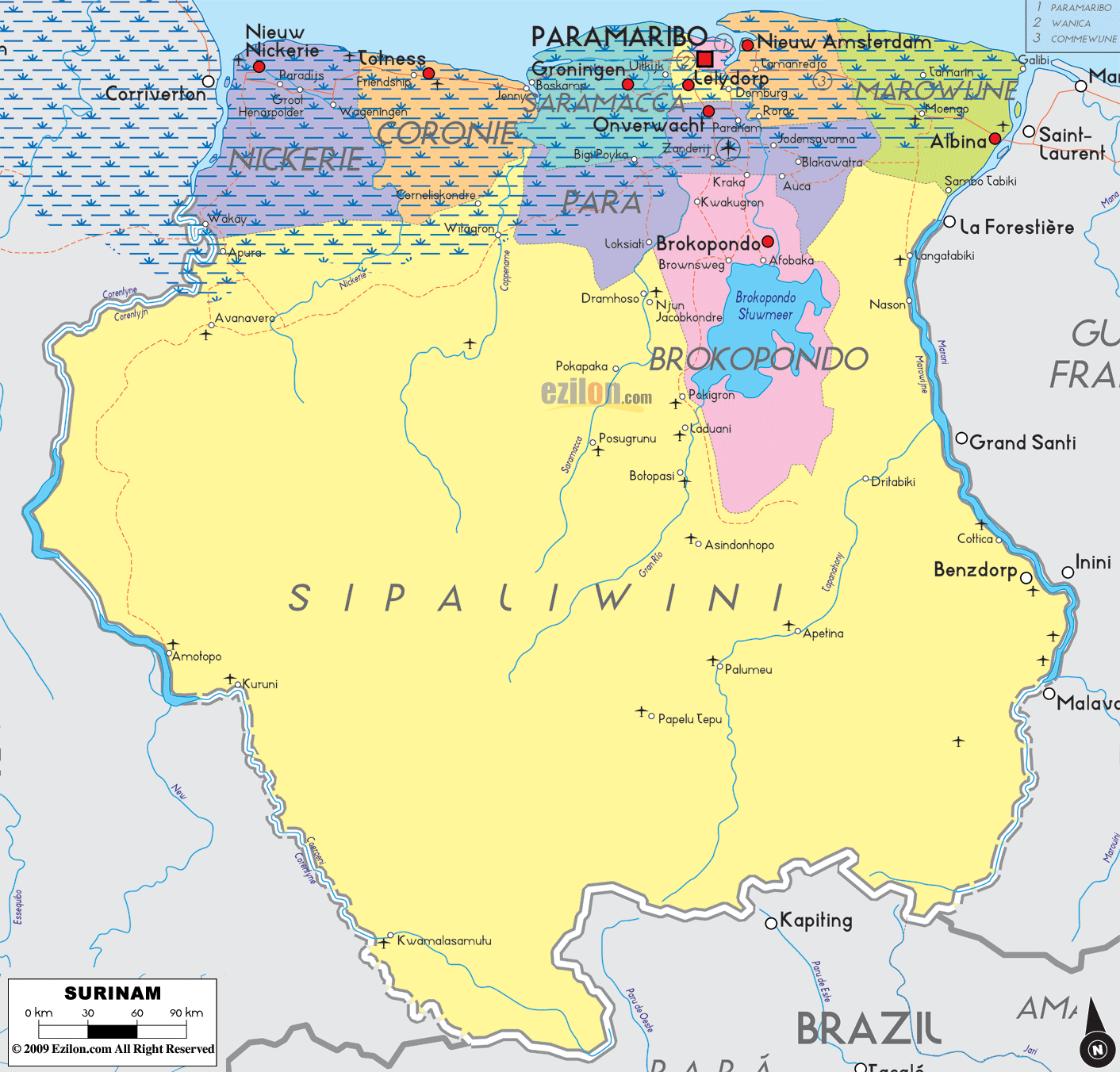
Suriname (officially, the Republic of Suriname) is divided into 10 administrative districts (distrikten, singular – distrikt).In alphabetical order, these districts are:Brokopondo, Commewijne, Coronie, Marowijne, Nickerie, Para, Paramaribo, Saramacca, Sipaliwini and Wanica. These districts are further subdivided into 63 resorts.
Covering an area of 163,820 sq. km, Suriname is one of the smallest sovereign nations in South America. Situated in the northern part of the country, on the banks of the Suriname River, at the Atlantic coast is, Paramaribo – the capital, the largest and the most populous city of Suriname. It is also the country’s chief port and the administrative, industrial, cultural and tourism center of Suriname.
Location Maps
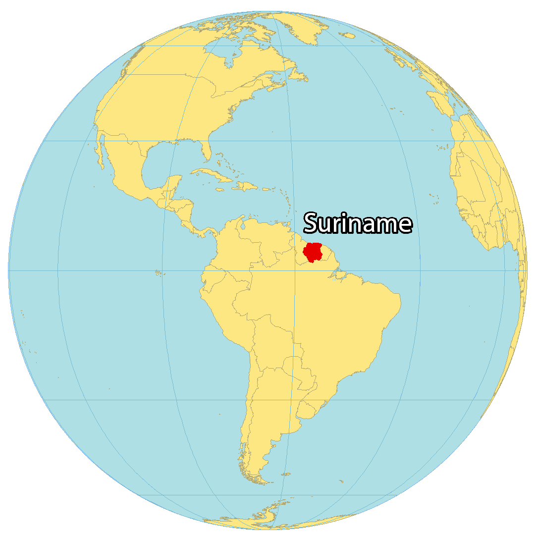
Where is Suriname?
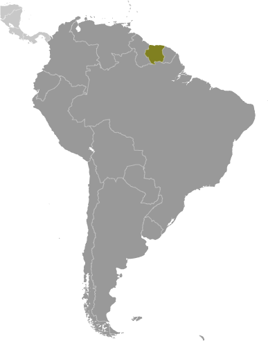
Suriname is a South American country located to the northeast along the coast of the Atlantic Ocean. It is known for its nature reserves, tropical rainforests, and ethnic diversity. It borders three other countries, Guyana to the west, French Guyana to the east, and Brazil to the south. The country occupies an area of 163,821 square kilometers (63,252 sq mi), making it the smallest in South America. It is also the second least populated, with the majority of people living on the north coast. The capital and largest city Paramaribo is located in the north, along with other towns such as Lelydorp, Brokopondo, and Nieuw Nickerie.
High Definition Political Map of Suriname
History
Indigenous settlement of Suriname dates back to 3,000 BC. The largest tribes were the Arawak, a nomadic coastal tribe that lived from hunting and fishing. They were the first inhabitants in the area. The Carib also settled in the area and conquered the Arawak by using their superior sailing ships. They settled in Galibi (Kupali Yumï, meaning “tree of the forefathers”) at the mouth of the Marowijne River. While the larger Arawak and Carib tribes lived along the coast and savanna, smaller groups of indigenous people lived in the inland rainforest, such as the Akurio, Trió, Warrau, and Wayana.
Colonial period
Beginning in the 16th century, French, Spanish and English explorers visited the area. A century later, Dutch and English settlers established plantation colonies along the many rivers in the fertile Guiana plains. The earliest documented colony in Guiana was an English settlement named Marshall’s Creek along the Suriname River. After that there was another short-lived English colony called Surinam that lasted from 1650 to 1667.
Disputes arose between the Dutch and the English for control of this territory. In 1667, during negotiations leading to the Treaty of Breda after the Second Anglo-Dutch War, the Dutch decided to keep the nascent plantation colony of Surinam they had gained from the English. In return the English kept New Amsterdam, the main city of the former colony of New Netherland in North America on the mid-Atlantic coast. The British renamed it after the Duke of York: New York City.
In 1683, the Society of Suriname was founded by the city of Amsterdam, the Van Aerssen van Sommelsdijck family, and the Dutch West India Company. The society was chartered to manage and defend the colony. The planters of the colony relied heavily on African slaves to cultivate, harvest and process the commodity crops of coffee, cocoa, sugar cane and cotton plantations along the rivers. Planters’ treatment of the slaves was notoriously brutal even by the standards of the time—historian C. R. Boxer wrote that “man’s inhumanity to man just about reached its limits in Surinam”—and many slaves escaped the plantations. In November 1795, the Society was nationalized by the Batavian Republic and from then on the Batavian Republic and its legal successors (the Kingdom of Holland and the Kingdom of the Netherlands) governed the territory as a national colony, barring a period of British occupation between 1799 and 1802, and between 1804 and 1816.
With the help of the native South Americans living in the adjoining rain forests, these runaway slaves established a new and unique culture in the interior that was highly successful in its own right. They were known collectively in English as Maroons, in French as Nèg’Marrons (literally meaning “brown negroes”, that is “pale-skinned negroes”), and in Dutch as Marrons. The Maroons gradually developed several independent tribes through a process of ethnogenesis, as they were made up of slaves from different African ethnicities. These tribes include the Saramaka, Paramaka, Ndyuka or Aukan, Kwinti, Aluku or Boni, and Matawai.
The Maroons often raided plantations to recruit new members from the slaves and capture women, as well as to acquire weapons, food and supplies. They sometimes killed planters and their families in the raids; colonists built defenses, which were significant enough that they were shown on 18th-century maps.
The colonists also mounted armed campaigns against the Maroons, who generally escaped through the rainforest, which they knew much better than the colonists did. To end hostilities, in the 18th century the European colonial authorities signed several peace treaties with different tribes. They granted the Maroons sovereign status and trade rights in their inland territories, giving them autonomy.
Abolition of slavery
From 1861 to 1863, with the American Civil War underway, and enslaved people escaping to Northern territory controlled by the Union, United States President Abraham Lincoln and his administration looked abroad for places to relocate people who were freed from enslavement and who wanted to leave the United States. It opened negotiations with the Dutch government regarding African-American emigration to and colonization of the Dutch colony of Suriname. Nothing came of the idea, and the idea was dropped after 1864.
The Netherlands abolished slavery in Suriname in 1863, under a gradual process that required slaves to work on plantations for 10 transition years for minimal pay, which was considered as partial compensation for their masters. After that transition period expired in 1873, most freedmen largely abandoned the plantations where they had worked for several generations in favor of the capital city, Paramaribo. Some of them were able to purchase the plantations they worked on, especially in the district of Para and Coronie. Their descendants still live on those grounds today. Several plantation owners did not pay their former enslaved workers the pay they owed them for the ten years following 1863. They paid the workers with the property rights of the ground of the plantation in order to escape their debt to the workers.
As a plantation colony, Suriname had an economy dependent on labor-intensive commodity crops. To make up for a shortage of labor, the Dutch recruited and transported contract or indentured laborers from the Dutch East Indies (modern Indonesia) and India (the latter through an arrangement with the British, who then ruled the area). In addition, during the late 19th and early 20th centuries, small numbers of laborers, mostly men, were recruited from China and the Middle East.
Although Suriname’s population remains relatively small, because of this complex colonization and exploitation, it is one of the most ethnically and culturally diverse countries in the world.
Decolonization
During World War II, on 23 November 1941, under an agreement with the Netherlands government-in-exile, the United States sent 2,000 soldiers to Suriname to protect the bauxite mines to support the Allies’ war effort. In 1942, the Dutch government-in-exile began to review the relations between the Netherlands and its colonies in terms of the post-war period.
In 1954, Suriname became one of the constituent countries of the Kingdom of the Netherlands, along with the Netherlands Antilles and the Netherlands. In this construction, the Netherlands retained control of its defense and foreign affairs. In 1974, the local government, led by the National Party of Suriname (NPS) (whose membership was largely Creole, meaning ethnically African or mixed African-European) started negotiations with the Dutch government leading towards full independence, which was granted on 25 November 1975. A large part of Suriname’s economy for the first decade following independence was fueled by foreign aid provided by the Dutch government.
Independence
The first President of the country was Johan Ferrier, the former governor, with Henck Arron (the then leader of the NPS) as Prime Minister. In the years leading up to independence, nearly one-third of the population of Suriname emigrated to the Netherlands, amidst concern that the new country would fare worse under independence than it had as a constituent country of the Kingdom of the Netherlands. Surinamese politics did degenerate into ethnic polarisation and corruption soon after independence, with the NPS using Dutch aid money for partisan purposes. Its leaders were accused of fraud in the 1977 elections, in which Arron won a further term, and the discontent was such that a large portion of the population fled to the Netherlands, joining the already significant Surinamese community there.
1980 military coup
On 25 February 1980, a military coup overthrew Arron’s government. It was initiated by a group of 16 sergeants, led by Dési Bouterse. Opponents of the military regime attempted counter-coups in April 1980, August 1980, 15 March 1981, and again on 12 March 1982. The first counter attempt was led by Fred Ormskerk, the second by Marxist-Leninists, the third by Wilfred Hawker, and the fourth by Surendre Rambocus.
Hawker escaped from prison during the fourth counter-coup attempt, but he was captured and summarily executed. Between 2 am and 5 am on 7 December 1982, the military, under Bouterse’s leadership, rounded up 13 prominent citizens who had criticized the military dictatorship and held them at Fort Zeelandia in Paramaribo. The dictatorship had all these men executed over the next three days, along with Rambocus and Jiwansingh Sheombar (who was also involved in the fourth counter-coup attempt).
Civil war, elections, and constitution
The brutal civil war between the Suriname army and Maroons loyal to rebel leader Ronnie Brunswijk, begun in 1986, continued and its effects further weakened Bouterse’s position during the 1990s. Due to the civil war, more than 10,000 Surinamese, mostly Maroons, fled to French Guiana in the late 1980s.
National elections were held in 1987. The National Assembly adopted a new constitution that allowed Bouterse to remain in charge of the army. Dissatisfied with the government, Bouterse summarily dismissed the ministers in 1990, by telephone. This event became popularly known as the “Telephone Coup”. His power began to wane after the 1991 elections.
At the 1988 Summer Olympics in Seoul, Suriname became the smallest independent South American state to win its first ever Olympic medal as Anthony Nesty won gold in the 100-metre butterfly.
In 1999, the Netherlands tried Bouterse in absentia on drug smuggling charges. He was convicted and sentenced to prison but remained in Suriname. The 1999 Surinamese protests occurred in 1999.
21st century
On 19 July 2010, Bouterse returned to power when he was elected as the president of Suriname. Before his election in 2010, he, along with 24 others, had been charged with the murders of 15 prominent dissidents in the December murders. However, in 2012, two months before the verdict in the trial, the National Assembly extended its amnesty law and provided Bouterse and the others with amnesty of these charges. He was reelected on 14 July 2015. However, Bouterse was convicted by a Surinamese court on 29 November 2019 and given a 20-year sentence for his role in the 1982 killings.
After winning the 2020 elections, Chan Santokhi was the sole nomination for president of Suriname. On 13 July, Santokhi was elected president by acclamation in an uncontested election. He was inaugurated on 16 July in a ceremony without public attendance due to the COVID-19 pandemic.
In February 2023, there were heavy protests against rising living costs in the capital Paramaribo. Protesters accused the government of President Chan Santokhi of corruption. They stormed the National Assembly, demanding the government to resign. However, the government condemned the protests.
Physical Map of Suriname

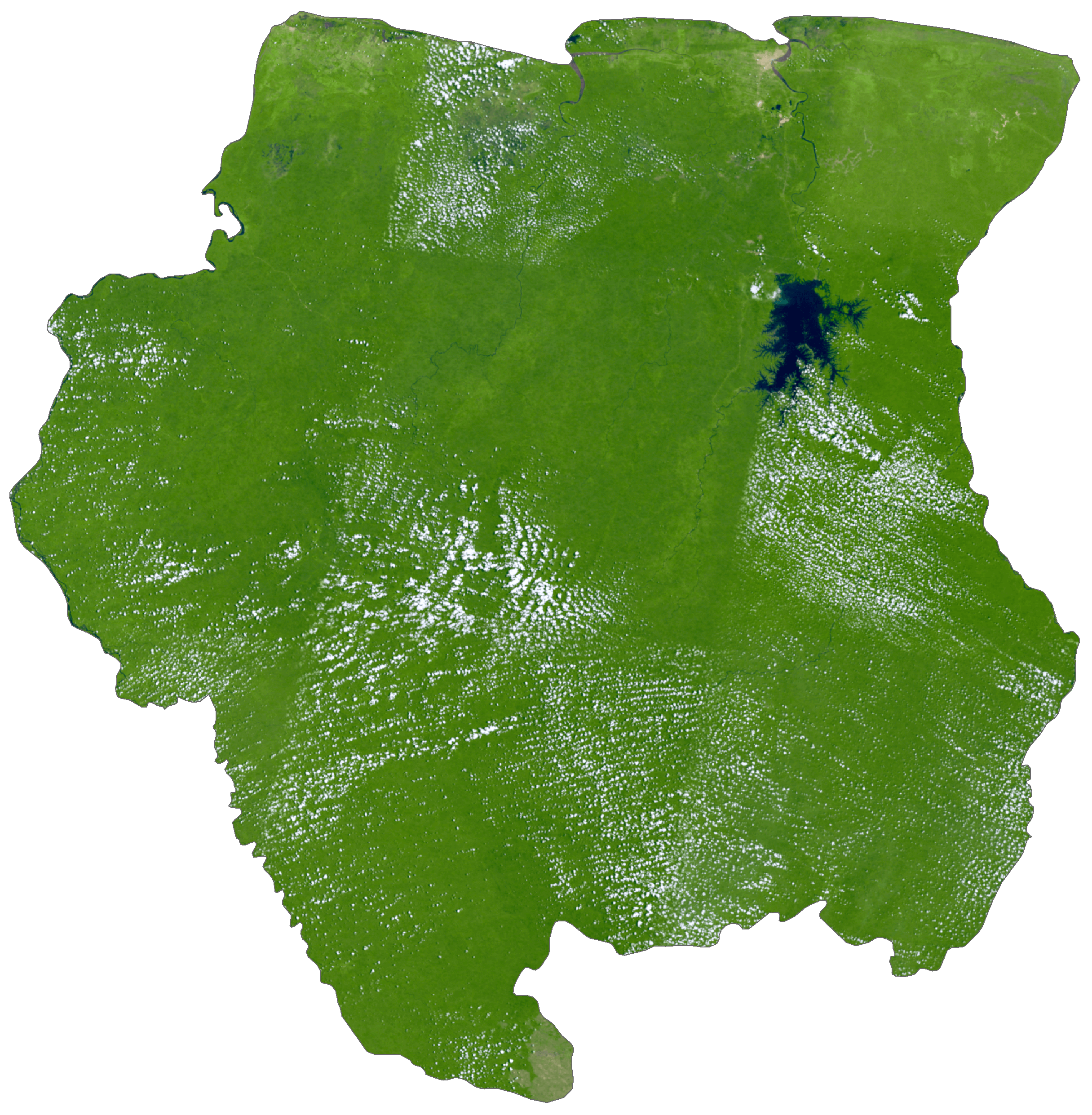
Suriname Satellite Map
Elevation Map