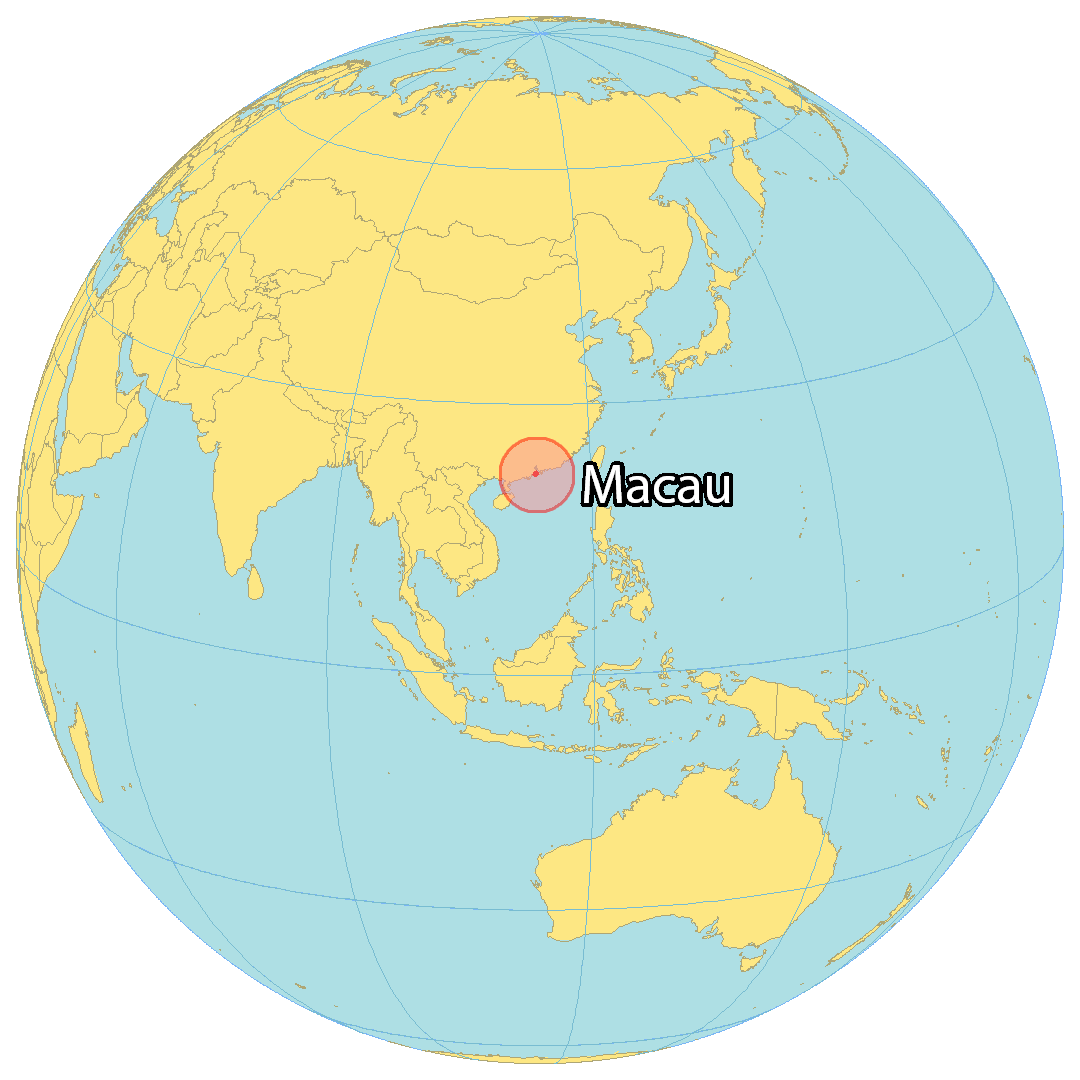
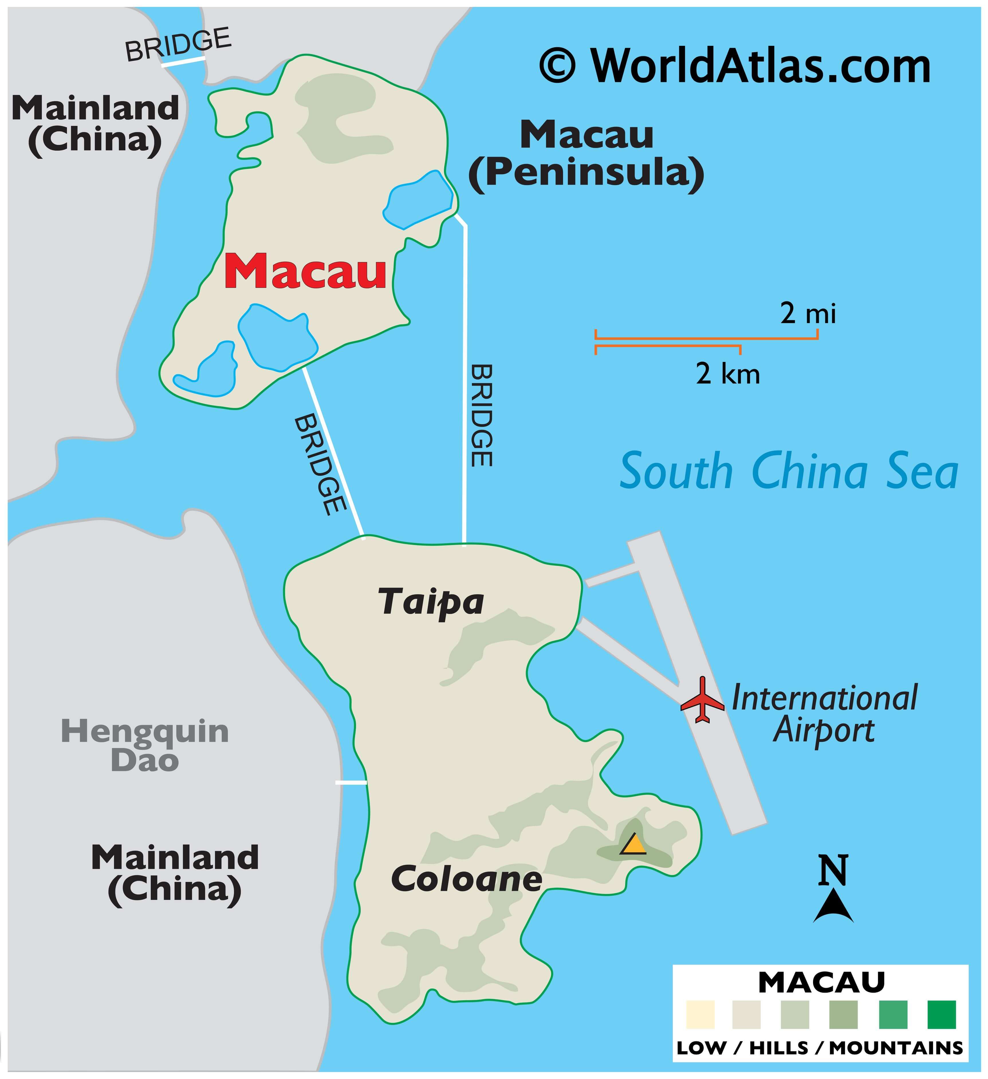
Macau is a Special Administrative Region of China with an area of 115.4 sq. km. As observed on the physical map of Maco, the region comprises of a peninsula attached to mainland Asia and the islands of Coloane and Taipa in the South China Sea.
Macao was formerly an island itself but was gradually connected to mainland by a growing sandbar. In more recent times, land reclamation has converted it into a peninsula. Constant land reclamation in the region has helped increase the area of Macau over the years.
The Macau Peninsula is mostly flat, but there are a few elevated spots.
Some steep, rolling hills are located on the island of Coloane, and along the southern coastline of the island of Taipa.
The highest point is Coloane Alto at 567 ft. (173 m). It has been marked on the map by a yellow upright trianble.
There are no major rivers or lakes in Macau.
| Flag: |  |
|---|---|
| Legal Name: | Macau Special Administrative Region |
| Largest City: |
Macao (651,875) |
| Official languages: |
|
| Demonym(s): | Macau |
| Government: | Devolved executive-led government within a unitary one-party state |
| Legislature: | Legislative Assembly |
| Total Area: | 28 km² |
| Land Area: | 28 km² |
| Population: | 640,445 |
| Density: | 21,340/km (55,270.3/sq mi) (1st) |
| GDP: | $53.86 Billion |
| GDP Per Capita: | $84,096.40 |
| Currency Value: | Patacas (MOP) |
| Driving side: | left |
| Calling code: | +853 |
| Internet TLD: |
|
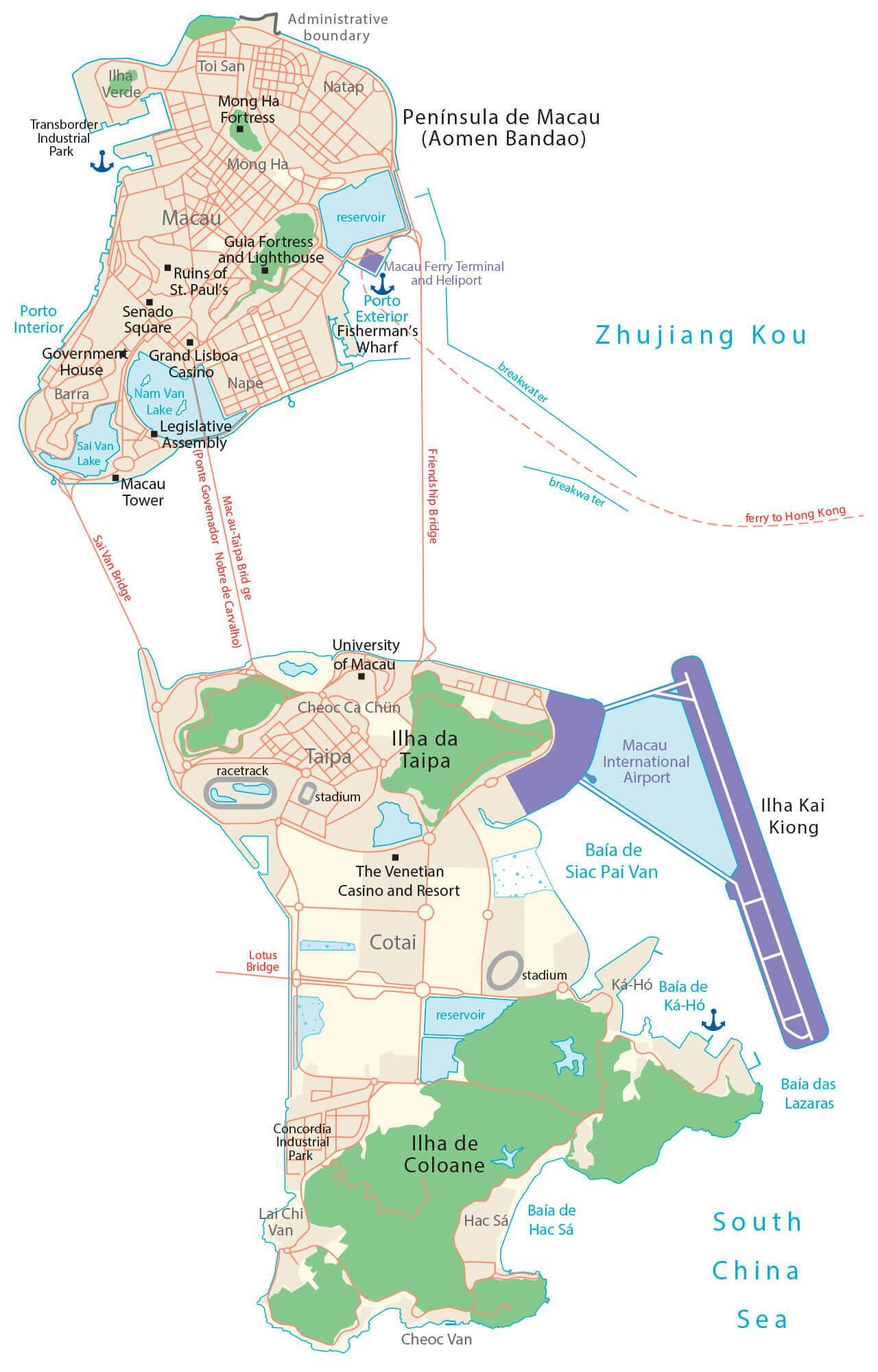
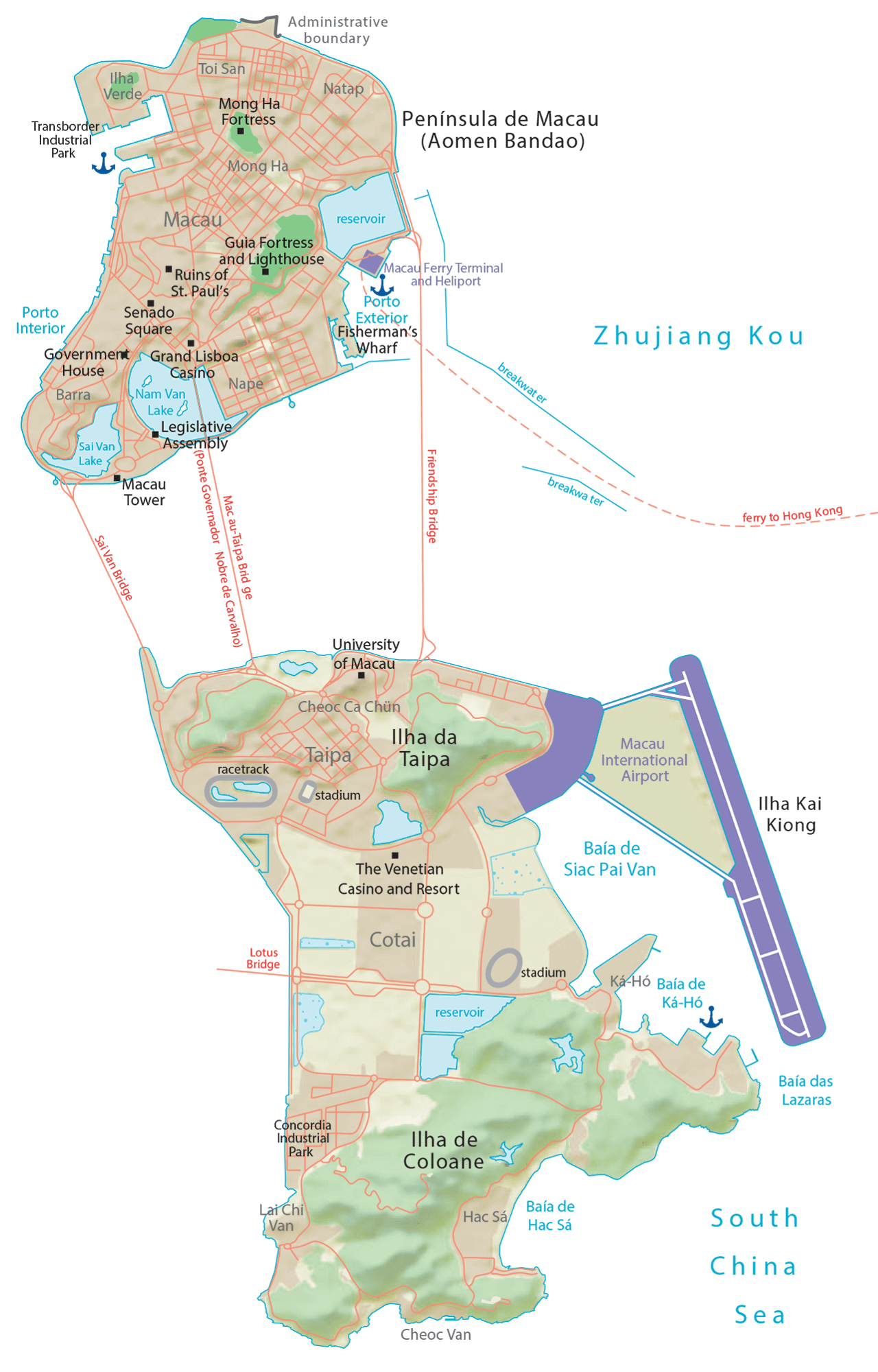
Discover the wonders of Macau with this detailed map. Explore its major landmarks and tourist attractions, from the Ruins of St. Paul’s to the Venetian Macao. Enjoy a physical map and satellite imagery to get a bird’s eye view of one of the most densely populated places in the world.
Online Interactive Political Map
Click on ![]() to view map in "full screen" mode.
to view map in "full screen" mode.
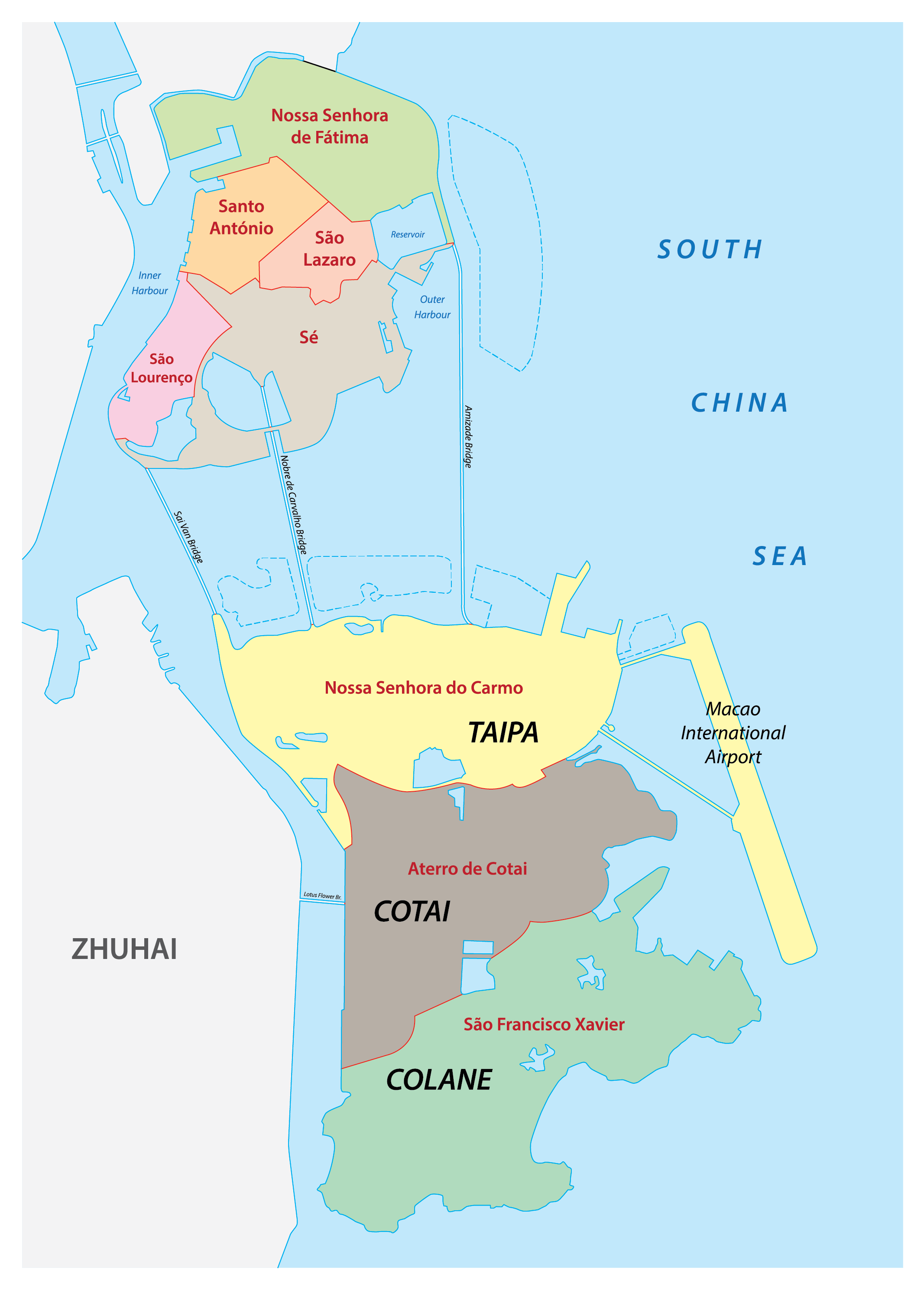
Macau is a special administrative region of the People’s Republic of China. It has seven parishes for symbolic reasons only. These are: Nossa Senhora de Fátima, Santo António, São Lázaro, Sé, São Lourenço, Nossa Senhora do Carmo, and São Francisco Xavier.
The Aterror de Cotai is a special territory of Macao that is not part of any of the parishes.
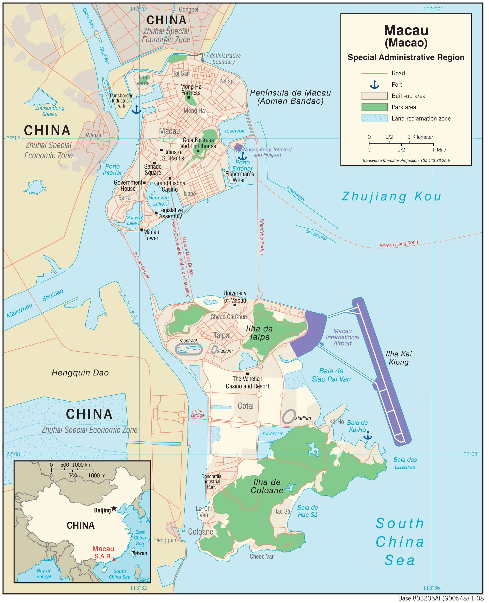
Location Maps
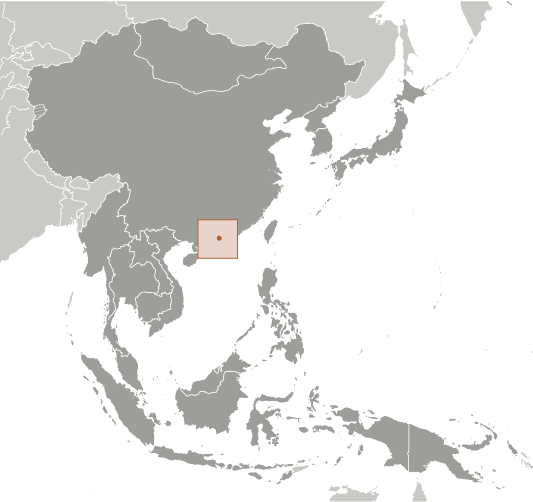
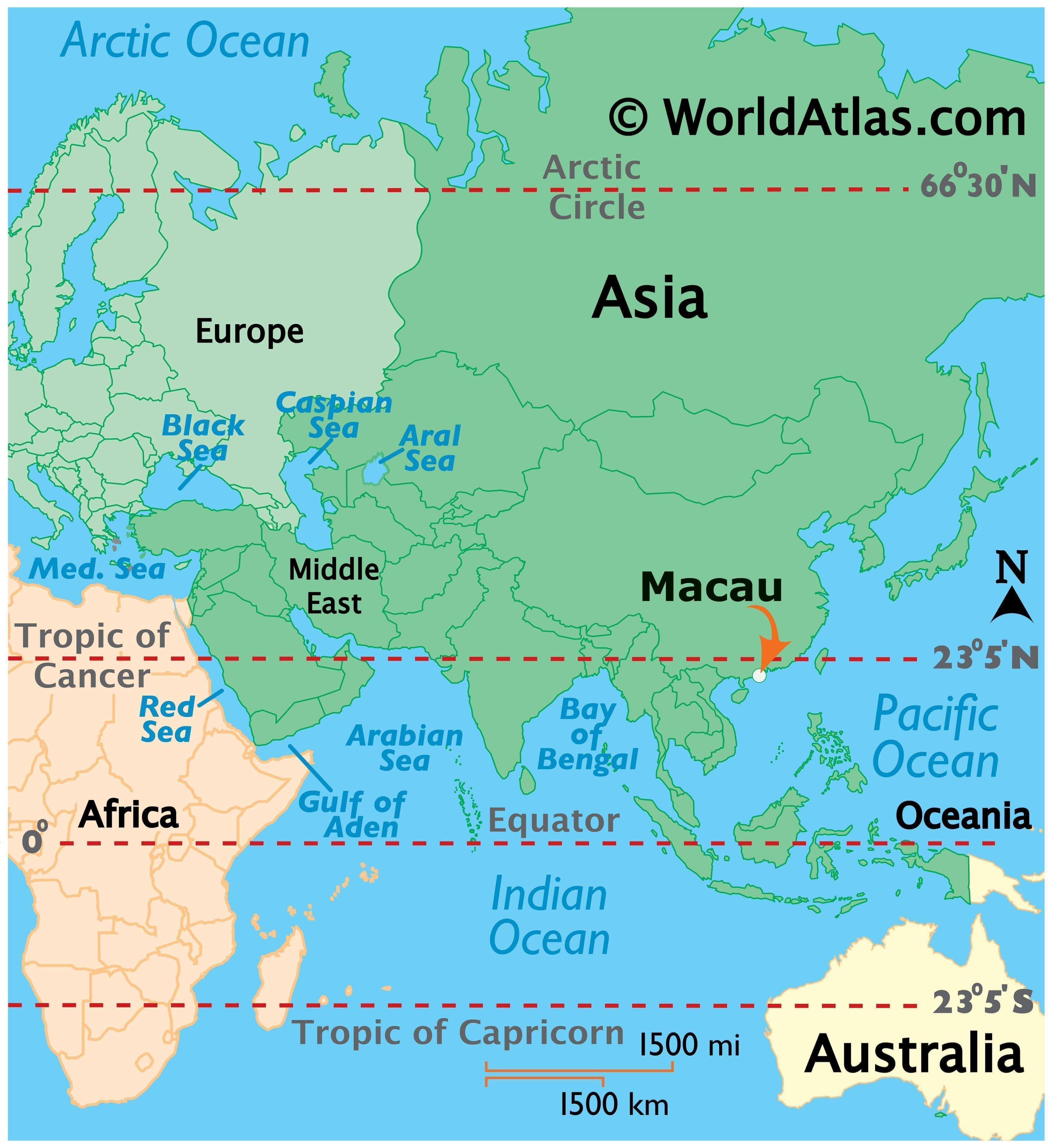
Where is Macau?
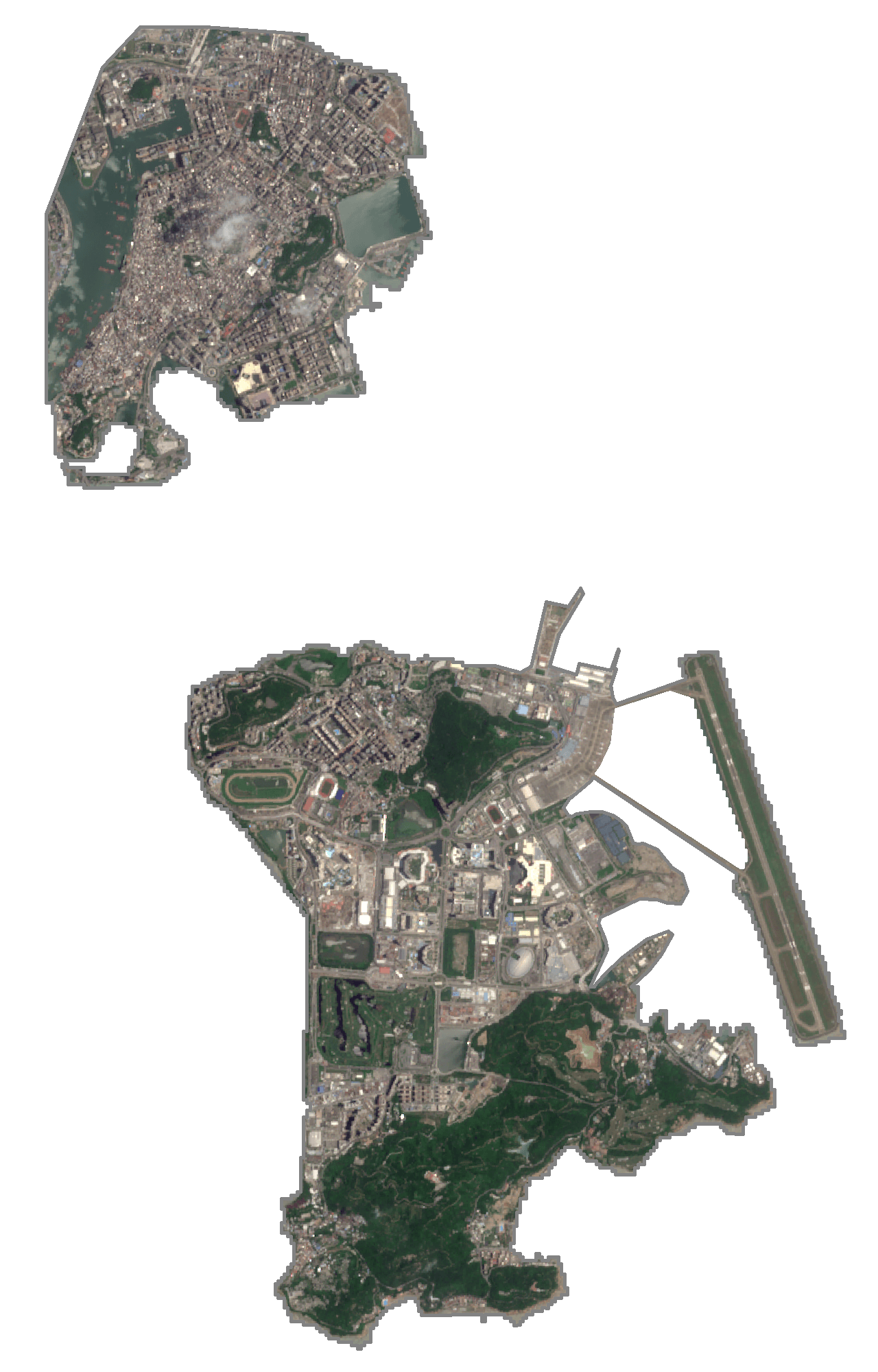
Macau is a small, densely populated territory located on the southern coast of China. It is situated on the western side of the Pearl River Delta, in the East Asian region. Macau consists of a peninsula and two islands, which are connected by bridges. The main island is called Taipa, and the other two islands are Coloane and Cotai.
Macau is also a special administrative region of China. It borders only China to the north. But it’s also just 60 km (37 mi) west of Hong Kong. Macau is known for being the “Las Vegas of Asia” because gambling and tourism are the largest economic drivers. It also has one of the highest per capita incomes in the world.
High Definition Political Map of Macau
History
During the Qin dynasty (221–206 BC), the region was under the jurisdiction of Panyu County, Nanhai Prefecture of the province of Guangdong. The region is first known to have been settled during the Han dynasty. It was administratively part of Dongguan Prefecture in the Jin dynasty (266–420 AD), and alternated under the control of Nanhai and Dongguan in later dynasties. In 1152, during the Song dynasty (960–1279 AD), it was under the jurisdiction of the new Xiangshan County. In 1277, approximately 50,000 refugees fleeing the Mongol conquest of China settled in the coastal area.
Macau did not develop as a major settlement until the Portuguese arrived in the 16th century. The first European visitor to reach China by sea was the explorer Jorge Álvares, who arrived in 1513. Merchants first established a trading post in Hong Kong waters at Tamão (present-day Tuen Mun), beginning regular trade with nearby settlements in southern China. Military clashes between the Ming and Portuguese navies followed the expulsion of the Tamão traders in 1521. Despite the trade ban, Portuguese merchants continued to attempt to settle on other parts of the Pearl River estuary, finally settling on Macau. In their first attempts at obtaining trading posts by force, the Portuguese were defeated by the Ming Chinese at the Battle of Tunmen in Tamão (or Tuen Mun) in 1521, where the Portuguese lost two ships; the Battle of Sincouwaan in Lantau Island where the Portuguese also lost two ships; in Shuangyu in 1548, where several Portuguese were captured; and near the Dongshan Peninsula in 1549, where two Portuguese junks and Galeote Pereira were captured. During these battles the Ming Chinese captured weapons from the defeated Portuguese which they then reverse engineered and mass-produced in China such as matchlock musket arquebuses which they named bird guns and Breech loading swivel guns which they named as Folangji (Frankish) cannon because the Portuguese were known to the Chinese under the name of Franks at this time. The Portuguese later returned to China peacefully and presented themselves under the name Portuguese instead of Franks in the Luso-Chinese agreement (1554) and rented Macau as a trading post from China by paying annual lease of hundreds of silver taels to Ming China. Luso-Canton trade relations were formally reestablished in 1554 and Portugal soon after acquired a permanent lease for Macau in 1557, agreeing to pay 500 taels of silver as annual land rent.
The initially small population of Portuguese merchants rapidly became a growing city. The Roman Catholic Diocese of Macau was created in 1576, and by 1583, the Senate had been established to handle municipal affairs for the growing settlement. Macau was at the peak of its prosperity as a major entrepôt during the late 16th century, providing a crucial connection in exporting Chinese silk to Japan during the Nanban trade period. Although the Portuguese were initially prohibited from fortifying Macau or stockpiling weapons, the Fortaleza do Monte was constructed in response to frequent Dutch naval incursions. The Dutch attempted to take the city in the 1622 Battle of Macau, but were repelled successfully by the Portuguese. Macau entered a period of decline in the 1640s following a series of catastrophic events for the burgeoning colony: Portuguese access to trade routes was irreparably severed when Japan halted trade in 1639, Portugal revolted against Spain in 1640, and Malacca fell to the Dutch in 1641.
Maritime trade with China was banned in 1644 following the Qing conquest under the Haijin policies and limited only to Macau on a lesser scale while the new dynasty focused on eliminating surviving Ming loyalists. While the Kangxi Emperor lifted the prohibition in 1684, China again restricted trade under the Canton System in 1757. Foreign ships were required to first stop at Macau before further proceeding to Canton. Qing authorities exercised a much greater role in governing the territory during this period; Chinese residents were subject to Qing courts and new construction had to be approved by the resident mandarin beginning in the 1740s. As the opium trade became more lucrative during the 18th century, Macau again became an important stopping point en route to China.
Following the First Opium War and the establishment of Hong Kong, Macau lost its role as a major port. Firecracker and incense production, as well as tea and tobacco processing, were vital industries in the colony during this time. Portugal was able to capitalise on China’s postwar weakness and assert its sovereignty; the Governor of Macau began refusing to pay China annual land rent for the colony in the 1840s, and annexed Taipa and Coloane, in 1851 and 1864 respectively. Portugal also occupied nearby Lapa and Montanha, but these would be returned to China by 1887, when perpetual occupation rights over Macau were formalised in the Sino-Portuguese Treaty of Peking. This agreement also prohibited Portugal from ceding Macau without Chinese approval. Despite occasional conflict between Cantonese authorities and the colonial government, Macau’s status remained unchanged through the republican revolutions of both Portugal in 1910 and China in 1911. The Kuomintang further affirmed Portuguese jurisdiction in Macau when the Treaty of Peking was renegotiated in 1928.
During the Second World War, the Empire of Japan did not occupy the colony and generally respected Portuguese neutrality in Macau. However, after Japanese troops captured a British cargo ship in Macau waters in 1943, Japan installed a group of government “advisors” as an alternative to military occupation. The territory largely avoided military action during the war except in 1945, when the United States ordered air raids on Macau after learning that the colonial government was preparing to sell aviation fuel to Japan. Portugal was later given over US$20 million in compensation for the damage in 1950.
Refugees from mainland China swelled the population as they fled from the Chinese Civil War. Access to a large workforce enabled Macau’s economy to grow as the colony expanded its clothing and textiles manufacturing industry, developed its tourism industry, and legalised casino gaming. However, at the height of the Cultural Revolution, residents dissatisfied with the colonial administration rioted in the 1966 12-3 incident, in which 8 people were killed and over 200 were injured. Portugal lost full control over the colony afterwards, and agreed to cooperate with the Chinese Communist Party in exchange for continued administration of Macau.
Following the 1974 Carnation Revolution, Portugal formally relinquished Macau as an overseas province and acknowledged it as a “Chinese territory under Portuguese administration”. After China first concluded arrangements on Hong Kong’s future with the United Kingdom, it entered negotiations with Portugal over Macau in 1986. They were concluded with the signing of the 1987 Joint Declaration on the Question of Macau, in which Portugal agreed to transfer the colony in 1999 and China would guarantee Macau’s political and economic systems for 50 years after the transfer. In the waning years of colonial rule, Macau rapidly urbanised and constructed large-scale infrastructure projects, including the Macau International Airport and a new container port. Macau was transferred to China on 20 December 1999, after 442 years of Portuguese rule.
Following the transfer, Macau liberalised its casino industry (which previously operated under a government-licensed monopoly) to allow foreign investors, starting a new period of economic development. The regional economy grew by a double-digit annual growth rate from 2002 to 2014, making Macau one of the richest economies in the world on a per capita basis. Political debates have centred on the region’s jurisdictional independence and the central government’s adherence of “one country, two systems”. While issues such as national security legislation have been controversial, Macanese residents generally have high levels of trust in the government. Kwong and Wong explain this by comparing Macau to Hong Kong: “The case of Macau shows that the very small size of a ‘microstate’ helps central authorities to exercise political control, stifle political pluralism, and monopolize opinions, all of which strengthen regime persistence.”
Physical Map of Macau
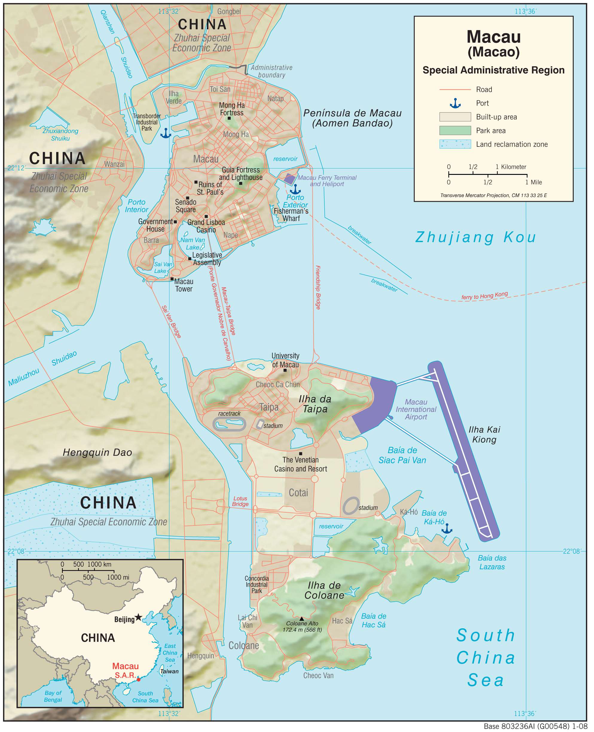
Geography
Macau is located on China’s southern coast, 60 km (37 mi) west of Hong Kong, on the western side of the Pearl River estuary. It is surrounded by the South China Sea in the east and south, and neighbours the Guangdong city of Zhuhai to the west and north. The territory consists of Macau Peninsula, Taipa, and Coloane. A 1 km (0.39 sq mi) parcel of land in neighbouring Hengqin island that hosts the University of Macau also falls under the regional government’s jurisdiction. The territory’s highest point is Coloane Alto, 170.6 metres (560 ft) above sea level.
Urban development is concentrated on peninsular Macau, where most of the population lives. The peninsula was originally a separate island with hilly terrain, which gradually became a tombolo as a connecting sandbar formed over time. Both natural sedimentation and land reclamation expanded the area enough to support urban growth. Macau has tripled its land area in the last century, increasing from 10.28 km (3.97 sq mi) in the late 19th century to 32.9 km (12.7 sq mi) in 2018.
Cotai, the area of reclaimed land connecting Taipa and Coloane, contains many of the newer casinos and resorts established after 1999. The region’s jurisdiction over the surrounding sea was greatly expanded in 2015, when it was granted an additional 85 km (33 sq mi) of maritime territory by the State Council. Further reclamation is currently underway to develop parts of the Macau New Urban Zone. The territory also has control over part of an artificial island to maintain a border checkpoint for the Hong Kong–Zhuhai–Macau Bridge.
Climate
Despite being located south of the Tropic of Cancer, Macau has a humid subtropical climate (Köppen Cwa), characteristic of southern China. The territory is dual season dominant – summer (May to September) and winter (November to February) are the longest seasons, while spring (March and April) and autumn (October) are relatively brief periods. The summer monsoon brings warm and humid air from the sea, with the most frequent rainfall occurring during the season. Typhoons also occur most often then, bringing significant spikes in rainfall. During the winter, northern winds from the continent bring dry air and much less rainfall. The highest and lowest temperatures recorded at the Macao Meteorological and Geophysical Bureau are 38.9 °C (102.0 °F) on both 2 July 1930 and 6 July 1930 and −1.8 °C (28.8 °F) on 26 January 1948.
Transportation Map of Macau
Macau Satellite Map