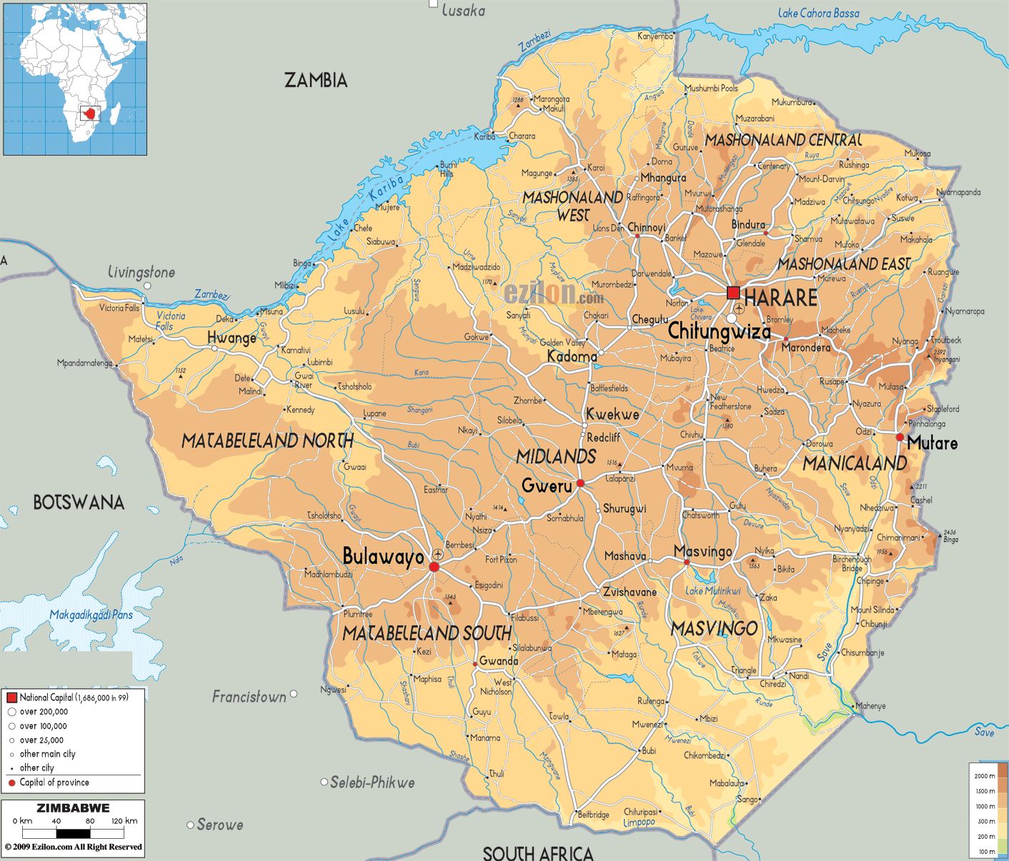
Situated within the tropics of southern Africa, Zimbabwe straddles a high inland plateau that drops northwards to the Zambezi valley.
The Inyanga and Udizi Mountains stretch along Zimbabwe’s eastern border with Mozambique, and the country’s highest and lowest point are both found there. Marked on the physical map above, Mount Inyangani at 8,503 ft. (2,592 m) is Zimbabwe’s highest point; its lowest, the intersection of the Runde and Save Rivers at 531 ft. (162 m). The Mafungabusa plateau (or Veld) covers the majority of land, central and east; the average elevation here is near 4,500 ft. (1,371 m) The Matobo Hills and Chizarira Hills anchor that plateau, north and south.
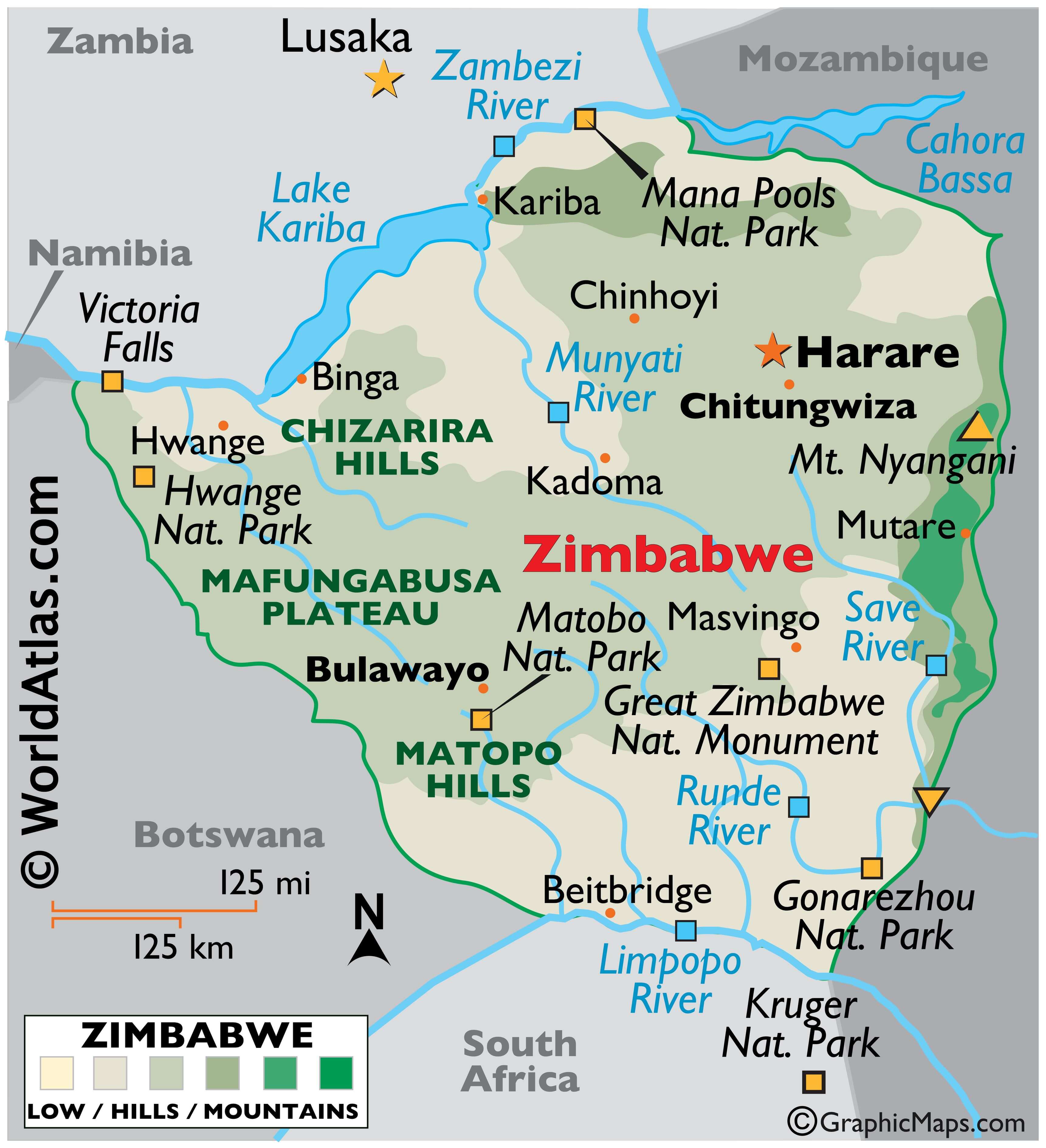
As can be noticed on the physical map of Zimbabwe, major bodies of water like Lake Kariba and Victoria Falls are both located on the western border of the country with Zambia. Victoria Falls, although neither the highest nor widest of waterfalls in the world, lays claim as the largest in the world based on a width of 5,604 ft. (1,708 m) and height of 354 ft. (108 m).
Important river systems of Zimbabwe include the Zambezi, Limpopo, Runde and Save and their numerous tributaries. Additional landforms include escarpments (steep slopes) along the Zambezi River and deep river valleys within the central plateau.
In addition, savanna grasslands cover the southern reaches, while evergreen forests are common central and east, especially in the mountain areas.
Several national parks protect these natural landscapes and the great diversity of wild flora and fauna of the country. Some of the important ones have been marked on the map. The Gonarezhou National Park of Zimbabwe is part of the Great Tranfrontier Park, a peace park that links it to South Africa’s Kruger National Park and Mozambique’s Limpopo National Park allowing the free movement of wildlife across international boundaries. The Great Zimbabwe National Monument is a UNESCO World Heritage Site in Zimbabwe. It is the ruins of a city from the Middle Ages that provides an insight into the culture and way of living of the Bantu/Shona people between the 11th and 15th centuries.
| Flag: |  |
|---|---|
| Legal Name: | Republic of Zimbabwe |
| Capital Value: | Harare |
| Official languages: | 16 languages:
|
| Demonym(s): | Zimbabwean Zimbo (colloquial) |
| Government: | Unitary dominant-party presidential republic |
| Legislature: | Parliament |
| Total Area: | 390,757 km² |
| Land Area: | 386,847 km² |
| Water Area: | 3,910 km² |
| Population: | 14,645,468 |
| Density: | 39/km (101.0/sq mi) |
| GDP: | $21.44 Billion |
| GDP Per Capita: | $1,463.99 |
| Currency Value: | Zimbabwean dollars (ZWD) |
| Driving side: | left |
| Calling code: | +263 |
| Internet TLD: | .zw |
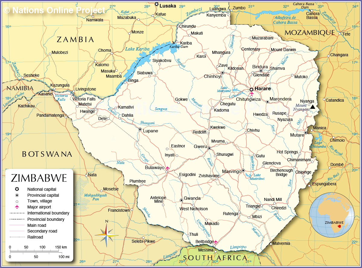
Explore the wonders of Zimbabwe with this amazing map collection! Our reference map shows the country’s major cities, towns, lakes, rivers, highways, and roads, while the satellite imagery offers stunning views of the landscape. And if you want to get a better understanding of the country’s terrain, our elevation map provides a detailed look at the various heights and depths of the terrain.
Online Interactive Political Map
Click on ![]() to view map in "full screen" mode.
to view map in "full screen" mode.
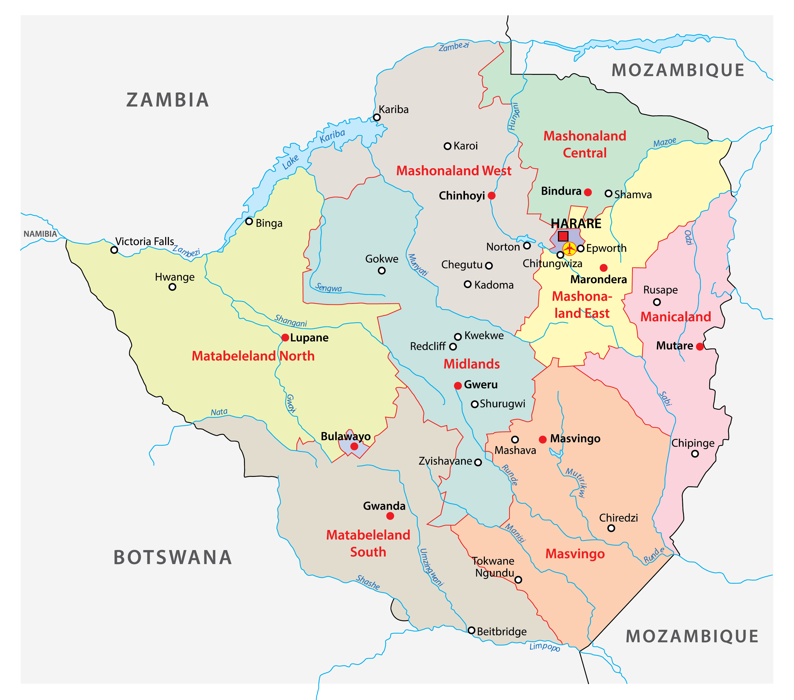
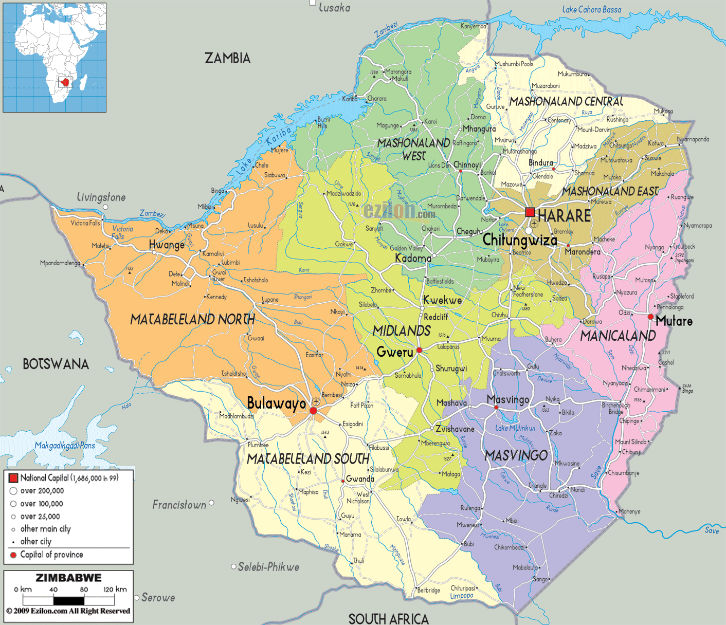
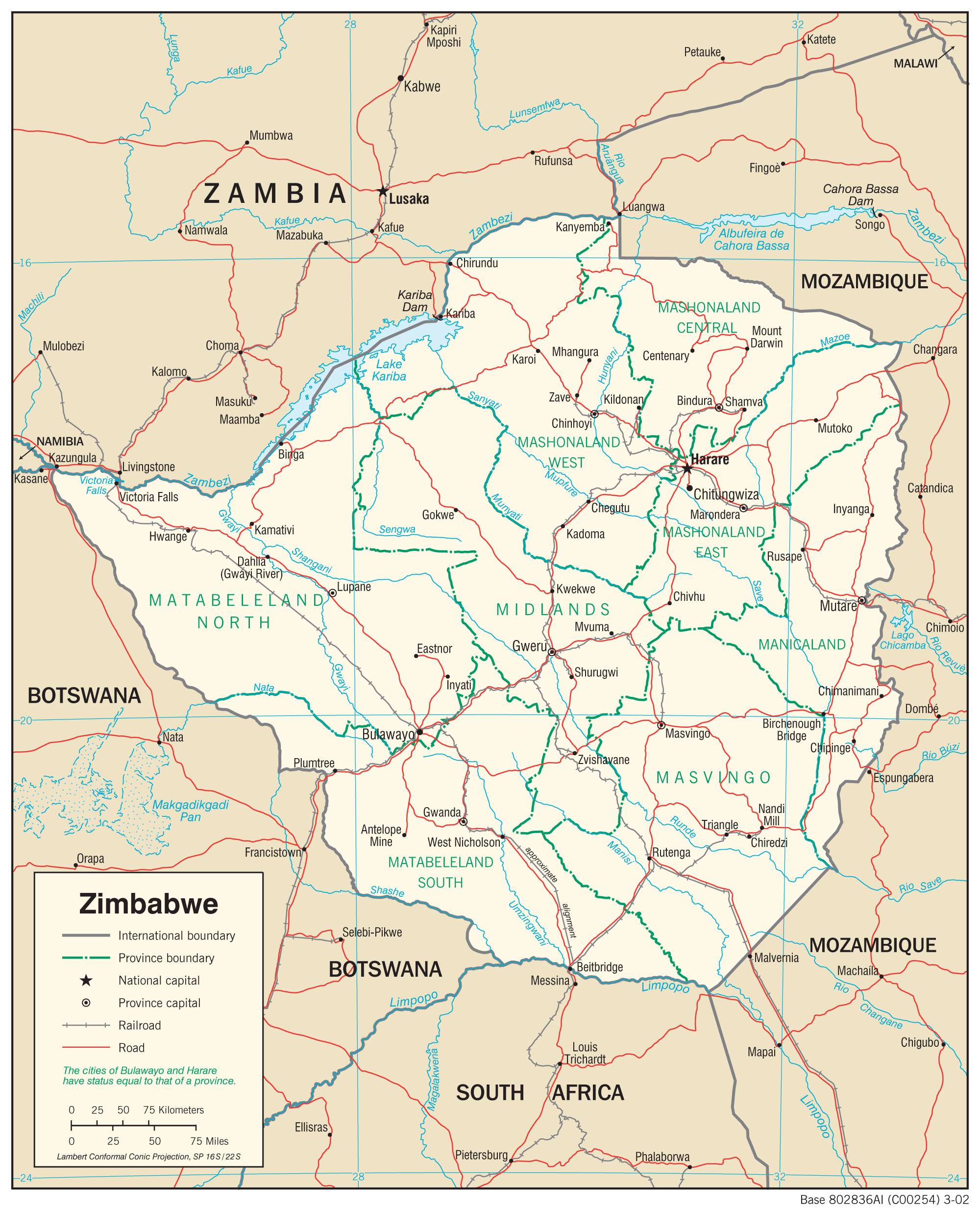
The political map of Zimbabwe shows its 8 provinces with their capitals and 2 cities with provincial status. The 8 provinces are Manicaland, Mashonaland Central, Mashonaland East, Mashonaland West, Masvingo, Matabeleland North, Matabeleland South, and Midlands. The two cities with provincial status include Bulawayo and Harare. The latter serves as the capital city of Zimbabwe. The provinces of the country are divided into districts which are further subdivided into wards.
With an area of 75,025 sq. km, Matabeleland North is the largest province of Zimbabwe by area. Hosting around 16.26% of the country’s total population, Harare is the most populous province in the country.
Location Maps
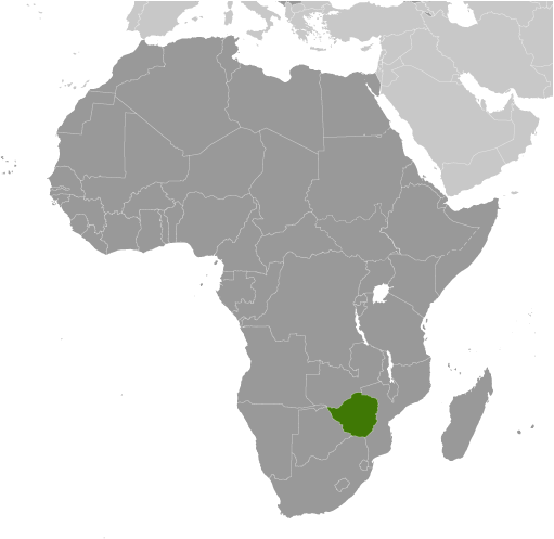
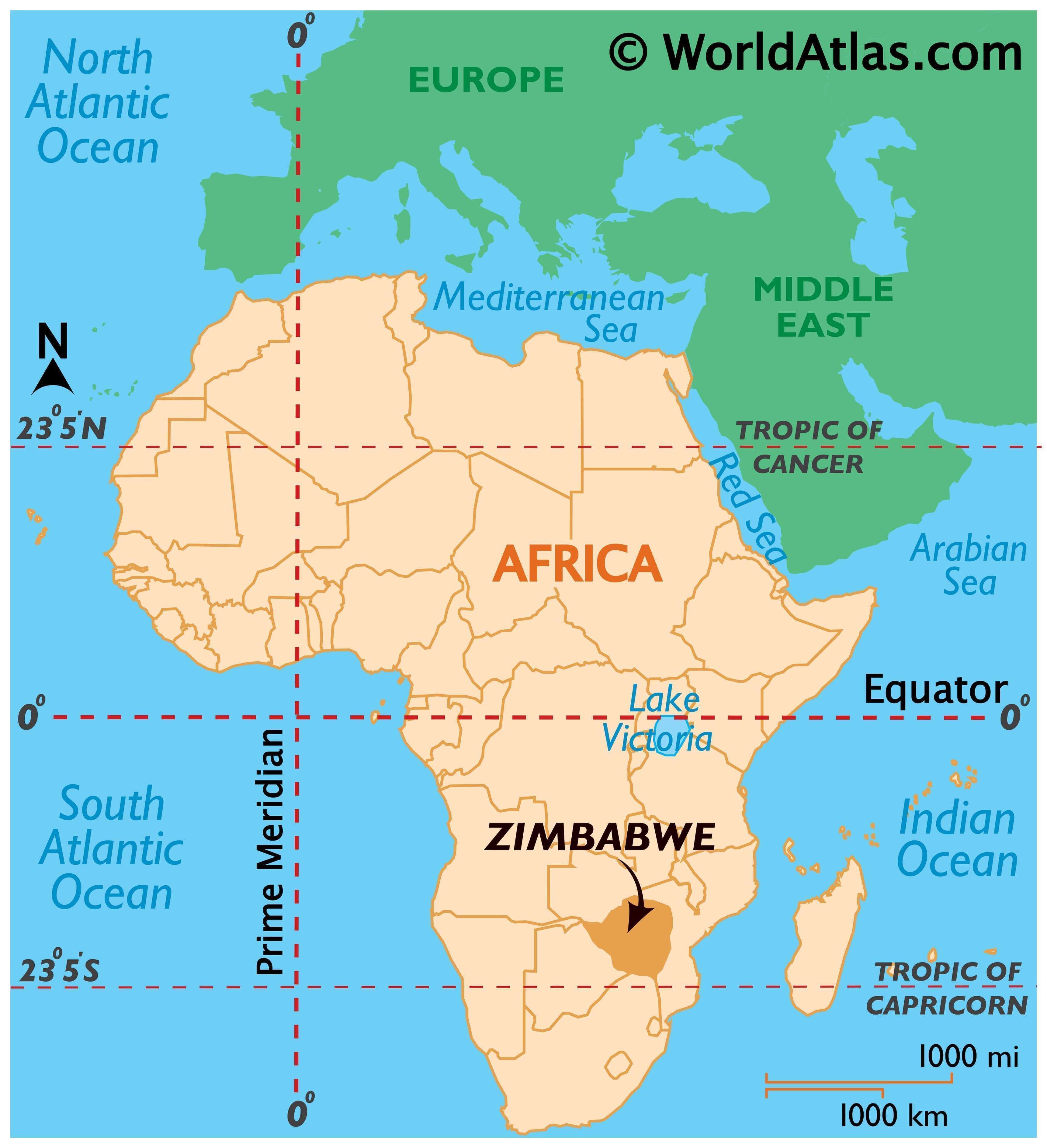
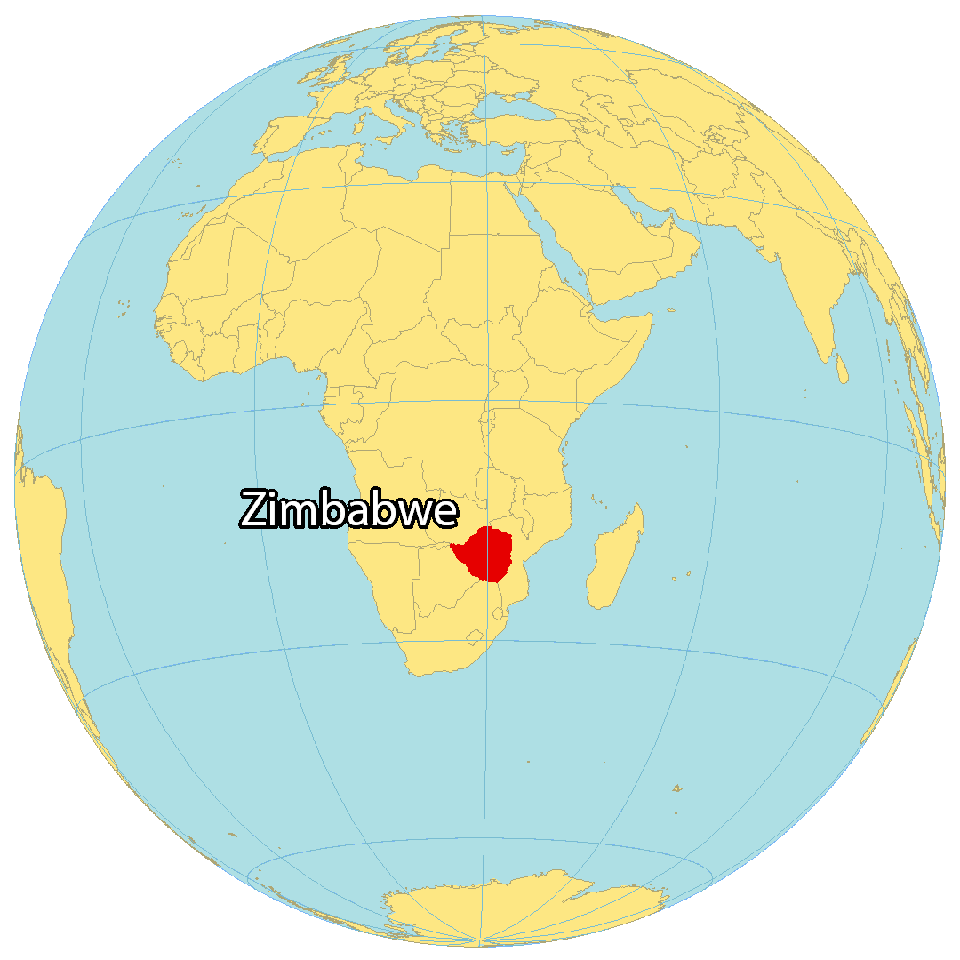
Where is Zimbabwe?
Zimbabwe is a landlocked country in Southern Africa, between South Africa to the south (along the Limpopo River) and Zambia to the north (along the Zambezi River). It also borders Mozambique to the east, and Botswana to the west. The country is known for its dramatic landscapes, wildlife reserves, safaris, and the world’s largest waterfall, Victoria Falls. The capital and largest city in Zimbabwe is Harare. Other major cities are Bulawayo, Chitungwiza, and Mutare.
High Definition Political Map of Zimbabwe
Physical Map of Zimbabwe
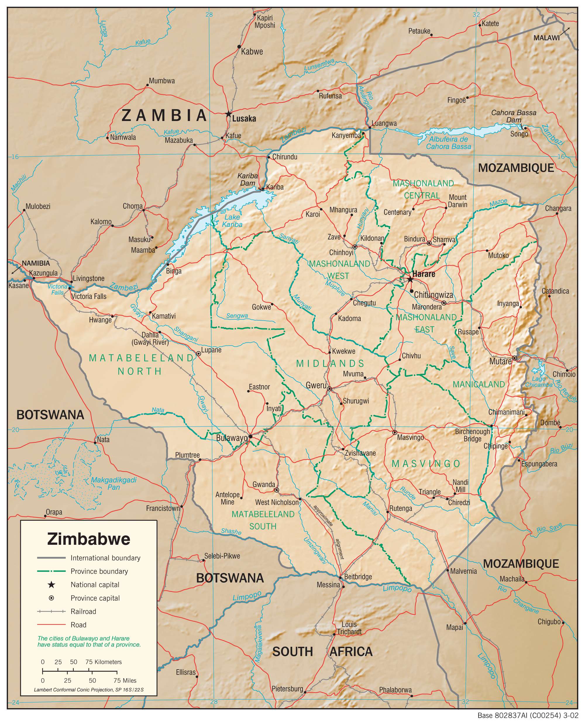
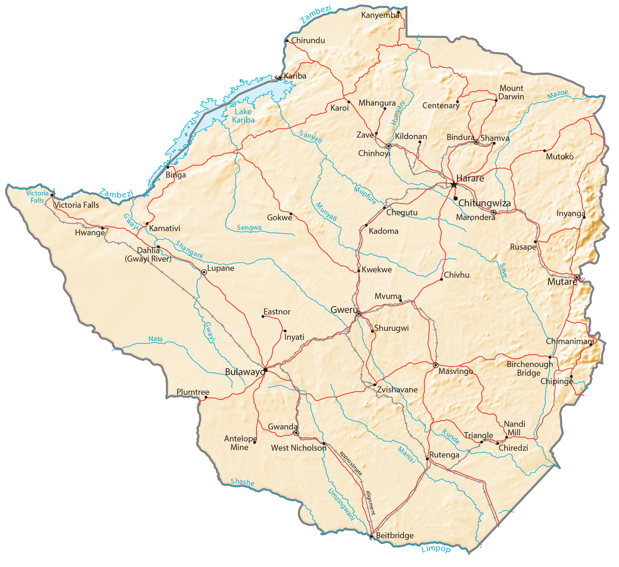
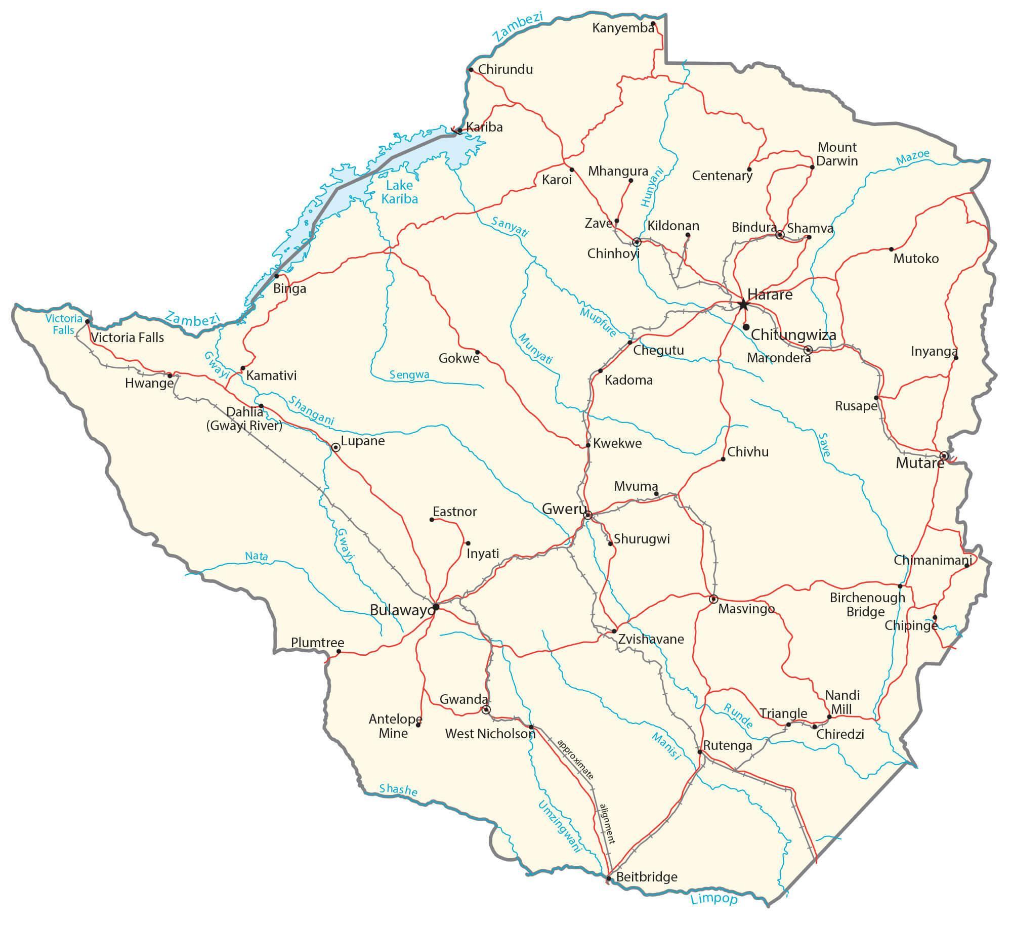
Transportation Map of Zimbabwe
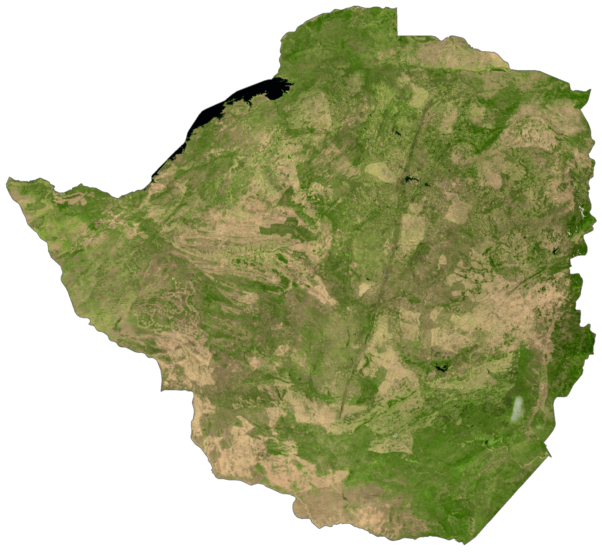
Zimbabwe Satellite Map