The landlocked country of Malawi in southeastern Africa covers an area of 118,484 sq. km.
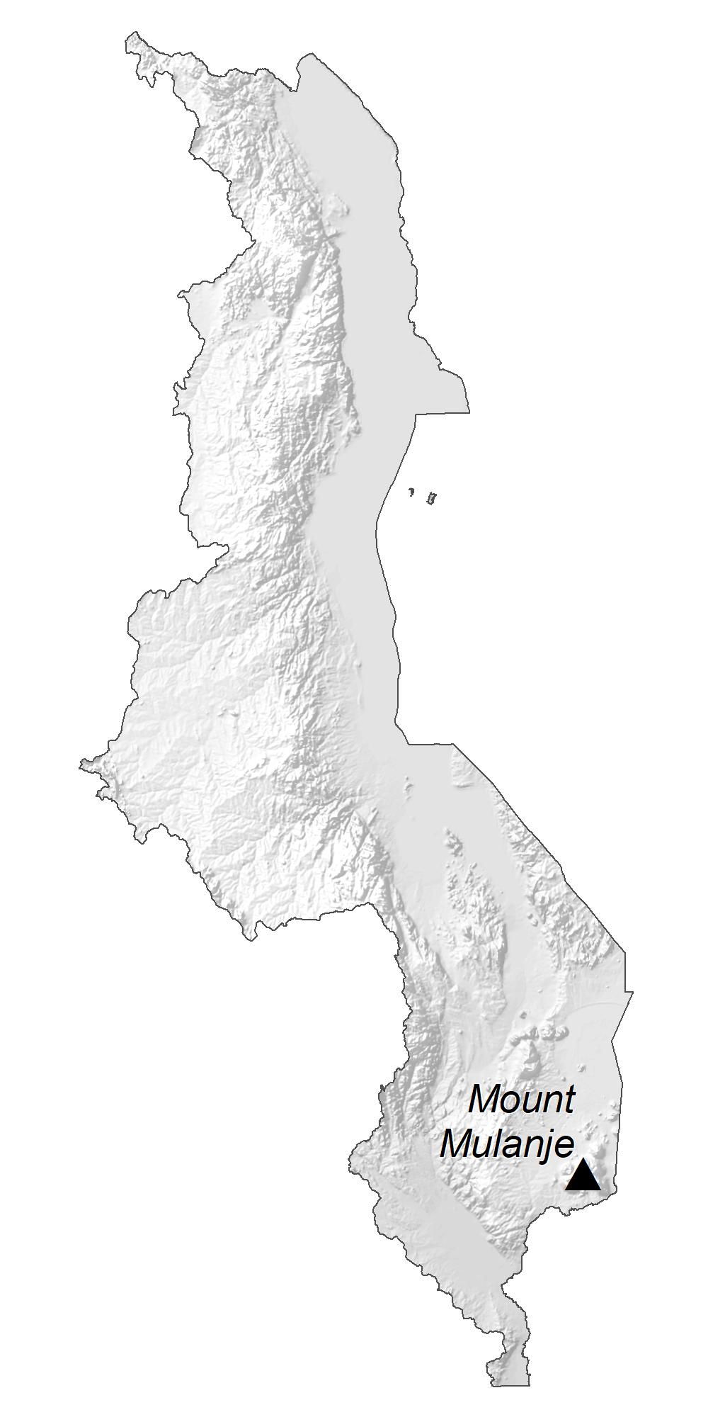
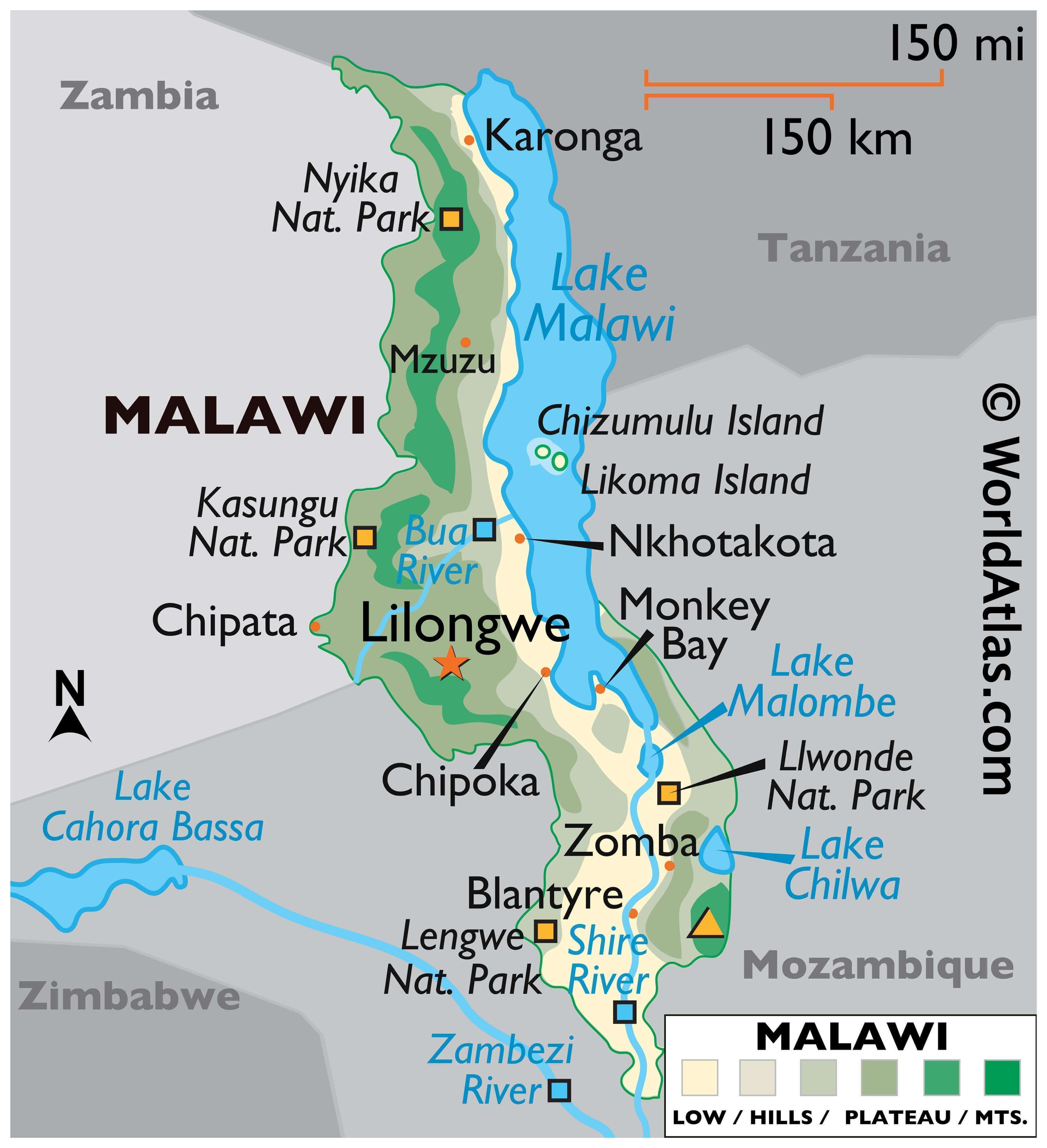
The country can be divided into four physiographic regions. These are the Great Rift Valley, the central plateau, highland region, and isolated mountains.
The Great Rift Valley traverses Malawi from north to south. As marked on the physical map of Malawi, this deep hosts Lake Malawi, the third-largest lake in Africa. The Shire River flows from the south end of that lake and joins the Zambezi River 249 mi (400 km) farther south in Mozambique.
In the west, the land forms high plateaus, generally between 900 and 1,200 m)above sea level. In the north, the Nyika Uplands rise as high as 2,600 m.
To the east of the Shire River the land rises to an elevation of 1,600 m, and eventually to the country’s highest point, Sapitwa Peak at 3,003 m near the Mozambique border. It has been marked on the map with a yellow upright triangle.
In the extreme south, the elevation is just slightly above sea level. It is there that Malawi’s lowest point sits at the junction of the Shire River and the border of Mozambique at 37 m.
| Flag: |  |
|---|---|
| Legal Name: | Republic of Malawi |
| Capital Value: | Lilongwe |
| Official languages: | English
|
| Demonym(s): | Malawian |
| Government: | Unitary presidential republic |
| Legislature: | National Assembly |
| Total Area: | 118,484 km² |
| Land Area: | 94,080 km² |
| Water Area: | 24,404 km² |
| Population: | 18,628,747 |
| Density: | 153.1/km (396.5/sq mi) (56th) |
| GDP: | $7.67 Billion |
| GDP Per Capita: | $411.55 |
| Currency Value: | Malawian kwachas (MWK) |
| Driving side: | left |
| Calling code: | +265 |
| Internet TLD: | .mw |
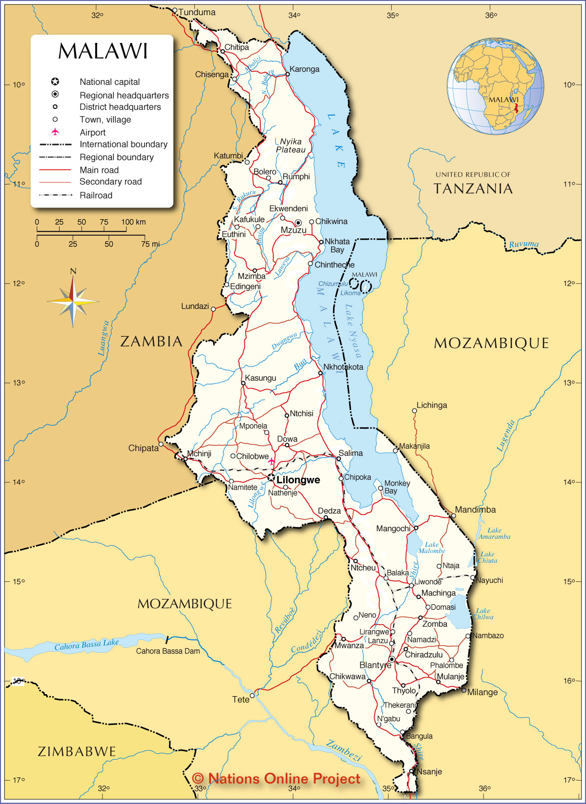
Explore the wonders of Malawi with this detailed map! From the stunning Lake Malawi to the Great Rift Valley, this map showcases the diverse geography and beauty that this African country has to offer. Discover the major cities and towns, as well as the lakes, rivers, and roads, all depicted in beautiful satellite imagery and an elevation feature.
Online Interactive Political Map
Click on ![]() to view map in "full screen" mode.
to view map in "full screen" mode.
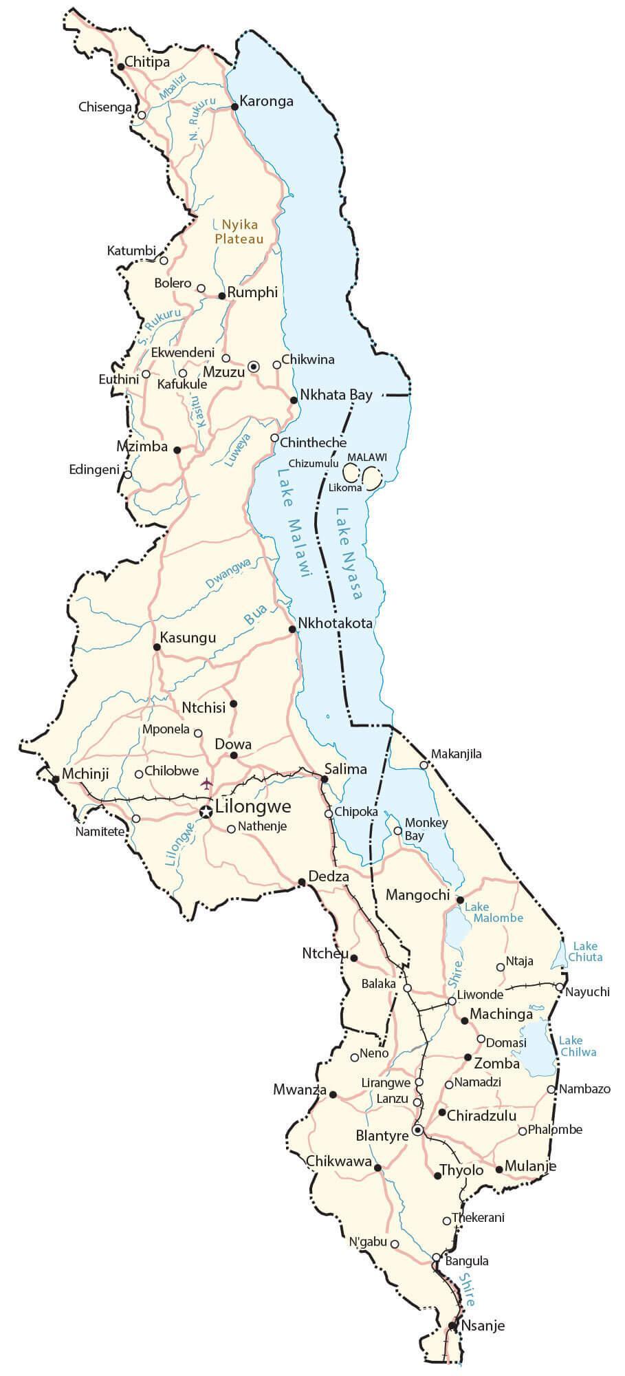
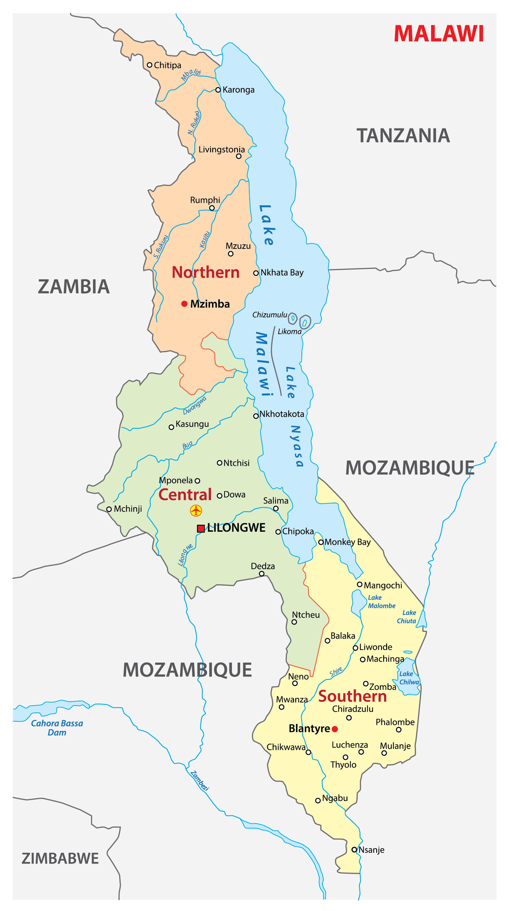
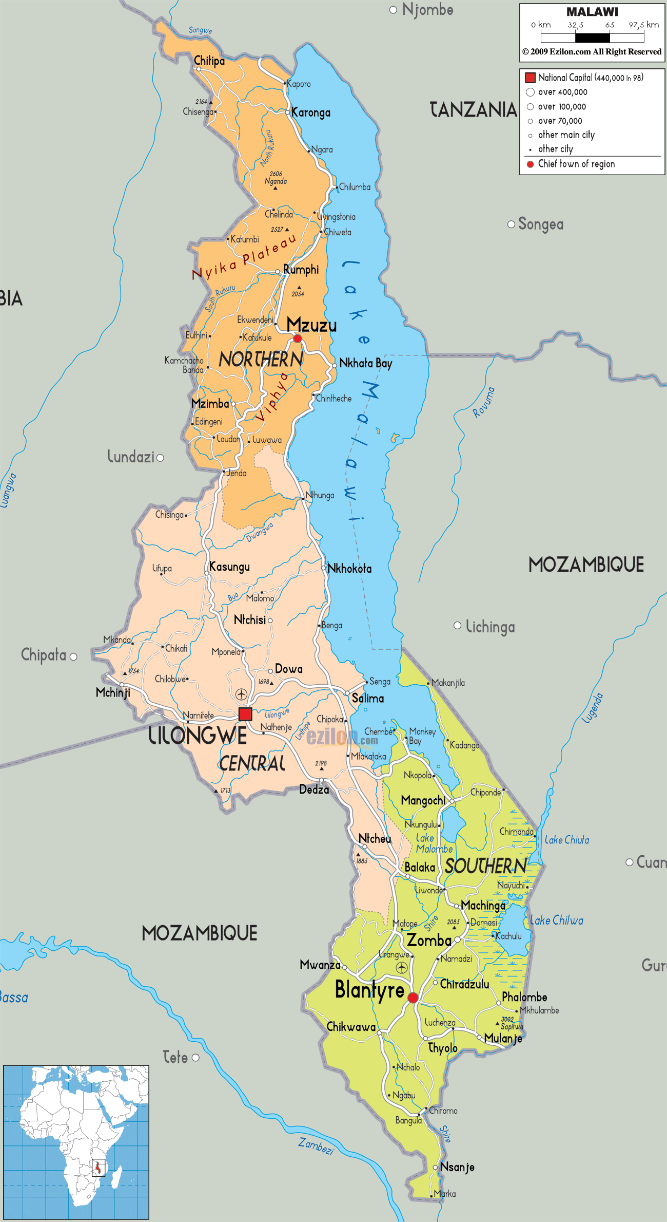
Malawi is divided into three regions with 28 districts. The regions are Northern, Central, and Southern. In alphabetical order, the districts are as follows: Balaka, Blantyre, Chikwawa, Chiradzulu, Chitipa, Dedza, Dowa, Karonga, Kasungu, Likoma, Lilongwe, Machinga, Mangochi, Mchinji, Mulanje, Mwanza, Mzimba, Neno, Ntcheu, Nkhata Bay, Nkhotakota, Nsanje, Ntchisi, Phalombe, Rumphi, Salima, Thyolo, and Zomba.
Mzimba in the Northern region is the largest district by area (10,619 sq. km). Lilongwe in the Central District that houses the national capital of Lilongwe is the most populous one.
Location Maps
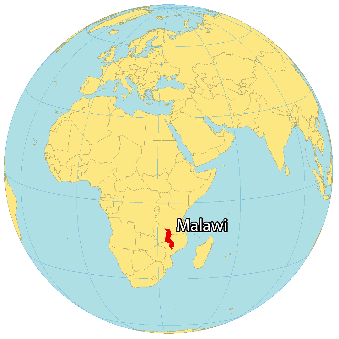
Where is Malawi?
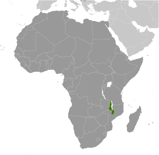
Malawi is a landlocked country situated in Southeast Africa, neighbouring Zambia to the west, Tanzania to the north, and Mozambique to the east. One of its most iconic features is the African Great Lake of Lake Malawi (also known as Lake Nyasa in Tanzania and Lago Niassa in Mozambique), which is one of the deepest lakes in the world.
Lilongwe is the capital and largest city of Malawi, and other major cities include Blantyre, Mzuzu, and Zomba. It has earned the nickname “The Warm Heart of Africa” due to its reputation for being welcoming and friendly.
High Definition Political Map of Malawi
History
Pre-colonial history
The area of Africa now known as Malawi had a very small population of hunter-gatherers before waves of Bantu peoples began emigrating from the north around the 10th century. Although most of the Bantu peoples continued south, some remained and founded ethnic groups based on common ancestry. By 1500 AD, the tribes had established the Kingdom of Maravi that reached from north of what is now Nkhotakota to the Zambezi River and from Lake Malawi to the Luangwa River in what is now Zambia.
Soon after 1600, with the area mostly united under one native ruler, native tribesmen began encountering, trading with and making alliances with Portuguese traders and members of the military. By 1700, however, the empire had broken up into areas controlled by many individual ethnic groups. The Indian Ocean slave trade reached its height in the mid-1800s, when approximately 20,000 people were enslaved and considered to be carried yearly from Nkhotakota to Kilwa where they were sold.
Colonial occupation
Missionary and explorer David Livingstone reached Lake Malawi (then Lake Nyasa) in 1859 and identified the Shire Highlands south of the lake as an area suitable for European settlement. As the result of Livingstone’s visit, several Anglican and Presbyterian missions were established in the area in the 1860s and 1870s, the African Lakes Company Limited was established in 1878 to set up a trade and transport concern working closely with the missions, and a small mission and trading settlement were established at Blantyre in 1876 and a British Consul took up residence there in 1883. The Portuguese government was also interested in the area so, to prevent Portuguese occupation, the British government sent Harry Johnston as British consul with instructions to make treaties with local rulers beyond Portuguese jurisdiction.
In 1889, a British protectorate was proclaimed over the Shire Highlands, which was extended in 1891 to include the whole of present-day Malawi as the British Central Africa Protectorate. In 1907, the protectorate was renamed Nyasaland, a name it retained for the remainder of its time under British rule. In a prime example of what is sometimes called the “Thin White Line” of colonial authority in Africa, the colonial government of Nyasaland was formed in 1891. The administrators were given a budget of £10,000 (1891 nominal value) per year, which was enough to employ ten European civilians, two military officers, seventy Punjabi Sikhs and eighty-five Zanzibar porters. These few employees were then expected to administer and police a territory of around 94,000 square kilometers with between one and two million people.
That same year, slavery came to its complete cessation when Sir Harry Johnston, the Commissioner of Nyasaland made his significant effort to put an end to the trade.
In 1944, the Nyasaland African Congress (NAC) was formed by the Africans of Nyasaland to promote local interests to the British government. In 1953, Britain linked Nyasaland with Northern and Southern Rhodesia in what was the Federation of Rhodesia and Nyasaland, often called the Central African Federation (CAF), for mainly political reasons. Even though the Federation was semi-independent, the linking provoked opposition from African nationalists, and the NAC gained popular support. An influential opponent of the CAF was Hastings Banda, a European-trained doctor working in Ghana who was persuaded to return to Nyasaland in 1958 to assist the nationalist cause. Banda was elected president of the NAC and worked to mobilise nationalist sentiment before being jailed by colonial authorities in 1959. He was released in 1960 and asked to help draft a new constitution for Nyasaland, with a clause granting Africans the majority in the colony’s Legislative Council.
Hastings Kamuzu Banda era (1961–1993)
In 1961, Banda’s Malawi Congress Party (MCP) gained a majority in the Legislative Council elections and Banda became Prime Minister in 1963. The Federation was dissolved in 1963, and on 6 July 1964, Nyasaland became independent from British rule and renamed itself Malawi, and that is commemorated as the nation’s Independence Day, a public holiday. Under a new constitution, Malawi became a republic with Banda as its first president. The new document also formally made Malawi a one-party state with the MCP as the only legal party. In 1971, Banda was declared president-for-life. For almost 30 years, Banda presided over a rigidly totalitarian regime, which ensured that Malawi did not suffer armed conflict. Opposition parties, including the Malawi Freedom Movement of Orton Chirwa and the Socialist League of Malawi, were founded in exile.
Malawi’s economy, while Banda was president, was often cited as an example of how a poor, landlocked, and heavily populated country deficient in mineral resources could achieve progress in both agriculture and industrial development. While in office, and using his control of the country, Banda constructed a business empire that eventually produced one-third of the country’s GDP and employed 10% of the wage-earning workforce.
Multi-party democracy (1993–present)
Under pressure for increased political freedom, Banda agreed to a referendum in 1993, where the populace voted for a multi-party democracy. In late 1993, a presidential council was formed, the life presidency was abolished and a new constitution was put into place, effectively ending the MCP’s rule. In 1994 the first multi-party elections were held in Malawi, and Banda was defeated by Bakili Muluzi (a former Secretary General of the MCP and former Banda Cabinet Minister). Re-elected in 1999, Muluzi remained president until 2004, when Bingu wa Mutharika was elected. Although the political environment was described as “challenging”, it was stated in 2009 that a multi-party system still existed in Malawi. Multiparty parliamentary and presidential elections were held for the fourth time in Malawi in May 2009, and President Mutharika was successfully re-elected, despite charges of election fraud from his rival.
President Mutharika was seen by some as increasingly autocratic and dismissive of human rights, and in July 2011 protests over high costs of living, devolving foreign relations, poor governance and a lack of foreign exchange reserves erupted. The protests left 18 people dead and at least 44 others suffering from gunshot wounds.
In April 2012, Mutharika died of a heart attack. Over a period of 48 hours, his death was kept secret, including an elaborate flight with the body to South Africa, where the ambulance drivers refused to move the body, saying they were not licensed to move a corpse. After the South African government threatened to reveal the information, the presidential title was taken over by Vice-President Joyce Banda (not related to the former president Banda).
In 2014 Malawian general election Joyce Banda lost the elections (coming third) and was replaced by Peter Mutharika, the brother of ex-President Mutharika. In the 2019 Malawian general election president Peter Mutharika was narrowly re-elected. In February 2020 Malawi Constitutional Court overturned the result because of irregularities and widespread fraud. In May 2020 Malawi Supreme Court upheld the decision and announced a new election was held on July 2. This was the first time an election in the country was legally challenged. Opposition leader Lazarus Chakwera won the 2020 Malawian presidential election and he was sworn in as the new president of Malawi.
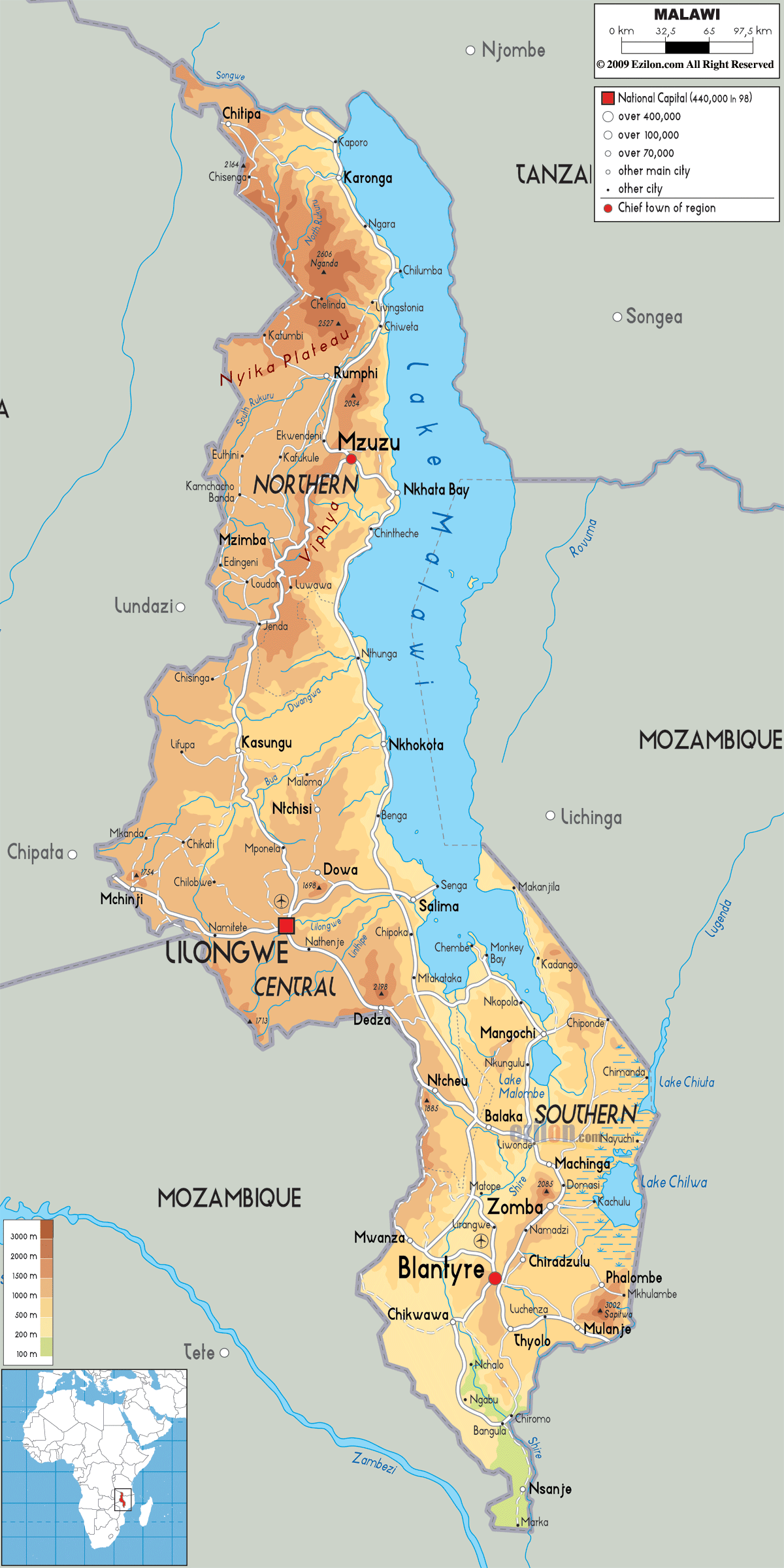
Physical Map of Malawi
Geography
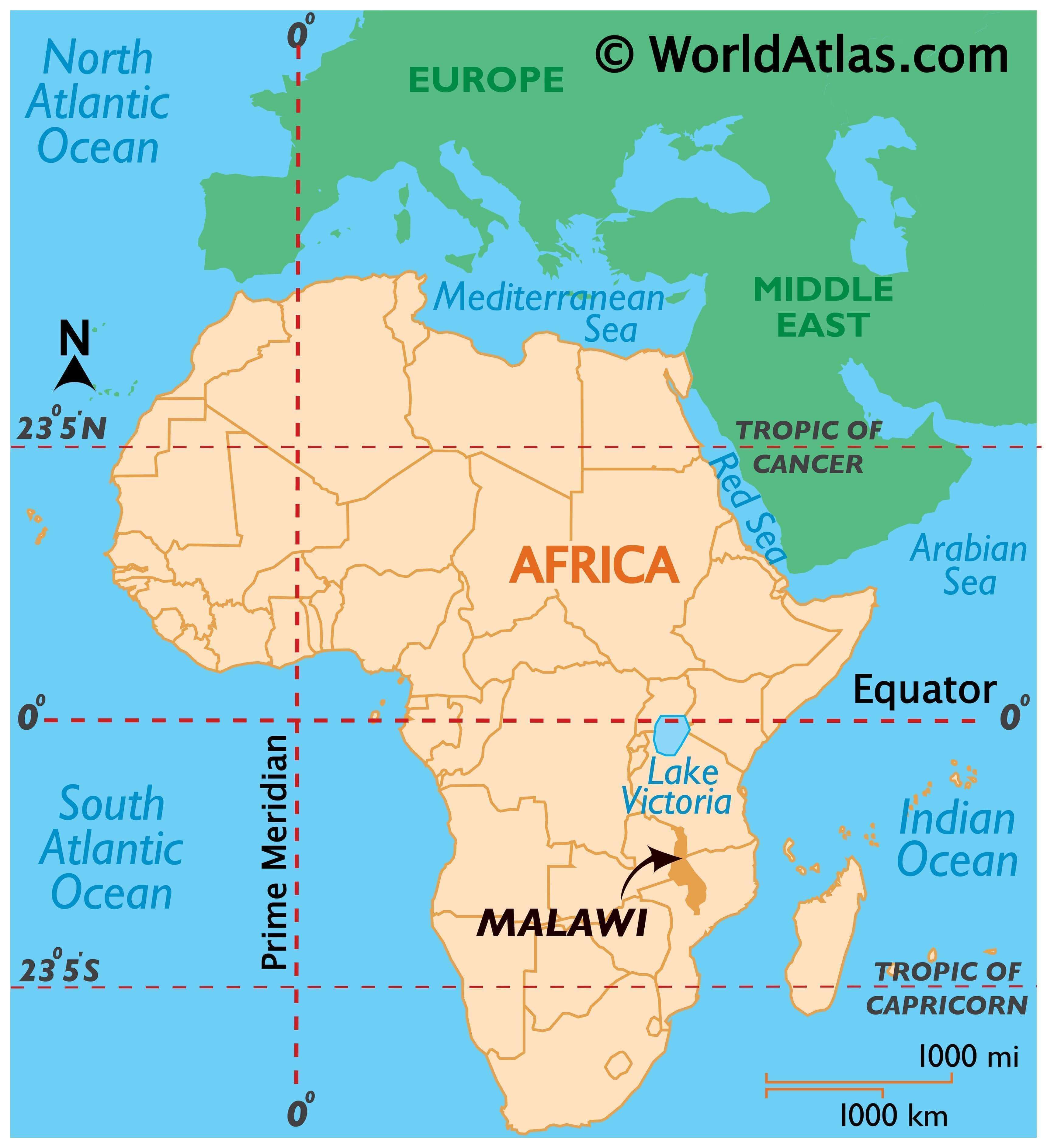
Malawi is a landlocked country in southeastern Africa, bordered by Zambia to the northwest, Tanzania to the northeast, and Mozambique to the south, southwest, and southeast. It lies between latitudes 9° and 18°S, and longitudes 32° and 36°E.
The Great Rift Valley runs through the country from north to south, and to the east of the valley lies Lake Malawi (also called Lake Nyasa), making up over three-quarters of Malawi’s eastern boundary. Lake Malawi is sometimes called the Calendar Lake as it is about 587 kilometres (365 mi) long and 84 kilometres (52 mi) wide. The Shire River flows from the south end of the lake and joins the Zambezi River 400 kilometres (250 mi) farther south in Mozambique. The surface of Lake Malawi is at 457 metres (1,500 ft) above sea level, with a maximum depth of 701 metres (2,300 ft), which means the lake bottom is over 213 metres (700 ft) below sea level at some points.
In the mountainous sections of Malawi surrounding the Rift Valley, plateaus rise generally 914 to 1,219 metres (3,000 to 4,000 ft) above sea level, although some rise as high as 2,438 metres (8,000 ft) in the north. To the south of Lake Malawi lie the Shire Highlands, gently rolling land at approximately 914 metres (3,000 ft) above sea level. In this area, the Zomba and Mulanje mountain peaks rise to respective heights of 2,134 and 3,048 metres (7,000 and 10,000 ft).
Malawi’s capital is Lilongwe, and its commercial centre is Blantyre with a population of over 500,000 people. Malawi has two sites listed on the UNESCO World Heritage List. Lake Malawi National Park was first listed in 1984 and the Chongoni Rock Art Area was listed in 2006.
Malawi’s climate is hot in the low-lying areas in the south of the country and temperate in the northern highlands. The altitude moderates what would otherwise be an equatorial climate. Between November and April, the temperature is warm with equatorial rains and thunderstorms, with the storms reaching their peak severity in late March. After March, the rainfall rapidly diminishes, and from May to September wet mists float from the highlands into the plateaus, with almost no rainfall during these months.
Flora and fauna
Animal life indigenous to Malawi includes mammals such as elephants, hippos, antelopes, buffaloes, big cats, monkeys, rhinos, and bats; a great variety of birds including birds of prey, parrots and falcons, waterfowl and large waders, owls and songbirds. Lake Malawi has been described as having one of the richest lake fish faunas in the world, being the home for some 200 mammals, 650 birds, 30+ mollusk, and 5,500+ plant species.
Seven terrestrial ecoregions lie within Malawi’s borders: Central Zambezian miombo woodlands, Eastern miombo woodlands, Southern miombo woodlands, Zambezian and mopane woodlands, Zambezian flooded grasslands, South Malawi montane forest-grassland mosaic, and Southern Rift montane forest-grassland mosaic.
There are five national parks, four wildlife and game reserves and two other protected areas in Malawi. The country had a 2019 Forest Landscape Integrity Index mean score of 5.74/10, ranking it 96th globally out of 172 countries.
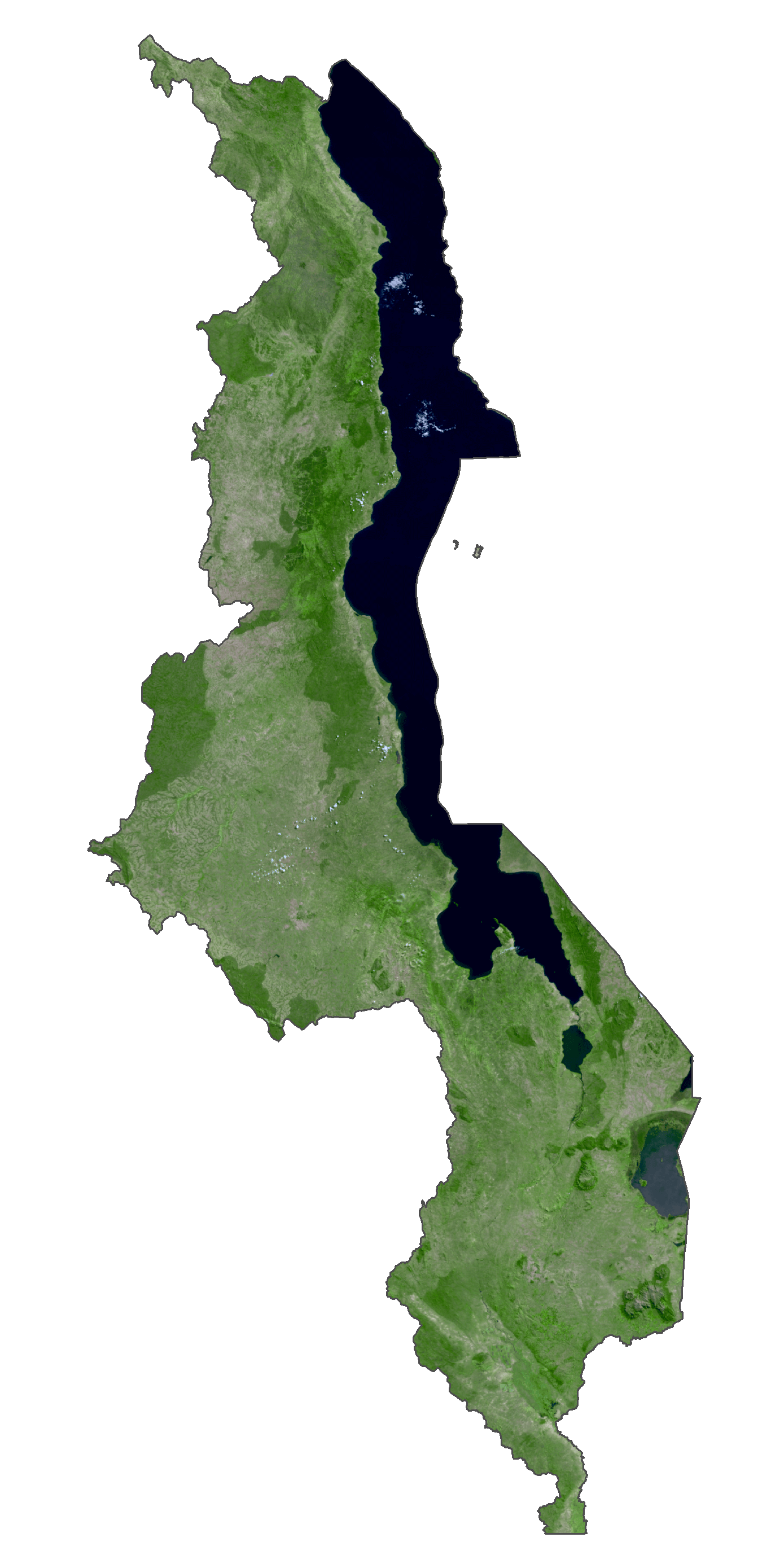
Malawi Satellite Map
Elevation Map