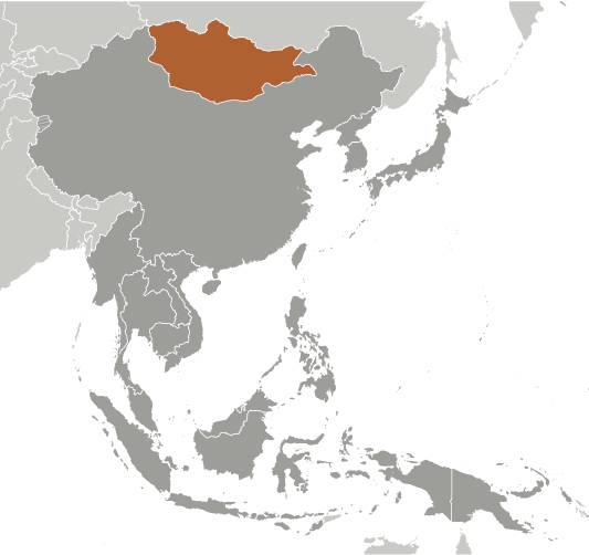
With an area of 1,564,116 sq. km, Mongolia is the world’s 18th largest country. It is located in East Asia where it is bounded by land on all sides.
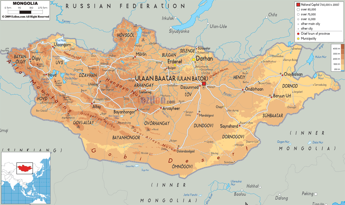
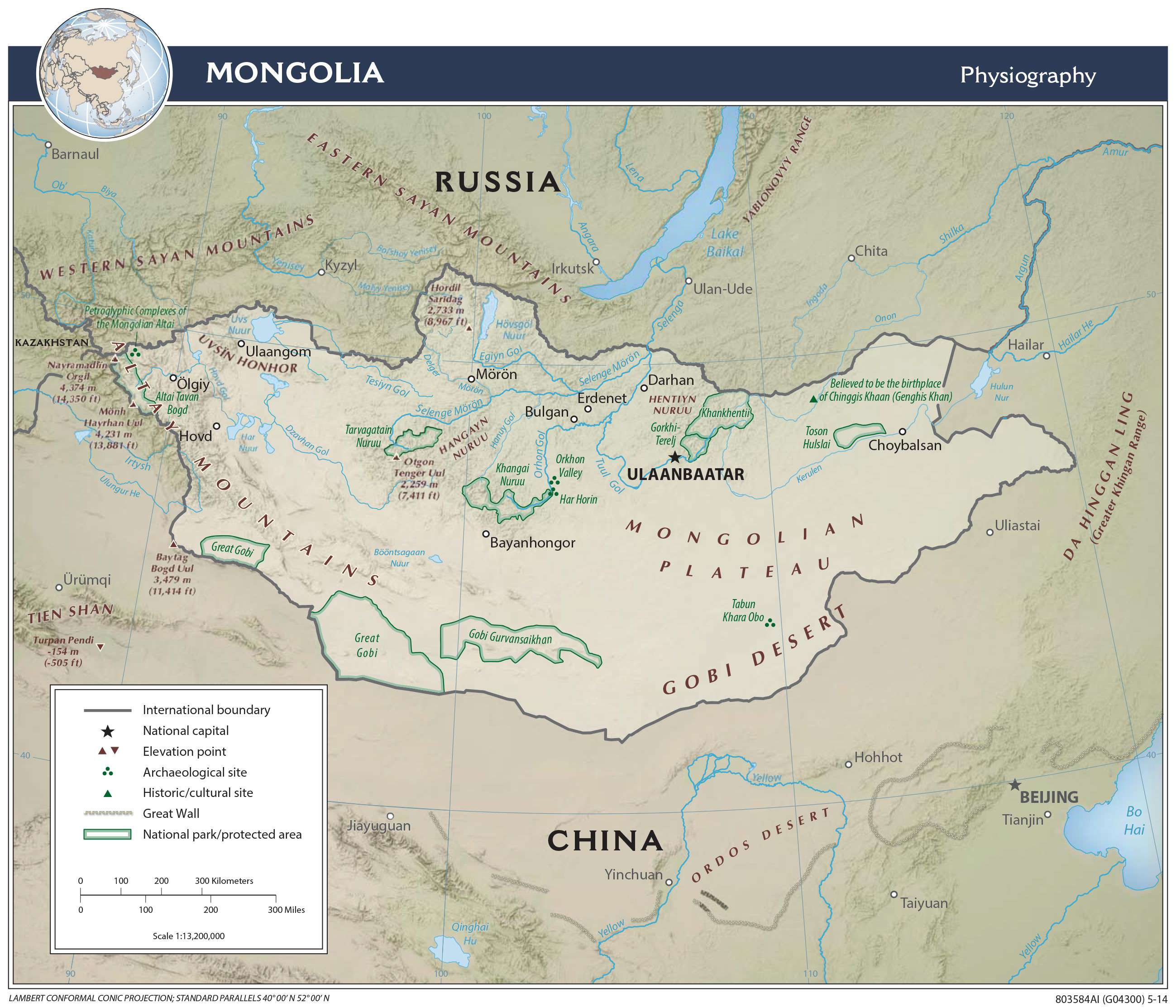
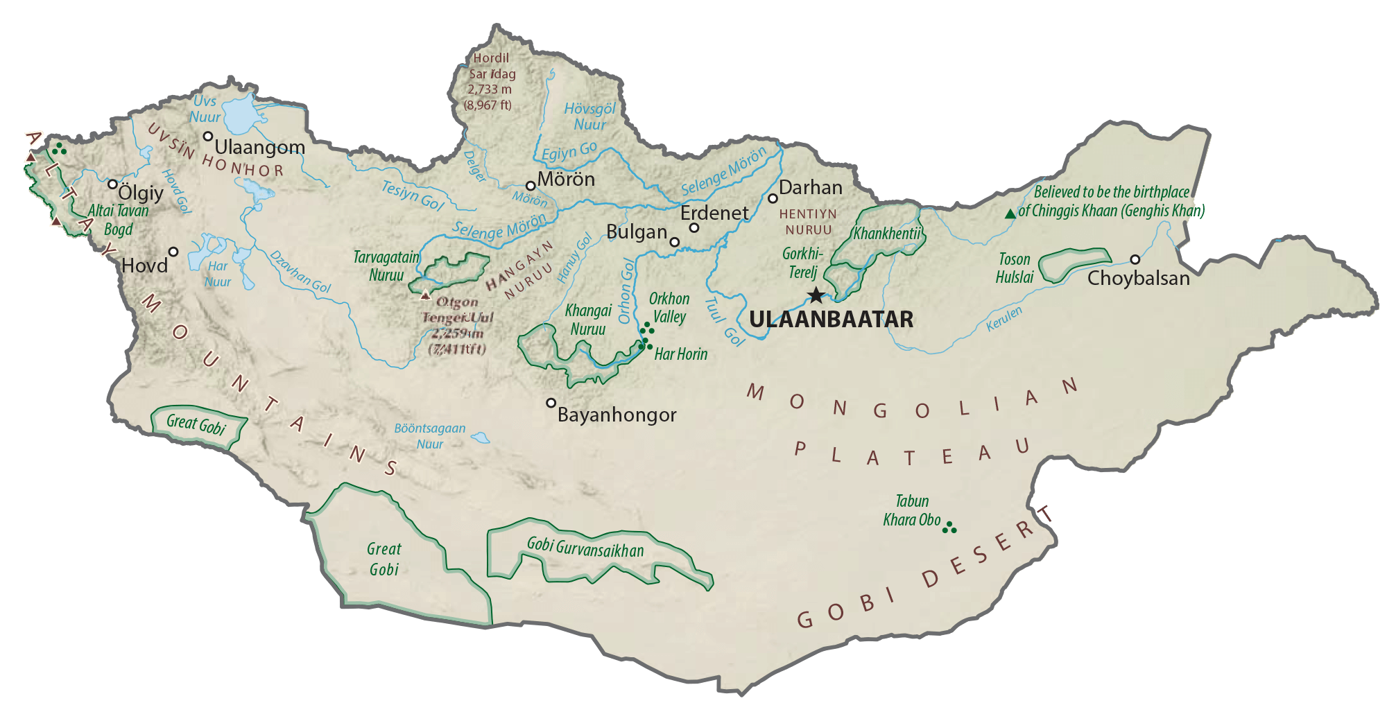
As observed on the physical map of Mongolia, the country features vast areas of elevated lands including plateaus, mountains, and hills.
From the Gobi Desert areas of the south, Mongolia rises into a grass-covered and generally treeless plain (steppe), punctuated by three mountain ranges. As marked on the map, these are the Khentii Mountains, Khangai Mountains, and the Altay Mountains.
The highest point of Mongolia (marked on the map by a yellow upright triangle), Nayramadlin Orgil at 14,350 ft. (4,374 m), is found in the rugged Atlay Mountains of the west.
Overall the country has an average elevation near 5,183 ft., (1,580 m); Hoh Nuur at 1,699 ft. (518 m) is the lowest point in the country.
Hovsgol Nuur, one of Asia’s largest freshwater lakes is located on its border with the Russian Federation. In addition to being the largest, Hovsgol Nuur is also the second-most voluminous in Asia, and contains nearly 70% of Mongolia’s freshwater.
The northern reaches of the country are replete with meandering rivers, thousands of small lakes, marshes and glaciers.
Mongolia, in the west and north, experiences frequent earthquakes, although volcanoes here are considered extinct.
| Flag: |  |
|---|---|
| Legal Name: | Mongolia |
| Capital Value: | Ulaanbaatar |
| Largest City: |
Ulaanbaatar (1,584,358) |
| Official languages: | Mongolian |
| Demonym(s): | Mongolian |
| Government: | Unitary semi-presidential republic |
| Legislature: | State Great Khural |
| Total Area: | 1,564,116 km² |
| Land Area: | 1,553,556 km² |
| Water Area: | 10,560 km² |
| Population: | 3,225,167 |
| Density: | 2.07/km (5.4/sq mi) |
| GDP: | $13.85 Billion |
| GDP Per Capita: | $4,295.24 |
| Currency Value: | Togrog/tugriks (MNT) |
| Driving side: | right |
| Calling code: | +976 |
| Internet TLD: | .mn, .мон |
Explore the beauty of Mongolia with this interactive map! This map of Mongolia showcases its major cities, towns, highways, roads, lakes, and rivers, as well as its satellite imagery, elevation map, and provincial map. With this map, you can explore Mongolia’s stunning landscape, topographical features, and geographic boundaries.
Online Interactive Political Map
Click on ![]() to view map in "full screen" mode.
to view map in "full screen" mode.
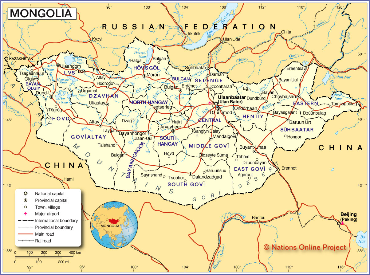
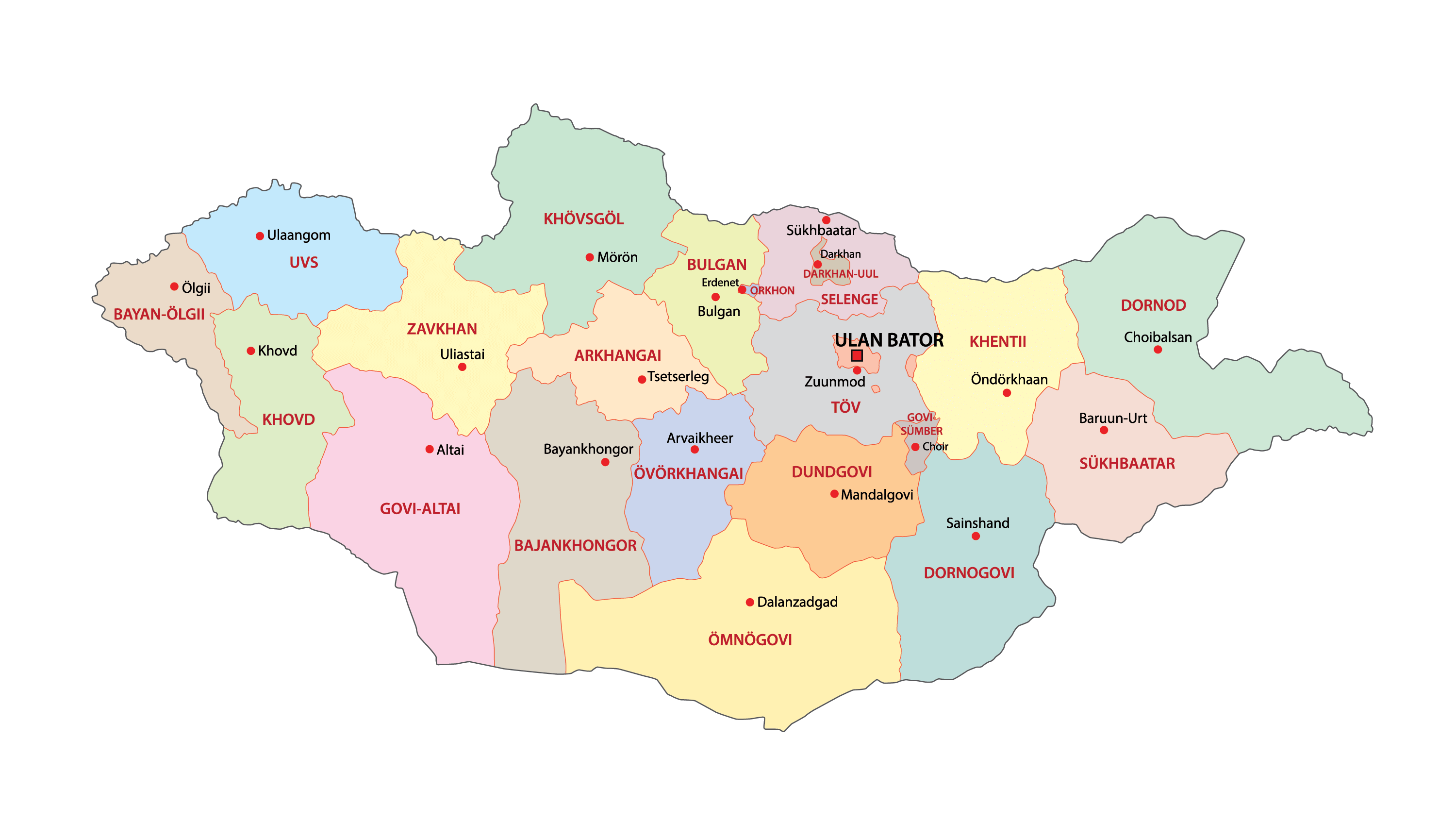
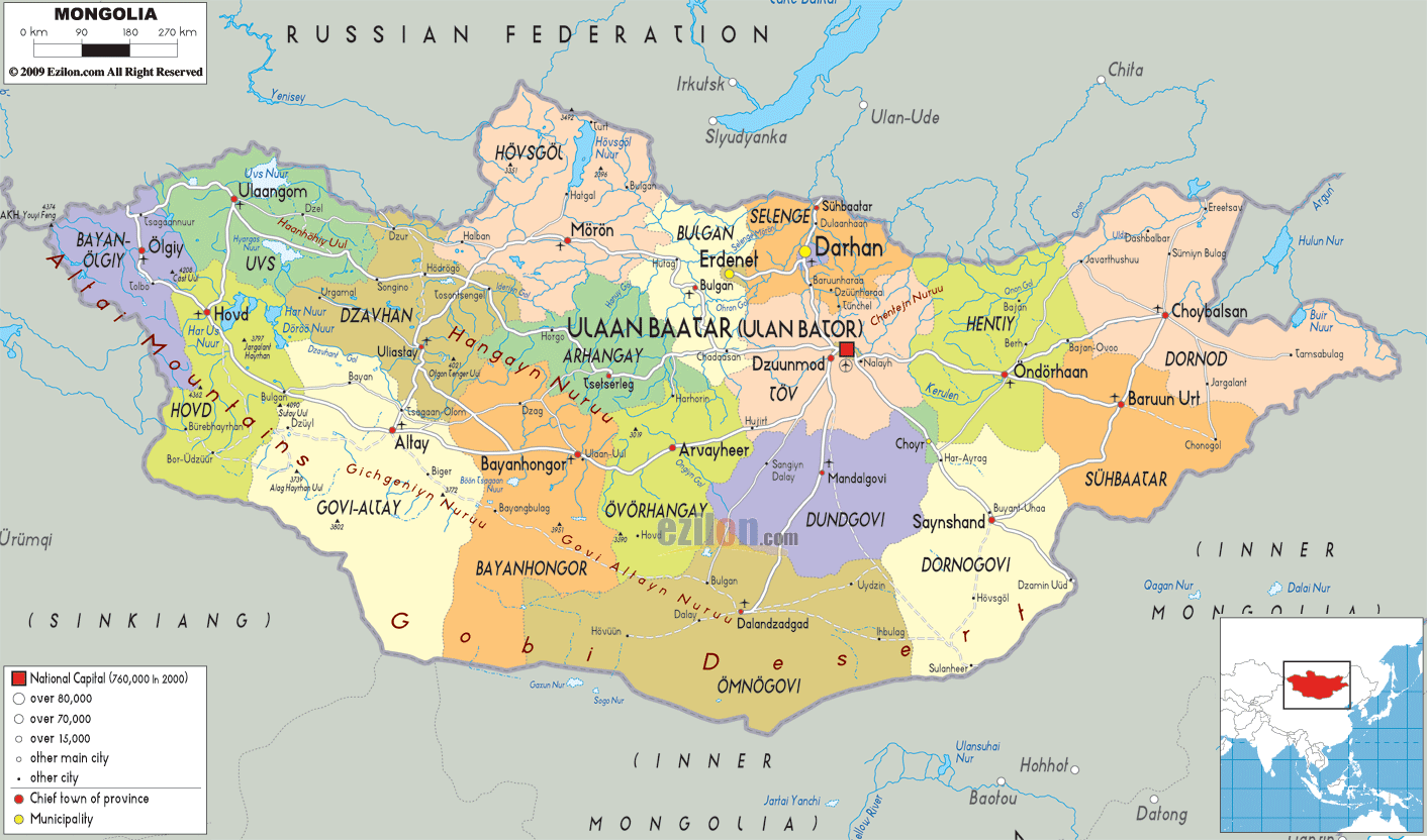
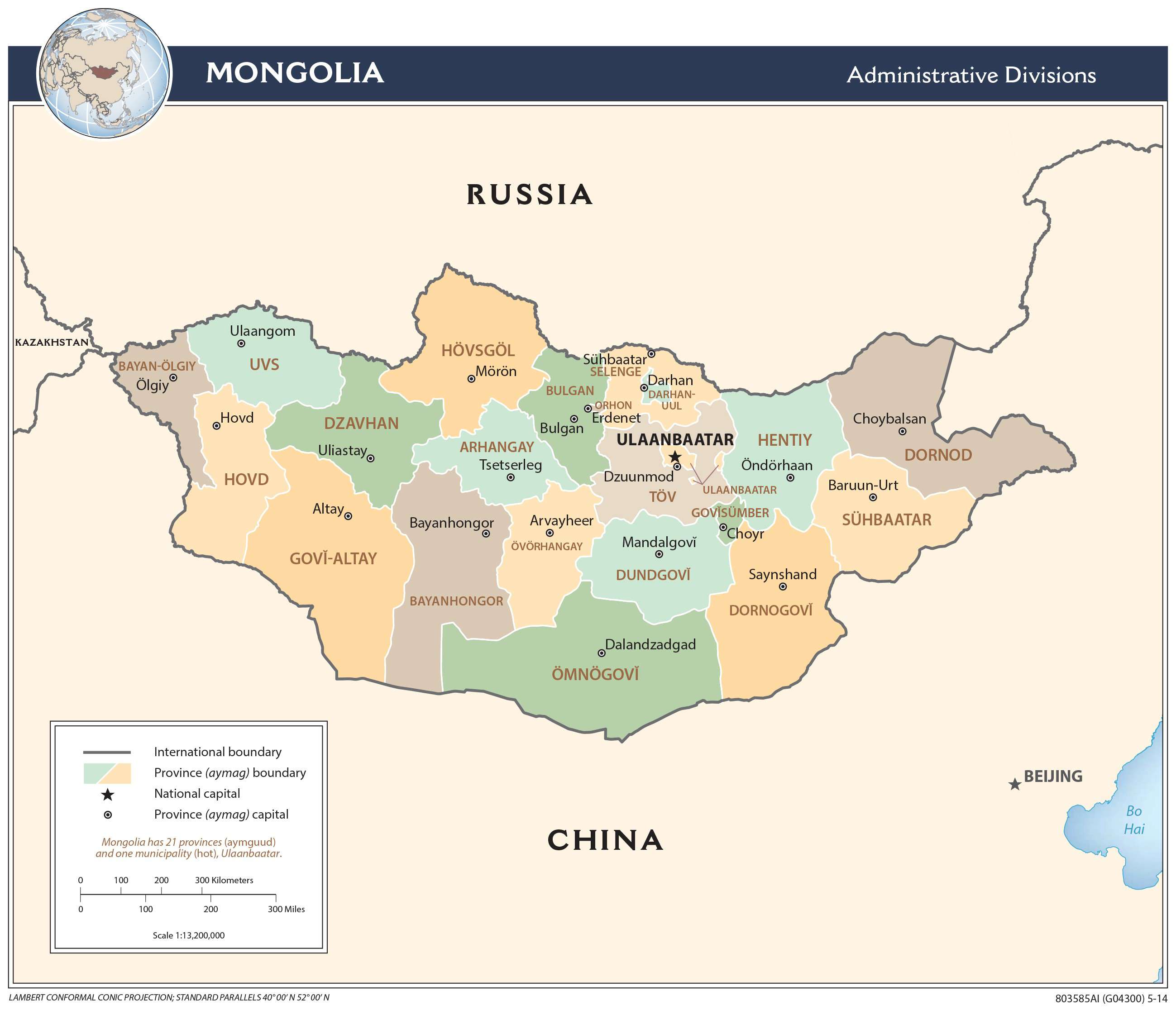
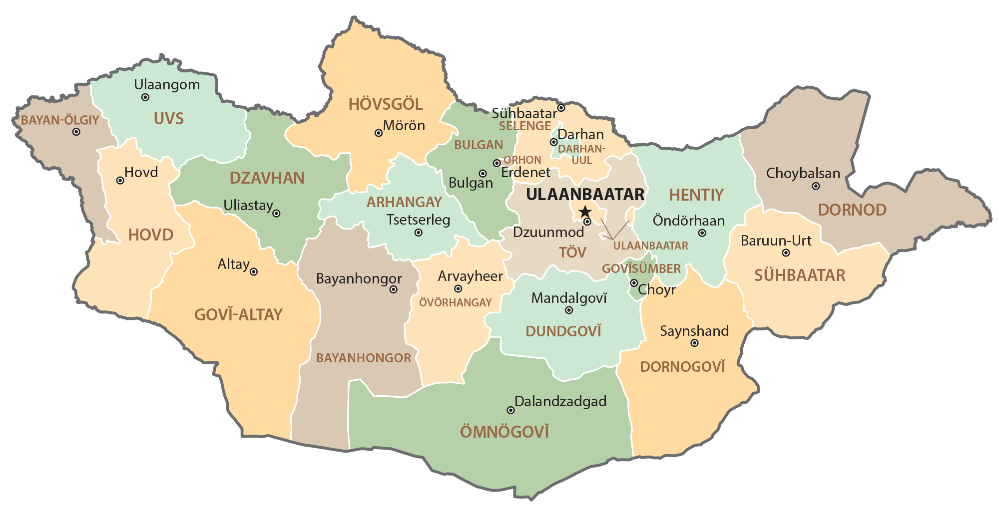
Mongolia is divided into 21 administrative provinces and 1 provincial municipality. In alphabetical order, these provinces are: Arhangay, Bayanhongor, Bayan-olgiy, Bulgan, Darhan-Uul, Dornod, Dornogovi, Dundgovi, Dzavhan (Zavkhan), Govi-Altay, Govisumber, Hentiy, Hovd, Hovsgol, Omnogovi, Orhon, Ovorhangay, Selenge, Suhabaatar, Tov and Uvs. Ulaanbaatar is a provincial municipality in Mongolia. These administrative provinces are further subdivided into a number of districts.
With an area of 1,566,000 sq. km, Mongolia is the 18th largest country in the world. With a population of about 3 million inhabitants, Mongolia is the world’s most sparsely populated country and has one of the lowest average population densities among any country in the world.
Located in north-central part of the country, Ulaanbaatar is the capital and largest city of Mongolia. It is also the country’s cultural, administrative and economic center and the most populous city.
Location Maps
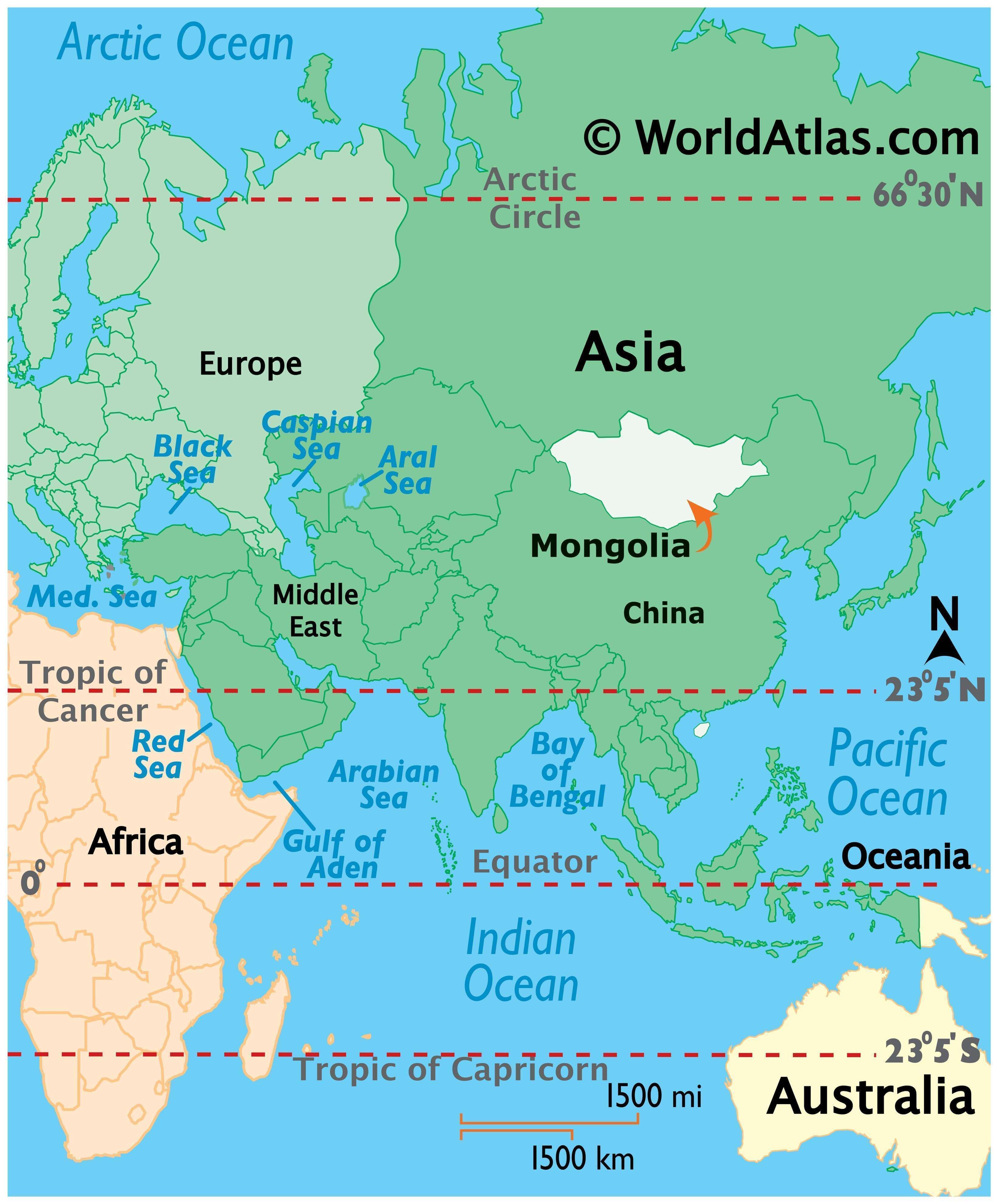
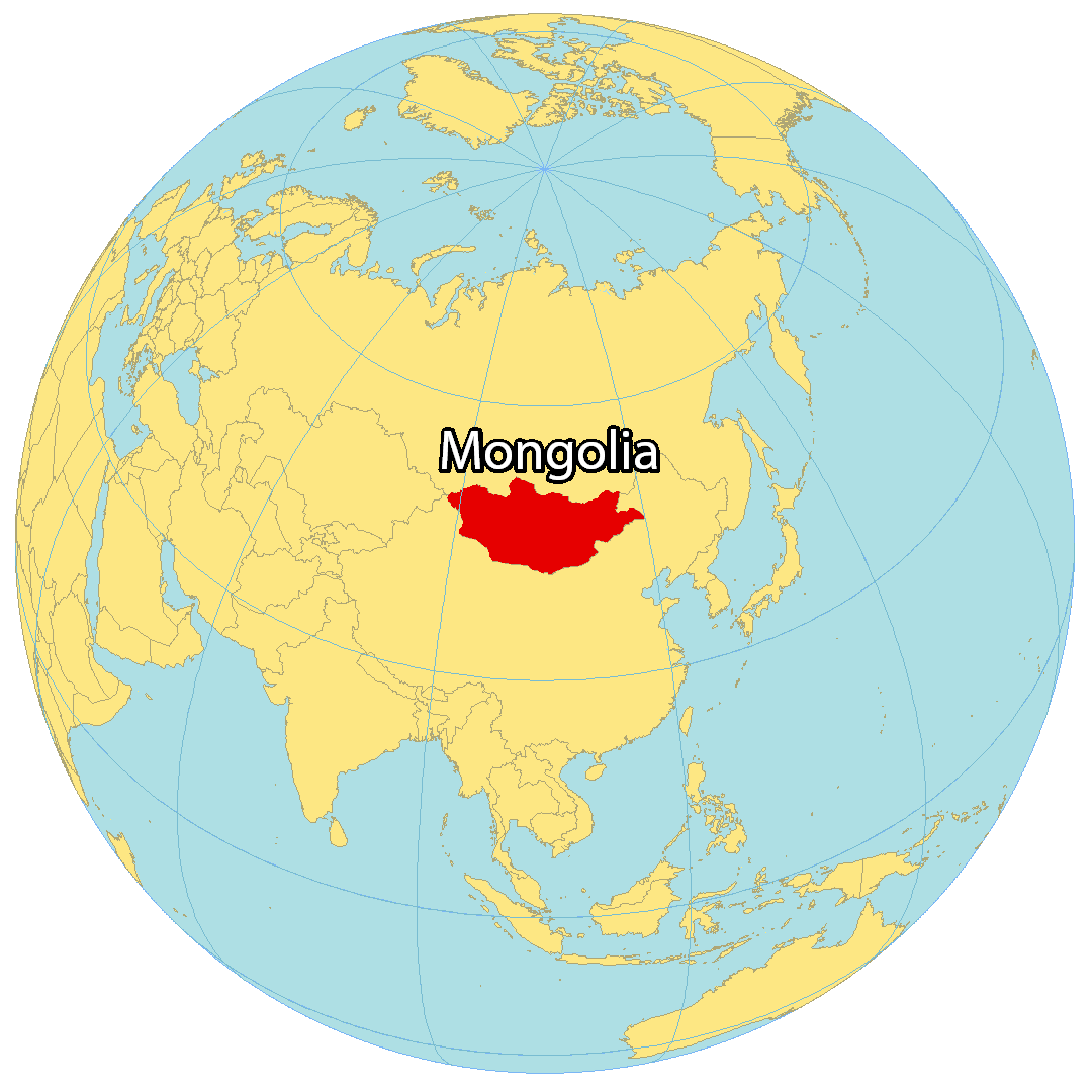
Where is Mongolia?
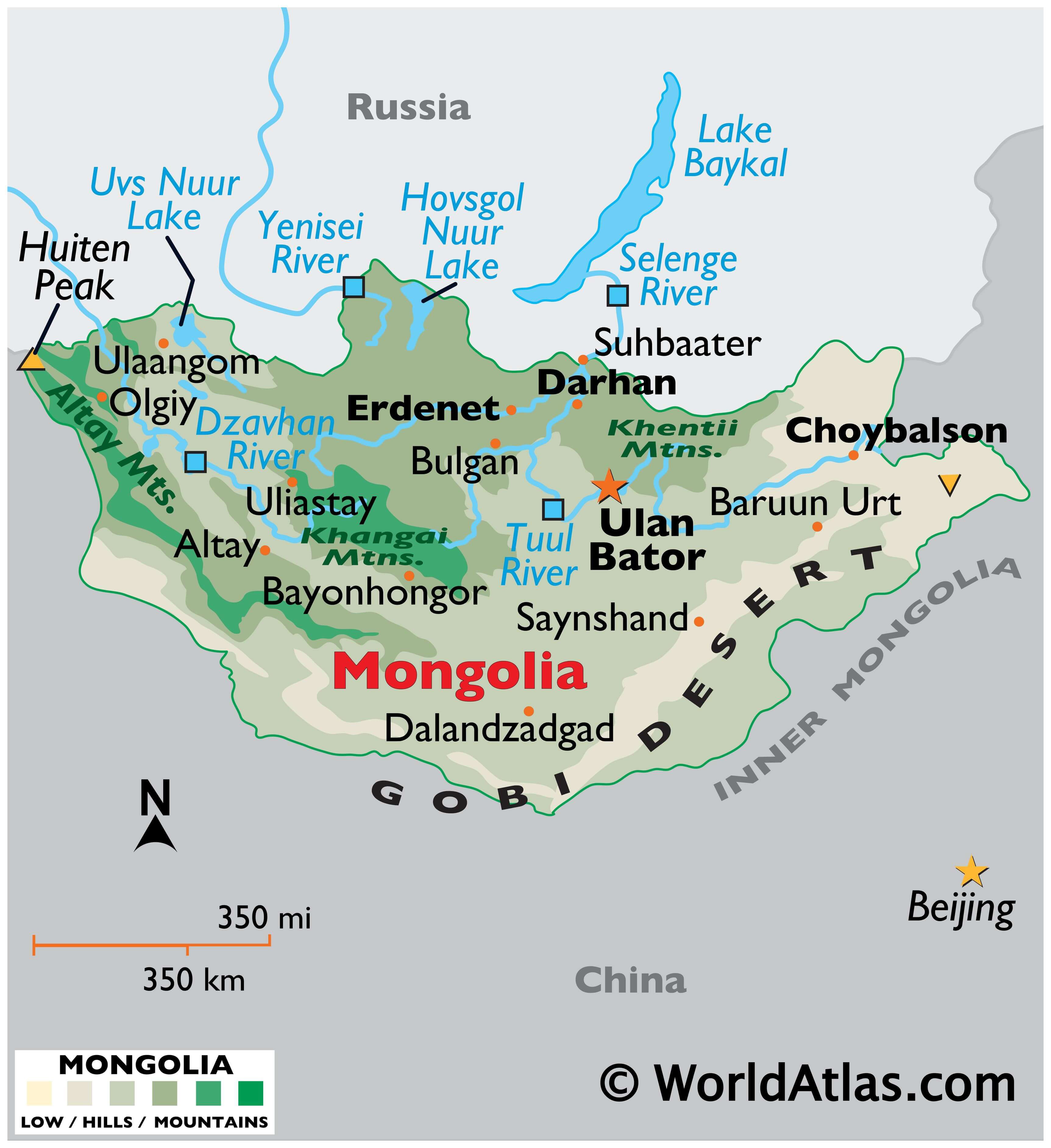
Mongolia is a landlocked country located in Northern Asia and is the world’s 18th-largest in terms of area. It’s situated between China to the south and Russia to the north. Most of the country is covered by steppe, with forests in the north and the Gobi Desert in the south. The Gobi is one of the world’s driest deserts, with annual precipitation of fewer than 50 millimeters (1 inch).
Mongolia is the least densely populated country in the world with just 5 people per square mile. The capital and largest city of Mongolia is Ulaanbaatar, which is also the world’s coldest capital. Other major cities are Erdenet, Darkhan, and Choibalsan.
High Definition Political Map of Mongolia
Mongolia Administrative Map
Physical Map of Mongolia
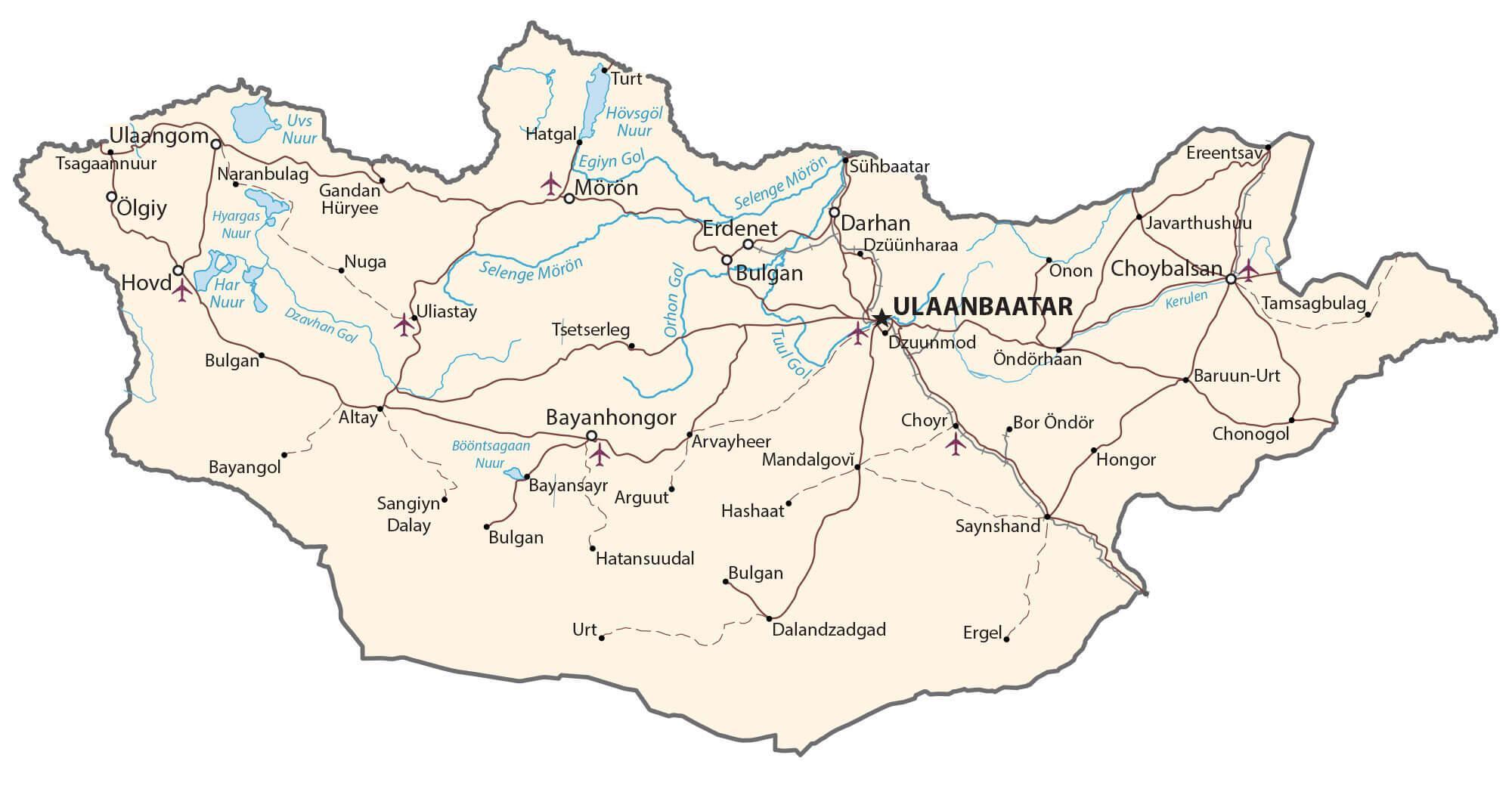
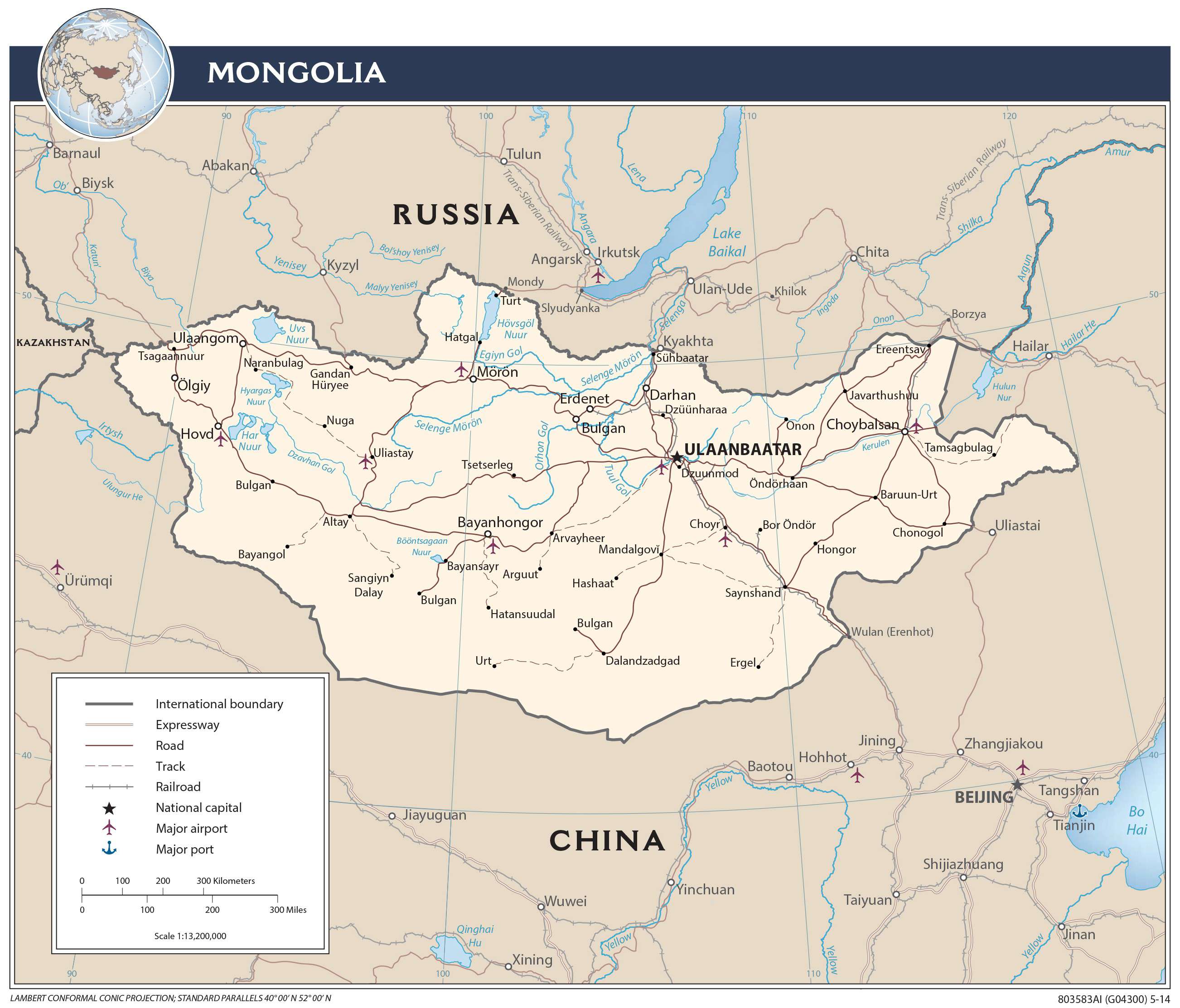
Transportation Map of Mongolia
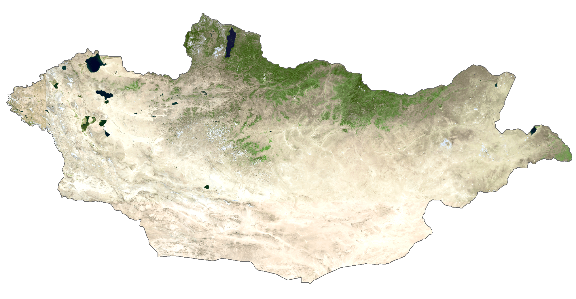
Mongolia Satellite Map