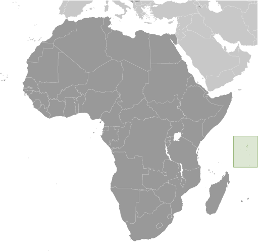
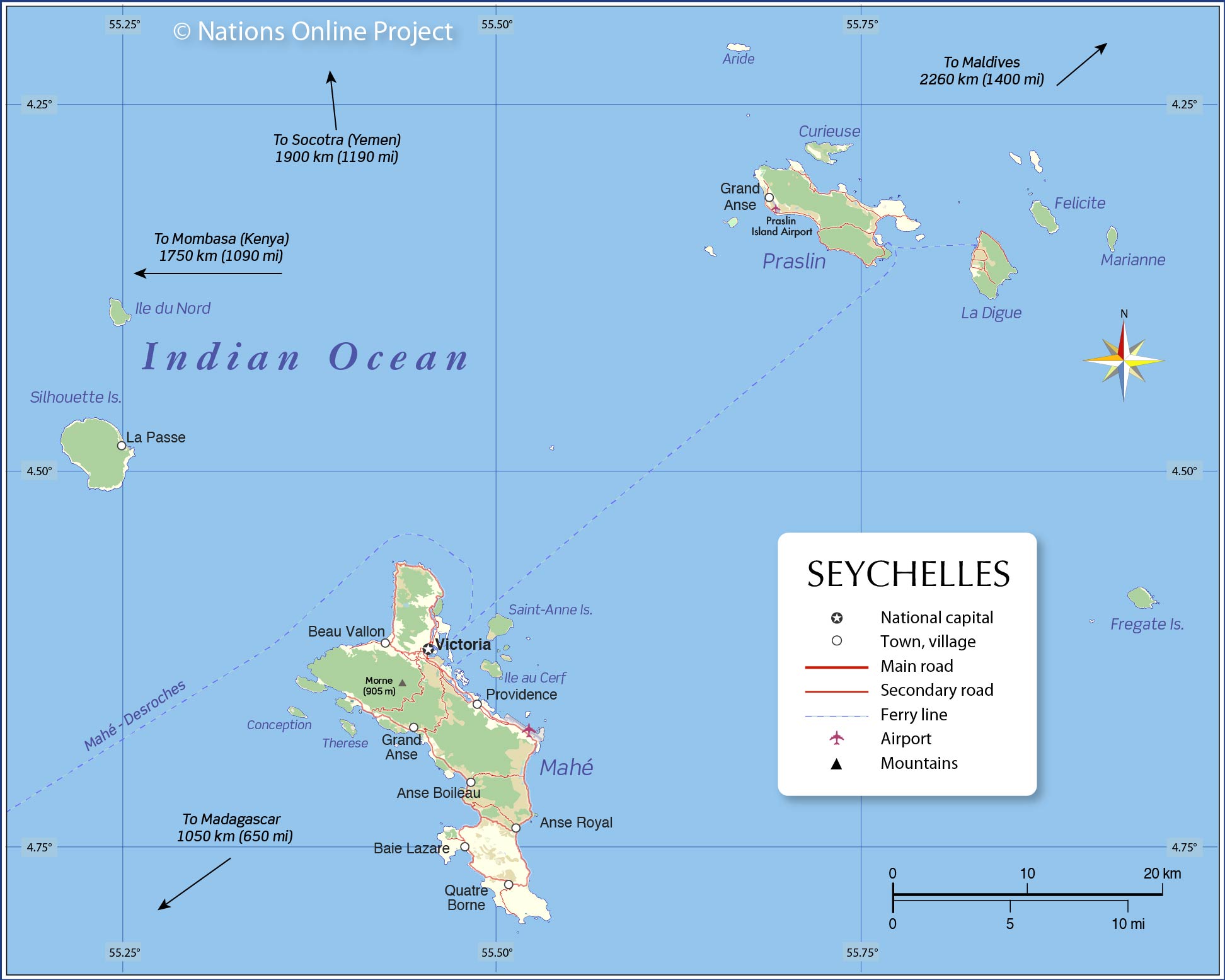
The small island country of Seychelles is an archipelago of over 100 islands and has a total land area of only 452 sq. km. However, the islands of the country are spread far and wide forming an Exclusive Economic Zone that covers a total area of 1,336,559 sq. km.
The country has two major island groups – the Mahé group and the Outer Islands. The former comprises of over 40 islands that with a granitic mountainous topography. The latter has over 70 islands which are flat and coralline but largely uninhabited due to the lack of sufficient freshwater resources. The highest point in the country, the 905 m high Morne Seychellois, is situated on the main and largest island of the country, Mahé.
| Flag: | 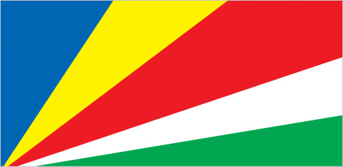 |
|---|---|
| Legal Name: | Republic of Seychelles |
| Capital Value: | Victoria |
| Official languages: |
|
| Demonym(s): |
|
| Government: | Unitary presidential republic |
| Legislature: | Lasanble Nasyonal |
| Total Area: | 455 km² |
| Land Area: | 455 km² |
| Population: | 97,625 |
| Density: | 214.5/km (555.6/sq mi) (67th) |
| GDP: | $1.70 Billion |
| GDP Per Capita: | $17,401.72 |
| Currency Value: | Seychelles rupees (SCR) |
| Driving side: | left |
| Calling code: | +248 |
| Internet TLD: | .sc |
Explore the Majestic Islands of Seychelles
Seychelles is a nation of 115 islands located in the Indian Ocean. It is known for its stunningly beautiful white sand beaches, lush vegetation, and crystal clear waters. The three main islands of Mahe, Praslin, and La Digue offer a wide range of activities for visitors, from snorkeling and kayaking to hiking and sightseeing. With its unique culture and stunning natural beauty, Seychelles is a must-visit destination for any traveler.
Check out this interactive map of Seychelles, which shows the major settlements, roads, and islands of the country with satellite imagery. Zoom in to get detailed views of the islands, and explore the captivating beauty of Seychelles!
Online Interactive Political Map
Click on ![]() to view map in "full screen" mode.
to view map in "full screen" mode.
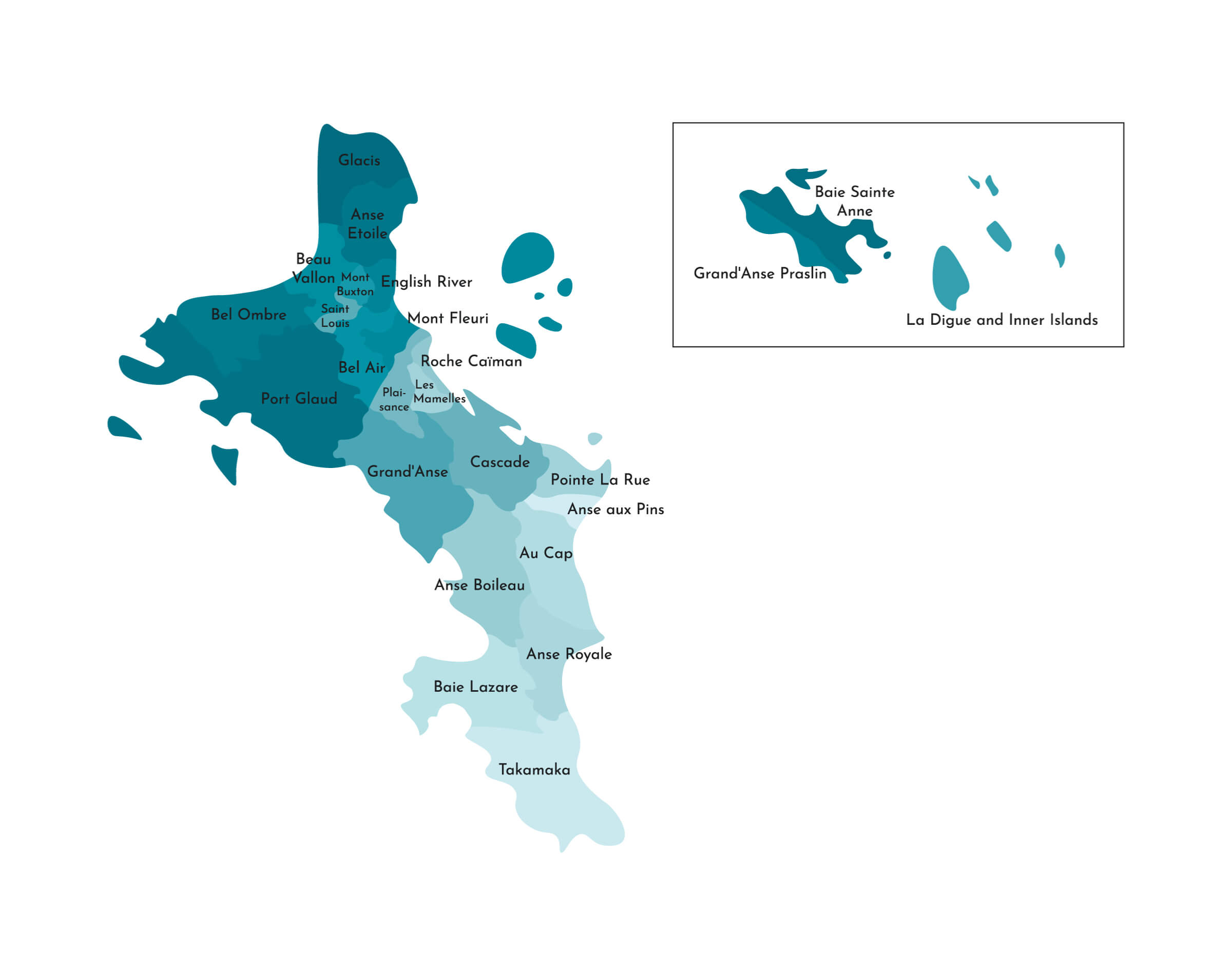
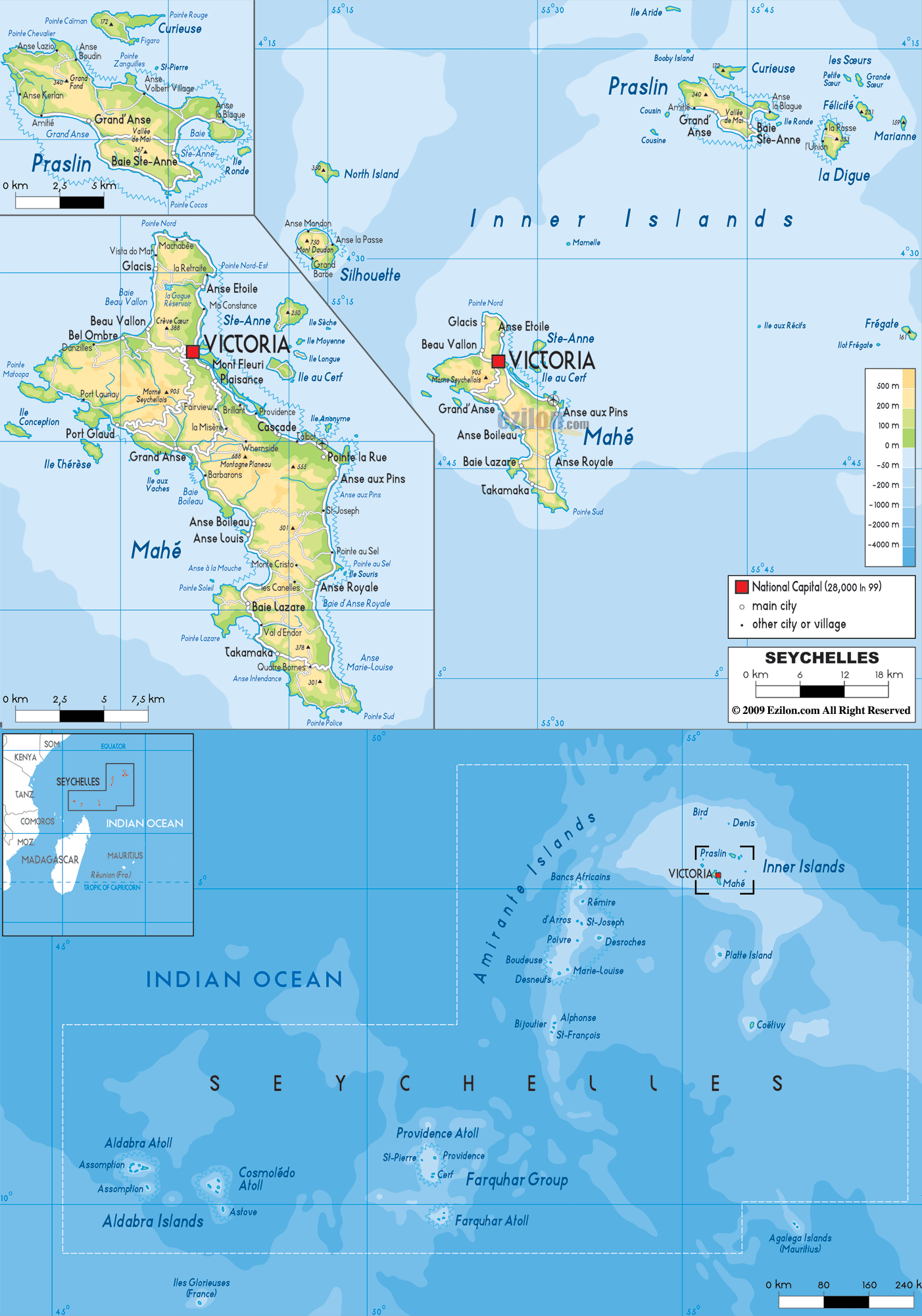
Seychelles has 26 administrative districts. In alphabetical order, these are Anse aux Pins, Anse Boileau, Anse Etoile, Anse Royale, Au Cap, Baie Lazare, Baie Sainte Anne, Beau Vallon, Bel Air, Bel Ombre, Cascade, English River, Glacis, Grand’ Anse (on Mahe), Grand’ Anse (on Praslin), Inner Islands, Les mamelles, Mont Buxton, Mont Fleuri, Plaisance, Pointe Larue, Port Glaud, Roche Caiman, Saint Louis, Takamaka. The 26th district is the Outer Islands which was recognized as a district in recent years by the country’s tourism department.
Three districts English River, Mont Fleuri, and Saint Louis (shown on the map above) together comprise the national capital of Victoria.
Location Maps
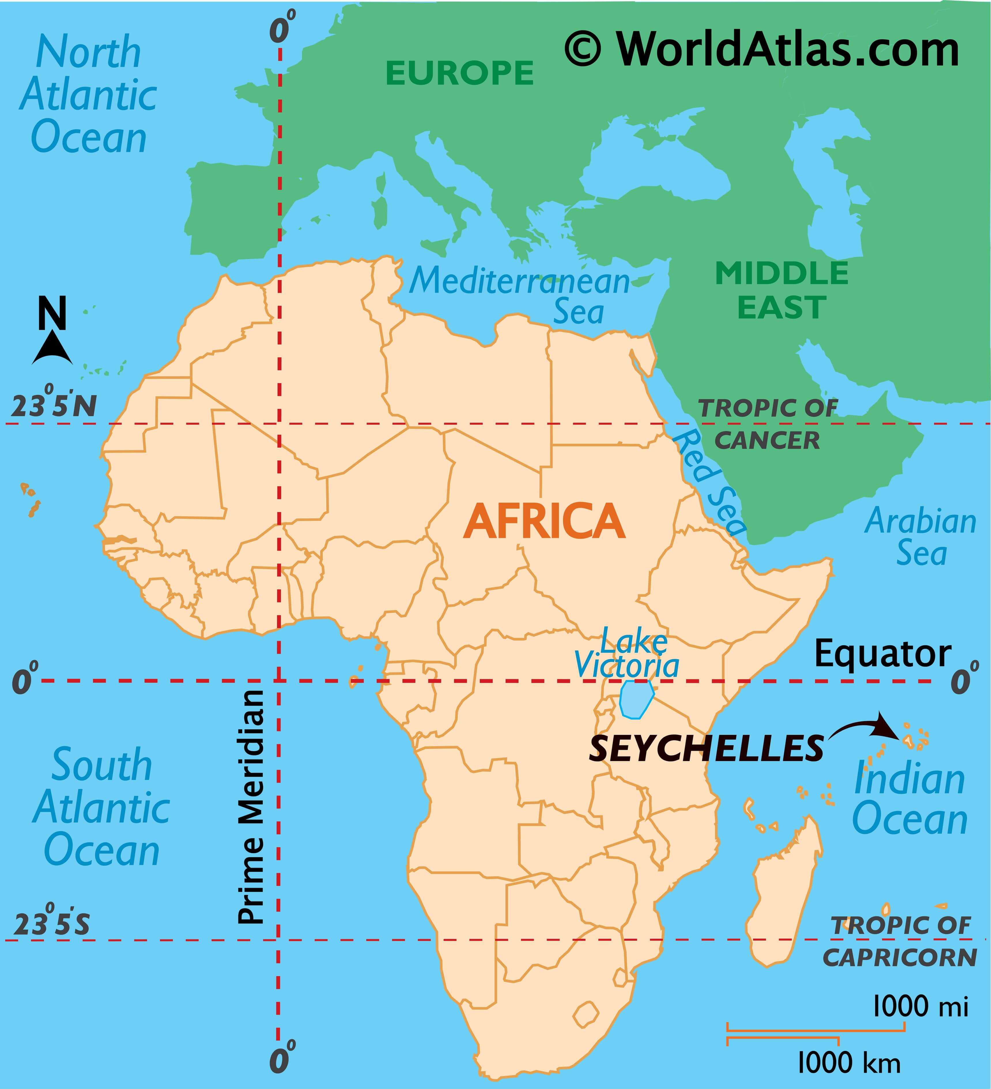
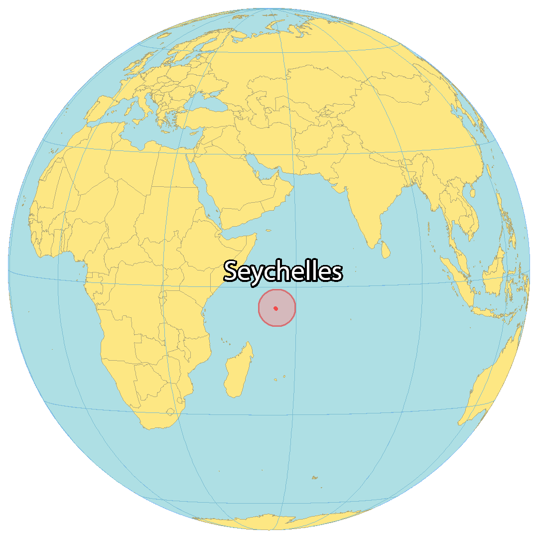
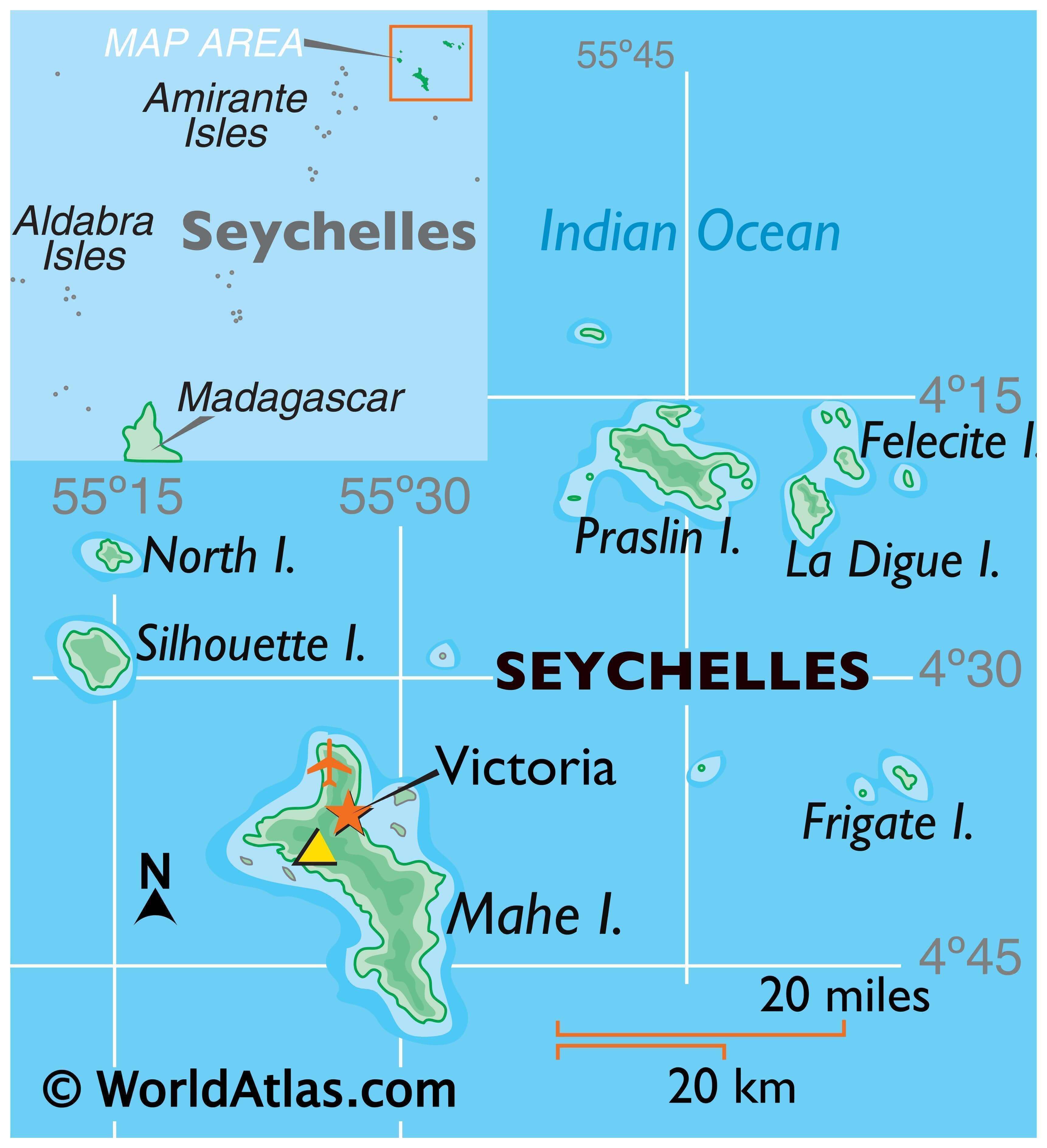
Where is Seychelles?
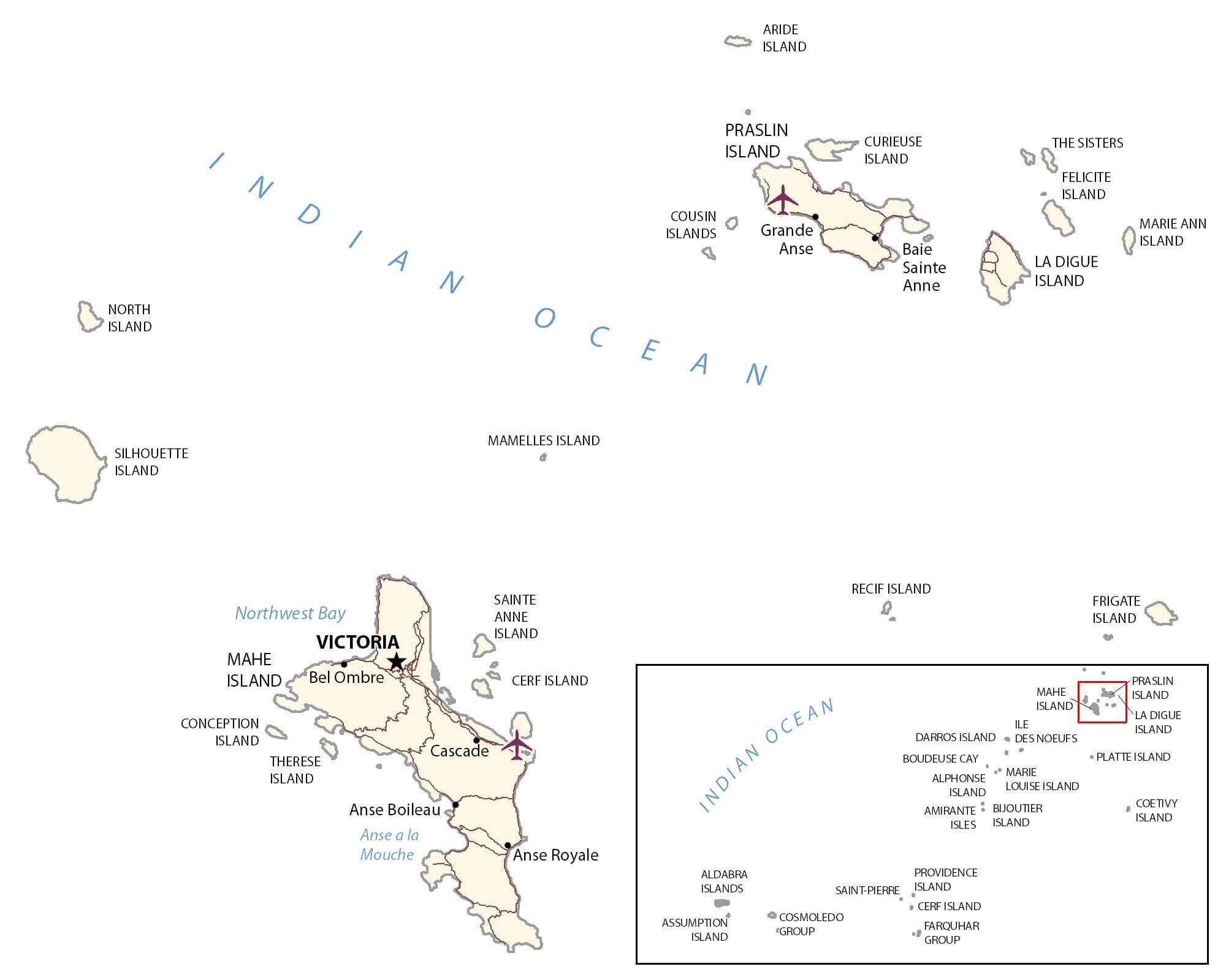
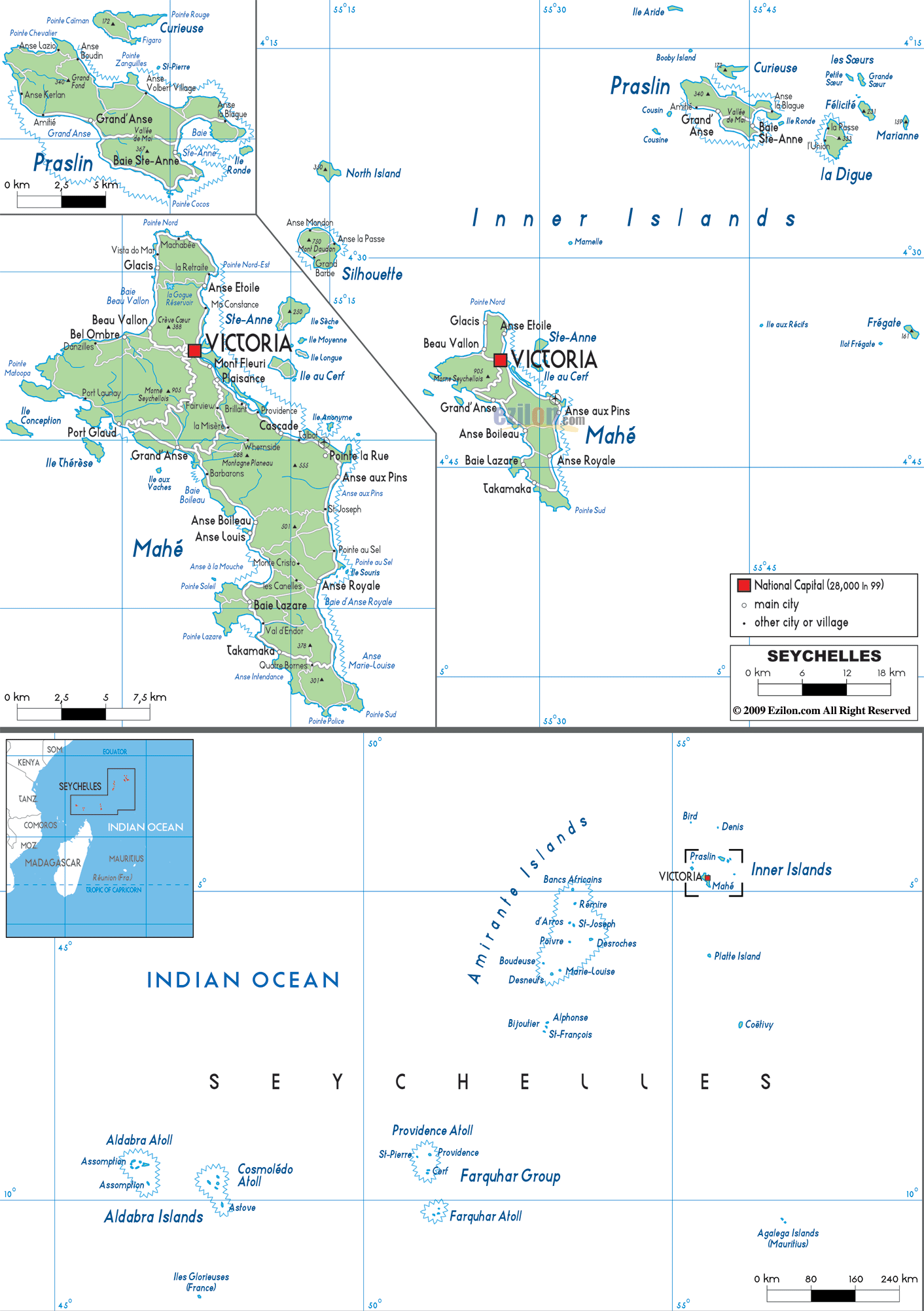
The Seychelles is an archipelago of about 115 islands in the Indian Ocean northeast of Madagascar. Most of the islands are small and uninhabited, but three of the main islands – Mahe, Praslin, and La Digue – are home to a majority of the population. Mahe is the largest island in size, covering 90% of the population, and Victoria is the capital and largest city on the island. Praslin is the second-largest at 38.5 square kilometers, and its major settlements include Baie Ste Anne, Anse Volbert, and Grand’ Anse. La Digue has an area of 10 square kilometers and is located to the east of Praslin. Finally, the island of Aldabra is the world’s largest raised coral atoll.
High Definition Political Map of Seychelles
History
Seychelles was uninhabited until the 18th century when Europeans arrived with enslaved Africans. It remained a British colony from 1814 until its independence in 1976. Seychelles have never been inhabited by indigenous people, but its islanders maintain their own Creole heritage.
Early history
Seychelles was uninhabited throughout most of recorded history. Tombs on the island, visible until 1910, are the basis for the scholarly belief that Austronesian seafarers and later Maldivian and Arab traders were the first to visit the archipelago. Vasco da Gama and his 4th Portuguese India Armada discovered the Seychelles on 15 March 1503; the first sighting was made by Thomé Lopes aboard Rui Mendes de Brito. Da Gama’s ships passed close to an elevated island, probably Silhouette Island, and the following day Desroches Island. They mapped a group of seven islands and named them The Seven Sisters. The earliest recorded landing was in January 1609, by the crew of the Ascension under Captain Alexander Sharpeigh during the fourth voyage of the British East India Company.
A transit point for trade between Africa and Asia, it was said that the islands were occasionally used by pirates until the French began to take control in 1756 when a Stone of Possession was laid on Mahé by Captain Nicholas Morphey. The islands were named after Jean Moreau de Séchelles, Louis XV’s Minister of Finance.
The British frigate Orpheus commanded by Captain Henry Newcome arrived at Mahé on 16 May 1794, during the War of the First Coalition. Terms of capitulation were drawn up and on the next day, Seychelles was surrendered to Britain. Jean Baptiste Quéau de Quincy, the French administrator of Seychelles during the years of war with the United Kingdom, declined to resist when armed enemy warships arrived. Instead, he successfully negotiated the status of capitulation to Britain which gave the settlers a privileged position of neutrality.
Britain eventually assumed full control upon the surrender of Mauritius in 1810, formalised in 1814 at the Treaty of Paris. Seychelles became a crown colony separate from Mauritius in 1903. Elections were held in 1966 and 1970.
Independence
In 1976, Seychelles was granted independence from the United Kingdom and became a republic. It has been a member of the Commonwealth ever since. In the 1970s Seychelles was “the place to be seen, a playground for film stars and the international jet set”. In 1977, a coup d’état by France Albert René ousted the first president of the republic, James Mancham. René discouraged over-dependence on tourism and declared that he wanted “to keep the Seychelles for the Seychellois”.
The 1979 constitution declared a socialist one-party state, which lasted until 1991.
In the 1980s there were a series of coup attempts against President René, some of which were supported by South Africa. In 1981, Mike Hoare led a team of 43 South African mercenaries masquerading as holidaying rugby players in the 1981 Seychelles coup d’état attempt. There was a gun battle at the airport, and most of the mercenaries later escaped in a hijacked Air India plane. The leader of this hijacking was German mercenary D. Clodo, a former member of the Rhodesian SAS. Clodo later stood trial in South Africa (where he was acquitted) as well as in his home country Germany for air piracy.
In 1986, an attempted coup led by the Seychelles Minister of Defence, Ogilvy Berlouis, caused President René to request assistance from India. In Operation Flowers are Blooming, the Indian naval vessel Vindhyagiri arrived in Port Victoria to help avert the coup.
The first draft of a new constitution failed to receive the requisite 60% of voters in 1992, but an amended version was approved in 1993.
In January 2013, Seychelles declared a state of emergency when the tropical cyclone Felleng caused torrential rain, and flooding and landslides destroyed hundreds of houses.
Following the coup in 1977, the president always represented the same political party until the October 2020 Seychellois general election, which was historic in that the opposition party won. Wavel Ramkalawan was the first president who did not represent United Seychelles (the current name of the former Seychelles People’s Progressive Front).
Physical Map of Seychelles
Geography
An island nation, Seychelles is located in the Somali Sea segment of the Indian Ocean, northeast of Madagascar and about 1,600 km (860 nmi) east of Kenya. The Constitution of Seychelles lists 155 named islands, and a further 7 reclaimed islands have been created subsequent to the publication of the Constitution. The majority of the islands are uninhabited, with many dedicated as nature reserves. Seychelles’ largest island, Mahé, is located 1,550 km (835 nmi) from Mogadishu (Somalia’s capital).
A group of 44 islands (42 granitic and 2 corallines) occupy the shallow waters of the Seychelles Bank and are collectively referred to as the inner islands. They have a total area of 244 km (94 sq mi), accounting for 54% of the total land area of the Seychelles and 98% of the entire population.
The islands have been divided into groups. There are 42 granitic islands known as the Granitic Seychelles. These are in descending order of size: Mahé, Praslin, Silhouette, La Digue, Curieuse, Félicité, Frégate, Ste. Anne, North, Cerf, Marianne, Grand Sœur, Thérèse, Aride, Conception, Petite Sœur, Cousin, Cousine, Long, Récif, Round (Praslin), Anonyme, Mamelles, Moyenne, Ile aux Vaches Marines, L’Islette, Beacon (Ile Sèche), Cachée, Cocos, Round (Mahé), L’Ilot Frégate, Booby, Chauve Souris (Mahé), Chauve Souris (Praslin), Ile La Fouche, Hodoul, L’Ilot, Rat, Souris, St. Pierre (Praslin), Zavé, Harrison Rocks (Grand Rocher).
There are two coral sand cays north of the granitics on the edge of the Seychelles Bank: Denis and Bird. There are two coral islands south of the Granitic: Coëtivy and Platte.
There are 29 coral islands in the Amirantes group, west of the granitic: Desroches, Poivre Atoll (comprising three islands—Poivre, Florentin and South Island), Alphonse, D’Arros, St. Joseph Atoll (comprising 14 islands—St. Joseph, Île aux Fouquets, Resource, Petit Carcassaye, Grand Carcassaye, Benjamin, Bancs Ferrari, Chiens, Pélicans, Vars, Île Paul, Banc de Sable, Banc aux Cocos and Île aux Poules), Marie Louise, Desnœufs, African Banks (comprising two islands—African Banks and South Island), Rémire, St. François, Boudeuse, Étoile, Bijoutier.
There are 13 coral islands in the Farquhar Group, south-southwest of the Amirantes: Farquhar Atoll (comprising 10 islands—Bancs de Sable, Déposés, Île aux Goëlettes, Lapins, Île du Milieu, North Manaha, South Manaha, Middle Manaha, North Island and South Island), Providence Atoll (comprising two islands—Providence and Bancs Providence) and St Pierre.
There are 67 raised coral islands in the Aldabra Group, west of the Farquhar Group: Aldabra Atoll (comprising 46 islands—Grande Terre, Picard, Polymnie, Malabar, Île Michel, Île Esprit, Île aux Moustiques, Ilot Parc, Ilot Émile, Ilot Yangue, Ilot Magnan, Île Lanier, Champignon des Os, Euphrate, Grand Mentor, Grand Ilot, Gros Ilot Gionnet, Gros Ilot Sésame, Héron Rock, Hide Island, Île aux Aigrettes, Île aux Cèdres, Îles Chalands, Île Fangame, Île Héron, Île Michel, Île Squacco, Île Sylvestre, Île Verte, Ilot Déder, Ilot du Sud, Ilot du Milieu, Ilot du Nord, Ilot Dubois, Ilot Macoa, Ilot Marquoix, Ilots Niçois, Ilot Salade, Middle Row Island, Noddy Rock, North Row Island, Petit Mentor, Petit Mentor Endans, Petits Ilots, Pink Rock and Table Ronde), Assumption Island, Astove and Cosmoledo Atoll (comprising 19 islands—Menai, Île du Nord (West North), Île Nord-Est (East North), Île du Trou, Goélettes, Grand Polyte, Petit Polyte, Grand Île (Wizard), Pagode, Île du Sud-Ouest (South), Île aux Moustiques, Île Baleine, Île aux Chauve-Souris, Île aux Macaques, Île aux Rats, Île du Nord-Ouest, Île Observation, Île Sud-Est and Ilot la Croix).
In addition to these 155 islands, as per the Constitution of Seychelles, there are 7 reclaimed islands: Ile Perseverance, Ile Aurore, Romainville, Eden Island, Eve, Ile du Port and Ile Soleil.
South Island, African Banks has been eroded by the sea. At St Joseph Atoll, Banc de Sable and Pelican Island have also eroded, while Grand Carcassaye and Petit Carcassaye have merged to form one island. There are also several unnamed islands at Aldabra, St Joseph Atoll and Cosmoledo. Pti Astove, though named, failed to make it into the Constitution for unknown reasons. Bancs Providence is not a single island, but a dynamic group of islands, comprising four large and about six very small islets in 2016.
Climate
The climate is equable although quite humid, as the islands are small, and is classified by the Köppen-Geiger system as a tropical rain forest (Af). The temperature varies little throughout the year. Temperatures on Mahé vary from 24 to 30 °C (75 to 86 °F), and rainfall ranges from 2,900 mm (114 in) annually at Victoria to 3,600 mm (142 in) on the mountain slopes. Precipitation levels are somewhat less on the other islands.
During the coolest months, July and August, the average low is about 24 °C (75 °F). The southeast trade winds blow regularly from May to November, and this is the most pleasant time of the year. The hot months are from December to April, with higher humidity (80%). March and April are the hottest months, but the temperature seldom exceeds 31 °C (88 °F). Most of the islands lie outside the cyclone belt, so high winds are rare.
Wildlife
Seychelles is among the world’s leading countries to protect lands for threatened species, allocating 42% of its territory for conservation. Like many fragile island ecosystems, Seychelles saw the loss of biodiversity when humans first settled in the area, including the disappearance of most of the giant tortoises from the granitic islands, the felling of coastal and mid-level forests, and the extinction of species such as the chestnut flanked white eye, the Seychelles parakeet, and the saltwater crocodile. However, extinctions were far fewer than on islands such as Mauritius or Hawaii, partly due to a shorter period of colonizer occupation. Seychelles today is known for success stories in protecting its flora and fauna. The rare Seychelles black parrot, the national bird of the country, is now protected.
The freshwater crab genus Seychellum is endemic to the granitic Seychelles, and a further 26 species of crabs and five species of hermit crabs live on the islands. From the year 1500 until the mid-1800s (approximately), the then-previously unknown Aldabra giant tortoise was killed for food by pirates and sailors, driving their numbers to near-extinction levels. Today, a healthy yet fragile population of 150,000 tortoises live solely on the atoll of Aldabra, declared a UNESCO World Heritage Site. Additionally, these ancient reptiles can further be found in numerous zoos, botanical gardens, and private collections internationally. Their protection from poaching and smuggling is overseen by CITES, whilst captive breeding has greatly reduced the negative impact on the remaining wild populations. The granitic islands of Seychelles supports three extant species of Seychelles giant tortoise.
Seychelles hosts some of the largest seabird colonies in the world, notably on the outer islands of Aldabra and Cosmoledo. In granitic Seychelles the largest colonies are on Aride Island including the world’s largest numbers of two species. The sooty tern also breeds on the islands. Other common birds include cattle egret (Bubulcus ibis) and the fairy tern (Gygis alba). More than 1,000 species of fish have been recorded.
The granitic islands of Seychelles are home to about 75 endemic plant species, with a further 25 or so species in the Aldabra group. Particularly well known is the coco de mer, a species of palm that grows only on the islands of Praslin and neighbouring Curieuse. Sometimes nicknamed the “love nut” (the shape of its “double” coconut resembles buttocks), the coco-de-mer produces the world’s heaviest seed. The jellyfish tree is to be found in only a few locations on Mahé. This strange and ancient plant, in a genus of its own, Medusagyne seems to reproduce only in cultivation and not in the wild. Other unique plant species include Wright’s gardenia (Rothmannia annae), found only on Aride Island’s Special Reserve. There are several unique species of orchid on the islands.
Seychelles is home to two terrestrial ecoregions: Granitic Seychelles forests and Aldabra Island xeric scrub. The country had a 2019 Forest Landscape Integrity Index mean score of 10/10, ranking it first globally out of 172 countries.
Environmental issues
Since the use of spearguns and dynamite for fishing was banned through efforts of local conservationists in the 1960s, the wildlife is unafraid of snorkelers and divers. Coral bleaching in 1998 has damaged most reefs, but some reefs show healthy recovery (such as Silhouette Island).
Despite huge disparities across nations, Seychelles claims to have achieved nearly all of its Millennium Development Goals. 17 MDGS and 169 targets have been achieved. Environmental protection is becoming a cultural value.
Their government’s Seychelles Climate Guide describes the nation’s climate as rainy, with a dry season with an ocean economy in the ocean regions. The Southeast Trades is on the decline but still fairly strong. Reportedly, weather patterns there are becoming less predictable.
Seychelles Satellite Map
