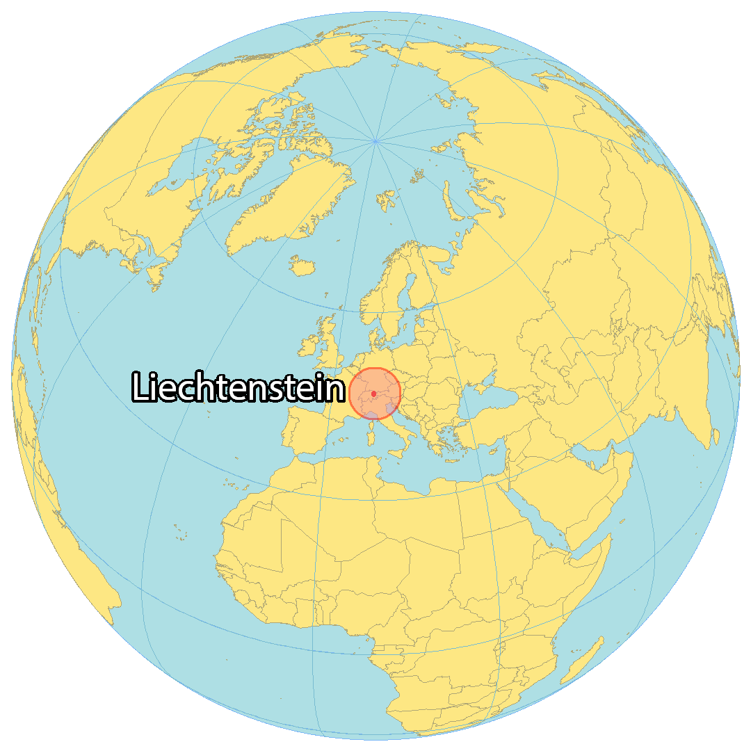
Liechtenstein covers a total area of 160 sq. km (62 sq mi) in Central Europe. It is a doubly landlocked country as it is surrounded by all landlocked countries. It is very small in size, barely the size of Washington DC, in the United States.
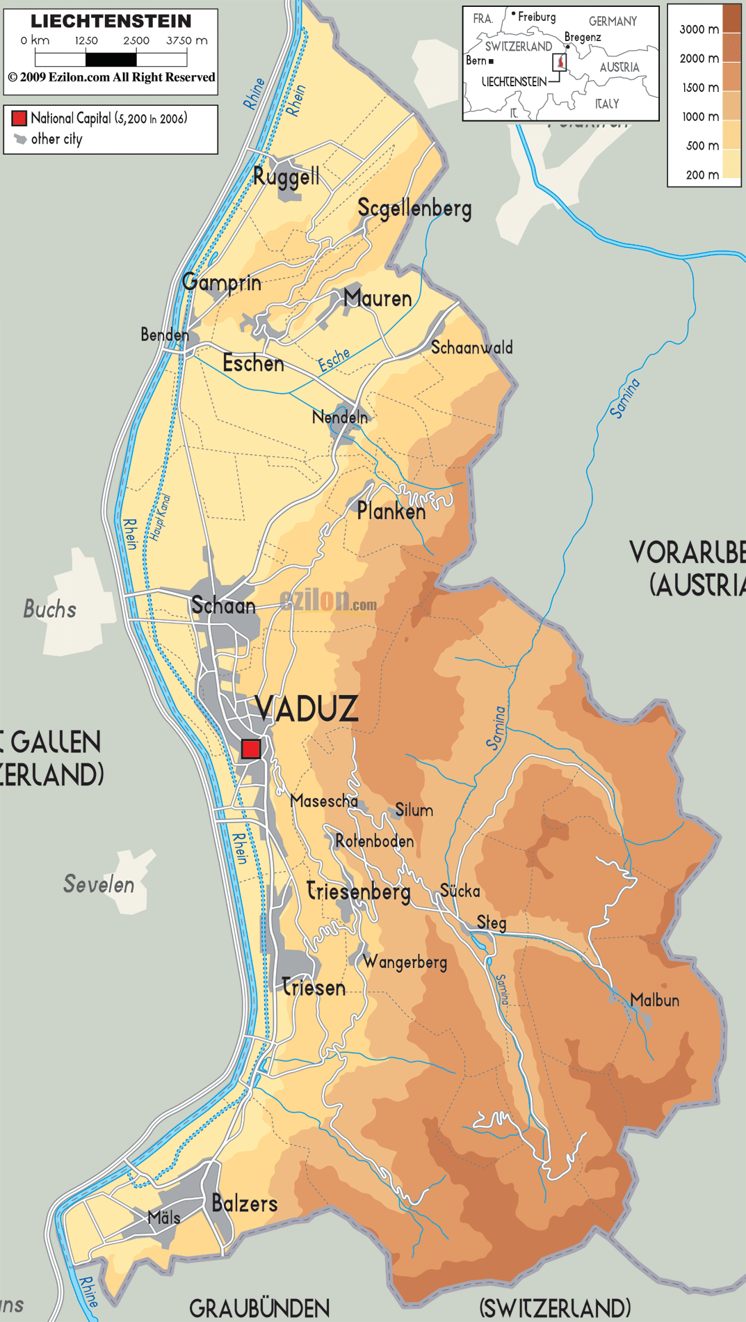
As observed on the physical map of Lichtenstein, the Alpine mountains cover the eastern half of the country. The western part is dominated by the Rhine River valley.
Liechtenstein’s highest point is Vorder Grauspitz, which reaches 8,526 feet (2,599 m). The lowest point in the country is Bangserfeld (429 m), Ruggell. Both these extreme points have been marked on the map above by triangles (upright and inverted).
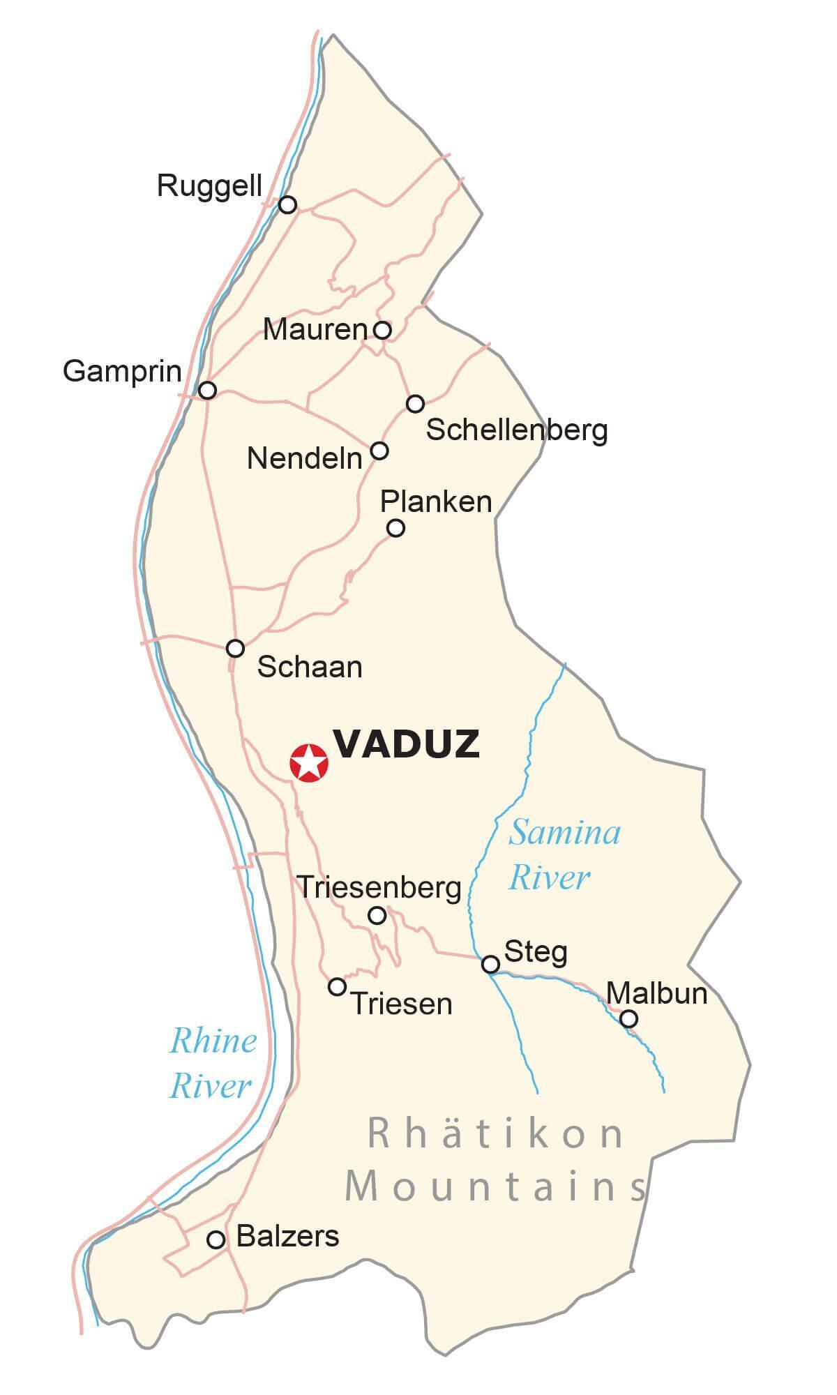
Liechtenstein has only one lake – Gampriner Seele. The Rhine and Samina are two major rivers flowing through the country.
| Flag: |  |
|---|---|
| Legal Name: | Principality of Liechtenstein |
| Capital Value: | Vaduz |
| Official languages: | German |
| Demonym(s): | Liechtensteiner |
| Government: | Unitary parliamentary semi-constitutional monarchy under a semi-direct democracy |
| Legislature: | Landtag |
| Total Area: | 160 km² |
| Land Area: | 160 km² |
| Population: | 38,019 |
| Density: | 237/km (613.8/sq mi) (57th) |
| GDP: | $6.55 Billion |
| GDP Per Capita: | $173,356.05 |
| Currency Value: | Swiss francs (CHF) |
| Driving side: | right |
| Calling code: | +423 |
| Internet TLD: | .li |
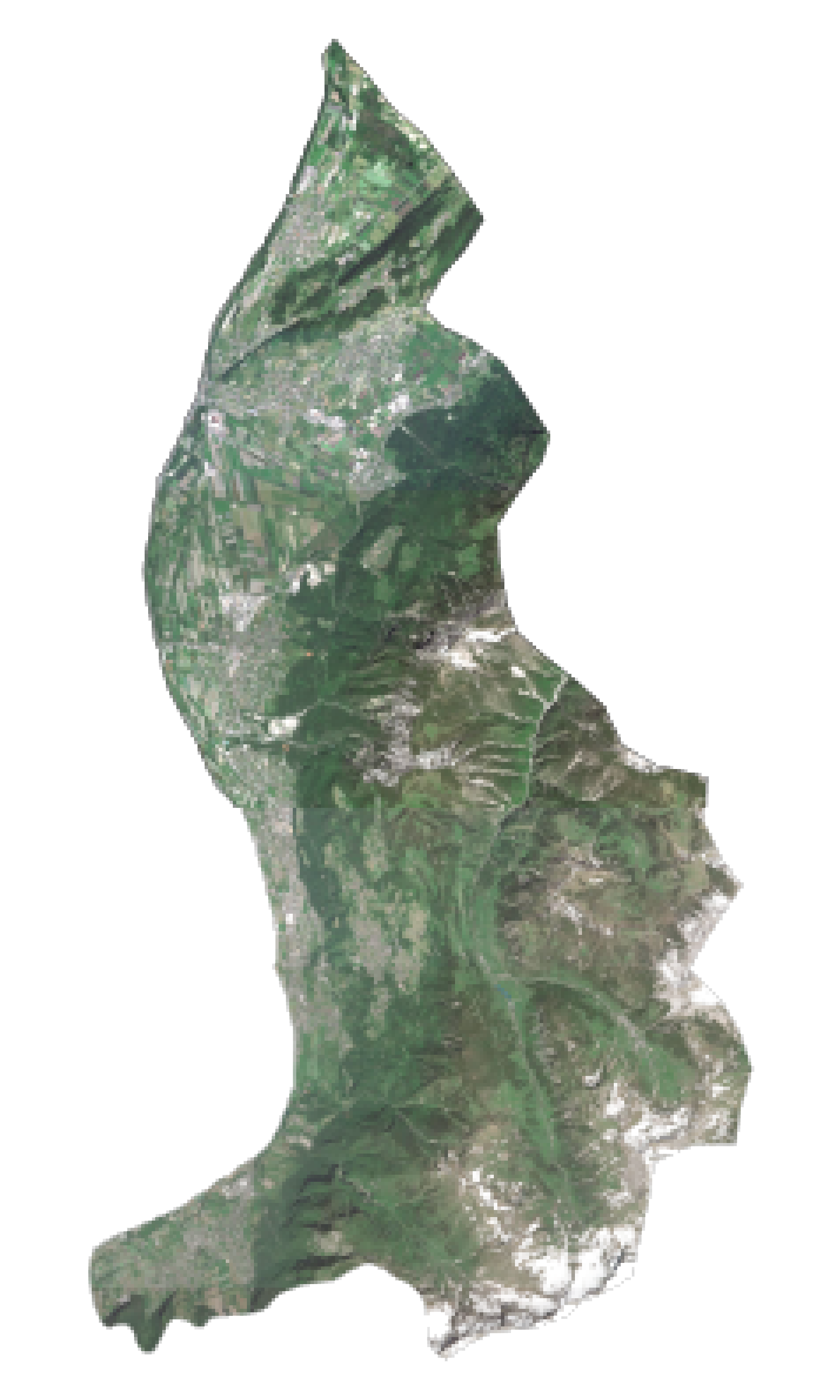
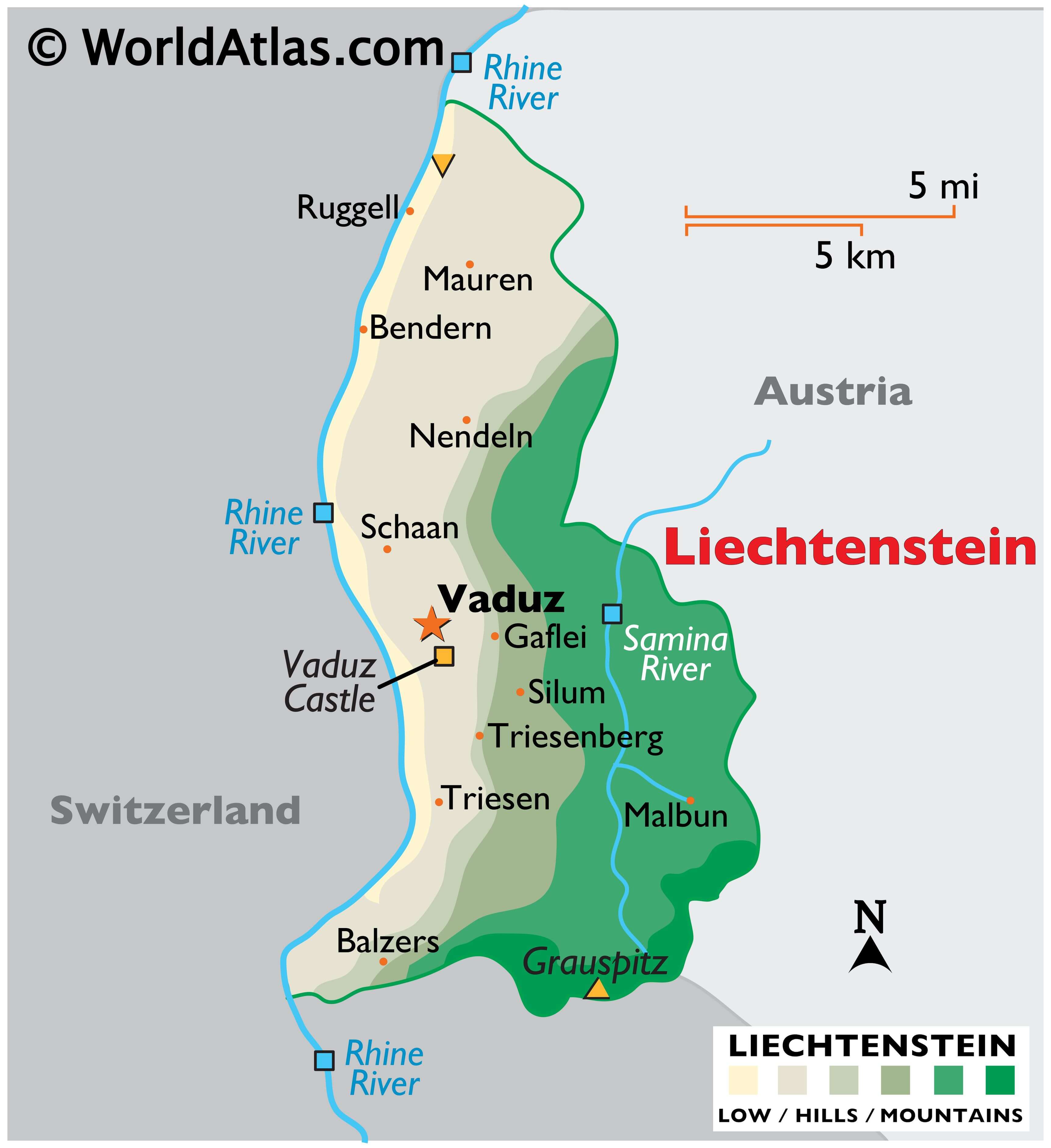
Liechtenstein is a tiny, landlocked country located in the heart of Europe’s alpine region. It is bordered by Switzerland and Austria and features a rugged terrain of rolling hills and mountains. To get a better look at this beautiful country, check out this satellite map of Liechtenstein. It displays the country’s populated places, rivers, and highways. It’s a great way to explore the country and plan your next adventure!
Online Interactive Political Map
Click on ![]() to view map in "full screen" mode.
to view map in "full screen" mode.
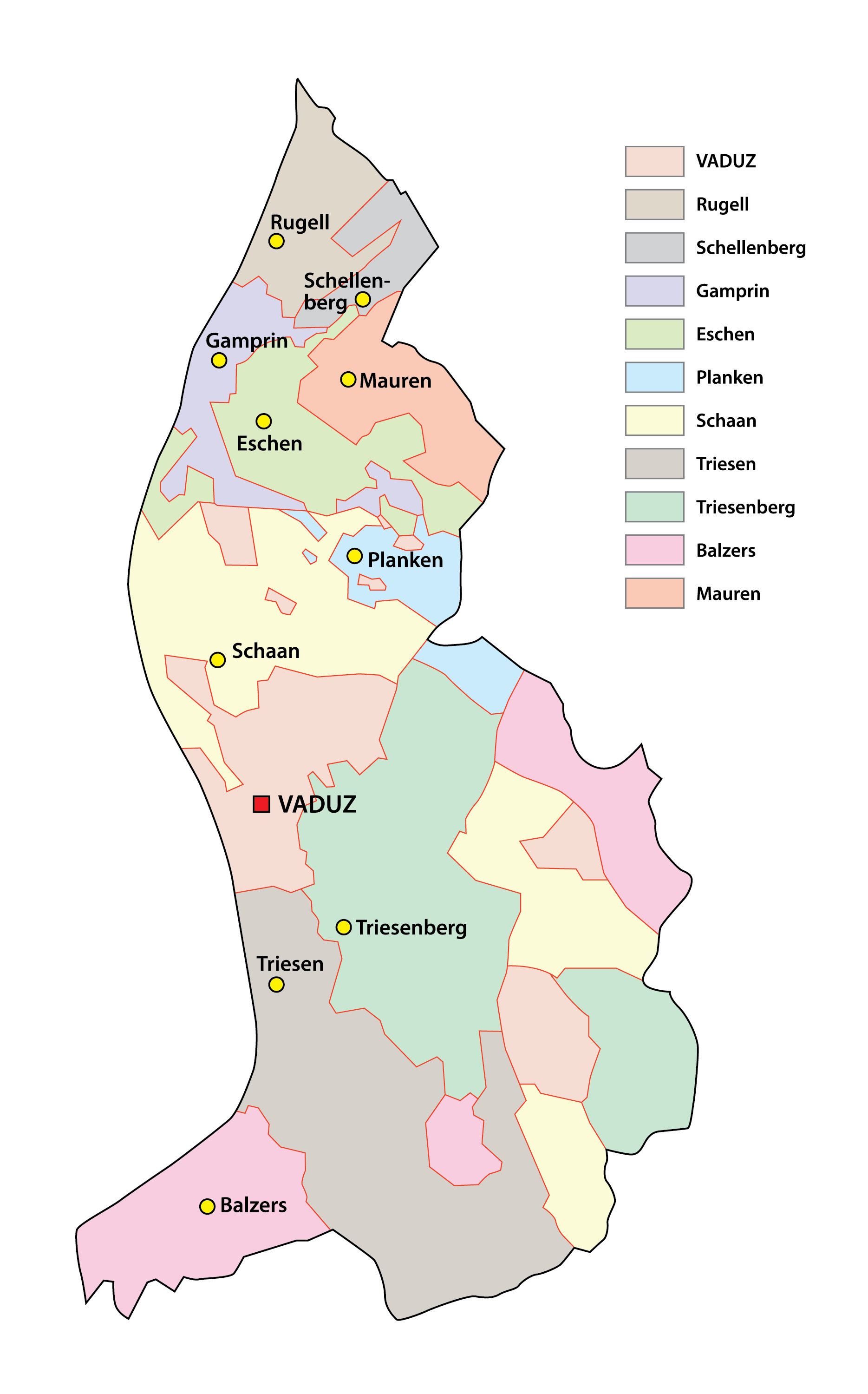
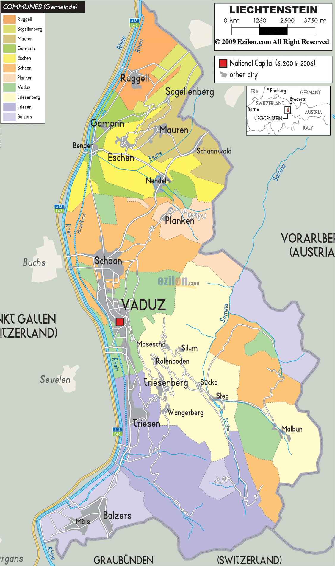
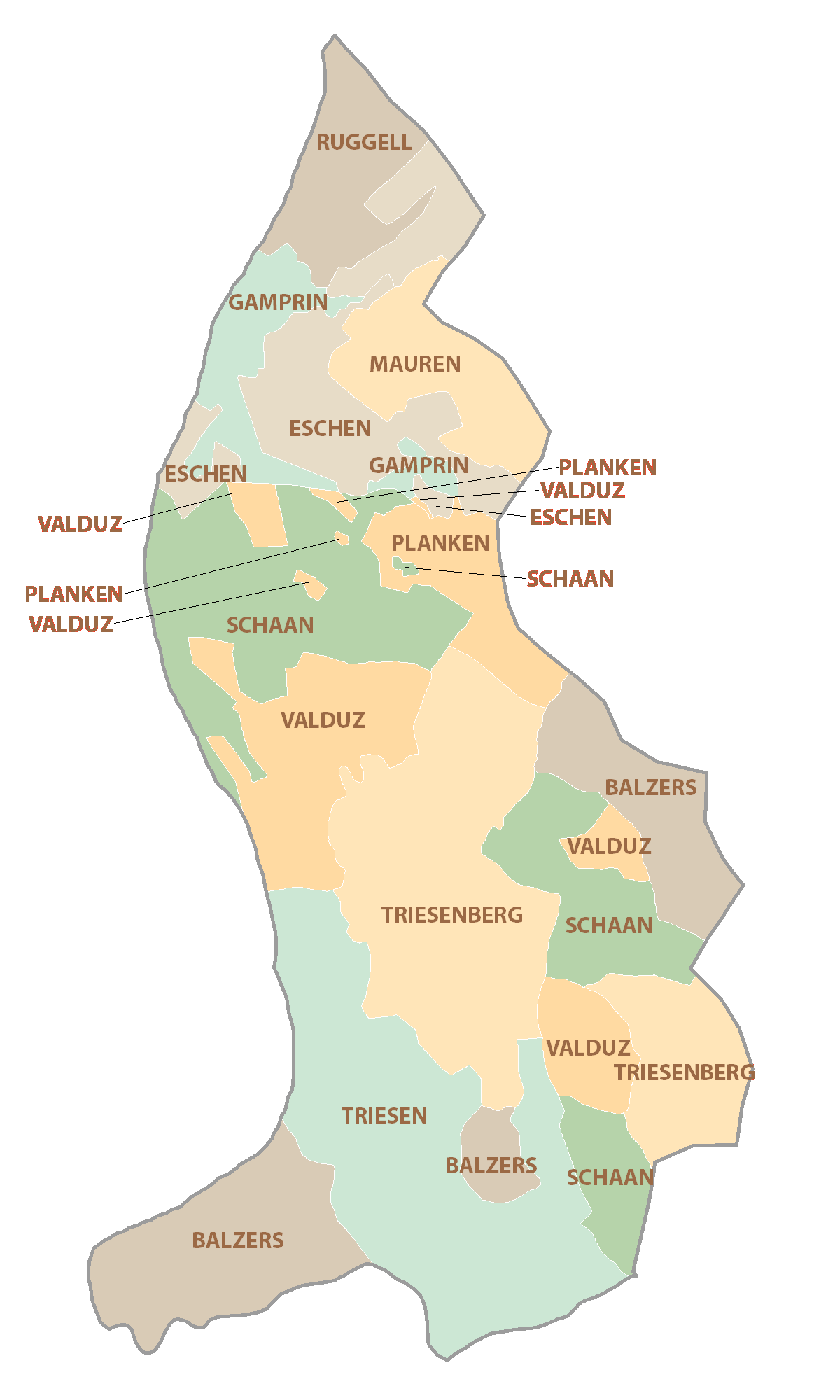
Liechtenstein (officially, the Principality of Liechtenstein) is divided into 11 communes or municipalities (Gemeinden, sing. Gemeinde) In alphabetical order, these communes are: Balzers, Eschen, Gamprin, Mauren, Planken, Ruggell, Schaan, Schellenberg, Triesen, Triesenberg and Vaduz.
With an area of 160 sq. km, Liechtenstein is the 4th smallest country in Europe and the 6th smallest country in the world. Located along the Rhine River, Vaduz is the national capital of Liechtenstein. Situated in the central part of the country, to the north of Vaduz is Schaan – the largest municipality of Liechtenstein. Schaan is also the most populous municipality and the country’s chief administrative, business and industrial hub.
Location Maps
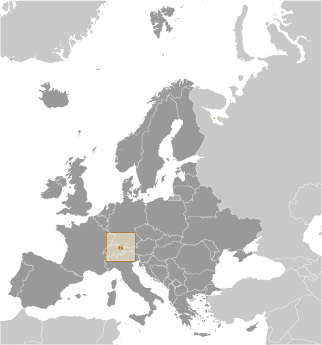
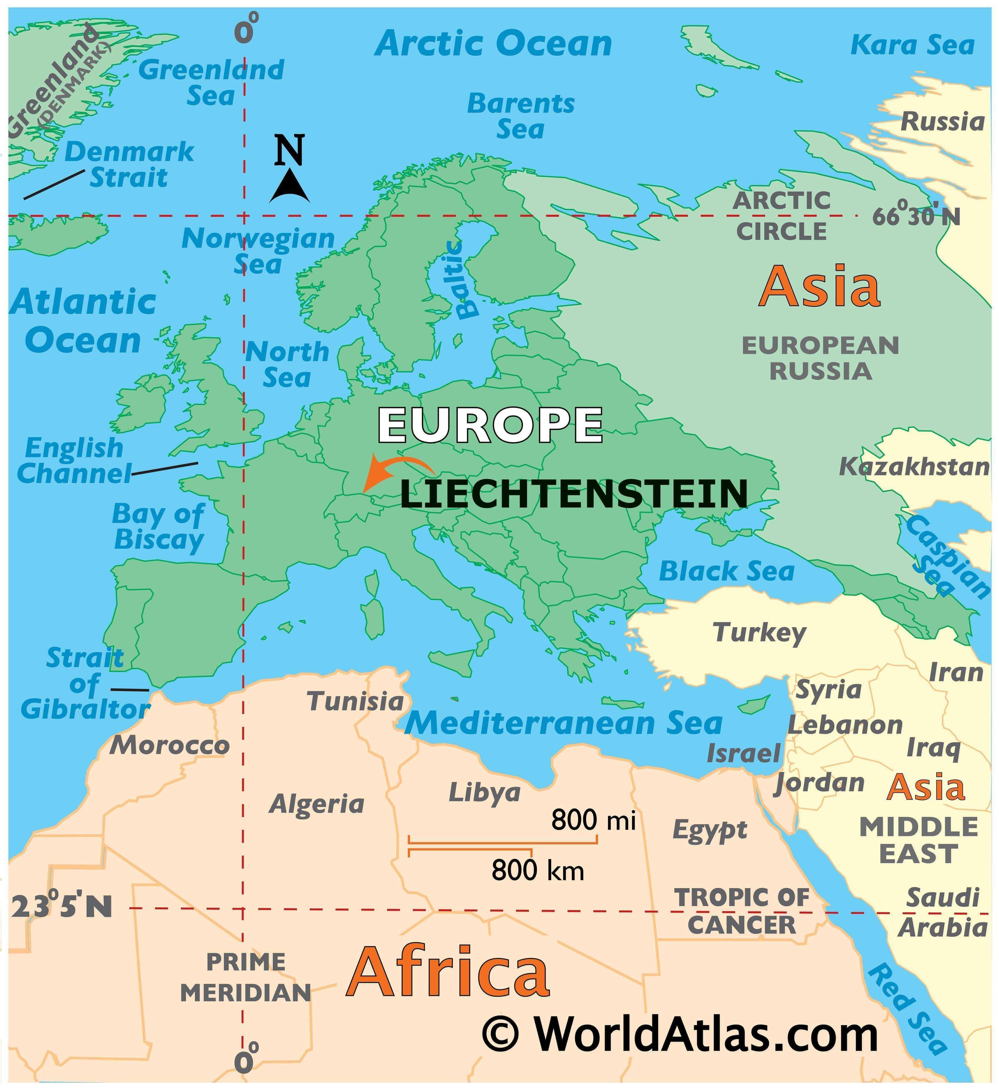
Where is Liechtenstein?
Liechtenstein is a small Central European country located between Switzerland and Austria. With an area of just 160 square kilometers, it is Europe’s fourth-smallest country. Liechtenstein is known for its alpine terrain, medieval castles, and sparsely populated villages. The population of Liechtenstein is just 38,750 people, making it one of the least populous in all of Europe.
Vaduz is the capital city of Liechtenstein, while Schaan is the most populous city with nearly 6,000 inhabitants. It is worth noting that the size of Liechtenstein is about 8 times smaller than Los Angeles.
High Definition Political Map of Liechtenstein
Liechtenstein Administrative Map
History
Early history
The oldest traces of human existence in the area of present-day Liechtenstein date back to the Middle Paleolithic era. Neolithic farming settlements appeared in the valleys around 5300 BC.
The Hallstatt and La Tène cultures flourished during the late Iron Age, from around 450 BCE—possibly under some influence of both the Greek and Etruscan civilisations. One of the most important tribal groups in the Alpine region were the Helvetii. In 58 BCE, at the Battle of Bibracte, Julius Caesar defeated the Alpine tribes, thereby bringing the region under Roman subjugation. By 15 BCE, Tiberius—later the second Roman emperor—with his brother, Drusus, conquered the entire Alpine area. Liechtenstein then became integrated into the Roman province of Raetia. The area was garrisoned by the Roman army, which maintained large legionary camps at Brigantium (Austria), near Lake Constance, and at Magia (Switzerland). The Romans built and maintained a road which ran through the territory. Around 260 CE Brigantium was destroyed by the Alemanni, a Germanic people who later settled in the area around 450.
In the Early Middle Ages, the Alemanni settled the eastern Swiss plateau by the 5th century and the valleys of the Alps by the end of the 8th century, with Liechtenstein located at the eastern edge of Alamannia. In the 6th century the entire region became part of the Frankish Empire following Clovis I’s victory over the Alemanni at Tolbiac in 504.
The area that later became Liechtenstein remained under Frankish hegemony (Merovingian and Carolingian dynasties) until the Treaty of Verdun divided the Carolingian empire in 843, following the death of Charlemagne in 814. The territory of present-day Liechtenstein formed part of East Francia. It would later be reunified with Middle Francia under the Holy Roman Empire, around 1000. Until about 1100, the predominant language of the area was Romansch, but thereafter German began to gain ground in the territory. In 1300 another Alemannic population—the Walsers, who originated in Valais—entered the region and settled; the mountain village of Triesenberg today preserves features of the Walser dialect.
Foundation of a dynasty
By 1200, dominions across the Alpine plateau were controlled by the Houses of Savoy, Zähringer, Habsburg, and Kyburg. Other regions were accorded the Imperial immediacy that granted the empire direct control over the mountain passes. When the Kyburg dynasty fell in 1264, the Habsburgs under King Rudolph I (Holy Roman Emperor in 1273) extended their territory to the eastern Alpine plateau that included the territory of Liechtenstein. This region was enfeoffed to the Counts of Hohenems until the sale to the Liechtenstein dynasty in 1699.
In 1396 Vaduz (the southern region of Liechtenstein) gained imperial immediacy, i.e. it became subject to the Holy Roman Emperor alone.
The family from which the principality takes its name originally came from Liechtenstein Castle in Lower Austria, which they had possessed from at least 1140 until the 13th century (and again from 1807 onwards). The Liechtensteins acquired land, predominantly in Moravia, Lower Austria, Silesia, and Styria. As these territories were all held in feudal tenure from more senior feudal lords, particularly various branches of the Habsburgs, the Liechtenstein dynasty was unable to meet a primary requirement to qualify for a seat in the Imperial diet (parliament), the Reichstag. Even though several Liechtenstein princes served several Habsburg rulers as close advisers, without any territory held directly from the Imperial throne, they held little power in the Holy Roman Empire.
For this reason, the family sought to acquire lands that would be classed as unmittelbar, or held without any intermediate feudal tenure, directly from the Holy Roman Emperor. During the early 17th century Karl I of Liechtenstein was made a Fürst (prince) by the Holy Roman Emperor Matthias after siding with him in a political battle. Hans-Adam I was allowed to purchase the minuscule Herrschaft (‘Lordship’) of Schellenberg and the county of Vaduz (in 1699 and 1712 respectively) from the Hohenems. Tiny Schellenberg and Vaduz had exactly the political status required: no feudal lord other than their comital sovereign and the suzerain Emperor.
Principality
On 23 January 1719, after the lands had been purchased, Charles VI, Holy Roman Emperor, decreed that Vaduz and Schellenberg were united and elevated the newly formed territory to the dignity of Fürstentum (‘principality’) with the name “Liechtenstein” in honour of “[his] true servant, Anton Florian of Liechtenstein”. On this date, Liechtenstein became a sovereign member state of the Holy Roman Empire.
By the early 19th century, as a result of the Napoleonic Wars in Europe, the Holy Roman Empire came under the effective control of France, following the crushing defeat at Austerlitz by Napoleon in 1805. In 1806 Emperor Francis II abdicated and dissolved the Holy Roman Empire, ending more than 960 years of feudal government. Napoleon reorganized much of the Empire into the Confederation of the Rhine. This political restructuring had broad consequences for Liechtenstein: the historical imperial, legal, and political institutions had been dissolved. The state ceased to owe an obligation to any feudal lord beyond its borders.
Modern publications generally attribute Liechtenstein’s sovereignty to these events. Its prince ceased to owe an obligation to any suzerain. From 25 July 1806, when the Confederation of the Rhine was founded, the Prince of Liechtenstein was a member, in fact, a vassal, of its hegemon, styled protector, the French Emperor Napoleon I, until the dissolution of the confederation on 19 October 1813.
Soon afterward, Liechtenstein joined the German Confederation (20 June 1815 – 23 August 1866), which was presided over by the Emperor of Austria.
In 1818, Prince Johann I granted the territory a limited constitution. In that same year Prince Aloys became the first member of the House of Liechtenstein to set foot in the principality that bore their name. The next visit would not occur until 1842.
Developments during the 19th century included:
- 1836: the first factory for making ceramics was opened.
- 1861: the Savings and Loans Bank was founded along with the first cotton-weaving mill.
- 1866: the German Confederation was dissolved.
- 1868: the Liechtenstein Army was disbanded for financial reasons.
- 1872: a railway line between Switzerland and the Austro-Hungarian Empire was constructed through Liechtenstein.
- 1886: two bridges over the Rhine to Switzerland were built.
20th century
Until the end of World War I, Liechtenstein was closely tied first to the Austrian Empire and later to Austria-Hungary; the ruling princes continued to derive much of their wealth from estates in the Habsburg territories, and spent much of their time at their two palaces in Vienna. Johann II appointed Carl von In der Maur, an Austrian aristocrat, to serve as the Governor of Liechtenstein. The economic devastation caused by World War I forced the country to conclude a customs and monetary union with its other neighbour Switzerland.
In 1929, 75-year-old Prince Franz I succeeded to the throne. He had just married Elisabeth von Gutmann, a wealthy woman from Vienna whose father was a Jewish businessman from Moravia. Although Liechtenstein had no official Nazi party, a Nazi sympathy movement arose within its National Union party. Local Liechtenstein Nazis identified Elisabeth as their Jewish “problem”.
In March 1938, just after the annexation of Austria by Nazi Germany, Franz named as regent his 31-year-old grandnephew and heir-presumptive, Prince Franz Joseph. Franz died in July that year, and Franz Joseph succeeded to the throne. Franz Joseph II moved to Liechtenstein in 1938, a few days after Austria’s annexation.
During World War II, Liechtenstein remained officially neutral, looking to neighbouring Switzerland for assistance and guidance, while family treasures from dynastic lands and possessions in Bohemia, Moravia, and Silesia were taken to Liechtenstein for safekeeping. At the close of the conflict, Czechoslovakia and Poland, acting to seize what they considered German possessions, expropriated all of the Liechtenstein dynasty’s properties in those three regions. The expropriations (subject to modern legal dispute at the International Court of Justice) included over 1,600 km (618 sq mi) of agricultural and forest land (most notably the UNESCO listed Lednice–Valtice Cultural Landscape), and several family castles and palaces.
In 2005 it was revealed that Jewish slave labourers from the Strasshof concentration camp, provided by the SS, had worked on estates in Austria owned by Liechtenstein’s Princely House.
Citizens of Liechtenstein were forbidden to enter Czechoslovakia during the Cold War. The diplomatic conflict revolving around the controversial postwar Beneš decrees resulted in Liechtenstein not having international relations with the Czech Republic or Slovakia. Diplomatic relations were established between Liechtenstein and the Czech Republic on 13 July 2009, and with Slovakia on 9 December 2009.
On 20 September 1990, Liechtenstein was admitted into the United Nations as 160th member state. As a member of the United Nations General Assembly, the microstate is one of the few not to play a prominent role in fewer UN-specialized agencies.
Financial centre
Liechtenstein was in dire financial straits following the end of World War II. The Liechtenstein dynasty often resorted to selling family artistic treasures, including the portrait Ginevra de’ Benci by Leonardo da Vinci, which was purchased by the National Gallery of Art of the United States in 1967 for US$5 million ($41 million in 2021 dollars), then a record price for a painting.
By the late 1970s, Liechtenstein used its low corporate tax rates to draw many companies and became one of the wealthiest countries in the world.
Liechtenstein is one of the few countries in Europe (along with Monaco and San Marino) not to have a tax treaty with the United States, and efforts toward one seem to have stalled.
As of September 2019 the Prince of Liechtenstein is the world’s sixth wealthiest monarch, with an estimated wealth of US$3.5 billion. The country’s population enjoys one of the world’s highest standards of living.
Physical Map of Liechtenstein
Liechtenstein Satellite Map