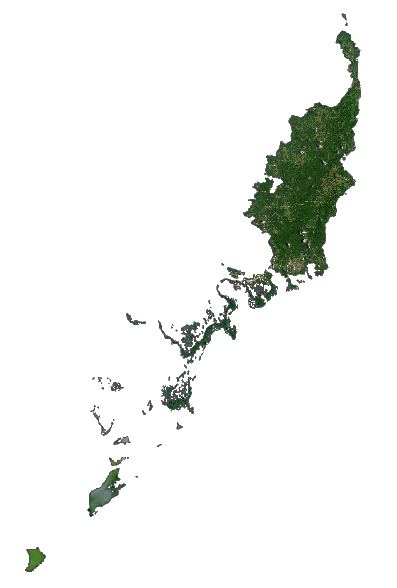
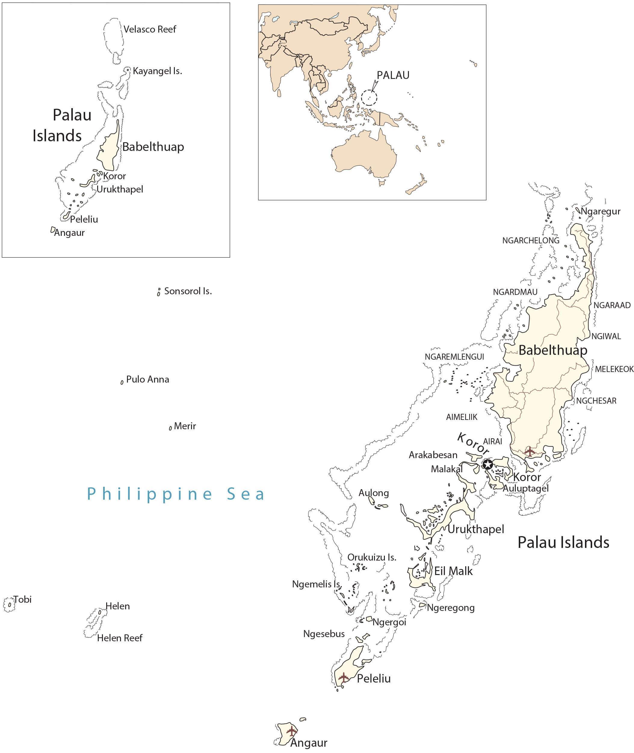
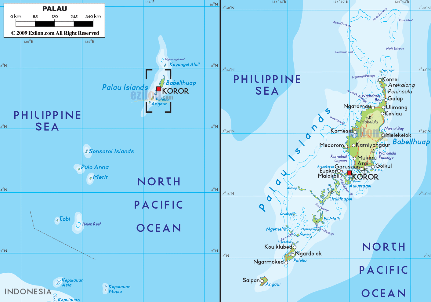
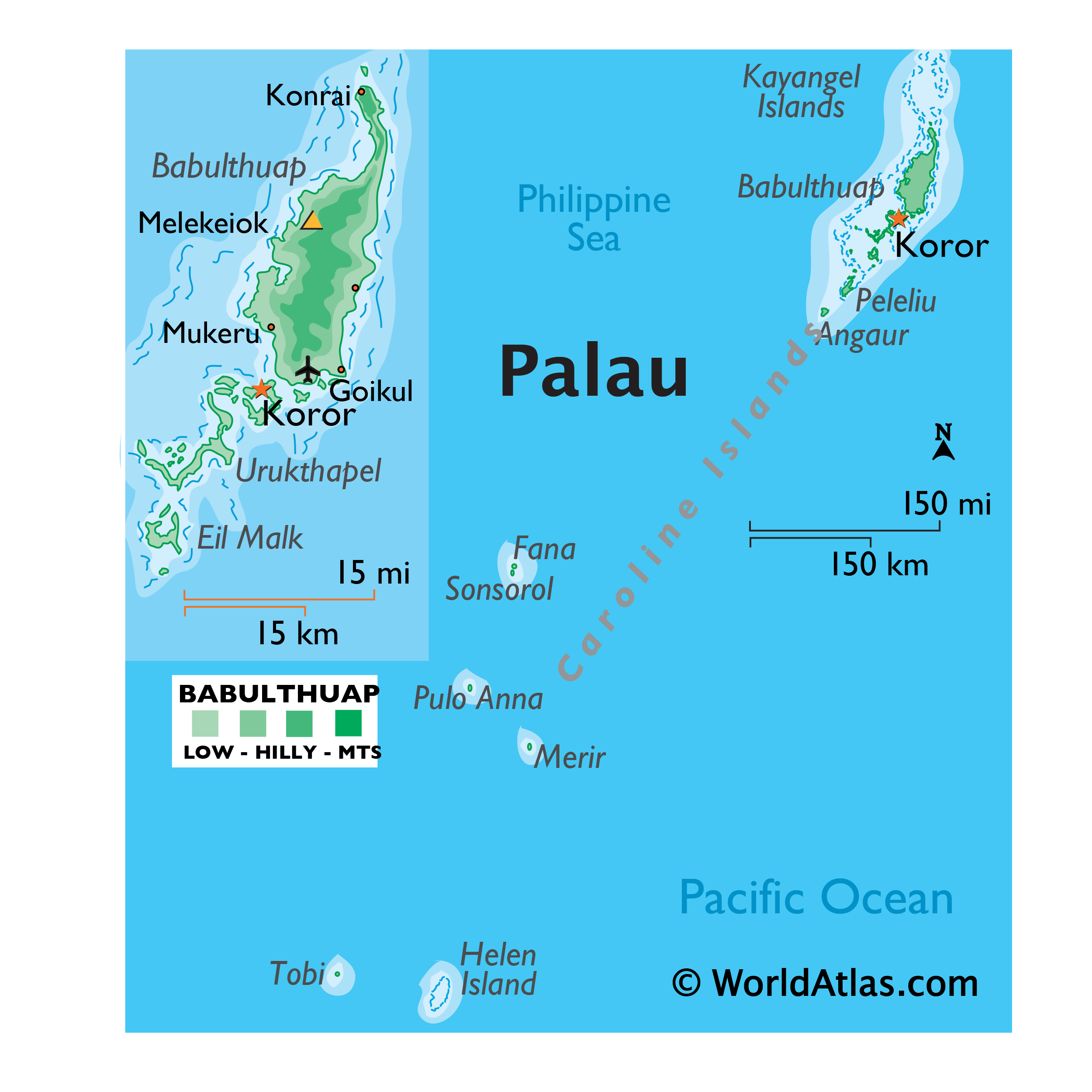
Covering an area of 466 sq.km (177 sq mi), the island nation of Palau comprises of 340 coral and volcanic islands located in the western Pacific Ocean. Palau consists of the far-western portion of the Caroline Islands, including the larger islands of Babeldaob, Angaur, Babulthuap, EilMalk, Koror, Peleiu and Urukthapel.
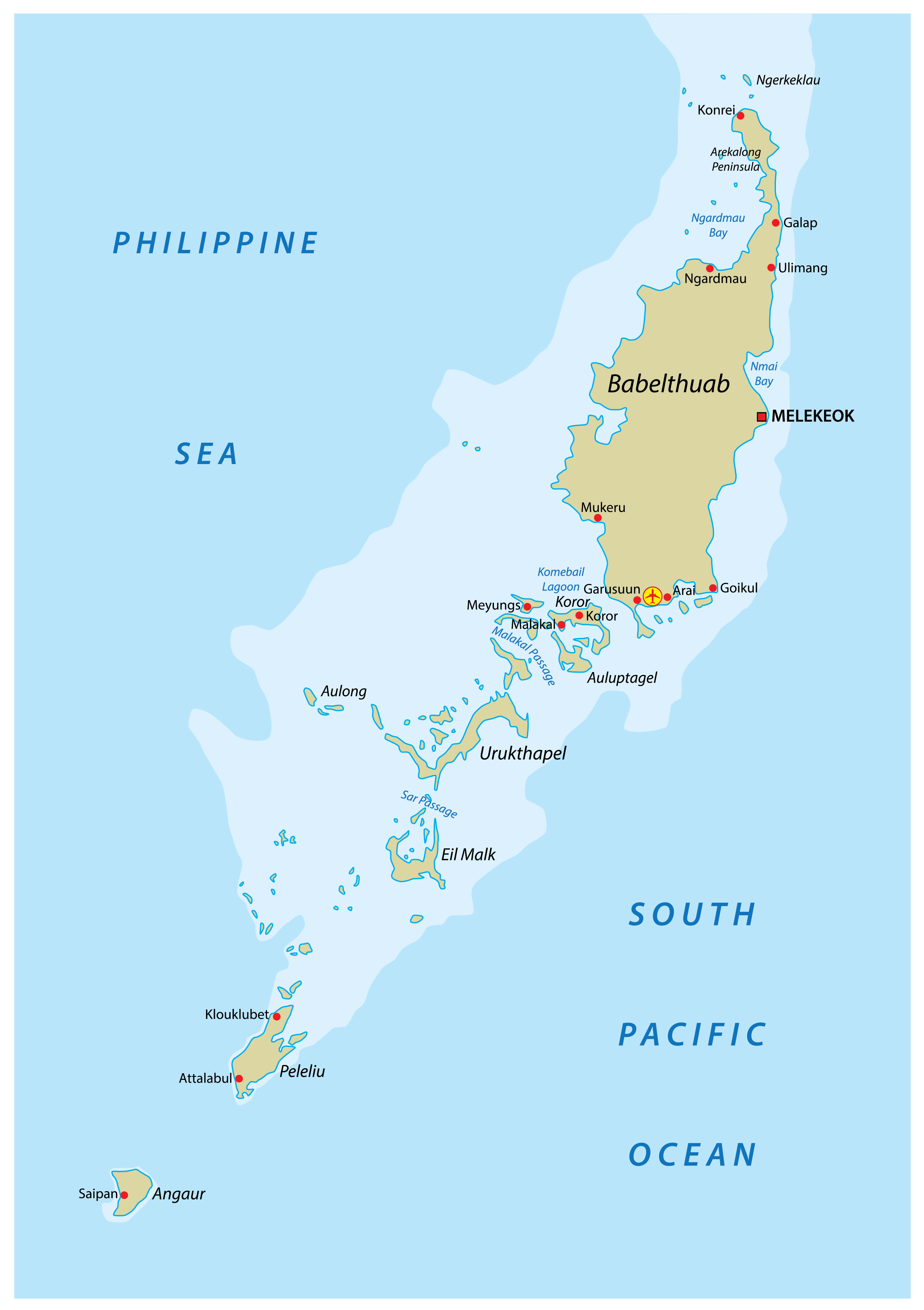
Palau is a beautiful tropical paradise, and one of the true unspoiled destinations on earth. Most of the 100-plus islands are small low-lying coral islands, ringed by barrier reefs. The exception is the mountainous Babulthuap which is volcanic in origin. The highest point is Mount Ngerchelchuus at an elevation of 715ft (215m). The point has been marked by yellow triangle on the map above. The lowest point is the Pacific Ocean (0m).
| Flag: |  |
|---|---|
| Legal Name: | Republic of Palau |
| Capital Value: | Ngerulmud |
| Official languages: |
|
| Demonym(s): | Palauan |
| Government: | Federal presidential republic under a non-partisan democracy |
| Legislature: | Olbiil era Kelulau |
| Total Area: | 459 km² |
| Land Area: | 459 km² |
| Population: | 18,008 |
| Density: | 46.7/km (121.0/sq mi) |
| GDP: | $283.99 Million |
| GDP Per Capita: | $15,859.43 |
| Currency Value: | US Dollar (USD) |
| Driving side: | right |
| Calling code: | +680 |
| Internet TLD: | .pw |
Explore the fascinating islands of Palau with this detailed map. Get a glimpse of the stunning Rock Islands, the roads that connect the five main islands, and the populated places. See the unique types of landscapes that make Palau so beautiful.
Online Interactive Political Map
Click on ![]() to view map in "full screen" mode.
to view map in "full screen" mode.
Palau (officially, the Republic of Palau) is divided into 16 states. These states are: Aimeliik, Airai, Angaur, Hatohobei, Kayangel, Koror, Melekeok, Ngaraard, Ngarchelong, Ngardmau, Ngatpang, Ngchesar, Ngeremlengui, Ngiwal, Peleliu and Sonsorol.
Covering an area of 466 sq.km, the island nation of Palau comprises of 340 coral and volcanic islands located in the western Pacific Ocean. Located on Babeldaob (the largest island of Palau), in the state of Melekeok is Ngerulmud – the capital of Palau. It is the world’s least populous capital city. Koror is the largest and the most populous city of Palau. It acts as the main commercial center of Palau.
Location Maps
Where is Palau?
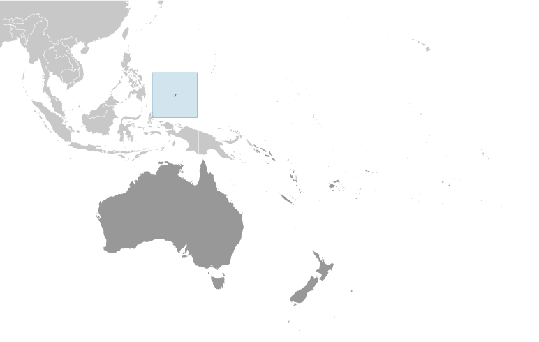
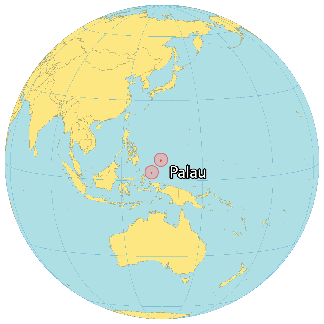
Palau is an island country that sits in Oceania, part of the Micronesia region. It is made up of around 500 islands located in the Pacific Ocean, though the majority of these are uninhabited tropical islands. It is situated next to Guam to the northeast, Papua New Guinea to the southeast, Malaysia and Indonesia to the southwest, and the Philippines to the west. The most populous islands are Angaur, Babeldaob, Koror, and Peleliu, with two-thirds of the population living in Koror. The capital of Palau is Ngerulmud, which has replaced Koror as the largest city.
High Definition Political Map of Palau
History
Early history
Palau was originally settled between the 3rd and 2nd millennia BCE, most likely from the Philippines or Indonesia. Sonsorol, part of the Southwest Islands, an island chain approximately 600 kilometers (370 mi; 320 nmi) from the main island chain of Palau, was sighted by the Spanish as early as 1522, when the Spanish mission of the Trinidad, the flagship of Ferdinand Magellan’s voyage of circumnavigation, sighted two small islands around the 5th parallel north, naming them “San Juan”.
After the 16th century
The next recording of the existence of Palau by Europeans came a century later in 1697 when a group of Palauans was shipwrecked on the Philippine island of Samar to the northwest. They were interviewed by the Czech missionary Paul Klein on 28 December 1696. Klein was able to draw the first known European map of Palau based on the Palauans’ representation of their home islands that they made with an arrangement of 87 pebbles on the beach. Klein reported his findings to the Jesuit Superior General in a letter sent in June 1697.
Spanish era
This map and the letter caused a vast interest in the new islands. Another letter written by Fr. Andrés Serrano was sent to Europe in 1705, essentially copying the information given by Klein. The letters resulted in three unsuccessful Jesuit attempts to travel to Palau from Spanish Philippines in 1700, 1708, and 1709. The islands were first visited by the Jesuit expedition led by Francisco Padilla on 30 November 1710. The expedition ended with the stranding of the two priests, Jacques Du Beron and Joseph Cortyl, on the coast of Sonsorol, because the mother ship Santísima Trinidad was driven to Mindanao by a storm. Another ship was sent from Guam in 1711 to save them only to capsize, causing the death of three more Jesuit priests. The failure of these missions gave Palau the original Spanish name Islas Encantadas (Enchanted Islands).
Transitions era
British traders became regular visitors to Palau in the 18th century (the British East India Company packet ship Antelope shipwrecked off Ulong Island in 1783, leading to Prince Lee Boo’s visit to London), followed by expanding Spanish influence in the 19th century. Palau, under the name Palaos, was included in the Malolos Congress in 1898, the first revolutionary congress in the Philippines, which wanted full independence from colonialists. Palau, at the time, was part of the Spanish East Indies headquartered in the Philippines. Palau had one appointed member to the Congress, becoming the only group of islands in the entire Caroline Islands granted high representation in a non-colonial Philippine Congress. Congress also supported the right of Palau to self-determination if ever it wished to pursue such a path. Later in 1899 as part of the Caroline Islands, Palau was sold by the Spanish Empire to the German Empire as part of German New Guinea in the German–Spanish Treaty (1899). During World War I, the Japanese Empire annexed the islands after seizing them from Germany in 1914. Following World War I, the League of Nations formally placed the islands under Japanese administration as part of the South Seas Mandate. In World War II, Palau was used by Japan to support its 1941 invasion of the Philippines, which succeeded in 1942. The invasion overthrew the American-installed Commonwealth government in the Philippines and installed the Japanese-backed Second Philippine Republic in 1943.
United States era
During World War II, the United States captured Palau from Japan in 1944 after the costly Battle of Peleliu, when more than 2,000 Americans and 10,000 Japanese were killed and later the Battle of Angaur. In 1945–1946, the United States re-established control of the Philippines and managed Palau through the Philippine capital of Manila. By the latter half of 1946, however, the Philippines was granted full independence with the formation of the Third Republic of the Philippines, shifting the U.S. Far West Pacific capital to Guam. Palau was passed formally to the United States under United Nations auspices in 1947 as part of the Trust Territory of the Pacific Islands established pursuant to Security Council Resolution 21.
Independence
Four of the Trust Territory districts joined together and formed the Federated States of Micronesia in 1979, but the districts of Palau and the Marshall Islands voted against the proposed constitution. Palau, the westernmost cluster of the Carolines, instead opted for independent status in 1978, which was widely supported by the Philippines, Taiwan, and Japan. It approved a new constitution and became the Republic of Palau on 1 January 1981. It signed a Compact of Free Association with the United States in 1982. In the same year, Palau became one of the founding members of the Nauru Agreement. After eight referendums and an amendment to the Palauan constitution, the Compact was ratified in 1993. The Compact went into effect on 1 October 1994, making Palau de jure independent, although it had been de facto independent since 25 May 1994, when the trusteeship ended. Formal diplomatic relations with the Philippines were re-established in the same year, although the two countries already had diplomatic back channels prior to 1994. Palau also became a member of the Pacific Islands Forum, but withdrew in February 2021 after a dispute regarding Henry Puna’s election as the Forum’s secretary-general.
Legislation making Palau an “offshore” financial center was passed by the U.S. Senate in 1998.
In 2001, Palau passed its first bank regulation and anti-money laundering laws.
In 2005, Palau led the Micronesia challenge, which would conserve 30% of near-shore coastal waters and 20% of forest land of participating countries by 2020. In 2009, Palau created the world’s first shark sanctuary, banning commercial shark fishing within its waters. In 2012, the Rock Islands of Palau was declared as a UNESCO World Heritage Site.
In 2015, Palau became a member of the Climate Vulnerable Forum under the chairmanship of the Philippines, and at the same time, the country officially protected 80% of its water resources, becoming the first country to do so. The protection of its water resources made significant increases in the country’s economy in less than two years. In 2017, it became the first state in the world to establish an eco-promise, known as the Palau Pledge, which are stamped on local and foreign passports. In 2018, Palau and the Philippines began re-connecting their economic and diplomatic relations. The Philippines supported Palau to become an observer state in ASEAN, as Palau also has Southeast Asian ethnic origins.
In November 2020, Surangel Whipps Jr was elected as the new President of Palau to succeed President Tommy Remengesau.
Physical Map of Palau
Geography
Palau’s territory consists of an archipelago located in the Pacific Ocean. Its most populous islands are Angaur, Babeldaob, Koror and Peleliu. The latter three lie together within the same barrier reef, while Angaur is an oceanic island several kilometers to the south. About two-thirds of the population lives on Koror.
The coral atoll of Kayangel is north of these islands, while the uninhabited Rock Islands (about 200) are west of the main island group. A remote group of six islands, known as the Southwest Islands, some 604 kilometers (375 miles) from the main islands, make up the states of Hatohobei and Sonsorol.
Climate
Palau has a tropical rainforest climate with an annual mean temperature of 28 °C (82 °F). Rainfall is heavy throughout the year, averaging 3,800 mm (150 in). The average humidity is 82% and, although rain falls more frequently between June and October, there is still much sunshine.
Palau lies on the edge of the typhoon belt. Tropical disturbances frequently develop near Palau every year, but significant tropical cyclones are quite rare. Mike, Bopha and Haiyan are the only systems that struck Palau as typhoons on record.
Environment
Palau has a history of strong environmental conservation. For example, Ngerukewid islands and the surrounding area are protected under the Ngerukewid Islands Wildlife Preserve, which was established in 1956.
While much of Palau remains free of environmental degradation, areas of concern include illegal dynamite fishing, inadequate solid waste disposal facilities in Koror, and extensive sand and coral dredging in the Palau lagoon. As with other Pacific island states, rising sea level presents a major environmental threat. However, according to the Emissions Database for Global Atmospheric Research average carbon dioxide emissions per person were 60 tonnes in 2019, the highest in the world, and mostly from transport. Inundation of low-lying areas threatens coastal vegetation, agriculture, and an already insufficient water supply. Wastewater treatment is a problem, along with the handling of toxic waste from fertilizers and biocides.
One species of saltwater crocodile, Crocodylus porosus, is also indigenous to Palau, occurring in varying numbers throughout the mangroves and in parts of the Rock Islands. Although this species is generally considered extremely dangerous, there has only been one fatal human attack, on 28 December 1965, in Palau in modern history. This attack led to a crocodile eradication program and trade in crocodile hides that ran into the 1980s. A management and conservation program running since the 1990s has led to a stabilization of the Palauan crocodile population. In Palau, the largest crocodile measured 4.5 meters (14 ft 9 in).
The country is also vulnerable to earthquakes, volcanic activity, and tropical storms. Palau already has a problem with inadequate water supply and limited agricultural areas to support its population.
On 5 November 2005, President Tommy E. Remengesau, Jr. took the lead on a regional environmental initiative called the Micronesia challenge, which would conserve 30% of near-shore coastal waters and 20% of forest land by 2020. Following Palau, the initiative was joined by the Federated States of Micronesia, the Marshall Islands, and the US territories of Guam and Northern Mariana Islands. Together, this combined region represents nearly 5% of the marine area of the Pacific Ocean and 7% of its coastline.
Palau contains the Palau tropical moist forests terrestrial ecoregion. It had a 2019 Forest Landscape Integrity Index mean score of 8.09/10, ranking it 27th globally out of 172 countries.
Sanctuary
On 25 September 2009, Palau announced that it would create the world’s first shark sanctuary. Palau banned all commercial shark fishing within the waters of its exclusive economic zone (EEZ). The sanctuary protects about 600,000 square kilometers (230,000 sq mi) of ocean, a similar size to France. President Johnson Toribiong announced the sanctuary at a meeting of the United Nations. President Toribiong proposed a worldwide ban on fishing for sharks. In 2012, Palau received the Future Policy Award from World Future Council, because “Palau is a global leader in protecting marine ecosystems”.
Palau Satellite Map