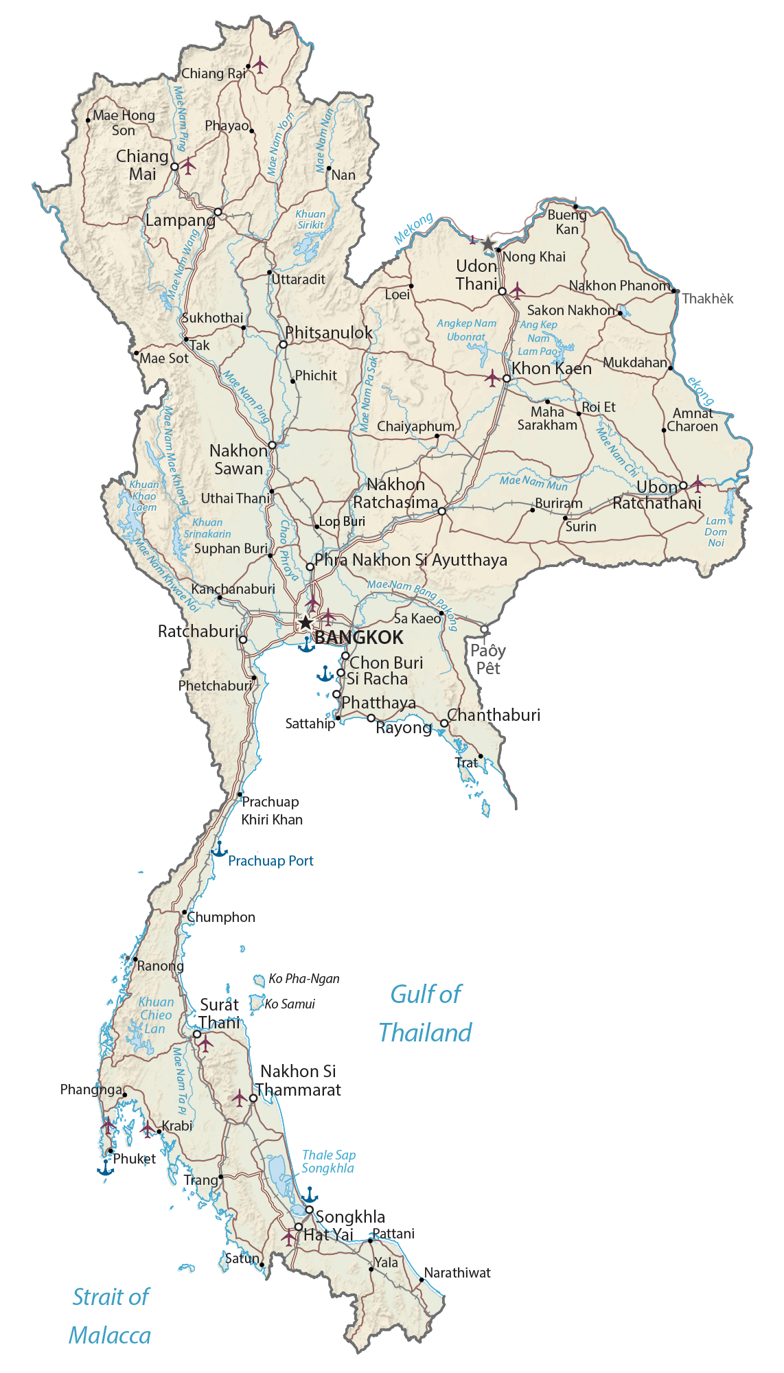
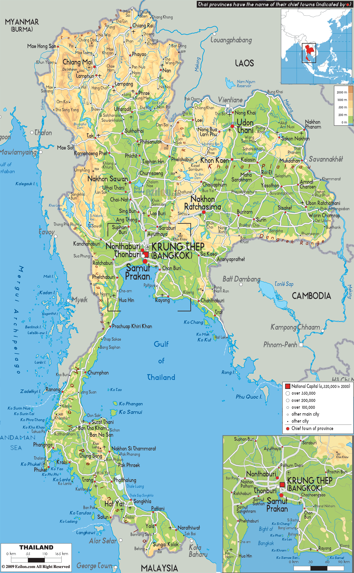
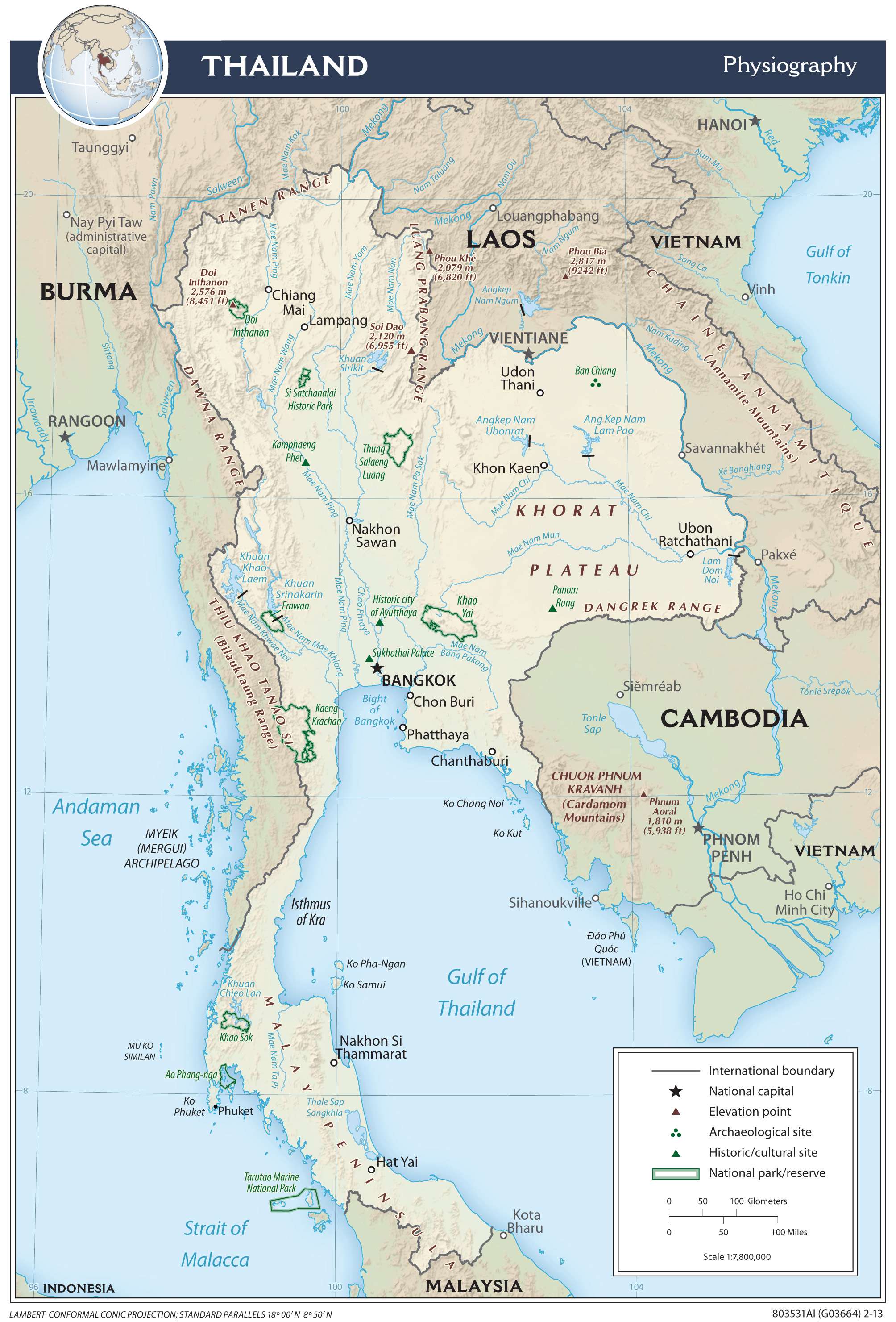
Thailand covers a total area of 513,120 sq. km in the Indo-Chinese Peninsula. The country has a varied landscape ranging from low mountains to fertile plains to sandy beaches.
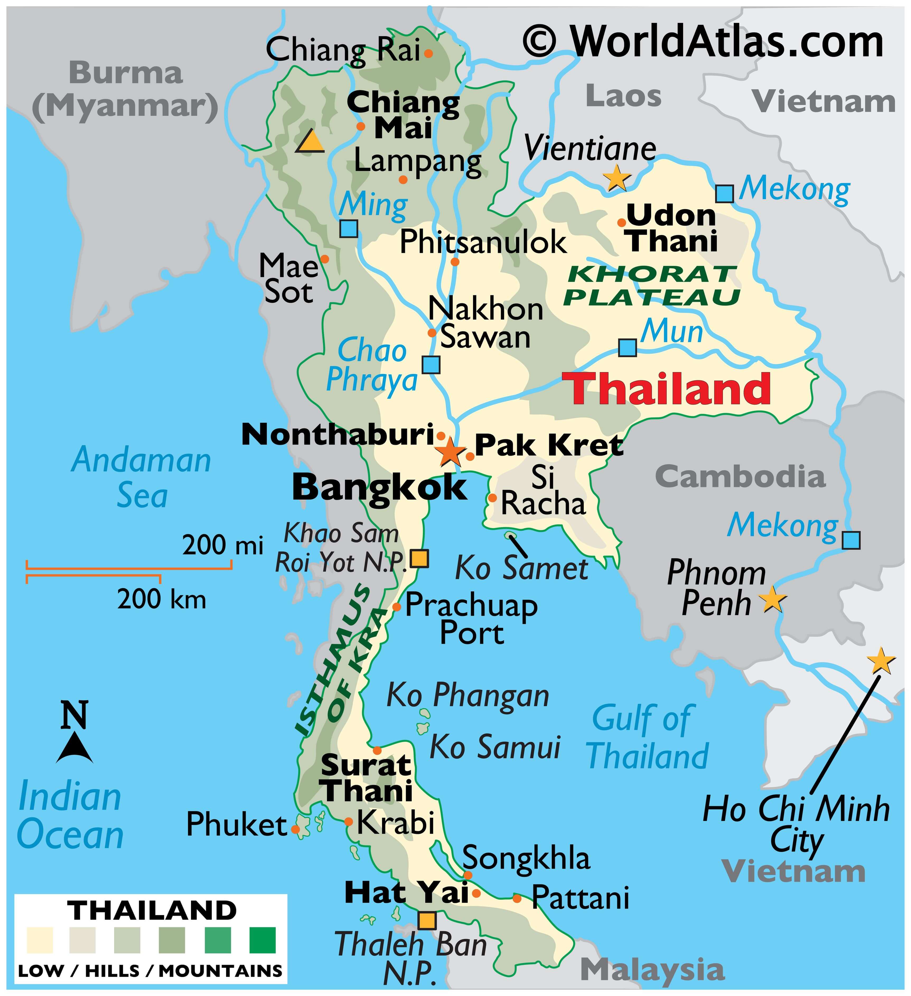
As observed on the physical map of Thailand above, fold mountains dominate the country’s landscape to the north and west. These mountains extend southward (in a narrow strip) along the Burma border to the northern edges of Malaysia. As marked on the map by an upright yellow triangle, the highest point of the country is Doi Inthanon whose summit peaks at 8,451 ft. (2,576 m).
To the northeast is the Khorat Plateau. It is a region of rolling low hills and small, shallow lakes, drains into the Mekong River system on its border with Laos.
The Chao Phraya River basin lies in the centre of the country. The Chao Phraya River, which flows for 231 miles (372 km), is home to some of the most historically significant and densely populated settlements of Thailand; the river and its tributaries drain into a delta south of Bangkok. The southeast represents the maritime corner of the central region.
Along Thailand’s southern peninsula (Isthmus of Kra) the land fades into mangrove swamps. Numerous islands are found off the coastline, with Phuket being the most famous.
The lowest point of the country is the Gulf of Thailand (0 m).
| Flag: |  |
|---|---|
| Legal Name: | Kingdom of Thailand |
| Capital Value: | Bangkok |
| Demonym(s): | Thai, Siamese |
| Government: | Unitary parliamentary semi-democratic constitutional monarchy |
| Legislature: | National Assembly |
| Total Area: | 513,120 km² |
| Land Area: | 510,890 km² |
| Water Area: | 2,230 km² |
| Population: | 69,625,582 |
| Density: | 132.1/km (342.1/sq mi) (88th) |
| GDP: | $543.65 Billion |
| GDP Per Capita: | $7,808.19 |
| Currency Value: | Baht |
| Driving side: | left |
| Calling code: | +66 |
| Internet TLD: |
|
Explore the beauty of Thailand with this interactive map. See the stunning landscapes, vibrant cities, and diverse cultures of this Southeast Asian country. Get a detailed view of the geography, major cities, highways, roads, rivers, lakes, and islands that make up this stunning nation.
Discover the unique beauty of Thailand with this interactive map. View the country’s stunning landscapes, vibrant cities, and diverse cultures. Explore the geography of Thailand, including its major cities, highways, roads, rivers, lakes, and islands.
Online Interactive Political Map
Click on ![]() to view map in "full screen" mode.
to view map in "full screen" mode.
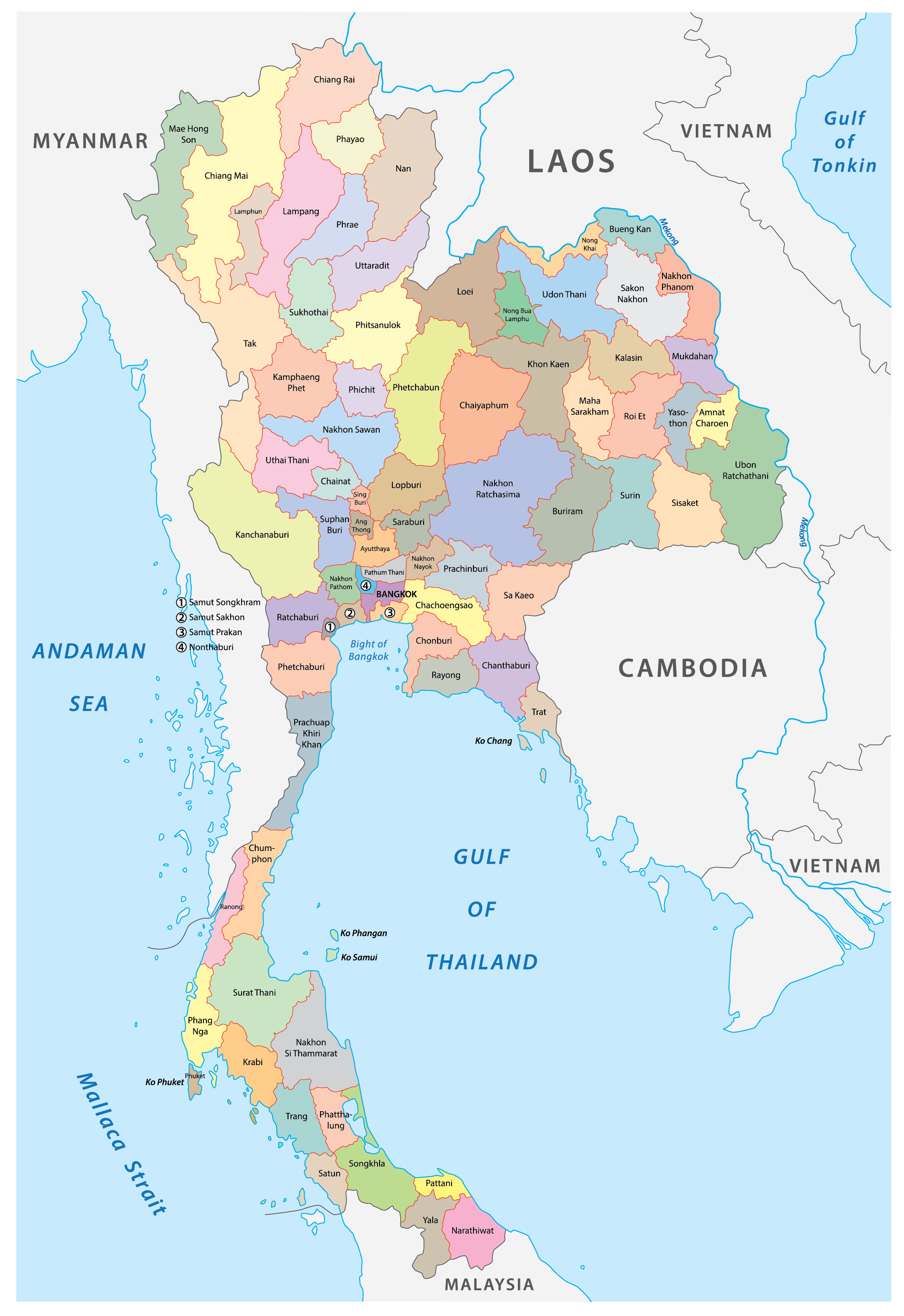
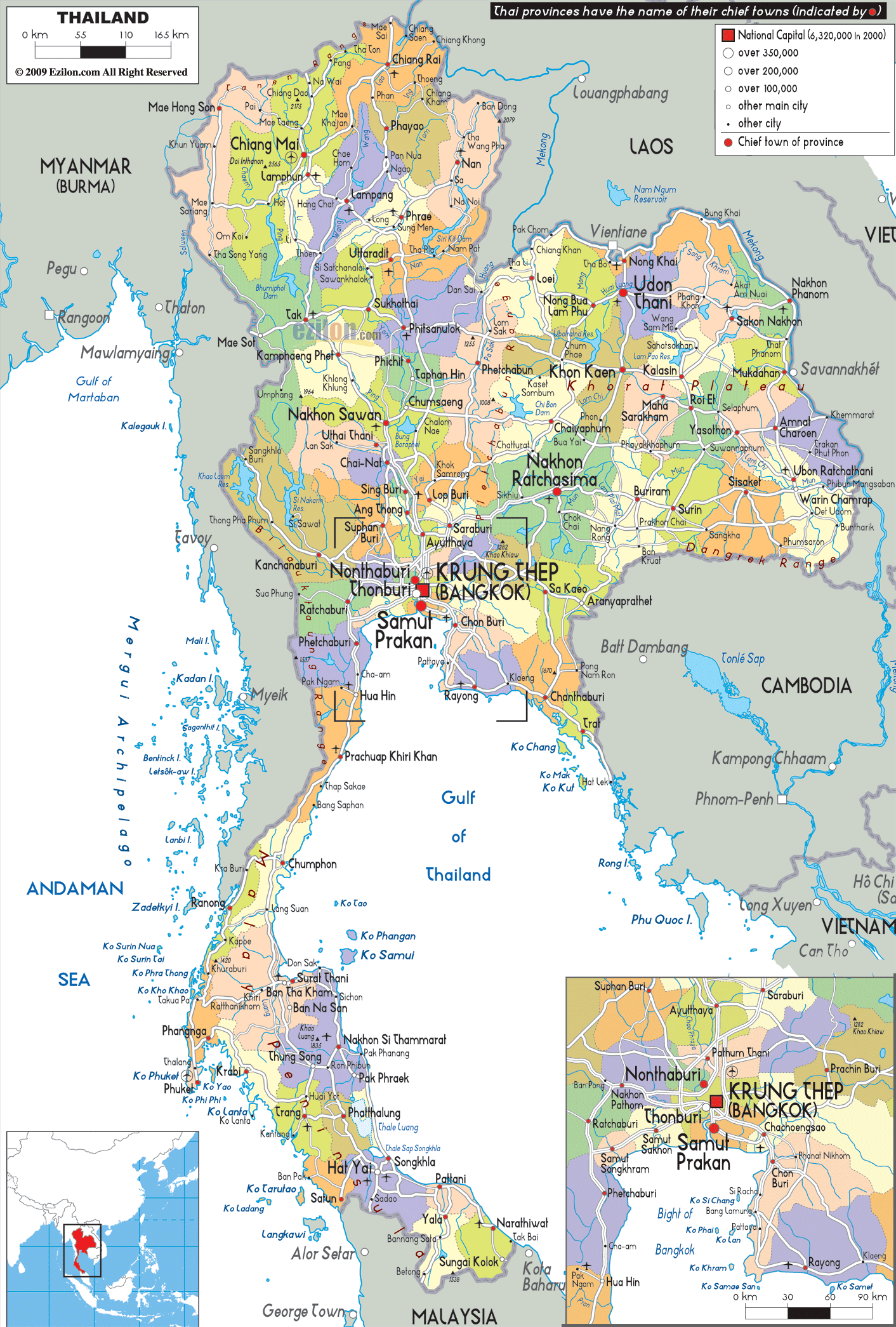
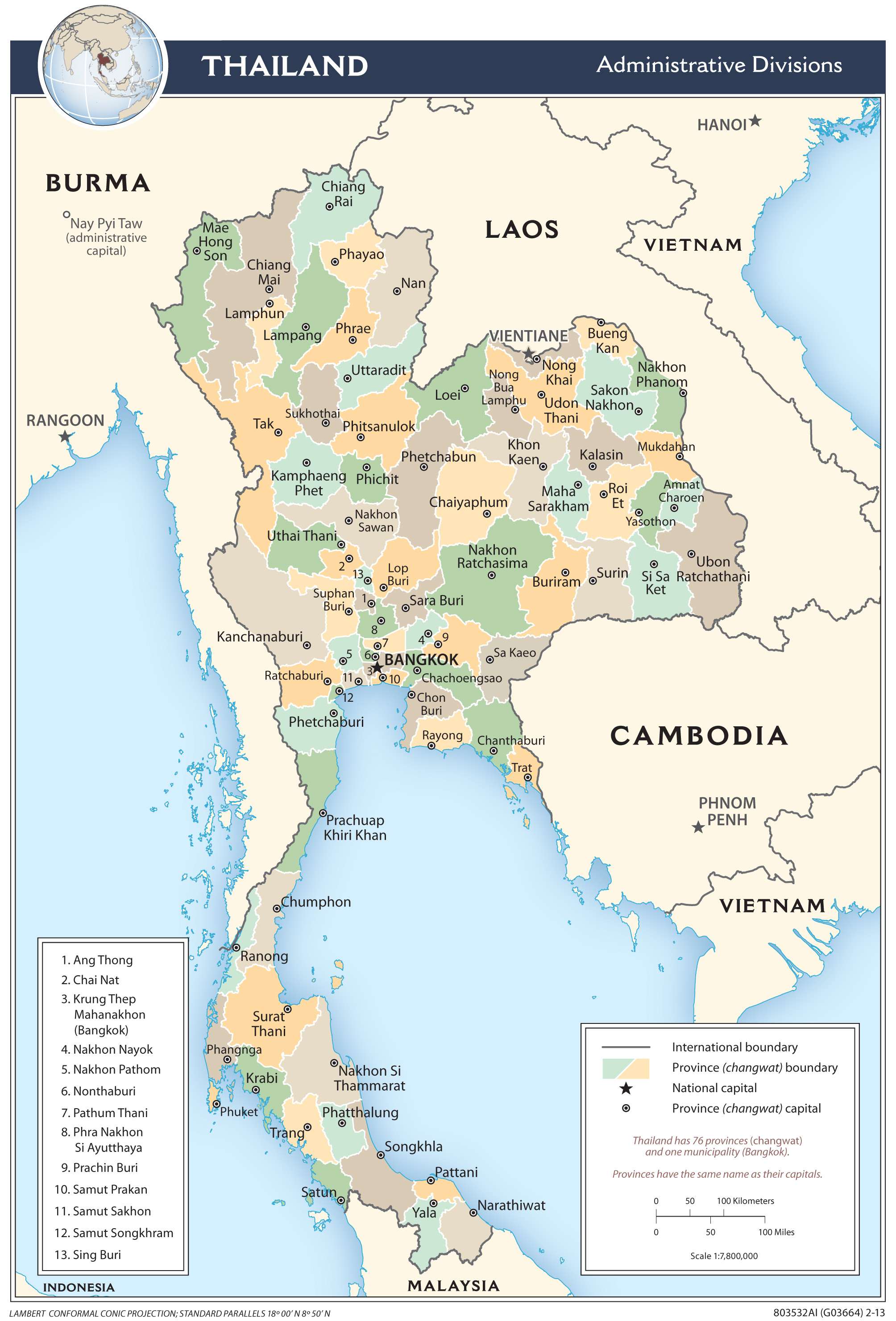
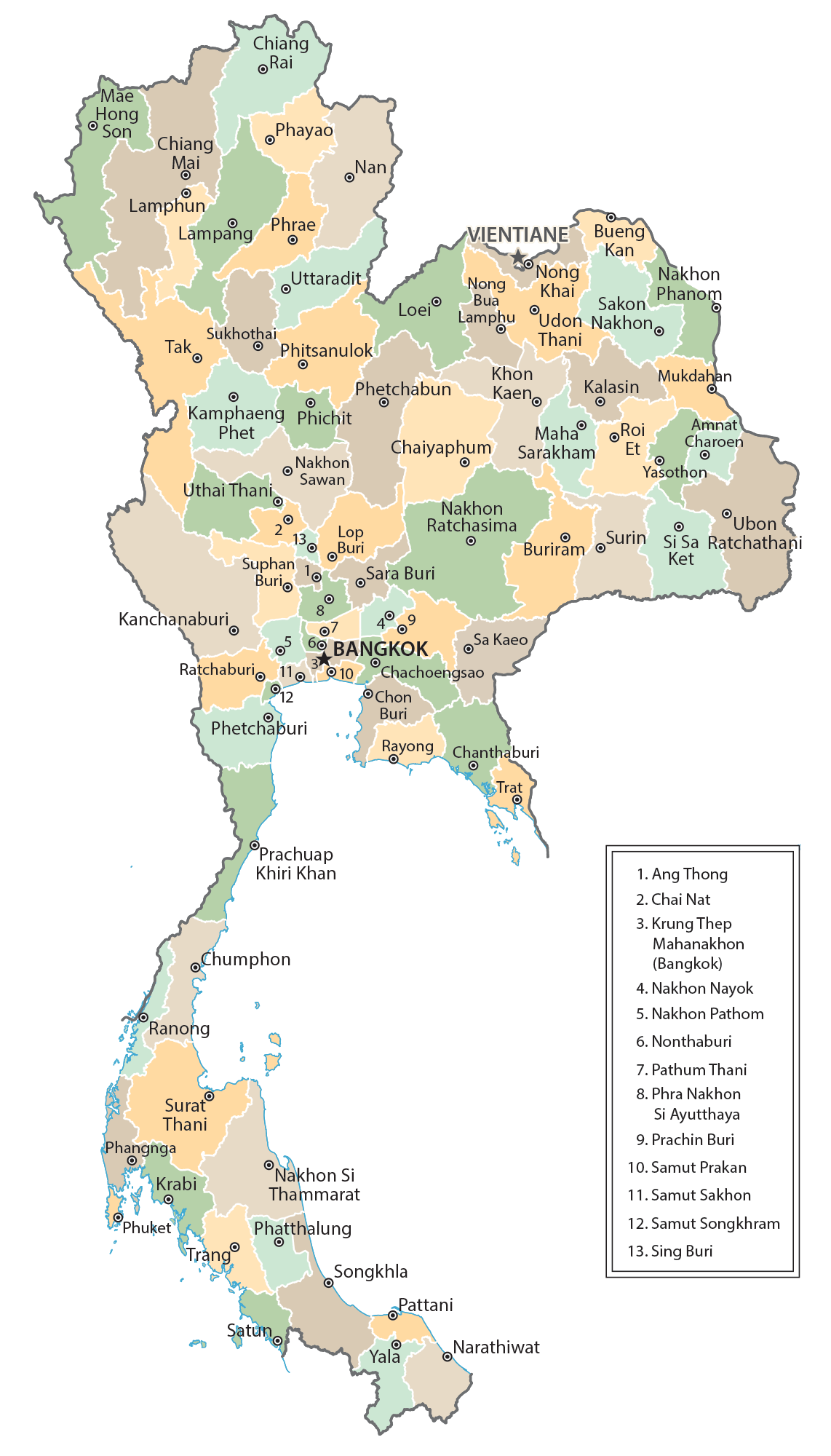
Thailand (officially, Kingdom of Thailand) is divided into 76 administrative provinces. These provinces are further subdivided into districts and smaller subdivisions. There are two specially governed districts – Bangkok and Pattaya.
76 provinces (changwat, singular and plural) are as follows: Amnat Charoen, Ang Thong, Bueng Kan, Buri Ram, Chachoengsao, Chai Nat, Chaiyaphum, Chanthaburi, Chiang Mai, Chiang Rai, Chon Buri, Chumphon, Kalasin, Kamphaeng Phet, Kanchanaburi, Khon Kaen, Krabi, Lampang, Lamphun, Loei, Lop Buri, Mae Hong Son, Maha Sarakham, Mukdahan, Nakhon Nayok, Nakhon Pathom, Nakhon Phanom, Nakhon Ratchasima, Nakhon Sawan, Nakhon Si Thammarat, Nan, Narathiwat, Nong Bua Lamphu, Nong Khai, Nonthaburi, Pathum Thani, Pattani, Phangnga, Phatthalung, Phayao, Phetchabun, Phetchaburi, Phichit, Phitsanulok, Phra Nakhon Si Ayutthaya, Phrae, Phuket, Prachin Buri, Prachuap Khiri Khan, Ranong, Ratchaburi, Rayong, Roi Et, Sa Kaeo, Sakon Nakhon, Samut Prakan, Samut Sakhon, Samut Songkhram, Saraburi, Satun, Sing Buri, Si Sa Ket, Songkhla, Sukhothai, Suphan Buri, Surat Thani, Surin, Tak, Trang, Trat, Ubon Ratchathani, Udon Thani, Uthai Thani, Uttaradit, Yala, Yasothon
With an area of 20,494 sq. km, Nakhon Ratchasima is the largest province and the most populous one as well.
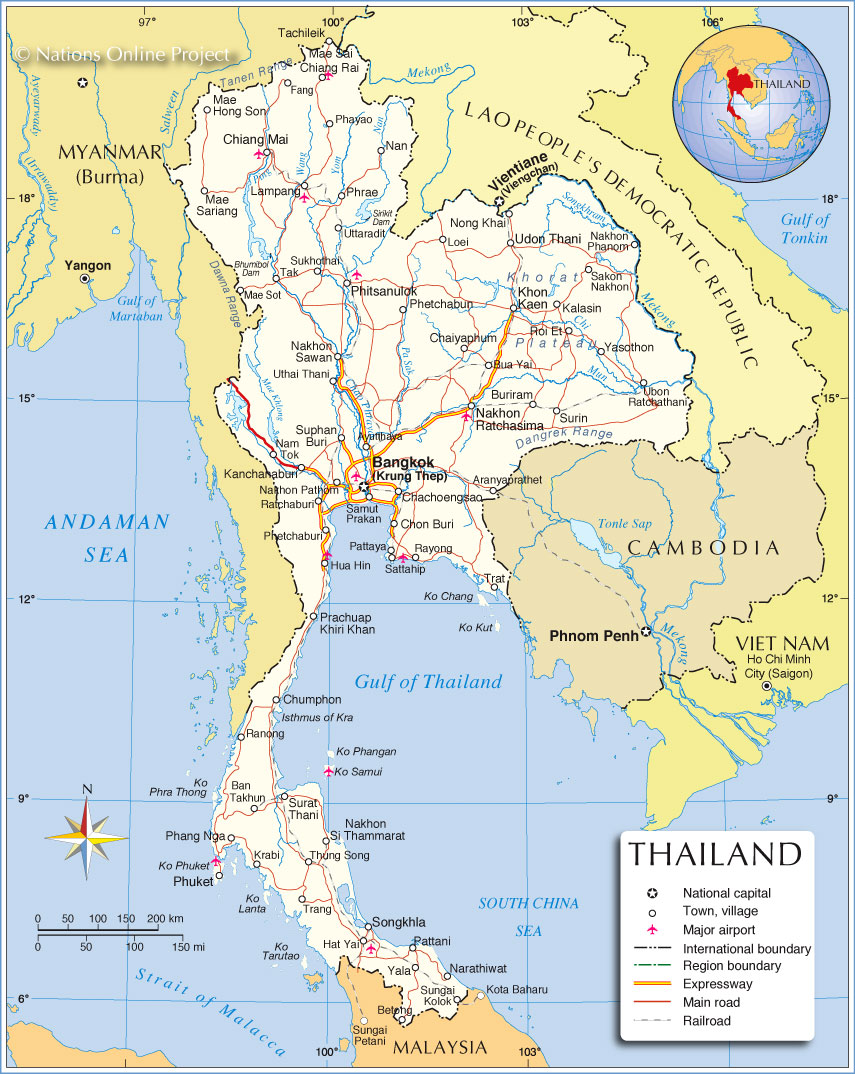
Bangkok (Thai: Krung Thep), the capital and the most populous city, is located in Central Thailand.
Location Maps
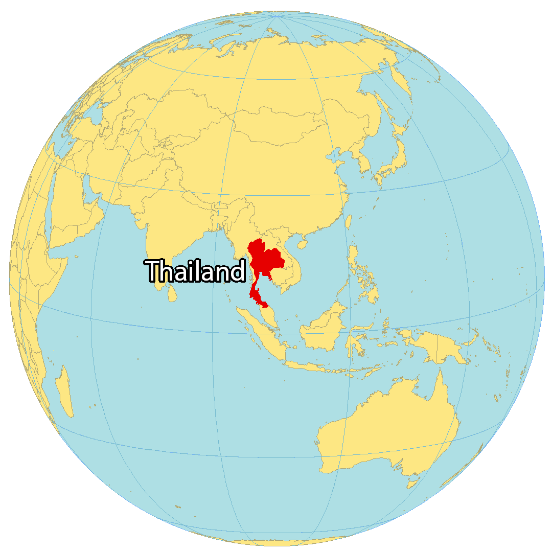
Where is Thailand?
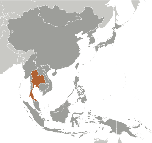
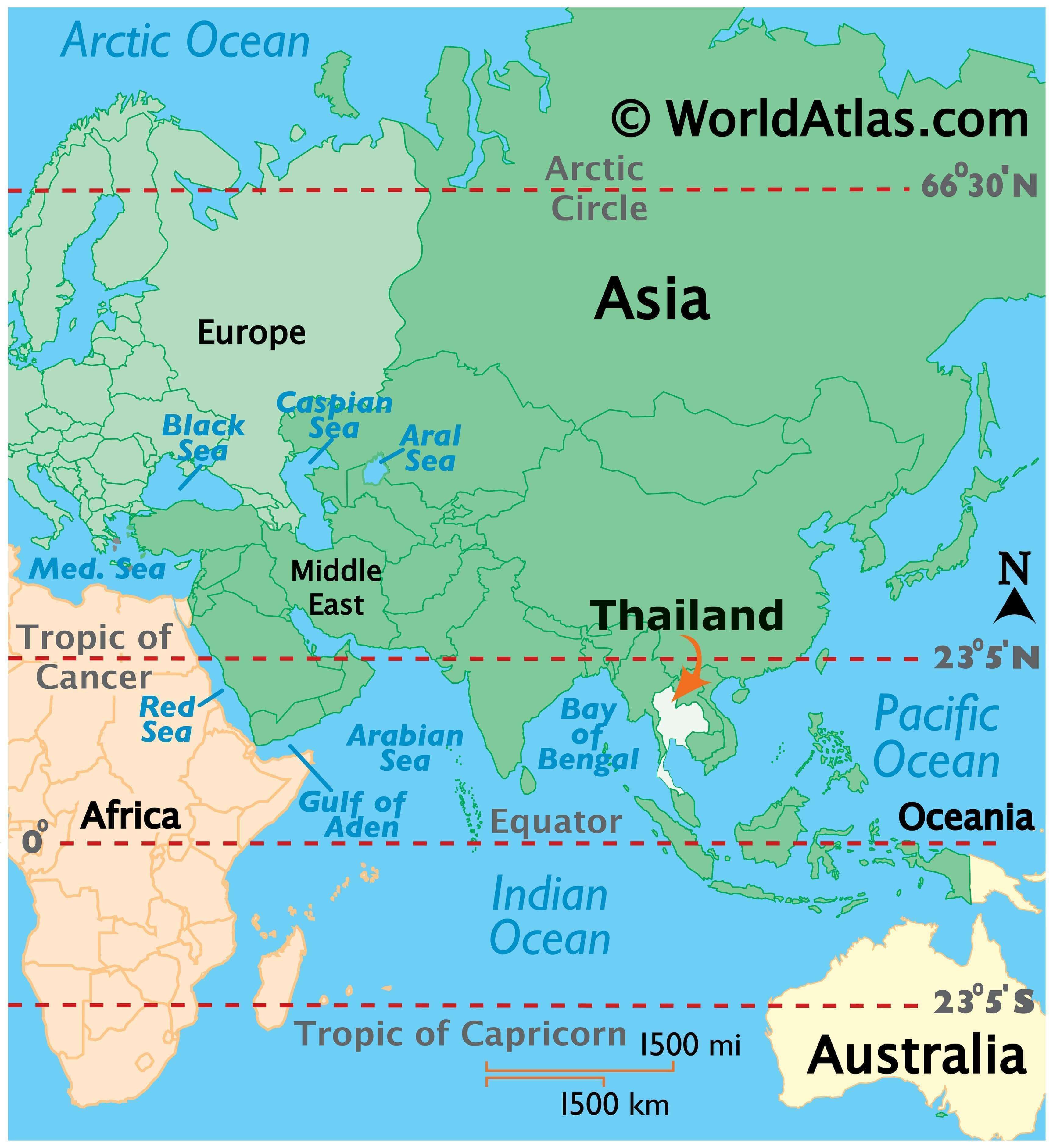
Thailand is located in the heart of Southeastern Asia, along the Gulf of Thailand. It is bordered by four Asian countries: Myanmar to the west, Laos to the north, Cambodia to the east, and Malaysia to the south. The country was formerly known as Siam, and changed its name to Thailand (Land of the Free) in 1939.
Thailand boasts 35,000 temples, and is one of the world’s most popular tourist destinations, with 16 million visitors each year. The capital and largest city of Thailand is Bangkok, and other major cities include Samut Prakan, Mueang Nonthaburi, and Udon Thani. The country is divided into four main regions: the central plains, the Khorat Plateau, the mountains and hills of the north and northeast, and the peninsula.
High Definition Political Map of Thailand
Thailand Administrative Map
Physical Map of Thailand
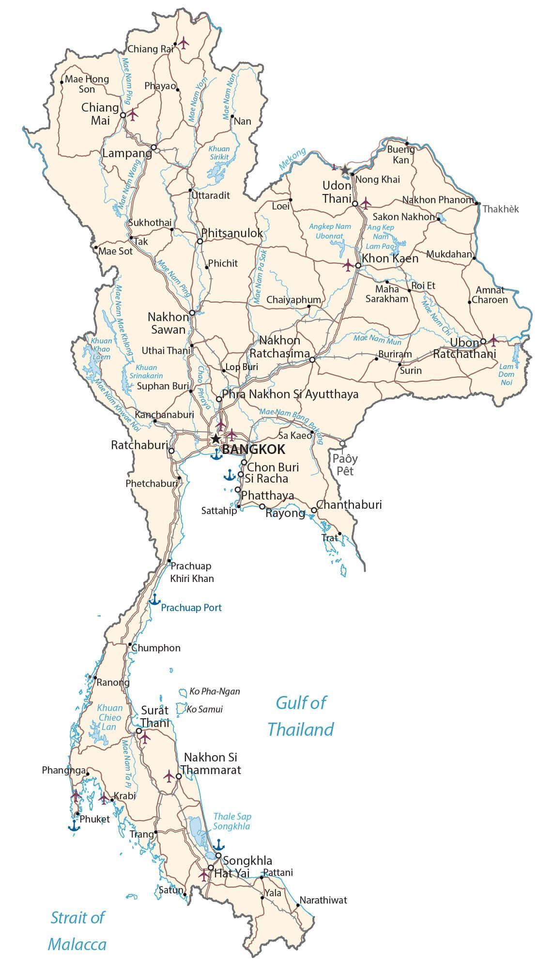
Transportation Map of Thailand
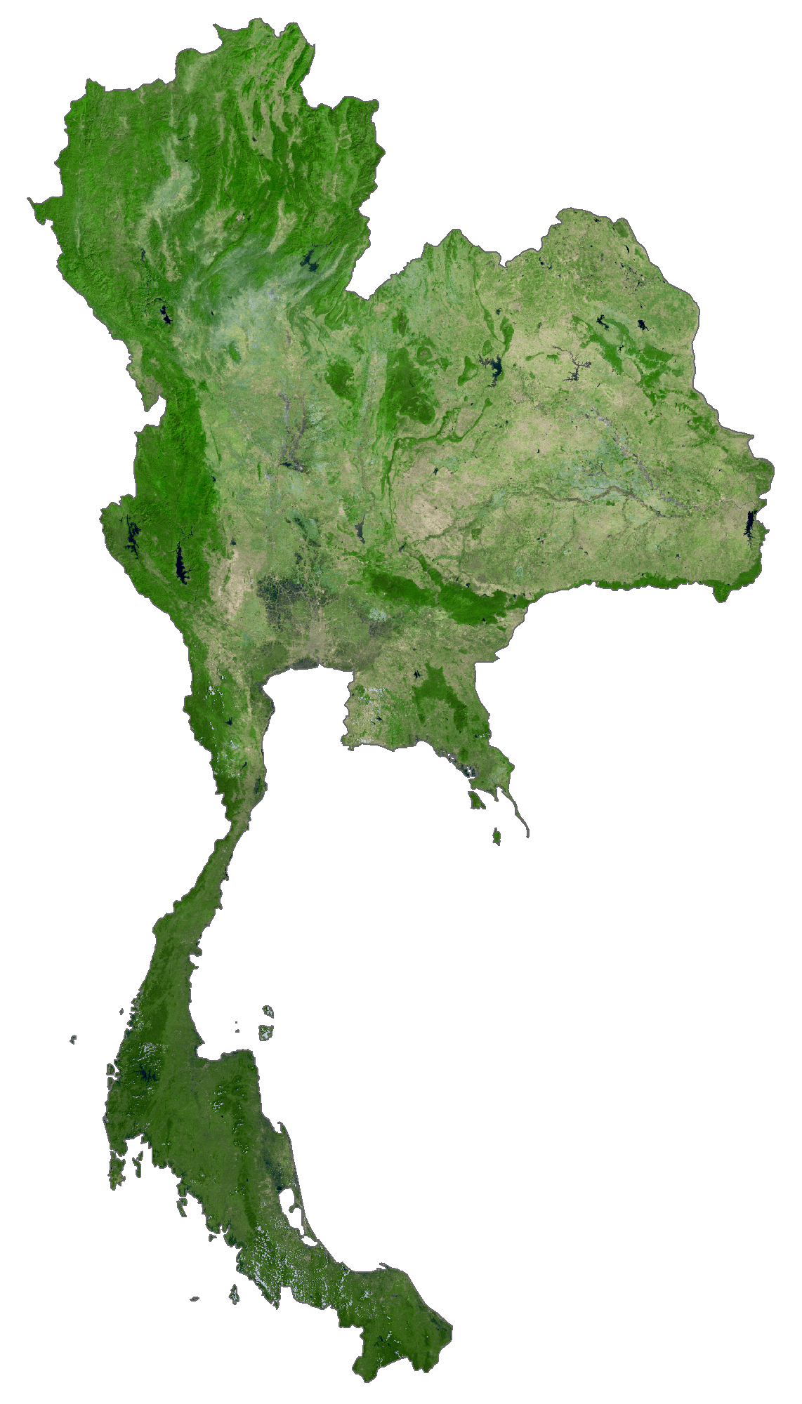
Thailand Satellite Map
Elevation Map