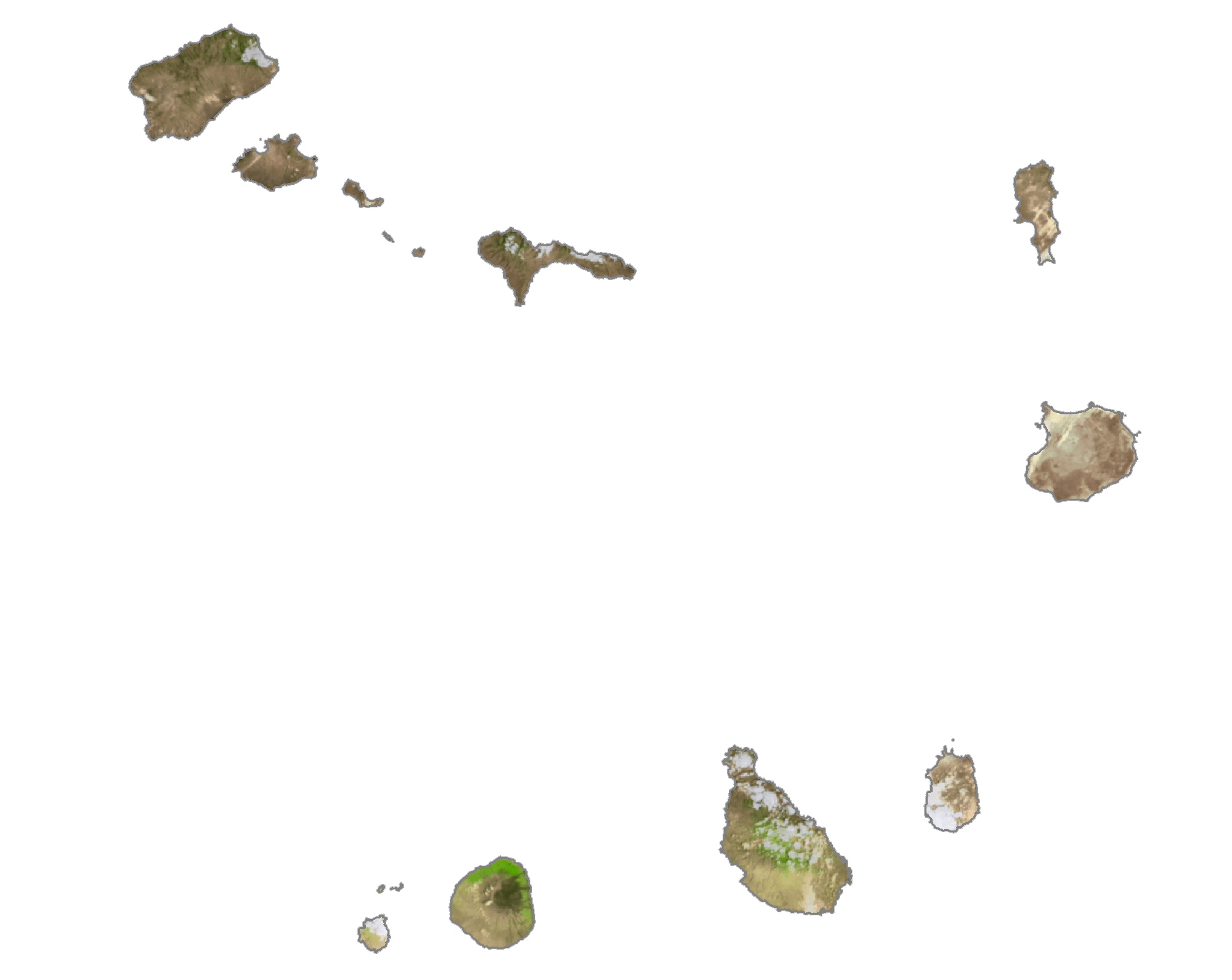
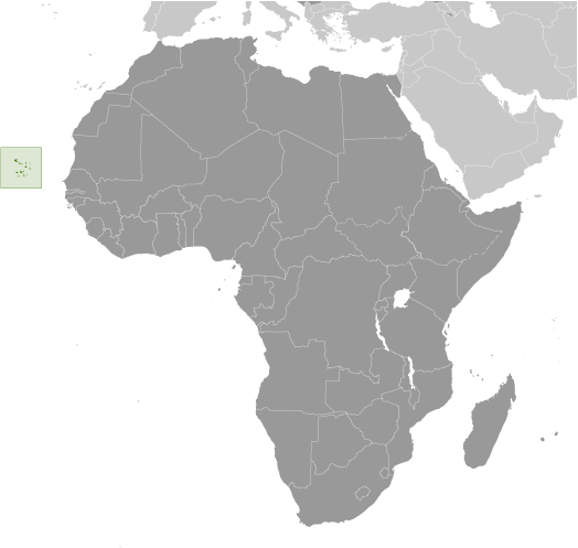
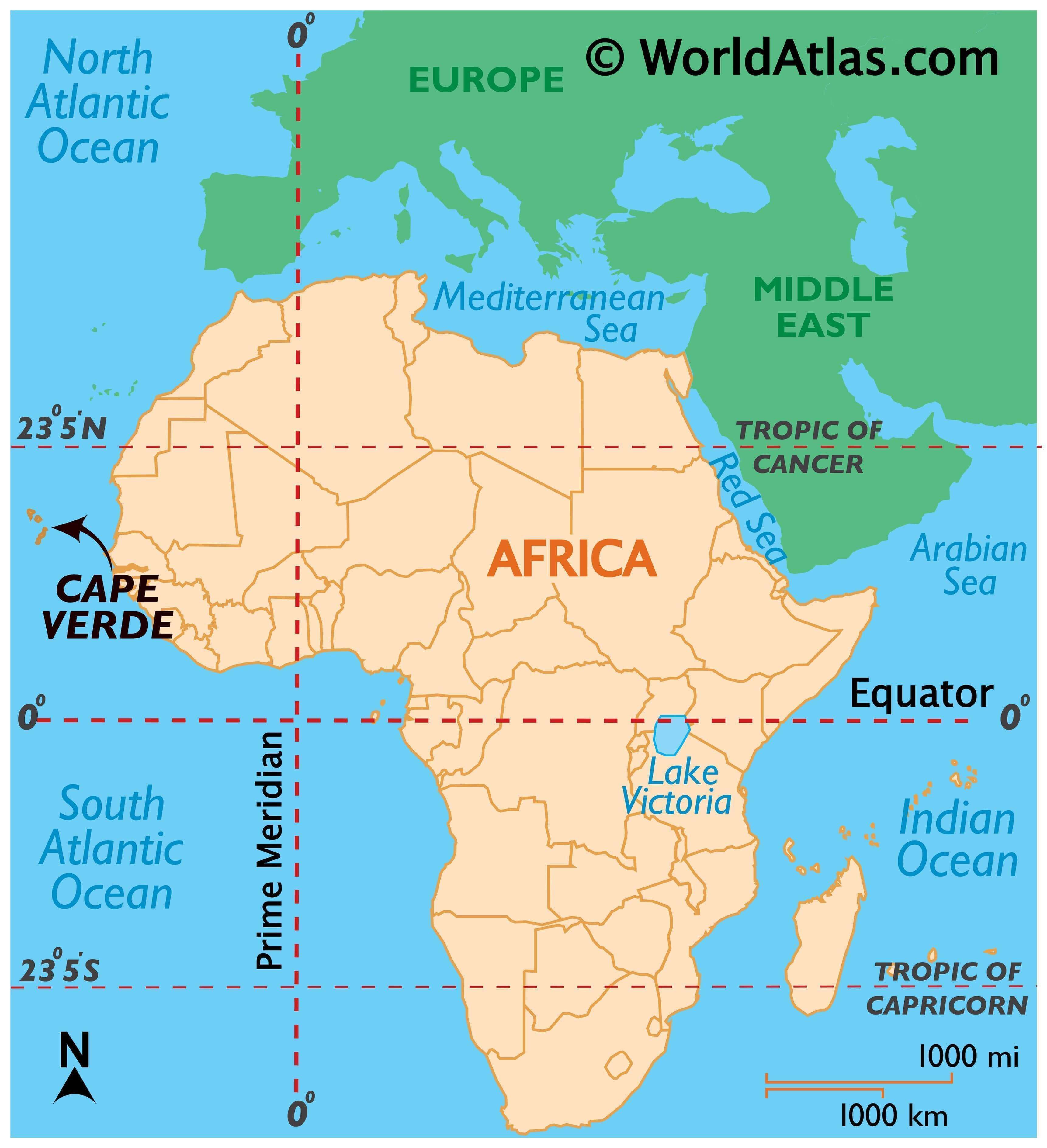
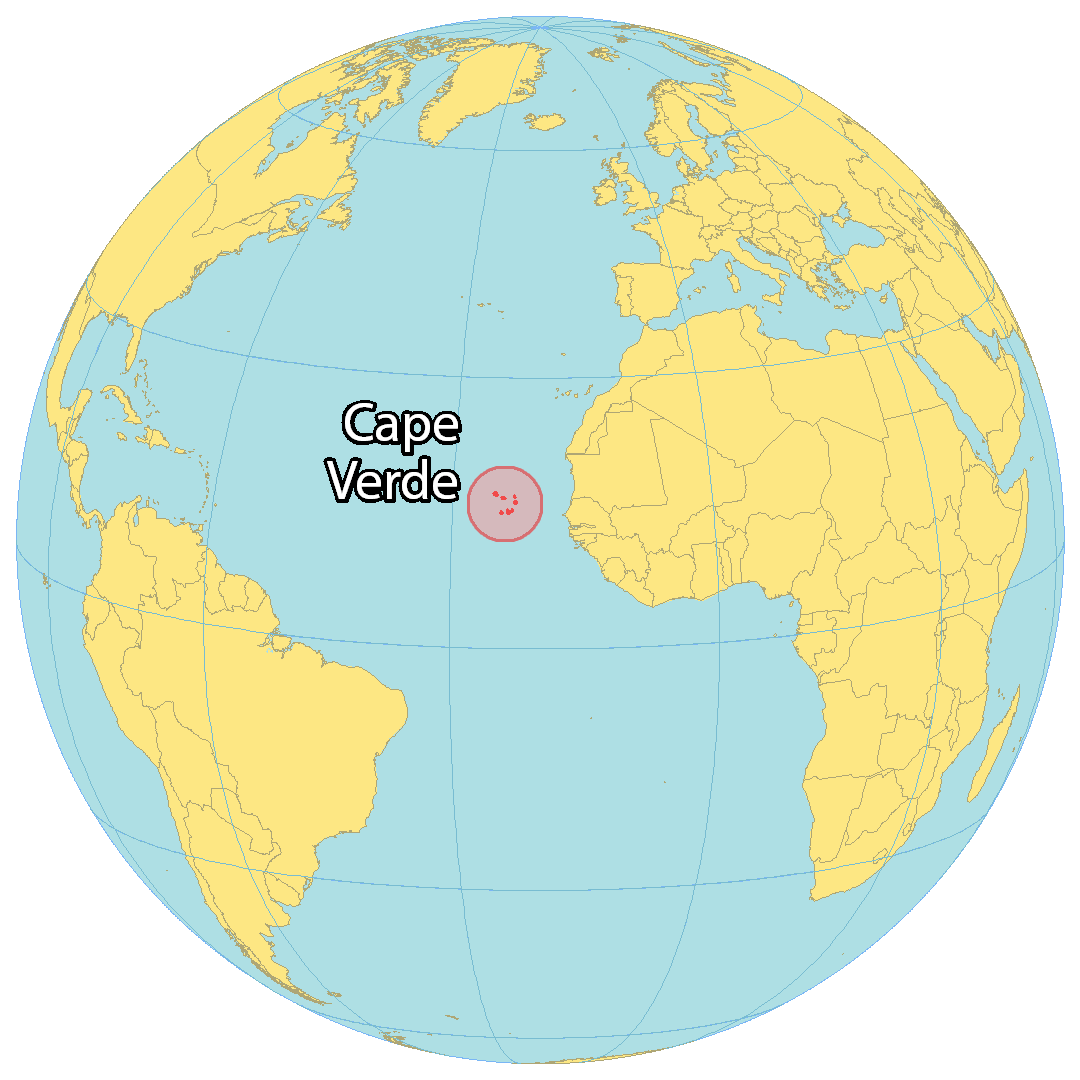
Cape Verde is an island country with an area of 4,033 sq. km in the central Atlantic Ocean.
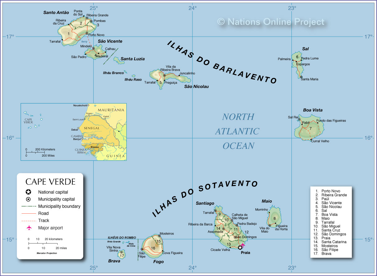
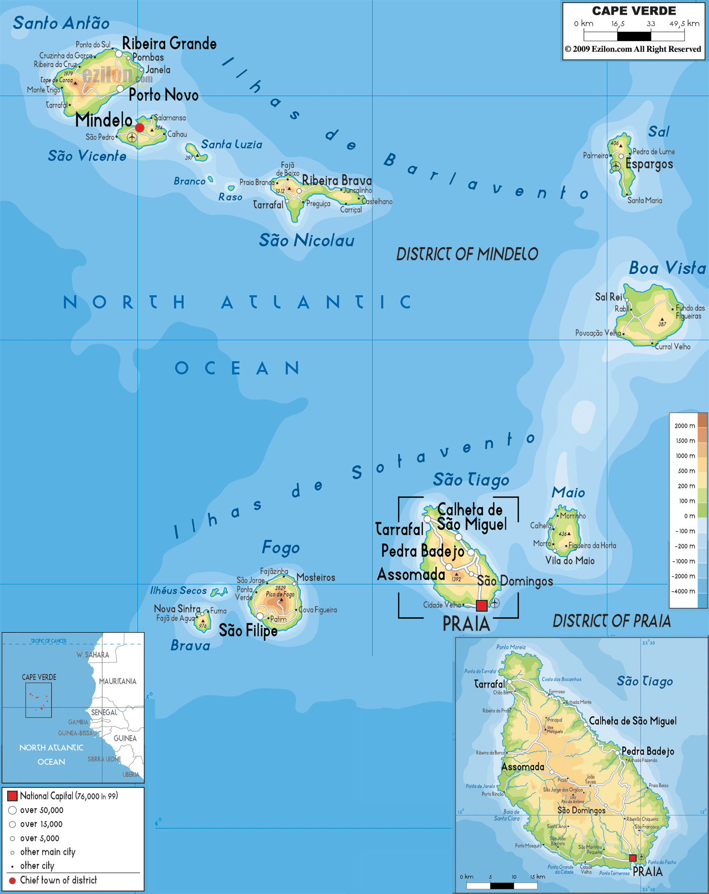
The physical map illustrates the physical characteristics of the country of Cape Verde. It is comprised of 9 inhabited islands, one uninhabited island, and various islets.
The islands are hilly and mountainous (all volcanic in origin), and encircled by rugged cliffs and reefs. The islands are divided into two groups: the windward islands and the leeward islands.
Santiago is the archipelago’s largest island, both in size and population. Extensive salt flats cover Sal and Maio, while arid slopes transition into fields of sugarcane on Santiago, Santo Antao, and Sao Nicolau.
As marked on the map by an upright erect triangle, Mt. Fogo on Fogo Island is an active volcano and the highest point of Cape Verde at 2,829 m. Its most recent eruption was in 1995.
There are no significant rivers, and the lowest point of the islands is the Atlantic Ocean (0 m).
| Flag: |  |
|---|---|
| Legal Name: | Republic of Cabo Verde |
| Capital Value: | Praia |
| Official languages: | Portuguese |
| Demonym(s): | Cape Verdean or Cabo Verdean |
| Government: | Unitary semi-presidential republic |
| Legislature: | National Assembly |
| Total Area: | 4,033 km² |
| Land Area: | 4,033 km² |
| Population: | 549,935 |
| Density: | 123.7/km (320.4/sq mi) (89th) |
| GDP: | $1.98 Billion |
| GDP Per Capita: | $3,603.78 |
| Currency Value: | Cabo Verdean escudos (CVE) |
| Driving side: | right |
| Calling code: | +238 |
| Internet TLD: | .cv |
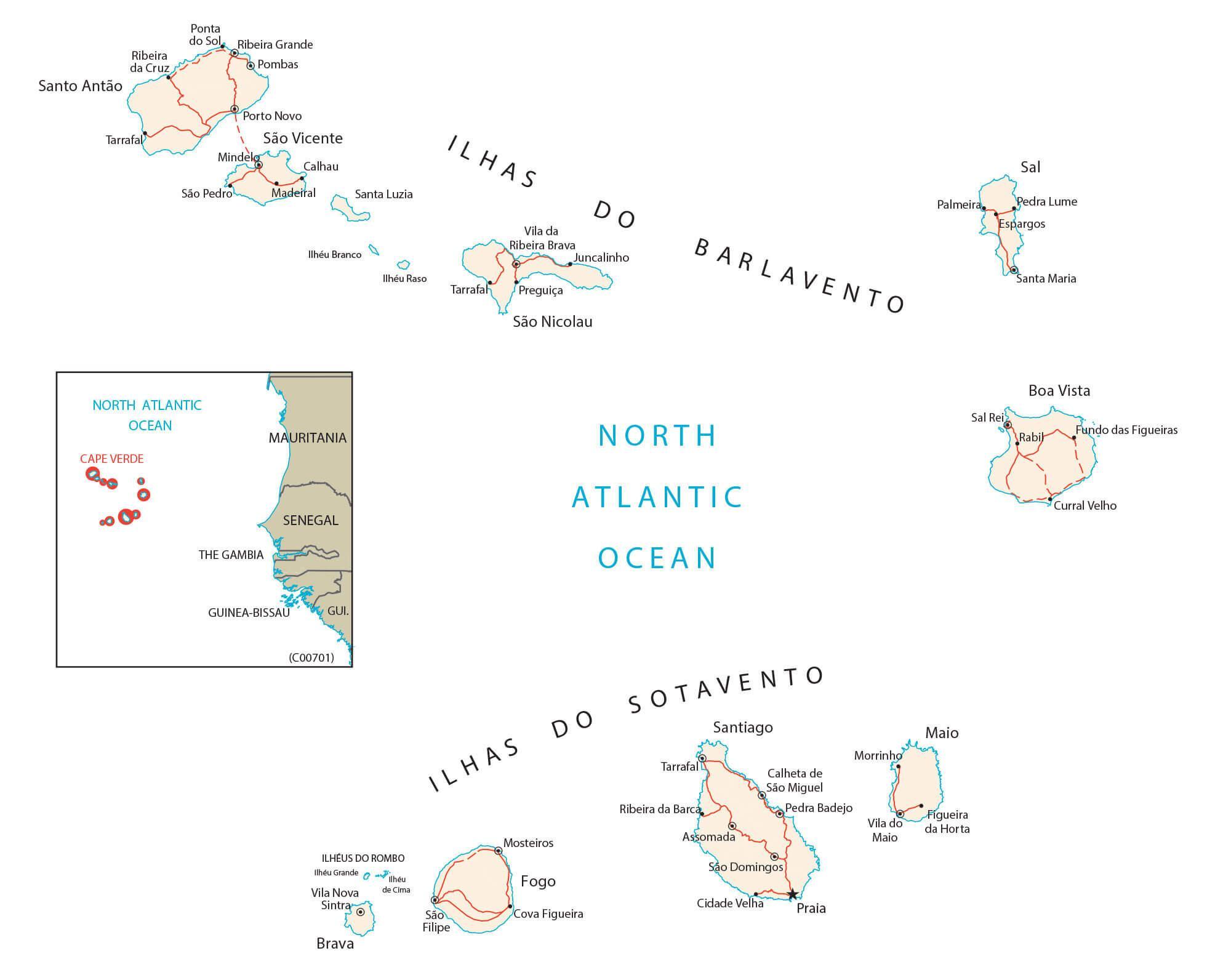
Explore the stunning beauty of Cape Verde with this interactive map featuring the major cities, towns, and roads of the islands. With satellite imagery and an elevation map, you can get a better understanding of the topography of the islands. Discover the beauty of Cape Verde with this map!
Online Interactive Political Map
Click on ![]() to view map in "full screen" mode.
to view map in "full screen" mode.
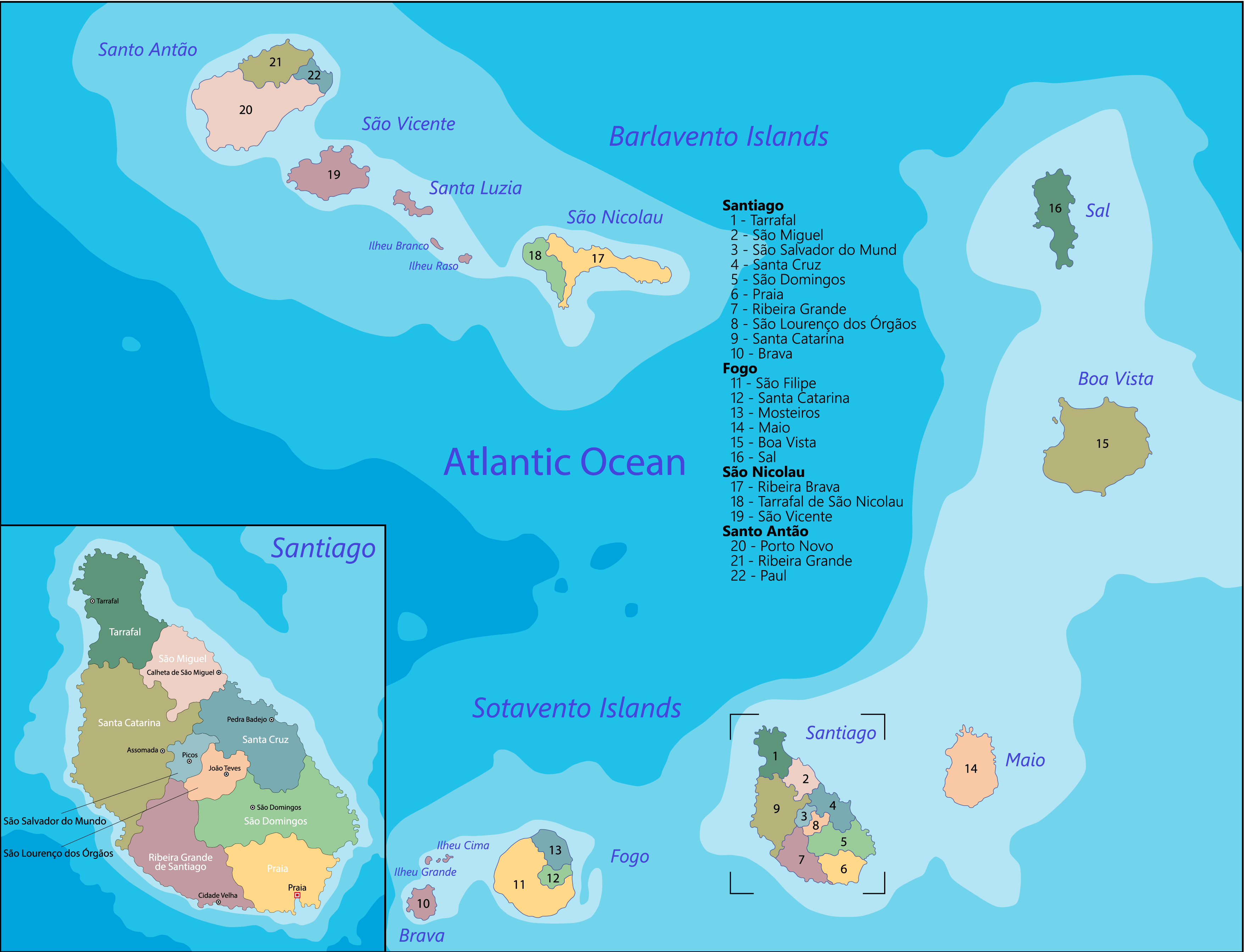
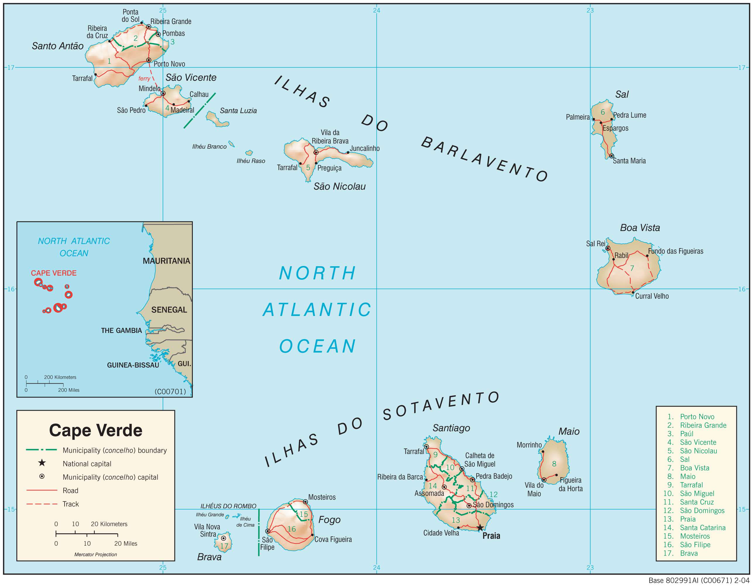
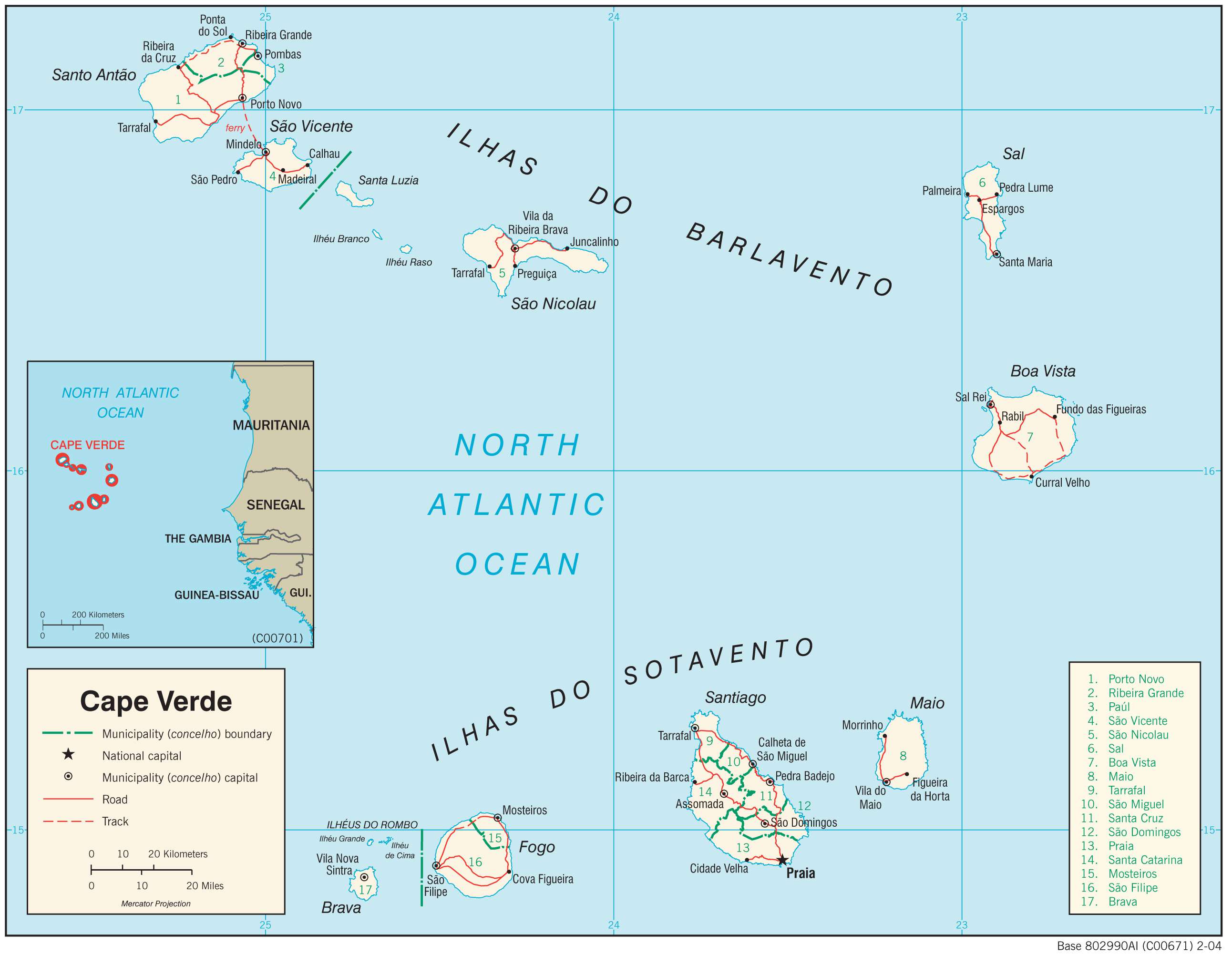
Cape Verde is divided into 22 major administrative divisions called concelhos or municipalities which are further subdivided into 32 freguesias or civil parishes.
The municipalities of Cape Verde in alphabetical order are: Boa Vista, Brava, Maio, Mosteiros, Paul, Porto Novo, Praia, Ribeira Brava, Ribeira Grande, Ribeira Grande de Santiago, Sal, Santa Catarina, Santa Catarina do Fogo, Santa Cruz, Sao Domingos, Sao Filipe, Sao Lourenco dos Orgaos, Sao Miguel, Sao Salvador do Mundo, Sao Vicente, Tarrafal, and Tarrafal de Sao Nicolau.
With an area of 631.1 sq. km, Boa Vista is the largest municipality by area and Praia is the most populous one which also serves as the national capital.
Location Maps
Where is Cape Verde?
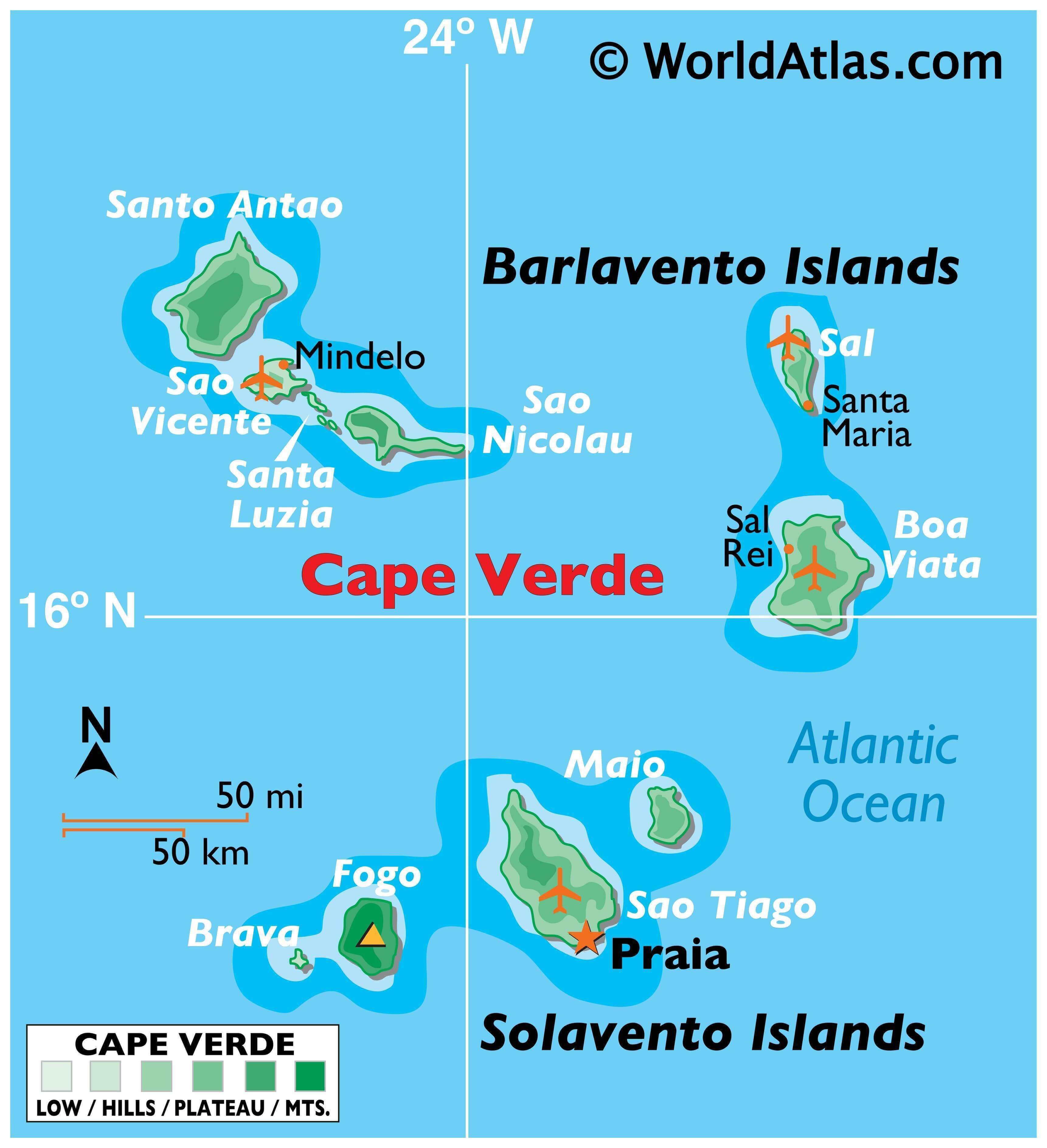
Cape Verde is a group of 10 islands that form a horseshoe shape in the North Atlantic Ocean. Located off the west coast of Africa, it is about 600 kilometers away from Senegal. It is also known as Cabo Verde, as it was first discovered by the Portuguese in the 15th century. The country is well-known for its high literacy rate, GDP, and its importance as a communications site and station for air and sea refueling.
High Definition Political Map of Cape Verde
History
The archipelago of modern-day Cape Verde was formed approximately 40–50 million years ago during the Eocene era.
Before the arrival of Europeans, the Cape Verde Islands were uninhabited. They were discovered by Genoese and Portuguese navigators around 1456. According to Portuguese official records, the first discoveries were made by Genoa-born António de Noli, who was afterwards appointed governor of Cape Verde by the Portuguese king Afonso V. Other navigators mentioned as contributing to discoveries on the Cape Verde archipelago are Diogo Dias, Diogo Afonso, Venetian Alvise Cadamosto, and Diogo Gomes (who had accompanied António de Noli on his voyage of discovery, and who claimed to have been the first to land on the Cape Verdean island of Santiago, and the first to name that island).
In 1462, Portuguese settlers arrived at Santiago and founded a settlement they called Ribeira Grande. Today it is called Cidade Velha (“Old City”), to distinguish it from a town of the same name on a different Cape Verdean island (Ribeira Grande on the island of Santo Antão). The original Ribeira Grande was the first permanent European settlement in the tropics.
In the 16th century, the archipelago prospered from the Atlantic slave trade. Pirates occasionally attacked the Portuguese settlements. Francis Drake, an English privateer, twice sacked the (then) capital Ribeira Grande in 1585 when it was a part of the Iberian Union. After a French attack in 1712, the town declined in importance relative to nearby Praia, which became the capital in 1770.
The decline in the slave trade in the 19th century resulted in an economic crisis. Cape Verde’s early prosperity slowly vanished. However, the islands’ position astride mid-Atlantic shipping lanes made Cape Verde an ideal location for re-supplying ships. Because of its excellent harbour, the city of Mindelo, located on the island of São Vicente, became an important commercial centre during the 19th century. Diplomat Edmund Roberts visited Cape Verde in 1832. Cape Verde was the first stop of Charles Darwin’s voyage with HMS Beagle in 1832.
With few natural resources and inadequate sustainable investment from the Portuguese, the citizens grew increasingly discontented with the colonial masters, who refused to provide the local authorities with more autonomy. In 1951, Portugal changed Cape Verde’s status from a colony to an overseas province in an attempt to blunt growing nationalism.
In 1956, Amílcar Cabral and a group of fellow Cape Verdeans and Guineans organized (in Portuguese Guinea) the clandestine African Party for the Independence of Guinea and Cape Verde (PAIGC). It demanded improvement in economic, social and political conditions in Cape Verde and Portuguese Guinea and formed the basis of the two nations’ independence movement. Moving its headquarters to Conakry, Guinea in 1960, the PAIGC began an armed rebellion against Portugal in 1961. Acts of sabotage eventually grew into a war in Portuguese Guinea that pitted 10,000 Soviet Bloc-supported PAIGC soldiers against 35,000 Portuguese and African troops.
By 1972, the PAIGC controlled much of Portuguese Guinea despite the presence of the Portuguese troops, but the organization did not attempt to disrupt Portuguese control in Cape Verde. Portuguese Guinea declared independence in 1973 and was granted de jure independence in 1974. A budding independence movement – originally led by Amílcar Cabral, assassinated in 1973 – passed on to his half-brother Luís Cabral and culminated in independence for the archipelago in 1975.
Independence (1975)
Following the April 1974 revolution in Portugal, the PAIGC became an active political movement in Cape Verde. In December 1974, the PAIGC and Portugal signed an agreement providing for a transitional government composed of Portuguese and Cape Verdeans. On 30 June 1975, Cape Verdeans elected a National Assembly which received the instruments of independence from Portugal on 5 July 1975. In the late 1970s and 1980s, most African countries prohibited South African Airways from overflights but Cape Verde allowed them and became a centre of activity for the airline’s flights to Europe and the United States.
Immediately following the November 1980 coup in Guinea-Bissau, relations between Cape Verde and Guinea-Bissau became strained. Cape Verde abandoned its hope for unity with Guinea-Bissau and formed the African Party for the Independence of Cape Verde (PAICV). Problems have since been resolved and relations between the countries are good. The PAICV and its predecessor established a one-party system and ruled Cape Verde from independence until 1990.
Responding to growing pressure for pluralistic democracy, the PAICV called an emergency congress in February 1990 to discuss proposed constitutional changes to end one-party rule. Opposition groups came together to form the Movement for Democracy (MpD) in Praia in April 1990. Together, they campaigned for the right to contest the presidential election scheduled for December 1990.
The one-party state was abolished on 28 September 1990, and the first multi-party elections were held in January 1991. The MpD won a majority of the seats in the National Assembly, and MpD presidential candidate António Mascarenhas Monteiro defeated the PAICV’s candidate with 73.5% of the votes. Legislative elections in December 1995 increased the MpD majority in the National Assembly. The party won 50 of the National Assembly’s 72 seats.
A February 1996 presidential election returned President Monteiro to office. Legislative elections in January 2001 returned power to the PAICV, with the PAICV holding 40 of the National Assembly seats, MpD 30, and Party for Democratic Convergence (PCD) and Labour and Solidarity Party (PTS) 1 each. In February 2001, the PAICV-supported presidential candidate Pedro Pires defeated former MpD leader Carlos Veiga by only 13 votes. President Pedro Pires was narrowly re-elected in 2006 elections.
President Jorge Carlos Fonseca led the country since 2011 Cape Verde presidential election and he was re-elected in the 2016 election. He was supported by the Movement for Democracy Party. MpD also won in the 2016 parliamentary elections, taking back parliamentary majority after 15 year-rule of African Party for the Independence of Cape Verde (PAICV). In April 2021, the ruling center-right Movement for Democracy (MpD) of Prime Minister Ulisses Correia e Silva won the parliamentary election.
On 26 August 2021, Cape Verde became the 150th country to ratify the 2005 Convention and Promotion of the Diversity of Cultural Expressions.
In October 2021, opposition candidate and former prime minister, Jose Maria Neves of PAICV, won Cape Verde’s presidential election. On 9 November 2021, Jose Maria Neves was sworn in as the new President of Cape Verde.
Physical Map of Cape Verde
Geography
The Cape Verde archipelago is in the Atlantic Ocean, approximately 570 kilometres (350 mi) off the western coast of the African continent, near Senegal, Gambia, and Mauritania as well as part of the Macaronesia ecoregion. It lies between latitudes 14° and 18°N, and longitudes 22° and 26°W.
The country is a horseshoe-shaped cluster of ten islands (nine inhabited) and eight islets, that constitute an area of 4033 km (1557 sq mi).
The islands are spatially divided into two groups:
- The Barlavento Islands (windward islands): Santo Antão, São Vicente, Santa Luzia, São Nicolau, Sal, Boa Vista; and
- The Sotavento Islands (leeward): Maio, Santiago, Fogo, Brava.
The largest island, both in size and population, is Santiago, which hosts the nation’s capital, Praia, the principal urban agglomeration in the archipelago.
Three of the Cape Verde islands, Sal, Boa Vista, and Maio, are fairly flat, sandy, and dry; the others are generally rockier with more vegetation.
Physical geography and geology
Geologically, the islands, covering a combined area of slightly over 4,033 square kilometres (1,557 square miles), are principally composed of igneous rocks, with volcanic structures and pyroclastic debris comprising the majority of the archipelago’s total volume. The volcanic and plutonic rocks are distinctly basic; the archipelago is a soda-alkaline petrographic province, with a petrologic succession similar to that found in other Macaronesian islands.
Magnetic anomalies identified in the vicinity of the archipelago indicate that the structures forming the islands date back 125–150 million years: the islands themselves date from 8 million (in the west) to 20 million years (in the east). The oldest exposed rocks occurred on Maio and the northern peninsula of Santiago and are 128–131 million-year-old pillow lavas. The first stage of volcanism in the islands began in the early Miocene, and reached its peak at the end of this period when the islands reached their maximum sizes. Historical volcanism (within human settlement) has been restricted to the island of Fogo.
The islands lie on a bathymetric swell known as the Cape Verde Rise. The Rise is one of the largest protuberances in the world’s oceans, rising 2.2 kilometres (1.4 miles) in a semi-circular region of 1200 km (460 sq mi), associated with a rise of the geoid.
Pico do Fogo, the largest active volcano in the region, erupted in 2014. It has an eight-kilometre-diameter (five-mile) caldera, the rim of which is at an elevation of 1,600 metres (5,249 feet) and an interior cone that rises to 2,829 metres (9,281 feet) above sea level. The caldera resulted from subsidence, following the partial evacuation (eruption) of the magma chamber, along a cylindrical column from within the magma chamber (at a depth of 8 kilometres (5 miles)).
Extensive salt flats are found on Sal and Maio. On Santiago, Santo Antão, and São Nicolau, arid slopes give way in places to sugarcane fields or banana plantations spread along the base of towering mountains. Ocean cliffs have been formed by catastrophic debris landslides.
According to the president of Nauru, in 2011 Cape Verde was ranked the eighth most endangered nation due to flooding from climate change.
Climate
Cape Verde’s climate is milder than that of the African mainland because the surrounding sea moderates temperatures on the islands and cold Atlantic currents produce an arid atmosphere around the archipelago. Conversely, the islands do not receive the upwelling (cold streams) that affect the West African coast, so the air temperature is cooler than in Senegal, but the sea is warmer. Due to the relief of some islands, such as Santiago with its steep mountains, the islands can have orographically induced precipitation, allowing rich woods and luxuriant vegetation to grow where the humid air condenses soaking the plants, rocks, soil, logs, moss, etc. On the higher islands and somewhat wetter islands, exclusively in mountainous areas, like Santo Antão island, the climate is suitable for the development of dry monsoon forests, and laurel forests. Average temperatures range from 22 °C (72 °F) in February to 27 °C (80.6 °F) in September. Cape Verde is part of the Sahelian arid belt, with nothing like the rainfall levels of nearby West Africa. It rains irregularly between August and October, with frequent brief heavy downpours. A desert is usually defined as terrain that receives less than 250 mm (9.8 in) of annual rainfall. Sal’s total of 145 mm (5.7 in) confirms this classification. Most of the year’s rain falls in September.
Sal, Boa Vista, and Maio have a flat landscape and arid climate, whilst the other islands are generally rockier and have more vegetation. Because of the infrequent occurrence of rainfall, where not mountainous, the landscape is so arid that less than two percent of it is arable. The archipelago can be divided into four broad ecological zones — arid, semiarid, subhumid and humid, according to altitude and average annual rainfall ranging from less than 100 millimetres (3.9 inches) in the arid areas of the coast as in the Deserto de Viana (67 millimetres (2.6 inches) in Sal Rei) to more than 1,000 millimetres (39 inches) in the humid mountain. Most rainfall precipitation is due to condensation of the ocean mist.
In some islands, like Santiago, the wetter climate of the interior and the eastern coast contrasts with the drier one on the south/southwest coast. Praia, on the southeast coast, is the largest city on the island and the largest city and capital of the country.
While most of Cape Verde receives little precipitation throughout the year, the northeastern slopes of high mountains see significant rainfall due to orographic lift, especially in areas far from the sea. In some such areas this precipitation is sufficient to support a rainforest habitat, albeit one significantly affected by the islands’ human presence. These umbria areas are identified as cool and moist. Cape Verde lies in the Cape Verde Islands dry forests ecoregion.
Western Hemisphere-bound hurricanes often have their early beginnings near the Cape Verde Islands. These are referred to as Cape Verde-type hurricanes. These hurricanes can become very intense as they cross warm Atlantic waters away from Cape Verde. The average hurricane season has about two Cape Verde-type hurricanes, which are usually the largest and most intense storms of the season because they often have plenty of warm open ocean over which to develop before encountering land. The five largest Atlantic tropical cyclones on record have been Cape Verde-type hurricanes. Most of the longest-lived tropical cyclones in the Atlantic basin are Cape Verde hurricanes.
As of 2015, the islands themselves have only been struck by hurricanes twice in recorded history (since 1851): once in 1892, and again in 2015 by Hurricane Fred, the easternmost hurricane ever to form in the Atlantic.
Biodiversity
Cape Verde’s isolation has resulted in the islands having several endemic species, particularly birds and reptiles, many of which are endangered by human development. Endemic birds include Alexander’s swift (Apus alexandri), Bourne’s heron (Ardea purpurea bournei), the Raso lark (Alauda razae), the Cape Verde warbler (Acrocephalus brevipennis), and the Iago sparrow (Passer iagoensis). The islands are also an important breeding area for seabirds including the Cape Verde shearwater. Reptiles include the Cape Verde giant gecko (Tarentola gigas).
Administrative divisions
Cape Verde is divided into 22 municipalities (concelhos) and subdivided into 32 parishes (freguesias), based on the religious parishes that existed during the colonial period:
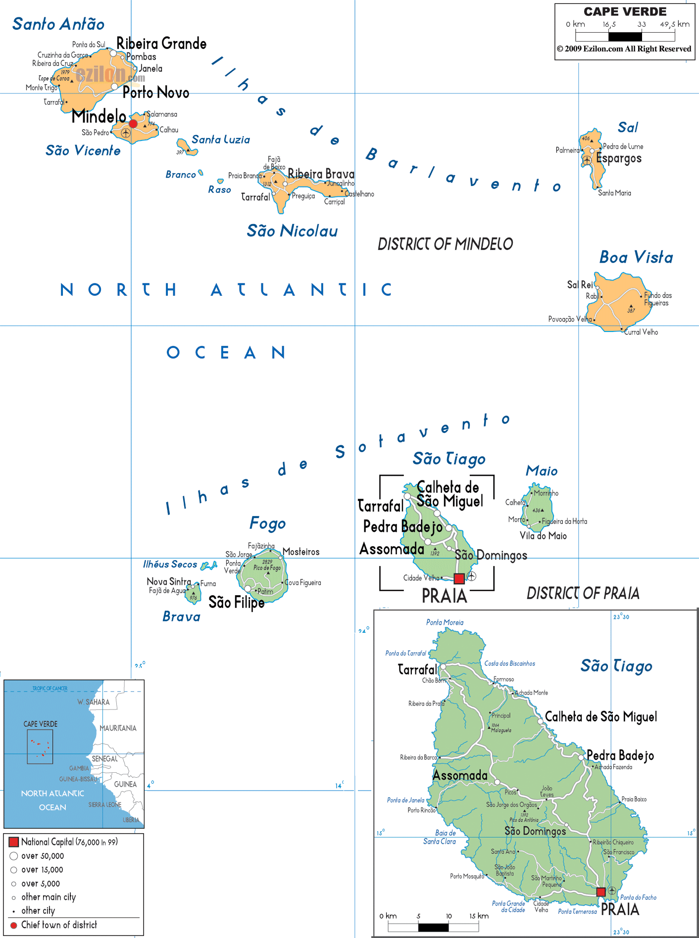
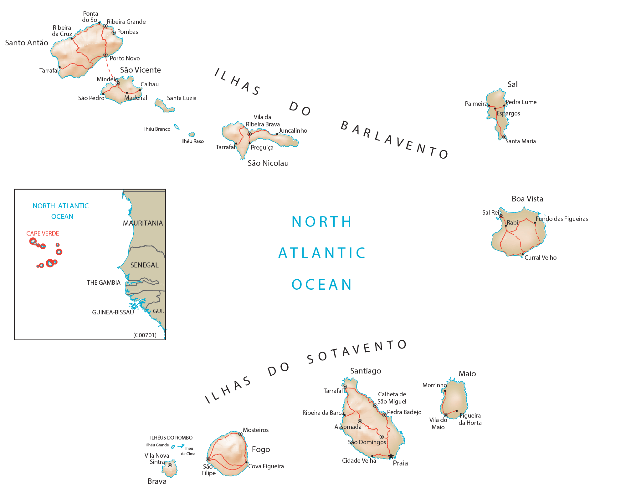
Transportation Map of Cape Verde
Cape Verde Satellite Map