Iran is a sovereign nation occupying an area of 1,648,195 sq. km in Western Asia.
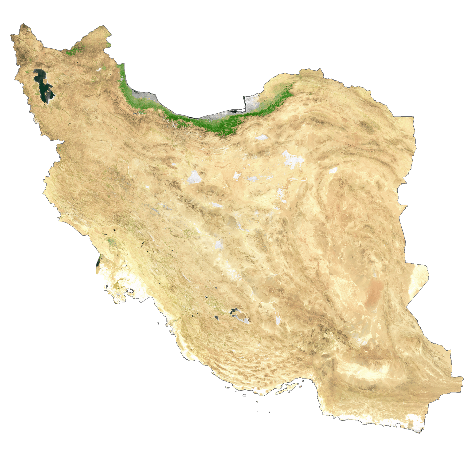
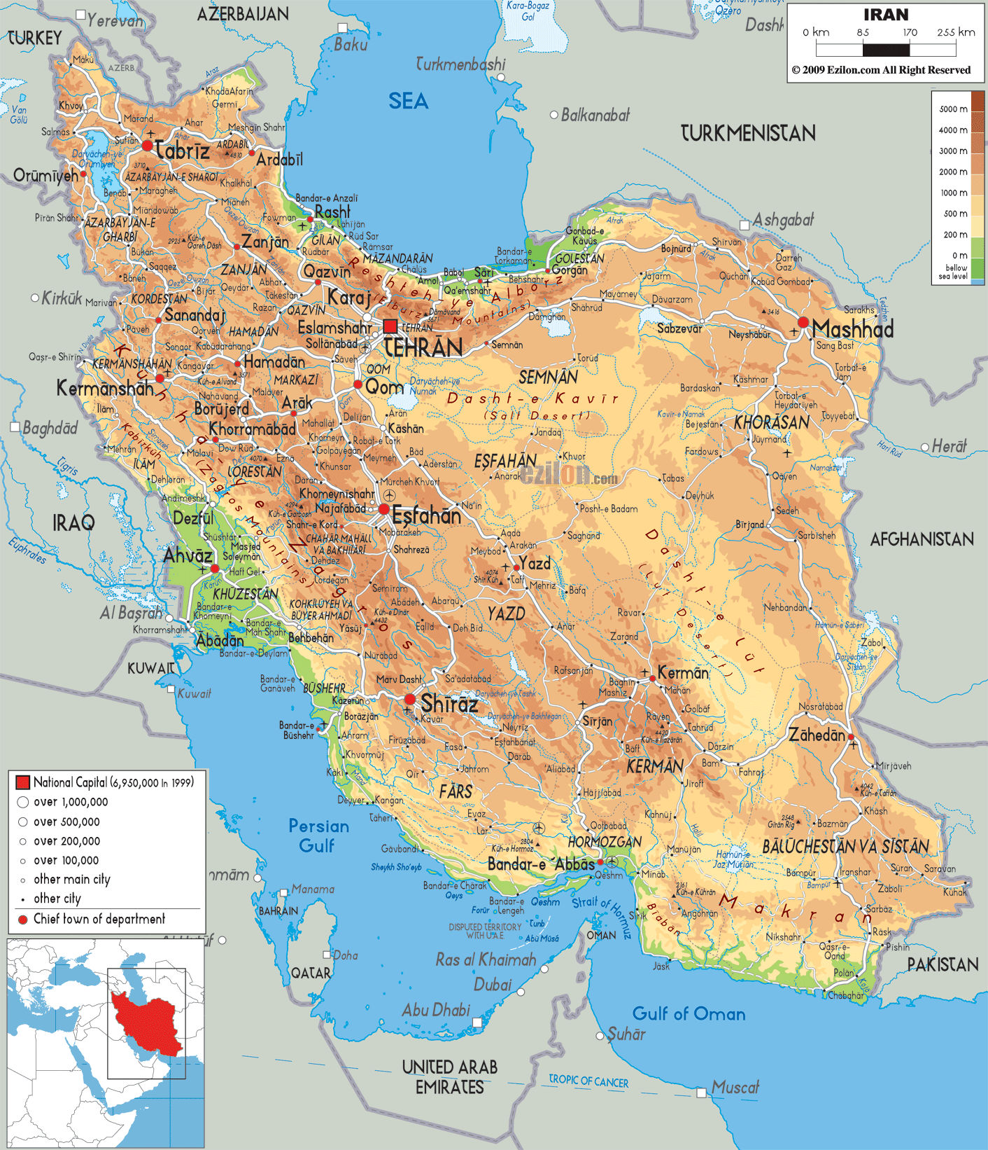
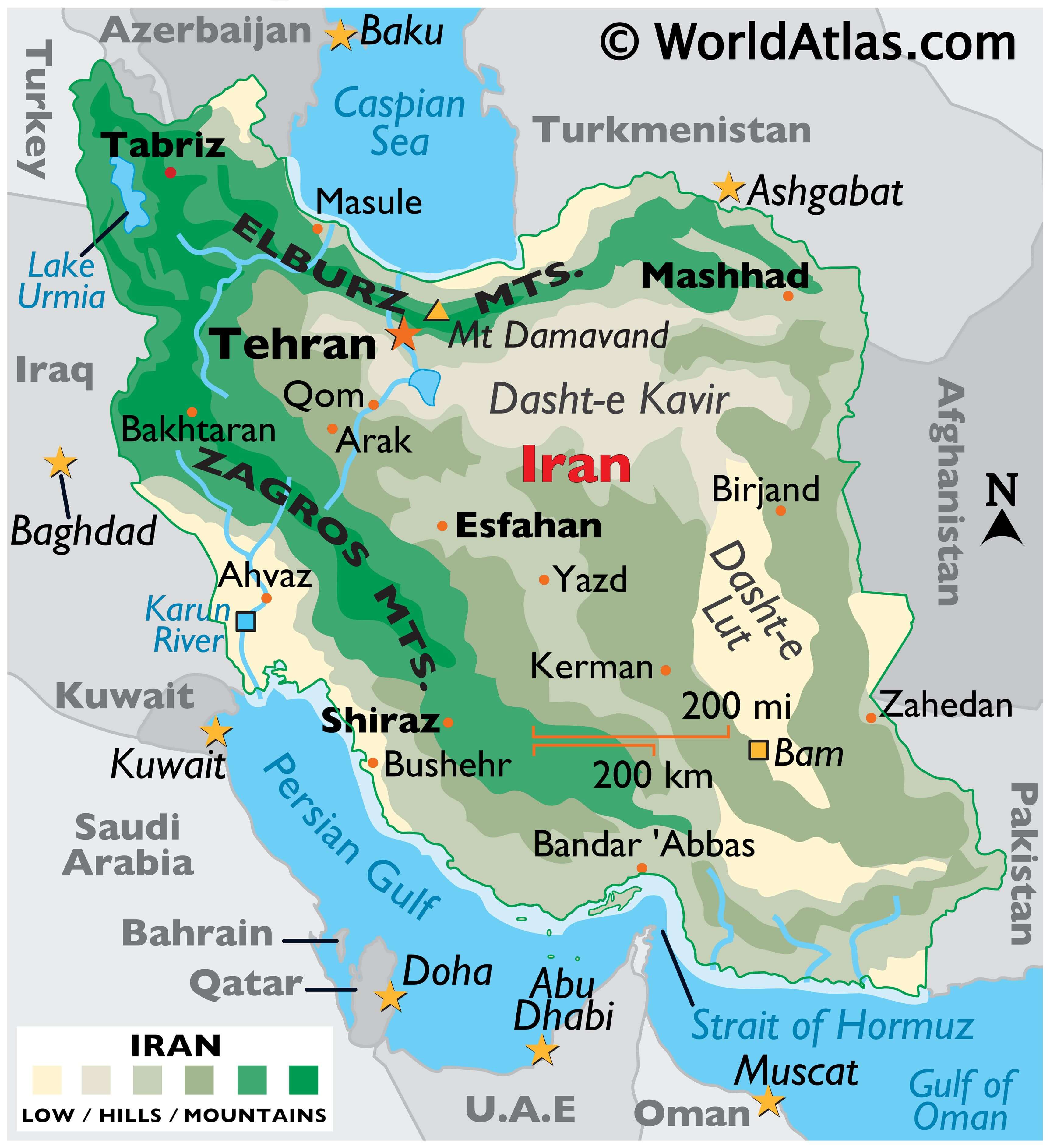
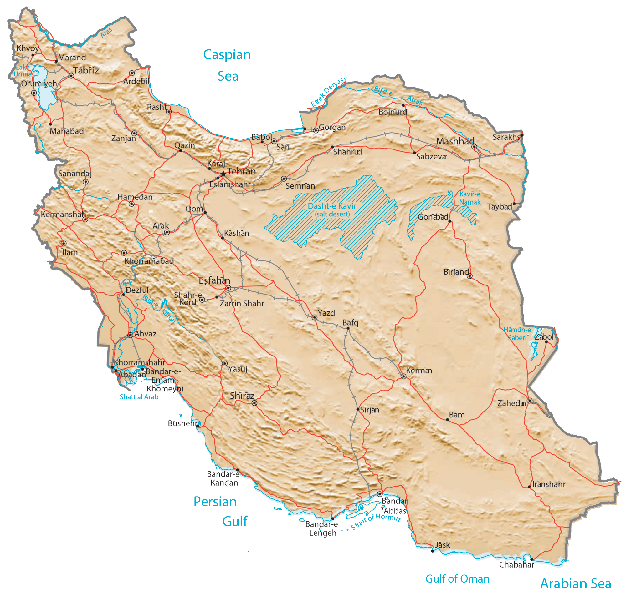
Iran is a very rugged country of plateaus and mountains with most of the land being above 1,500 feet (460 m). The mountain ranges surround the high interior basin of the country. Of note are the Elburz Mountains in the north, and the Zagros Mountains along Iran’s western borders as observed on the physical map of Iran above. Iran’s highest point, Mt. Damavand reaches 18,934 ft (5,771m). It has been marked on the map by a yellow triangle and is part of the Elburz Mountain chain.
The central and eastern portion is covered by the Plateau of Iran. Marked on the map, the Dasht-e Kavir is sandstone and salty desert plateau, which in the heat of summer is one of the hottest places on the planet.
The coastal areas outside the mountain rings have some of the lowest elevations in the country.
The most significant river is the Karun, in the southwestern corner of the country. Lake Urmia (in the far-northwest) is the country’s largest body of water.
| Flag: |  |
|---|---|
| Legal Name: | Islamic Republic of Iran |
| Capital Value: | Tehran |
| Official languages: | Persian |
| Demonym(s): | Iranian |
| Government: | Unitary theocratic Islamic republic |
| Legislature: | Islamic Consultative Assembly |
| Total Area: | 1,648,195 km² |
| Land Area: | 1,531,595 km² |
| Water Area: | 116,600 km² |
| Population: | 82,913,906 |
| Density: | 48/km (124.3/sq mi) (162nd) |
| GDP: | $445.35 Billion |
| GDP Per Capita: | $5,520.31 |
| Currency Value: | Iranian rials (IRR) |
| Driving side: | right |
| Calling code: | +98 |
| Internet TLD: |
|
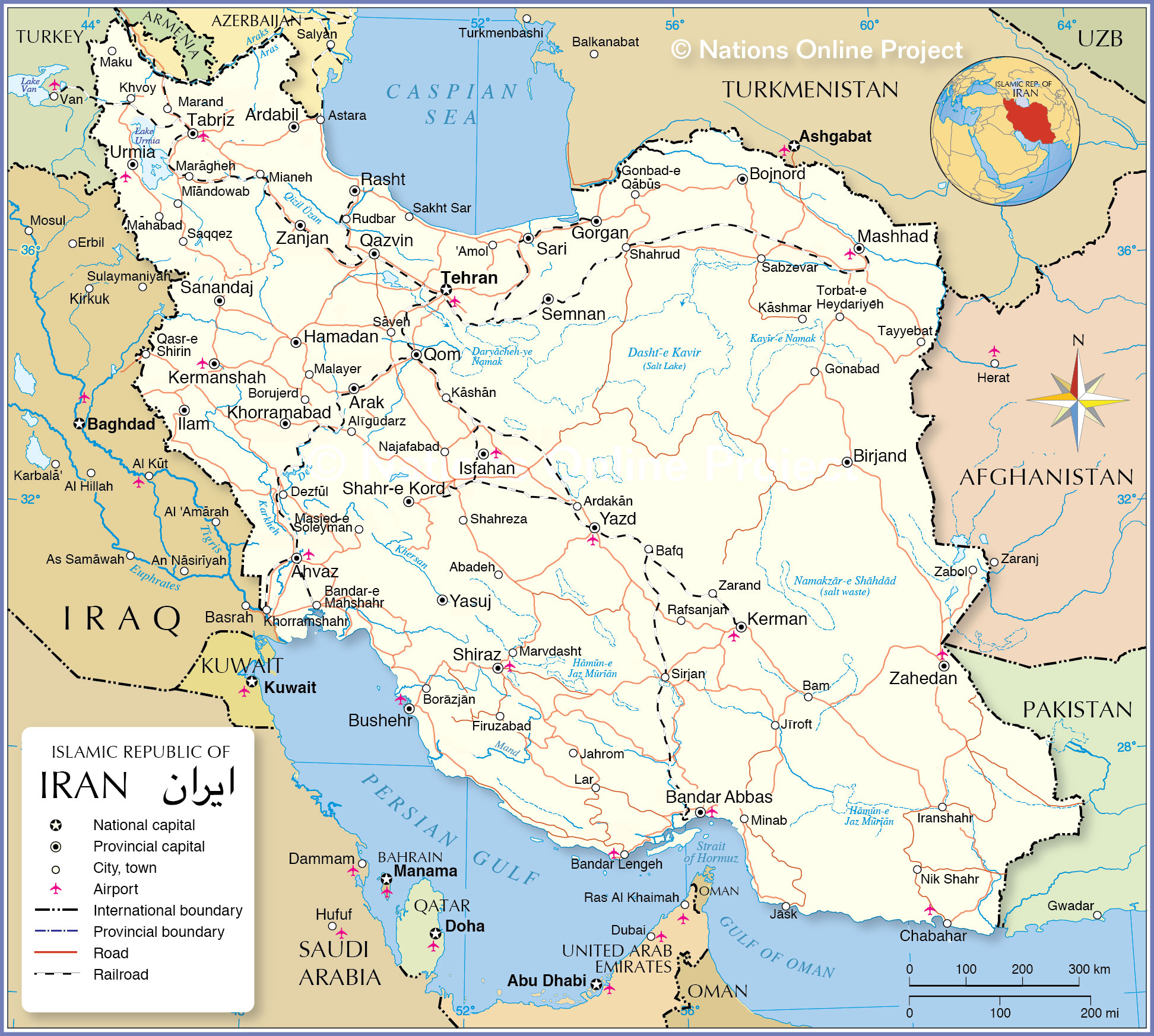
Exploring Iran: A Tour of Its Geography
Iran is a country full of fascinating landscapes and unique geography. From its mountain ranges and deserts to its major cities and roads, there is much to explore. This map of Iran showcases its various features, from its rivers and railways to its towns and cities.
The satellite imagery and terrain map show the vastness of the country and its various mountain ranges and deserts that stretch out through most of Iran. While the major cities and towns of Iran are clearly visible, so too are its roads and railways, which connect these cities and towns, allowing people to move around the country.
Rivers, too, are an important part of Iran’s geography, and they are visible on the map. These rivers are a vital source of water for many of the country’s towns and cities, and they also provide a means of transport by boat.
So, if you’re looking to explore Iran and its unique geography, this map is a great place to start. From mountains and deserts to cities and rivers, it showcases the many features of this amazing country.
Online Interactive Political Map
Click on ![]() to view map in "full screen" mode.
to view map in "full screen" mode.
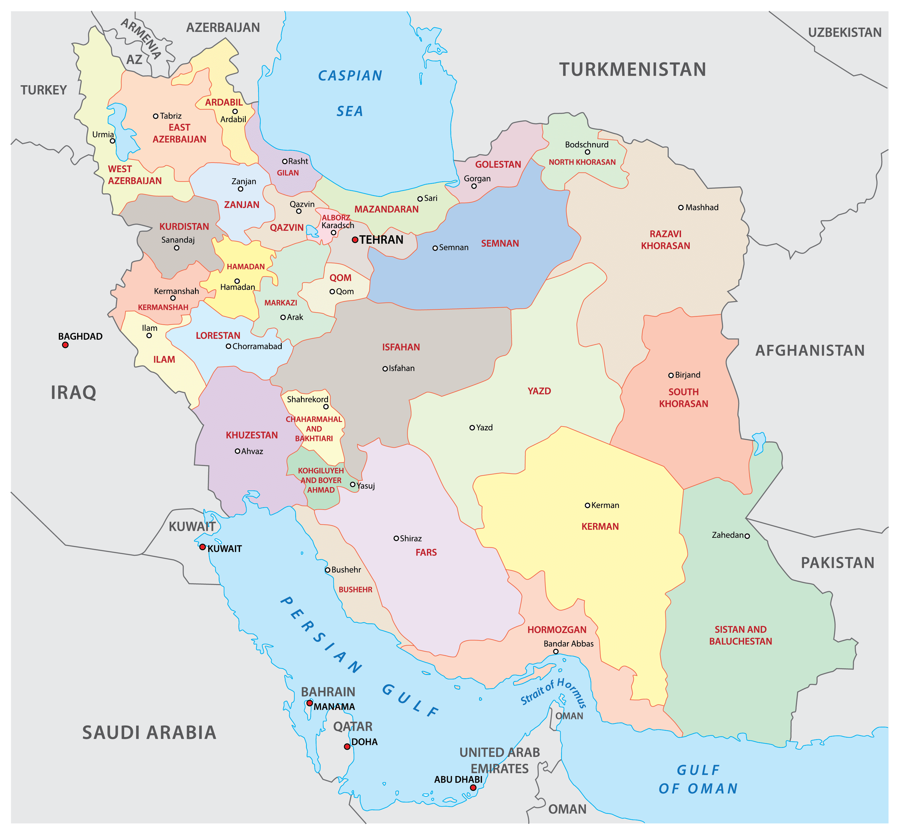
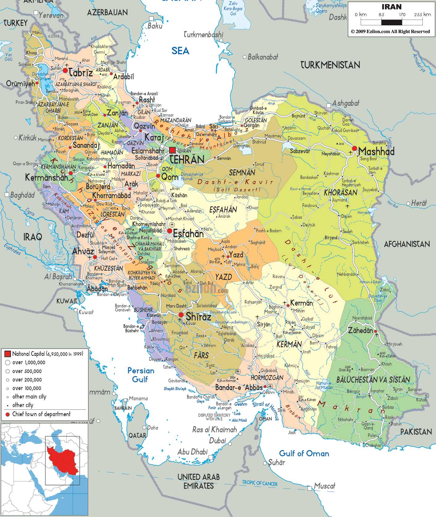
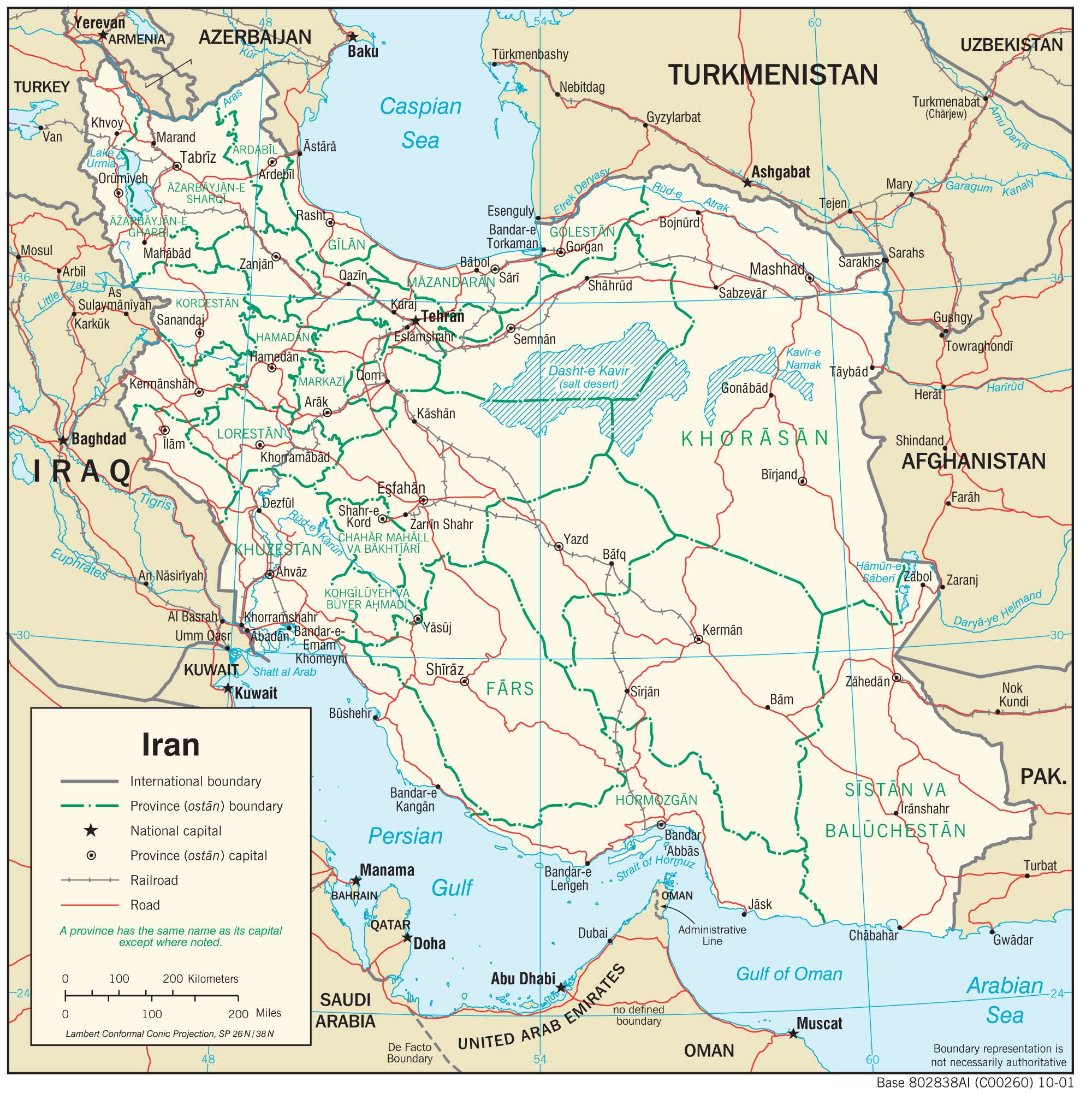
Iran (officially, Islamic Republic of Iran) is divided into 31 administrative provinces (ostanha, sing. ostan). In alphabetical order, these provinces are: Alborz, Ardabil, Azarbayjan – e Gharbi (West Azerbaijan), Azarbayjan –e Sharqi (East Azerbaijan), Bushehr, Chahar Mahal va Bakhtiari, Esfahan, Fars, Gilan, Golestan, Hamadan, Hormozgan, Ilam, Kerman, Kermanshah, Khorasan-e Jonubi (South Khorasan), Khorasan-e Razavi (Razavi Khorasan), Khorasan-e Shomali (North Khorasan), Khuzestan, Kohgiluyeh va Bowyer Ahmad, Kordestan, Lorestan, Markazi, Mazandaran, Qazvin, Qom, Semnan, Sistan va Baluchestan, Tehran, Yard and Zanjan.
With an area of 1,648,195 sq. km, Iran is the 2nd largest country in the Middle East and the 17th largest country in the world. Tehran is the capital and the largest city of Iran. It is also the most populous city in Western Asia as well as the country’s leading cultural and economic center.
Location Maps
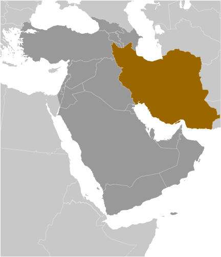
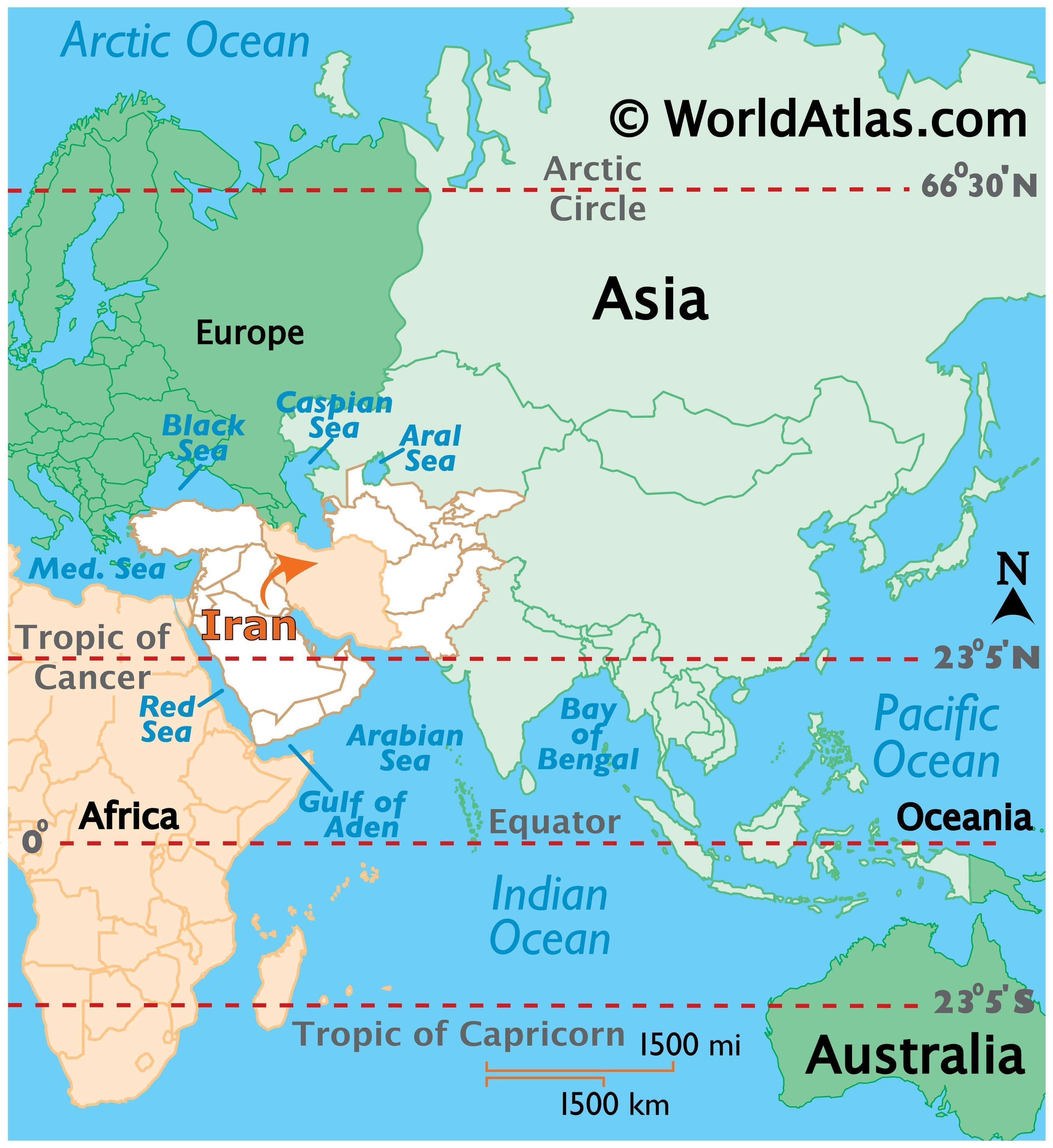
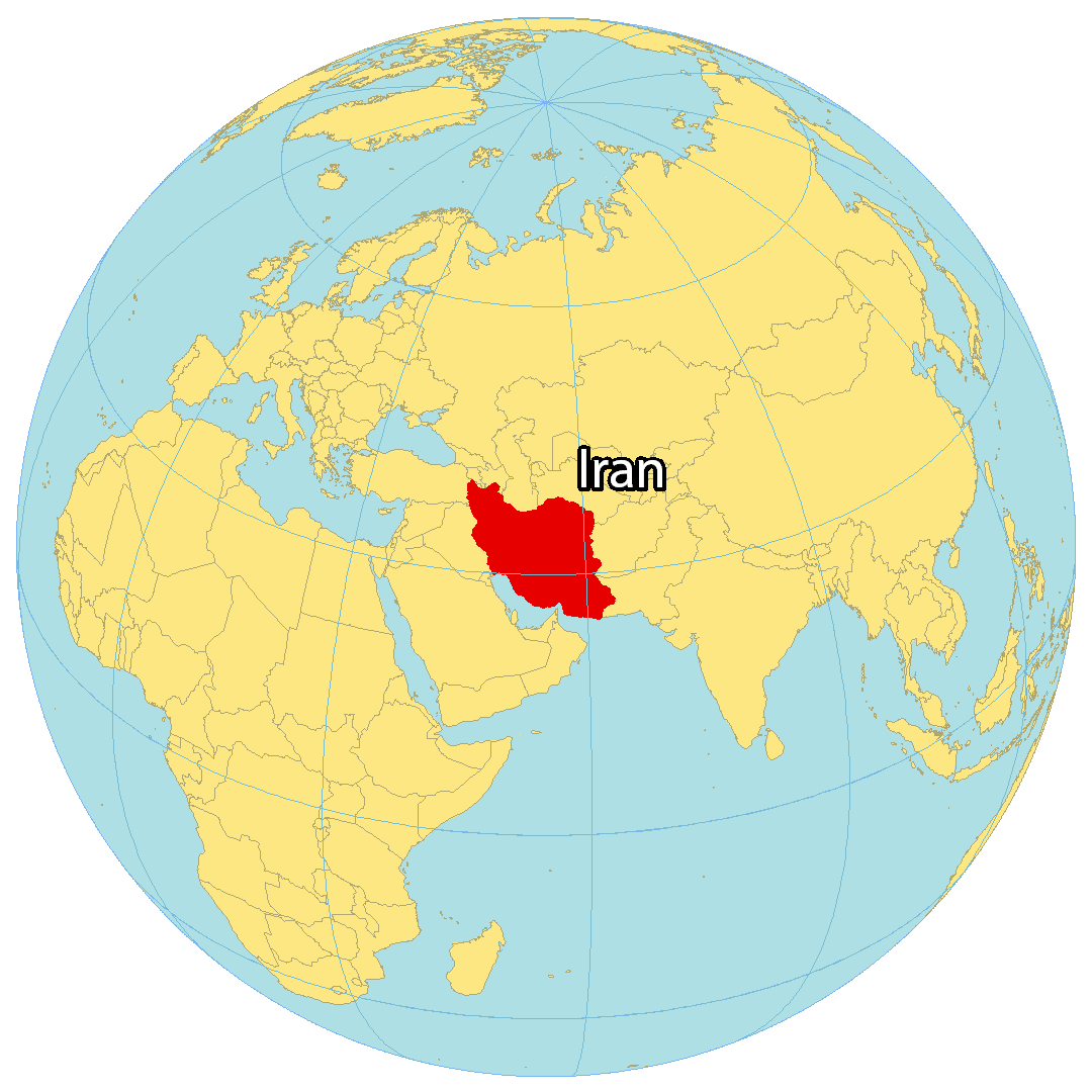
Where is Iran?
Iran is the second-largest landmass in the Middle East and the third most populated, after Egypt and Turkey. It is situated along the coast of both the Caspian Sea and the Persian Gulf for a distance of 2,815 km (1,749 mi). Iran shares a border with Iraq to the west, Turkey to the northeast, Armenia and Azerbaijan to the north, Turkmenistan to the northeast, as well as Pakistan and Afghanistan to the east.
The country has a population of over 86 million people, with Tehran as its capital and largest city. It has a diverse landscape, with mountains, deserts, and forests, and Persian is its official language, with the Iranian rial as its currency.
High Definition Political Map of Iran
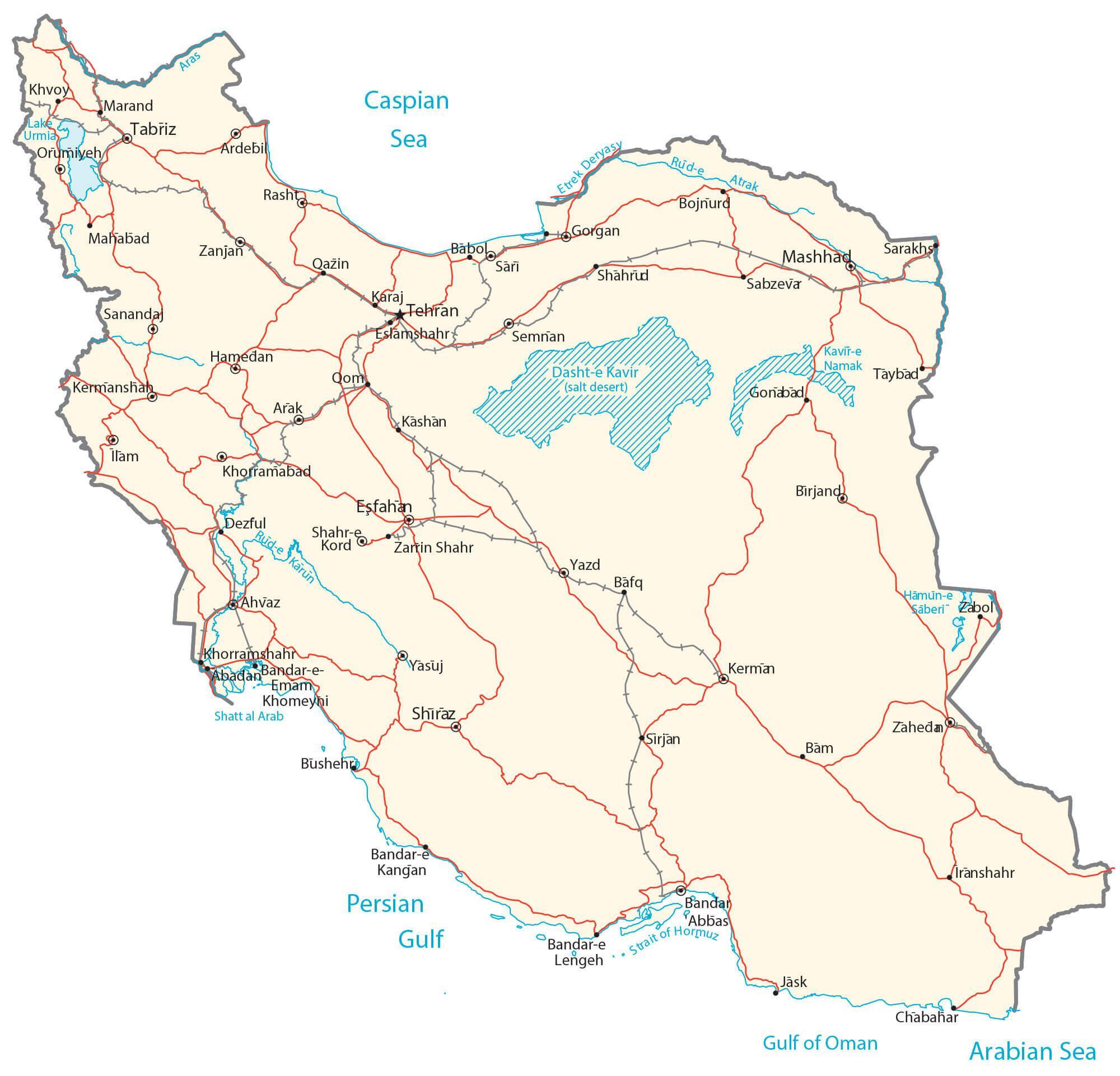
Physical Map of Iran
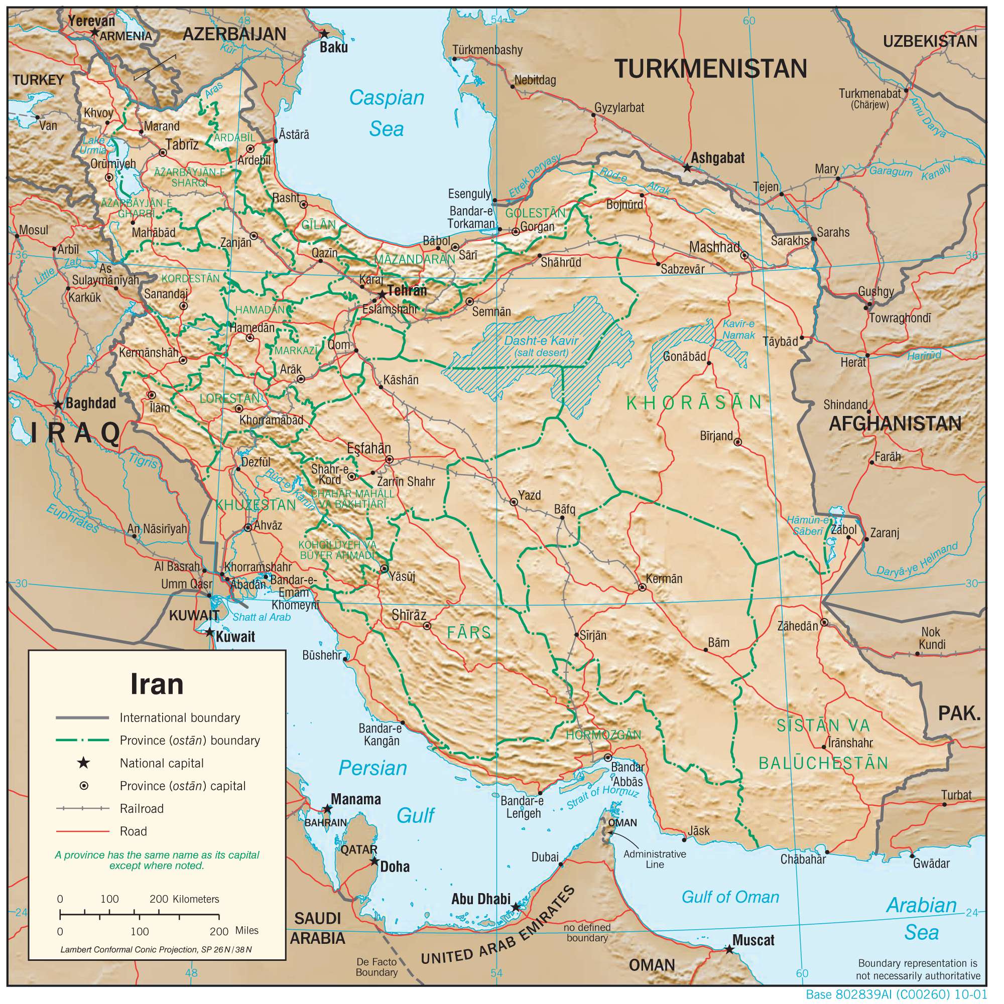
Transportation Map of Iran
Iran Satellite Map