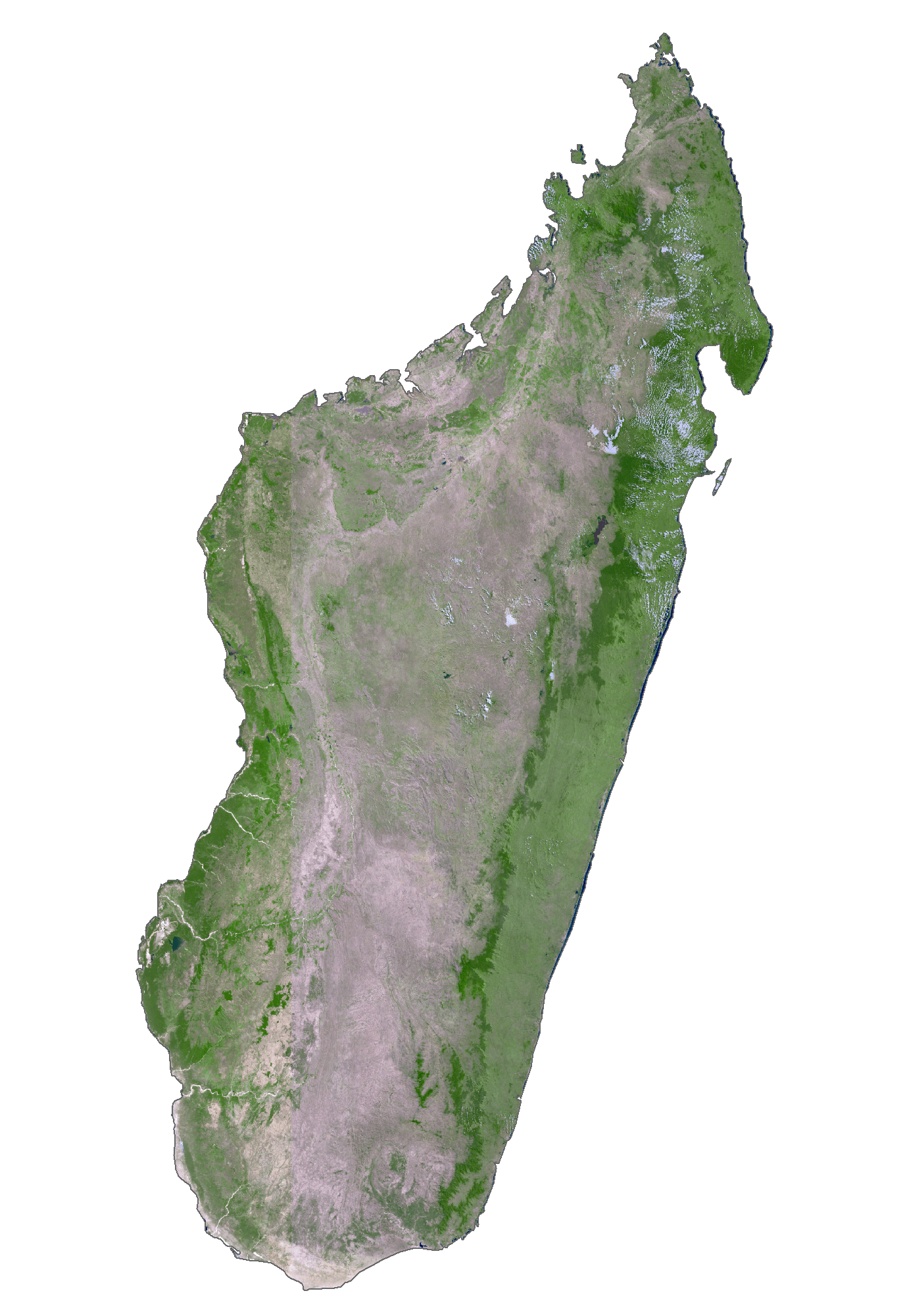
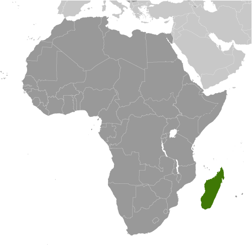
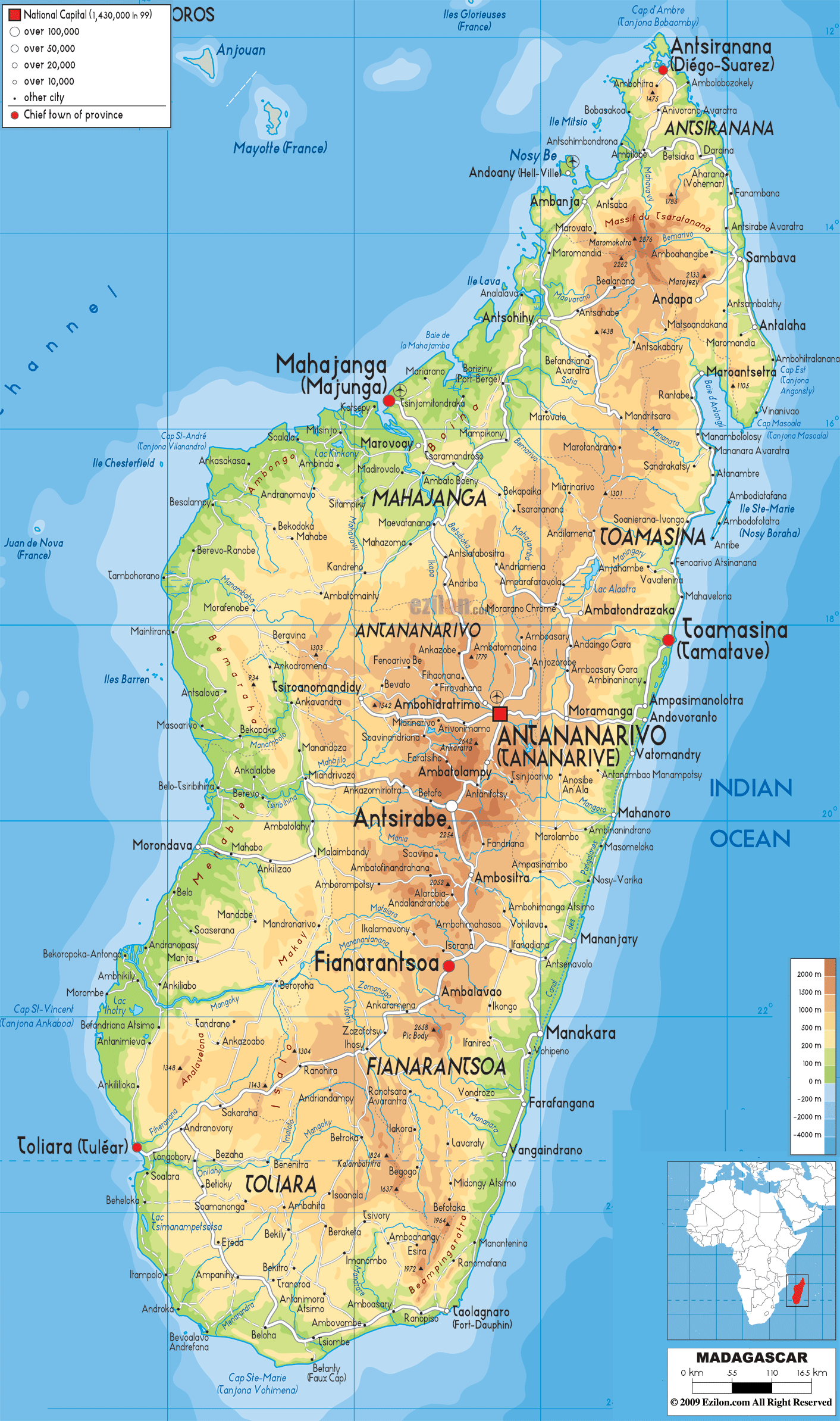
Located off the coast of East Africa in the Indian Ocean, Madagascar is the second-largest island country in the world. It covers an area of t 592,800 sq. kilometers.
The country can be divided into three parallel longitudinal physiographic regions. The coastal strip in the east, the central plateau, and the western regions of low plateaus and plains.
A steep, narrow escarpment runs along Madagascar’s eastern coast, and the island’s remaining tropical rainforest is located here. Along the west coast of the island swamps of mangroves give way to deep bays.Moving inland, the central highlands are punctuated by grassy, deforested hills bordering rice-growing valleys.
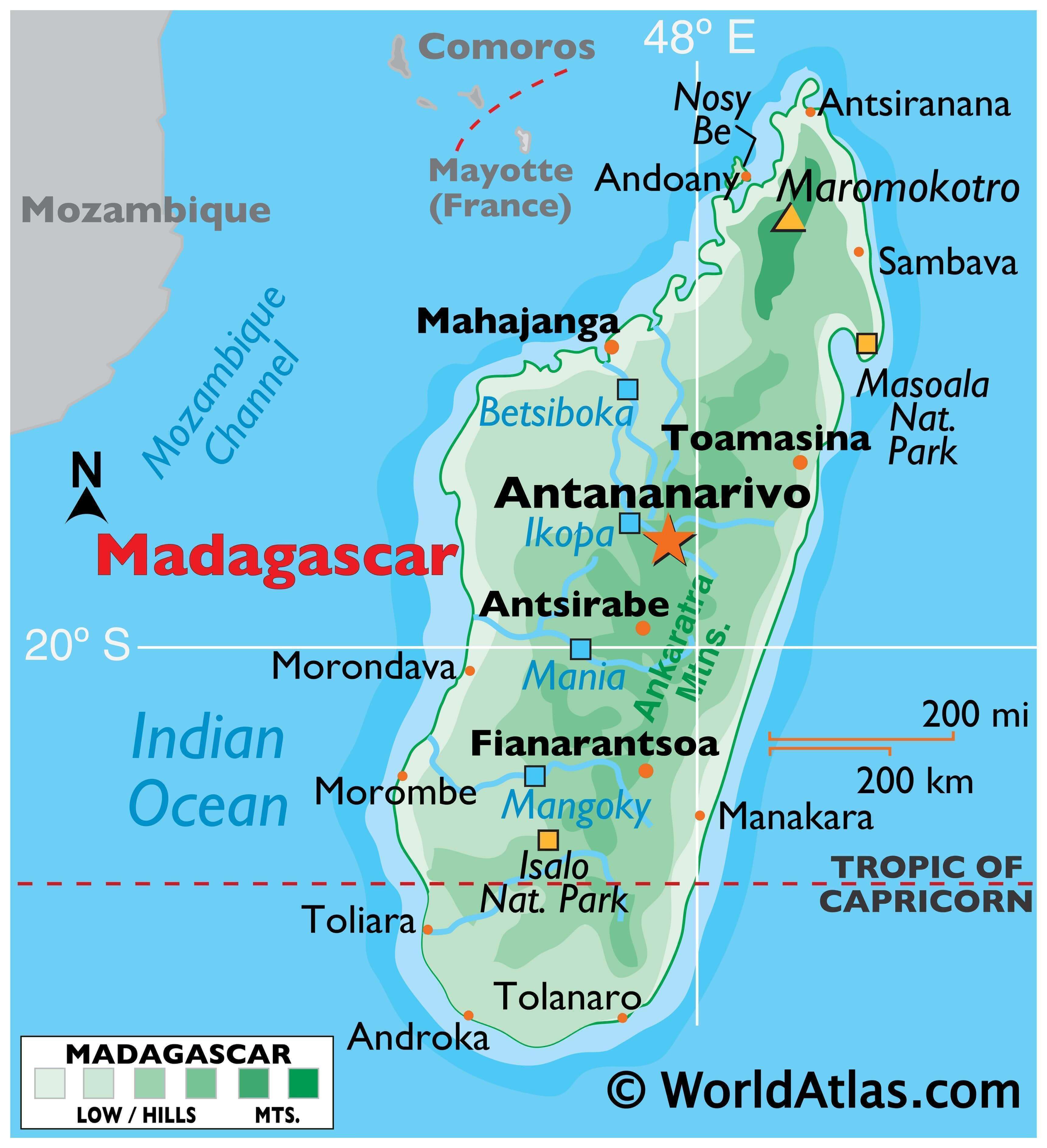
At the north end of the island, the Tsaratanana Massif region is home to Madagascar’s highest point, Maromokotro at 2,876 m. The point has been marked on the map with an upright yellow triangle. In the centre, the Ankaratra Massif (marked on the map) is a major volcanic mass with the highest peak at 2,643 m.
Major rivers of Madagascar include the Mananara, Mangoro Sambirano, Mahajamba, Betsiboka, Mania, north and south Mahavavy, Mangoky, Onilahy, and the Ikopa; lakes unclude: Alaotra, Lake Kinkony and Lake Ihotry.
Madagascar’s lowest point is the Indian Ocean at 0 m.
| Flag: |  |
|---|---|
| Legal Name: | Republic of Madagascar |
| Capital Value: | Antananarivo |
| Official languages: | Malagasy • French |
| Demonym(s): | Malagasy |
| Government: | Unitary semi-presidential republic |
| Legislature: | Parliament |
| Total Area: | 587,041 km² |
| Land Area: | 581,540 km² |
| Water Area: | 5,501 km² |
| Population: | 26,969,307 |
| Density: | 47.7/km (123.5/sq mi) |
| GDP: | $14.08 Billion |
| GDP Per Capita: | $522.22 |
| Currency Value: | Malagasy ariary (MGA) |
| Driving side: | right |
| Calling code: | +261 |
| Internet TLD: | .mg |
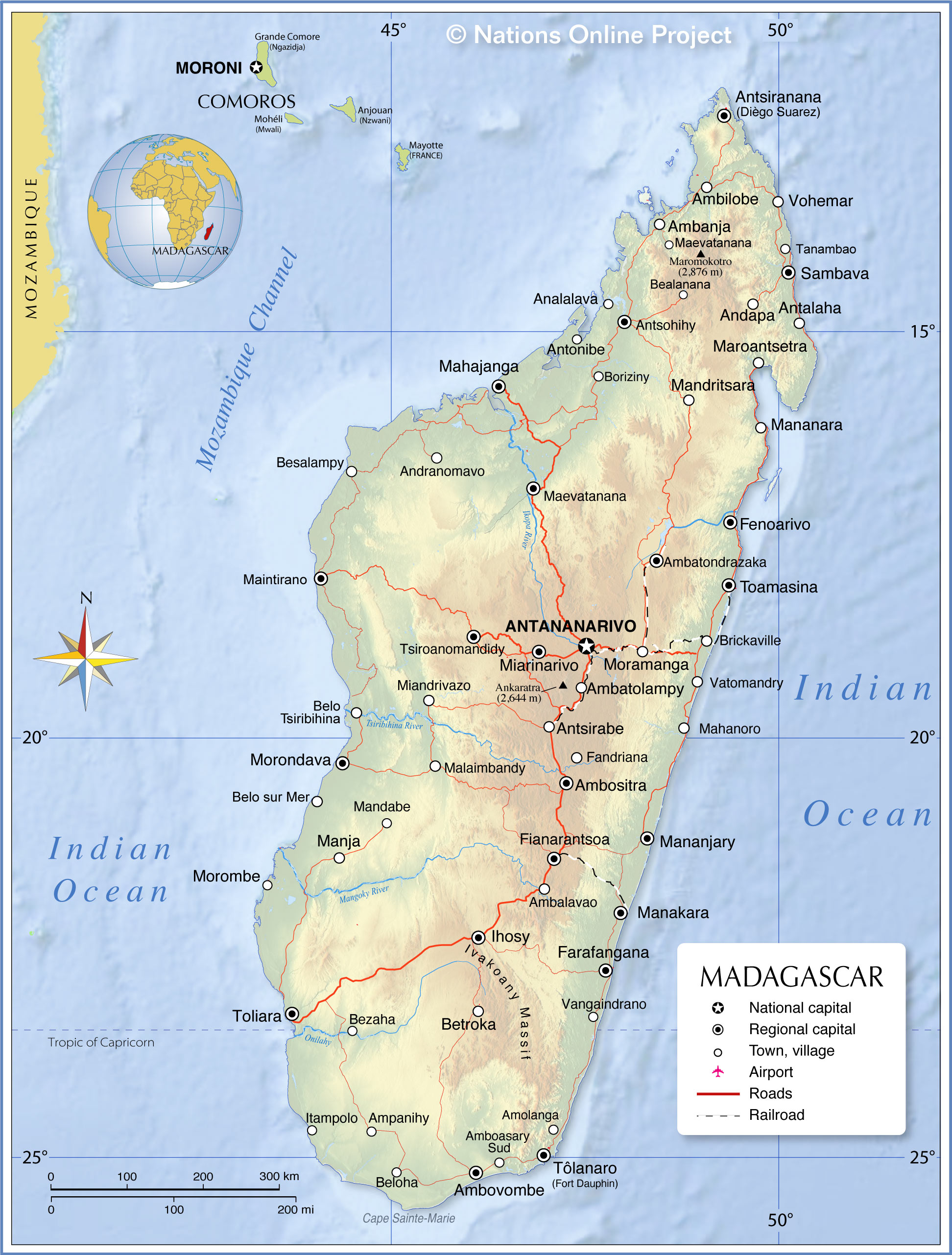
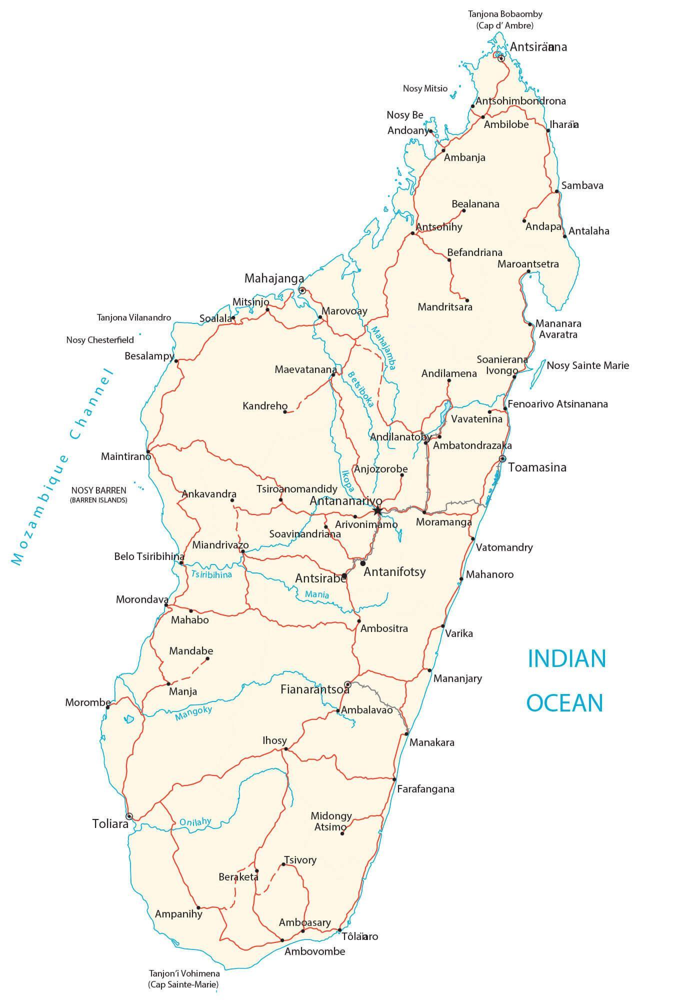
Explore Madagascar with this map of the African island nation. See the terrain of the island and its major cities, as well as the roads connecting them. Satellite imagery reveals the lowlands of the coast, as well as the high plateau of its interior.
Online Interactive Political Map
Click on ![]() to view map in "full screen" mode.
to view map in "full screen" mode.
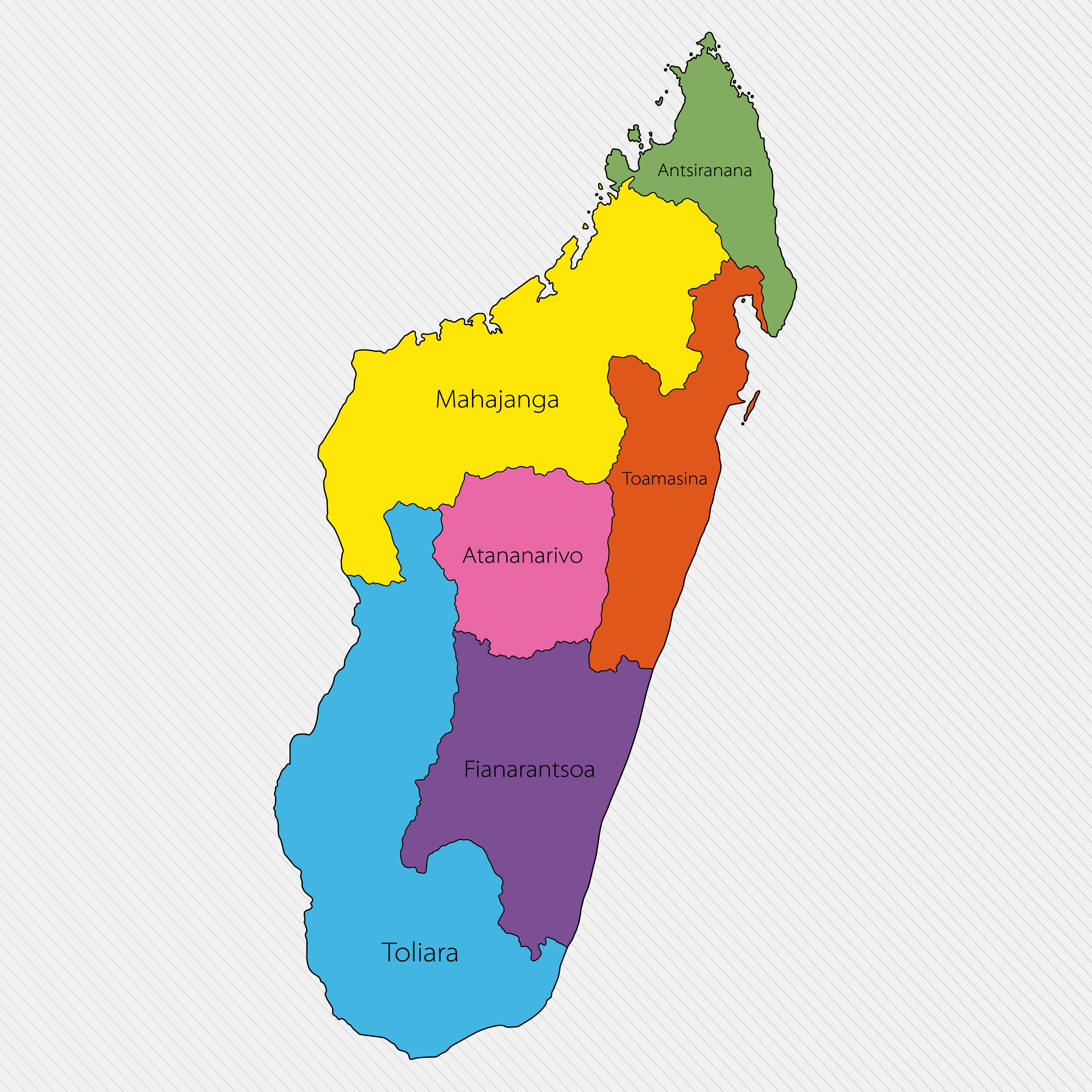
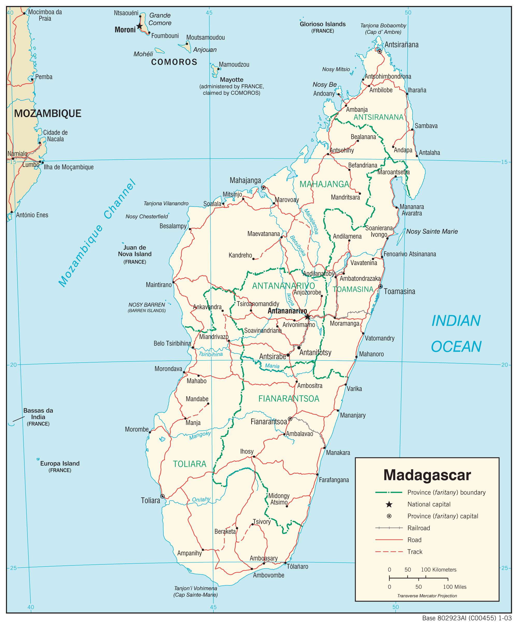
Madagascar is divided into 6 provinces (faritany). In alphabetical order these are: Antananarivo, Antsiranana, Fianarantsoa, Mahajanga, Toamasina, and Toliara. Antananarivo is the capital of the country.
Location Maps
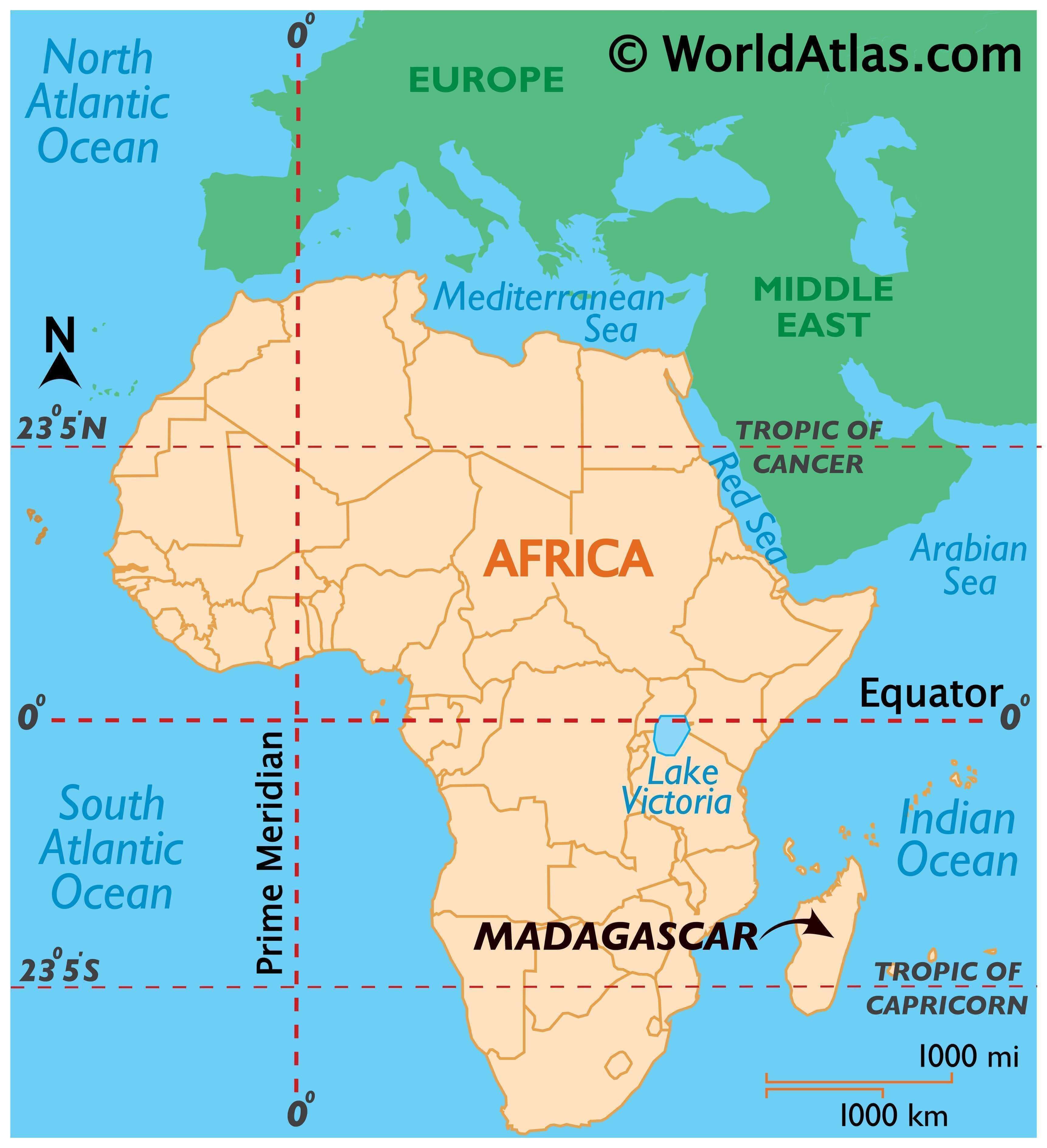
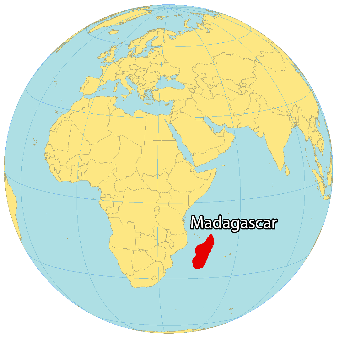
Where is Madagascar?
Madagascar is an island situated in the Indian Ocean, off the coast of southern Africa. It is 430 km (267 mi) from the mainland of Africa, and has a total coastline of 2,470 km (1,535 mi) with an area of 801,590 square kilometers (309,500 sq mi). This makes it the fourth largest island in the world. The capital and largest city is Maputo, and other major cities are Nampula, Beira, and Chimoio.
The geography of Madagascar is incredibly diverse, ranging from rainforests to mountains, beaches to coral reefs. It is also home to many endemic species that are not found anywhere else in the world, making it a hub of biodiversity.
High Definition Political Map of Madagascar

Physical Map of Madagascar
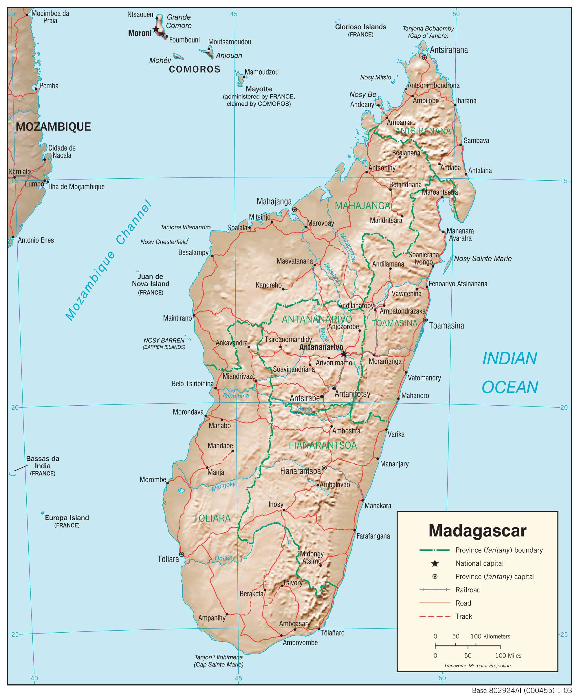
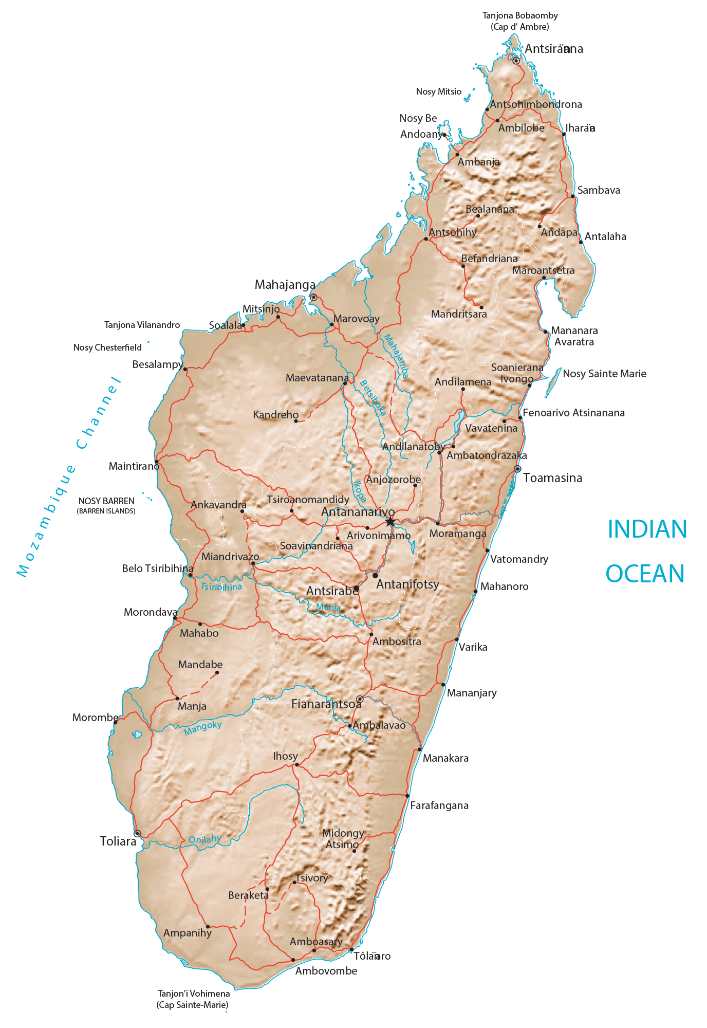
Transportation Map of Madagascar
Madagascar Satellite Map