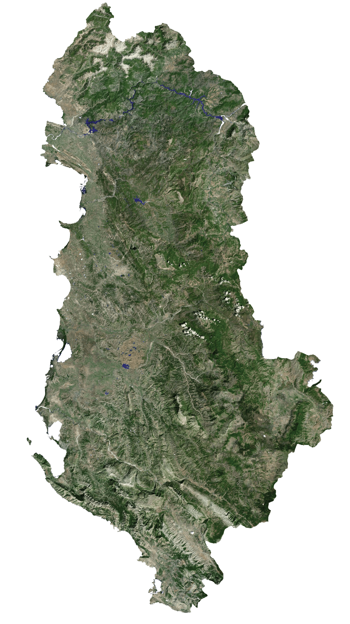
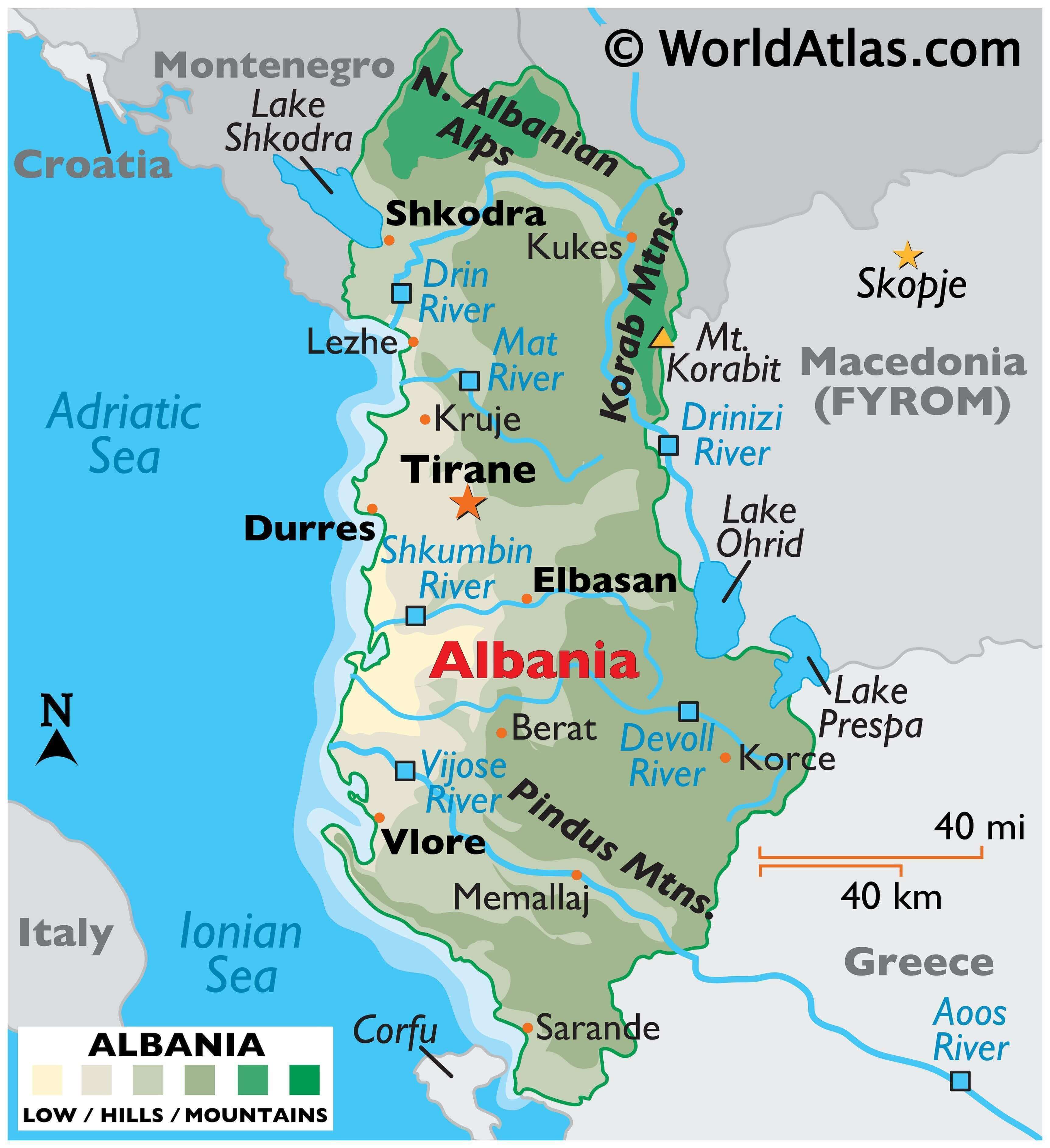
Albania is a sovereing country occupying an area of 28,748 sq. km (11,100 sq mi) in southeast Europe. As observed on the physical map of Albania, the country exhibits significant diversity in topography. The landscape ranges from snow-capped mountains to warm and sunny coastal areas along the Ionian and Adriatic seas.
From the broad and swampy coastal plain fronting the Adriatic Sea, the land rises into hills and mountains that makes up roughly 70% of the country’s area. Marked on the map above are the major mountain ranges of Albania- the Albanian Alps, and the Korab and Pindus Mountains. The highest point is Mt. Karabit in the Korab mountains at 9,066 ft (2,764 m). The mountain is located on Albania’s border with North Macedonia. A yellow triangle marks the position of this point on the map.
From the mountains, flowing inland toward the Adriatic Sea, are significant rivers like the Drin and Vlore. The three major lakes of Albania include Shkodra (shared with Montenegro), Ohrid and Prespa (both shared with Macedonia). Lake Ohrid is the deepest lake in the Balkans, and reaches depths of 935 ft (284 m). The lowest point in Albania is the Adriatic Sea at 0 m.
| Flag: |  |
|---|---|
| Legal Name: | Republic of Albania |
| Capital Value: | Tirana (Tirane) |
| Largest City: |
Tiranë (Tirana) (493,712) |
| Official languages: | Albanian |
| Demonym(s): | Albanian |
| Government: | Unitary parliamentary republic |
| Legislature: | Kuvendi |
| Total Area: | 28,748 km² |
| Land Area: | 27,398 km² |
| Water Area: | 1,350 km² |
| Population: | 2,854,191 |
| Density: | 97/km (251.2/sq mi) |
| GDP: | $15.28 Billion |
| GDP Per Capita: | $5,352.86 |
| Currency Value: | Leke (ALL) |
| Driving side: | right |
| Calling code: | +355 |
| Internet TLD: | .al |
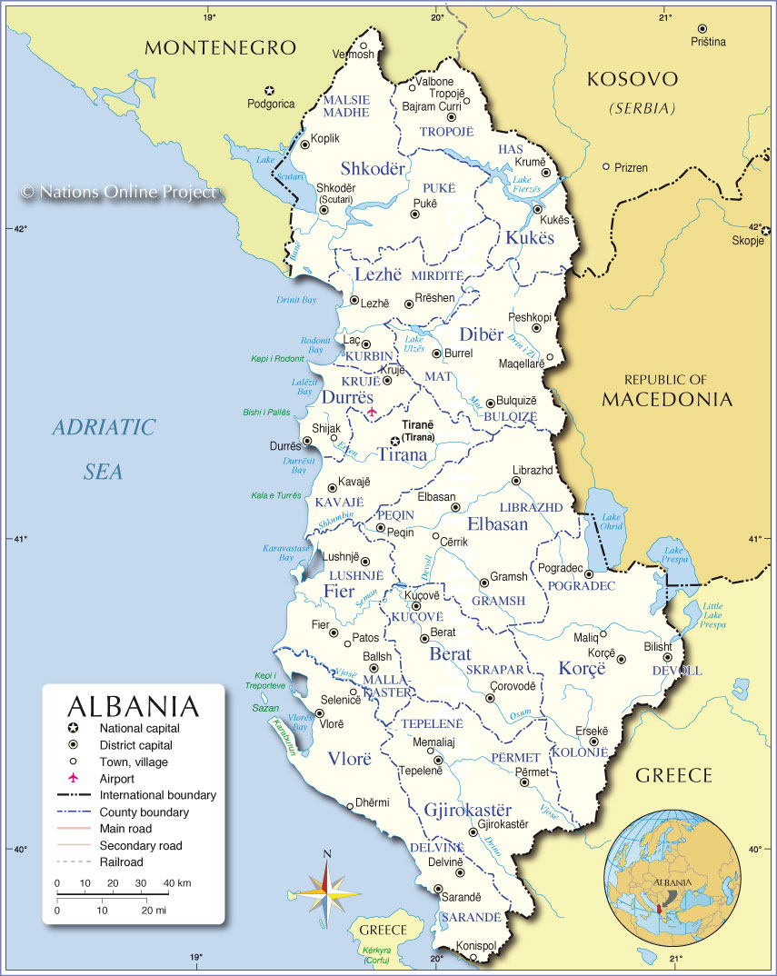
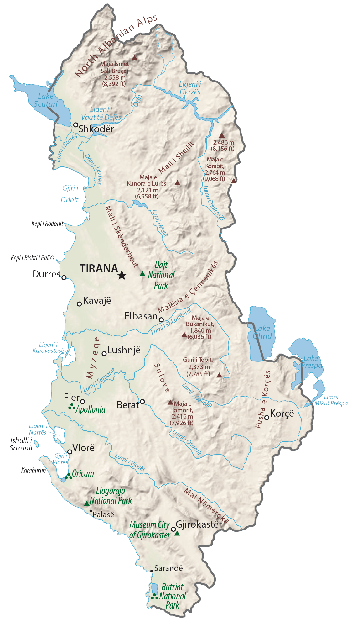
Albania is a country of contrasts, with its eastern side characterised by the rugged terrain of the Balkan Mountains, and its western side by the lowlands of the Adriatic and Ionian Seas. This map of Albania shows the country’s major cities, towns, roads, and rivers, as well as its physical and satellite maps. It’s a great way to get an overview of the country’s geography and to plan your next trip to Albania.
Online Interactive Political Map
Click on ![]() to view map in "full screen" mode.
to view map in "full screen" mode.
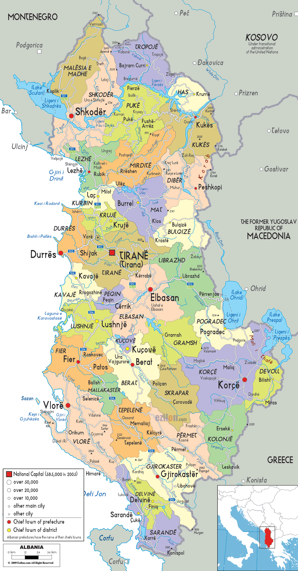
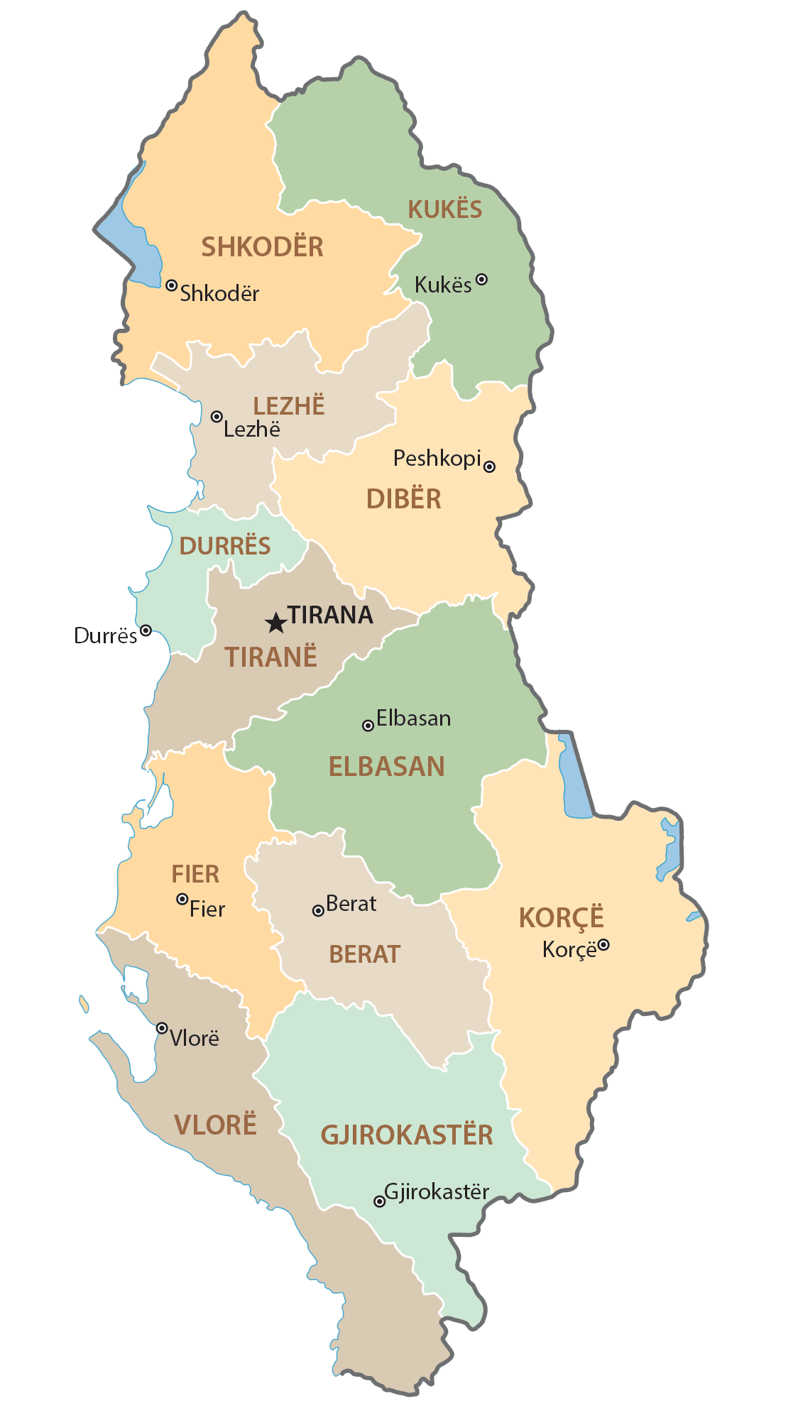
Albania (officially, the Republic of Albania) is divided into 12 counties (qarqe, sing. qark). The counties are: Berat, Diber, Durres, Elbasan, Fier, Gjirokaster, Korce, Kukes, Lezhe, Shkoder, Tirane and Vlore. The counties are subdivided into 61 municipalities and several smaller subdivisions.
Located in the heart of the country is, Tirana – the capital, the largest and the most populous city of Albania. It is the main administrative, financial and economic center of the country.
Location Maps
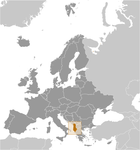
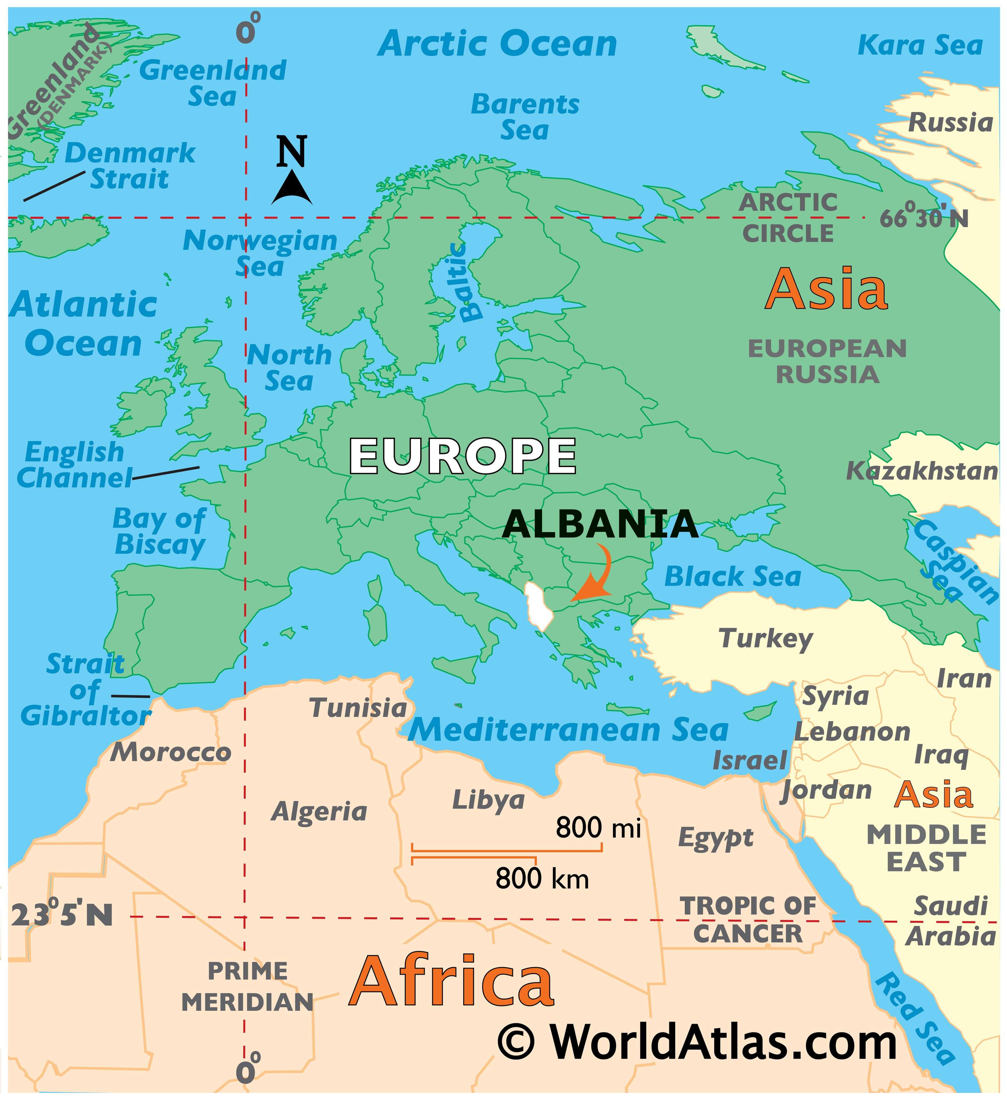
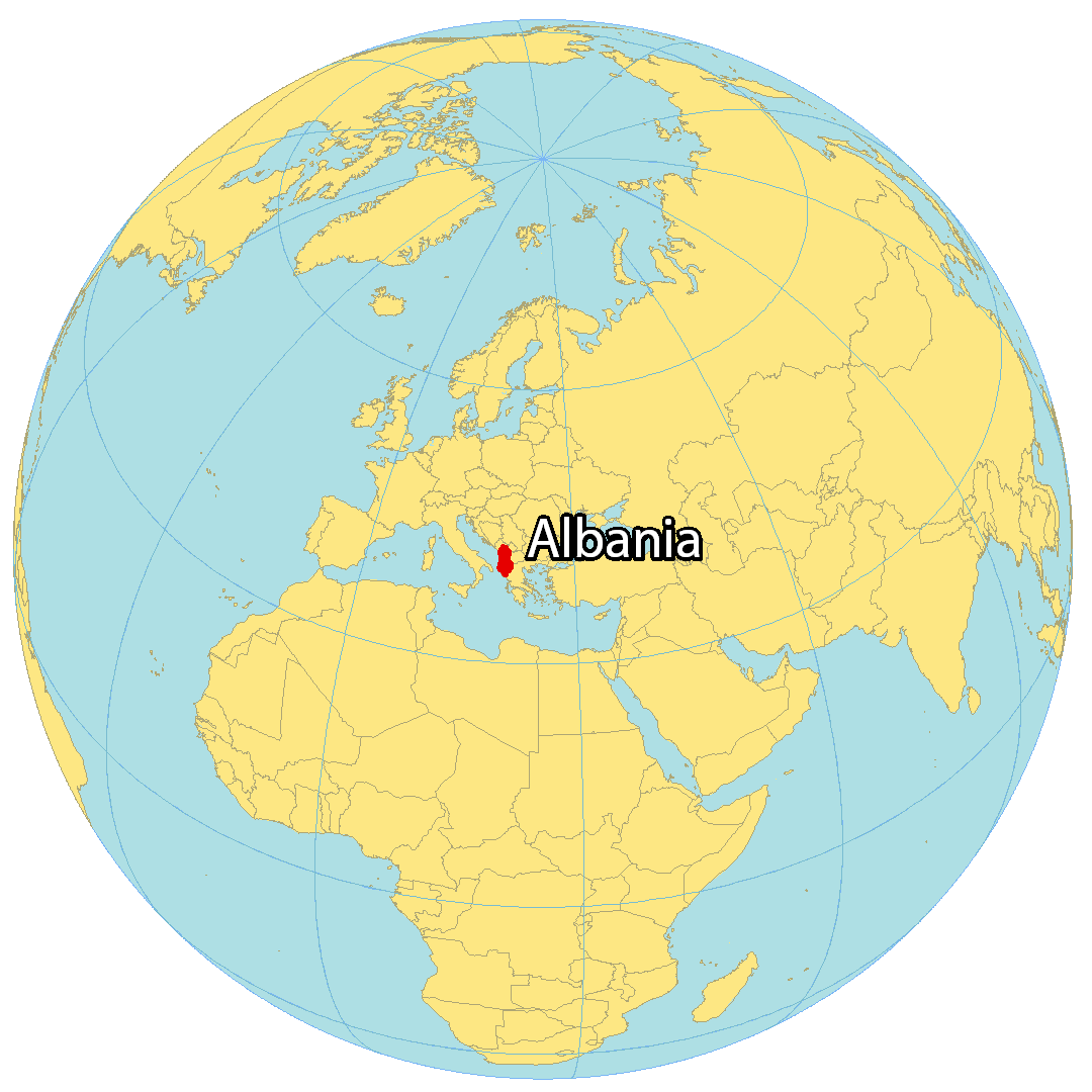
Where is Albania?
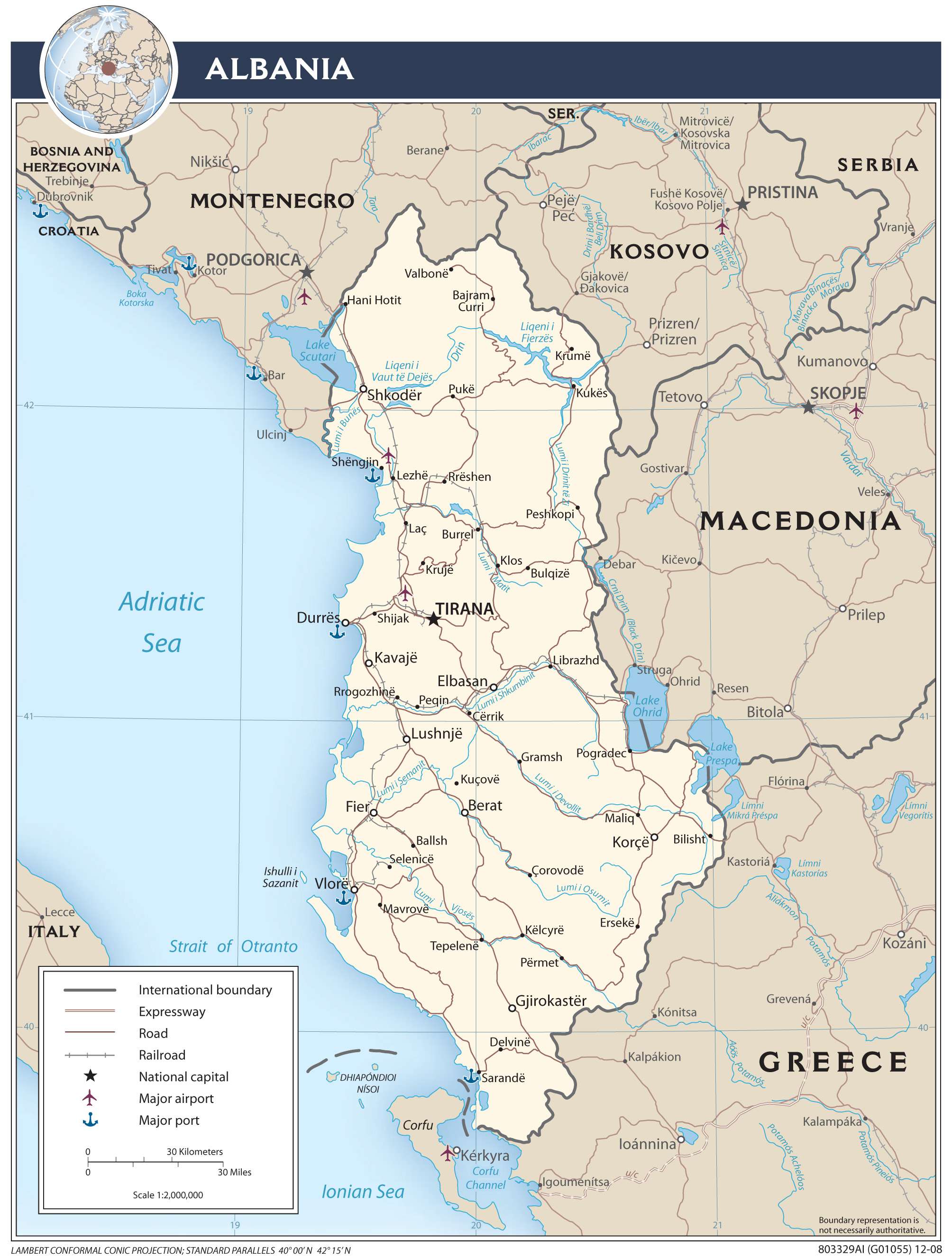
Albania is a country located in Southeastern Europe, with its coastline on both the Adriatic and Ionian Seas. It is bordered by Montenegro to the north, Greece to the southeast, Kosovo to the east, and North Macedonia to the east. The capital and largest city in Albania is Tirana, located in the west-central region of the country. A unique feature of the country is the presence of 173,000 war bunkers, which were built during the Cold War era as a means of militaristic preparation, but were ultimately never used in combat.
High Definition Political Map of Albania
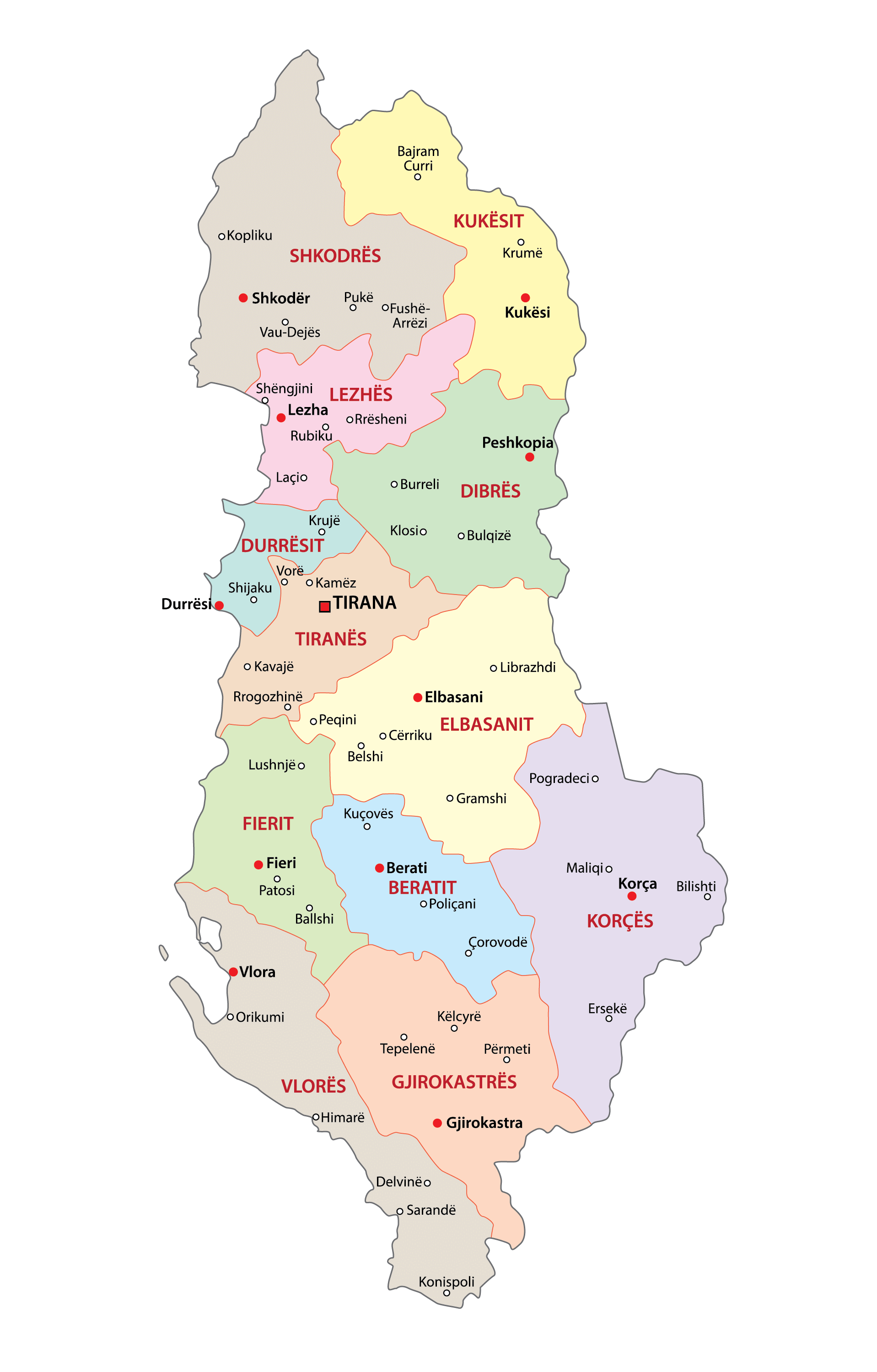
Albania Administrative Map

Physical Map of Albania


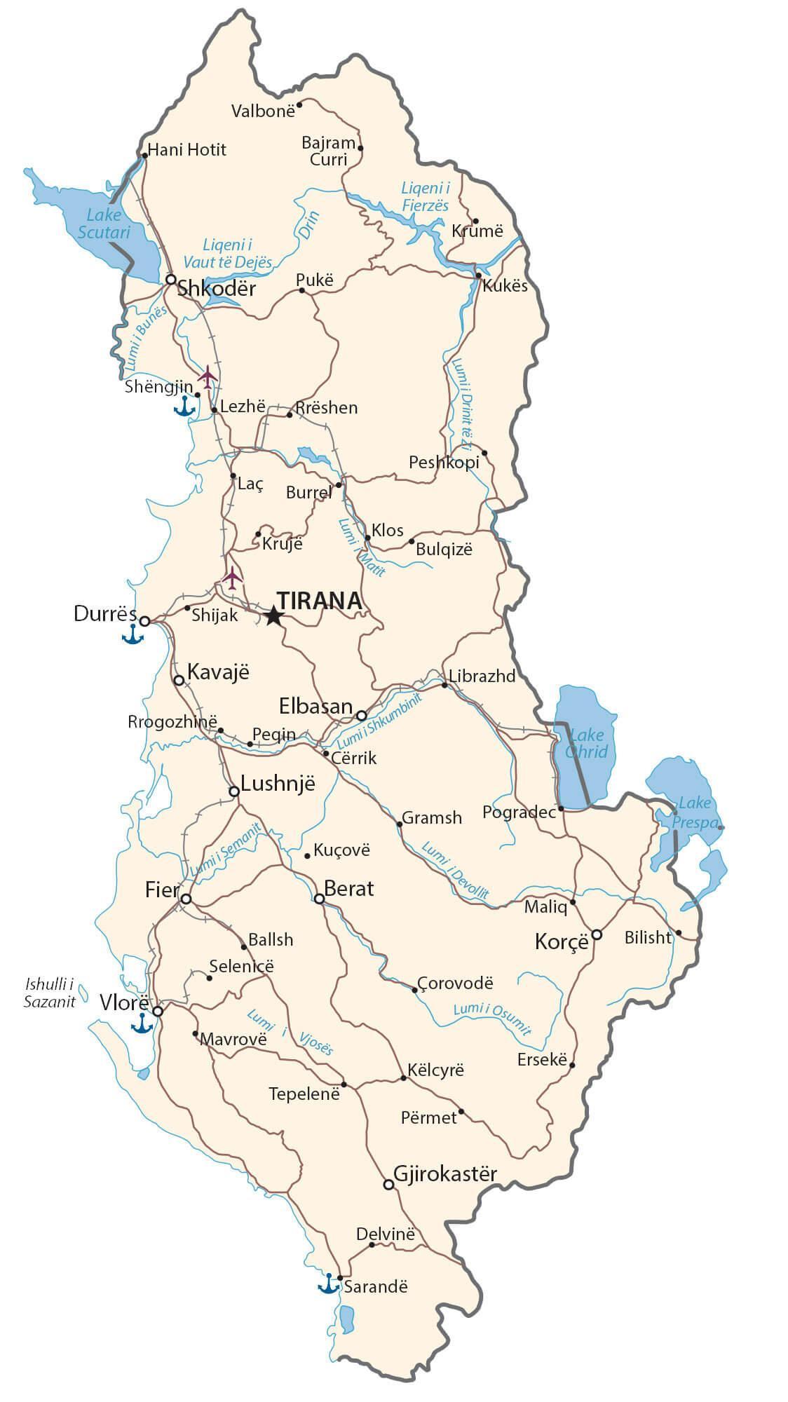
Transportation Map of Albania
Albania Satellite Map