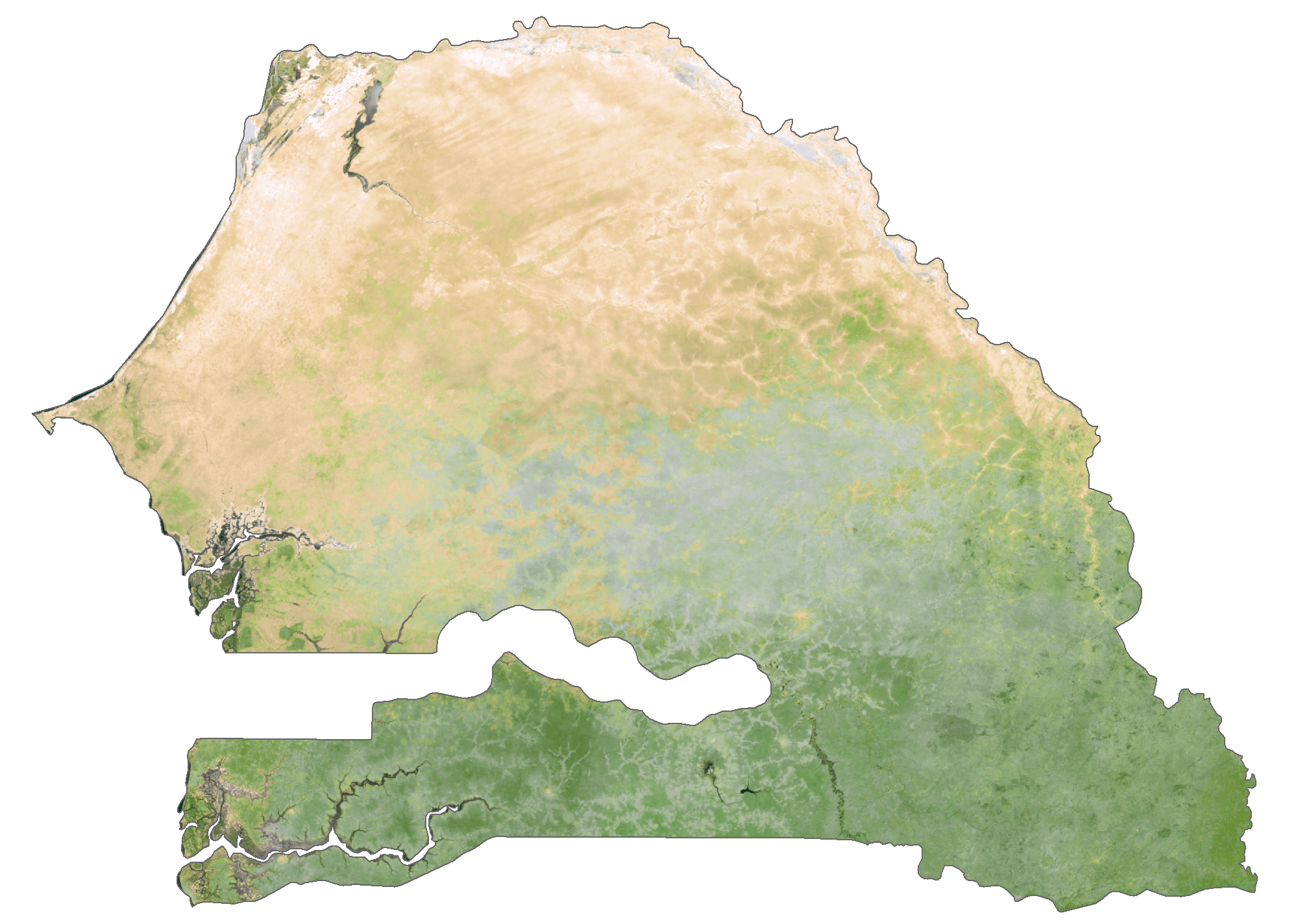
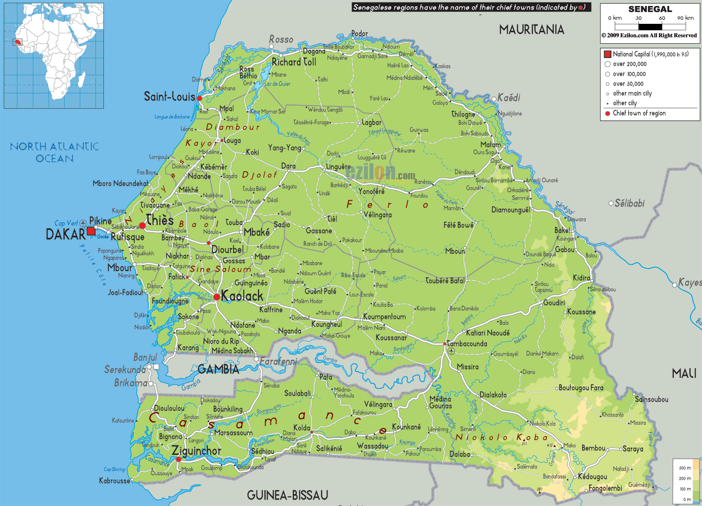
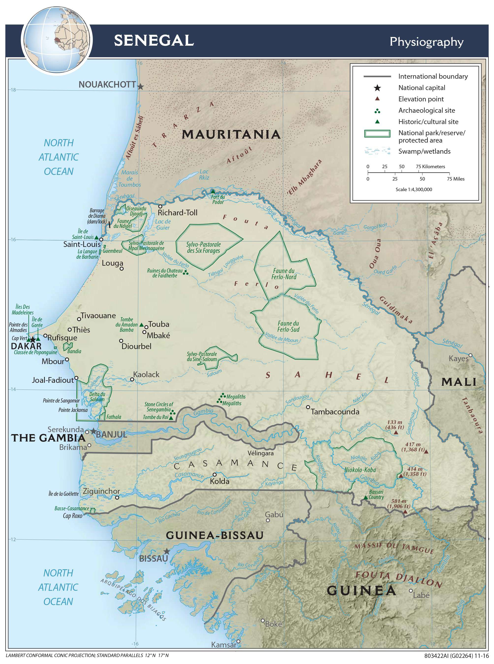
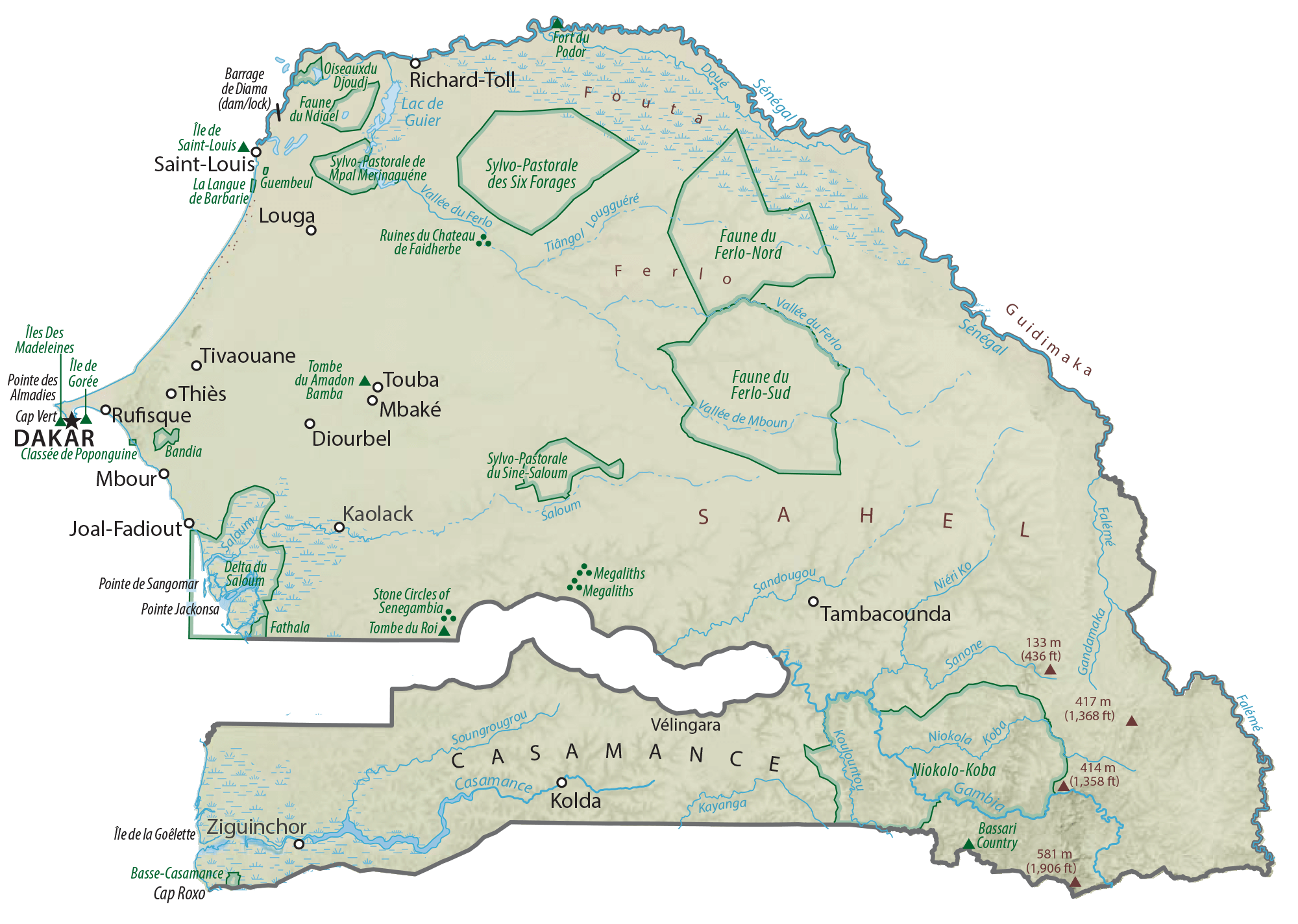
Senegal is a relatively flat country in West Africa with an area of 196,712 sq. km. It is located in a depression called the Senegal-Mauritanian Basin.
The country can be divided into three major physical regions. To the west is the Cape Verde headland or peninsula with small plateaus of volcanic origin. It hosts the national capital of Dakar as visible on the map. The relatively high eastern and southeastern parts with fringes of ancient massifs including the country’s highest point at 581 m constitutes another distinct physical region. The third is the massive lowland area between the highland region to the east and Cape Verde to the west. The country also has a sandy coastline along the Atlantic to the west that is generally low except for the Cape Verde region.
Major rivers draining the country include Senegal, Gambia, Saloum, and Casamance.
| Flag: |  |
|---|---|
| Legal Name: | Republic of Senegal |
| Capital Value: | Dakar |
| Official languages: | French |
| Demonym(s): | Senegalese |
| Government: | Unitary presidential republic |
| Legislature: | National Assembly |
| Total Area: | 196,722 km² |
| Land Area: | 192,530 km² |
| Water Area: | 4,192 km² |
| Population: | 16,296,364 |
| Density: | 68.7/km (177.9/sq mi) (134th) |
| GDP: | $23.58 Billion |
| GDP Per Capita: | $1,446.83 |
| Currency Value: | Communaute Financiere Africaine francs (XOF) |
| Driving side: | right |
| Calling code: | +221 |
| Internet TLD: | .sn |
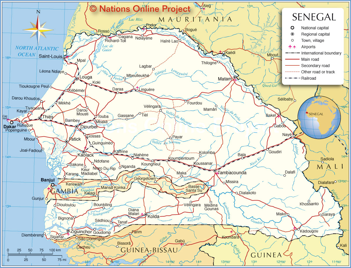
Explore the beauty of Senegal with this detailed map. See the country’s deserts, savannas, and topography, all without leaving your computer! This map of Senegal includes cities, towns, highways, roads, and regions. View satellite imagery to get a detailed look at the country’s natural features.
Online Interactive Political Map
Click on ![]() to view map in "full screen" mode.
to view map in "full screen" mode.
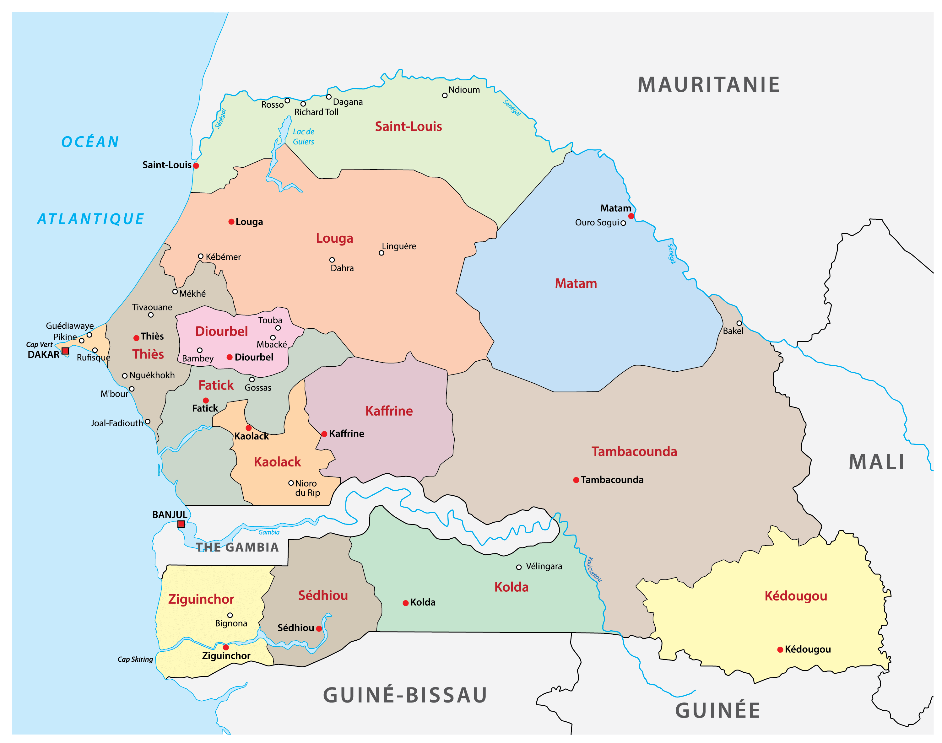
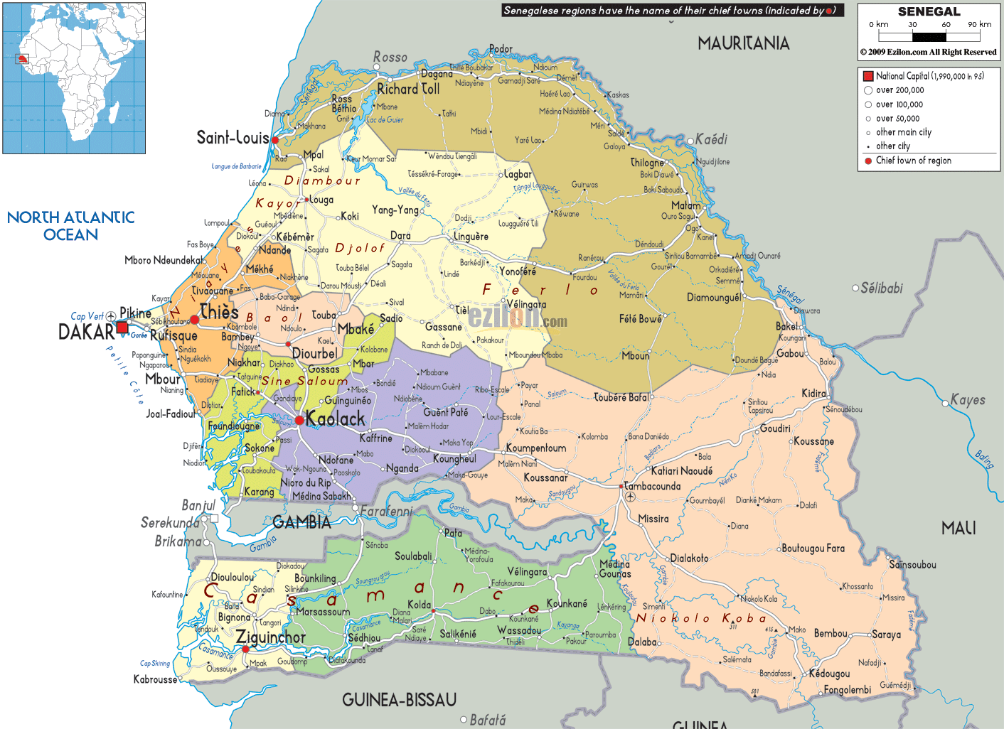
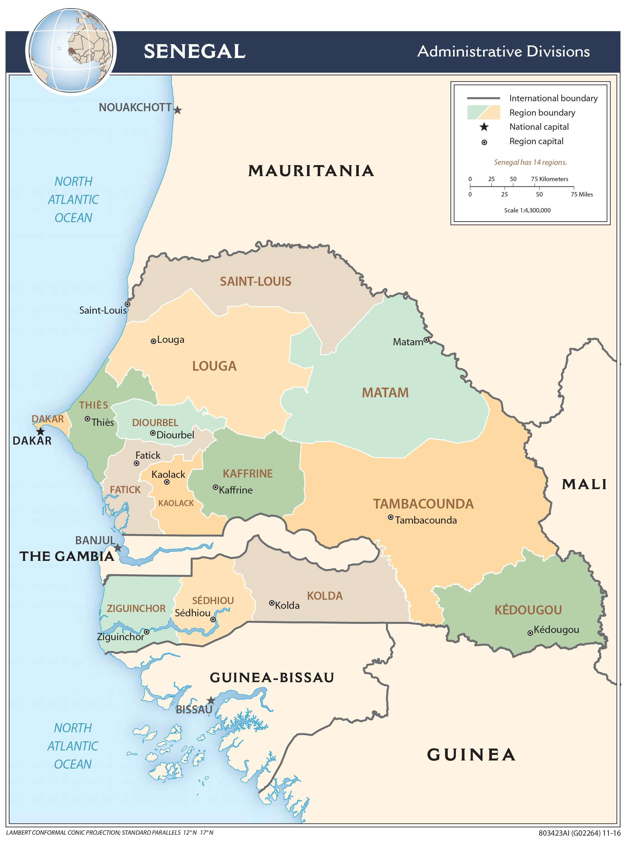
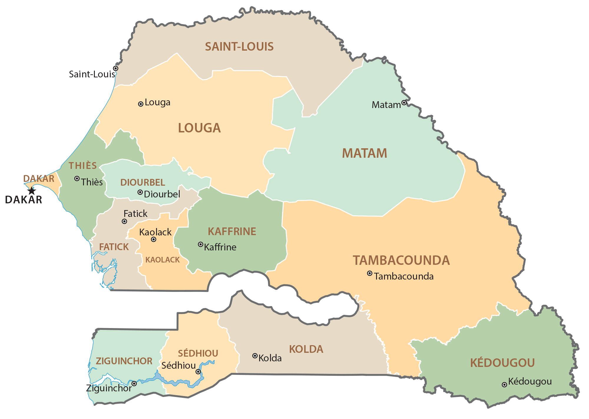
Senegal has four levels of administrative divisions. At the top of the hierarchy are the 14 regions of the country that take their name from the regional capitals. In alphabetical order, they are as follows: Dakar, Diourbel, Fatick, Kaffrine, Kaolack, Kedougou, Kolda, Louga, Matam, Saint-Louis, Sedhiou, Tambacounda, Thies, Ziguinchor.
These regions are further subdivided into 45 departments which are then divided into smaller administrative divisions.
With an area of 42,364 sq. km, Tambacounda is the largest region in the country by area. Dakar that hosts the national capital city of Dakar is the most populous region in the country.
Location Maps
Where is Senegal?
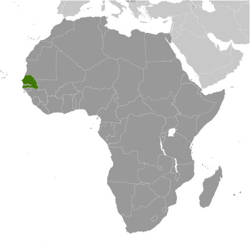
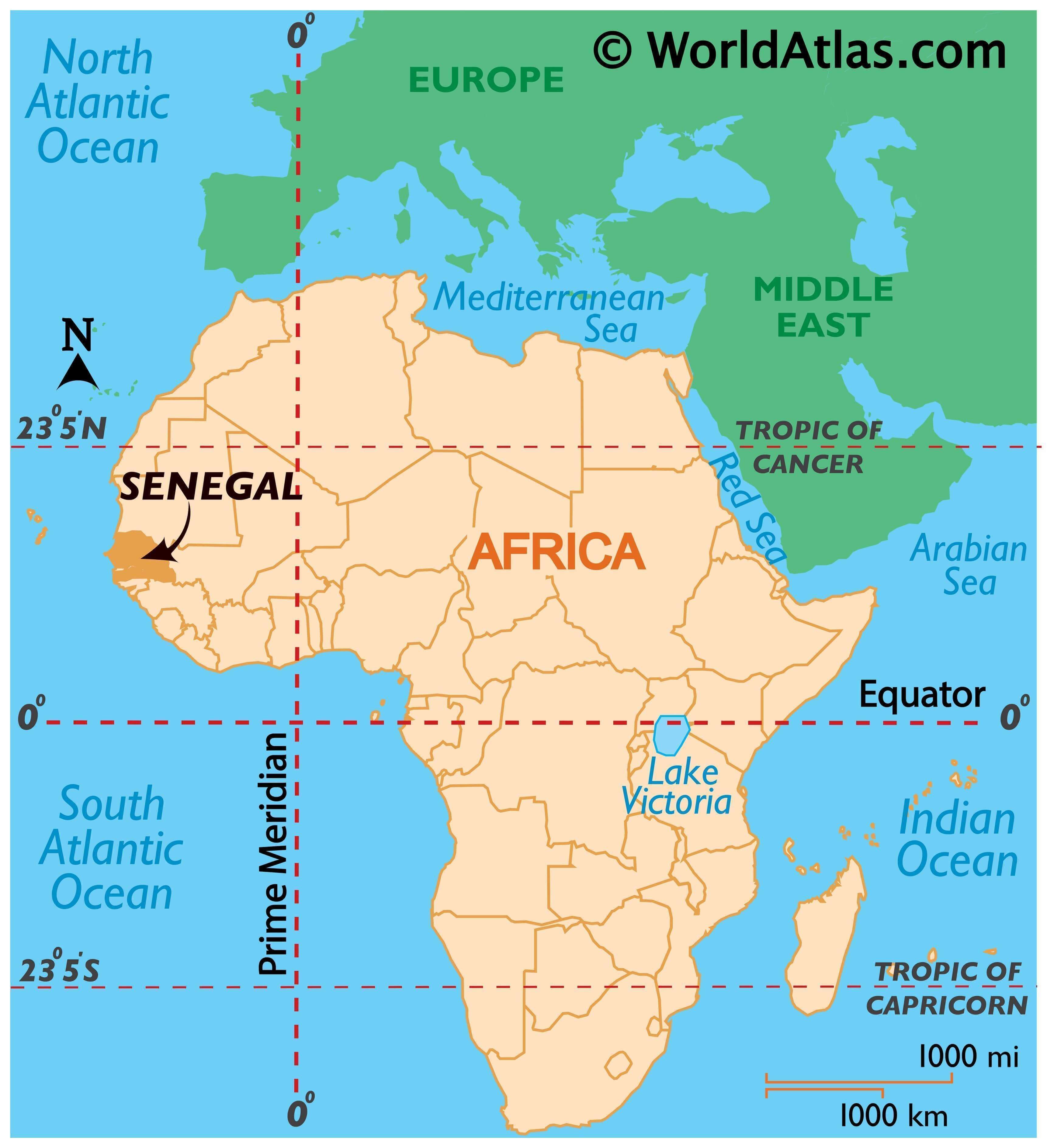
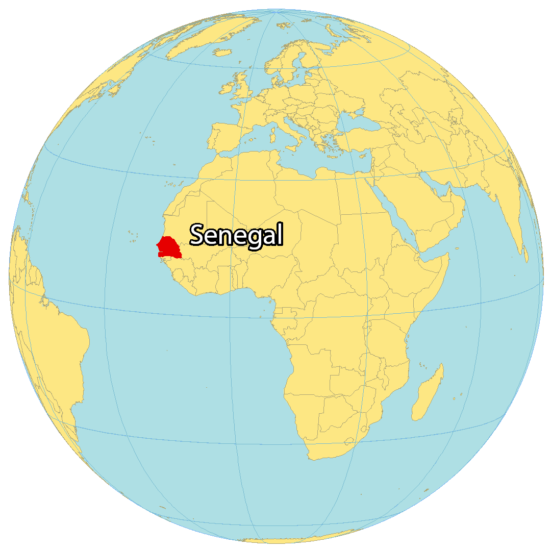
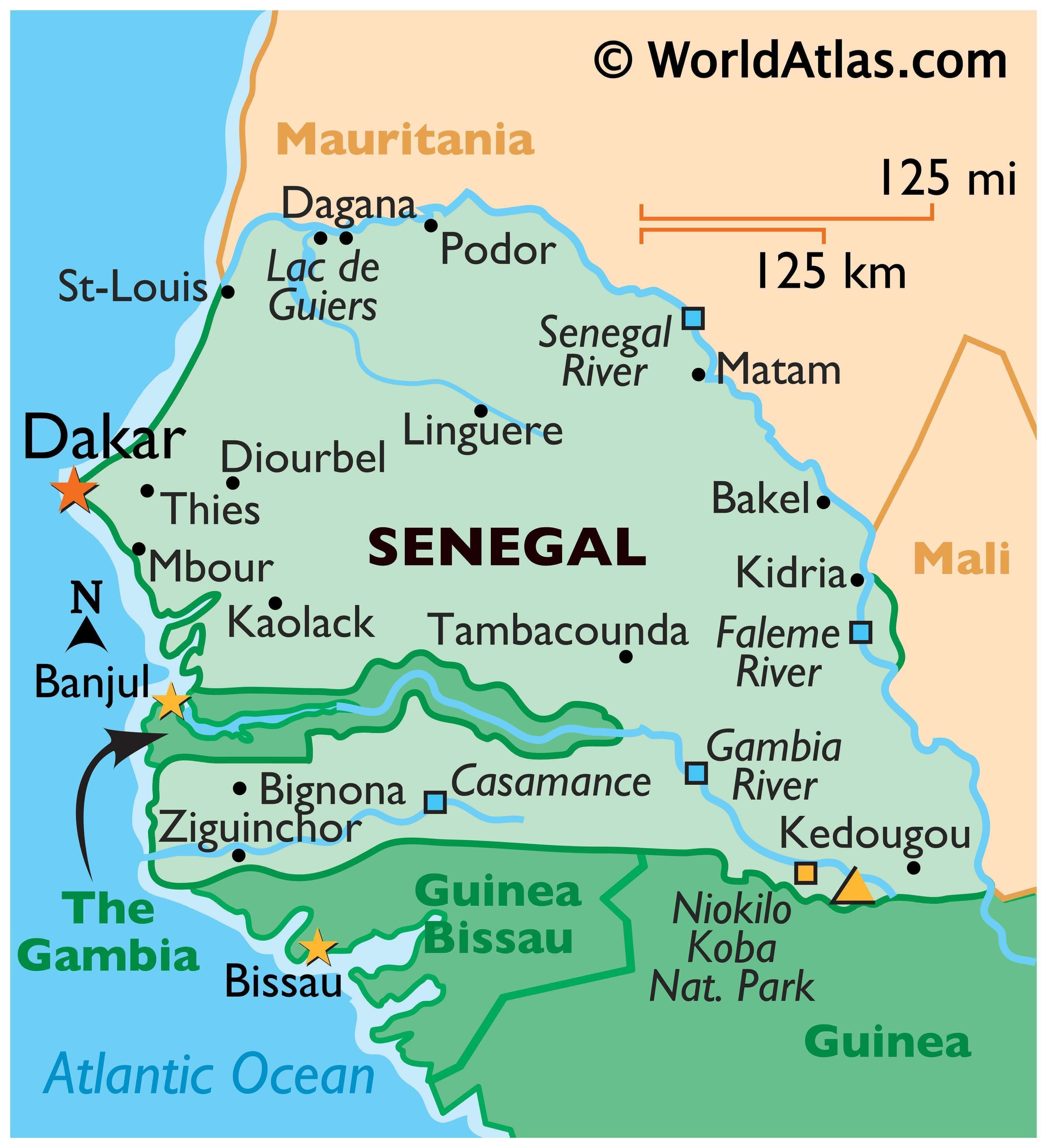
Senegal is the westernmost country in the mainland of Africa. It is situated on the west coast of the Atlantic Ocean, and borders Mauritania to the north, Mali to the east, Guinea to the southeast, and Guinea-Bissau to the southwest. It completely surrounds The Gambia, which is a 20 to 30-mile buffer along the Gambia River. Senegal also shares a maritime border with Cape Verde, which is about 600 kilometers (373 mi) off the west coast of Senegal, Africa. The capital and largest city of Senegal is Dakar.
High Definition Political Map of Senegal
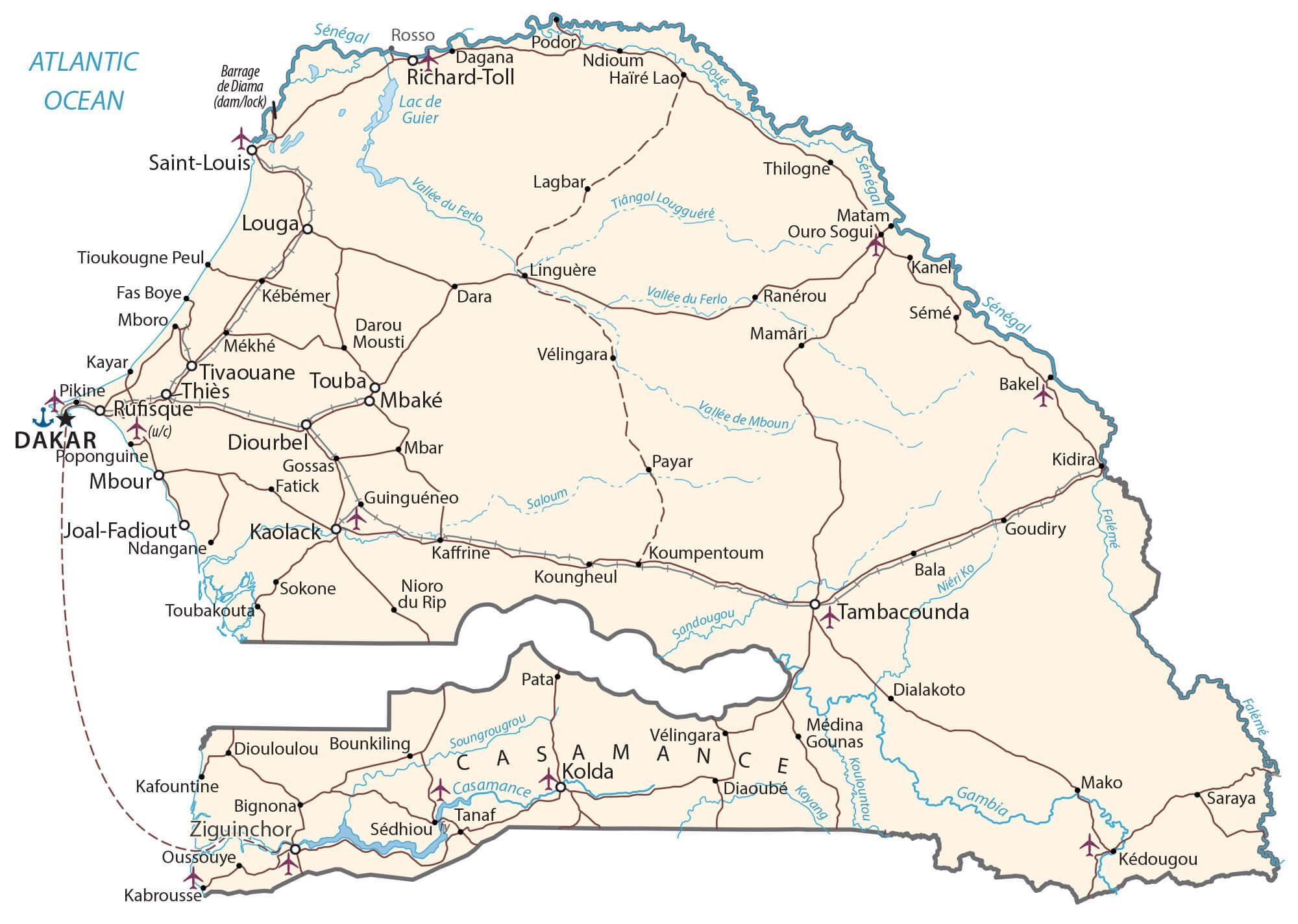
Senegal Administrative Map
History
Early and pre-colonial eras
Archaeological findings throughout the area indicate that Senegal was inhabited in prehistoric times and has been continuously occupied by various ethnic groups. Some kingdoms were created around the seventh century: Takrur in the ninth century, Namandiru and the Jolof Empire during the 13th and 14th centuries. Eastern Senegal was once part of the Ghana Empire.
Islam was introduced through Toucouleur and Soninke contact with the Almoravid dynasty of the Maghreb, who in turn propagated it with the help of the Almoravids and Toucouleur allies. This movement faced resistance from ethnicities of traditional religions, the Serers in particular.
In the 13th and 14th centuries, the area came under the influence of the empires to the east; the Jolof Empire of Senegal was also founded during this time. In the Senegambia region, between 1300 and 1900, close to one-third of the population was enslaved, typically as a result of being taken captive in warfare.
In the 14th century the Jolof Empire grew more powerful, having united Cayor and the kingdoms of Baol, Siné, Saloum, Waalo, Futa Tooro and Bambouk, or much of present-day West Africa. The empire was a voluntary confederacy of various states rather than being built on military conquest. The empire was founded by Ndiadiane Ndiaye, a part Serer and part Toucouleur, who was able to form a coalition with many ethnicities, but collapsed around 1549 with the defeat and killing of Lele Fouli Fak by Amari Ngone Sobel Fall.
Colonial era
In the mid-15th century, the Portuguese landed on the Senegal coastline, followed by traders representing other countries, including the French. Various European powers—Portugal, the Netherlands, and Great Britain—competed for trade in the area from the 15th century onward.
In 1677, France gained control of what had become a minor departure point in the Atlantic slave trade: the island of Gorée next to modern Dakar, used as a base to purchase slaves from the warring chiefdoms on the mainland.
European missionaries introduced Christianity to Senegal and the Casamance in the 19th century. It was only in the 1850s that the French began to expand onto the Senegalese mainland, after they abolished slavery and began promoting an abolitionist doctrine, adding native kingdoms like the Waalo, Cayor, Baol, and Jolof Empire. French colonists progressively invaded and took over all the kingdoms, except Siné and Saloum, under Governor Louis Faidherbe.
Yoro Dyao was in command of the canton of Foss-Galodjina and was set over Wâlo (Ouâlo) by Louis Faidherbe, where he served as a chief from 1861 to 1914. Senegalese resistance to the French expansion and curtailing of their lucrative slave trade was led in part by Lat-Dior, Damel of Cayor, and Maad a Sinig Kumba Ndoffene Famak Joof, the Maad a Sinig of Siné, resulting in the Battle of Logandème.
In 1915, over 300 Senegalese came under Australian command, ahead of the taking of Damascus by Australians, before the expected arrival of the famed Lawrence of Arabia. French and British diplomacy in the area were thrown into disarray.
On 25 November 1958, Senegal became an autonomous republic within the French Community.
Independence
In January 1959, Senegal and the French Sudan merged to form the Mali Federation, which became fully independent on 20 June 1960, as a result of a transfer of power agreement signed with France on 4 April 1960. Due to internal political difficulties, the Federation broke up on 20 August 1960 when Senegal and French Sudan (renamed the Republic of Mali) each proclaimed independence.
Léopold Sédar Senghor, internationally known poet, politician, and statesman, was elected Senegal’s first president in August 1960. Pro-African, Senghor advocated a brand of African socialism.
After the breakup of the Mali Federation, President Senghor and Prime Minister Mamadou Dia governed together under a parliamentary system. In December 1962, their political rivalry led to an attempted coup by Prime Minister Dia. The coup was put down without bloodshed and Dia was arrested and imprisoned. Senegal adopted a new constitution that consolidated the President’s power.
Senghor was considerably more tolerant of opposition than most African leaders became in the 1960s. Nonetheless, political activity was somewhat restricted for a time. Senghor’s party, the Senegalese Progressive Union (now the Socialist Party of Senegal), was the only legally permitted party from 1965 until 1975. In the latter year, Senghor allowed the formation of two opposition parties that began operation in 1976—a Marxist party (the African Independence Party) and a liberal party (the Senegalese Democratic Party).
The 1960s and early 1970s saw the continued and persistent violating of Senegal’s borders by the Portuguese military from Portuguese Guinea. In response, Senegal petitioned the United Nations Security Council in 1963, 1965, 1969 (in response to shelling by Portuguese artillery), 1971 and finally in 1972.
1980 to present
In 1980, President Senghor decided to retire from politics. The next year, he transferred power in 1981 to his hand-picked successor, Abdou Diouf. Former prime minister Mamadou Dia, who was Senghor’s rival, ran for election in 1983 against Diouf, but lost. Senghor moved to France, where he died at the age of 95.
In the 1980s, Boubacar Lam discovered Senegalese oral history that was initially compiled by the Tuculor noble, Yoro Dyâo, not long after World War I, which documented migrations into West Africa from the Nile Valley; ethnic groups, from the Senegal River to the Niger Delta, retained traditions of having an eastern origin.
Senegal joined with The Gambia to form the nominal Senegambia Confederation on 1 February 1982. However, the union was dissolved in 1989. Despite peace talks, a southern separatist group (Movement of Democratic Forces of Casamance or MFDC) in the Casamance region has clashed sporadically with government forces since 1982 in the Casamance conflict. In the early 21st century, violence has subsided and President Macky Sall held talks with rebels in Rome in December 2012.
Abdou Diouf was president between 1981 and 2000. He encouraged broader political participation, reduced government involvement in the economy, and widened Senegal’s diplomatic engagements, particularly with other developing nations. Domestic politics on occasion spilled over into street violence, border tensions, and a violent separatist movement in the southern region of the Casamance. Nevertheless, Senegal’s commitment to democracy and human rights strengthened. Abdou Diouf served four terms as president.
During the Gulf War, over 500 Senegalese participated in the Battle of Khafji and the unexpected Liberation of Kuwait campaign, under the command of the U.S.-led coalition.
In the presidential election of 1999, opposition leader Abdoulaye Wade defeated Diouf in an election deemed free and fair by international observers. Senegal experienced its second peaceful transition of power, and its first from one political party to another. On 30 December 2004 President Wade announced that he would sign a peace treaty with the separatist group in the Casamance region. This, however, has yet to be implemented. There was a round of talks in 2005, but the results have not yet yielded a resolution.
In March 2012, the incumbent president Abdoulaye Wade lost the presidential election and Macky Sall was elected as the new President of Senegal. President Macky Sall was re-elected in 2019 elections. The presidential term was reduced from seven years to five.
Since 3 March 2021, Senegal has been rocked by a series of mass protests in response to the arrest of Ousmane Sonko for alleged rape and mishandling of the COVID-19 pandemic.
Physical Map of Senegal
Geography
Senegal is located on the west of the African continent. It lies between latitudes 12° and 17°N, and longitudes 11° and 18°W.
Senegal is externally bounded by the Atlantic Ocean to the west, Mauritania to the north, Mali to the east, and Guinea and Guinea-Bissau to the south; internally it almost completely surrounds The Gambia, namely on the north, east and south, except for Gambia’s short Atlantic coastline.
The Senegalese landscape consists mainly of the rolling sandy plains of the western Sahel which rise to foothills in the southeast. Here is also found Senegal’s highest point, Baunez ridge situated 2.7 km southeast of Nepen Diakha at 648 m (2,126 ft). The northern border is formed by the Senegal River; other rivers include the Gambia and Casamance Rivers. The capital Dakar lies on the Cap-Vert peninsula, the westernmost point of continental Africa.
The Cape Verde islands lie some 560 kilometres (350 mi) off the Senegalese coast, but Cap-Vert (“Cape Green”) is a maritime placemark, set at the foot of “Les Mammelles”, a 105-metre (344 ft) cliff resting at one end of the Cap-Vert peninsula onto which is settled Senegal’s capital Dakar, and 1 kilometre (0.6 mi) south of the “Pointe des Almadies”, the westernmost point in Africa.
Senegal contains four terrestrial ecoregions: Guinean forest-savanna mosaic, Sahelian Acacia savanna, West Sudanian savanna, and Guinean mangroves. It had a 2019 Forest Landscape Integrity Index mean score of 7.11/10, ranking it 56th globally out of 172 countries.
Climate
Senegal has a tropical climate with pleasant heat throughout the year with well-defined dry and humid seasons that result from northeast winter winds and southwest summer winds. The dry season (December to April) is dominated by hot, dry, harmattan wind. Dakar’s annual rainfall of about 600 mm (24 in) occurs between June and October when maximum temperatures average 30 °C (86.0 °F) and minimums 24.2 °C (75.6 °F); December to February maximum temperatures average 25.7 °C (78.3 °F) and minimums 18 °C (64.4 °F).
Interior temperatures are higher than along the coast (for example, average daily temperatures in Kaolack and Tambacounda for May are 30 °C (86.0 °F) and 32.7 °C (90.9 °F) respectively, compared to Dakar’s 23.2 °C (73.8 °F) ), and rainfall increases substantially farther south, exceeding 1,500 mm (59.1 in) annually in some areas.
In Tambacounda in the far interior, particularly on the border of Mali where desert begins, temperatures can reach as high as 54 °C (129.2 °F). The northernmost part of the country has a near hot desert climate, the central part has a hot semi-arid climate and the southernmost part has a tropical wet and dry climate. Senegal is mainly a sunny and dry country.
Climate change in Senegal will have wide reaching impacts on many aspects of life in Senegal. Climate change will cause an increase in average temperatures over west Africa by between 1.5 and 4 °C (3 °F and 7 °F) by mid-century, relative to 1986–2005. Projections of rainfall indicate an overall decrease in rainfall and an increase in intense mega-storm events over the Sahel. The sea level is expected to rise faster in West Africa than the global average. Although Senegal is currently not a major contributor to global greenhouse gas emissions, it is one of the most vulnerable countries to climate change.
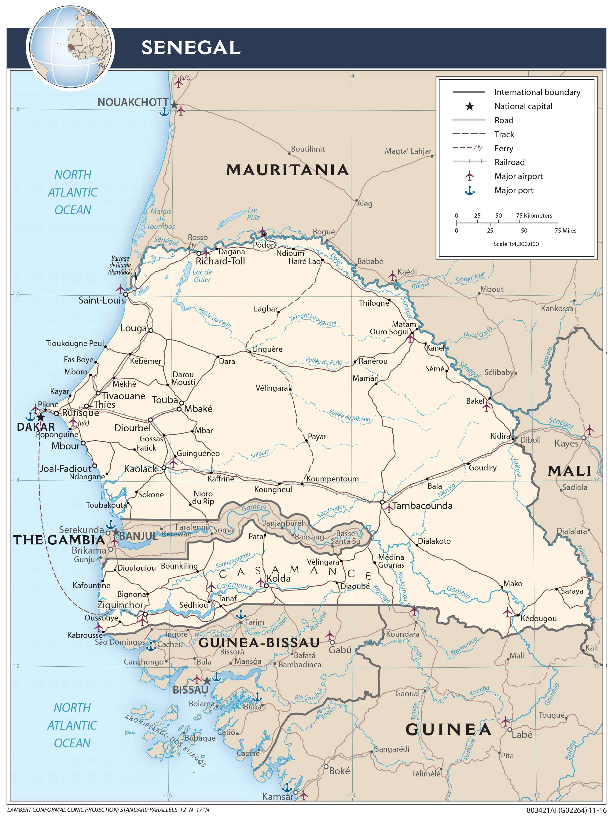
Transportation Map of Senegal
Senegal Satellite Map