Kyrgyzstan, a landlocked country, covers an area of 199,951 sq. km in Central Asia.
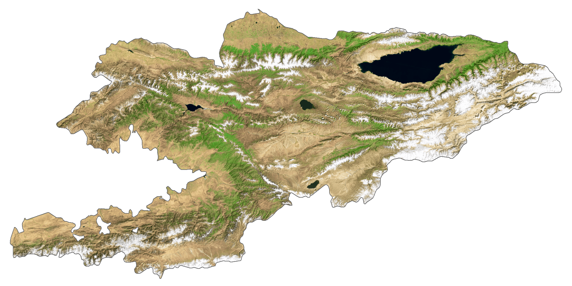
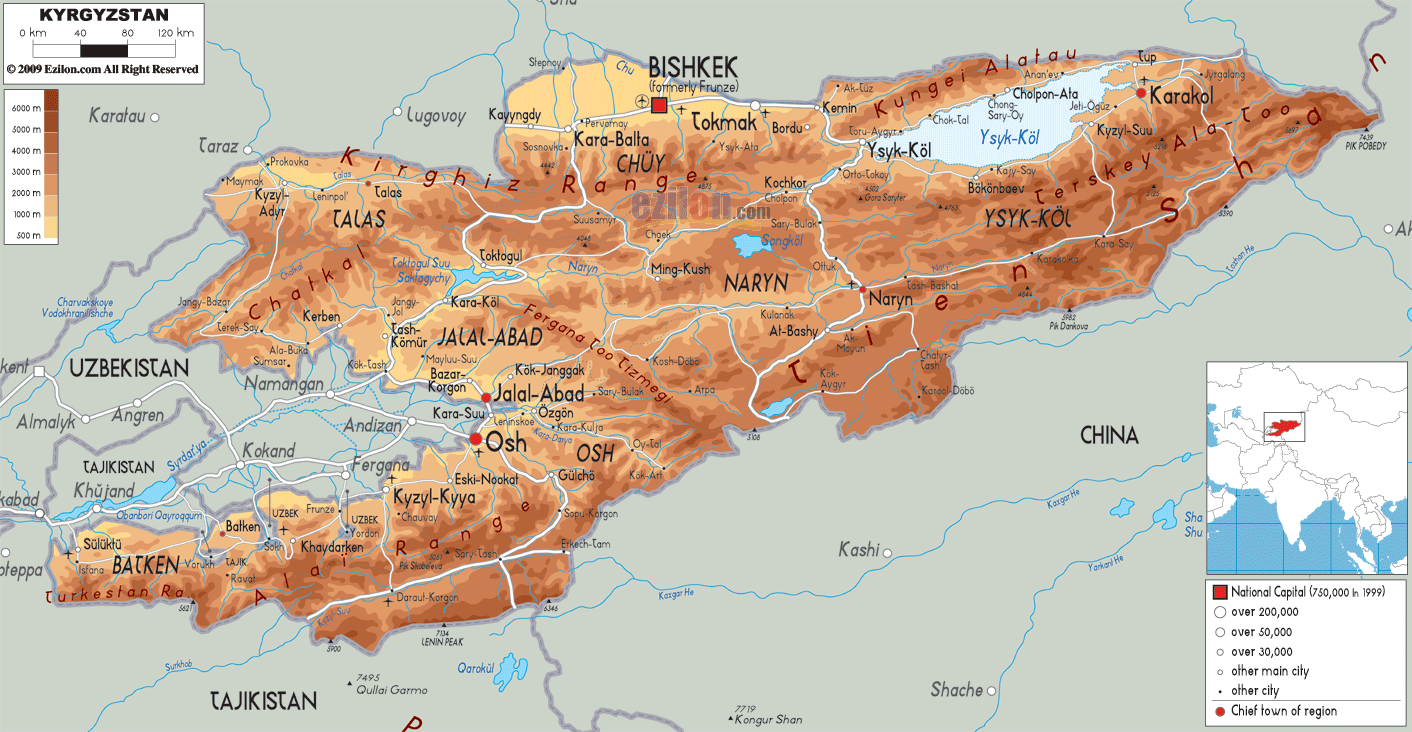
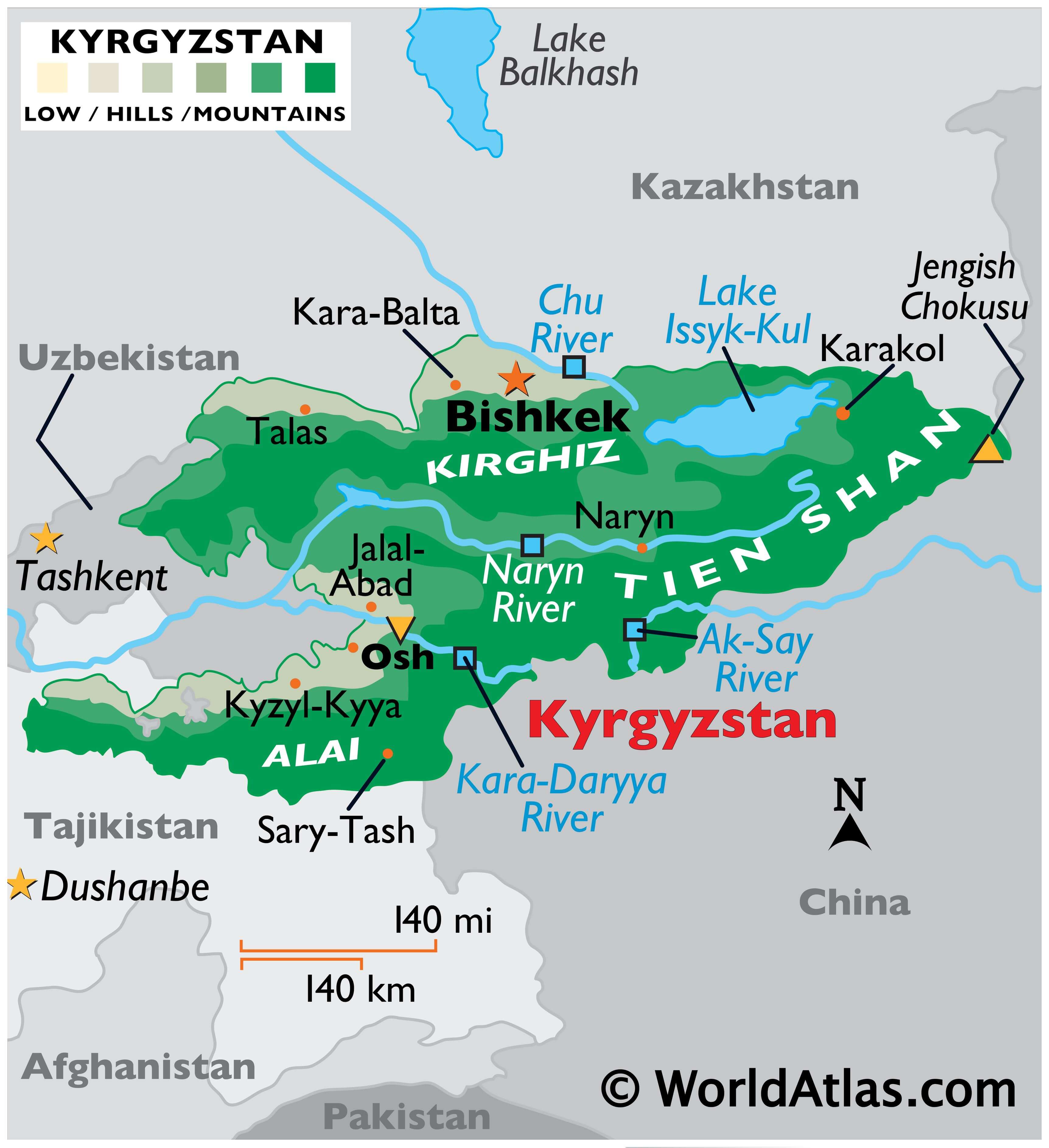
As observed on the map above, over 90% of Kyrgyzstan is dominated by massive, rugged mountain ranges, including the Alai, Kirghiz, and Tien Shan, and their associated valleys and basins. Large areas of those mountain regions are covered by glaciers.
A few flat areas (lower valleys) are found in the north and far southwest, but almost 35% of the land is higher than 9,842 ft. (3,000 m) above sea level.
Kyrgyzstan’s highest point (marked on the map by a yellow upright triangle) is Jengish Chokusu which peaks at 24,406 ft. (7,439 m).
Dozens and dozens of rivers flow from the upper reaches of the mountains; the most significant ones include the Al-Say, Chu, Kara Darya, and Naryn. Issyk-Kul is the world’s second-largest alpine lake.
The Kara Darya River has the lowest point of Kyrgyzstan at 132 m (433 ft) above sea level.
| Flag: |  |
|---|---|
| Legal Name: | Kyrgyz Republic |
| Capital Value: | Bishkek |
| Largest City: |
Bishkek (1,038,429) |
| Official languages: |
|
| Demonym(s): | Kyrgyz |
| Government: | Unitary presidential republic |
| Legislature: | Supreme Council |
| Total Area: | 199,951 km² |
| Land Area: | 191,801 km² |
| Water Area: | 8,150 km² |
| Population: | 6,456,900 |
| Density: | 27.4/km (71.0/sq mi) (109th) |
| GDP: | $8.45 Billion |
| GDP Per Capita: | $1,309.39 |
| Currency Value: | Soms (KGS) |
| Driving side: | right |
| Calling code: | +996 |
| Internet TLD: | .kg |
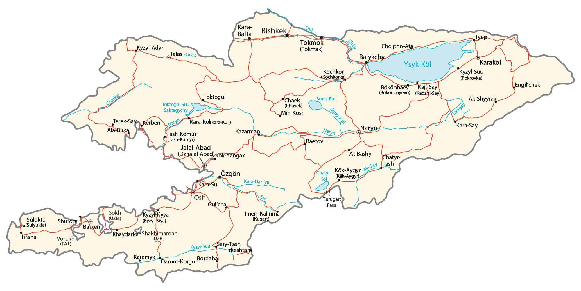
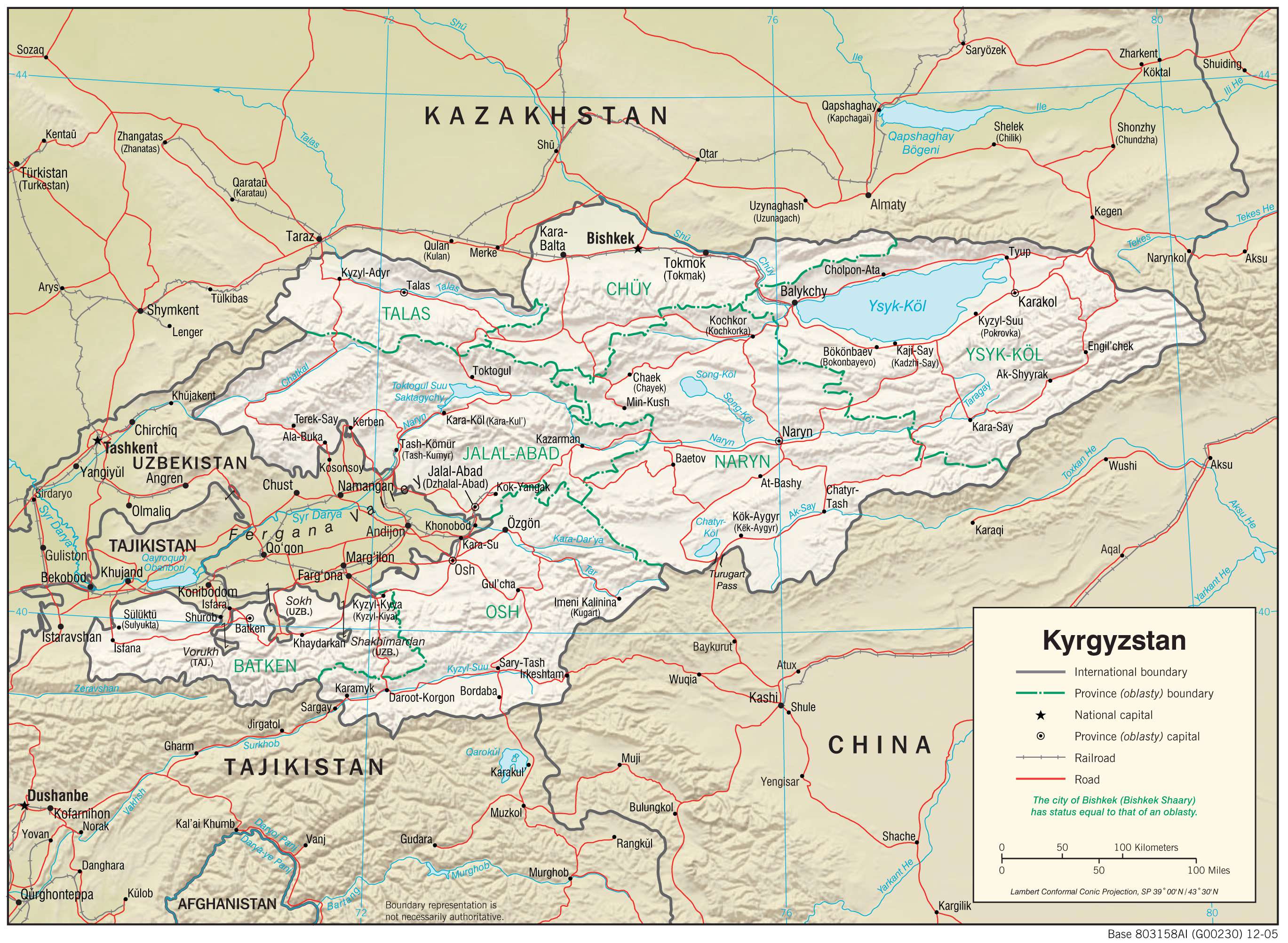
Kyrgyzstan is a landlocked country located in Central Asia, and it is home to some of the most beautiful landscapes in the world. From the towering Tien Shan Mountains and the deep Issyk-Kul Lake, to the sprawling cities and towns, Kyrgyzstan has something for everyone. This map of Kyrgyzstan provides an up-close look at the country, showing its cities, towns, highways, roads, lakes, and rivers. Utilizing satellite imagery, the physical map displays the country’s topography, including the Tien Shan Mountains and Issyk-Kul Lake.
Online Interactive Political Map
Click on ![]() to view map in "full screen" mode.
to view map in "full screen" mode.
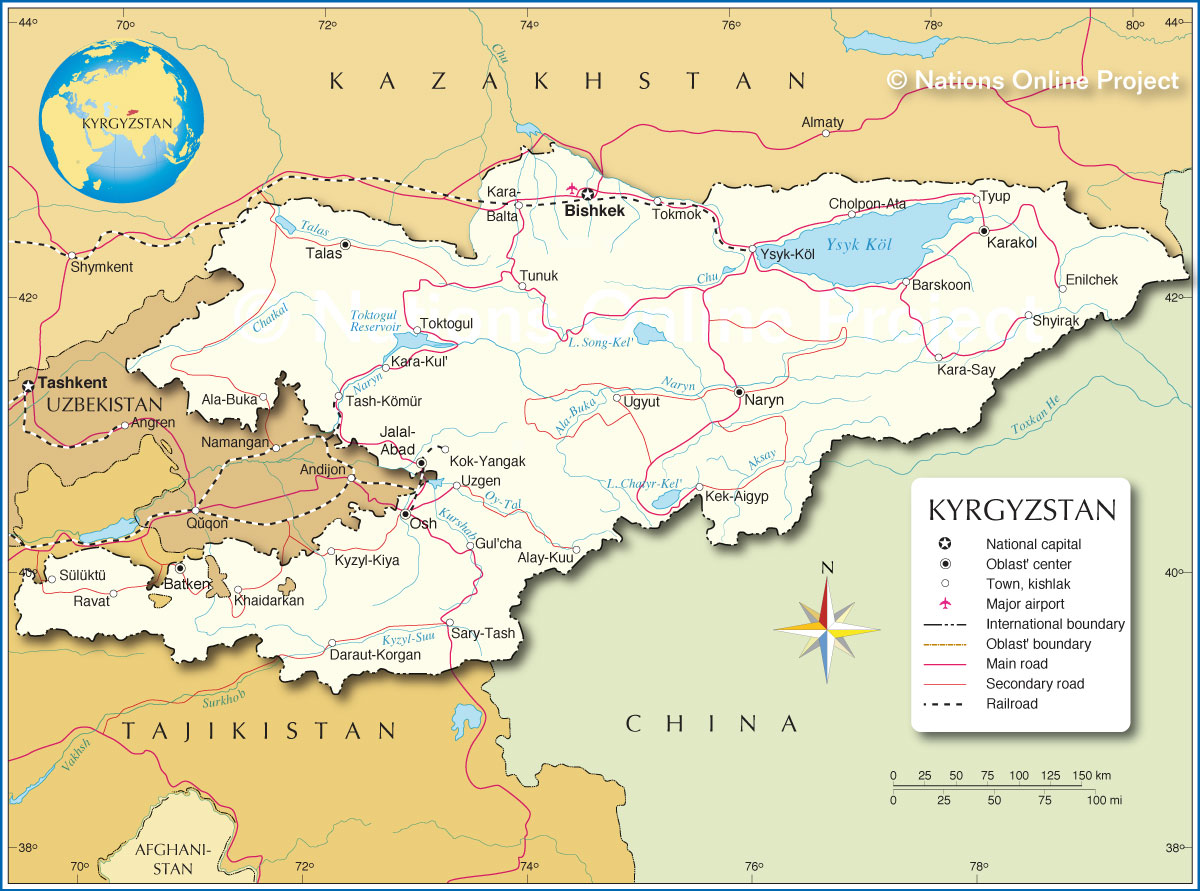
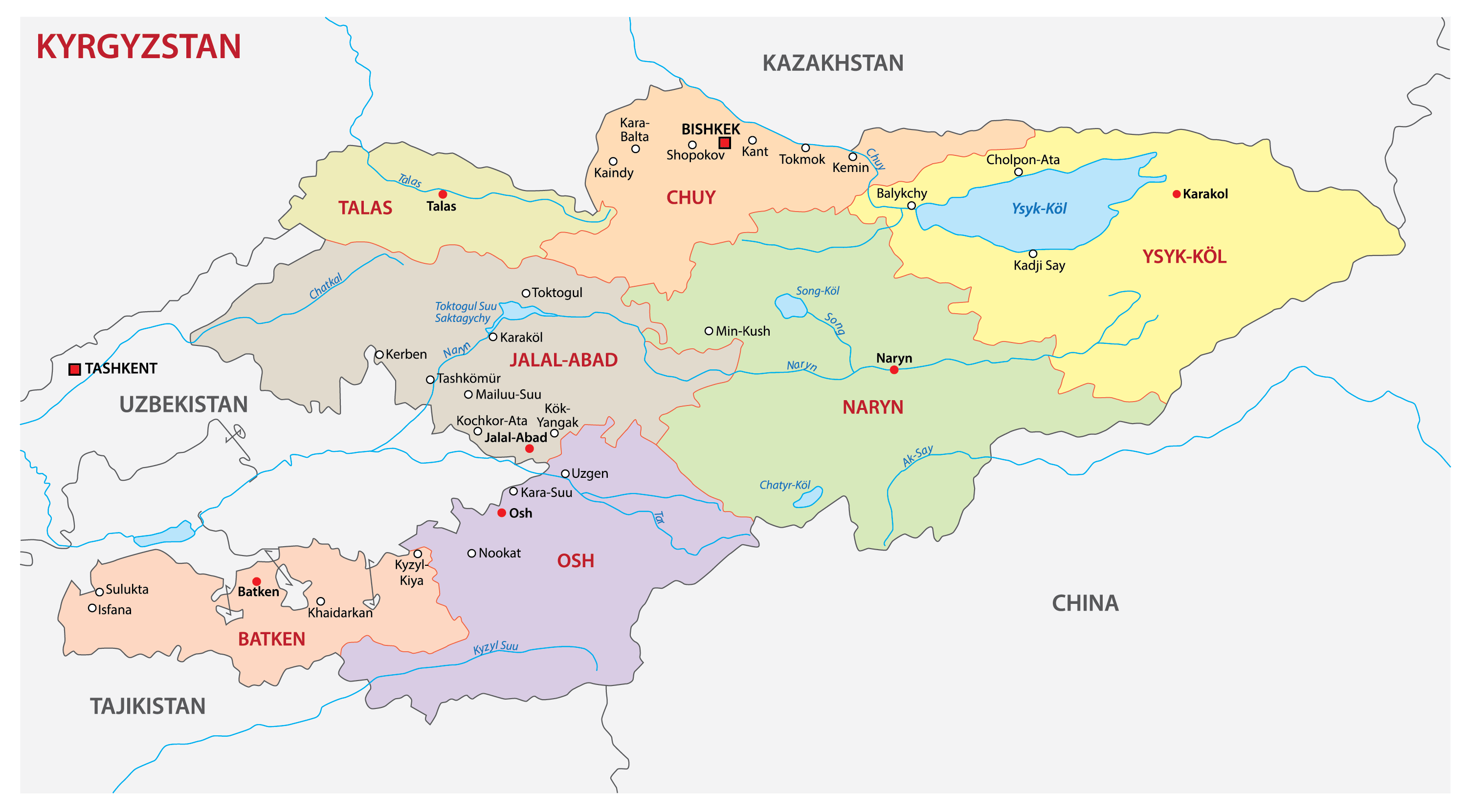
Kyrgyzstan (officially, The Kyrgyz Republic) is a sovereign country divided into 7 administrative regions (sing. oblast; plur. oblasttar) and two independent cities (shaar). In alphabetical order, the regions are: Batken, Chuy, Issyk-kul, Jalal-Abad, Naryn, Osh and Talas. Bishkek city and Osh city are the two independent cities. Each region is further subdivided into districts (raion).
Bishkek, the capital and largest city of Kyrgyzstan, is located in the northern part of the country. The ancient city of Osh, located in the Fergana Valley is the second largest city of Kyrgyzstan.
Location Maps
Where is Kyrgyzstan?
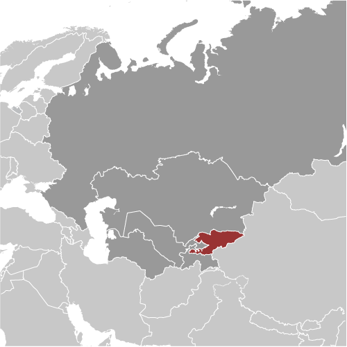
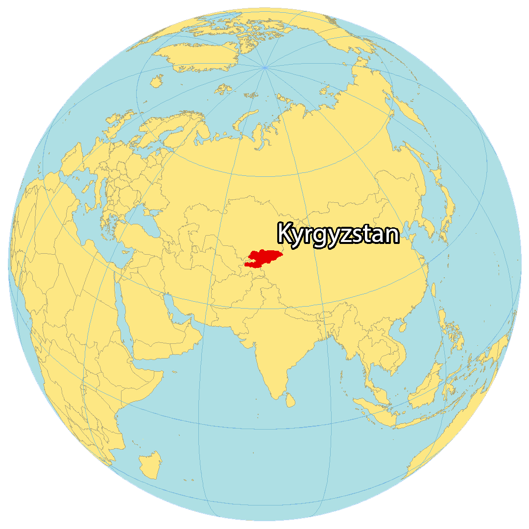
Kyrgyzstan is a landlocked country situated in Central Asia. It shares borders with Uzbekistan to the west, Tajikistan to the south, China to the east and Kazakhstan to the north. It is the smallest of the five newly independent Central Asian nations. The capital and largest city of Kyrgyzstan is Bishkek, while other major cities include Osh, Jalal-Abad and Karakol.
Kyrgyzstan’s landscape is predominantly mountainous, with the Tian Shan and Pamir mountain ranges forming a majority of the country’s borders. Lake Issyk-Kul is the largest lake in Kyrgyzstan and the second-largest mountain lake in the world after Titicaca, which is located between Peru and Bolivia.

High Definition Political Map of Kyrgyzstan
History
Kyrgyzstan is a Central Asian country with a rich history dating back thousands of years. The Kyrgyz people are believed to have migrated to the region from Siberia in the 10th century. Throughout the centuries, various empires and kingdoms, such as the Mongol Empire, the Timurid Empire, and the Kazakh Khanate, ruled over the region.
In the 19th century, Kyrgyzstan came under the control of the Russian Empire. During the Soviet era, the country was a part of the USSR and experienced rapid modernization and industrialization. However, the Soviet regime also imposed strict controls on political and social life in the country.
Following the collapse of the Soviet Union in 1991, Kyrgyzstan declared its independence. The country’s first president was Askar Akayev, who held office from 1991 until 2005. During his presidency, Kyrgyzstan struggled with economic and political instability, including corruption, poverty, and political violence.
In 2005, a popular uprising known as the Tulip Revolution ousted Akayev from power. In the following years, Kyrgyzstan experienced further political turmoil and violence, including ethnic clashes between Kyrgyz and Uzbek communities.
In 2010, another popular uprising overthrew President Kurmanbek Bakiyev. Since then, Kyrgyzstan has undergone a period of political transition and democratic reforms. The country has also focused on developing its economy, particularly in the areas of tourism, agriculture, and mining.
Today, Kyrgyzstan is a parliamentary republic with a diverse population of around 6.5 million people. The country is known for its beautiful natural landscapes, including mountains, lakes, and forests, as well as its rich cultural heritage, which includes traditional nomadic customs and music.
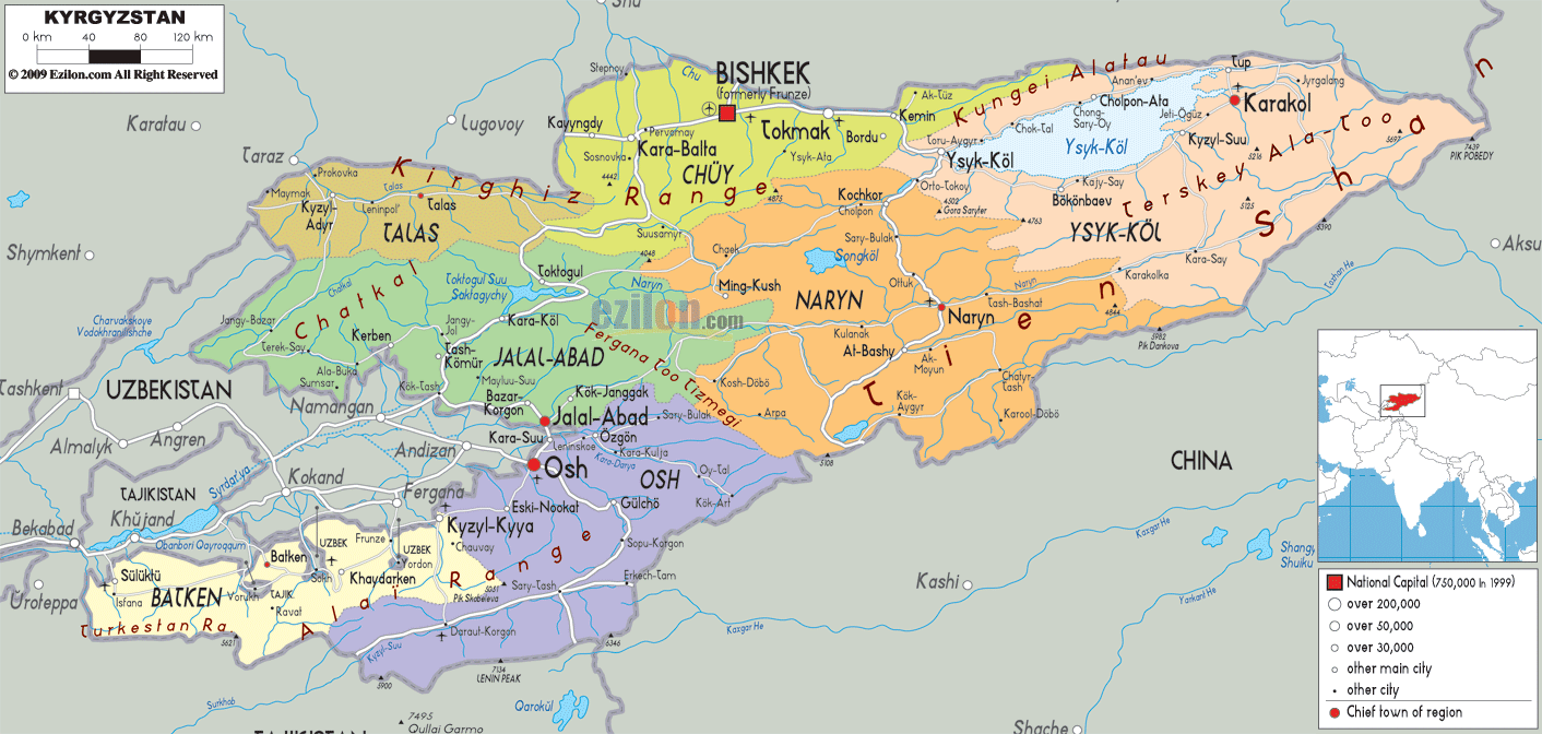
Physical Map of Kyrgyzstan
Geography
Kyrgyzstan is a landlocked country in Central Asia, bordering Kazakhstan, China, Tajikistan and Uzbekistan. It lies between latitudes 39° and 44° N, and longitudes 69° and 81° E. It is farther from the sea than any other individual country, and all its rivers flow into closed drainage systems which do not reach the sea. The mountainous region of the Tian Shan covers over 80% of the country (Kyrgyzstan is occasionally referred to as “the Switzerland of Central Asia”, as a result), with the remainder made up of valleys and basins.
Issyk-Kul Lake, or Ysyk-Köl in Kyrgyz, in the north-eastern Tian Shan is the largest lake in Kyrgyzstan and the second largest mountain lake in the world after Titicaca. The lowest point is in Kara-Daryya (Karadar’ya) at 132 meters and the highest peaks are in the Kakshaal-Too range, forming the Chinese border. Peak Jengish Chokusu, at 7,439 m (24,406 ft), is the highest point and is considered by geologists to be the northernmost peak over 7,000 m (22,966 ft) in the world. Heavy snowfall in winter leads to spring floods which often cause serious damage downstream. The runoff from the mountains is also used for hydro-electricity.
Kyrgyzstan has significant deposits of metals including gold and rare-earth metals. Due to the country’s predominantly mountainous terrain, less than 8% of the land is cultivated, and this is concentrated in the northern lowlands and the fringes of the Fergana Valley.
Bishkek in the north is the capital and largest city, with 937,400 inhabitants (as of 2015). The second city is the ancient town of Osh, located in the Fergana Valley near the border with Uzbekistan. The principal river is the Kara Darya, which flows west through the Fergana Valley into Uzbekistan. Across the border in Uzbekistan it meets another major Kyrgyz river, the Naryn.
The confluence forms the Syr Darya, which originally flowed into the Aral Sea. As of 2010, it no longer reaches the sea, as its water is withdrawn upstream to irrigate cotton fields in Tajikistan, Uzbekistan, and southern Kazakhstan. The Chu River also briefly flows through Kyrgyzstan before entering Kazakhstan.
Kyrgyzstan contains seven terrestrial ecosystems: Tian Shan montane conifer forests, Alai-Western Tian Shan steppe, Gissaro-Alai open woodlands, Tian Shan foothill arid steppe, Pamir alpine desert and tundra, Tian Shan montane steppe and meadows, and Central Asian northern desert. It had a 2019 Forest Landscape Integrity Index mean score of 8.86/10, ranking it 13th globally out of 172 countries.
Climate
The climate varies regionally. The low-lying Fergana Valley in the southwest is subtropical and extremely hot in summer, with temperatures reaching 40 °C (104 °F) The northern foothills are temperate and the Tian Shan varies from dry continental to polar climate, depending on elevation. In the coldest areas temperatures are sub-zero for around 40 days in winter, and even some desert areas experience constant snowfall in this period. In the lowlands the temperature ranges from around −6 °C (21 °F) in January to 24 °C (75 °F) in July.
Enclaves and exclaves
There is one exclave, the tiny village of Barak (population 627), in the Fergana Valley. The village is surrounded by Uzbek territory. It is located on the road from Osh (Kyrgyzstan) to Khodjaabad (Uzbekistan) about 4 kilometres (2 miles) north-west from the Kyrgyz–Uzbek border in the direction of Andijan. Barak is administratively part of Kara-Suu District in Kyrgyzstan’s Osh Region.
There are four Uzbek enclaves within Kyrgyzstan. Two of them are the towns of Sokh, with an area of 325 km (125 sq mi) and a population of 42,800 in 1993—although some estimates go as high as 70,000 (99% are Tajiks, the remainder Uzbeks); and Shakhimardan (also known as Shahimardan, Shohimardon, or Shah-i-Mardan, area 90 km (35 sq mi) and a population of 5,100 in 1993; 91% are Uzbeks, the remainder Kyrgyz); the other two are the tiny territories of Chong-Kara (roughly 3 km (2 mi) long by 1 km (0.6 mi) wide) and Jangy-ayyl (a dot of land barely 2–3 km (1–2 mi) across). Chong-Kara is on the Sokh river, between the Uzbek border and the Sokh enclave. Jangy-ayyl is about 60 kilometres (37 mi) east of Batken, in a northward projection of the Kyrgyz-Uzbek border near Khalmion.
There are also two enclaves belonging to Tajikistan on the Kyrgyz-Tajik border: Vorukh (exclave area between 95–130 km (37–50 sq mi), population estimated between 23,000 and 29,000, 95% Tajiks and 5% Kyrgyz, distributed among 17 villages), located 45 kilometres (28 mi) south of Isfara on the right bank of the river Karavshin, and a small settlement Lolazor (Western Qalacha or Kayragach) near the Kyrgyz railway station of Kairagach.
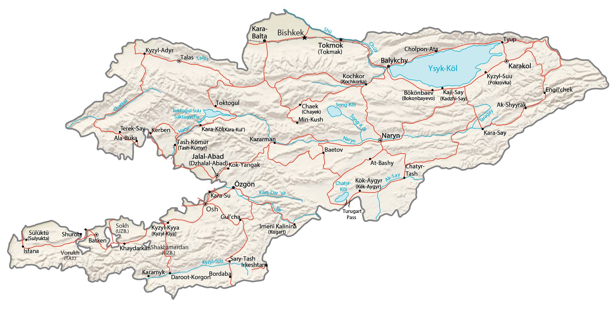
Transportation Map of Kyrgyzstan

Kyrgyzstan Satellite Map