Burkina Faso is a West African landlocked country with an area of 274,200 sq. km.
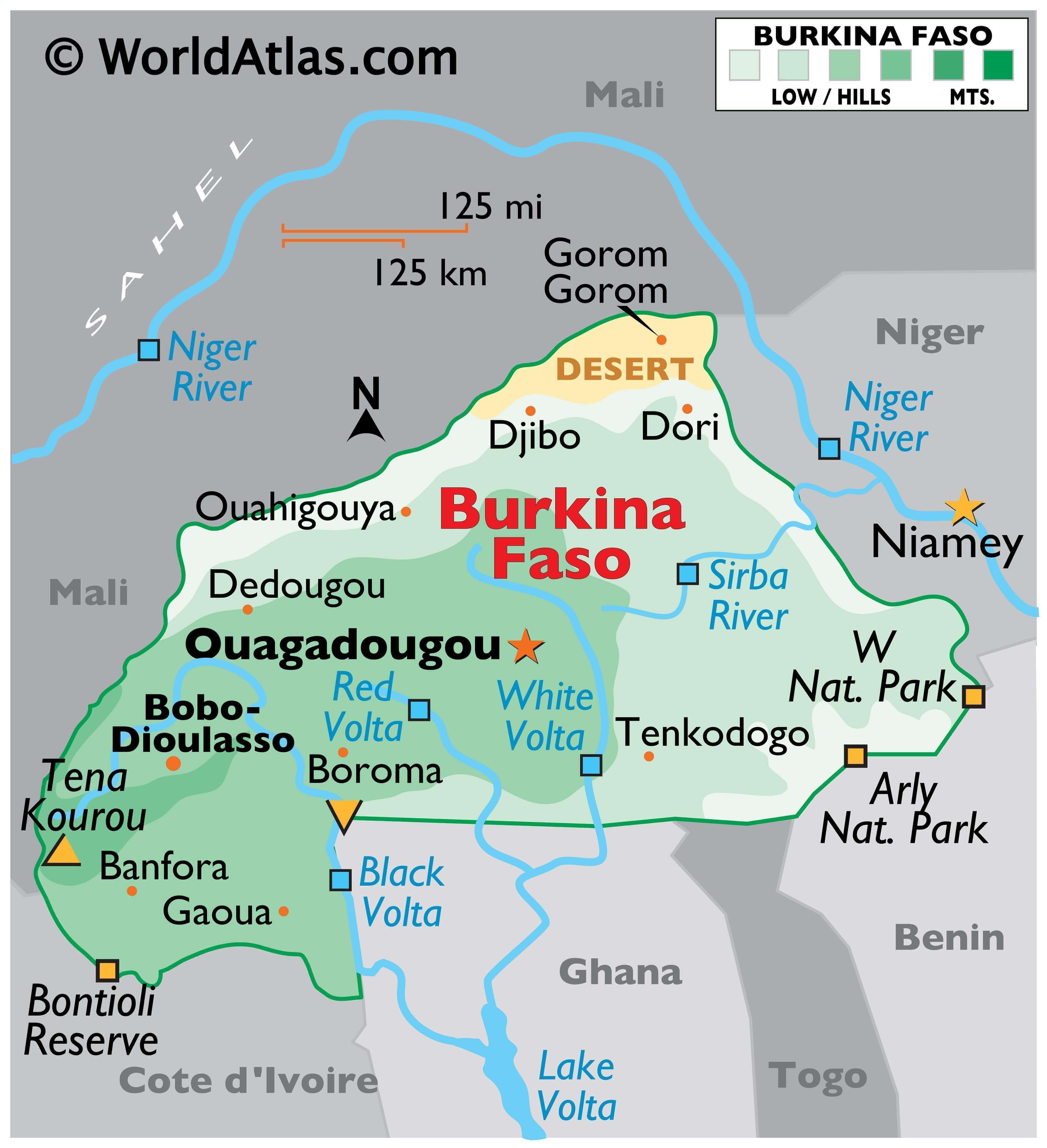
Burkina Faso is located on a massive plateau that is cut deeply by the three main rivers of Black Volta, White Volta, and Red Volta. As visible on the physical map above, these rivers enter Ghana to converge and form the Volta River.
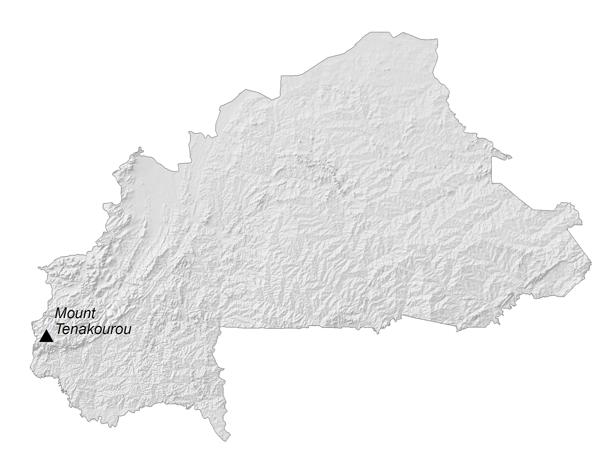
To the southwest of Burkina Faso is a sandstone plateau that is bordered by the Banfora Escarpment. As can be seen on the map, this region hosts the country’s tallest point, the 747 m high Tena Kouron.
The lowest point of the country is the Mouhoun (Black Volta) River at 656 ft. (200 m)
As marked on the map, to the north there is a small expanse of desert.
Out of all the rivers in Burkina Faso, the Black Volta is one of two that flows year-round, with the second being the Komoe. The Niger River basin drains 27% of the surface of the country. In addition to the rivers, Burkina Faso contains numerous lakes and large ponds; even still, water shortages are a consistent problem, especially in the north as most sources are seasonal.
| Flag: |  |
|---|---|
| Legal Name: | Burkina Faso |
| Capital Value: | Ouagadougou |
| Official languages: | French |
| Demonym(s): | Burkinabè |
| Government: | Unitary state under a military junta |
| Legislature: | Transitional Legislative Assembly |
| Total Area: | 274,200 km² |
| Land Area: | 273,800 km² |
| Water Area: | 400 km² |
| Population: | 20,321,378 |
| Density: | 64/km (165.8/sq mi) |
| GDP: | $15.75 Billion |
| GDP Per Capita: | $774.84 |
| Currency Value: | Communaute Financiere Africaine francs (XOF) |
| Driving side: | right |
| Calling code: | +226 |
| Internet TLD: | .bf |
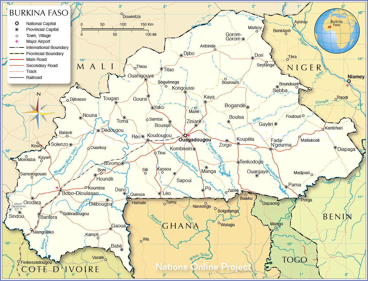
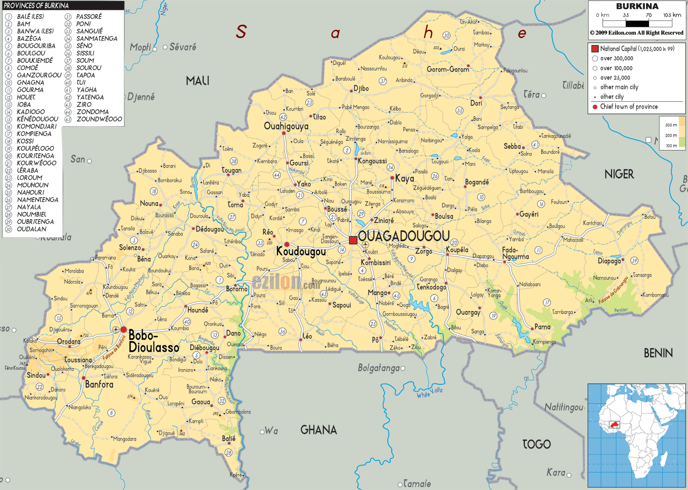
Explore the beauty of Burkina Faso with this detailed map. It features major cities, towns, rivers, and highways, as well as an elevation map and satellite imagery of the country, which is located in Western Africa.
Online Interactive Political Map
Click on ![]() to view map in "full screen" mode.
to view map in "full screen" mode.
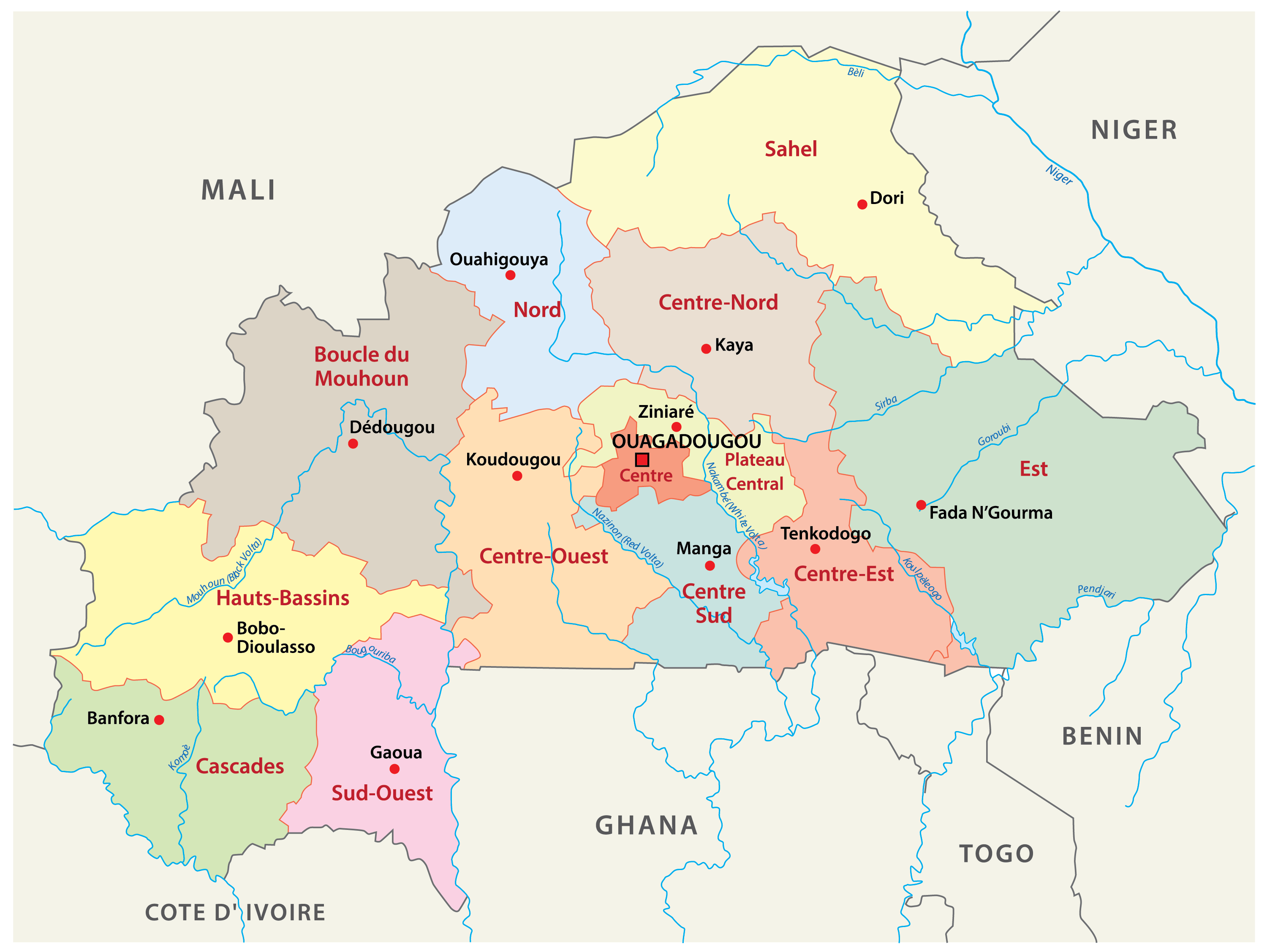
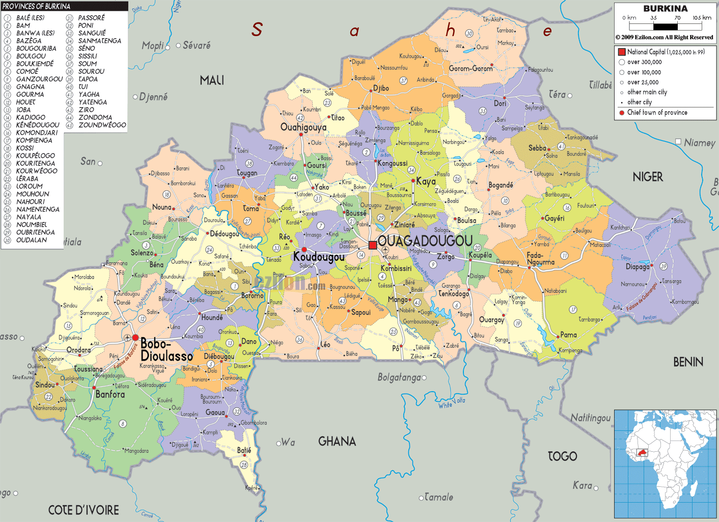
Burkina Faso is divided into 13 regions which are then divided into 45 provinces and subdivided into 351 communes.
The 13 regions are; Boucle du Mouhoun, Cascades, Centre, Centre-Est, Centre-Nord, Centre-Ouest, Centre-Sud, Est, Hauts-Bassins, Nord, Plateau-Central, Sahel, Sud-Ouest. With an area of 46,694 sq. km, Est is the largest region while Centre is the most populous one. Ouagadougou, the national capital city, is also located in the Centre Region.
Location Maps
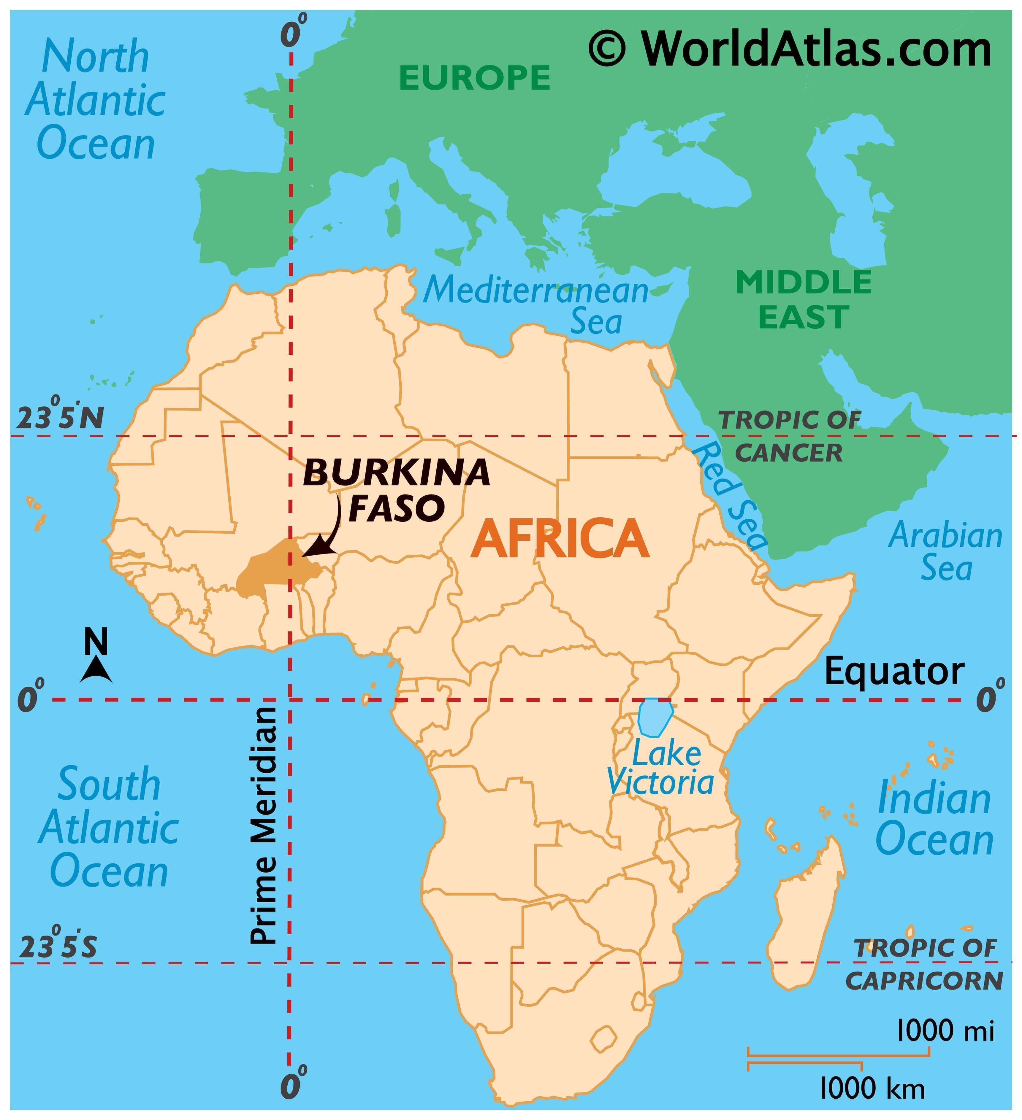
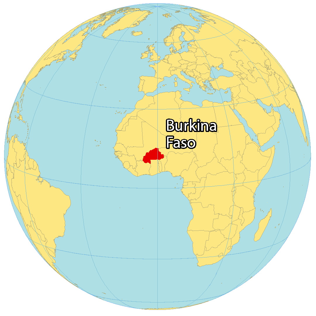
Where is Burkina Faso?
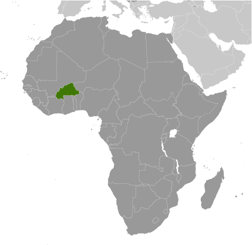
Burkina Faso is a landlocked country located in Western Africa. It borders Mali to the northwest, Niger to the northeast, as well as Benin, Togo, Ghana, and the Ivory Coast to the south. Approximately 21.4 million people call this country home.
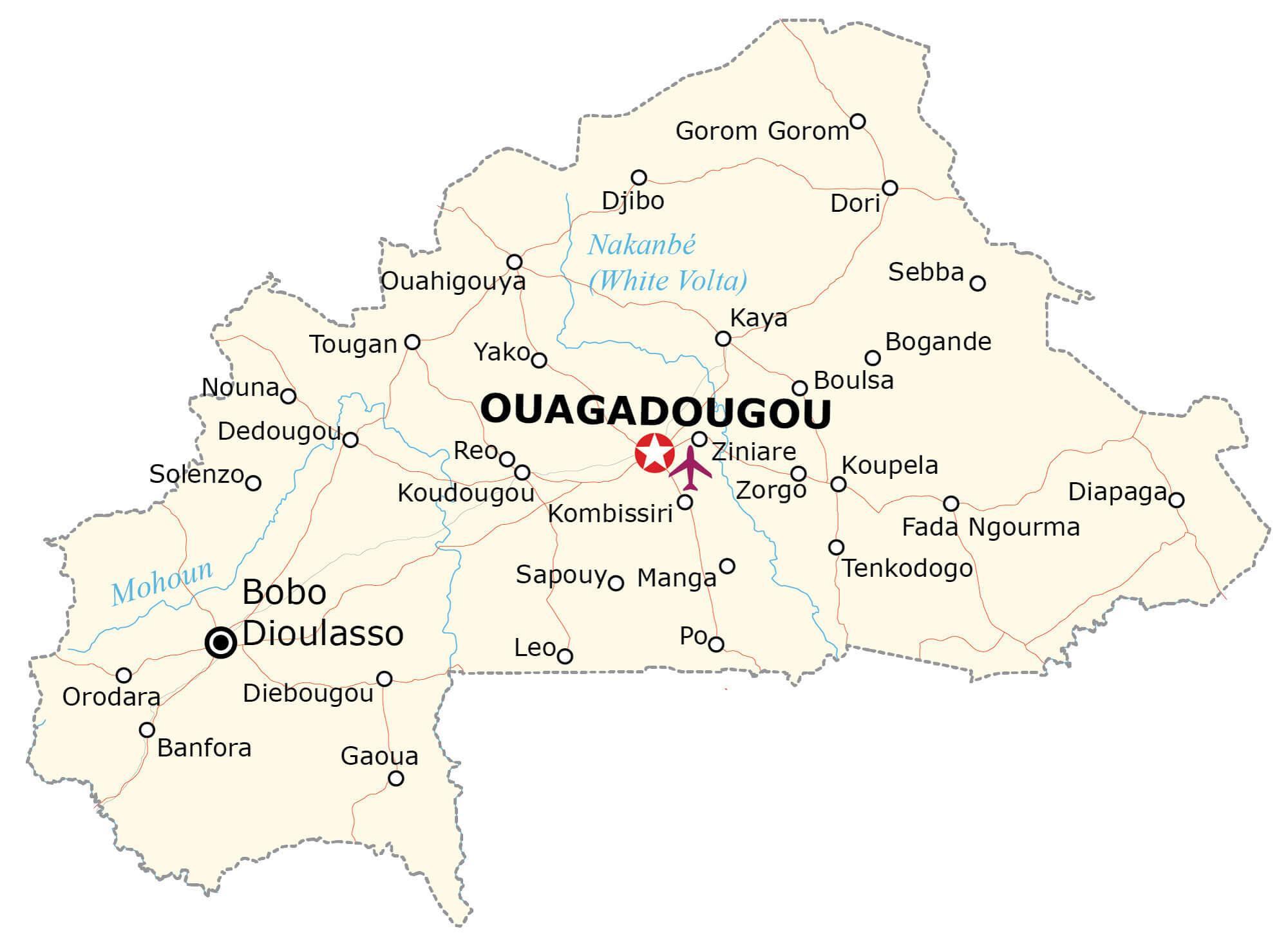
Ouagadougou is the capital and largest city of Burkina Faso with about 2.5 million people living there. Prior to 1984, the country was known as the Republic of Upper Volta until it changed its name to the current one.
High Definition Political Map of Burkina Faso
Physical Map of Burkina Faso
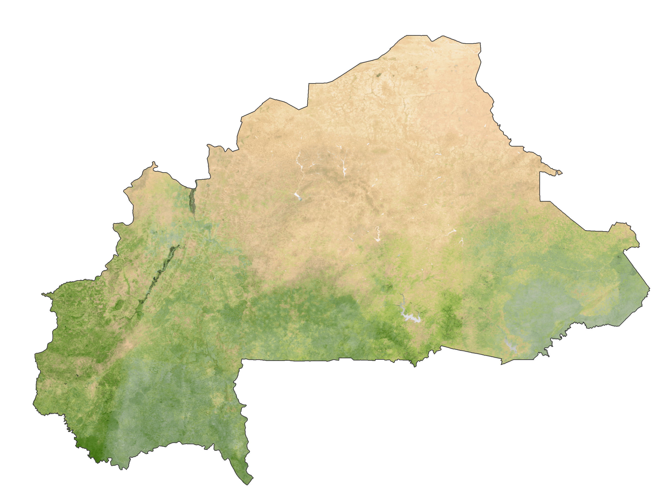
Burkina Faso Satellite Map
Elevation Map