The Nordic island nation of Iceland occupies an area of 103,000 km2 (40,000 sq miles) in the North Atlantic Ocean. The island owes its existence to a large volcanic fissure in the Mid-Atlantic Ridge, where the Eurasian and American tectonic plates meet. Even today, the country is growing by about 5 cm per year, as it splits wider at the points where two tectonic plates meet.
Iceland is largely an arctic desert punctuated by mountains, glaciers, geysers, hot springs, volcanoes, and waterfalls.
Most of the vegetation and agricultural areas are in the lowlands close to the coastline.
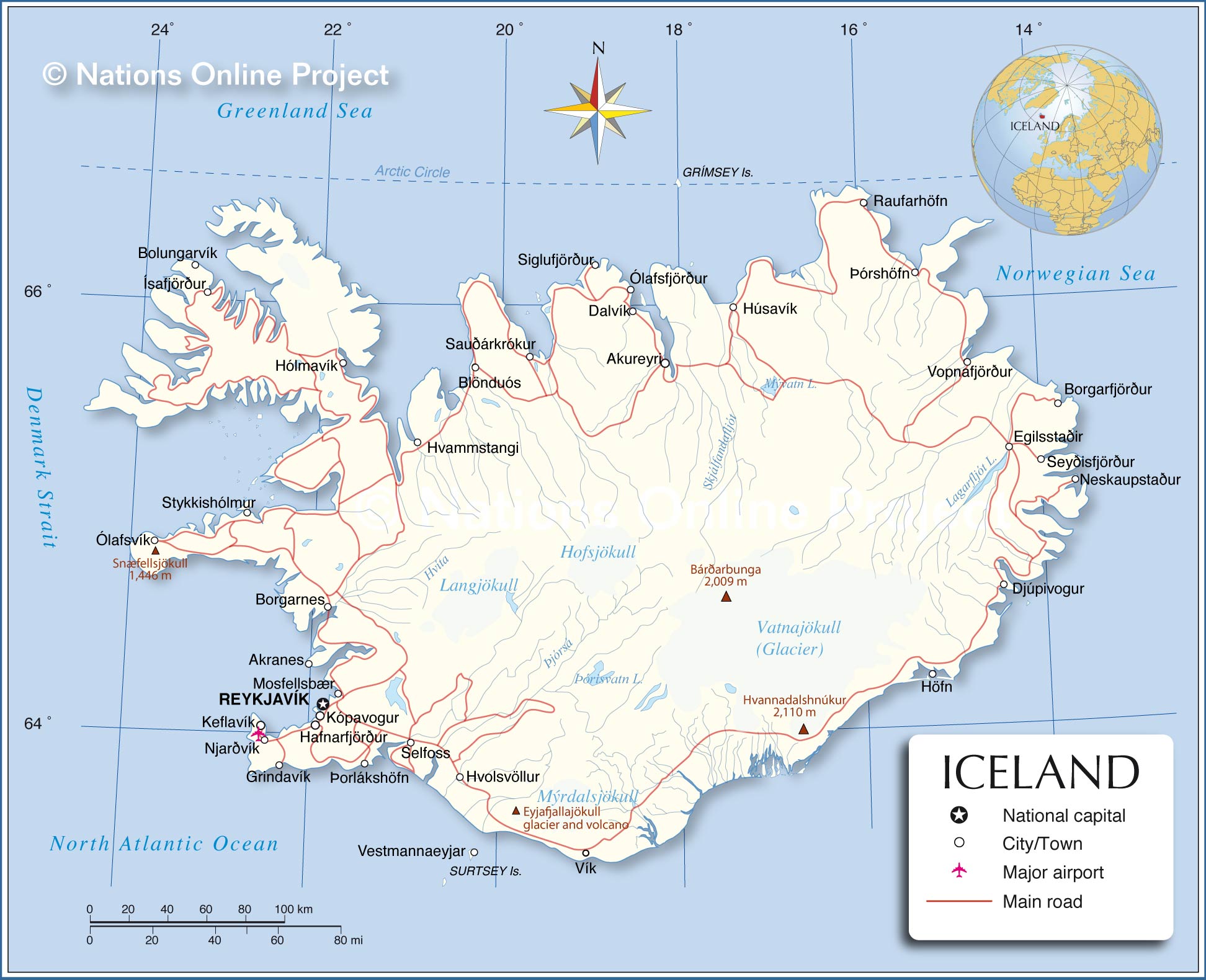
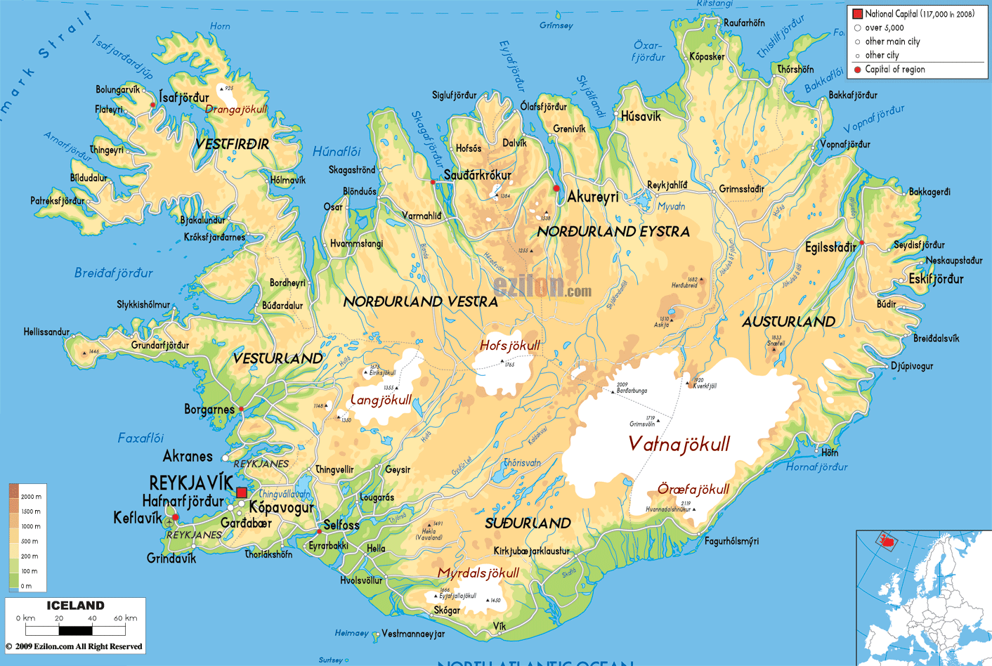
As can be observed on the physical map of Iceland, the country’s most distinctive features are the glaciers that cover over 4,600 sq. mi (11,922 sq. km) or 11. 5% of the total area of the country. During the past few decades, however, they’ve markedly thinned and retreated owing to a milder climate.
By far the largest of the glaciers is the Vatnajokull in southeast Iceland, with an area of 3,240 sq. mi (8,400 sq. km). The Vatnajokull glacier is equal in size to all the glaciers on the European mainland put together and reaches a thickness of 3000 ft. (1 km).
The highest point in Iceland is Hvannadalshnukur, a peak on the edge of the Öræfajökull Volcano, which rises 6,922 feet (2,110 m). The location of this point have been marked on the map by a yellow upright triangle.
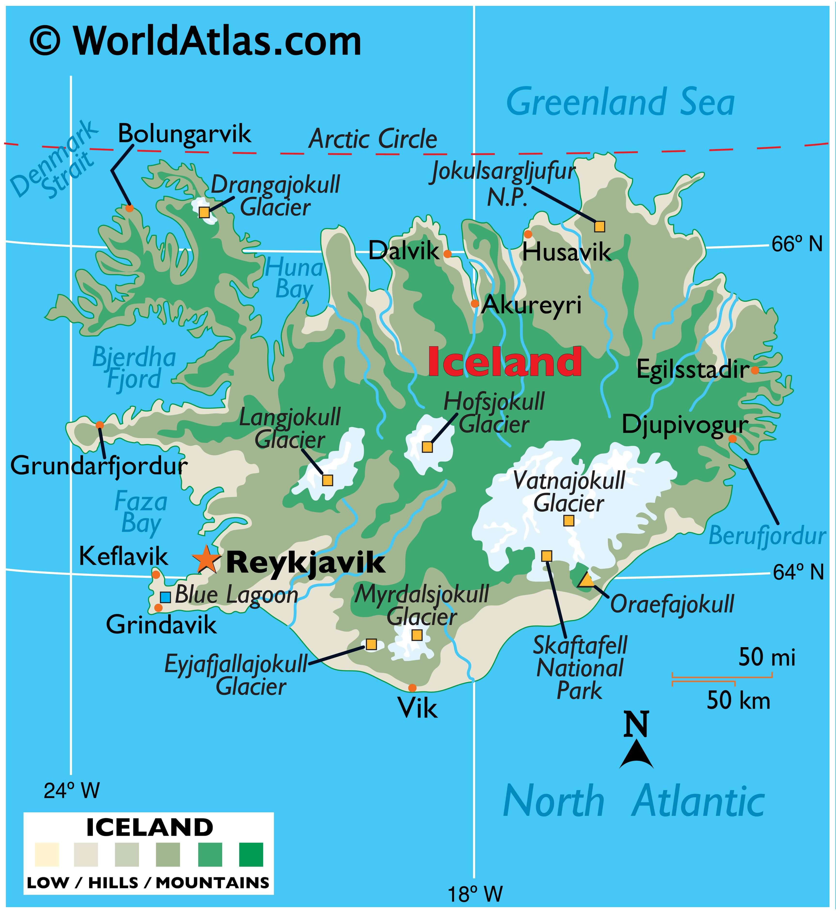
And speaking of Volcanoes, on March 21, 2010, the Eyjafjallajökull Volcano in southern Iceland erupted for the first time since 1821, forcing 600 people to flee their homes. Further eruptions in April forced hundreds of people to abandon their homes. And in fact, the resultant cloud of volcanic ash brought major disruption to air travel across Europe.
Due to its stunning geographical features including mountains, glaciers, waterfalls, volcanoes and the pristine environment, Iceland is a great tourist destination for nature lovers.
| Flag: |  |
|---|---|
| Legal Name: | Republic of Iceland |
| Capital Value: | Reykjavik |
| Demonym(s): |
|
| Government: | Unitary parliamentary republic |
| Legislature: | Alþingi |
| Total Area: | 103,000 km² |
| Land Area: | 100,250 km² |
| Water Area: | 2,750 km² |
| Population: | 361,313 |
| Density: | 3.66/km (9.5/sq mi) (240th) |
| GDP: | $24.19 Billion |
| GDP Per Capita: | $66,944.83 |
| Currency Value: | Icelandic kronur (ISK) |
| Driving side: | right |
| Calling code: | +354 |
| Internet TLD: | .is |
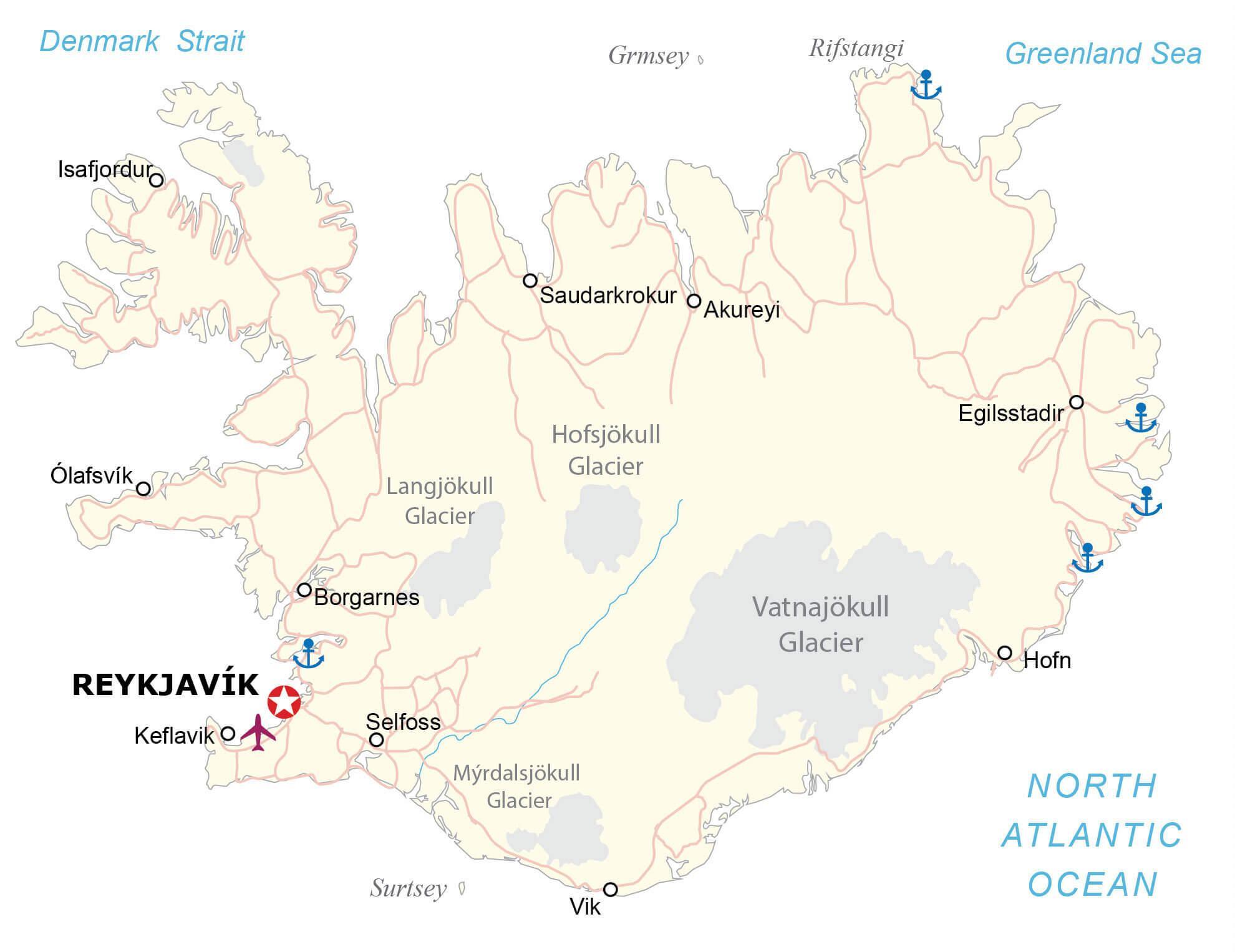
Whether you’re a fan of the breathtaking landscapes or the bustling cities, Iceland has something for everyone. This incredible country is full of unique geological formations and diverse landscapes. To better explore the area, check out this map of Iceland, which features the roads and cities that are situated along its borders. With a satellite and topographic map, you can get a better understanding of the area and plan your journey accordingly.
Online Interactive Political Map
Click on ![]() to view map in "full screen" mode.
to view map in "full screen" mode.
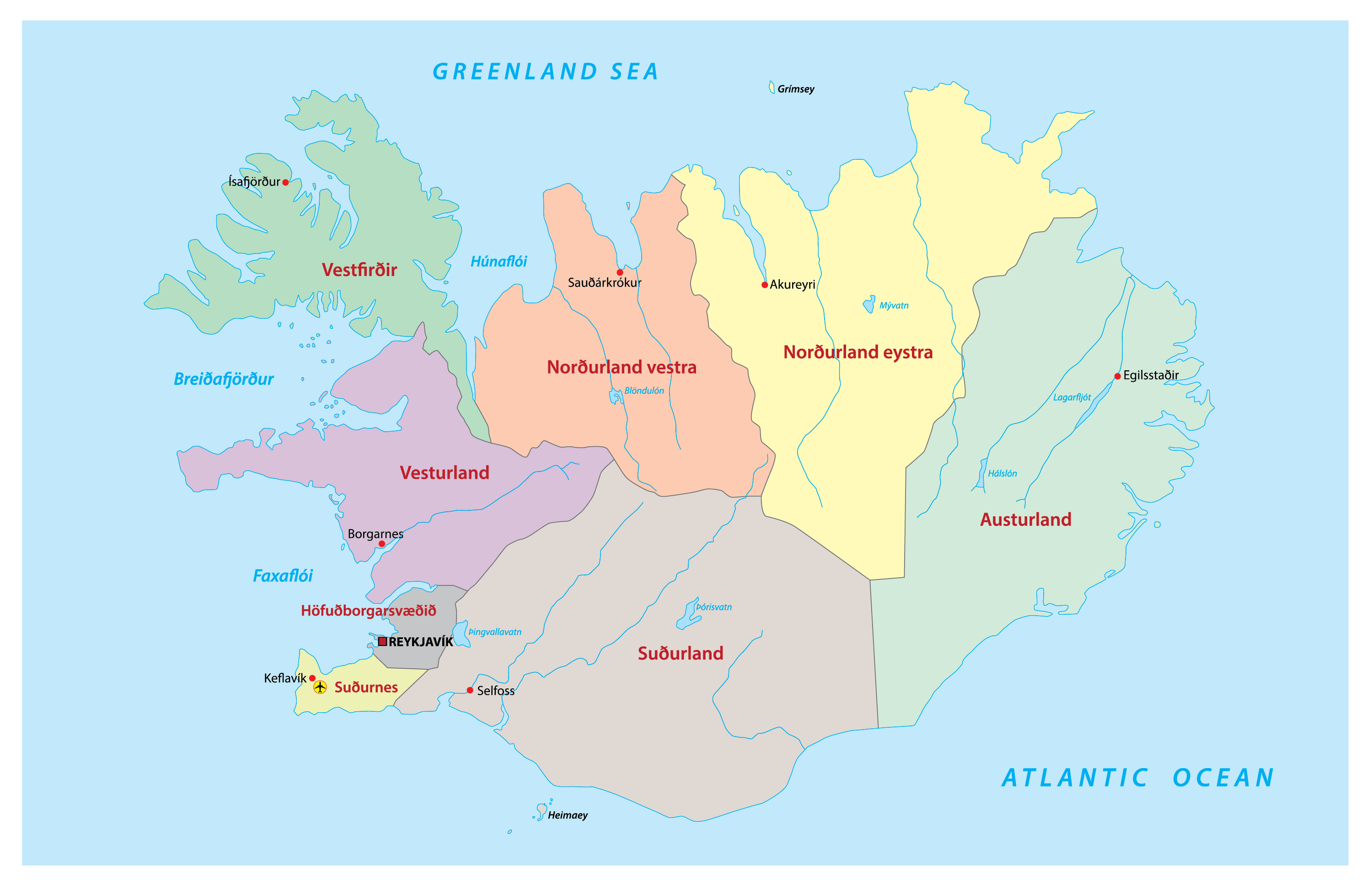
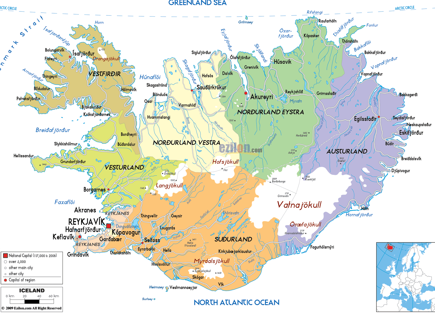
Iceland has 8 regions that are purely statistical divisions. These are 1. Capital Region Höfuðborgarsvæði 2. Southern Peninsula Suðurnes 3. Western Region Vesturland 4. Westfjords Vestfirðir 5. Northwestern Region Norðurland vestra 6. Northeastern Region Norðurland eystra 7. Eastern Region Austurland 8. Southern Region Suðurland
Iceland is divided into 74 municipalities as the first level administrative divisions (sveitarfelog, singular – sveitarfelagidh). In alphabetical order, these municipalities are: Akrahreppur, Akraneskaupstadhur, Akureyrarkaupstadhur, Arneshreppur, Asahreppur, Blaskogabyggdh, Blonduosbaer, Bolungarvikurkaupstadhur, Borgarbyggdh, Borgarfjardharhreppur, Breidhdalshreppur, Dalabyggdh, Dalvikurbyggdh, Djupavogshreppur, Eyjafjardharsveit, Eyja-og Miklaholtshreppur, Fjallabyggdh, Fjardhabyggdh, Fljotsdalsheradh, Fljotsdalshreppur, Floahreppur, Gardhabaer, Grimsnes-og Grafningshreppur, Grindavikurbaer, Grundarfjardharbaer, Grytubakkahreppur, Hafnarfjardharkaupstadhur, Helgafellssveit, Horgarsveit, Hrunamannahreppur, Hunathing Vestra, Hunavatnshreppur, Hvalfjardharsveit, Hveragerdhisbaer, Isafjardharbaer, Kaldrananeshreppur, Kjosarhreppur, Kopavogsbaer, Langanesbyggdh, Mosfellsbaer, Myrdalshreppur, Nordhurthing, Rangarthing Eystra, Rangarthing Ytra, Reykholahreppur, Reykjanesbaer, Reykjavikurborg, Sandgerdhisbaer, Seltjarnarnesbaer, Seydhisfjardharkaupstadhur, Skaftarhreppur, Skagabyggdh, Skeidha-og Gnupverjahreppur, Skorradalshreppur, Skutustadhahreppur, Snaefellsbaer, Strandabyggdh, Stykkisholmsbaer, Sudhavikurhreppur, Svalbardhshreppur, Svalbardhsstrandarhreppur, Sveitarfelagidh Arborg, Sveitarfelagidh Gardhur, Sveitarfelagidh Hornafjordhur, Sveitarfelagidh Olfus, Sveitarfelagidh Skagafjordhur, Sveitarfelagidh Skagastrond, Sveitarfelagidh Vogar, Talknafjardharhreppur, Thingeyjarsveit, Tjorneshreppur, Vestmannaeyjabaer, Vesturbyggdh and Vopnafjardharhreppur.
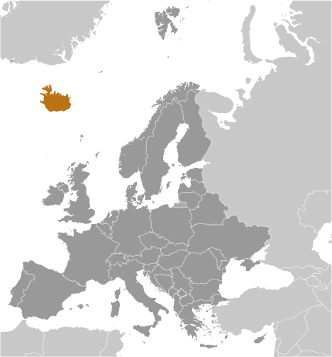
With an area of 103,000 sq. km, Iceland is the 18th largest island in the world and the 2nd largest island in Europe. It is the most sparsely populated and the westernmost country in Europe. Located along the south western shores of the country, in the Faxa Bay area is, Reykjavik – the capital and the largest city of Iceland. It is the northernmost capital city of a Sovereign State in the world and one of the smallest capitals of Europe. Reykjavik is a major fishing port and the country’s chief administrative, cultural, industrial and economic centers.
Location Maps
Where is Iceland?
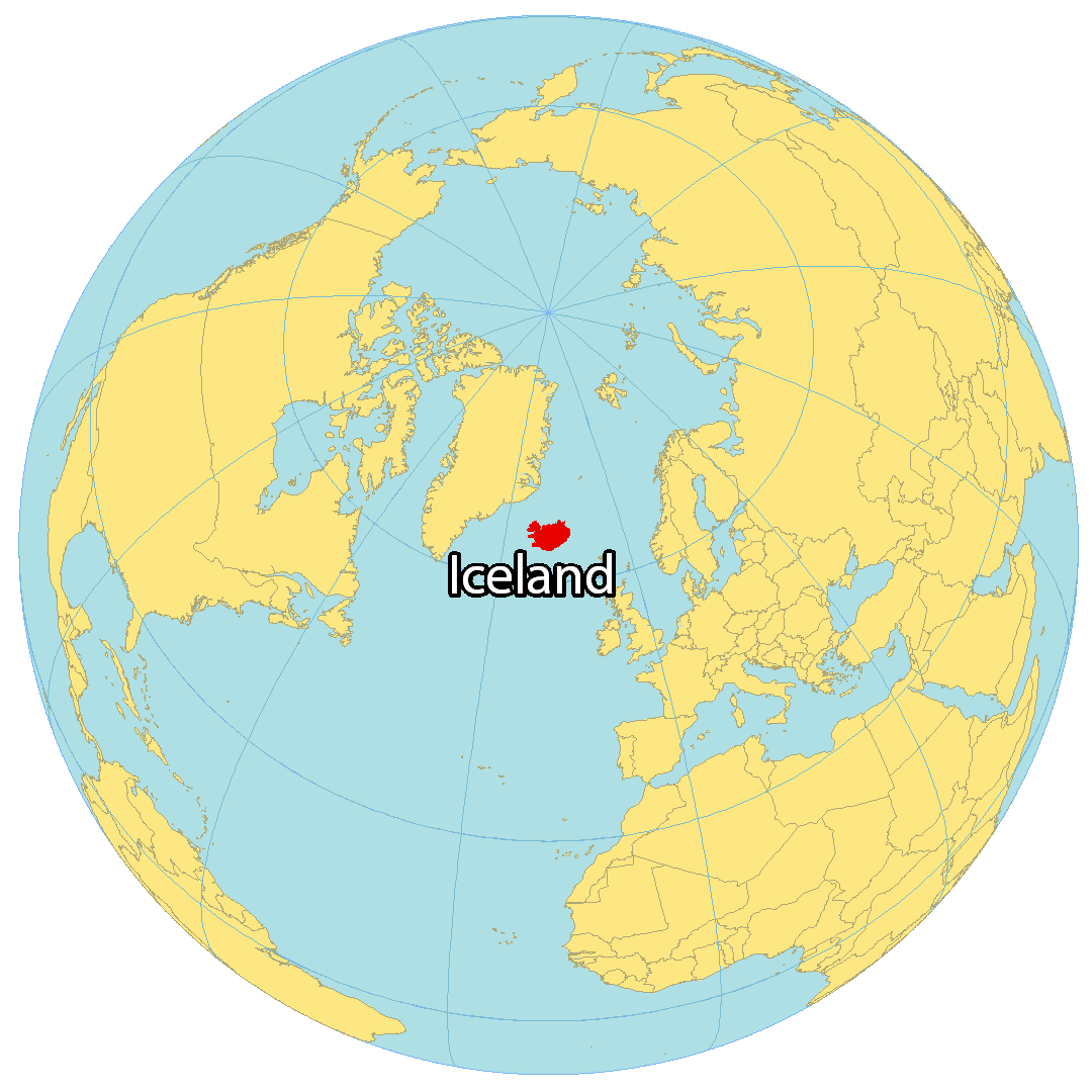
Iceland is a Nordic island country situated in the North Atlantic Ocean. With an area of 103,000 km² and a population of around 370,000, it is one of the most sparsely populated countries in Europe. It lies just below the Arctic Circle, and is northwest of the United Kingdom. Its closest neighboring island is Greenland, which is a distance of about 300 kilometers away. Iceland is the westernmost European country, with Reykjavik being the northernmost capital in the world.
Reykjavik is the capital and largest city of Iceland, with the city and the surrounding areas in the southwest of the country home to over two-thirds of the population. Iceland is geologically and volcanically active, with its interior consisting of a plateau characterized by lava fields, mountains, and glaciers. Many glacial rivers flow to the sea through the lowlands.
High Definition Political Map of Iceland
Physical Map of Iceland
Geography
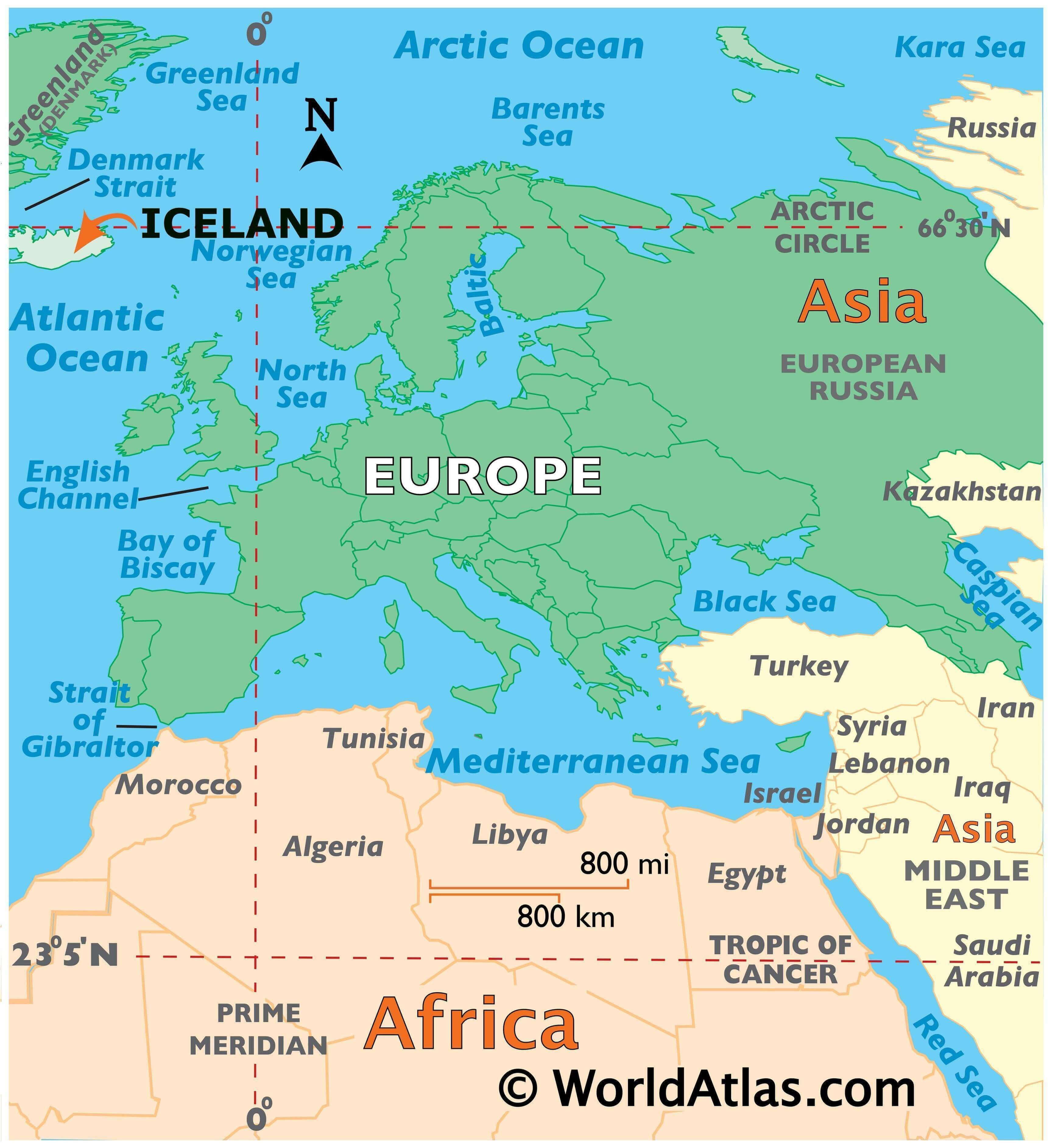
Iceland is at the juncture of the North Atlantic and Arctic Oceans. The main island is entirely south of the Arctic Circle, which passes through the small Icelandic island of Grímsey off the main island’s northern coast. The country lies between latitudes 63 and 68°N, and longitudes 25 and 13°W.
Iceland is closer to continental Europe than to mainland North America, although it is closest to Greenland (290 km, 180 mi), an island of North America. Iceland is generally included in Europe for geographical, historical, political, cultural, linguistic and practical reasons. Geologically, the island includes parts of both continental plates. The closest bodies of land in Europe are the Faroe Islands (420 km, 260 mi); Jan Mayen Island (570 km, 350 mi); Shetland and the Outer Hebrides, both about 740 km (460 mi); and the Scottish mainland and Orkney, both about 750 km (470 mi). The nearest part of Continental Europe is mainland Norway, about 970 km (600 mi) away, while mainland North America is 2,070 km (1,290 mi) away, at the northern tip of Labrador.
Iceland is the world’s 18th-largest island, and Europe’s second-largest island after Great Britain and before Ireland. The main island covers 101,826 km (39,315 sq mi), but the entire country is 103,000 km (40,000 sq mi) in size, of which 62.7% is tundra. Iceland contains about 30 minor islands, including the lightly populated Grímsey and the Vestmannaeyjar archipelago. Lakes and glaciers cover 14.3% of its surface; only 23% is vegetated. The largest lakes are Þórisvatn reservoir: 83–88 km (32–34 sq mi) and Þingvallavatn: 82 km (32 sq mi); other important lakes include Lagarfljót and Mývatn. Jökulsárlón is the deepest lake, at 248 m (814 ft).
Geologically, Iceland is part of the Mid-Atlantic Ridge, a ridge along which the oceanic crust spreads and forms new crust. This part of the mid-ocean ridge is located above a mantle plume, causing Iceland to be subaerial (above the surface of the sea). The ridge marks the boundary between the Eurasian and North American Plates, and Iceland was created by rifting and accretion through volcanism along the ridge.
Many fjords punctuate Iceland’s 4,970-km-long (3,088-mi) coastline, which is also where most settlements are situated. The island’s interior, the Highlands of Iceland, is a cold and uninhabitable combination of sand, mountains, and lava fields. The major towns are the capital city of Reykjavík, along with its outlying towns of Kópavogur, Hafnarfjörður, and Garðabær, nearby Reykjanesbær where the international airport is located, and the town of Akureyri in northern Iceland. The island of Grímsey on the Arctic Circle contains the northernmost habitation of Iceland, whereas Kolbeinsey contains the northernmost point of Iceland. Iceland has three national parks: Vatnajökull National Park, Snæfellsjökull National Park, and Þingvellir National Park. The country is considered a “strong performer” in environmental protection, having been ranked 13th in Yale University’s Environmental Performance Index of 2012.
Geology
A geologically young land, Iceland is the surface expression of the Iceland Plateau, a large igneous province forming as a result of volcanism from the Iceland hotspot and along the Mid-Atlantic Ridge, the latter of which runs right through it. This means that the island is highly geologically active with many volcanoes including Hekla, Eldgjá, Herðubreið, and Eldfell. The volcanic eruption of Laki in 1783–1784 caused a famine that killed nearly a quarter of the island’s population. In addition, the eruption caused dust clouds and haze to appear over most of Europe and parts of Asia and Africa for several months afterwards, and affected climates in other areas.
Iceland has many geysers, including Geysir, from which the English word is derived, and the famous Strokkur, which erupts every 8–10 minutes. After a phase of inactivity, Geysir started erupting again after a series of earthquakes in 2000. Geysir has since grown quieter and does not erupt often.
With the widespread availability of geothermal power and the harnessing of many rivers and waterfalls for hydroelectricity, most residents have access to inexpensive hot water, heating, and electricity. The island is composed primarily of basalt, a low-silica lava associated with effusive volcanism as has occurred also in Hawaii. Iceland, however, has a variety of volcanic types (composite and fissure), many producing more evolved lavas such as rhyolite and andesite. Iceland has hundreds of volcanoes with about 30 active volcanic systems.
Surtsey, one of the youngest islands in the world, is part of Iceland. Named after Surtr, it rose above the ocean in a series of volcanic eruptions between 8 November 1963 and 5 June 1968. Only scientists researching the growth of new life are allowed to visit the island.
On 21 March 2010, a volcano in Eyjafjallajökull in the south of Iceland erupted for the first time since 1821, forcing 600 people to flee their homes. Additional eruptions on 14 April forced hundreds of people to abandon their homes. The resultant cloud of volcanic ash brought major disruption to air travel across Europe.
Another large eruption occurred on 21 May 2011. This time it was the Grímsvötn volcano, located under the thick ice of Europe’s largest glacier, Vatnajökull. Grímsvötn is one of Iceland’s most active volcanoes, and this eruption was much more powerful than the 2010 Eyjafjallajökull activity, with ash and lava hurled 20 km (12 mi) into the atmosphere, creating a large cloud.
A great deal of volcanic activity was occurring in the Reykjanes Peninsula in 2020 and into 2021, after nearly 800 years of inactivity. After the eruption of the Fagradalsfjall volcano on 19 March 2021, National Geographic’s experts predicted that this “may mark the start of decades of volcanic activity.” The eruption was small, leading to a prediction that this volcano was unlikely to threaten “any population centers”.
The highest elevation for Iceland is listed as 2,110 m (6,923 ft) at Hvannadalshnúkur (64°00′N 16°39′W).
Climate
The climate of Iceland’s coast is subarctic. The warm North Atlantic Current ensures generally higher annual temperatures than in most places of similar latitude in the world. Regions in the world with similar climates include the Aleutian Islands, the Alaska Peninsula, and Tierra del Fuego, although these regions are closer to the equator. Despite its proximity to the Arctic, the island’s coasts remain ice-free through the winter. Ice incursions are rare, with the last having occurred on the north coast in 1969.
The climate varies between different parts of the island. Generally speaking, the south coast is warmer, wetter, and windier than the north. The Central Highlands are the coldest part of the country. Low-lying inland areas in the north are the aridest. Snowfall in winter is more common in the north than in the south.
The highest air temperature recorded was 30.5 °C (86.9 °F) on 22 June 1939 at Teigarhorn on the southeastern coast. The lowest was −38 °C (−36.4 °F) on 22 January 1918 at Grímsstaðir and Möðrudalur in the northeastern hinterland. The temperature records for Reykjavík are 26.2 °C (79.2 °F) on 30 July 2008, and −24.5 °C (−12.1 °F) on 21 January 1918.
Plants
Phytogeographically, Iceland belongs to the Arctic province of the Circumboreal Region within the Boreal Kingdom. Plantlife consists mainly of grassland, which is regularly grazed by livestock. The most common tree native to Iceland is the northern birch (Betula pubescens), which formerly formed forests over much of Iceland, along with aspens (Populus tremula), rowans (Sorbus aucuparia), common junipers (Juniperus communis), and other smaller trees, mainly willows.
When the island was first settled, it was extensively forested, with around 30% of the land covered in trees. In the late 12th century, Ari the Wise described it in the Íslendingabók as “forested from mountain to sea shore”. Permanent human settlement greatly disturbed the isolated ecosystem of thin, volcanic soils and limited species diversity. The forests were heavily exploited over the centuries for firewood and timber. Deforestation, climatic deterioration during the Little Ice Age, and overgrazing by sheep imported by settlers caused a loss of critical topsoil due to erosion. Today, many farms have been abandoned. Three-quarters of Iceland’s 100,000 square kilometres (39,000 sq mi) is affected by soil erosion; 18,000 km (6,900 sq mi) is affected to a degree serious enough to make the land useless. Only a few small birch stands now exist in isolated reserves. The planting of new forests has increased the number of trees, but the result does not compare to the original forests. Some of the planted forests include introduced species. The tallest tree in Iceland is a sitka spruce planted in 1949 in Kirkjubæjarklaustur; it was measured at 25.2 m (83 ft) in 2013. Algae such as Chondrus crispus, Phyllphora truncata and Phyllophora crispa and others have been recorded from Iceland.
Animals
The only native land mammal when humans arrived was the Arctic fox, which came to the island at the end of the ice age, walking over the frozen sea. On rare occasions, bats have been carried to the island with the winds, but they are not able to breed there. No native or free-living reptiles or amphibians are on the island.
The animals of Iceland include the Icelandic sheep, cattle, chickens, goats, the sturdy Icelandic horse, and the Icelandic Sheepdog, all descendants of animals imported by Europeans. Wild mammals include the Arctic fox, mink, mice, rats, rabbits, and reindeer. Polar bears occasionally visit the island, travelling from Greenland on icebergs, but no Icelandic populations exist. In June 2008, two polar bears arrived in the same month. Marine mammals include the grey seal (Halichoerus grypus) and harbour seal (Phoca vitulina).
Many species of fish live in the ocean waters surrounding Iceland, and the fishing industry is a major part of Iceland’s economy, accounting for roughly half of the country’s total exports. Birds, especially seabirds, are an important part of Iceland’s animal life. Atlantic puffins, skuas, and black-legged kittiwakes nest on its sea cliffs.
Commercial whaling is practised intermittently along with scientific whale hunts. Whale watching has become an important part of Iceland’s economy since 1997.
Around 1,300 species of insects are known in Iceland. This is low compared with other countries (over one million species have been described worldwide). Iceland is essentially free of mosquitoes.