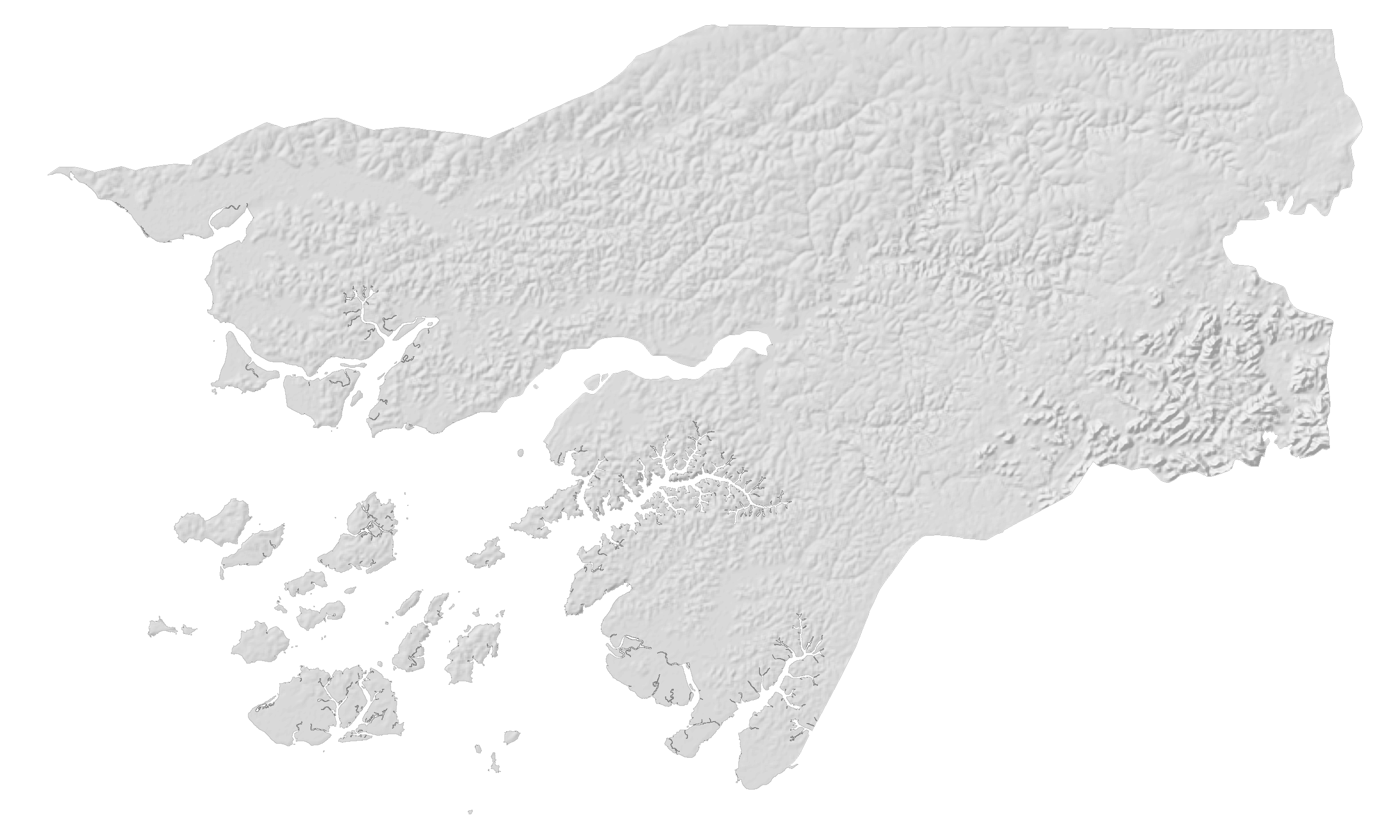
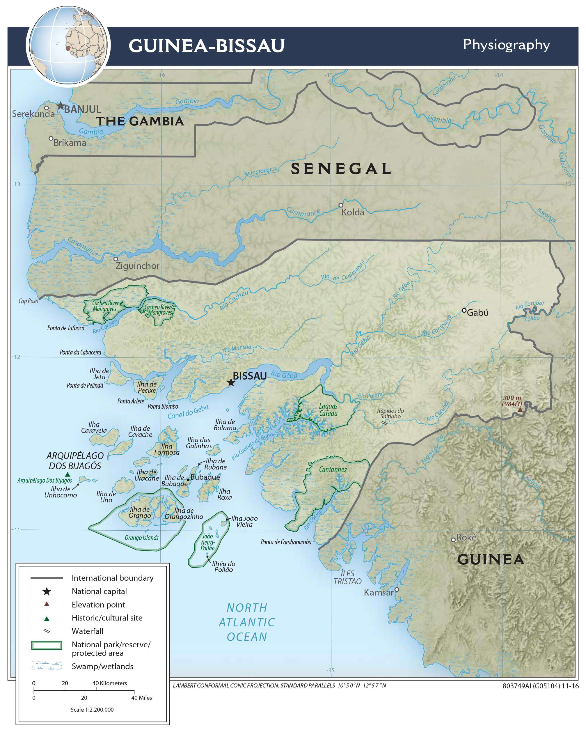
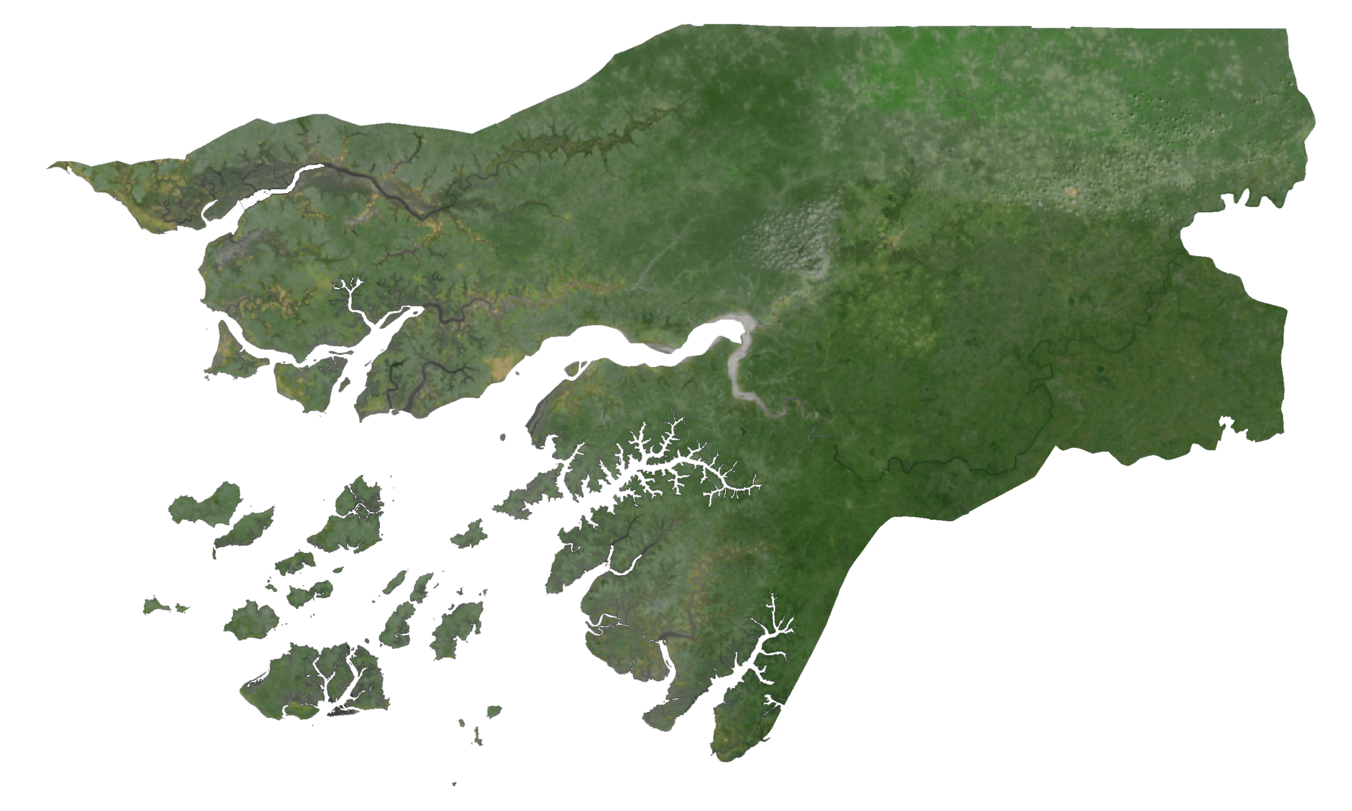
Guinea-Bissau is a West African country with an area of 36,125 sq. km. As observed on the physical map of the country, it has a coastline on the Atlantic Ocean. Most of Guinea-Bissau is low-lying. The coastal plains with Guinean mangrove swamps lead to flat savanna and forests inland. Due to the flat nature of the terrain, tidal waters reach as far as 100 km inland.
The southeastern part of the country is relatively high and dominated by the Fouta Djallon plateau with an elevation of around 180 m. From the western slopes of this plateau, Boe hills arise and extend westwards for a short distance.
The highest point of the country is an unnamed hill at 984 ft (300 m); the lowest point of Guinea-Bissau is the Atlantic Ocean (0 m)
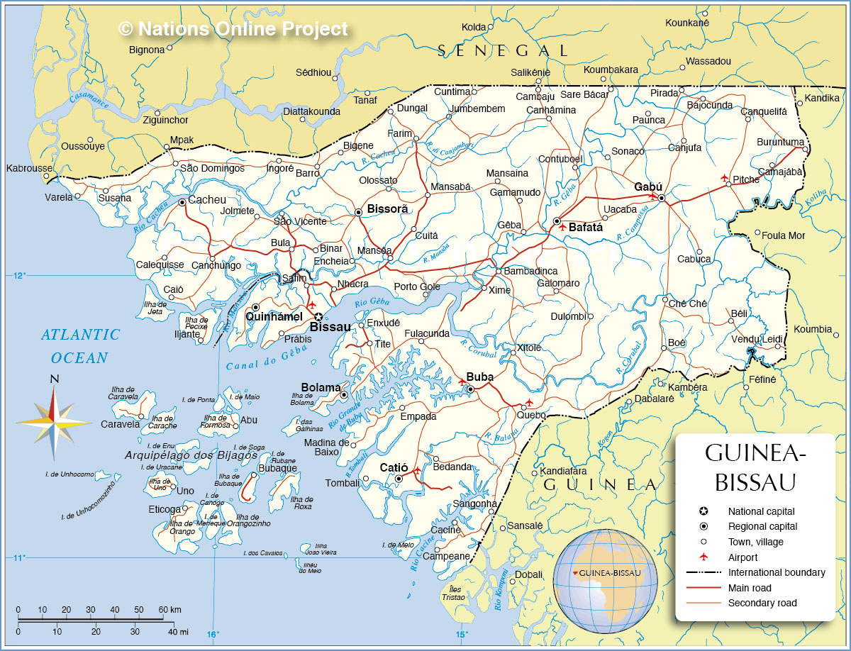
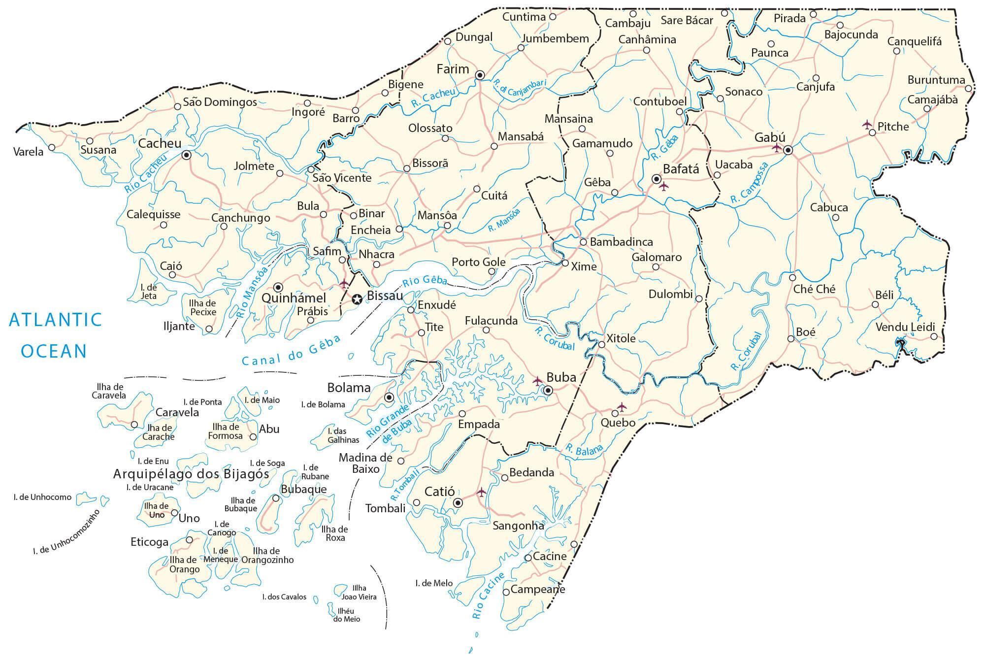
Corubal, Geba, and Cacheu are some of the major rivers draining Guinea-Bissau and have been marked on the map.
Off the coast of Guinea-Bissau, is the Bijagos Archipelago. It is a group of some eighteen major islands and dozens of smaller ones that extends along the Atlantic Ocean coastline. The Orango Islands National Park is its main attraction.
| Flag: |  |
|---|---|
| Legal Name: | Republic of Guinea-Bissau |
| Capital Value: | Bissau |
| Largest City: |
Bissau (599,714) |
| Official languages: | Portuguese |
| Demonym(s): | Bissau-Guinean |
| Government: | Unitary semi-presidential republic |
| Legislature: | National People’s Assembly |
| Total Area: | 36,125 km² |
| Land Area: | 28,120 km² |
| Water Area: | 8,005 km² |
| Population: | 1,920,922 |
| Density: | 46.9/km (121.5/sq mi) (154th) |
| GDP: | $1.34 Billion |
| GDP Per Capita: | $697.78 |
| Currency Value: | Communaute Financiere Africaine francs (XOF) |
| Driving side: | right |
| Calling code: | +245 |
| Internet TLD: | .gw |
Discover Guinea-Bissau with this interactive map! Explore its islands, populated places, and roads with satellite imagery for an in-depth look. Get a better understanding of the topography with the physical map.
Online Interactive Political Map
Click on ![]() to view map in "full screen" mode.
to view map in "full screen" mode.
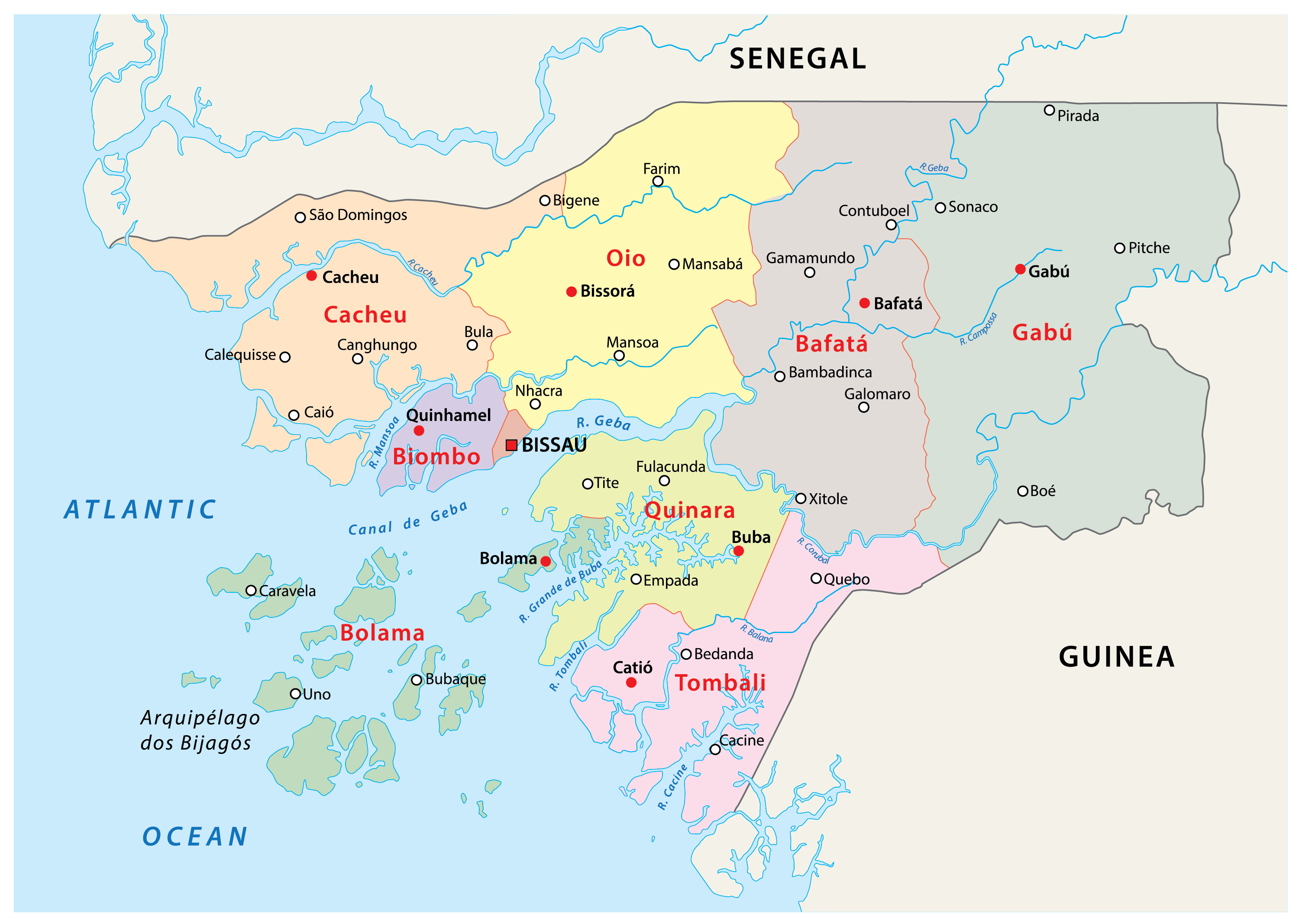
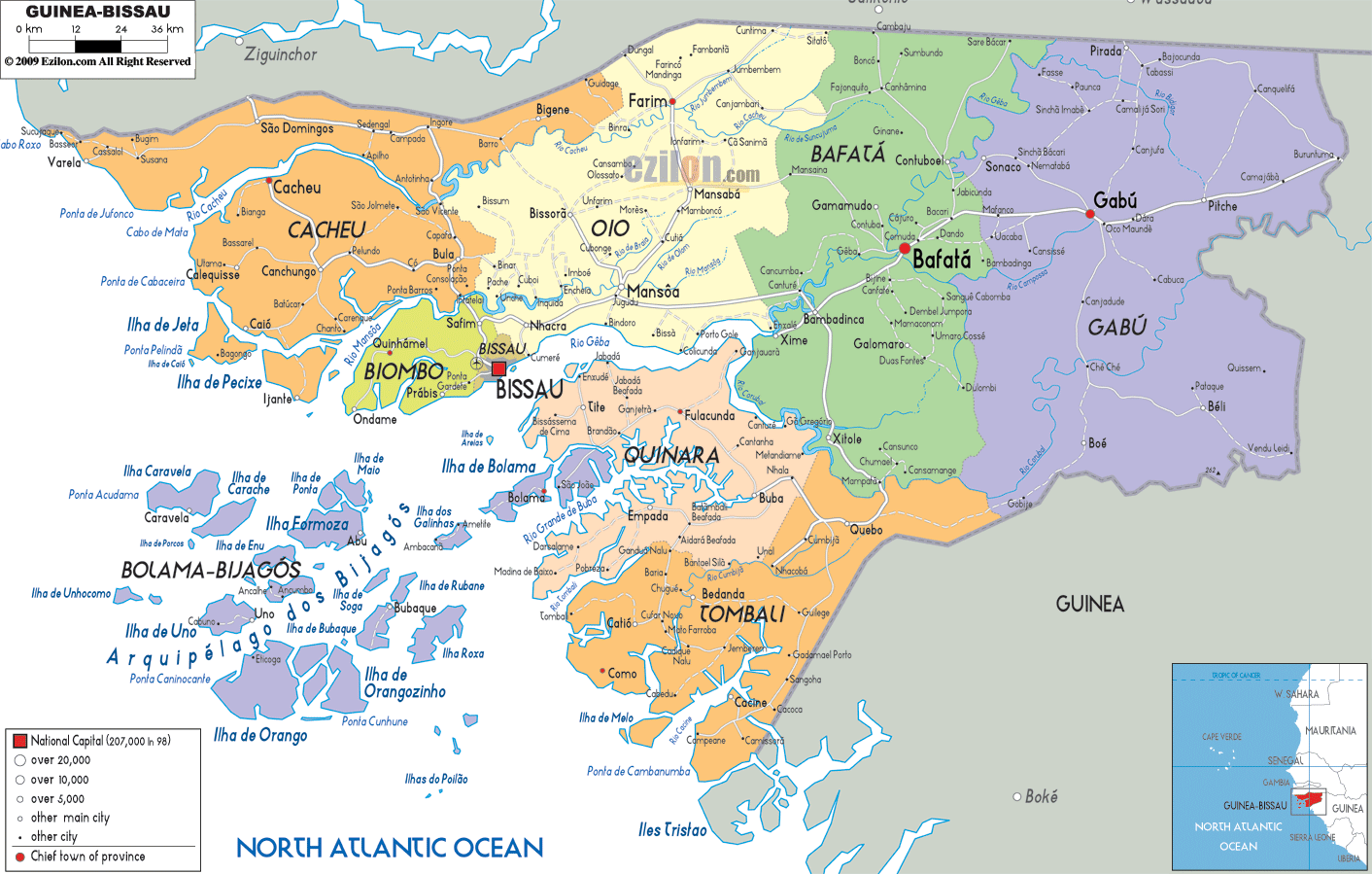
Guinea-Bissau has 8 regions and one autonomous sector. The regions are further subdivided into 37 sectors which are in turn made up of sections which comprise of towns, villages, localities, etc.
The regions of the country are Bafata, Biombo, Bolama/Bijagos, Cacheu, Gabu, Oio, Quinara, and Tombali. Bissau is the autonomous sector. It is also the country’s capital city.
With an area of 9,150.0 sq. km, Gabu is the largest region of Guinea-Bissau by area.
Location Maps
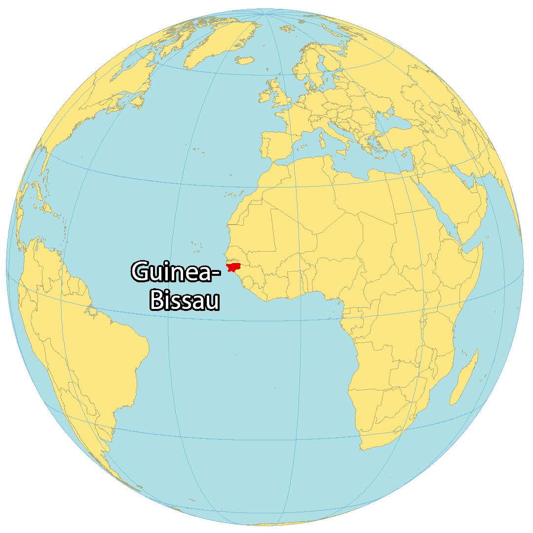
Where is Guinea Bissau?
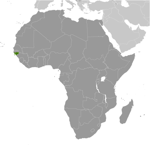
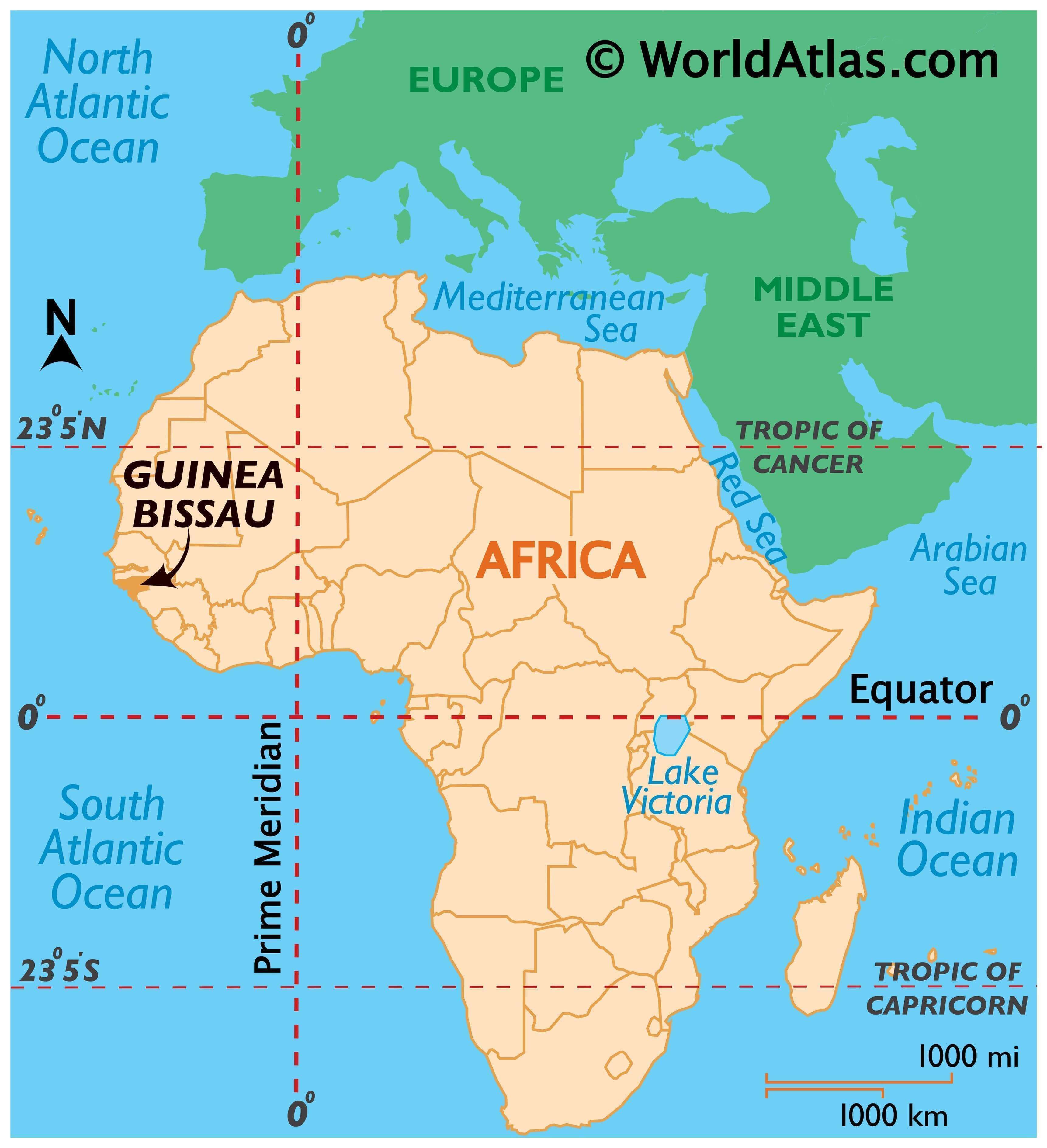
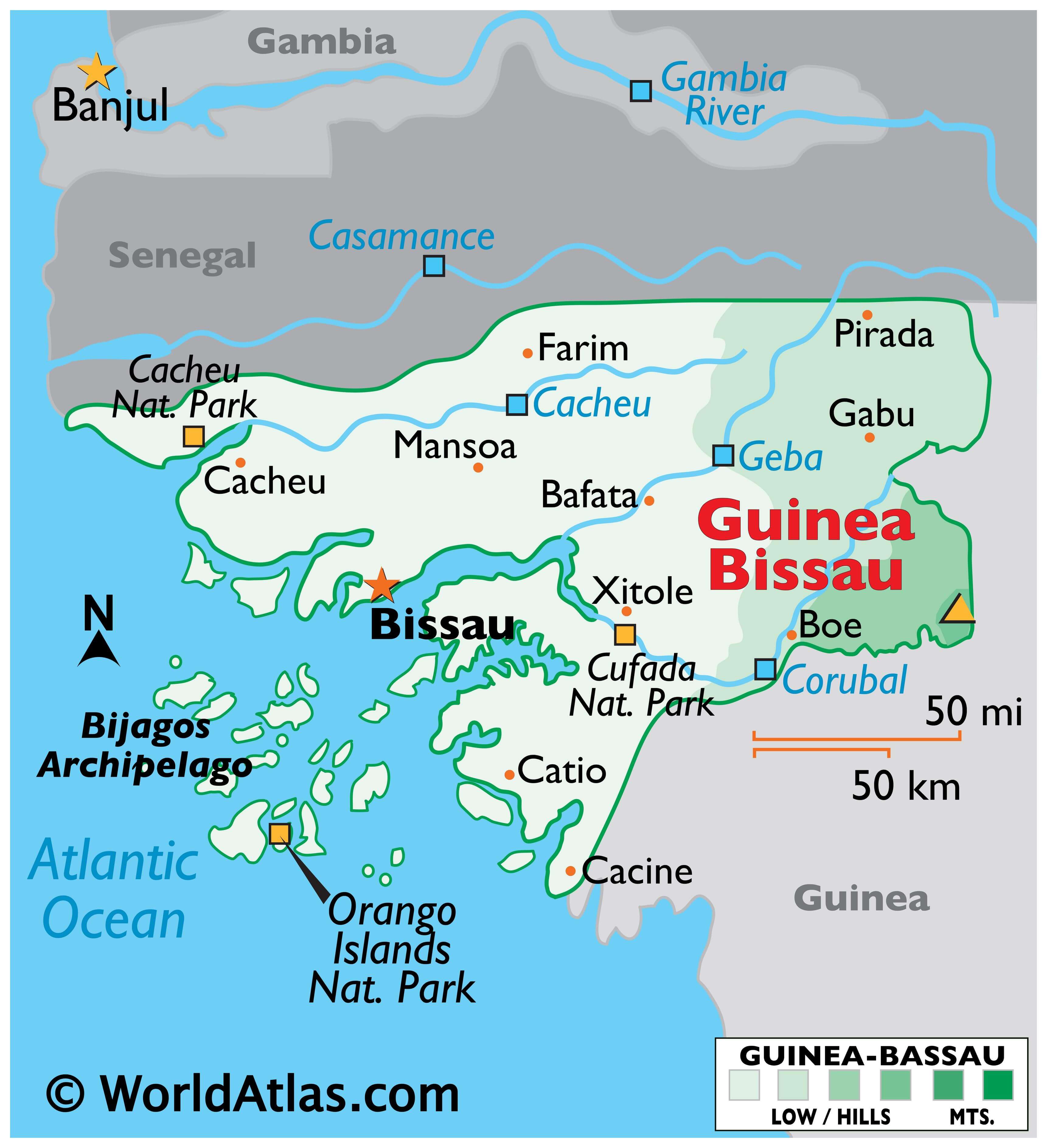
Guinea-Bissau is a small African nation located on the western coast of the continent. It includes the Bissagos Islands, an archipelago of about 88 islands in the North Atlantic Ocean. It shares borders with two countries: Senegal to the north and Guinea to the southeast. The capital and largest city in the country is Bissau, while other major cities are Bafatá, Gabú, and Bissorã.
Guinea-Bissau occupies an area of 36,125 square kilometers, which is larger than Lesotho but smaller than Togo. This includes the Bijagos Archipelago, a group of 88 islands that lie off of the mainland.
High Definition Political Map of Guinea Bissau
Guinea Bissau Administrative Map

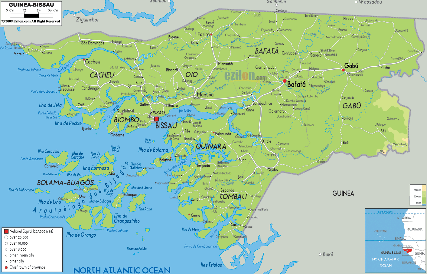
Physical Map of Guinea Bissau
Transportation Map of Guinea Bissau

Guinea Bissau Satellite Map
Elevation Map