About the size of the U.S. State of Texas, Afghanistan occupies an area of 647,230 km2 (249,900 sq mi) in Southern Asia.
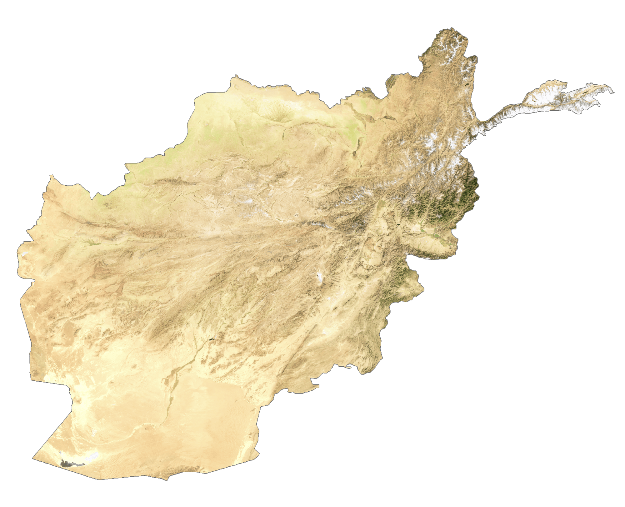
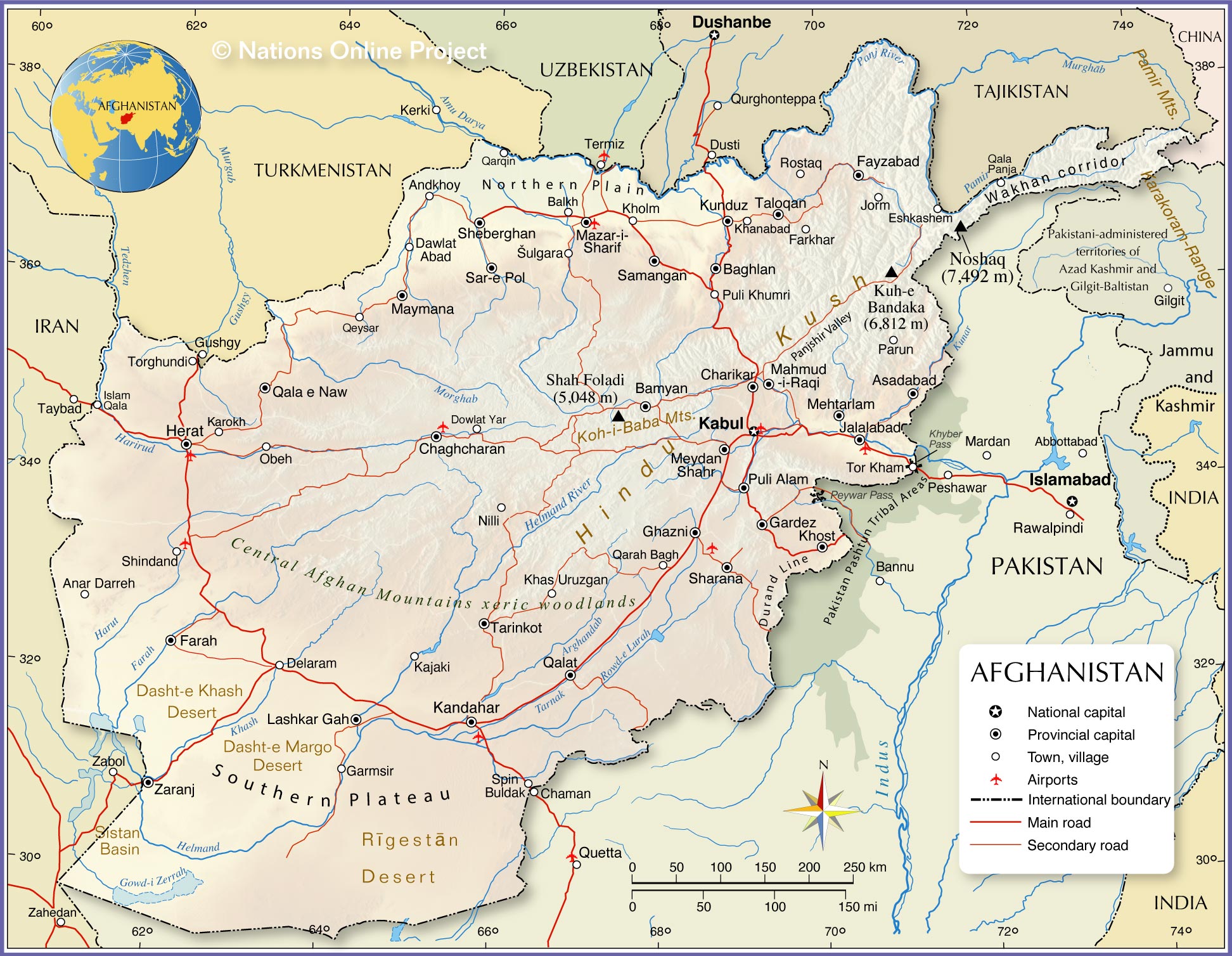
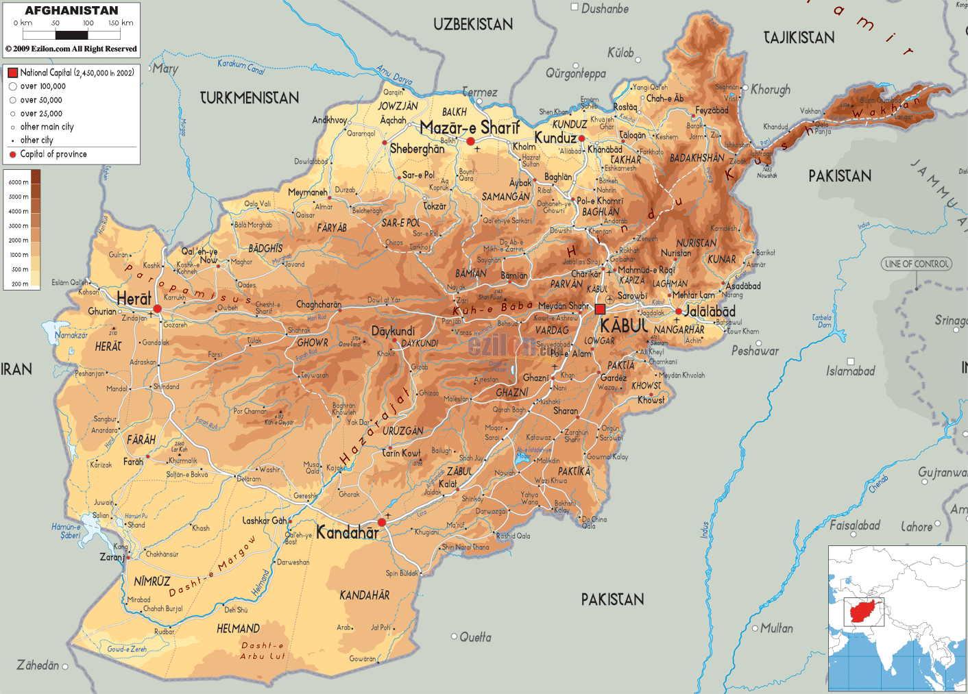
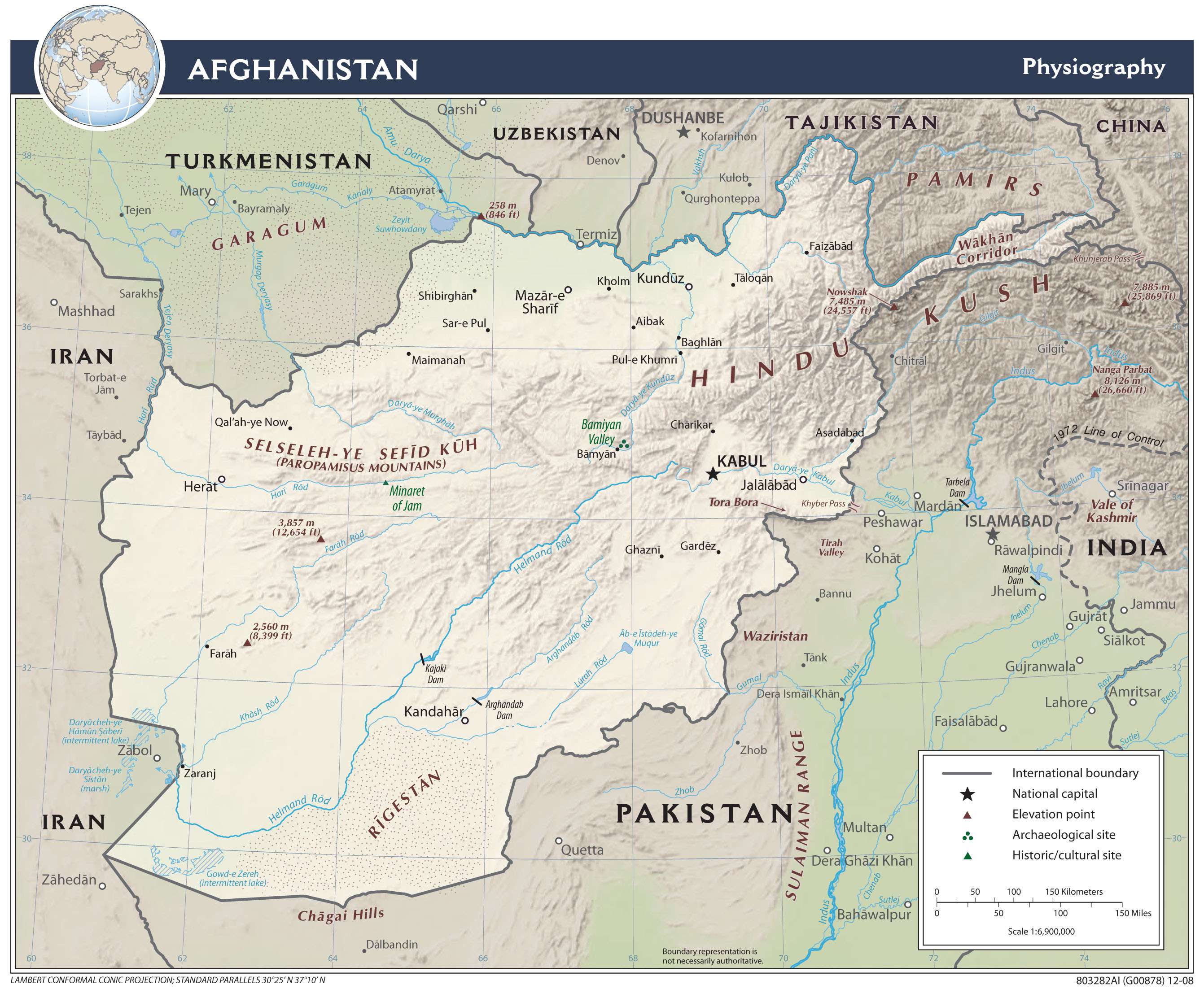
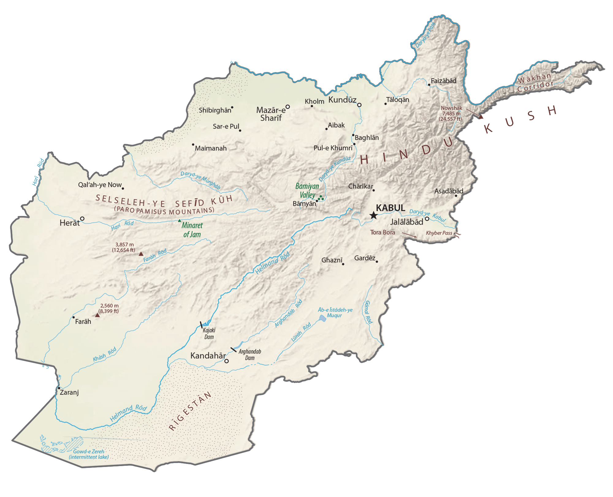
As observed on the physical map of the country above, most of Afghanistan is a rugged, inhospitable mountainous landscape. More than 50% of the total land area lies above 6,500 ft. (2,000 m). It all culminates in the high peaks of the Hindu Kush, where extensions of the Pamir Mountains, Karakorum Mountains and the Himalayas all come together.
Afghanistan’s highest point is Mt. Nowshak (marked on the map by a yellow triangle) which peaks at 24,446 ft. (7,485 m).
In the north, a fertile plain front the Amu Darya River. In the south, below the mountains, rolling desert and scattered salt flats cover the land.
Afghanistan is drained by numerous rivers; significant ones include the Amu Darya, Hari, Helmand, and the Kabul – directly east of the capital city, flowing down into the Indus River in Pakistan.
In 2009 Afghanistan designated a portion of the Hindu Kush Mountains, known as Band-e Amir, their first national park. The park contains six deep blue lakes, Band-e Gholaman, Band-e Qambar, Band-e Haibat, Band-e Panir, Band-e Pudina and Band-e Zulfiqar, all of which are separated by natural dams.
| Flag: |  |
|---|---|
| Legal Name: | Islamic Republic of Afghanistan |
| Capital Value: | Kabul |
| Official languages: |
|
| Demonym(s): | Afghan |
| Government: | Unitary totalitarian provisional theocratic Islamic emirate |
| Legislature: | Leadership Council |
| Total Area: | 652,230 km² |
| Land Area: | 652,230 km² |
| Population: | 38,041,754 |
| Density: | 48.08/km (124.5/sq mi) (174th) |
| GDP: | $19.10 Billion |
| GDP Per Capita: | $502.12 |
| Currency Value: | Afghanis (AFA) |
| Driving side: | right |
| Calling code: | +93 |
| Internet TLD: | .af افغانستان. |
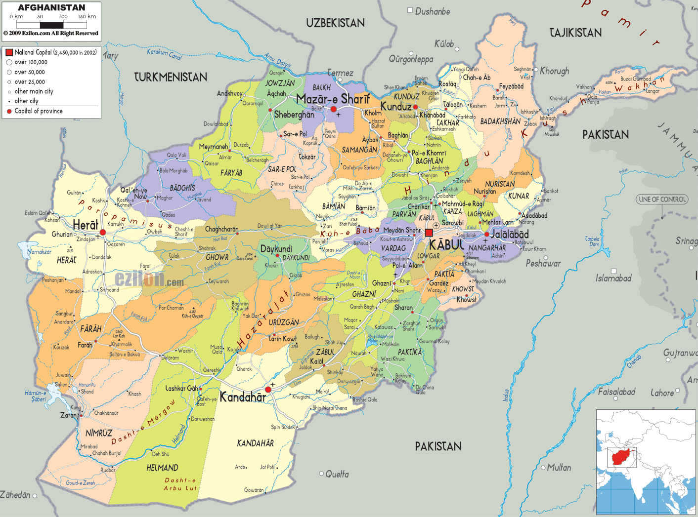
Explore this beautiful Afghanistan map to discover key features of the country, such as its capital city Kabul, the 800-km stretch Hindu Kush mountain range, major cities, towns, roads, and rivers.
Online Interactive Political Map
Click on ![]() to view map in "full screen" mode.
to view map in "full screen" mode.
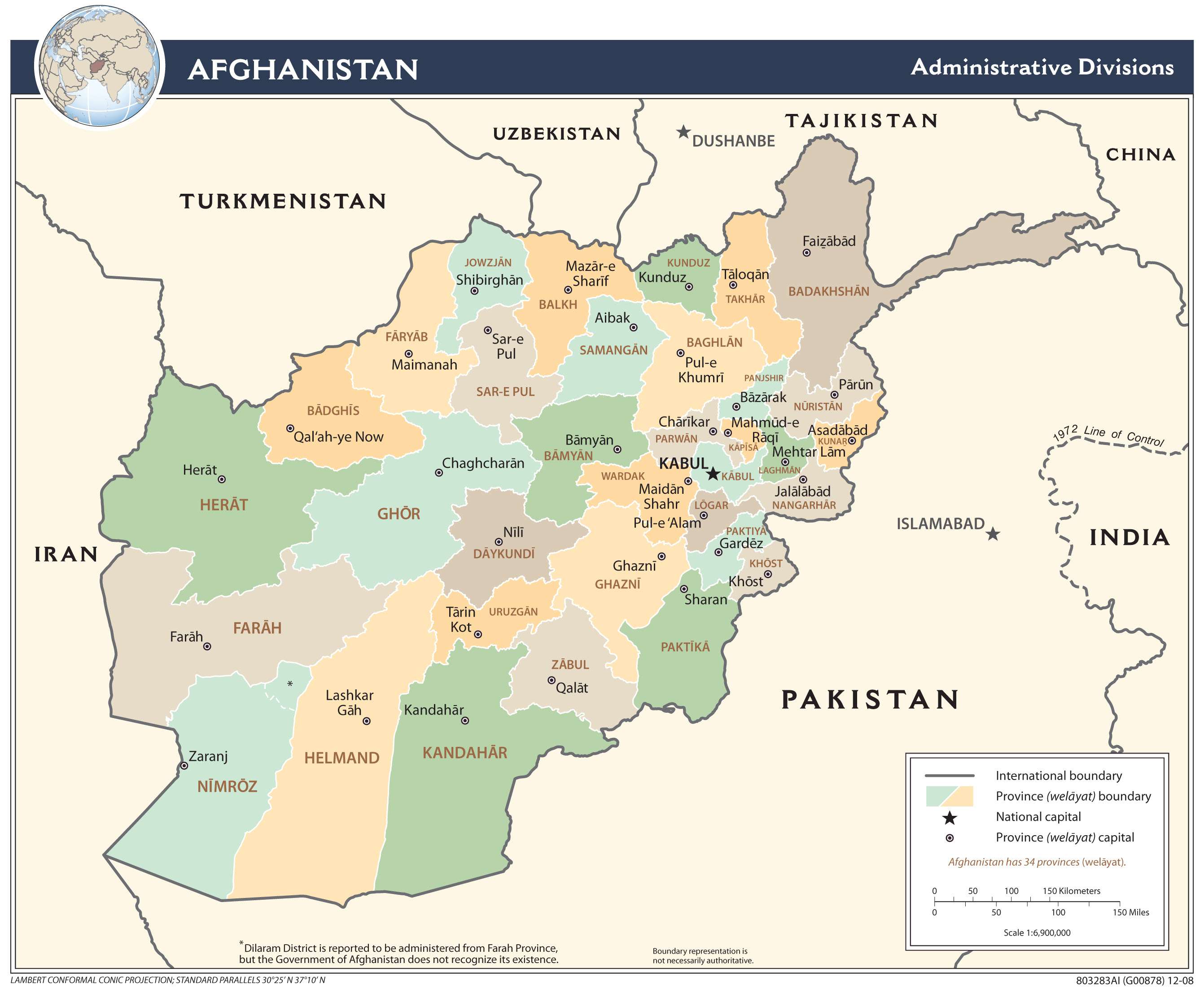
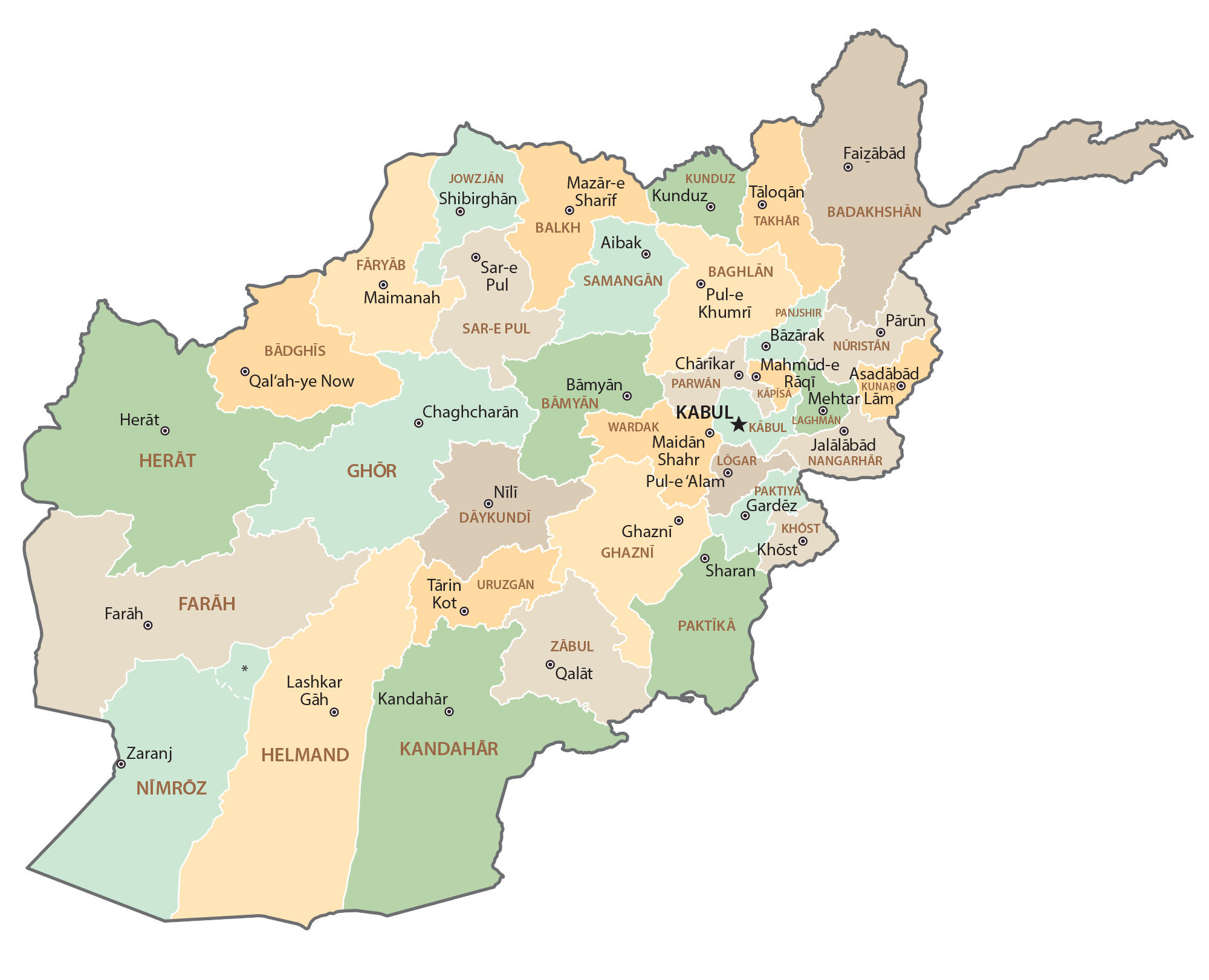
Afghanistan (officially, The Islamic Republic of Afghanistan) is divided into 34 administrative provinces (welayat). In alphabetical order, the 34 provinces are: Badakhshan, Badghis, Baghlan, Balkh, Bamyan, Daykundi, Farah, Faryab, Ghazni, Ghor, Helmand, Herat, Jowzjan, Kabul, Kandahar, Kapisa, Khost, Kunar, Kunduz, Laghman, Logar, Nangarhar, Nimroz, Nuristan, Paktika, Paktiya, Panjshir, Parwan, Samangan, Sar-e-Pul, Takhar, Uruzgan, Wardak and Zabul. These provinces are further subdivided into several districts.
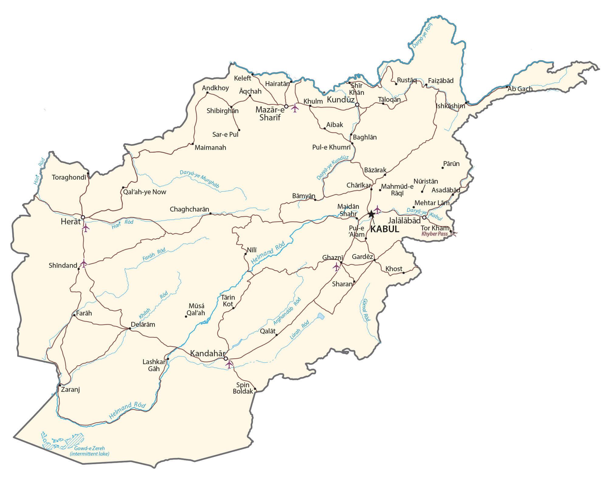
Located in the east-central part of the country, Kabul – is the capital and largest city of Afghanistan. Kabul’s location at an altitude of 1790m, in a narrow valley of the Hindu Kush Mountains – makes it one of the highest capitals in the world. Kabul is the only city in Afghanistan, with populations over a million. Kabul is the country’s largest urban center as well as the political, cultural and economic hub of Afghanistan.
Location Maps
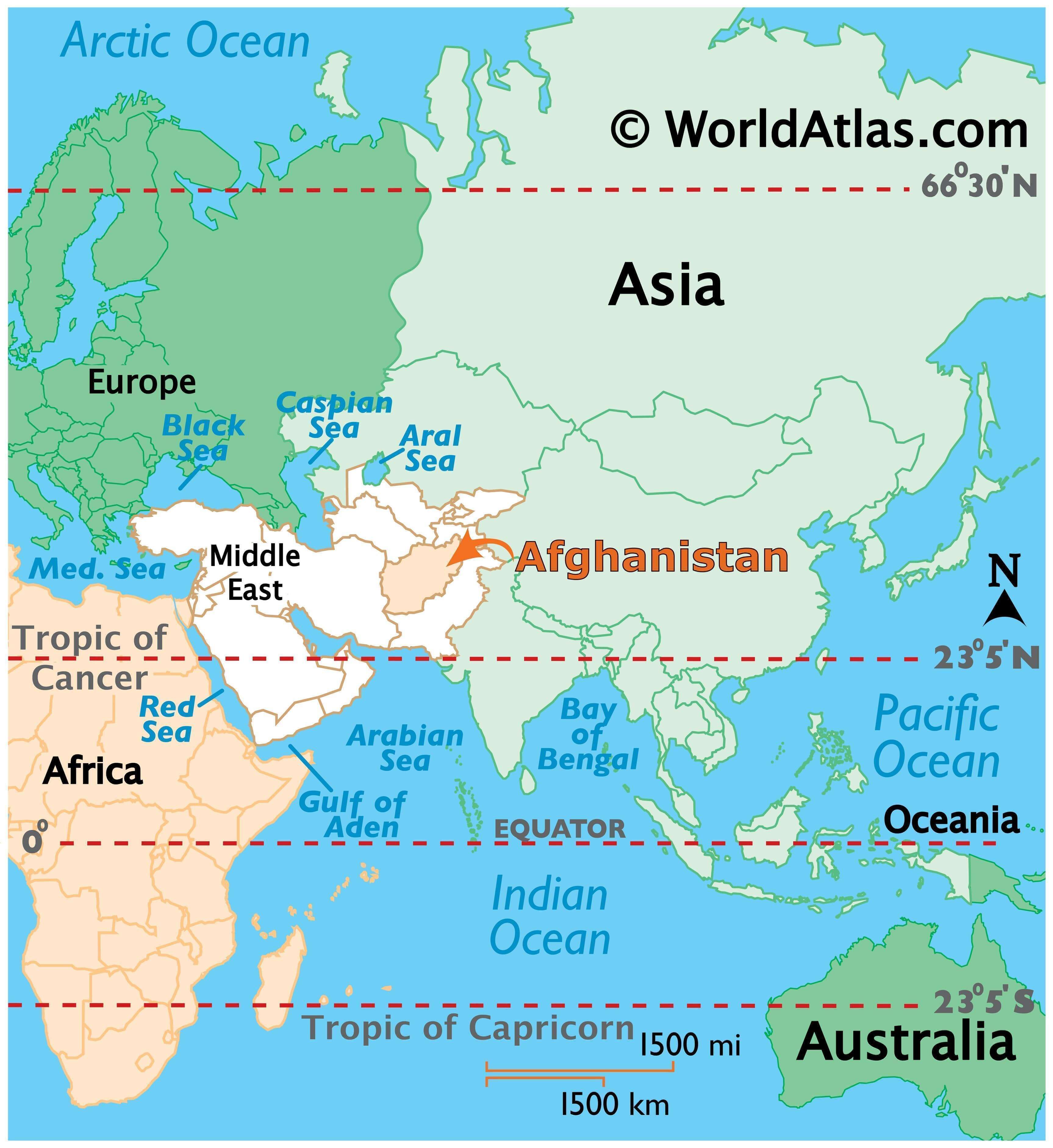
Where is Afghanistan?
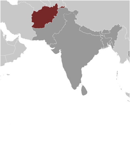
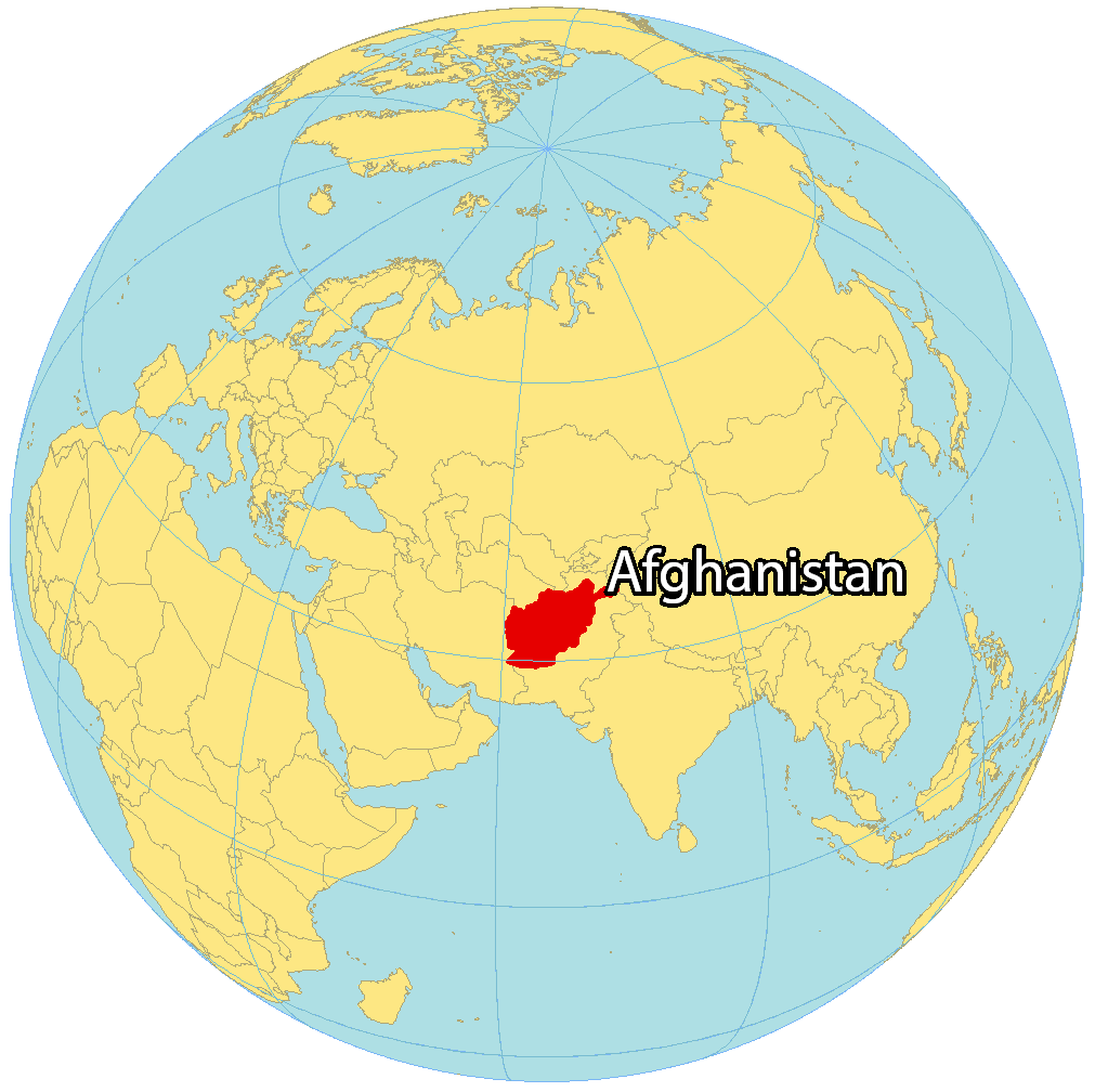
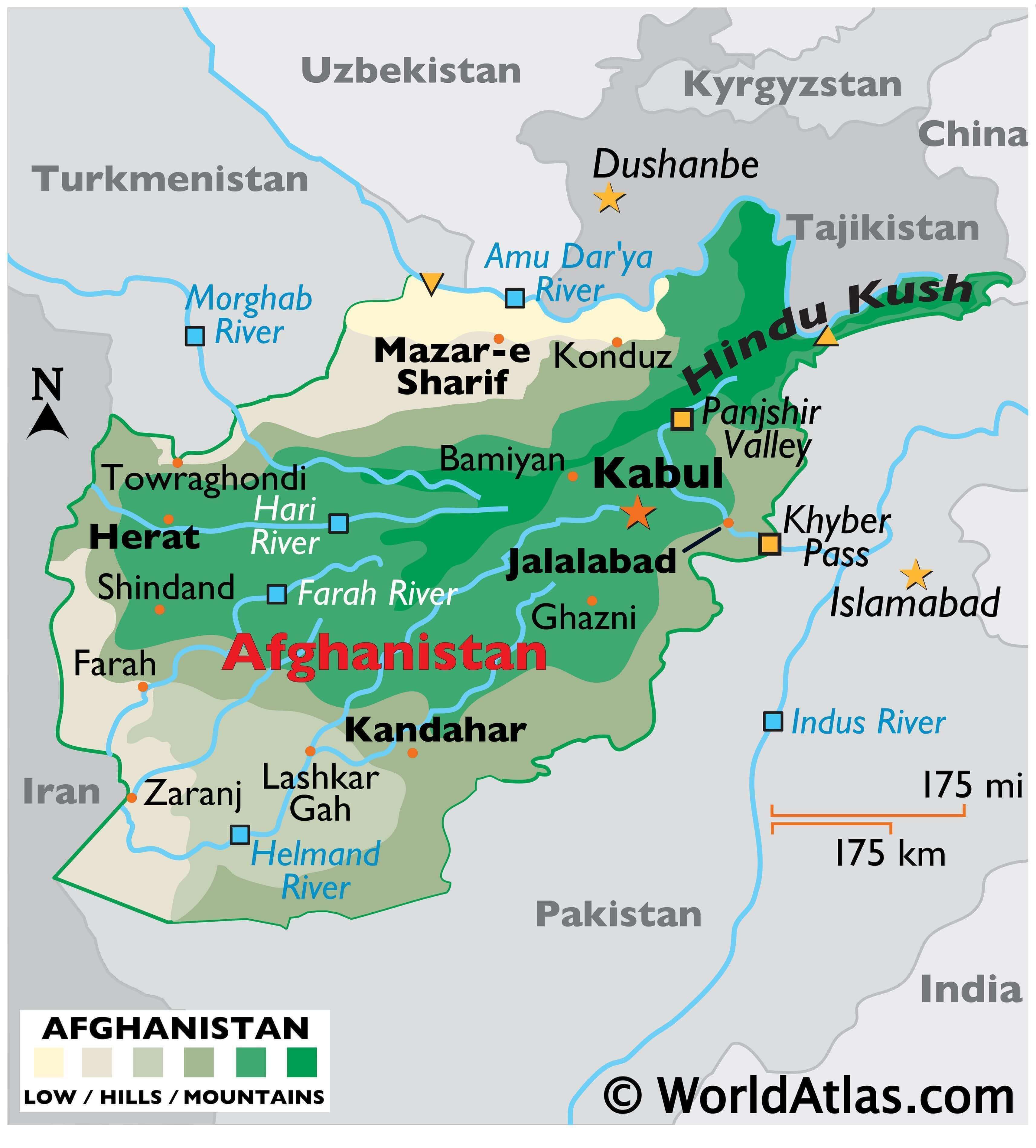
Afghanistan is located in Central Asia and is often recognized as the “Crossroads to Asia”. It’s surrounded by six other countries, specifically, Pakistan to the south and Iran to the west. Then, Turkmenistan, Uzbekistan, and Tajikistan are to the north and China is to the northeast of Afghanistan.
Afghanistan occupies an area of 652,864 square kilometers (252,072 sq mi), which is similar in area to France or the state of Texas. Kabul is the capital city of Afghanistan and is one of the 100 most populous cities in the world.
High Definition Political Map of Afghanistan
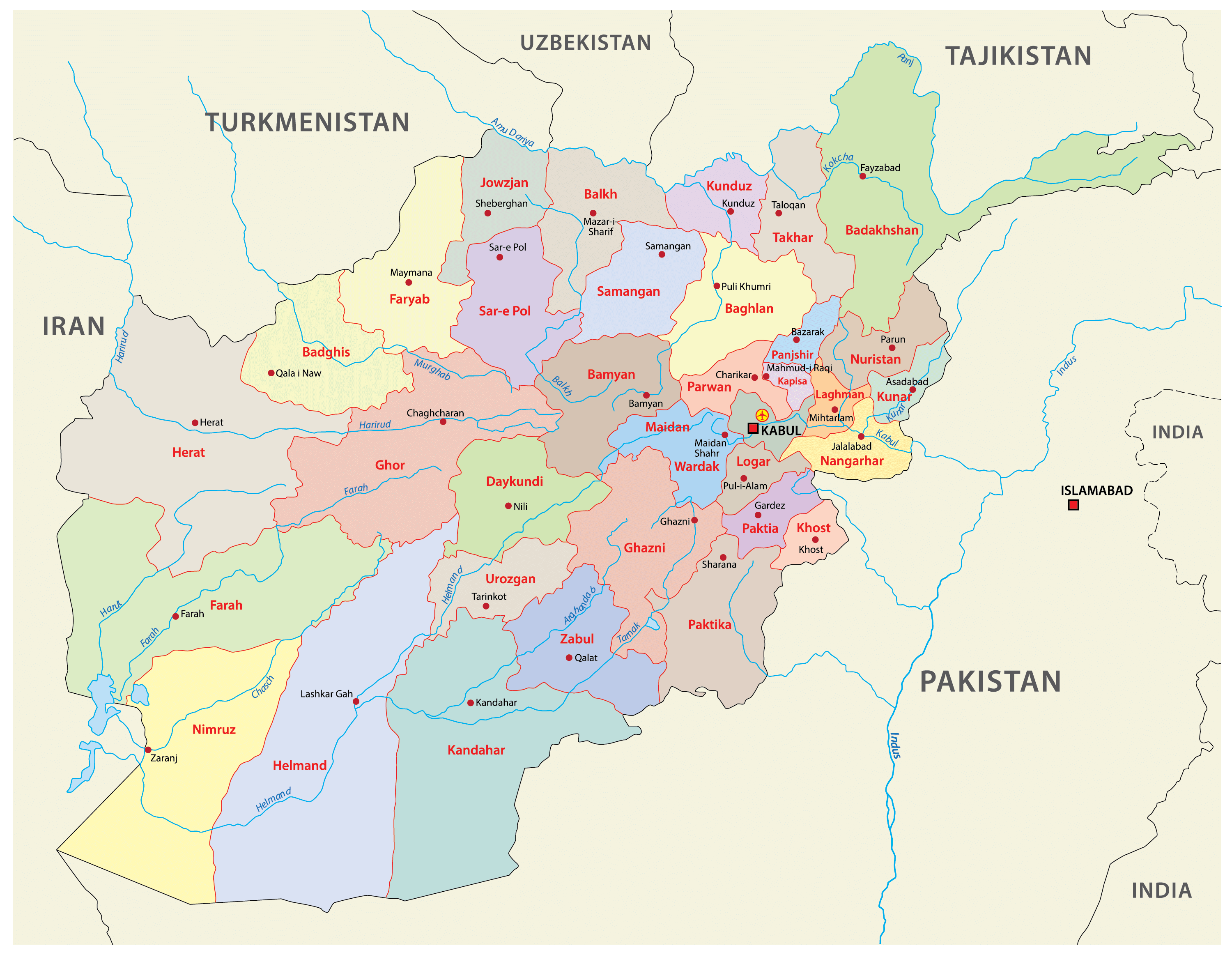
Afghanistan Administrative Map
History
Afghanistan is a landlocked country located in South Asia, with a long and complex history. The region has been inhabited for thousands of years, with evidence of human settlement dating back to the Neolithic period.
In ancient times, Afghanistan was part of the Persian Empire and later the Greco-Bactrian Kingdom. The area was also a major center of Buddhism and Hinduism.
In the 7th century, Islam was introduced to the region, and Afghanistan became part of the Islamic Caliphate. Over the centuries, various dynasties and empires, such as the Ghaznavids, Ghurids, Timurids, and Mughals, ruled over the region.
In the 19th century, Afghanistan became caught up in the “Great Game” between the British Empire and Russia, with both powers vying for influence in the region. Afghanistan remained independent, but the country’s rulers had to navigate a delicate balance between the two powers.
During the 20th century, Afghanistan underwent significant political and social changes. In 1919, Afghanistan declared its independence from Britain, but the country continued to struggle with political instability and economic underdevelopment.
In the 1970s, a Communist government came to power in Afghanistan, sparking a long period of conflict that continues to this day. In 1979, the Soviet Union invaded Afghanistan, triggering a ten-year-long war that devastated the country and led to the rise of the Taliban, a fundamentalist Islamist group that took control of the country in 1996.
The Taliban’s rule was marked by extreme repression, including the imposition of strict Islamic law and the suppression of women’s rights. In 2001, following the September 11 terrorist attacks, the United States launched a military campaign in Afghanistan, toppling the Taliban regime and installing a new government.
Since then, Afghanistan has continued to struggle with political instability and violence. The country has held several elections, but allegations of fraud and corruption have marred the process. The Taliban remains a potent force in Afghanistan, and the country continues to face significant economic, social, and security challenges.
Physical Map of Afghanistan
Geography
Afghanistan is located in Southern-Central Asia. The region centered at Afghanistan is considered the “crossroads of Asia”, and the country has had the nickname Heart of Asia. The renowned Urdu poet Allama Iqbal once wrote about the country:
At over 652,864 km (252,072 sq mi), Afghanistan is the world’s 41st largest country, slightly bigger than France and smaller than Myanmar, and about the size of Texas in the United States. There is no coastline, as Afghanistan is landlocked. Afghanistan shares its longest land border (the Durand Line) with Pakistan to the east and south, followed by borders with Tajikistan to the north-east, Iran to the west, Turkmenistan to the north-west, Uzbekistan to the north and China to the north-east; India recognizes a border with Afghanistan through Pakistani-administered Kashmir. Clockwise from south-west, Afghanistan shares borders with the Sistan and Baluchestan Province, South Khorasan Province and Razavi Khorasan Province of Iran; Ahal Region, Mary Region and Lebap Region of Turkmenistan; Surxondaryo Region of Uzbekistan; Khatlon Region and Gorno-Badakhshan Autonomous Region of Tajikistan; Xinjiang Uyghur Autonomous Region of China; and the Gilgit-Baltistan territory, Khyber Pakhtunkhwa province and Balochistan province of Pakistan.
The geography in Afghanistan is varied, but is mostly mountainous and rugged, with some unusual mountain ridges accompanied by plateaus and river basins. It is dominated by the Hindu Kush range, the western extension of the Himalayas that stretches to eastern Tibet via the Pamir Mountains and Karakoram Mountains in Afghanistan’s far north-east. Most of the highest points are in the east consisting of fertile mountain valleys, often considered part of the “Roof of the World”. The Hindu Kush ends at the west-central highlands, creating plains in the north and southwest, namely the Turkestan Plains and the Sistan Basin; these two regions consist of rolling grasslands and semi-deserts, and hot windy deserts, respectively. Forests exist in the corridor between Nuristan and Paktika provinces (see East Afghan montane conifer forests), and tundra in the north-east. The country’s highest point is Noshaq, at 7,492 m (24,580 ft) above sea level. The lowest point lies in Jowzjan Province along the Amu River bank, at 258 m (846 ft) above sea level.
Despite having numerous rivers and reservoirs, large parts of the country are dry. The endorheic Sistan Basin is one of the driest regions in the world. The Amu Darya rises at the north of the Hindu Kush, while the nearby Hari Rud flows west towards Herat, and the Arghandab River from the central region southwards. To the south and west of the Hindu Kush flow a number of streams that are tributaries of the Indus River, such as the Helmand River. One exception is the Kabul River which flows in an easterly direction to the Indus ending at the Indian Ocean. Afghanistan receives heavy snow during the winter in the Hindu Kush and Pamir Mountains, and the melting snow in the spring season enters the rivers, lakes, and streams. However, two-thirds of the country’s water flows into the neighboring countries of Iran, Pakistan, and Turkmenistan. As reported in 2010, the state needs more than US$2 billion to rehabilitate its irrigation systems so that the water is properly managed.
The northeastern Hindu Kush mountain range, in and around the Badakhshan Province of Afghanistan, is in a geologically active area where earthquakes may occur almost every year. They can be deadly and destructive, causing landslides in some parts or avalanches during the winter. The last strong earthquakes were in 1998, which killed about 6,000 people in Badakhshan near Tajikistan. This was followed by the 2002 Hindu Kush earthquakes in which over 150 people were killed and over 1,000 injured. A 2010 earthquake left 11 Afghans dead, over 70 injured, and more than 2,000 houses destroyed. In June 2022, a destructive 5.9 earthquake struck near the border with Pakistan, killing at least 1,150 people and sparking fears of a major humanitarian crisis.
Climate
Afghanistan has a continental climate with harsh winters in the central highlands, the glaciated northeast (around Nuristan), and the Wakhan Corridor, where the average temperature in January is below −15 °C (5 °F) and can reach −26 °C (−15 °F), and hot summers in the low-lying areas of the Sistan Basin of the southwest, the Jalalabad basin in the east, and the Turkestan plains along the Amu River in the north, where temperatures average over 35 °C (95 °F) in July and can go over 43 °C (109 °F). The country is generally arid in the summers, with most rainfall falling between December and April. The lower areas of northern and western Afghanistan are the driest, with precipitation more common in the east. Although proximate to India, Afghanistan is mostly outside the monsoon zone, except the Nuristan Province which occasionally receives summer monsoon rain.
Biodiversity
Several types of mammals exist throughout Afghanistan. Snow leopards, Siberian tigers and brown bears live in the high elevation alpine tundra regions. The Marco Polo sheep exclusively live in the Wakhan Corridor region of north-east Afghanistan. Foxes, wolves, otters, deer, wild sheep, lynx and other big cats populate the mountain forest region of the east. In the semi-desert northern plains, wildlife include a variety of birds, hedgehogs, gophers, and large carnivores such as jackals and hyenas.
Gazelles, wild pigs and jackals populate the steppe plains of the south and west, while mongoose and cheetahs exist in the semi-desert south. Marmots and ibex also live in the high mountains of Afghanistan, and pheasants exist in some parts of the country. The Afghan hound is a native breed of dog known for its fast speed and its long hair; it is relatively known in the west.
Endemic fauna of Afghanistan includes the Afghan flying squirrel, Afghan snowfinch, Paradactylodon (or the “Paghman mountain salamander”), Stigmella kasyi, Vulcaniella kabulensis, Afghan leopard gecko, Wheeleria parviflorellus, amongst others. Endemic flora include Iris afghanica. Afghanistan has a wide variety of birds despite its relatively arid climate – an estimated 460 species of which 235 breed within.
The forest region of Afghanistan has vegetation such as pine trees, spruce trees, fir trees and larches, whereas the steppe grassland regions consist of broadleaf trees, short grass, perennial plants and shrublands. The colder high elevation regions are composed of hardy grasses and small flowering plants. Several regions are designated protected areas; there are three national parks: Band-e Amir, Wakhan and Nuristan. Afghanistan had a 2018 Forest Landscape Integrity Index mean score of 8.85/10, ranking it 15th globally out of 172 countries.
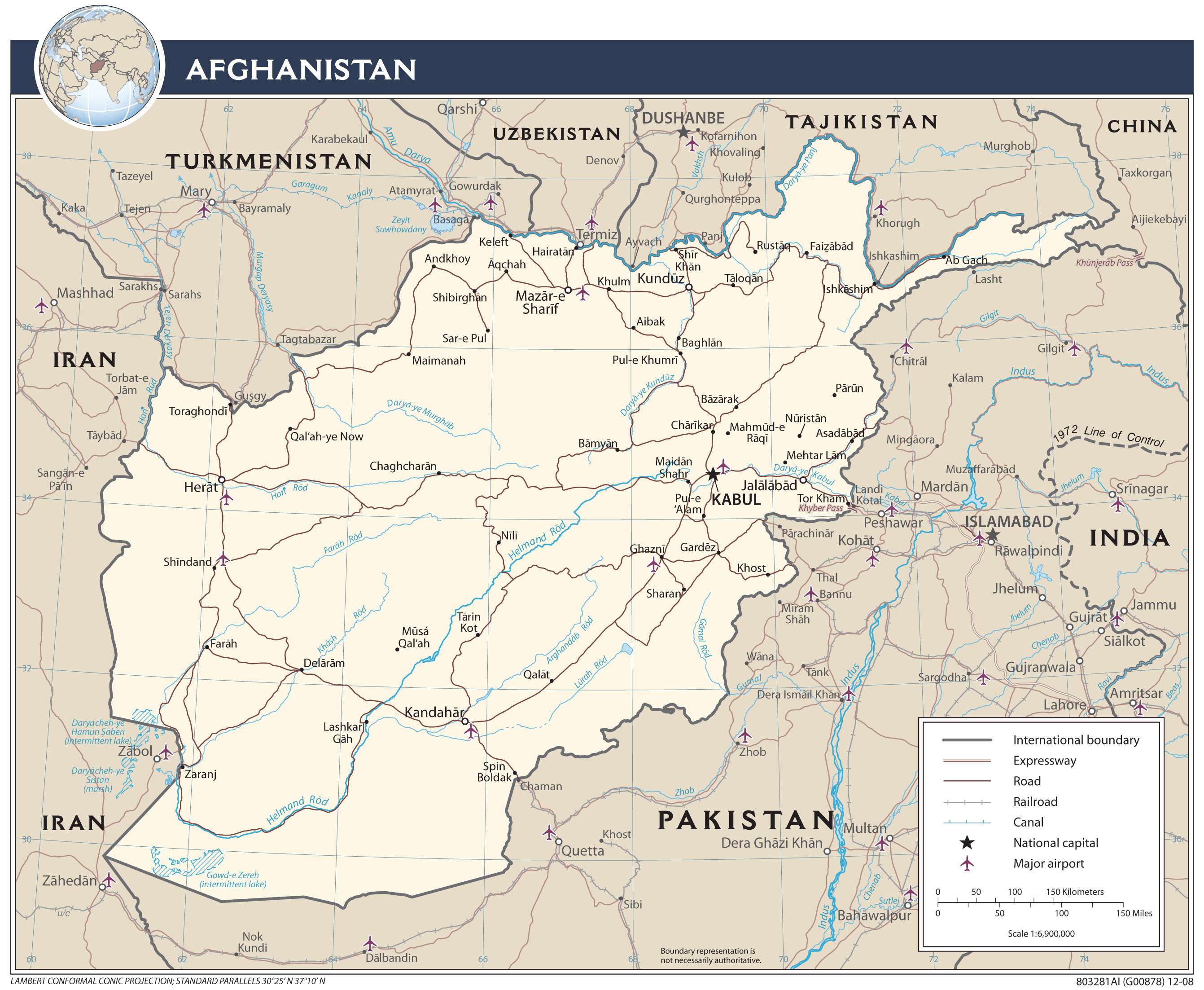
Transportation Map of Afghanistan
Afghanistan Satellite Map