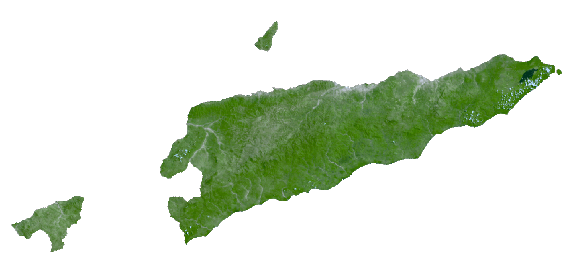
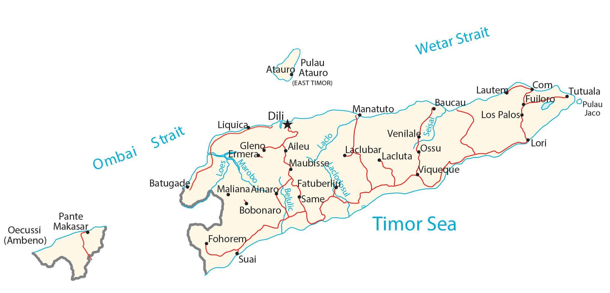
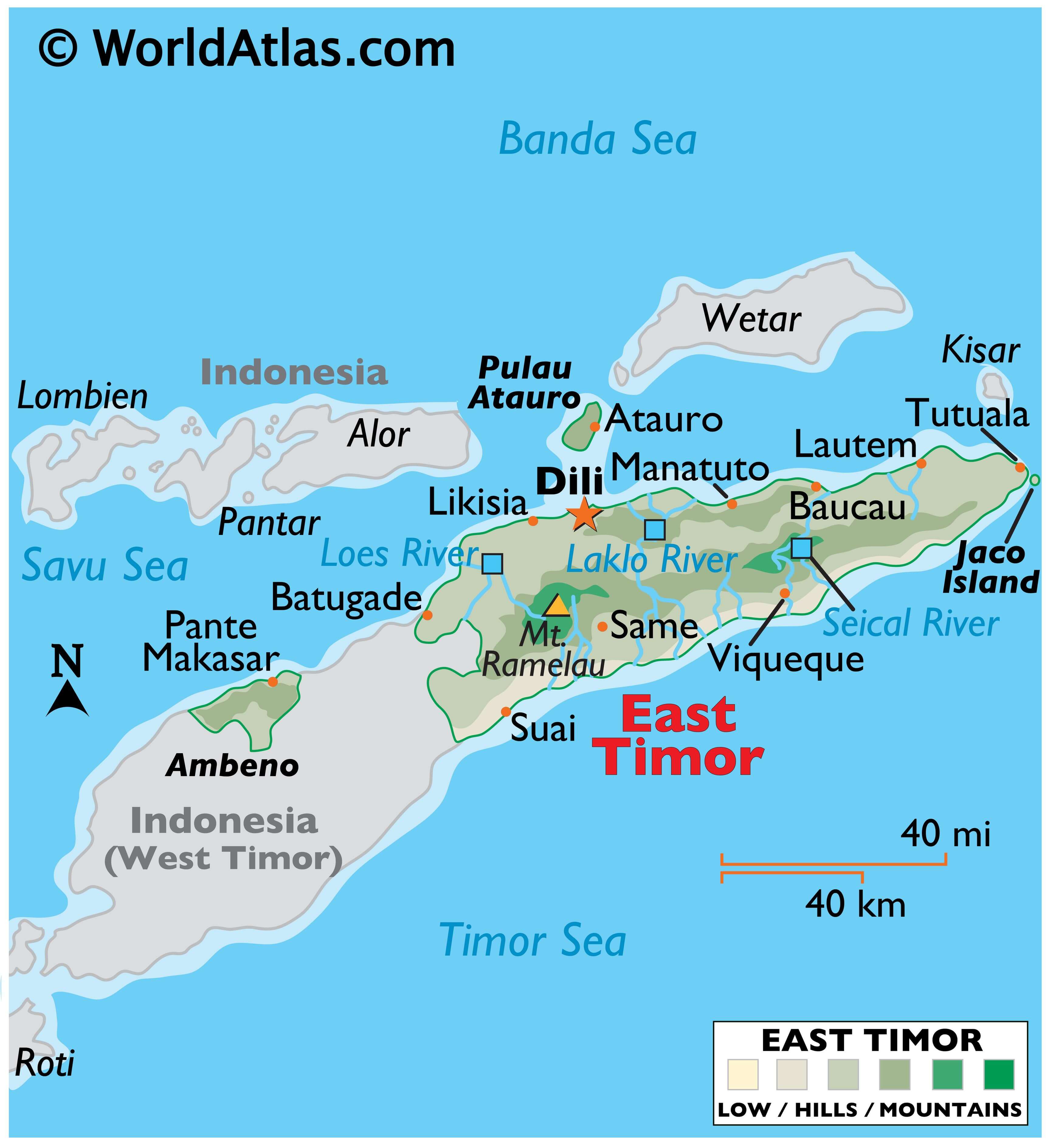
Sharing the island of Timor with West Timor of Indonesia, Timor-Leste, also called East Timor, is a sovereign nation with a total area of about 15,007 sq. km. As shown on the physical map of the country above, East Timor also includes several islands like Atauro and Jaco. It also has an enclave of Ambeno on the northwestern coast of the Timor island.
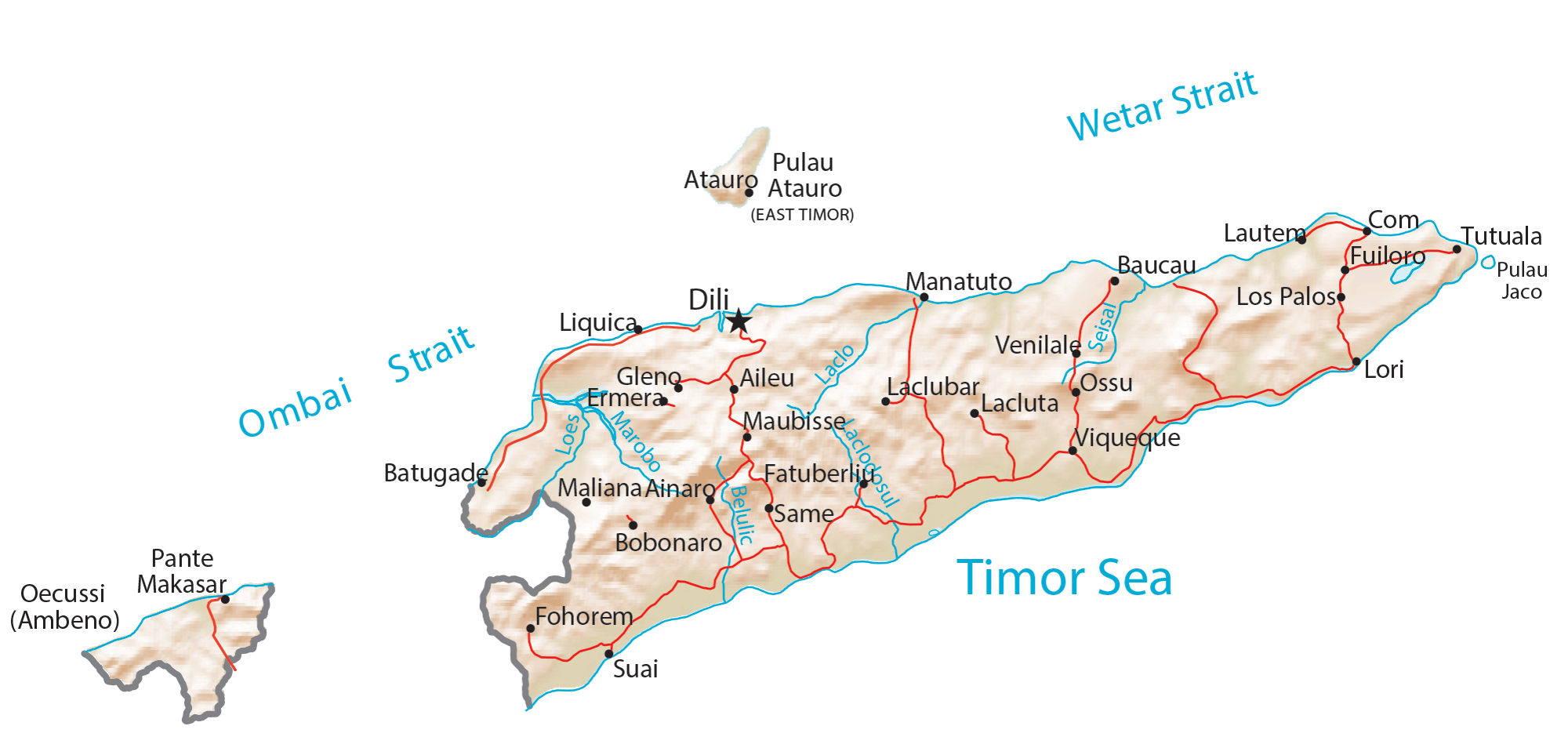
The terrain is mostly mountainous. The country is surrounded by a flat plain that rises abruptly into the foothills of the rugged mountains that run through its heart.
The loftiest peaks are found in the Ramelau Range, where the country’s highest point, Foho Tatamailau, is located at 2,963 m. An upright triangle marks the position of this highest point on the map.
Meandering rivers have formed deep gorges through the mountains. The most significant rivers are the Lakla, Lies and Seical. Their courses can be seen on the map. In addition, dozens of smaller rivers drain the land.
| Flag: |  |
|---|---|
| Legal Name: | Democratic Republic of Timor-Leste |
| Capital Value: | Dili |
| Official languages: |
|
| Demonym(s): |
|
| Government: | Unitary semi-presidential republic |
| Legislature: | National Parliament |
| Total Area: | 14,874 km² |
| Land Area: | 14,874 km² |
| Population: | 1,293,119 |
| Density: | 78/km (202.0/sq mi) (137th) |
| GDP: | $1.67 Billion |
| GDP Per Capita: | $1,294.19 |
| Currency Value: | US Dollar (USD) |
| Driving side: | left |
| Calling code: | +670 |
| Internet TLD: | .tl |
Discover the beauty of East Timor (Timor-Leste) with this detailed map. Explore its interior plateau, cities, highways, lakes, and rivers. Get to know the country’s geography and topography like never before!
Online Interactive Political Map
Click on ![]() to view map in "full screen" mode.
to view map in "full screen" mode.
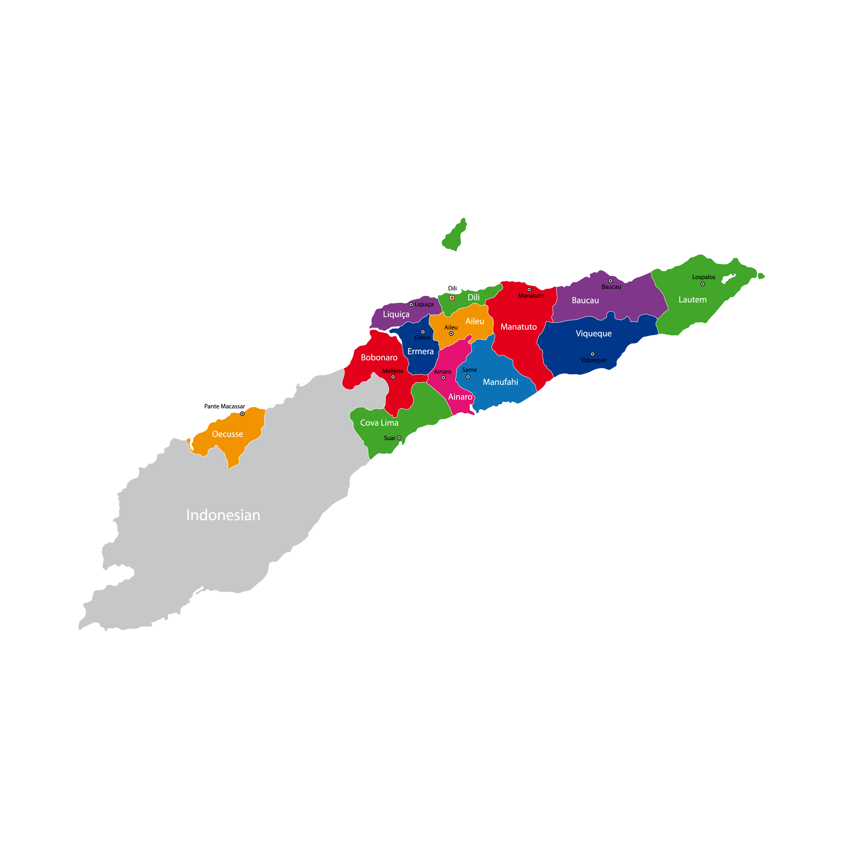
Timor Leste/East Timor is divided into 13 municipalities. In alphabetical order, these municipalities are: Aileu, Ainaro, Baucau, Bobonaro, Cova Lima, Dili, Ermera, Liquiḉẚ, Lautẻm, Manatuto, Manufahi, Oecusse, and Viqueque. These municipalities are further subdivided into 65 administrative posts, 442 villages, and 2,225 aldeias.
With an area of 1,877 sq. km, Viqueque is the largest municipality of the country while Dili is the most populous one. The latter is the capital city of Timor Leste and also the main maritime port and commercial hub of the nation.
Location Maps
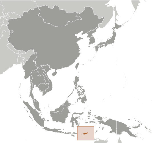
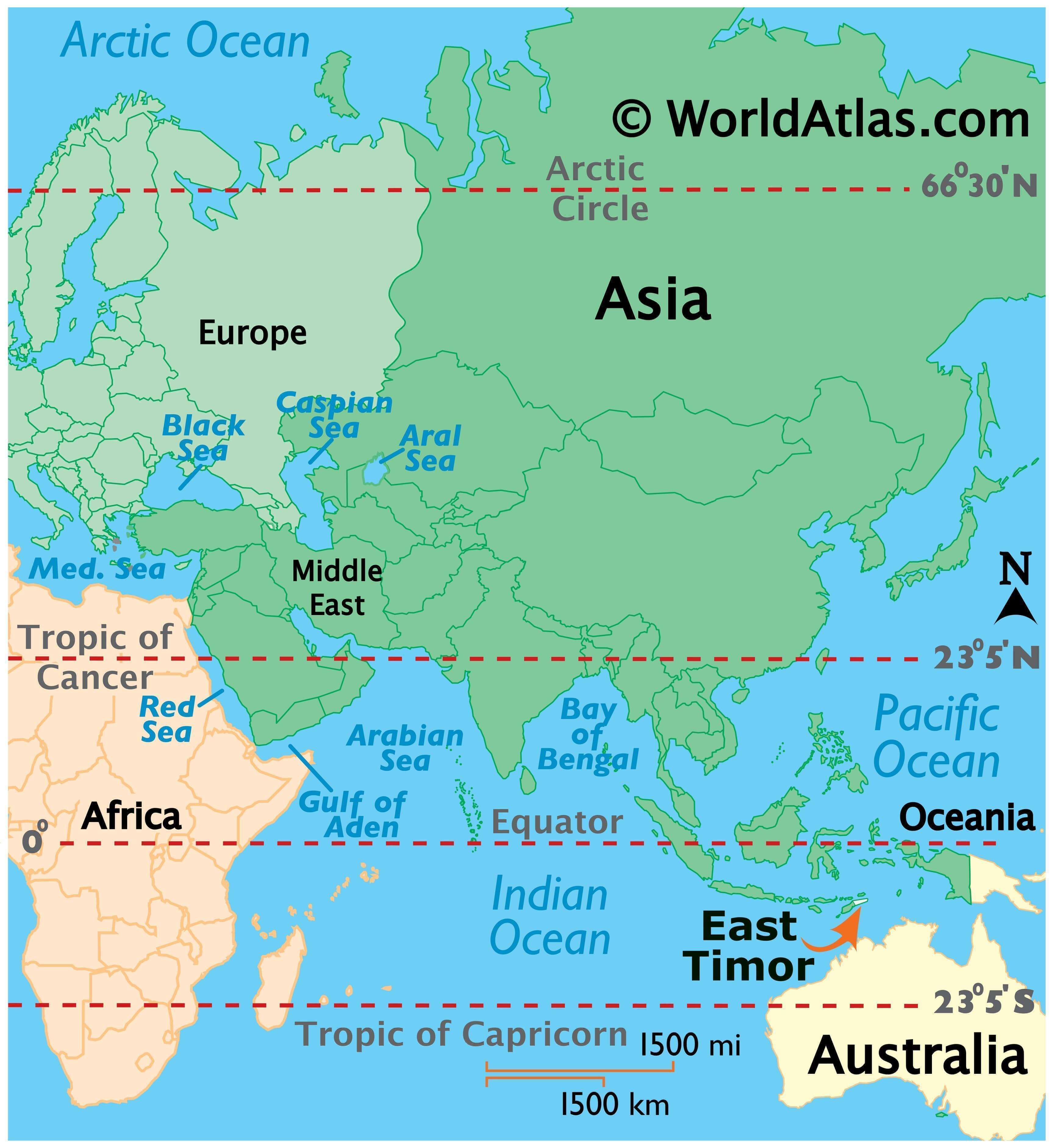
Where is Timor-Leste?
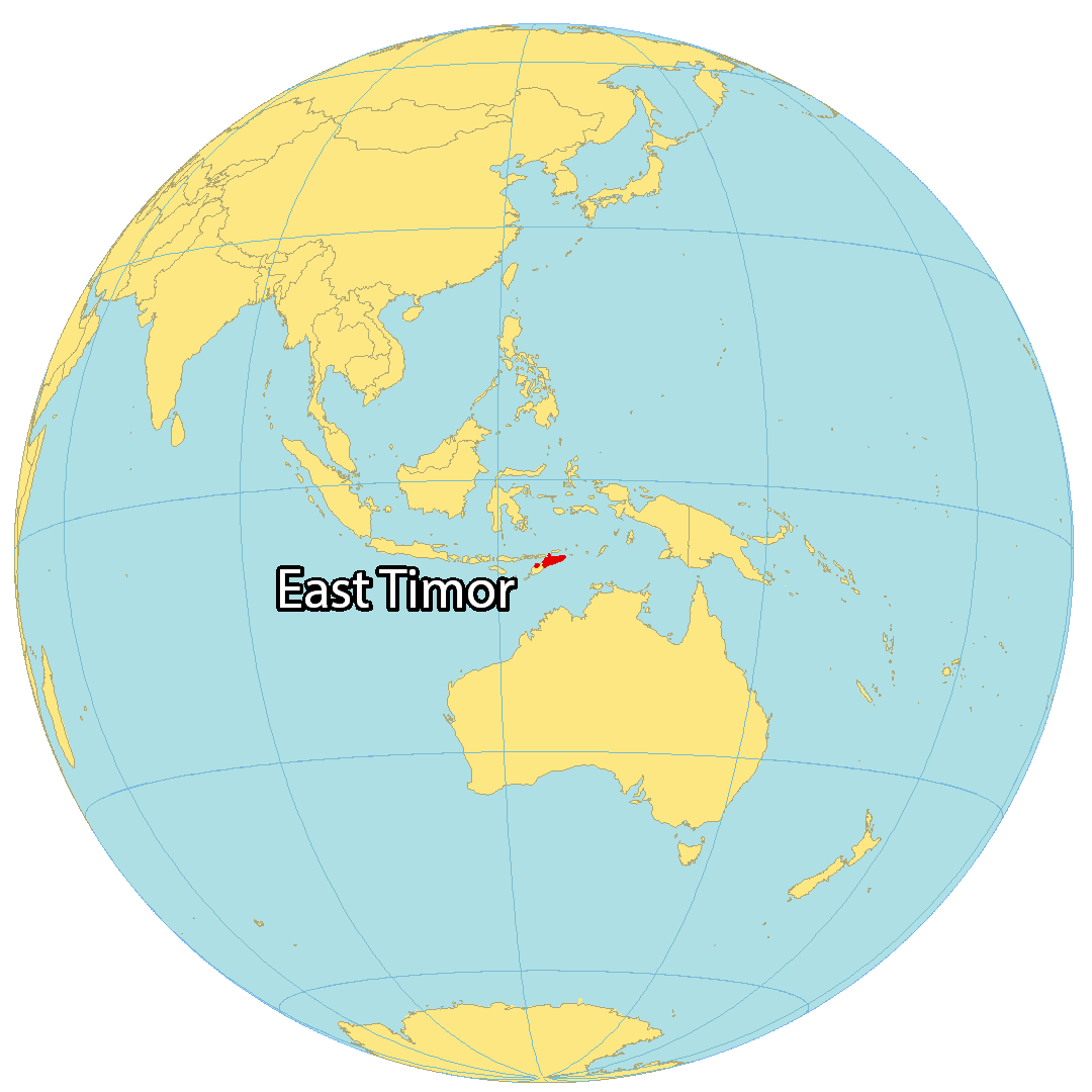
East Timor (Timor-Leste) is a small country located in southeastern Asia, occupying the eastern half of the island of Timor. The capital and largest city of East Timor is Dili, located in the north. The country also includes the islands of Pulau Atauro and Pulau Jaco in the north and east, and the exclave of Oecussi to the west.
East Timor is the only country in Asia that is entirely located in the Southern Hemisphere. It is situated east of Indonesia and northwest of Australia, between the Timor Sea, Savu Sea, and the Banda Sea.
High Definition Political Map of Timor-Leste
History
Prehistory and Classical era
Cultural remains at Jerimalai on the eastern tip of East Timor have been dated to 42,000 years ago. The first known inhabitants are those who arrived during the Australo-Melanesian migration through the region, likely bringing the precursors to today’s Papuan languages. A later migration of Austroasiatic-speakers is suspected, although no such languages remain. The arrival of Austronesian peoples brought new languages, and merged with existing cultures on the island. Timorese origin myths recount settlers sailing around the eastern end of the island before landing in the south. These people are sometimes noted as being from the Malay Peninsula or the Minangkabau highlands of Sumatra. Austronesian migration to Timor may be associated with the development of agriculture on the island.
While information is limited about the political system of Timor during this period, the island had developed an interconnected series of polities governed by customary law. Small communities, centred around a particular sacred house, were part of wider sucos (or principalities), which were themselves part of larger kingdoms led by a liurai. Authority within these kingdoms was held by two individuals, with the worldly power of the liurai balanced by the spiritual power of a rai nain, who was generally associated with the primary sacred house of the kingdom. These polities were numerous and saw shifting alliances and relations, but many were stable enough that they survived from initial European documentation in the 16th century until the end of Portuguese rule.
From perhaps the thirteenth century, the island exported sandalwood, which was valued both for its use in crafting and as a source of perfume. Timor was included in Southeast Asian, Chinese, and Indian trading networks by the fourteenth century, exporting sandalwood, honey, and wax. The island was recorded by the Majapahit Empire as a source of tribute. It was sandalwood that attracted European explorers to the island in the early sixteenth century. Early European presence was limited to trade, with the first Portuguese settlement being on the nearby island of Solor.
Portuguese era (1769–1975)
Early Portuguese presence on Timor was very limited; trade was directed through Portuguese settlements on nearby islands. Only in the 17th century did they establish a more direct presence on the island, a consequence of being driven out of other islands by the Dutch. After Solor was lost in 1613 the Portuguese moved to Flores. In 1646 the capital moved to Kupang on Timor’s west, before Kupang too was lost to the Dutch in 1652. The Portuguese then moved to Lifau, in what is now East Timor’s Oecusse exclave. Effective European occupation in the east of the island only began in 1769, when the city of Dili was founded, although actual control remained highly limited. A definitive border between the Dutch and Portuguese parts of the island was established by the Permanent Court of Arbitration in 1914 and remains the international boundary between the successor states Indonesia and East Timor, respectively.
For the Portuguese, East Timor remained little more than a neglected trading post, with minimal investment in infrastructure and education, until the late nineteenth century. Even when Portugal established actual control over the interior of its colony, investment remained minimal. Sandalwood continued to be the main export crop and coffee exports became significant in the mid-nineteenth century.
At the beginning of the twentieth century, a faltering domestic economy prompted the Portuguese to extract greater wealth from its colonies, which was met with East Timorese resistance. The colony was seen as an economic burden during the Great Depression and received little support or management from Portugal.
During World War II, Dili was occupied by the Allies in 1941, and later by the Japanese beginning in 1942. The mountainous interior of the colony became the scene of a guerrilla campaign, known as the Battle of Timor. Waged by East Timorese volunteers and Allied forces against the Japanese, the struggle killed between 40,000 and 70,000 East Timorese civilians. The Japanese eventually drove the last of the Australian and Allied forces out in early 1943. Portuguese control resumed, however, after Japanese surrender at the end of World War II.
Portugal began investment in the colony in the 1950s, funding education and promoting coffee exports, but the economy did not improve substantially and infrastructure improvements were limited. Growth rates remained low, near 2%. Following the 1974 Portuguese revolution, Portugal effectively abandoned its colony in Timor, and civil war between East Timorese political parties broke out in 1975.
The Revolutionary Front for an Independent East Timor (Fretilin) resisted a Timorese Democratic Union (UDT) coup attempt in August 1975, and unilaterally declared independence on 28 November 1975. Fearing a communist state within the Indonesian archipelago, the Indonesian military launched an invasion of East Timor in December 1975. Indonesia declared East Timor its 27th province on 17 July 1976. The United Nations Security Council opposed the invasion, and the territory’s nominal status in the UN remained as “non-self-governing territory under Portuguese administration”.
Indonesian occupation (1975–1999)
Fretilin resisted the invasion, initially as an army, holding territory until November 1978, and then as a guerrilla resistance. The Indonesian occupation of Timor was marked by violence and brutality. A detailed statistical report prepared for the Commission for Reception, Truth and Reconciliation in East Timor cited a minimum of 102,800 conflict-related deaths in the period between 1974 and 1999, including approximately 18,600 killings and 84,200 excess deaths from hunger and illness. The total number of conflict-related deaths during this period is difficult to determine due to a lack of data. One estimate based on Portuguese, Indonesian, and Catholic Church data suggests it may have been as high as 200,000. Repression and restrictions counteracted improvements in health and education infrastructure and services, meaning there was little overall improvement in living standards; economic growth mostly benefited immigrants from elsewhere in Indonesia. A huge expansion of education was intended to increase Indonesian language use and internal security as much as it was for development.
The 1991 massacre of more than 200 demonstrators by the Indonesian military was a turning point for the independence cause, and brought increased international pressure on Indonesia. Following the resignation of Indonesian President Suharto, the new President BJ Habibie, prompted by a letter from Australian Prime Minister John Howard, decided to hold a referendum on independence. A UN-sponsored agreement between Indonesia and Portugal allowed for a UN-supervised popular referendum in August 1999. A clear vote for independence was met with a punitive campaign of violence by East Timorese pro-integration militias supported by elements of the Indonesian military. In response, the Indonesian government allowed a multinational peacekeeping force, INTERFET, to restore order and aid East Timorese refugees and internally displaced persons. On 25 October 1999, the administration of East Timor was taken over by the UN through the United Nations Transitional Administration in East Timor (UNTAET). INTERFET deployment ended in February 2000 with the transfer of military command to the UN.
Contemporary era
On 30 August 2001, the East Timorese voted in their first election organised by the UN to elect members of the Constituent Assembly. On 22 March 2002, the Constituent Assembly approved the Constitution. By May 2002, more than 205,000 refugees had returned. On 20 May 2002, the Constitution of the Democratic Republic of East Timor came into force and East Timor was recognised as independent by the UN. The Constituent Assembly was renamed the National Parliament, and Xanana Gusmão was elected as the country’s first president. On 27 September 2002 the country became a UN member state.
In 2006, a crisis of unrest and factional fighting forced 155,000 people to flee their homes; the United Nations sent in security forces to restore order. The following year, Gusmão declined to run for another term. While there were minor incidents in the build-up to the mid-year presidential elections, the process was peaceful overall and José Ramos-Horta was elected president. In June 2007, Gusmão ran in the parliamentary elections and became prime minister at the head of the National Congress for Timorese Reconstruction (CNRT) party. In February 2008, Ramos-Horta was critically injured in an attempted assassination; Prime Minister Gusmão also faced gunfire separately but escaped unharmed. Australian reinforcements were immediately sent to help keep order. In March 2011, the UN handed over operational control of the police force to the East Timor authorities. The United Nations ended its peacekeeping mission on 31 December 2012.
Francisco Guterres of the centre-left Fretilin party became president in May 2017. The leader of Fretilin, Mari Alkatiri, formed a coalition government after the July 2017 parliamentary election. This government soon fell, leading to a second general election in May 2018. In June 2018, former president and independence fighter, Taur Matan Ruak, became the new prime minister. José Ramos-Horta again became president in 20 May 2022 after winning the April 2022 presidential election runoff against Francisco Guterres.
Physical Map of Timor-Leste


Geography
Located in between Southeast Asia and the South Pacific, the island of Timor is the largest of the Lesser Sunda Islands, which lie within the Malay archipelago. The island is surrounded by the Ombai and Wetar Straits of the rougher Banda Sea in the north, and the calmer Timor Sea in the south. East Timor shares the island with Indonesia, with Indonesian territory separating the Oecusse exclave from the rest of the country. The island of Atauro lies north of the mainland, with the fourth area being the small island of Jaco. The Savu Sea lies north of Oecusse. The country is about 265 kilometres (165 mi) long and 97 kilometres (60 mi) wide, with a total land area of 14,874 square kilometres (5,743 sq mi). This territory is situated between 8′15S – 10′30S latitude and 125′50E – 127′30E longitude. The country’s coastline covers around 700 kilometres (430 mi), while the main land border with Indonesia is 125 kilometres (78 mi) long, and the Oecusse land border is around 100 kilometres (62 mi) long. Maritime borders exist with Australia to the south and Indonesia elsewhere. East Timor has an exclusive economic zone of 77,051 km (29,750 sq mi).
The interior of the country is mountainous, with ridges of inactive volcanic mountains extending along the island. Almost half of the country has a slope of at least 40%. The south is slightly less mountainous, and has some plains near the coastline. The highest point is Tatamailau (also known as Mount Ramelau) at 2,963 metres (9,721 ft). Most rivers dry up at least partially during the dry season. Outside of some coastal areas and river valleys, the soil is shallow and prone to erosion, and its quality is poor. The capital and largest city is Dili. The second-largest city is the eastern town of Baucau.
The climate is tropical with relatively stable temperatures throughout the year. A wet season lasts from December to May throughout the country, and lasts slightly longer in the south and the interior due to the effect of a monsoon from Australia. During this period, rainfall can reach 222–252 millimetres (8.7–9.9 in) per month. In the dry season, it drops to 12–18 millimetres (0.47–0.71 in). The country is vulnerable to flooding and landslides that occur as a result of heavy rain, especially when rainfall levels are increased by the La Niña effect. The mountainous interior is cooler than the coasts. Coastal areas are heavily dependent on groundwater, which faces pressure from mismanagement, deforestation, and climate change. While the temperature is thought to have experienced a small increase due to climate change, there has been little change in annual rainfall.
Coastal ecosystems around the country are diverse and varied, with vary spatially between the north and south coastlines, as well as between the eastern tip and areas more to the west. These ecosystems include coral reefs, as the country’s waters are part of the Coral Triangle biodiversity hotspot. The easternmost area of East Timor consists of the Paitchau Range and the Lake Ira Lalaro area, which contains the country’s first conservation area, the Nino Konis Santana National Park. It contains the last remaining tropical dry forested area within the country. It hosts a number of unique plant and animal species and is sparsely populated. The northern coast is characterised by a number of coral reef systems that have been determined to be at risk.
There are around 41,000 terrestrial plant species in the country. Forests covered 35% of East Timor’s land in the mid 2010s. The forests of the northern coast, central uplands, and southern coast are distinct. East Timor is home to the Timor and Wetar deciduous forests ecoregion. There is some environmental protection in law, but it has not been a government priority. In addition to climate change, local ecosystems are threatened by deforestation, land degradation, overfishing, and pollution.
Transportation Map of Timor-Leste

Timor-Leste Satellite Map