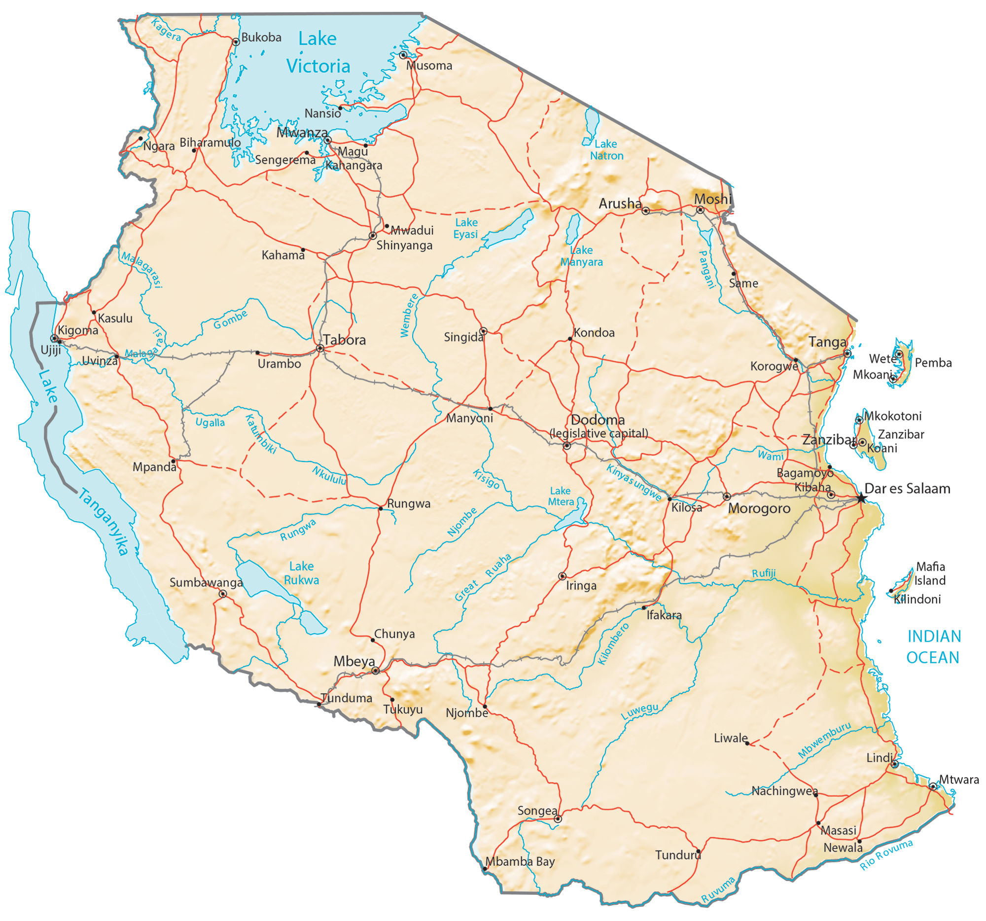
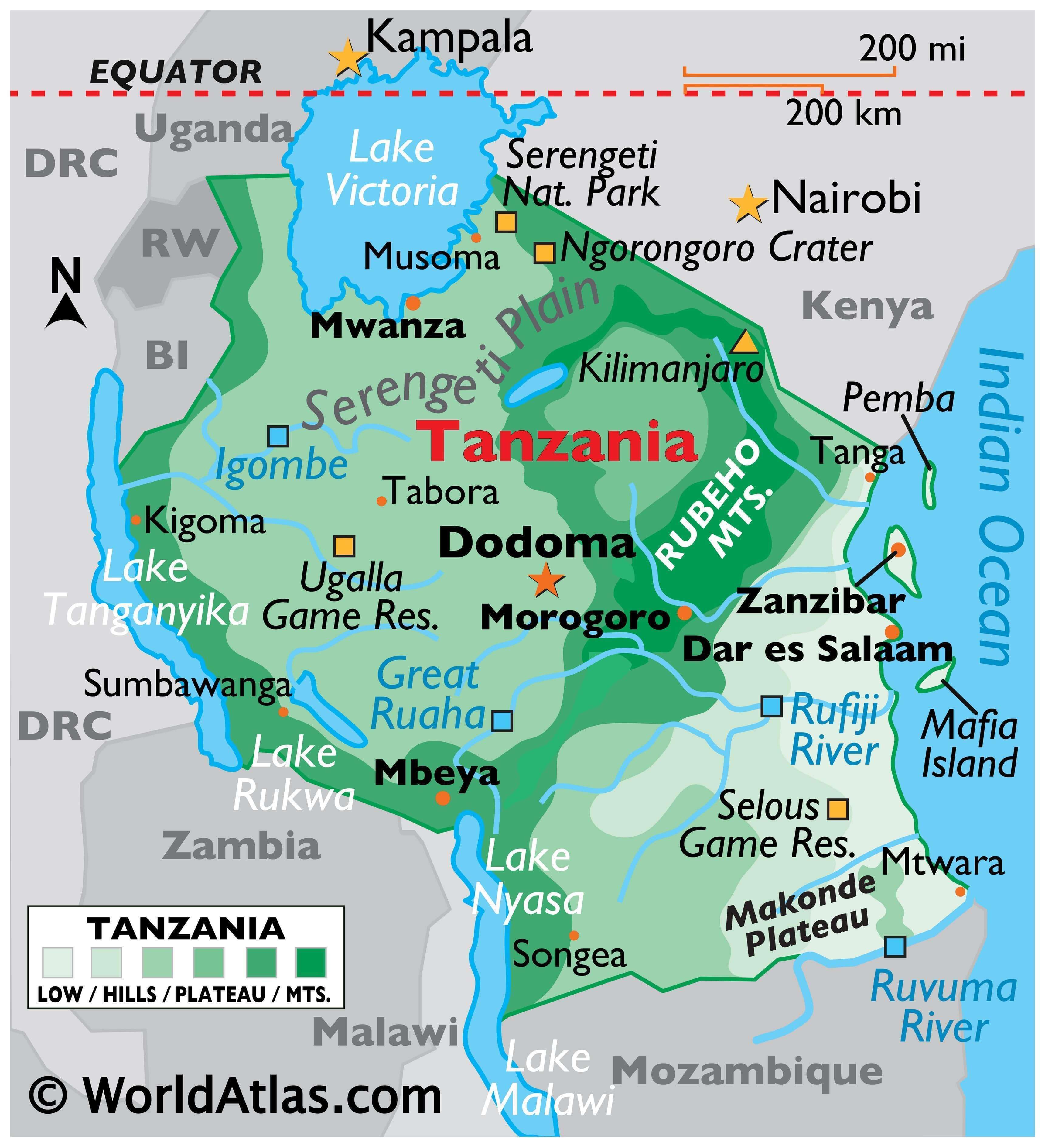
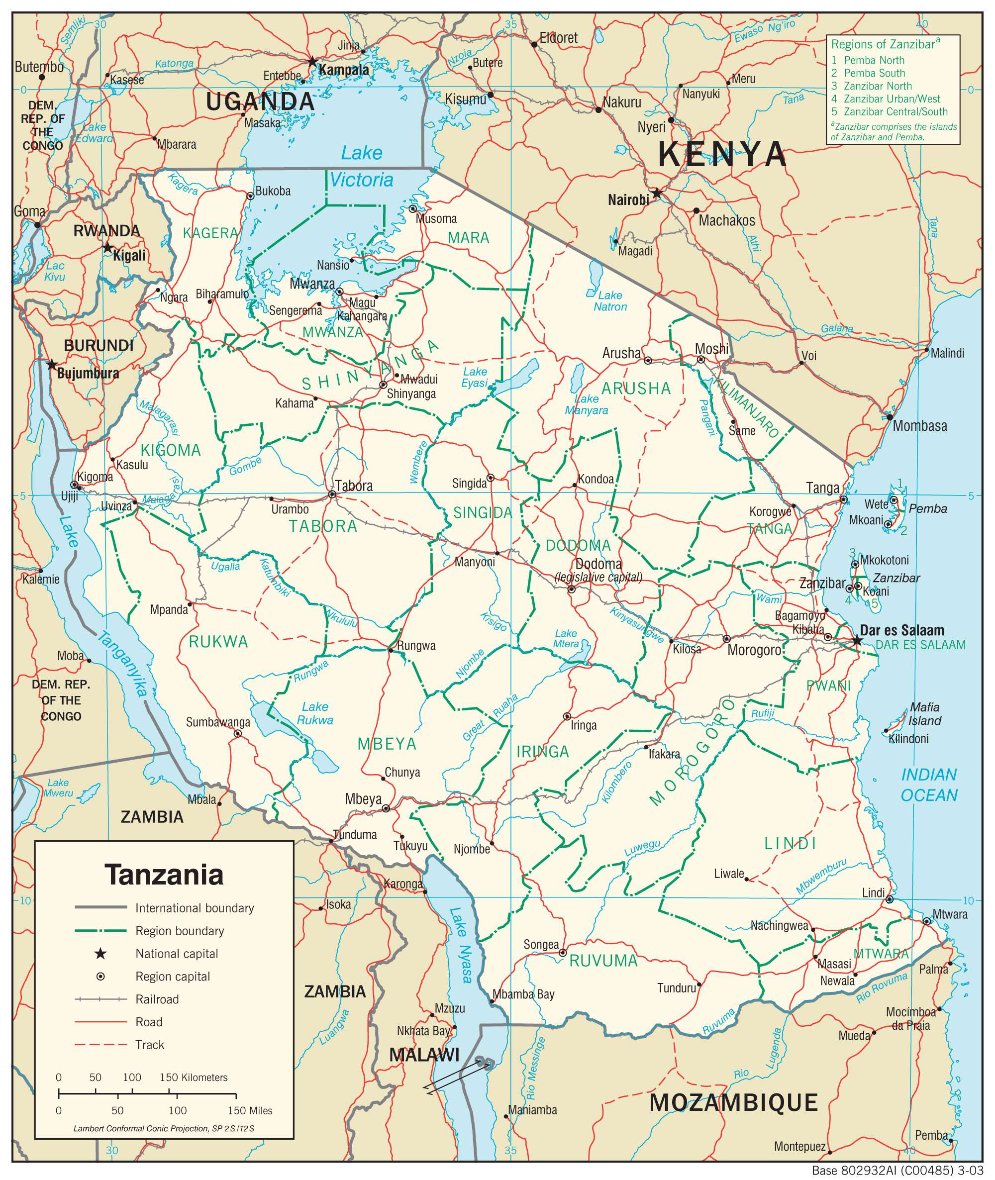
Tanzania has varied geography with several spectacular and globally famous natural features several of which have been represented on the physical map above.
The country has two branches of the East African Rift System that runs in the north-south direction through the country. The central part between these two mountain systems is occupied by a massive plateau covered with vast tracts of grasslands, arable lands and protected areas. Dodoma, the national capital, is located in this region.
The 5,895m tall Mount Kilimanjaro, Africa’s highest peak and an inactive volcano, is located in north-east Tanzania which is a highly mountainous region and part of the eastern branch of the East African Rift System. Lake Nyasa is also part of this mountain system.
Further north is the Ngorongoro Conservation Area hosting the Ngorongoro Crater marked on the physical map above, a massive volcanic caldera that is part of the Crater Highlands region. It is a UNESCO World Heritage Site.
Northwards and westwards is the renowned Serengeti National Park of Tanzania that draws tourists from across the globe to witness the annual wildlife migrations.
As can be observed on the map, the northern border of Tanzania with Kenya and Uganda has the southern portion of Lake Victoria, Africa’s biggest lake and source of the River Nile.
Another famous lake, the world’s second deepest one, Lake Tanganyika is located along Tanzania’s border with the Democratic Republic of the Congo. It is part of the western branch of the East African Rift System.
The eastern coast of the country comprises of a narrow band of coastal lowlands that hosts Dar-es-salaam, the commercial capital. The Zanzibar and Pemba islands are located north-east of this city in the Indian Ocean
Rivers that drain eastern and central Tanzania drain into the Indian Ocean. The 600 km long Rufiji River is the longest river in the country and it drains into the Indian Ocean. Northern Tanzanian rivers mostly empty into Lake Victoria while the western part of the country lies in the watershed of Lake Tanganyika. Lake Malawi receives waters from many southwestern Tanzanian Rivers. Several endorheic basins are located in north-central Tanzania.
| Flag: |  |
|---|---|
| Legal Name: | United Republic of Tanzania |
| Capital Value: | Dar es Salaam (administrative capital), Dodoma (legislative capital); note – Dodoma was designated the national capital in 1996 and serves as the meeting place for the National Assembly; Dar es Salaam remains the de facto capital, the country’s larges |
| Official languages: |
|
| Demonym(s): | Tanzanian |
| Government: | Unitary dominant-party presidential republic |
| Legislature: | National Assembly |
| Total Area: | 947,300 km² |
| Land Area: | 885,800 km² |
| Water Area: | 61,500 km² |
| Population: | 58,005,463 |
| Density: | 47.5/km (123.0/sq mi) (157th) |
| GDP: | $63.18 Billion |
| GDP Per Capita: | $1,122.12 |
| Currency Value: | Tanzanian shillings (TZS) |
| Driving side: | left |
| Calling code: | +255 |
| Internet TLD: | .tz |
Explore Tanzania with this reference map! View its iconic landscapes, including Mount Kilimanjaro, the Serengeti, and Lake Victoria. Satellite imagery and an elevation map provide a detailed view of the country’s mountains, valleys, plains, and plateaus.
Online Interactive Political Map
Click on ![]() to view map in "full screen" mode.
to view map in "full screen" mode.
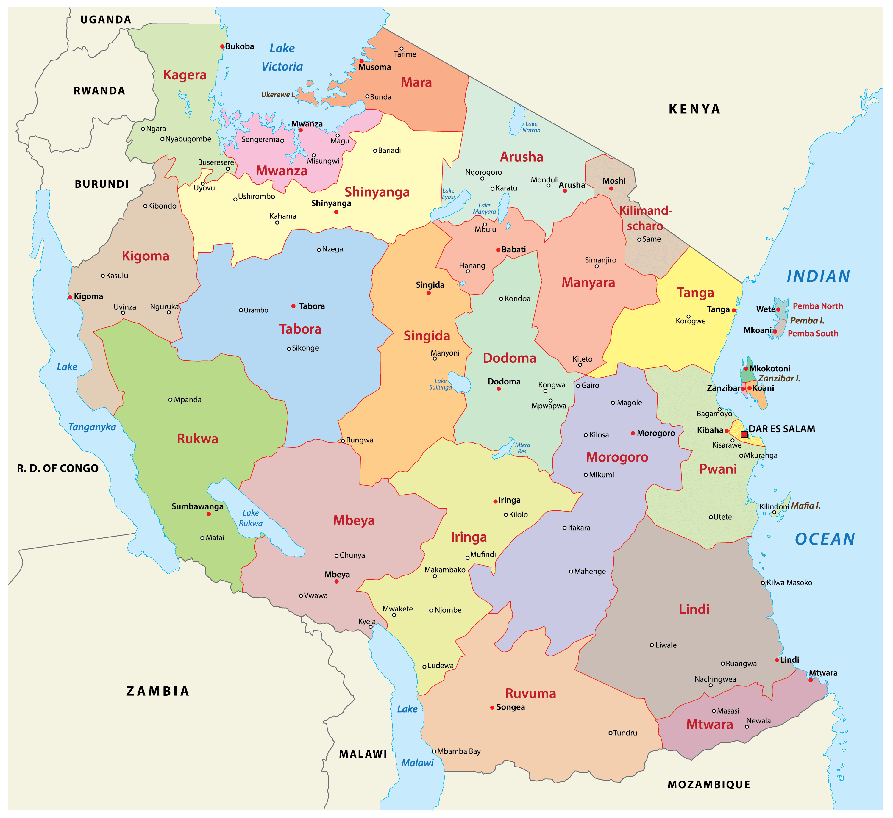
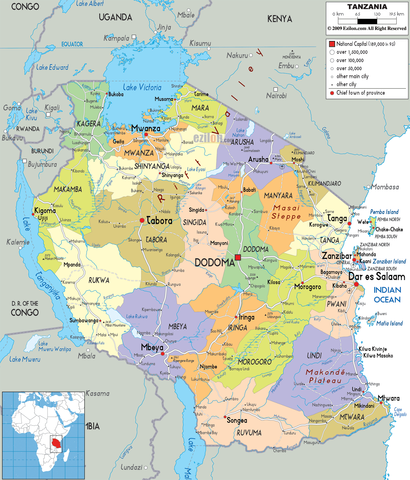
Tanzania is divided into 31 regions as visible on the political map above. In alphabetical order, these regions are as follows: Arusha, Dar es Salaam, Dodoma, Geita, Iringa, Kagera, Kaskazini Pemba (Pemba North), Kaskazini Unguja (Zanzibar North), Katavi, Kigoma, Kilimanjaro, Kusini Pemba (Pemba South), Kusini Unguja (Zanzibar Central/South), Lindi, Manyara, Mara, Mbeya, Mjini Magharibi (Zanzibar Urban/West), Morogoro, Mtwara, Mwanza, Njombe, Pwani (Coast), Rukwa, Ruvuma, Shinyanga, Simiyu, Singida, Songwe, Tabora, Tanga
Each region of the country is further sub-divided into districts, and districts into divisions which are further sub-divided into local wards. It does not stop there. Wards are further divided into streets (in urban areas) and villages (in rural areas).
With an area of 76,150 sq. km, Tabora is the largest region in Tanzania by area. Dar-es-Salaam Region that hosts Dar-es-Salaam city, the former capital of Tanzania, is the country’s largest region by population.
Dodoma, the current capital of the country is part of the Dodoma Region.
Location Maps
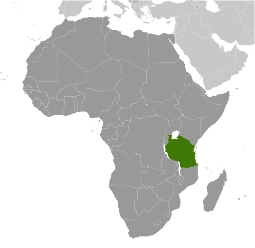
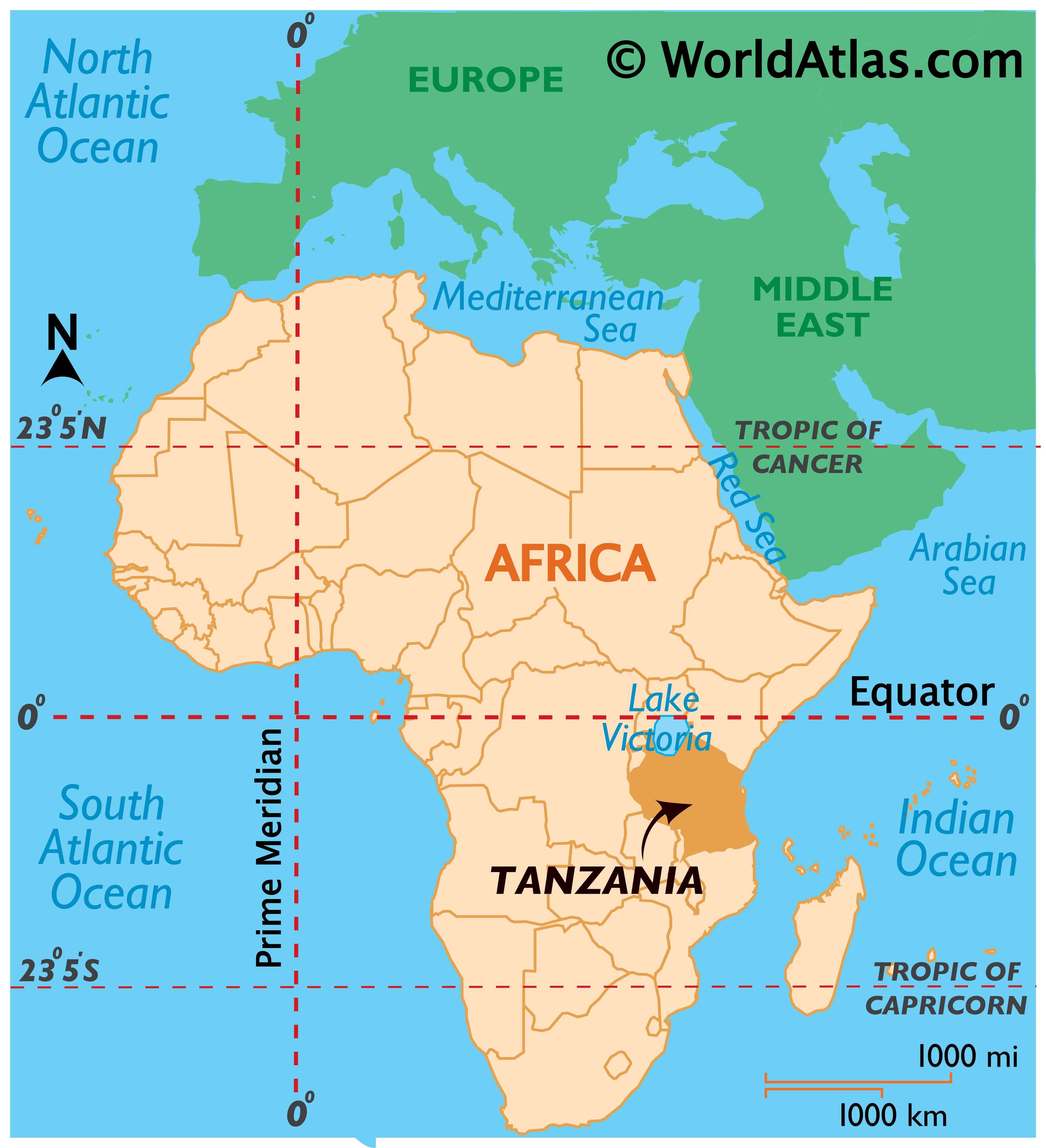
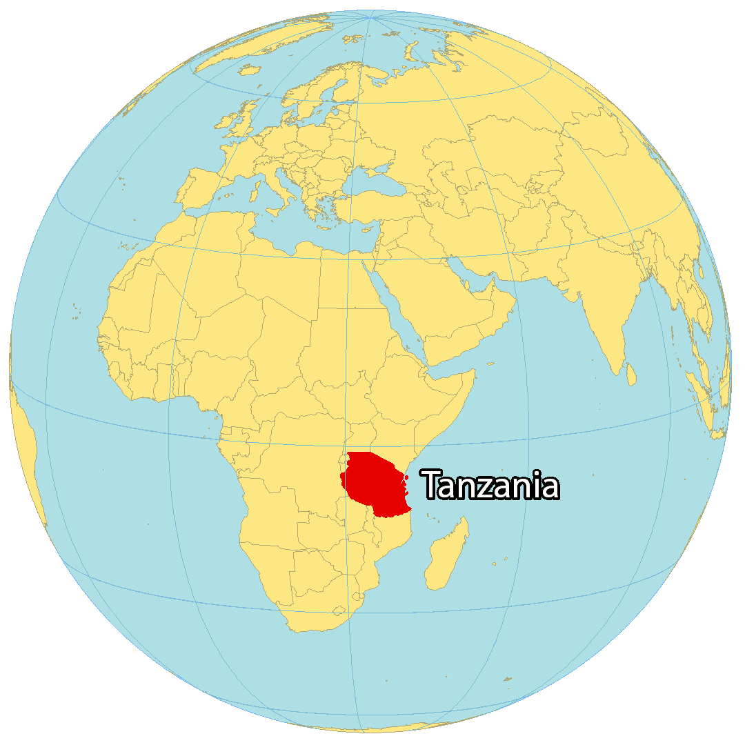
Where is Tanzania?
Tanzania is a country located in eastern Africa, along the Indian Ocean. It’s known for its wilderness, safaris, and Big Five game animals, including the elephant, lion, leopard, buffalo, and rhino. Its borders are shared with 8 African countries including Uganda, Kenya, Rwanda, Burundi, the Democratic Republic of Congo, Zambia, Malawi, and Mozambique. The capital city is Dodoma, although the largest city and commercial hub is Dar es Salaam. Other major cities include Mwanza, Zanzibar, and Arusha. Tanzania is home to memorable sites such as Mount Kilimanjaro, the source of the Nile, the Serengeti, and Africa’s largest lake, Lake Victoria. The geography of the country is varied, with a central plateau and is bordered by mountains, including the Usambara and Uluguru ranges.
High Definition Political Map of Tanzania
History
Ancient
Tanzania is one of the oldest continuously inhabited areas on Earth. Traces of fossil remains of humans and hominids date back to the Quaternary era. The Olduvai Gorge, in the Ngorongoro Conservation Area, a UNESCO World Heritage Site, features a collection with remnants of tools that document the development and use of transitional technology.
The indigenous populations of eastern Africa are thought to be the linguistically isolated Hadza and Sandawe hunter-gatherers of Tanzania.
The first wave of migration was by Southern Cushitic speakers who moved south from Ethiopia and Somalia into Tanzania. They are ancestral to the Iraqw, Gorowa, and Burunge. Based on linguistic evidence, there may also have been two movements into Tanzania of Eastern Cushitic people at about 4,000 and 2,000 years ago, originating from north of Lake Turkana.
Archaeological evidence supports the conclusion that Southern Nilotes, including the Datoog, moved south from the present-day South Sudan / Ethiopia border region into central northern Tanzania between 2,900 and 2,400 years ago.
These movements took place at approximately the same time as the settlement of the iron-making Mashariki Bantu from West Africa in the Lake Victoria and Lake Tanganyika areas. They brought with them the west African planting tradition and the primary staple of yams. They subsequently migrated out of these regions across the rest of Tanzania between 2,300 and 1,700 years ago.
Eastern Nilotic peoples, including the Maasai, represent a more recent migration from present-day South Sudan within the past 500 to 1,500 years.
The people of Tanzania have been associated with the production of iron and steel. The Pare people were the main producers of sought-after iron for peoples who occupied the mountain regions of north-eastern Tanzania. The Haya people on the western shores of Lake Victoria invented a type of high-heat blast furnace, which allowed them to forge carbon steel at temperatures exceeding 1,820 °C (3,310 °F) more than 1,500 years ago.
Travellers and merchants from the Persian Gulf and India have visited the east African coast since early in the first millennium AD. Islam was practised by some on the Swahili Coast as early as the eighth or ninth century AD.
Medieval
Bantu-speakers built farming and trade villages along the Tanzanian coast from the outset of the first millennium. Archaeological finds at Fukuchani, on the north-west coast of Zanzibar, indicate a settled agricultural and fishing community from the 6th century CE at the latest. The considerable amount of daub found indicates timber buildings, and shell beads, bead grinders, and iron slag have been found at the site. There is evidence for limited engagement in long-distance trade: a small amount of imported pottery has been found, less than 1% of total pottery finds, mostly from the Gulf and dated to the 5th to 8th century. The similarity to contemporary sites such as Mkokotoni and Dar es Salaam indicate a unified group of communities that developed into the first centre of coastal maritime culture. The coastal towns appear to have been engaged in Indian Ocean and inland African trade at this early period. Trade rapidly increased in importance and quantity beginning in the mid-8th century and by the close of the 10th century Zanzibar was one of the central Swahili trading towns.
Growth in Egyptian and Persian shipping from the Red Sea and the Persian Gulf revitalised Indian Ocean trade, particularly after the Fatimid Caliphate relocated to Fustat (Cairo). Swahili agriculturalists built increasingly dense settlements to tap into trade, these forming the earliest Swahili city-states. The Venda-Shona Kingdoms of Mapungubwe and Zimbabwe in South Africa and Zimbabwe, respectively, became a major producer of gold around this same period. Economic, social, and religious power was increasingly vested in Kilwa, Tanzania’s major medieval city-state. Kilwa controlled a number of smaller ports stretching down to modern-day Mozambique. Sofala became the major gold emporium and Kilwa grew rich off the trade, lying at the southern end of the Indian Ocean Monsoons. Kilwa’s major rivals lay to the north, in modern-day Kenya, namely Mombasa and Malindi. Kilwa remained the major power in East Africa until the arrival of the Portuguese at the end of the 15th century.
Colonial
Claiming the coastal strip, Omani Sultan Said bin Sultan moved his capital to Zanzibar City in 1840. During this time, Zanzibar became the centre for the east African slave trade. Between 65 and 90 per cent of the Arab-Swahili population of Zanzibar was enslaved. One of the most infamous slave traders on the East African coast was Tippu Tip, who was the grandson of an enslaved African. The Nyamwezi slave traders operated under the leadership of Msiri and Mirambo. According to Timothy Insoll, “Figures record the exporting of 718,000 slaves from the Swahili coast during the 19th century, and the retention of 769,000 on the coast.” In the 1890s, slavery was abolished.
In 1863, the Holy Ghost Mission established an early reception center and depot at Zanzibar. In 1877, responding to appeals of Henry Stanley following his trans-Africa expedition, and permission being given to Stanley by King Mutessa I of Buganda of Buganda, the Church Missionary Society sent missionaries Edward Baxter and Henry Cole to establish inland missions. In 1885, Germany conquered the regions that are now Tanzania (minus Zanzibar) and incorporated them into German East Africa (GEA). The Supreme Council of the 1919 Paris Peace Conference awarded all of GEA to Britain on 7 May 1919, over the strenuous objections of Belgium. The British colonial secretary, Alfred Milner, and Belgium’s minister plenipotentiary to the conference, Pierre Orts [fr], then negotiated the Anglo-Belgian agreement of 30 May 1919 where Britain ceded the north-western GEA provinces of Ruanda and Urundi to Belgium. The conference’s Commission on Mandates ratified this agreement on 16 July 1919. The Supreme Council accepted the agreement on 7 August 1919. On 12 July 1919, the Commission on Mandates agreed that the small Kionga Triangle south of the Rovuma River would be given to Portuguese Mozambique, with it eventually becoming part of independent Mozambique. The commission reasoned that Germany had virtually forced Portugal to cede the triangle in 1894. The Treaty of Versailles was signed on 28 June 1919, although the treaty did not take effect until 10 January 1920. On that date, the GEA was transferred officially to Britain, Belgium, and Portugal. Also on that date, “Tanganyika” became the name of the British territory. In the mid-1920s, the British implemented a system of indirect rule in Tanzania.
The Maji-Maji rebellion, between 1905 and 1907, was an uprising of several African tribes in German East Africa against the colonial authorities, in particular because of forced labor and deportation of certain tribes. It was the subject of a bloody repression, which combined with famine caused 300 000 deaths among the population.
During World War II, about 100,000 people from Tanganyika joined the Allied forces and were among the 375,000 Africans who fought with those forces. Tanganyikans fought in units of the King’s African Rifles during the East African Campaign in Somalia and Abyssinia against the Italians, in Madagascar against the Vichy French during the Madagascar Campaign, and in Burma against the Japanese during the Burma Campaign. Tanganyika was an important source of food during this war, and its export income increased greatly compared to the pre-war years of the Great Depression Wartime demand, however, caused increased commodity prices and massive inflation within the colony.
In 1954, Julius Nyerere transformed an organisation into the politically oriented Tanganyika African National Union (TANU). TANU’s main objective was to achieve national sovereignty for Tanganyika. A campaign to register new members was launched, and within a year, TANU had become the leading political organisation in the country. Nyerere became Minister of British-administered Tanganyika in 1960 and continued as prime minister when Tanganyika became independent in 1961.
Modern
British rule came to an end on 9 December 1961. Elizabeth II, who had acceded to the British throne in 1952, continued to reign through the first year of Tanganyika’s independence, but now distinctly as Queen of Tanganyika, represented by the governor general. Tanganyika also joined the British Commonwealth in 1961. On 9 December 1962, Tanganyika became a democratic republic under an executive president.
After the Zanzibar Revolution overthrew the Arab dynasty in neighbouring Zanzibar, accompanied with the slaughter of thousands of Arab Zanzibaris, which had become independent in 1963, the archipelago merged with mainland Tanganyika on 26 April 1964. The new country was then named the United Republic of Tanganyika and Zanzibar. On 29 October of the same year, the country was renamed the United Republic of Tanzania (“Tan” comes from Tanganyika and “Zan” from Zanzibar). The union of the two hitherto separate regions was controversial among many Zanzibaris (even those sympathetic to the revolution) but was accepted by both the Nyerere government and the Revolutionary Government of Zanzibar owing to shared political values and goals.
Following Tanganyika’s independence and unification with Zanzibar leading to the state of Tanzania, President Nyerere emphasised a need to construct a national identity for the citizens of the new country. To achieve this, Nyerere provided what is regarded as one of the most successful cases of ethnic repression and identity transformation in Africa. With more than 130 languages spoken within its territory, Tanzania is one of the most ethnically diverse countries in Africa. Despite this obstacle, ethnic divisions remained rare in Tanzania when compared to the rest of the continent, notably its immediate neighbour, Kenya. Furthermore, since its independence, Tanzania has displayed more political stability than most African countries, particularly due to Nyerere’s ethnic repression methods.
In 1967, Nyerere’s first presidency took a turn to the left after the Arusha Declaration, which codified a commitment to socialism as well as Pan-Africanism. After the declaration, banks and many large industries were nationalised.
Tanzania was also aligned with China, which from 1970 to 1975 financed and helped build the 1,860-kilometre-long (1,160 mi) TAZARA Railway from Dar es Salaam to Zambia. Nonetheless, from the late 1970s, Tanzania’s economy took a turn for the worse, in the context of an international economic crisis affecting both developed and developing economies.
In 1978, the neighbouring Uganda, under the leadership of Idi Amin, invaded Tanzania. This disastrous invasion would culminate in Tanzania invading Uganda with the aid of Ugandan rebels and deposing Idi Amin as a result. However, the war severely damaged Tanzania’s economy.
Through the 1980s, conservation oriented national parks such as Serengeti and Kilimanjaro, with Mount Kilimanjaro as the tallest freestanding summit on Earth, were included on the UNESCO World Heritage List.
From the mid-1980s, the regime financed itself by borrowing from the International Monetary Fund and underwent some reforms. Since then, Tanzania’s gross domestic product per capita has grown and poverty has been reduced, according to a report by the World Bank.
In 1992, the Constitution of Tanzania was amended to allow multiple political parties. In Tanzania’s first multi-party elections, held in 1995, the ruling Chama Cha Mapinduzi won 186 of the 232 elected seats in the National Assembly, and Benjamin Mkapa was elected as president.
The presidents of Tanzania since Independence have been Julius Nyerere 1962–1985, Ali Hassan Mwinyi 1985–1995, Benjamin Mkapa 1995–2005 Jakaya Kikwete 2005–2015 John Magufuli 2015–2021 and Samia Hassan Suluhu since 2021. After the long tenure of president Nyerere, the Constitution has a term limit: a president can serve a maximum of two terms. Each term is five years. Every president has represented the ruling party Chama cha Mapinduzi (CCM). President Magufuli won a landslide victory and re-election in October 2020. According to the opposition, the election was full of fraud and irregularities.
On 17 March 2021, President John Magufuli died from heart complications while in office. Magufuli’s vice president, Samia Suluhu Hassan, became Tanzania’s first female president.
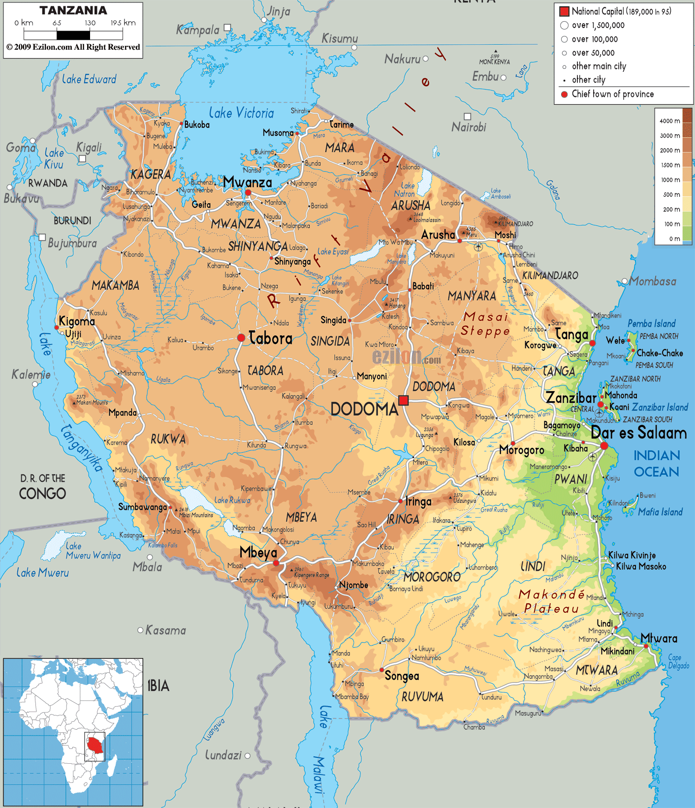
Physical Map of Tanzania
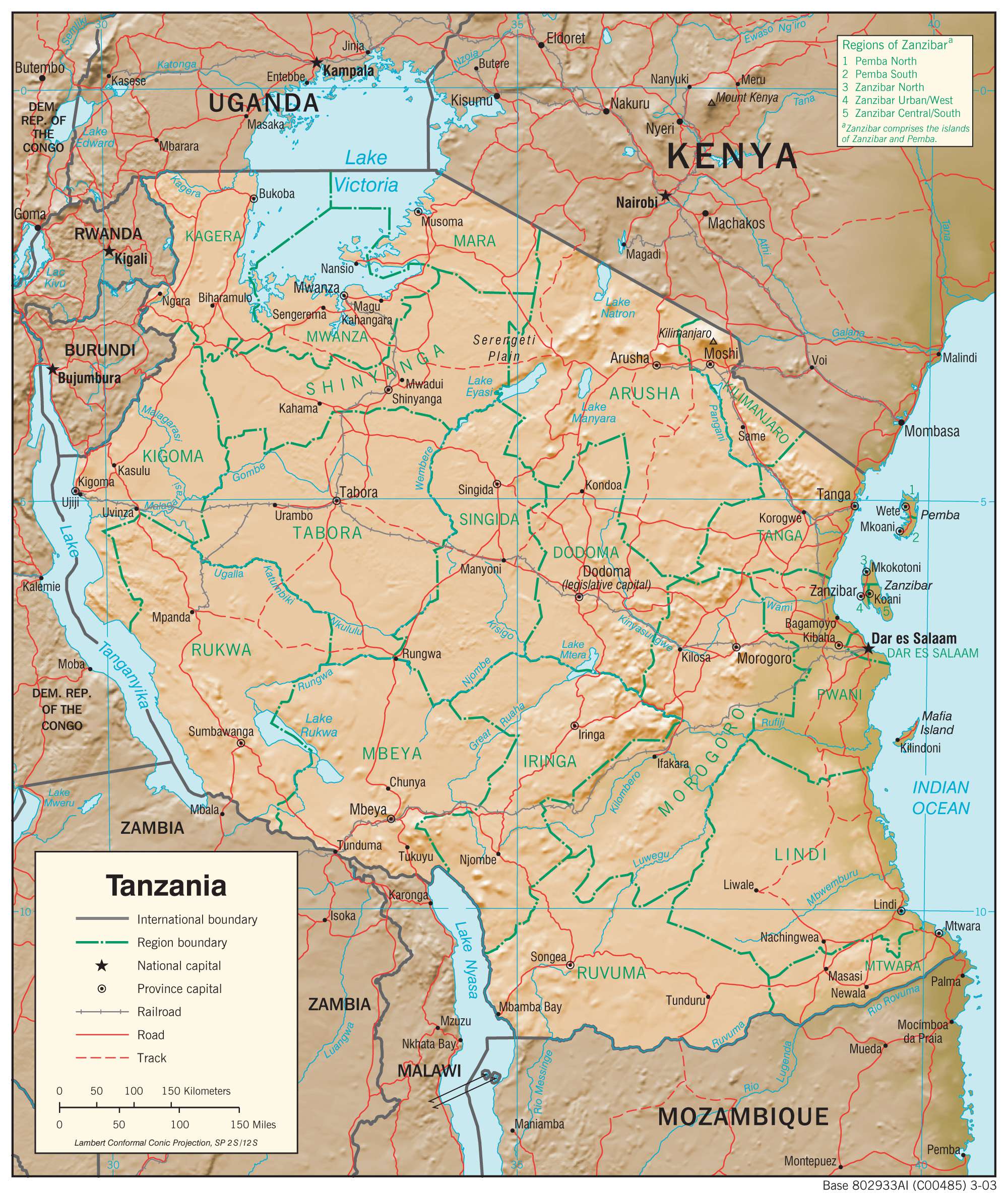
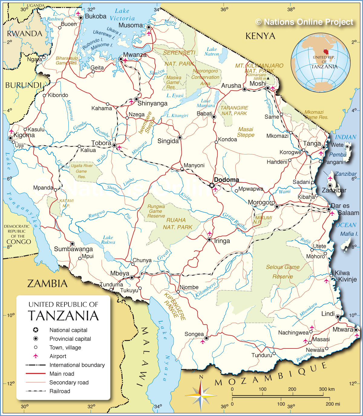
Transportation Map of Tanzania
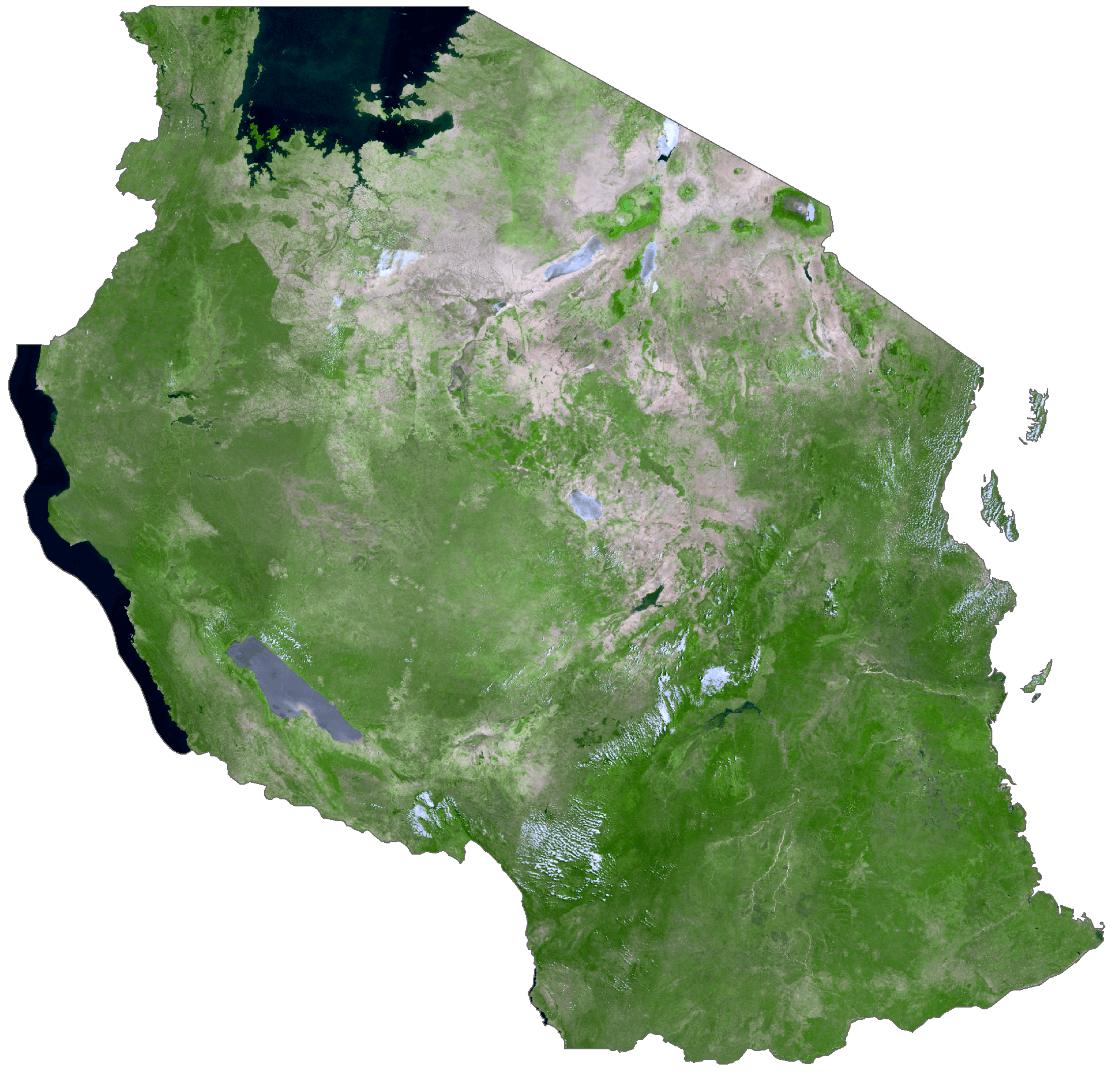
Tanzania Satellite Map
Elevation Map