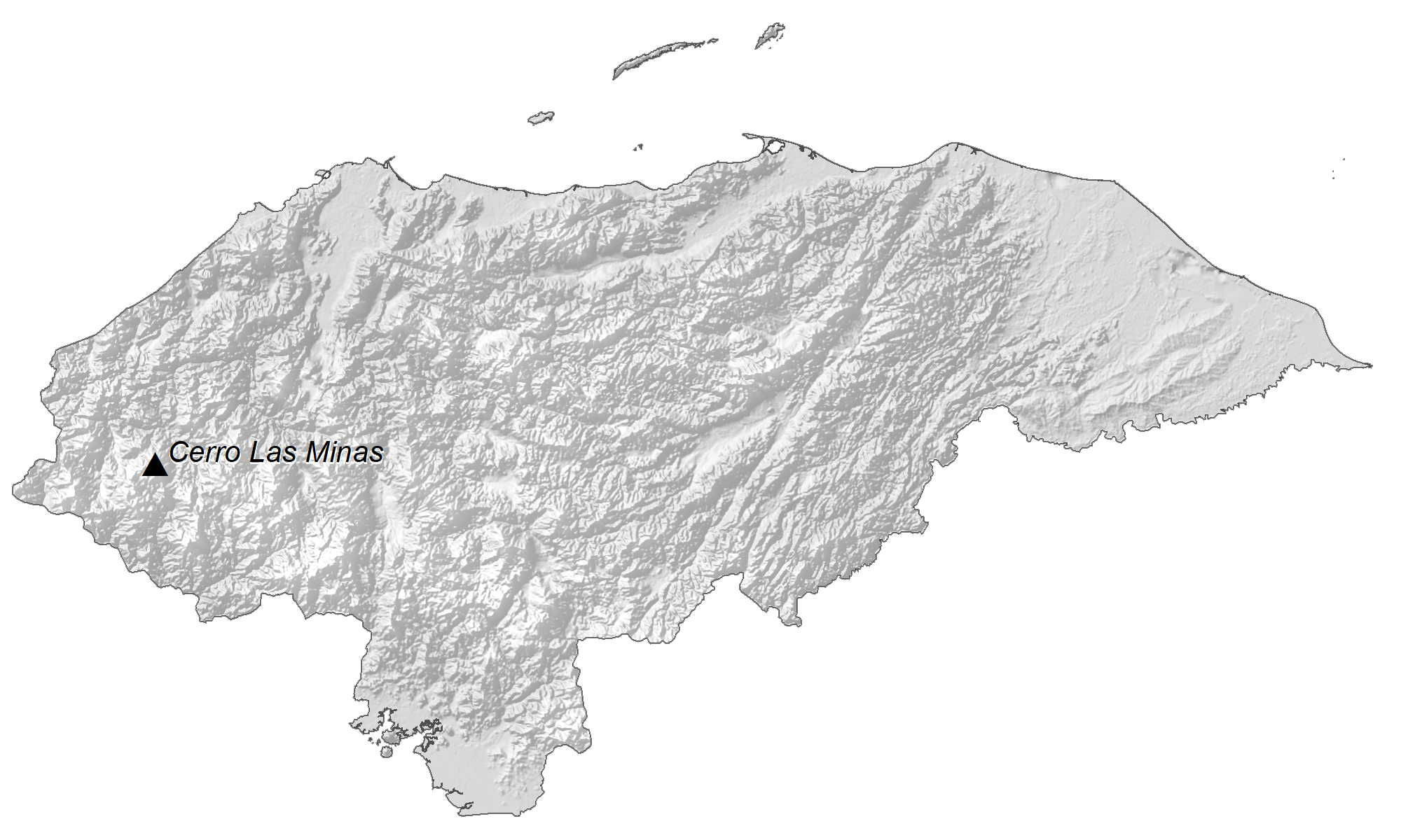
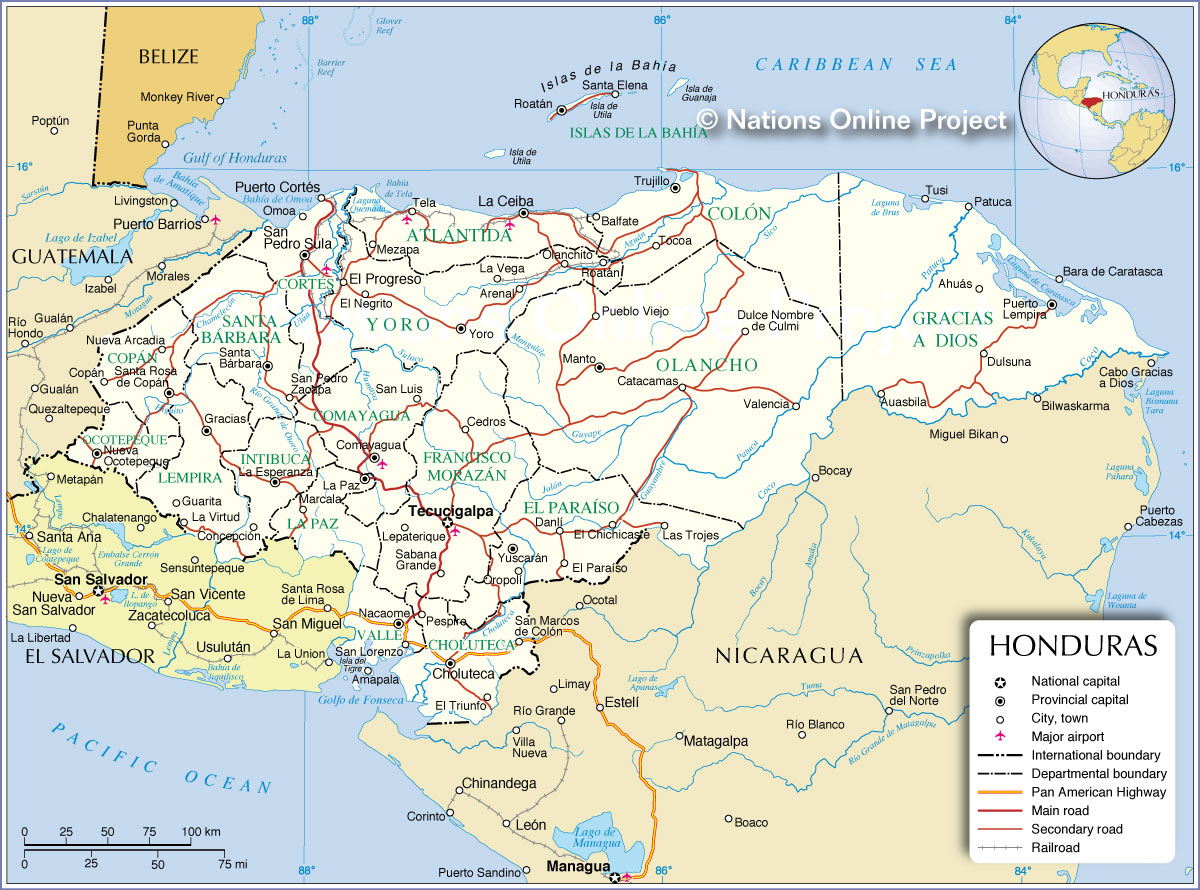
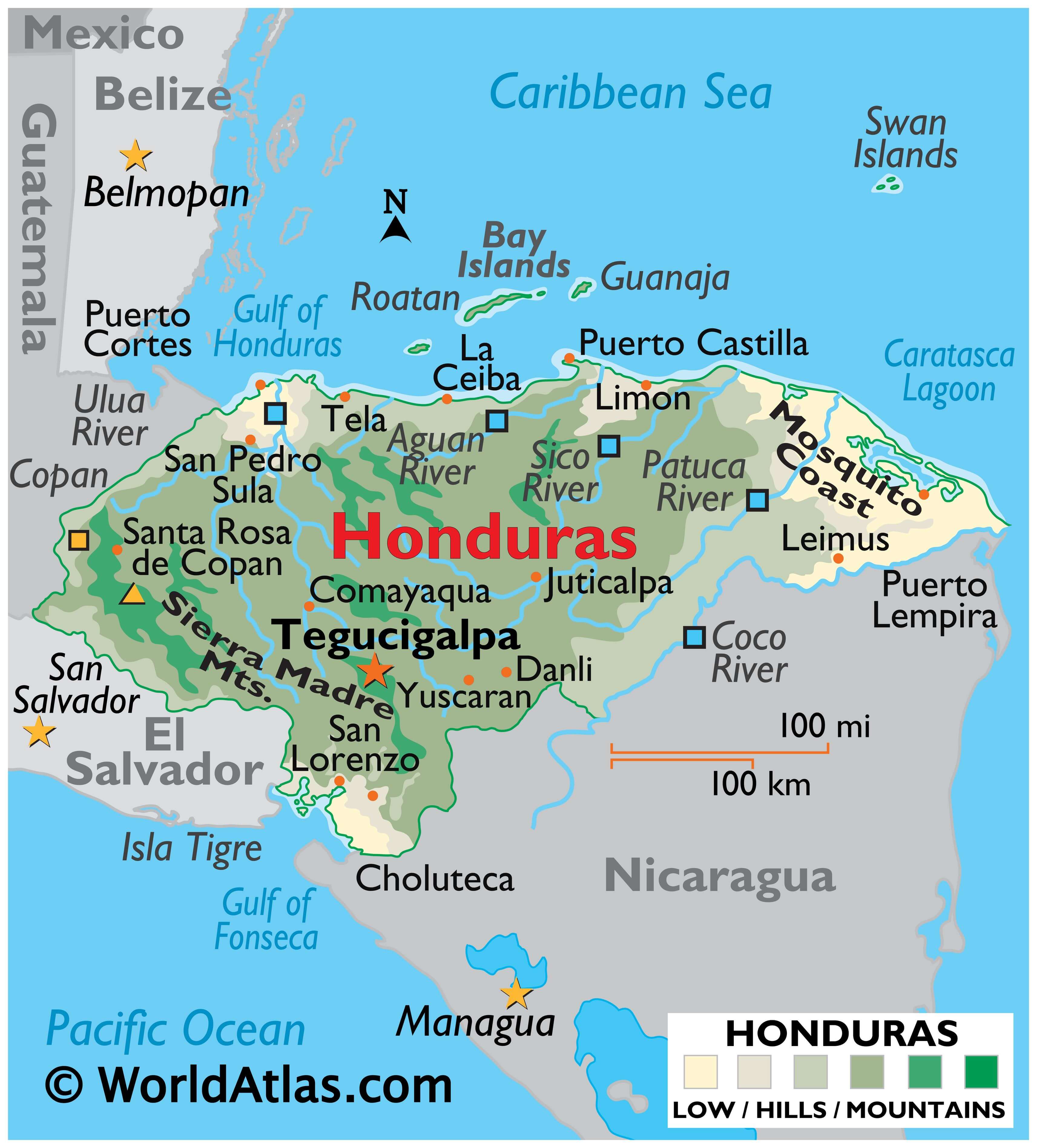
Honduras occupies an area of 112,492 sq. km (43,433 sq. mi) in Central America. As observed on the physical map of Honduras, the country has three major topographical regions. These are a vast interior plateau of hills and mountains that dominate the landscape; the Caribbean lowlands, and the Pacific lowlands- fringing the Gulf of Fonseca.
The forested interior hills and the Sierra Madre Mountains are crisscrossed by a large series of rivers and wide, fertile valleys; fronted by sandy beaches. The 2,870 m (9,420 ft) high Cerro Las Minas located in the western part of the country is the highest point of Honduras.
The Caribbean lowlands extend along its entire northern coastline, and there, in the northeast, as marked on the map, the Mosquito Coast is a broad uninhabited stretch of thick jungle, lagoons and mangrove swamps.
The Pacific lowlands surround the Gulf of Fonseca, and that land also becomes somewhat swampy near the coast. The country has numerous cays and islands in the Caribbean Sea, including Isla de la Bahia (Bay Islands), the tiny Cayos Cocinos (Hog Islands), and the remote Swan Islands. A few long-dormant volcanic islands stand in the Gulf of Fonseca, including Tigre and Zacate.
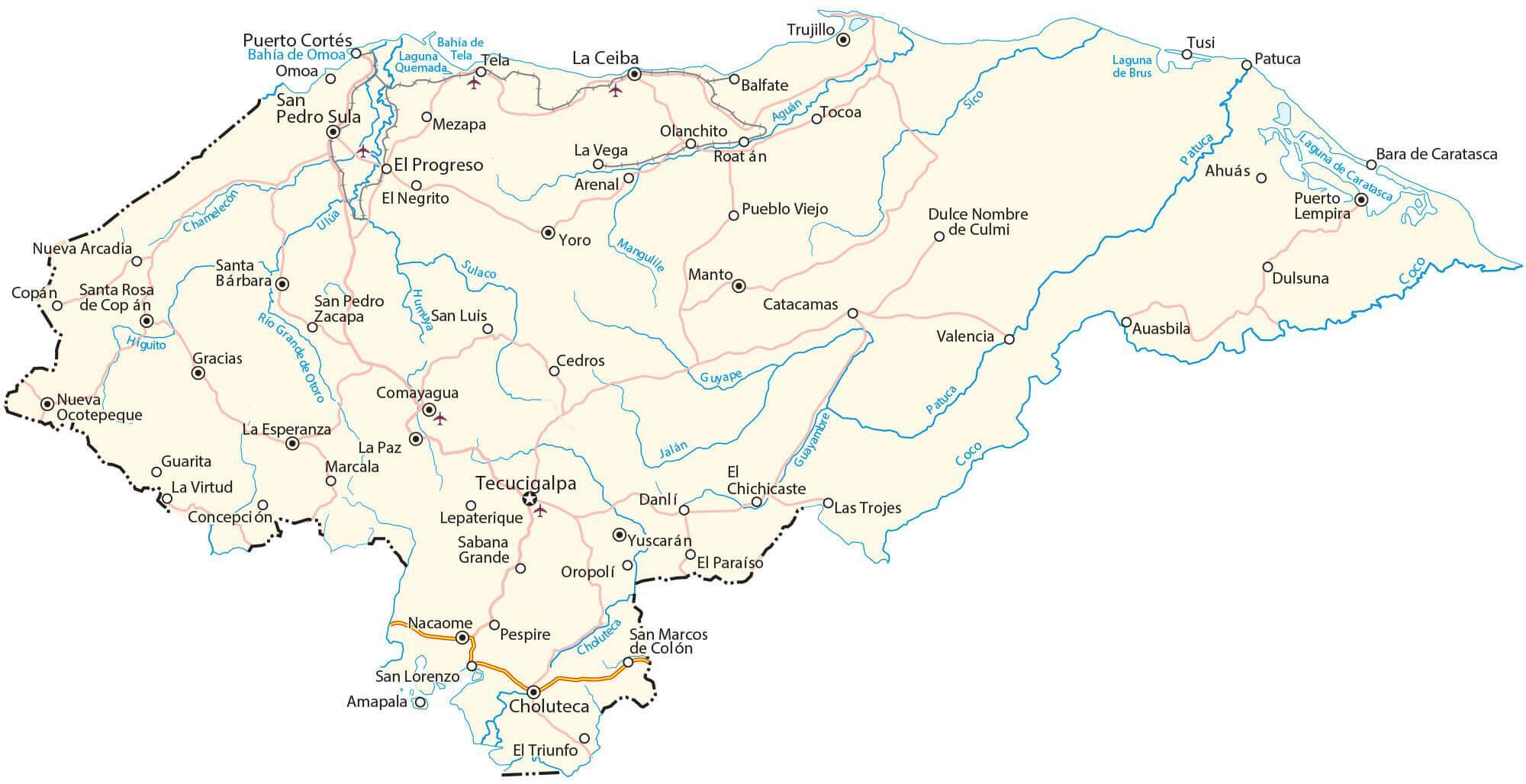
Honduras is water-rich; the most important rivers include the Aquan, Coco, Patuca, Sico and Ulua; Lake Yojoa is the only significant lake, and the Caratasca Lagoon in the northeast is the largest of many coastal lagoons.
| Flag: |  |
|---|---|
| Legal Name: | Republic of Honduras |
| Capital Value: | Tegucigalpa; note – article eight of the Honduran constitution states that the twin cities of Tegucigalpa and Comayaguela, jointly, constitute the capital of the Republic of Honduras; however, virtually all governmental institutions are on the Tegucigalpa |
| Official languages: | Spanish |
| Demonym(s): |
|
| Government: | Unitary presidential republic |
| Legislature: | National Congress |
| Total Area: | 112,090 km² |
| Land Area: | 111,890 km² |
| Water Area: | 200 km² |
| Population: | 9,746,117 |
| Density: | 85/km (220.1/sq mi) (128th) |
| GDP: | $25.10 Billion |
| GDP Per Capita: | $2,574.91 |
| Currency Value: | Lempiras (HNL) |
| Driving side: | right |
| Calling code: | +504 |
| Internet TLD: | .hn |
Explore the stunning beauty and captivating culture of Honduras through this interactive Honduras map. Uncover its rich history, diverse landscapes, and vibrant cities. From the vibrant coral reefs in the Caribbean Sea to the lush rainforests in the Pacific Ocean, this map of Honduras will give you a glimpse of the country’s many wonders. Discover its major highways, cities, and places. Get an aerial view of the country’s landscape and learn about its terrain and elevation. This Honduras map will help you explore the country like never before!
Online Interactive Political Map
Click on ![]() to view map in "full screen" mode.
to view map in "full screen" mode.
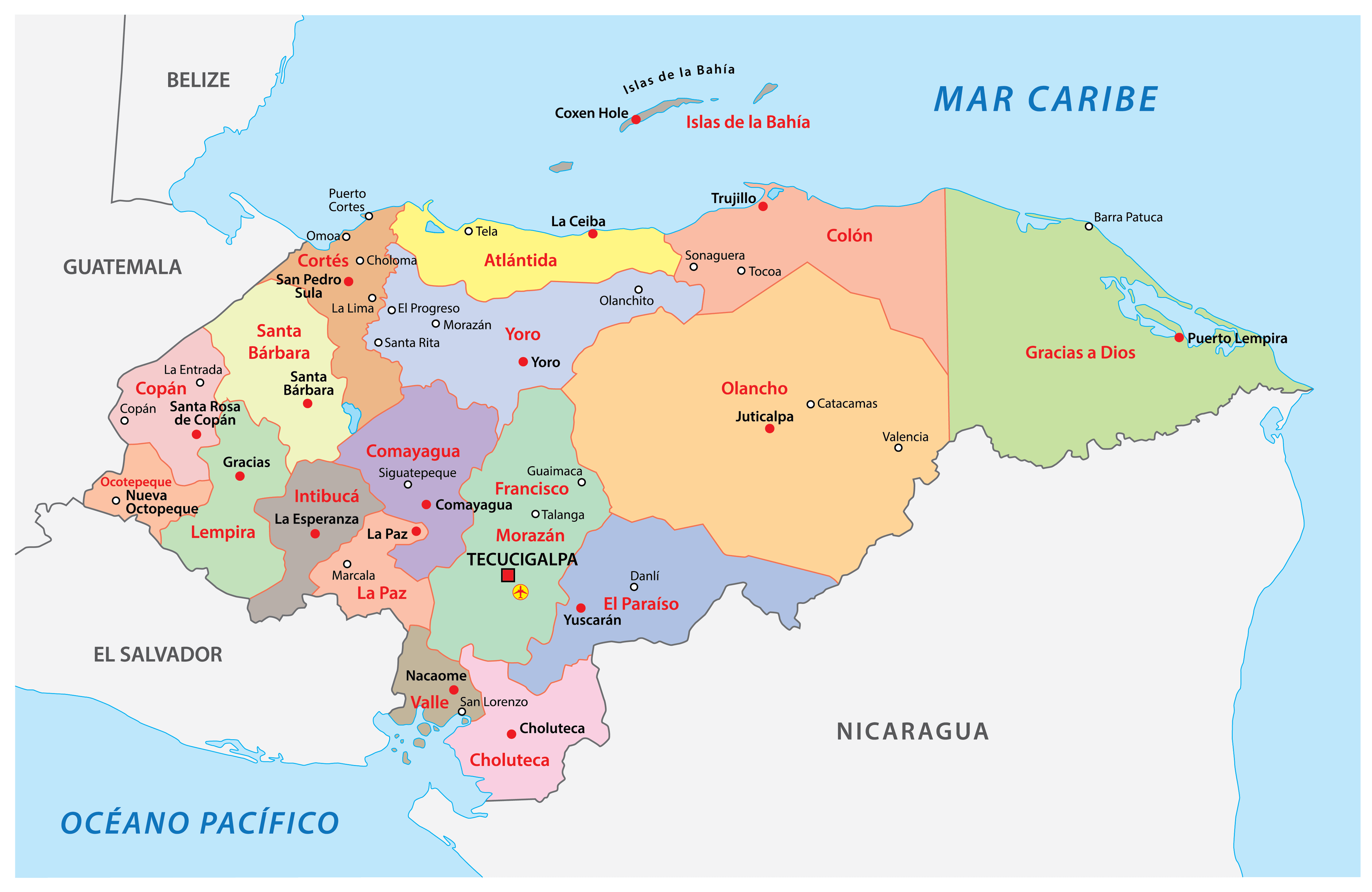
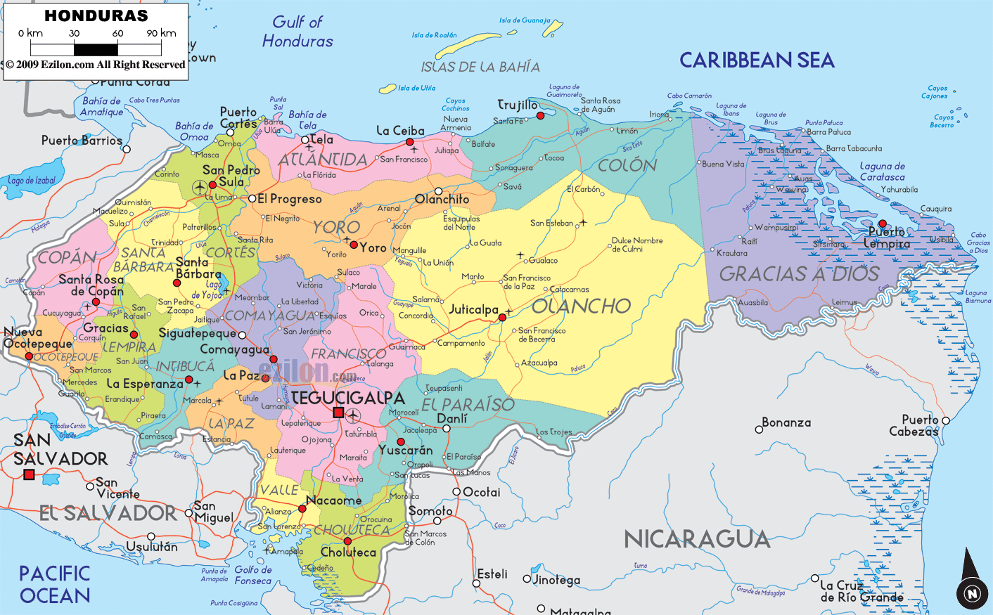
Honduras (officially, the Republic of Honduras) is divided into 18 departments (departamentos, sing. departamento). In alphabetical order, the departments are: Atlantida, Choluteca, Colon, Comayagua, Copan, Cortes, El Paraiso, Francisco Morazan, Gracias a Dios, Intibuca, Islas de la Bahia, La Paz, Lempira, Ocotepeque, Olancho, Santa Barbara, Valle and Yoro. These departments are further subdivided into 298 municipalities.
Situated in a valley and surrounded by mountains, in the southern-central region of the country is, Tegucigalpa – the capital, the largest and the most populous city of Honduras. It is also the administrative, cultural, educational and economic center of the country.
Location Maps
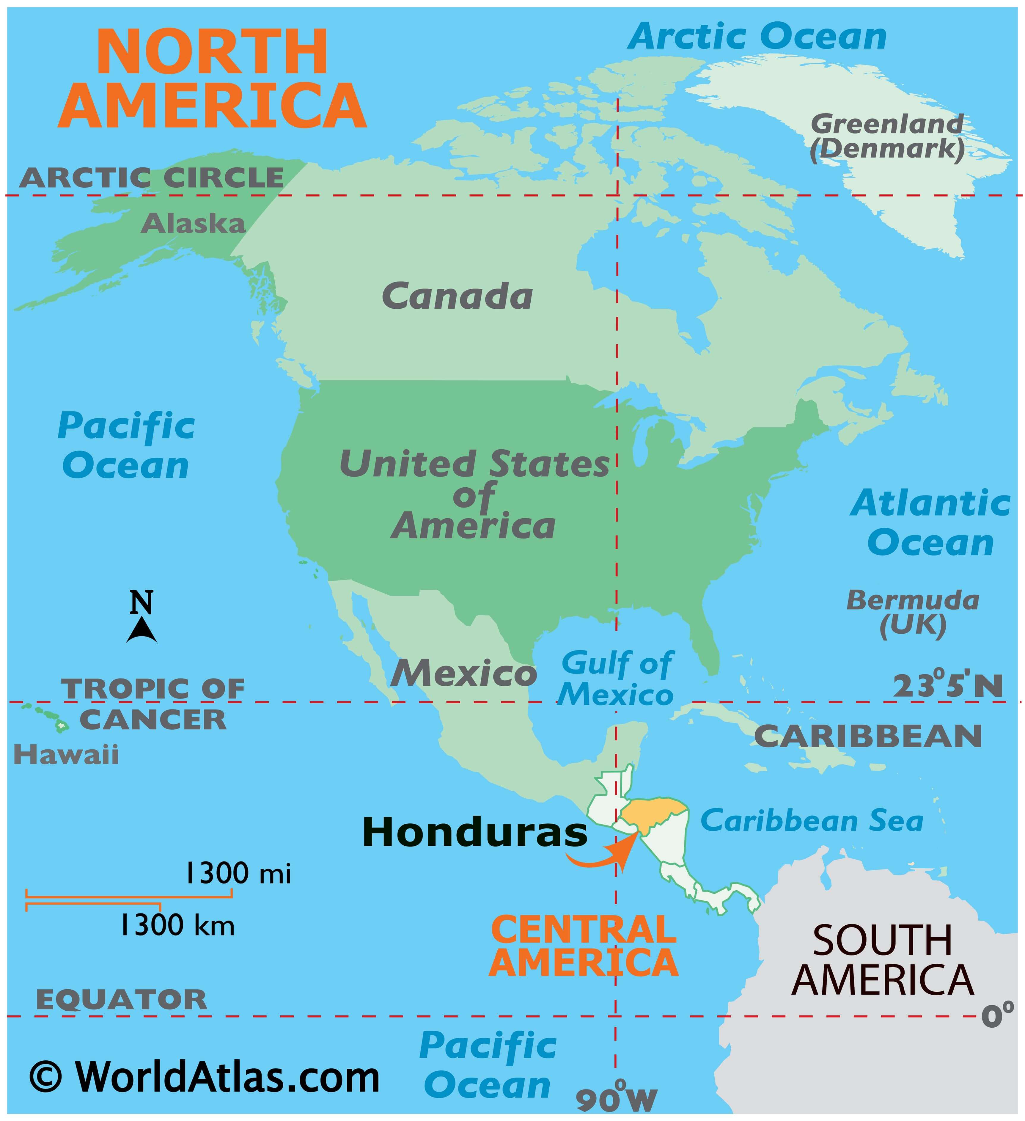
Where is Honduras?
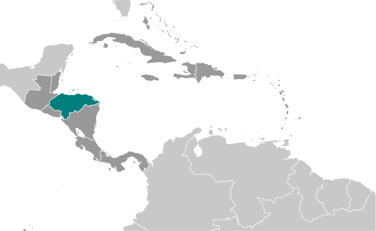
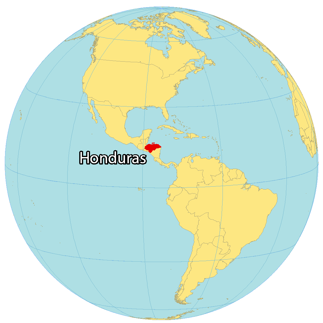
Honduras is a country located in Central America in the Caribbean Sea and the Pacific Ocean. It’s known for its Mayan ruins, natural resources, and barrier reefs. Honduras borders just three countries including Guatemala to the northwest, El Salvador to the west, and Nicaragua to the southeast. Also, it shares an 832 kilometers (517 mi) coastline with the Caribbean Sea and the Pacific Ocean by the Gulf of Fonseca. In total, it has a population of approximately 10 million people. Over one-tenth of Honduran people live in the capital city of Tegucigalpa.
High Definition Political Map of Honduras
History
Pre-colonial period
In the pre-Columbian era, modern Honduras was split between two pan-cultural regions: Mesoamerica in the west and the Isthmo-Colombian area in the east. Each complex had a “core area” within Honduras (the Sula Valley for Mesoamerica, and La Mosquitia for the Isthmo-Colombian area), and the intervening area was one of gradual transition. However, these concepts had no meaning in the Pre-Columbian era itself and represent extremely diverse areas. The Lenca people of the interior highlands are also generally considered to be culturally Mesoamerican, though the extent of linkage with other areas varied over time (for example, expanding during the zenith of the Toltec Empire).
In the extreme west, Maya civilization flourished for hundreds of years. The dominant, best known, and best studied state within Honduras’s borders was in Copán, which was located in a mainly non-Maya area, or on the frontier between Maya and non-Maya areas. Copán declined with other Lowland centres during the conflagrations of the Terminal Classic in the 9th century. The Maya of this civilization survive in western Honduras as the Ch’orti’, isolated from their Choltian linguistic peers to the west.
However, Copán represents only a fraction of Honduran pre-Columbian history. Remnants of other civilizations are found throughout the country. Archaeologists have studied sites such as Naco [es] and La Sierra in the Naco Valley, Los Naranjos on Lake Yojoa, Yarumela in the Comayagua Valley, La Ceiba and Salitron Viejo (both now under the Cajón Dam reservoir), Selin Farm and Cuyamel in the Aguan valley, Cerro Palenque, Travesia, Curruste, Ticamaya, Despoloncal, and Playa de los Muertos in the lower Ulúa River valley, and many others.
In 2012, LiDAR scanning revealed that several previously unknown high density settlements existed in La Mosquitia, corresponding to the legend of “La Ciudad Blanca”. Excavation and study has since improved knowledge of the region’s history. It is estimated that these settlements reached their zenith from 500 to 1000 AD.
Spanish conquest (1524–1539)
On his fourth and the final voyage to the New World in 1502, Christopher Columbus landed near the modern town of Trujillo, near Guaimoreto Lagoon, becoming the first European to visit the Bay Islands on the coast of Honduras. On 30 July 1502, Columbus sent his brother Bartholomew to explore the islands and Bartholomew encountered a Mayan trading vessel from Yucatán, carrying well-dressed Maya and a rich cargo. Bartholomew’s men stole the cargo they wanted and kidnapped the ship’s elderly captain to serve as an interpreter in the first recorded encounter between the Spanish and the Maya.
In March 1524, Gil González Dávila became the first Spaniard to enter Honduras as a conquistador. followed by Hernán Cortés, who had brought forces down from Mexico. Much of the conquest took place in the following two decades, first by groups loyal to Cristóbal de Olid, and then by those loyal to Francisco de Montejo but most particularly by those following Alvarado. In addition to Spanish resources, the conquerors relied heavily on armed forces from Mexico—Tlaxcalans and Mexica armies of thousands who remained garrisoned in the region.
Resistance to conquest was led in particular by Lempira. Many regions in the north of Honduras never fell to the Spanish, notably the Miskito Kingdom. After the Spanish conquest, Honduras became part of Spain’s vast empire in the New World within the Kingdom of Guatemala. Trujillo and Gracias were the first city-capitals. The Spanish ruled the region for approximately three centuries.
Spanish Honduras (1524–1821)
Honduras was organized as a province of the Kingdom of Guatemala and the capital was fixed, first at Trujillo on the Atlantic coast, and later at Comayagua, and finally at Tegucigalpa in the central part of the country.
Silver mining was a key factor in the Spanish conquest and settlement of Honduras. Initially the mines were worked by local people through the encomienda system, but as disease and resistance made this option less available, slaves from other parts of Central America were brought in. When local slave trading stopped at the end of the sixteenth century, African slaves, mostly from Angola, were imported. After about 1650, very few slaves or other outside workers arrived in Honduras.
Although the Spanish conquered the southern or Pacific portion of Honduras fairly quickly, they were less successful on the northern, or Atlantic side. They managed to found a few towns along the coast, at Puerto Caballos and Trujillo in particular, but failed to conquer the eastern portion of the region and many pockets of independent indigenous people as well. The Miskito Kingdom in the northeast was particularly effective at resisting conquest. The Miskito Kingdom found support from northern European privateers, pirates and especially the British formerly English colony of Jamaica, which placed much of the area under its protection after 1740.
Independence (1821)
Honduras gained independence from Spain in 1821 and was a part of the First Mexican Empire until 1823, when it became part of the United Provinces of Central America. It has been an independent republic and has held regular elections since 1838. In the 1840s and 1850s Honduras participated in several failed attempts at Central American unity, such as the Confederation of Central America (1842–1845), the covenant of Guatemala (1842), the Diet of Sonsonate (1846), the Diet of Nacaome (1847) and National Representation in Central America (1849–1852). Although Honduras eventually adopted the name Republic of Honduras, the unionist ideal never waned, and Honduras was one of the Central American countries that pushed the hardest for a policy of regional unity.
Policies favoring international trade and investment began in the 1870s, and soon foreign interests became involved, first in shipping from the north coast, especially tropical fruit and most notably bananas, and then in building railroads. In 1888, a projected railroad line from the Caribbean coast to the capital, Tegucigalpa, ran out of money when it reached San Pedro Sula. As a result, San Pedro grew into the nation’s primary industrial center and second-largest city. Comayagua was the capital of Honduras until 1880, when the capital moved to Tegucigalpa.
Since independence, nearly 300 small internal rebellions and civil wars have occurred in the country, including some changes of régime.
20th century and the role of American companies
In the late nineteenth century, Honduras granted land and substantial exemptions to several US-based fruit and infrastructure companies in return for developing the country’s northern regions. Thousands of workers came to the north coast as a result to work in banana plantations and other businesses that grew up around the export industry. Banana-exporting companies, dominated until 1930 by the Cuyamel Fruit Company, as well as the United Fruit Company, and Standard Fruit Company, built an enclave economy in northern Honduras, controlling infrastructure and creating self-sufficient, tax-exempt sectors that contributed relatively little to economic growth. American troops landed in Honduras in 1903, 1907, 1911, 1912, 1919, 1924 and 1925.
In 1904, the writer O. Henry coined the term “banana republic” to describe Honduras, publishing a book called Cabbages and Kings, about a fictional country, Anchuria, inspired by his experiences in Honduras, where he had lived for six months. In The Admiral, O.Henry refers to the nation as a “small maritime banana republic”; naturally, the fruit was the entire basis of its economy. According to a literary analyst writing for The Economist, “his phrase neatly conjures up the image of a tropical, agrarian country. But its real meaning is sharper: it refers to the fruit companies from the United States that came to exert extraordinary influence over the politics of Honduras and its neighbors.” In addition to drawing Central American workers north, the fruit companies encouraged immigration of workers from the English-speaking Caribbean, notably Jamaica and Belize, which introduced an African-descended, English-speaking and largely Protestant population into the country, although many of these workers left following changes to immigration law in 1939. Honduras joined the Allied Nations after Pearl Harbor, on 8 December 1941, and signed the Declaration by United Nations on 1 January 1942, along with twenty-five other governments.
Constitutional crises in the 1940s led to reforms in the 1950s. One reform gave workers permission to organize, and a 1954 general strike paralyzed the northern part of the country for more than two months, but led to reforms. In 1963 a military coup unseated democratically elected President Ramón Villeda Morales. In 1960, the northern part of what was the Mosquito Coast was transferred from Nicaragua to Honduras by the International Court of Justice.
War and upheaval (1969–1999)
In 1969, Honduras and El Salvador fought what became known as the Football War. Border tensions led to acrimony between the two countries after Oswaldo López Arellano, the president of Honduras, blamed the deteriorating Honduran economy on immigrants from El Salvador. The relationship reached a low when El Salvador met Honduras for a three-round football elimination match preliminary to the World Cup.
Tensions escalated and on 14 July 1969, the Salvadoran army invaded Honduras. The Organization of American States (OAS) negotiated a cease-fire which took effect on 20 July and brought about a withdrawal of Salvadoran troops in early August. Contributing factors to the conflict were a boundary dispute and the presence of thousands of Salvadorans living in Honduras illegally. After the week-long war, as many as 130,000 Salvadoran immigrants were expelled.
Hurricane Fifi caused severe damage when it skimmed the northern coast of Honduras on 18 and 19 September 1974. Melgar Castro (1975–78) and Paz Garcia (1978–82) largely built the current physical infrastructure and telecommunications system of Honduras.
In 1979, the country returned to civilian rule. A constituent assembly was popularly elected in April 1980 to write a new constitution, and general elections were held in November 1981. The constitution was approved in 1982 and the PLH government of Roberto Suazo won the election with a promise to carry out an ambitious program of economic and social development to tackle the recession in which Honduras found itself. He launched ambitious social and economic development projects sponsored by American development aid. Honduras became host to the largest Peace Corps mission in the world, and nongovernmental and international voluntary agencies proliferated. The Peace Corps withdrew its volunteers in 2012, citing safety concerns.
During the early 1980s, the United States established a continuing military presence in Honduras to support El Salvador, the Contra guerrillas fighting the Nicaraguan government, and also develop an airstrip and modern port in Honduras. Though spared the bloody civil wars wracking its neighbors, the Honduran army quietly waged campaigns against Marxist–Leninist militias such as the Cinchoneros Popular Liberation Movement, notorious for kidnappings and bombings, and against many non-militants as well. The operation included a campaign of extrajudicial killings by government units, most notably the CIA-trained Battalion 316.
In 1998, Hurricane Mitch caused massive and widespread destruction. Honduran President Carlos Roberto Flores said that fifty years of progress in the country had been reversed. Mitch destroyed about 70% of the country’s crops and an estimated 70–80% of the transportation infrastructure, including nearly all bridges and secondary roads. Across Honduras 33,000 houses were destroyed, and an additional 50,000 damaged. Some 5,000 people killed, and 12,000 more injured. Total losses were estimated at US$3 billion.
21st century
In 2007, President of Honduras Manuel Zelaya and President of the United States George W. Bush began talks on US assistance to Honduras to tackle the latter’s growing drug cartels in Mosquito, Eastern Honduras using US special forces. This marked the beginning of a new foothold for the US military’s continued presence in Central America.
Under Zelaya, Honduras joined ALBA in 2008, but withdrew in 2010 after the 2009 Honduran coup d’état. In 2009, a constitutional crisis resulted when power was transferred in a coup from the president to the head of Congress. The OAS suspended Honduras because it did not regard its government as legitimate.
Countries around the world, the OAS, and the United Nations formally and unanimously condemned the action as a coup d’état, refusing to recognize the de facto government, even though the lawyers consulted by the Library of Congress submitted to the United States Congress an opinion that declared the coup legal. The Honduran Supreme Court also ruled that the proceedings had been legal. The government that followed the de facto government established a truth and reconciliation commission, Comisión de la Verdad y Reconciliación, which after more than a year of research and debate concluded that the ousting had been a coup d’état, and illegal in the commission’s opinion.
On 28 November 2021, the former first lady Xiomara Castro, leftist presidential candidate of opposition Liberty and Refoundation Party, won 53% of the votes in the presidential election to become the first female president of Honduras, bringing an end to the 12-year reign of the right-wing National Party. She was sworn in on 27 January 2022. Her husband, Manuel Zelaya, held the same office from 2006 until 2009.
In April 2022, former president of Honduras, Juan Orlando Hernández, who served two terms between 2014 and January 2022, was extradited to the United States to face charges of drug trafficking and money laundering. Hernandez denied the accusations.
Physical Map of Honduras

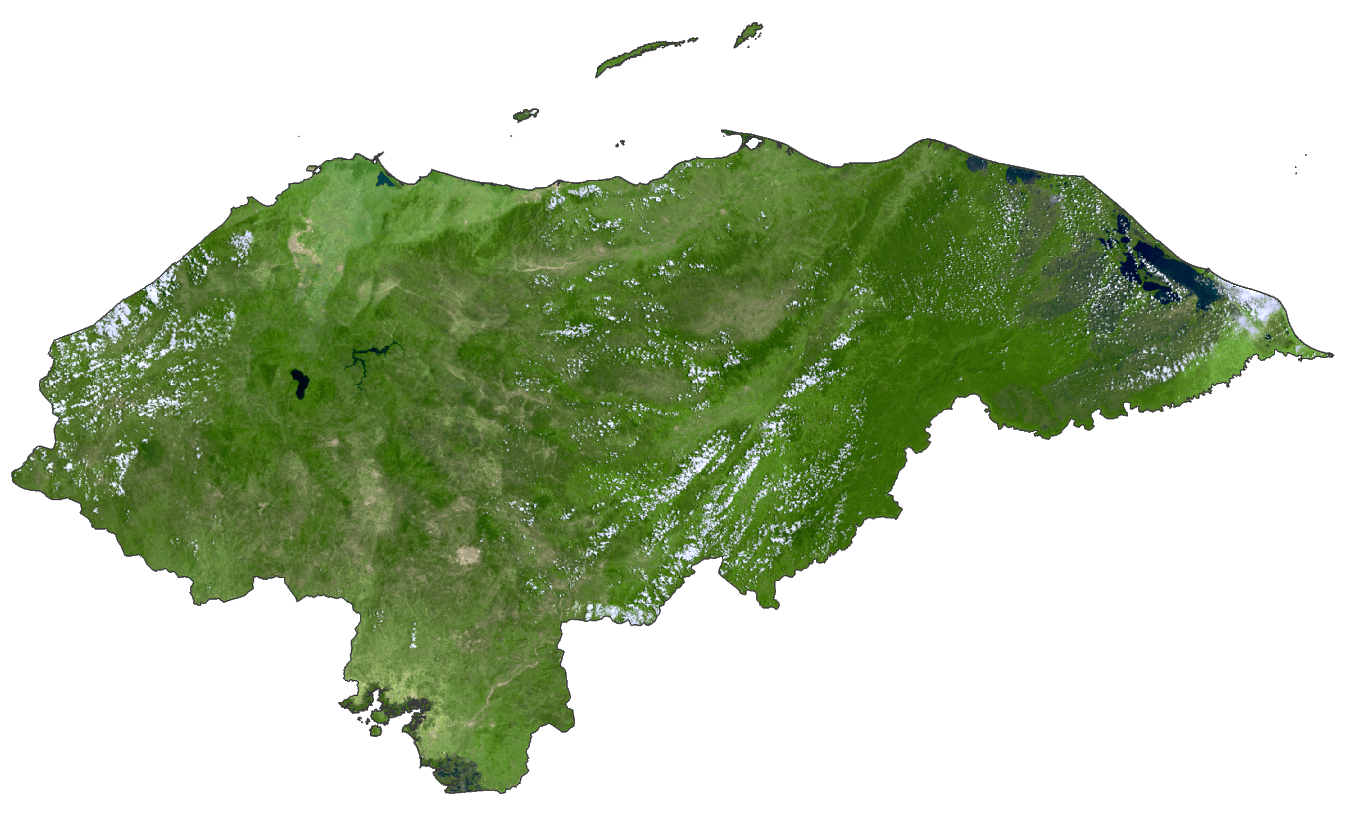
Honduras Satellite Map
Elevation Map