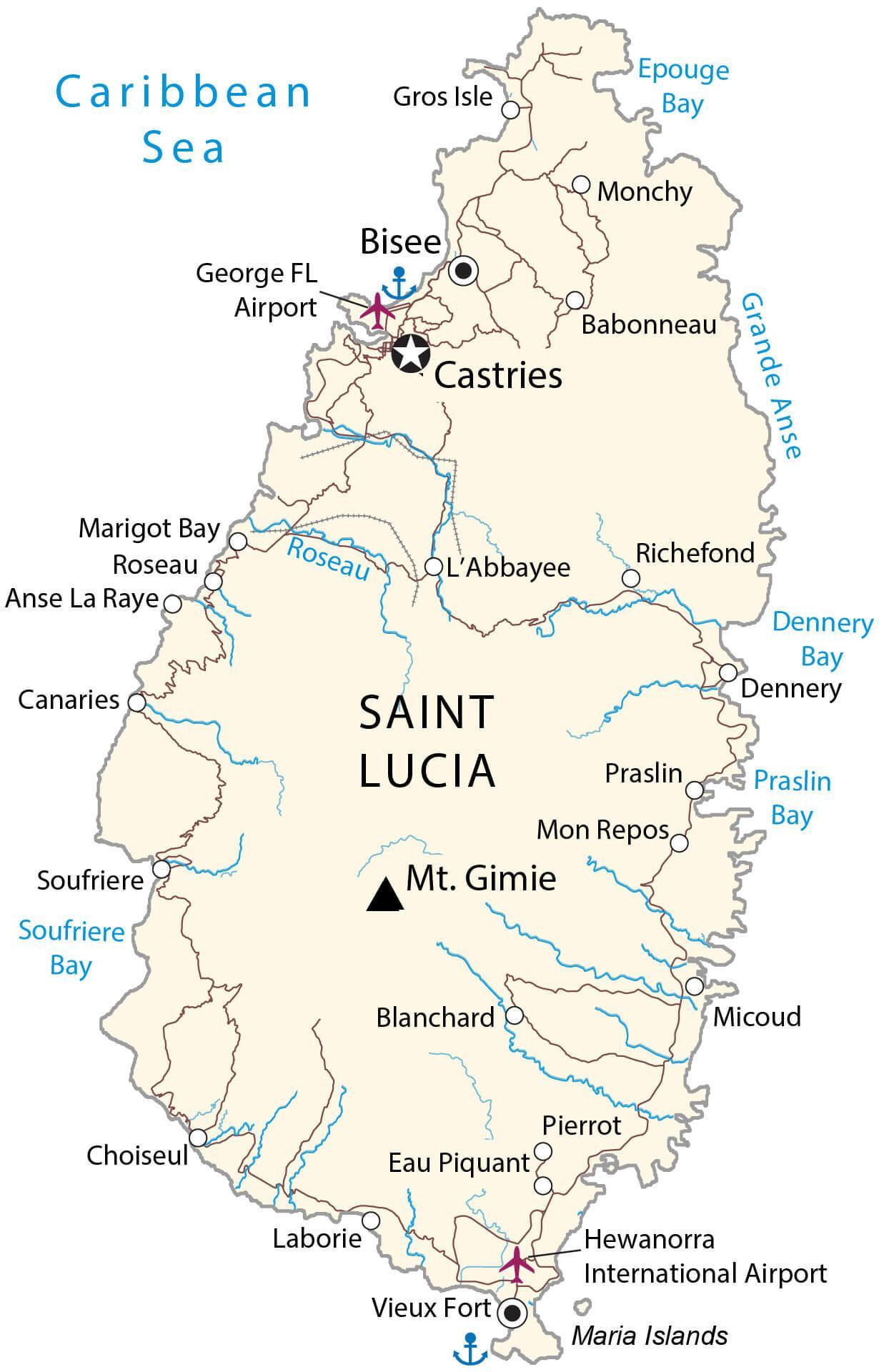
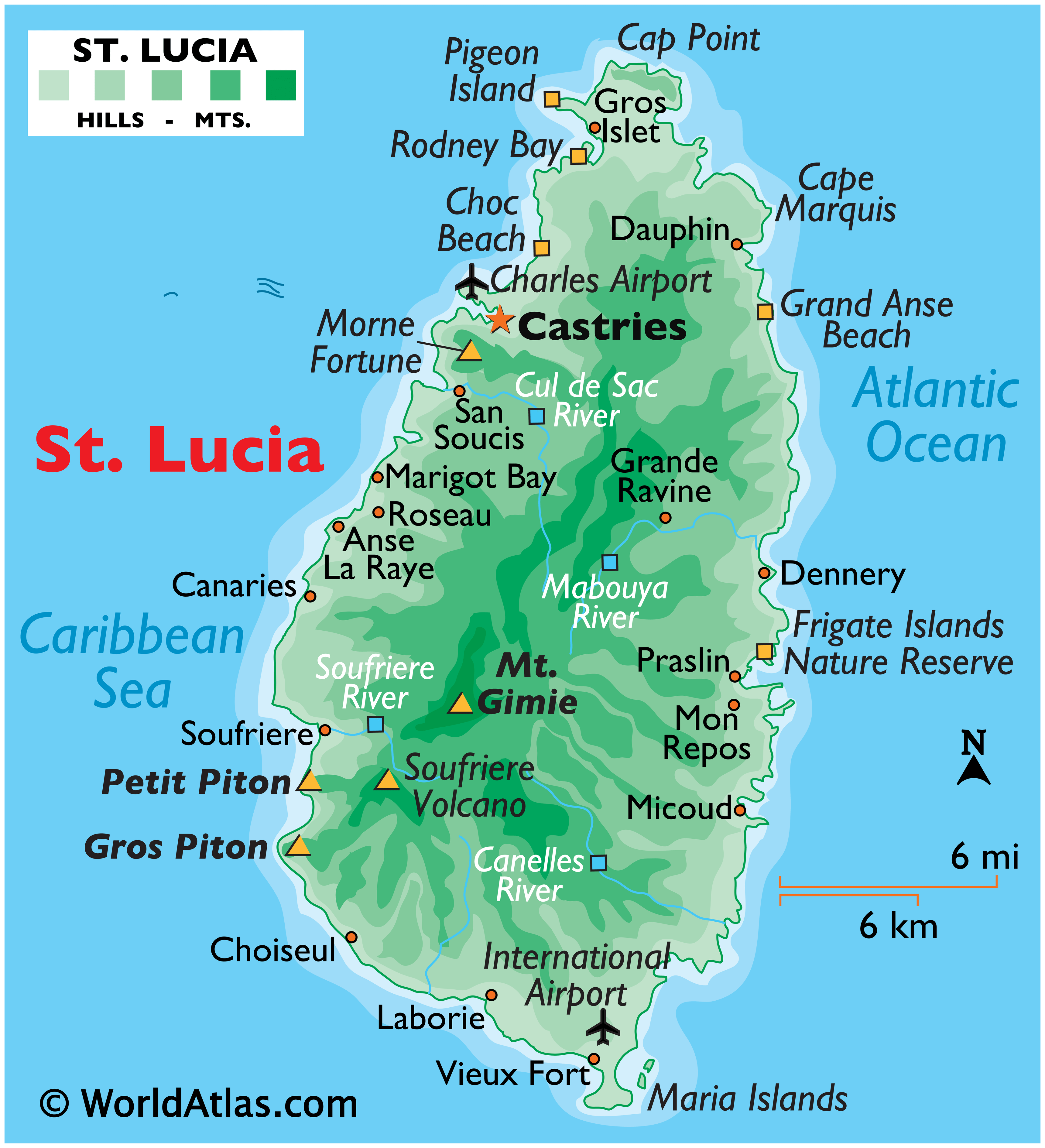
Volcanic in origin, Saint Lucia is one of the many small islands that comprise the Caribbean’s Windward Islands. Covering a total land area of 617 sq.km, St. Lucia’s landscape is dominated by dense jungle and a central ridge of forested mountains.
St. Lucia is known around the world for the striking twin peaks of Gros Piton and Petit Piton on its south western coast. The positions of these peaks have been marked on the physical map of St. Lucia above.
The island’s highest peak, Mount Gimie is positioned in the South-Central mountain range and rises to 958m (3,143 ft) above sea level. The island is drained by dozens of small rivers that flow to the sea; the largest ones include the Canelles, Cul de Sac, Mabouya and Soufriere. The island is ringed by miles of sandy beaches, as well as many small bays.
| Flag: |  |
|---|---|
| Legal Name: | Saint Lucia |
| Capital Value: | Castries |
| Official languages: | English |
| Demonym(s): | Saint Lucian |
| Government: | Unitary parliamentary constitutional monarchy |
| Legislature: | Parliament |
| Total Area: | 616 km² |
| Land Area: | 606 km² |
| Water Area: | 10 km² |
| Population: | 182,790 |
| Density: | 299.4/km (775.4/sq mi) (29th) |
| GDP: | $2.12 Billion |
| GDP Per Capita: | $11,611.42 |
| Currency Value: | East Caribbean dollars (XCD) |
| Driving side: | left |
| Calling code: | +1 758 |
| Internet TLD: | .lc |
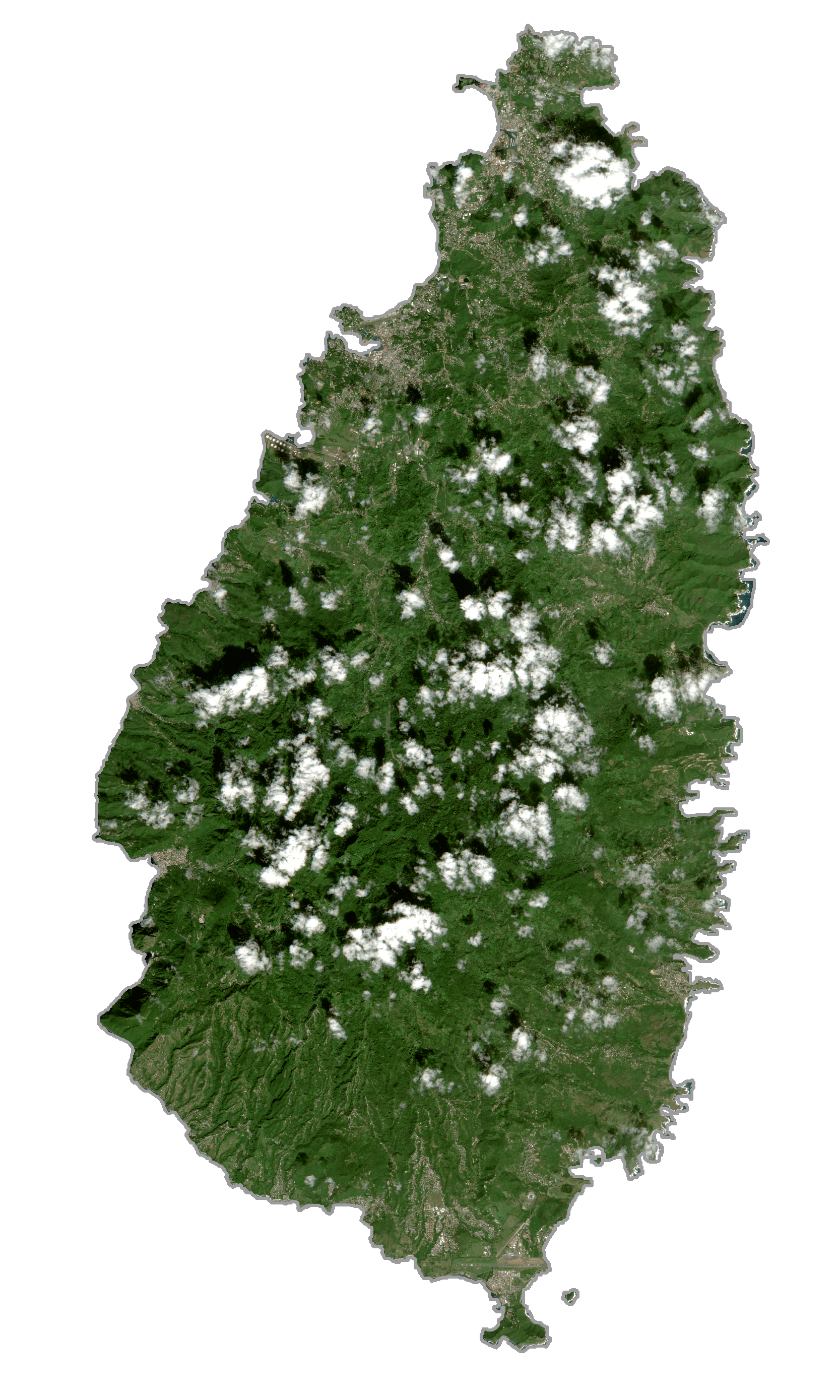
Explore the beauty of Saint Lucia through this map. With satellite imagery, you can view the Pitons, two mountainous volcanic spires located in the southwest of the island. Discover populated places, roads, and water with this Saint Lucia map (previously called Iyonola).
Online Interactive Political Map
Click on ![]() to view map in "full screen" mode.
to view map in "full screen" mode.
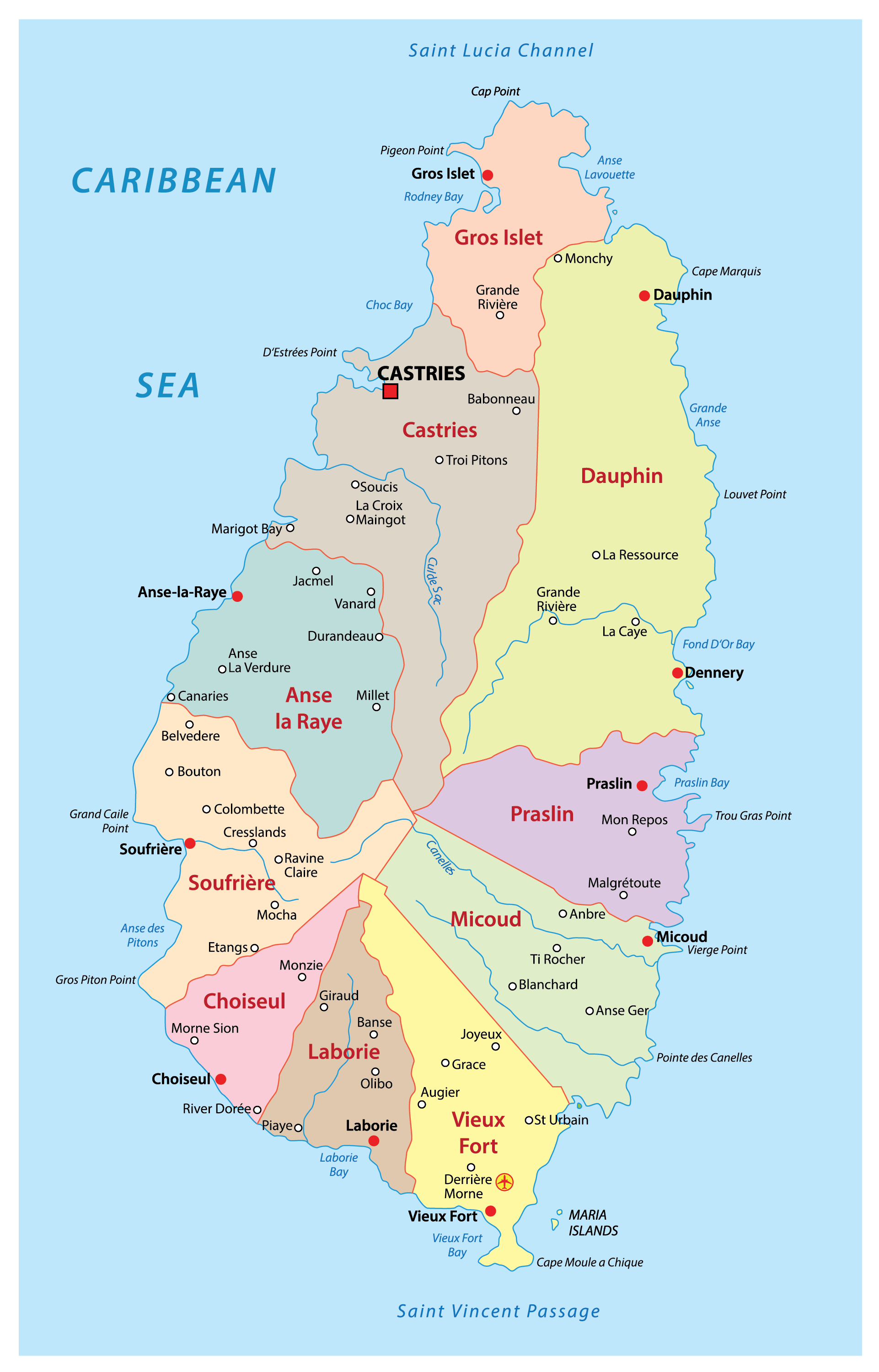
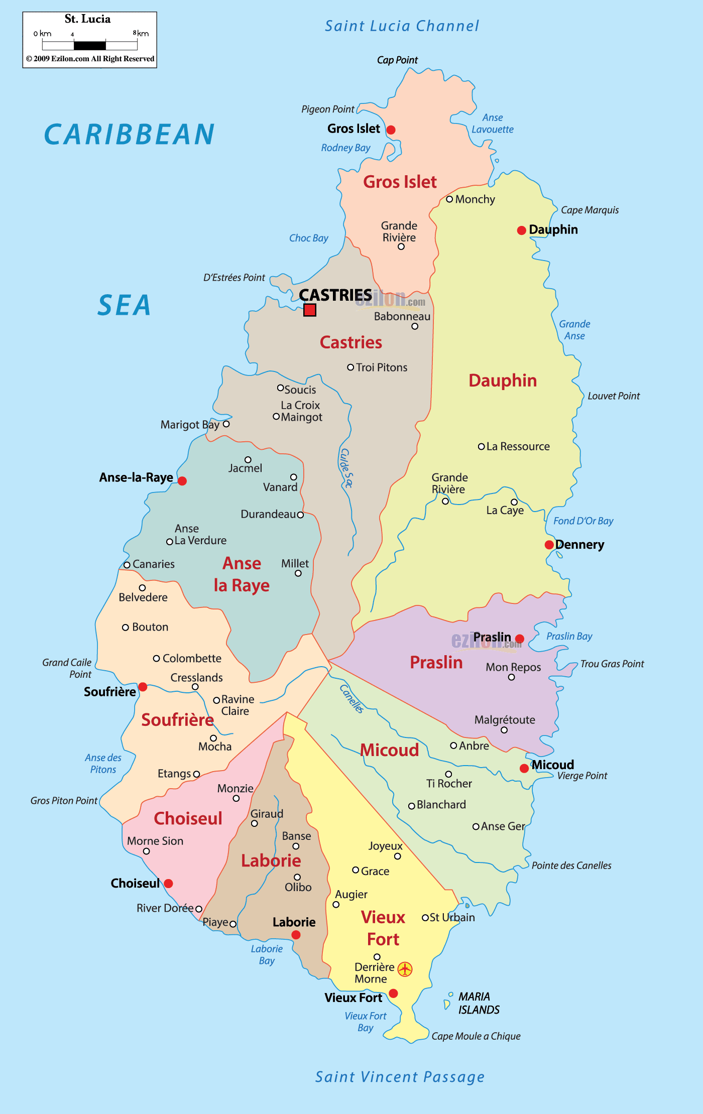
Saint Lucia is divided into 11 districts/quarters. In alphabetical order, the districts are: Anse-la-Raye, Canaries, Castries, Choiseul, Dauphin, Dennery, Gros-Islet, Laborie, Micoud, Soufriere and Vieux-Fort.
Located on a flood gate that has been built on reclaimed land in the north western coast of the island country is Castries – the capital and the largest city of Saint Lucia. Castries is the major port and a landlocked deep water harbour of Saint Lucia.
Location Maps
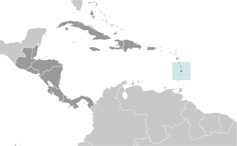
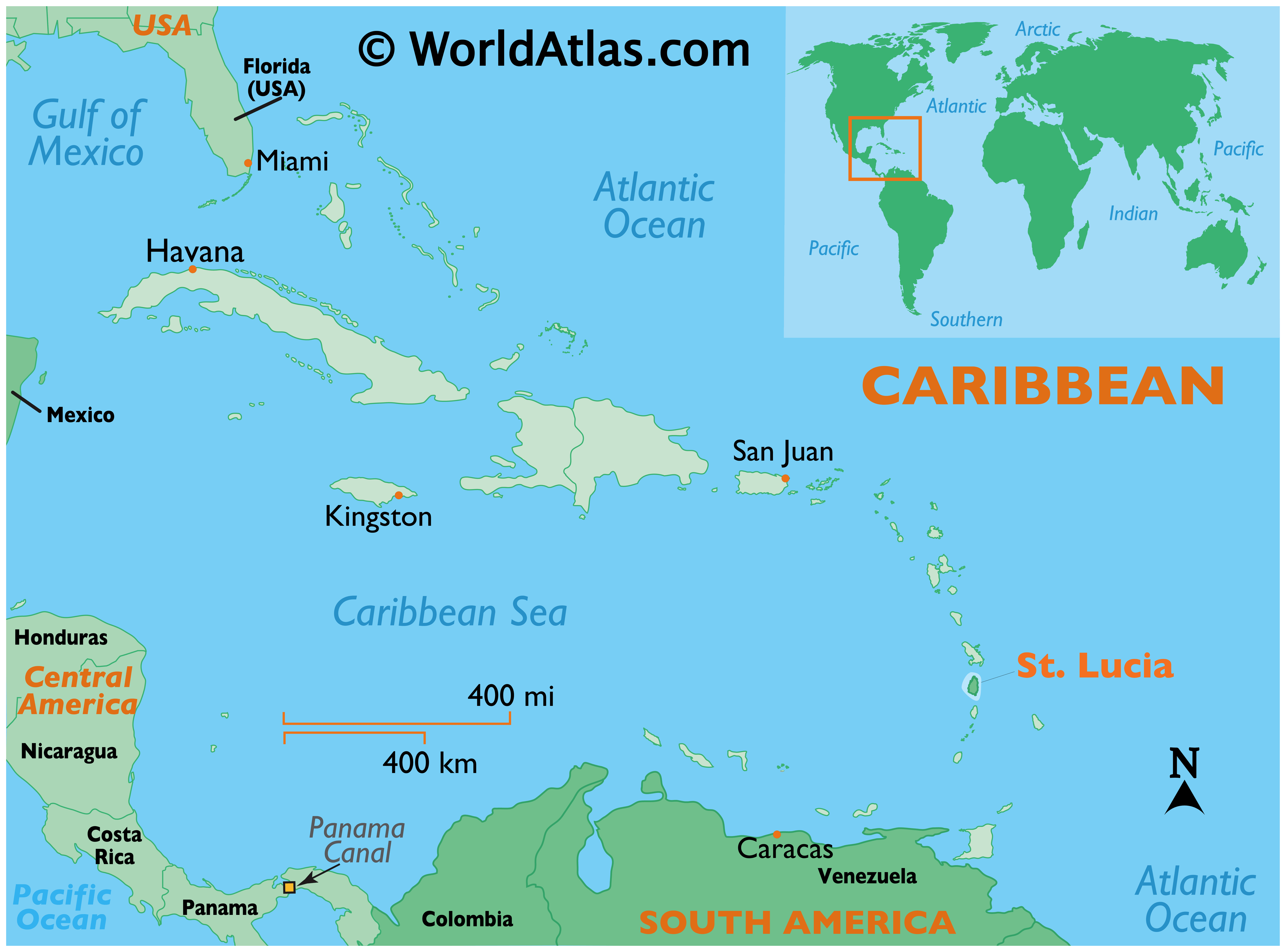
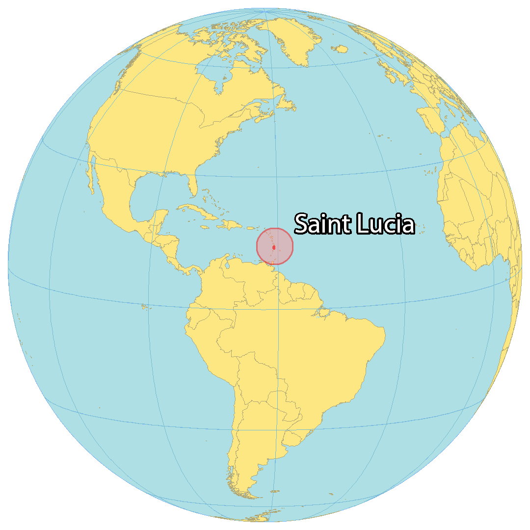
Where is Saint Lucia?
Saint Lucia is an island situated in the Caribbean Sea and part of the Lesser Antilles. It covers a total area of 617 square kilometers (238 sq mi) and is smaller than Dominica but bigger than Barbados. It is 30 kilometers (18 mi) away from St. Vincent and the Grenadines to the south and 34 kilometers (21 mi) from the French island of Martinique to the north. Barbados is located 147 kilometers (91 mi) to the east. The capital and most populous city of Saint Lucia is Castries, which is located on the western side of the island. Other major towns are Gros Islet, Soufrière, and Vieux Fort.
High Definition Political Map of Saint Lucia
History
Pre-colonial period
The first proven inhabitants of Saint Lucia were the Arawaks, though there may have been other native peoples prior to them. The Arawaks are believed to have come from northern South America, sometime around AD 200–400, as there are numerous archaeological sites on the island where specimens of their pottery have been found. The Arawaks called the island Iouanalao, meaning ‘Land of the Iguanas’, due to the island’s high number of iguanas.
The Caribs arrived around AD 800, and seized control from the Arawaks by killing their men and assimilating the women into their own society. They called the island Hewanarau, then later Hewanorra, which means “there where iguanas are found”.
Early European period
It is possible that Christopher Columbus may have sighted the island during his fourth voyage in 1502, but he does not mention the island in his log. Juan de la Cosa noted the island on his map of 1500, calling it El Falcon, and another island to the south Las Agujas. A Spanish cédula from 1511 mentions the island within the Spanish domain, and a globe in the Vatican made in 1520, shows the island as Sancta Lucia.
In the late 1550s, the French pirate François le Clerc (known as Jambe de Bois, due to his wooden leg) set up a camp on Pigeon Island, from where he attacked passing Spanish ships. In 1605, an English vessel called the Oliphe Blossome was blown off-course on its way to Guyana, and the 67 colonists started a settlement on Saint Lucia, after initially being welcomed by the Carib chief Anthonie. By 26 September 1605, only 19 survived following continued attacks by the Carib chief Augraumart, so the settlers fled the island. The English tried to settle the island again in 1638, but the Caribs continued to be hostile. Eventually, the French successfully claimed the island in 1650 and they signed a treaty with the Caribs in 1660. In 1664, Thomas Warner (son of Sir Thomas Warner, the governor of St Kitts) claimed Saint Lucia for England but the English fled again in 1666, with the French gaining full control of the island after the signing of the Treaty of Breda. Saint Lucia was made an official French crown colony in 1674, as a dependency of Martinique.
18th and 19th centuries
After the slave-based sugar industry developed, both the British and the French found the island attractive. During the 18th century, the island changed ownership, or was declared neutral territory, a dozen times, although the French settlements remained and the island was a de facto French colony well into the eighteenth century.
In 1722, George I of Great Britain granted both Saint Lucia and Saint Vincent to the 2nd Duke of Montagu. Montague appointed Nathaniel Uring, a merchant sea captain and adventurer, as deputy-governor. Uring went to the islands with a group of seven ships, and established settlement at Petit Carenage. Unable to get enough support from British warships, he and the new colonists were quickly run off by the French.
During the Seven Years’ War, Britain occupied Saint Lucia for a year, but handed the island back to the French in 1763, under the Treaty of Paris. Like the English and Dutch on other islands, in 1765, the French began to develop the land for the cultivation of sugar cane as a commodity crop on large plantations. The British occupied the island again in 1778.
From 1782 to 1803, control of the island switched multiple times. In January 1791, during the French Revolution, the National Assembly sent four commissaires to St Lucia to spread the revolutionary philosophy. By August 1791, slaves began to abandon their estates and Governor Jean-Joseph Sourbader de Gimat fled. In December 1792, Lt. Jean-Baptiste Raymond de Lacrosse arrived with revolutionary pamphlets, and the impoverished whites and free people of colour began to arm themselves as patriots. On 1 February 1793, France declared war on England and Holland, and General Nicolas Xavier de Ricard took over as Governor. The National Convention abolished enslavement on 4 February 1794. On 1 April 1794, St. Lucia was captured by a British expeditionary force led by Vice Admiral John Jervis. Morne Fortune was renamed Fort Charlotte. Soon, a combined force of French Revolutionary Army soldiers and maroons, L’Armee Française dans les Bois, began to fight back, starting the First Brigand War.
A short time later, the British invaded the island as a part of the war with France that had recently broken out. On 21 February 1795, French forces under the nominal control of Victor Hugues, defeated a battalion of British troops at Vieux Fort and Rabot. In 1796, Castries was burned as part of the conflict. Leading the 27th Inniskilling Fusiliers, General John Moore retook Fort Charlotte in 1796, after two days of bitter fighting. As an honour, the Fusiliers’ regimental colour was displayed on the flagstaff of the captured fortress at Morne Fortune for an hour before being replaced by the Union Jack. Upon the capture of the fort, Moore’s superior, Ralph Abercromby, departed the island and placed Moore in charge of the British garrison. Moore remained at this post until falling ill with yellow fever, leading to his return to Britain before 1798.
In 1803, the British regained control of the island. Many members of the L’Armee Française dans les Bois escaped into the thick rainforest where they evaded capture and established maroon communities.
Slavery on the island continued for a short time, but anti-slavery sentiment was rising in Britain. The British stopped the import of slaves by anyone, white or coloured, when they abolished the slave trade in 1807.
France and Great Britain continued to contest Saint Lucia until the British secured it in 1814, as part of the Treaty of Paris, ending the Napoleonic Wars. Thereafter, Saint Lucia was considered one of the British Windward Islands colonies.
The institution of slavery was abolished on the island in 1834, as it was throughout the British Empire. After abolition, all former slaves had to serve a four-year “apprenticeship”, to accustom them to the idea of freedom. During that period, they worked for their former masters for at least three-quarters of the work week. Full freedom was duly granted by the British in 1838. By that time, people of African ethnicity greatly outnumbered those of ethnic European background. People of Carib descent also comprised a minority on the island.
20th century
Saint Lucia’s first representative government was introduced in 1924, with the first election taking place in 1925. Many Saint Lucians served during the Second World War, and the conflict visited the island directly during the Battle of the Caribbean, when a German U-boat attacked and sank two British ships in Castries harbour on March 9, 1942. The United States used the island as a military hub during the war, including setting up a secondary naval base in Gros Islet and using what is now the island’s international airport as an air force base.
Universal suffrage was introduced in 1951 and elections were held the same year. In 1958, Saint Lucia joined the West Indies Federation, although the federation was dissolved just years later in 1962. In 1967, Saint Lucia became one of the six members of the West Indies Associated States, with internal self-government. Independence was peacefully gained in 1979 under Sir John Compton of United Workers Party, with the island remaining within the British Commonwealth, keeping then-Queen Elizabeth II as Monarch, represented locally by a Governor-General.
Post-independence era
Despite leading the country to independence, Compton’s initial term as Prime Minister lasted only a few months, being defeated by the Saint Lucia Labour Party (SLP) under Allan Louisy in the 1979 Saint Lucian general election. In 1980, Hurricane Allen struck the island, destroying much of its infrastructure and reducing economic growth. Compton returned to power after the 1982 Saint Lucian general election after much instability during the labour government’s term. During Compton’s 2nd time as the island’s leader, banana exports significantly increased and easily became the nation’s main source of revenue. There were also improvements to infrastructure, and education was expanded to rural areas. Saint Lucia was also key to the US invasion of Grenada. During the 90s and 2000s, the nation’s economy began shifting away from agriculture to tourism under the leadership of Kenny Anthony. The 9/11 attacks saw the deaths of 2 Saint Lucians, and caused an economic slowdown in the country, although growth remained decent until the beginning of the Great Recession. The recession, as well as the landfall of Hurricane Tomas in 2010, led to slow economic growth during the early 2010s, although the economy picked up during the later part of the decade and avoided contraction until 2020, after the Covid-19 pandemic caused major economic issues globally.
Physical Map of Saint Lucia
Geography
Saint Lucia has a total area of 617 square kilometers (238 sq mi). As a volcanic island, Saint Lucia is very mountainous, with its highest point being Mount Gimie, at 950 metres (3,120 feet) above sea level. The Pitons, two mountainous volcanic plugs, form the island’s most famous landmark. Saint Lucia is also home to the world’s only drive in volcano, the Sulphur Springs. There are a number of small islands off the coast, the largest of which are the Maria Islands, located in the south-east of the island.
Saint Lucia lies between latitude 14° N and longitude 61° W. The population tends to be concentrated around the coast, with the interior more sparsely populated, due to the presence of dense forests. Many species are endemic to the island, including the Anolis luciae, a species of lizard, and the Boa orophias, a species of boid snake.
Saint Lucia has five terrestrial ecoregions: Windward Islands moist forests, Leeward Islands dry forests, Windward Islands dry forests, Windward Islands xeric scrub, and Lesser Antilles mangroves. The country had a 2019 Forest Landscape Integrity Index mean score of 6.17/10, ranking it 84th globally out of 172 countries.
Climate
Saint Lucia has a tropical climate, specifically a tropical rainforest climate (Af), moderated by northeast trade winds, with a dry season from 1 December to 31 May, and a wet/rainy season from 1 June to 30 November.
Average daytime and nighttime temperatures are around 30 °C (86.0 °F), and 24 °C (75.2 °F) respectively. Being fairly close to the equator, the island’s temperature does not fluctuate much between winter and summer.
Geology
The geology of St. Lucia can be described as composing three main areas. The oldest, 16–18 Ma, volcanic rocks are exposed from Castries northward and consist of eroded basalt and andesite centres. The middle, central highlands, portion of the island consists of dissected andesite centres, 10.4 to 1 Mya, while the lower southwest portion of the island contains recent activity from the Soufriere Volcanic Centre (SVC). This SVC, centred about the Qualibou depression, contains pyroclastic flow deposits, lava flows, domes, block and ash flow deposits, and explosion craters. This depression’s perimeter includes the town of Soufriere, Mount Tabac, Mt. Gimie, Morne Bonin, and Gros Piton. At 10 kilometres (6.2 mi) in diameter, though the western portion is open towards the Grenada basin, the depression formed as recently as 100 kya. The depression is noted for its geothermal activity, especially at Sulphur Springs and Soufrière Estates, a phreatic eruption in 1776, and recent seismic activity (2000–2001).
Eroded andesitic stratovolcanoes to the north east of the depression include Mt. Gimie, Piton St Esprit, and Mt. Grand Magazin, all greater than 1 Ma in age. Andesitic and dacite pyroclastic flows from these volcanoes are found at Morne Tabac dome (532 ka), Morne Bonin dome (273 kya), and Bellevue (264 kya). Avalanche deposits from the formation of the Qualibou depression are found offshore, and in the massive blocks of Rabot, Pleisance, and Coubaril. The dacitic domes of Petit Piton (109 kya) and Gros Piton (71 kya) were then extruded onto the depression floor accompanied by the Anse John (104 kya) and La Pointe (59.8 kya) pyroclastic flows. Later, pyroclastic flows include pumice-rich Belfond and Anse Noir (20 kya). Finally, the dacitic domes of Terre Blanche (15.3 kya) and Belfond (13.6 kya) formed within the depression.
Saint Lucia Satellite Map