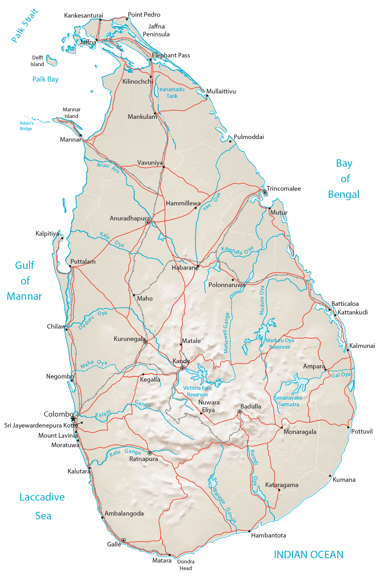
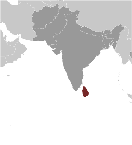
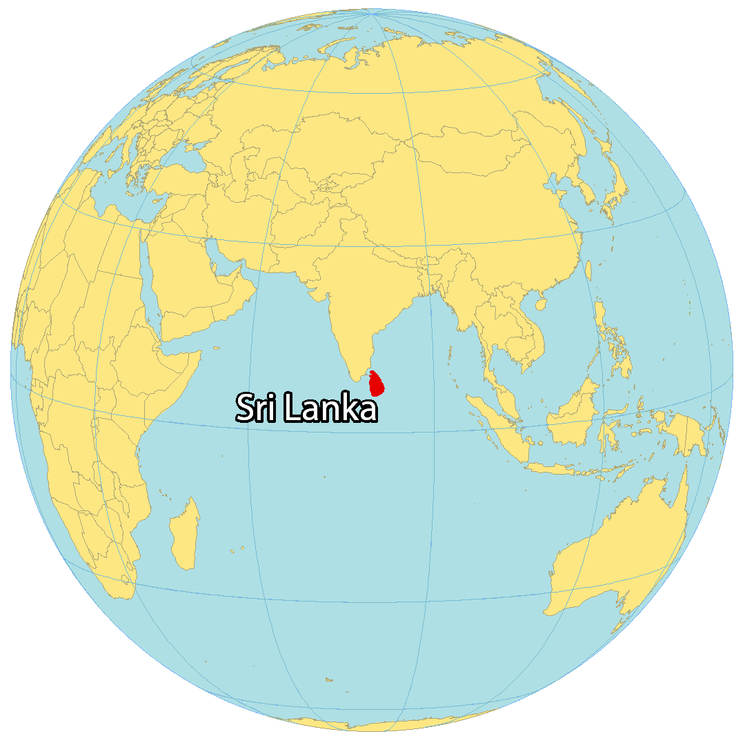
Sri Lanka is an island country located to the south of the Indian Peninsula in the Indian Ocean and has an area of 65,610 sq. km.
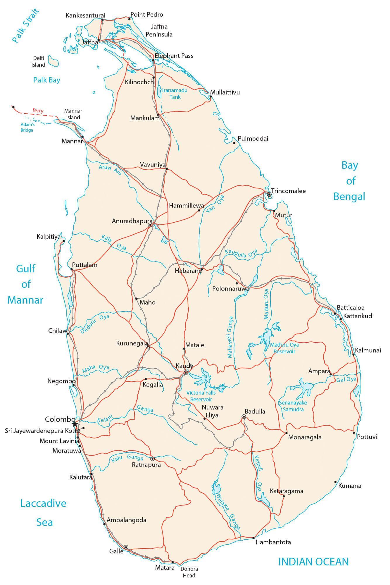
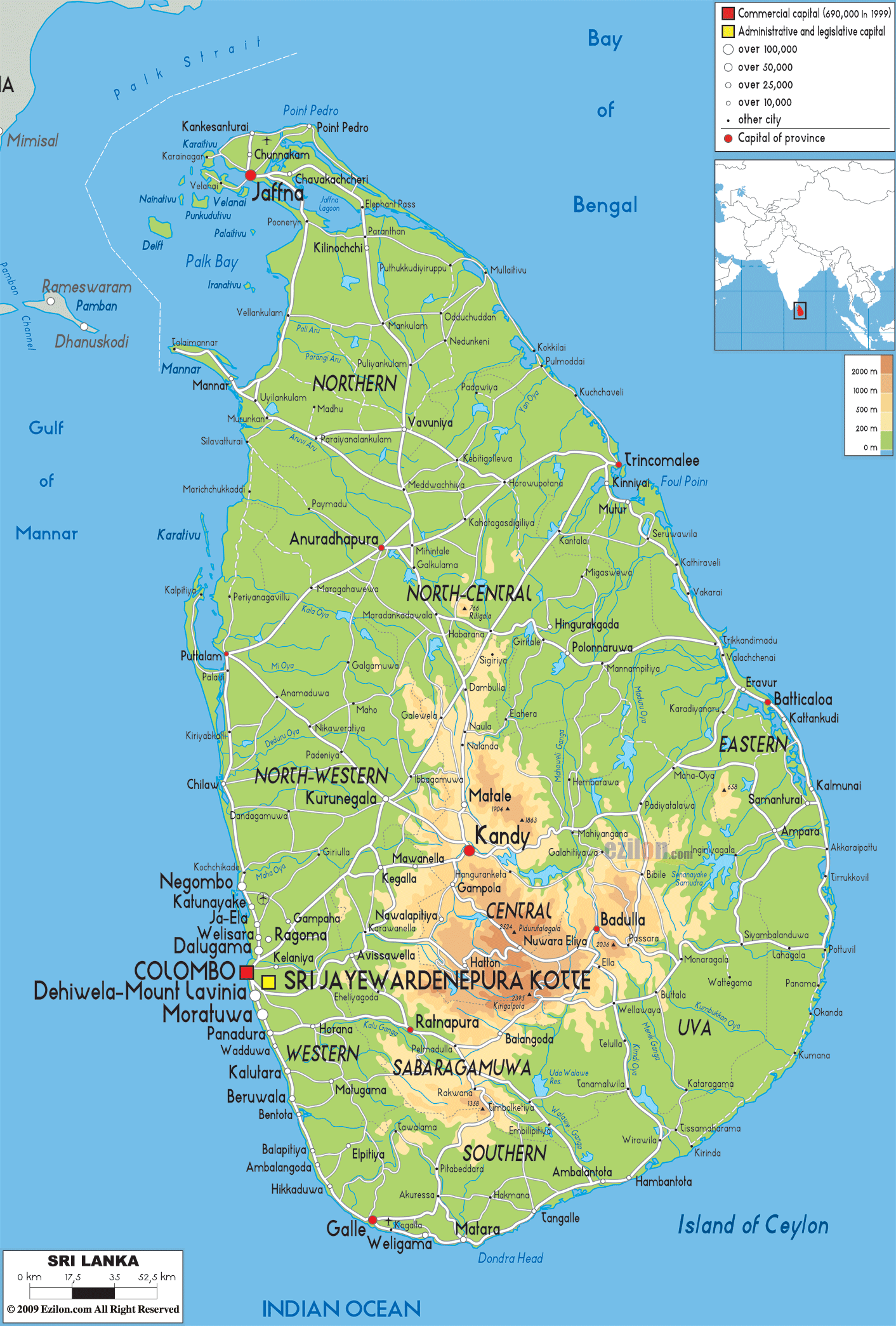
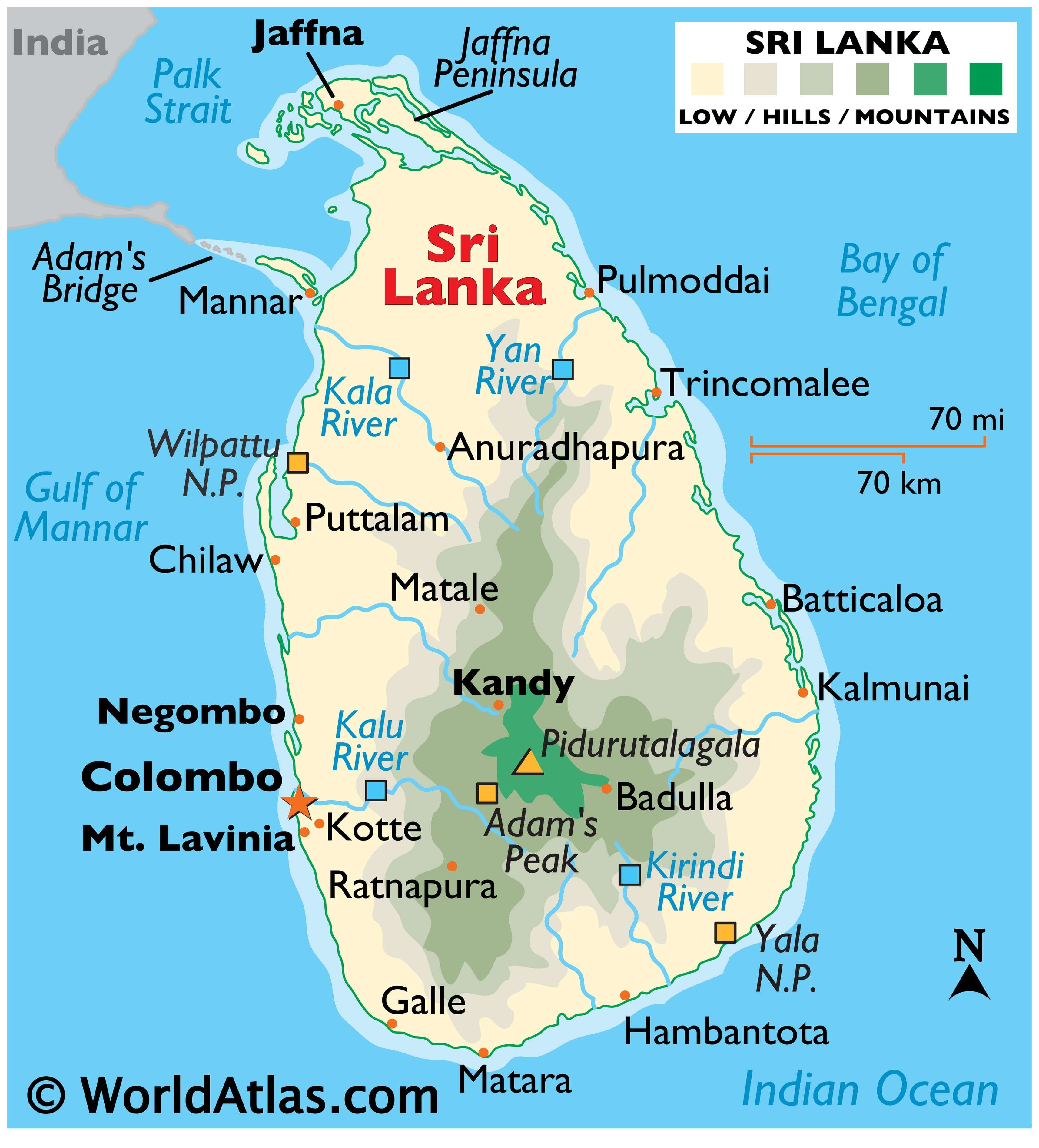
As observed on the physical map above, most of Sri Lanka is low-lying and is ringed by (almost endless) sandy beaches, and small, irregular lagoons.
The coastal areas merge into a flat coastal plain, one that gently rises into the foothills of a mountainous region, central and south.
Intermixed throughout those mountains are numerous deep valleys and gorges. About 40% of the landmass is heavily forested.
Pidurutalagala, the country’s highest point at 8,261 ft. (2,518 m), along with Adam’s Peak (the country’s famous religious site) both rise in the mountains directly east of Colombo. Both have been marked on the map.
The country’s lowest point is the Indian Ocean at 0 m.
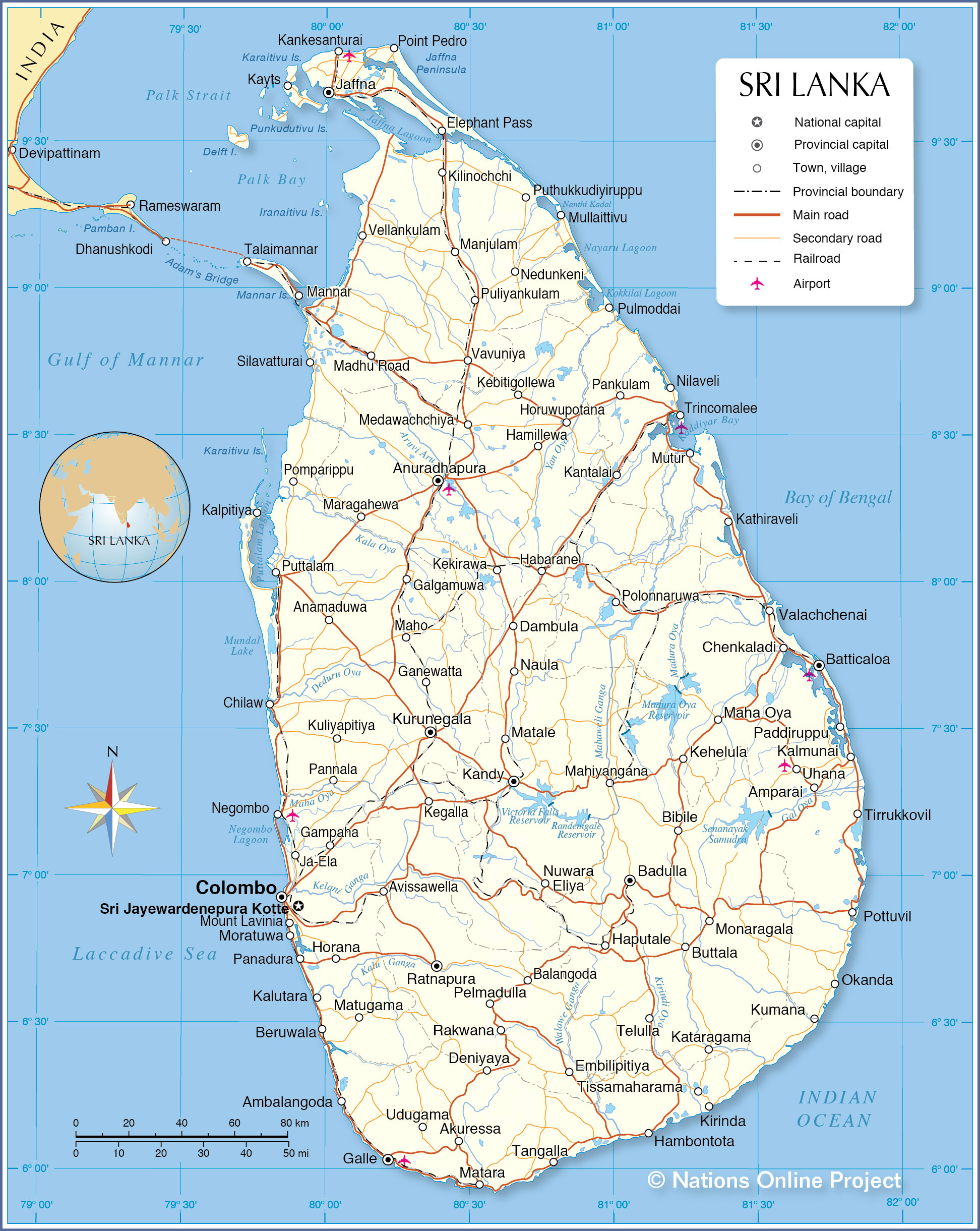
Numerous short and narrow rivers rise in the central highland; the most significant include the Kala, Kalu, Kirindi and Yan rivers.
Off the northwestern coast of Sri Lanka a chain of limestone shoals, known as Adam’s Bridge, separates the Gulf of Mannar from the Palk Strait, and runs along the water to the southeastern coast of India.
At one point it was completely passable, but Adam’s Bridge broke apart in the late 15th century when a cyclone hit the region. Today, the bridge is 18 miles (30 km) long, and ranges from 3 – 30ft. (1 – 10m) deep in some areas.
| Flag: |  |
|---|---|
| Legal Name: | Democratic Socialist Republic of Sri Lanka |
| Capital Value: | Colombo (commercial capital); Sri Jayewardenepura Kotte (legislative capital) |
| Largest City: |
Colombo (612,535) |
| Official languages: |
|
| Demonym(s): | Sri Lankan |
| Government: | Unitary semi-presidential republic |
| Legislature: | Parliament |
| Total Area: | 65,610 km² |
| Land Area: | 64,630 km² |
| Water Area: | 980 km² |
| Population: | 21,803,000 |
| Density: | 337.7/km (874.6/sq mi) (24th) |
| GDP: | $84.01 Billion |
| GDP Per Capita: | $3,853.08 |
| Currency Value: | Sri Lankan rupees (LKR) |
| Driving side: | left |
| Calling code: | +94 |
| Internet TLD: |
|
Discover Sri Lanka with this detailed map. It showcases major cities, towns, highways, roads, rivers, lakes, and its main island. Get a better understanding of the geography of Sri Lanka with this interactive reference map, satellite imagery, and physical map.
Online Interactive Political Map
Click on ![]() to view map in "full screen" mode.
to view map in "full screen" mode.
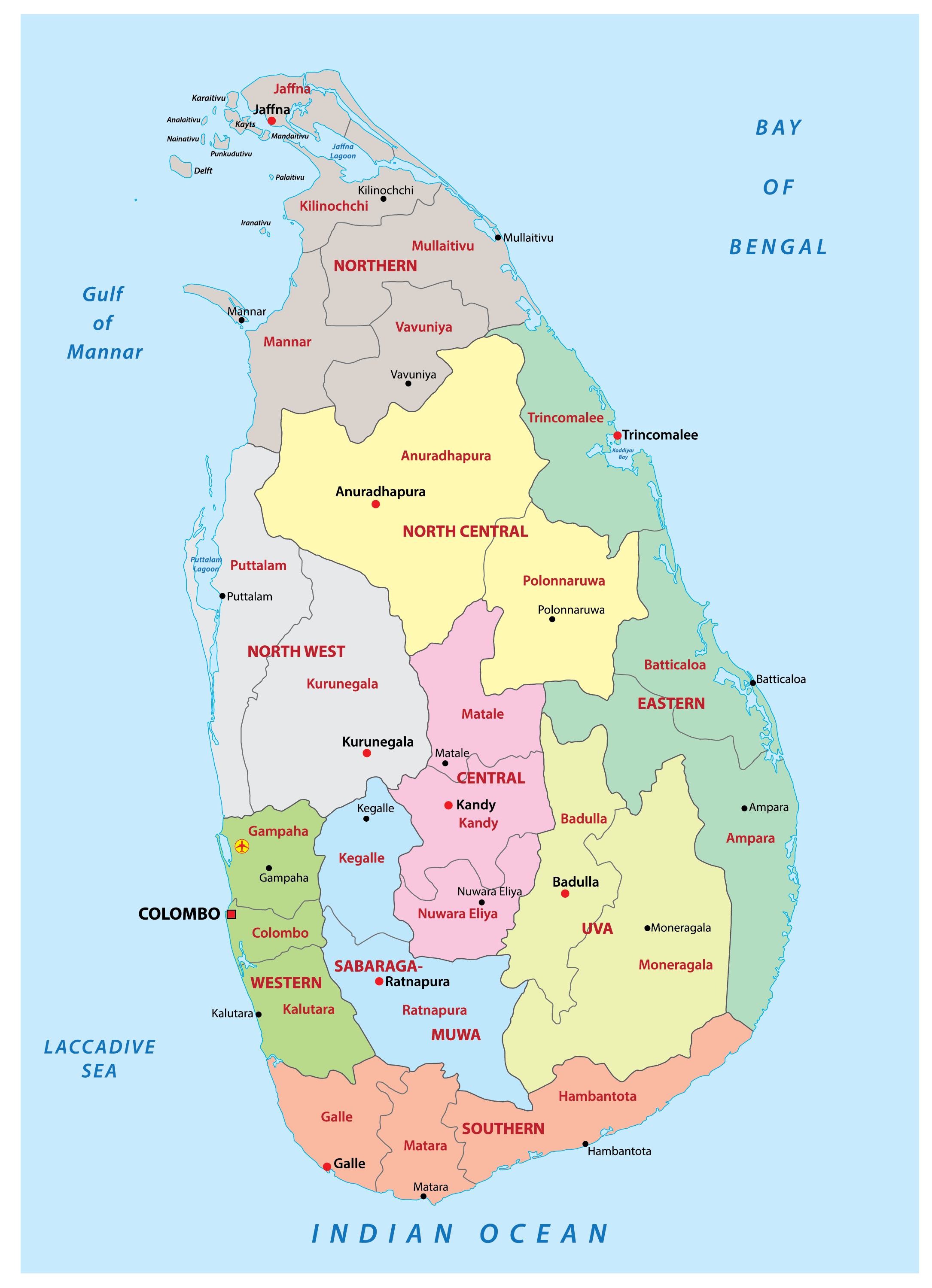
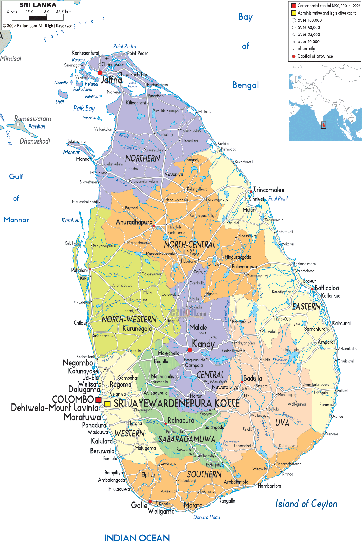
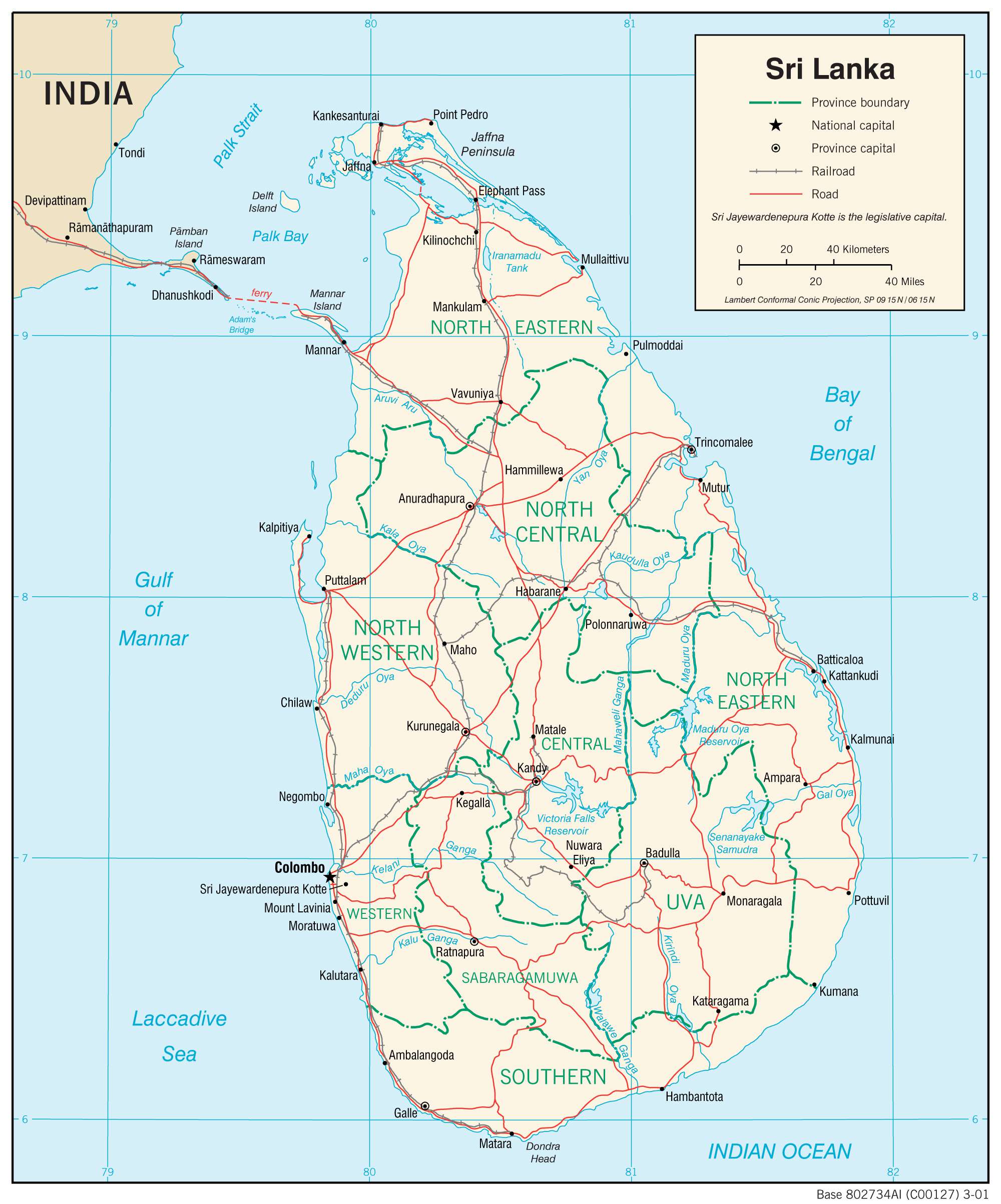
Sri Lanka (officially, the Democratic Socialist Republic of Sri Lanka) is divided into 9 administrative provinces. In alphabetical order, these provinces are: Central, Eastern, North Central, Northern, North Western, Sabaragamuwa, Southern, Uva and Western. These provinces are further subdivided into 25 districts and other smaller subdivisions.
Sri Lanka is one of the Asian countries with two capitals. The satellite city of Sri Jayawardenepura Kotte is the administrative capital and seat of the National Legislature of Sri Lanka. While the capital city of Colombo – is the chief economic and commercial center of Sri Lanka and the greater South Asia. Located in the south western part of the country, Colombo is a port city and one of the largest man-made harbors in the world. With a combined population of over 8 lakhs, the two capitals of Sri Lanka represent the two largest urban areas of the country.
Location Maps
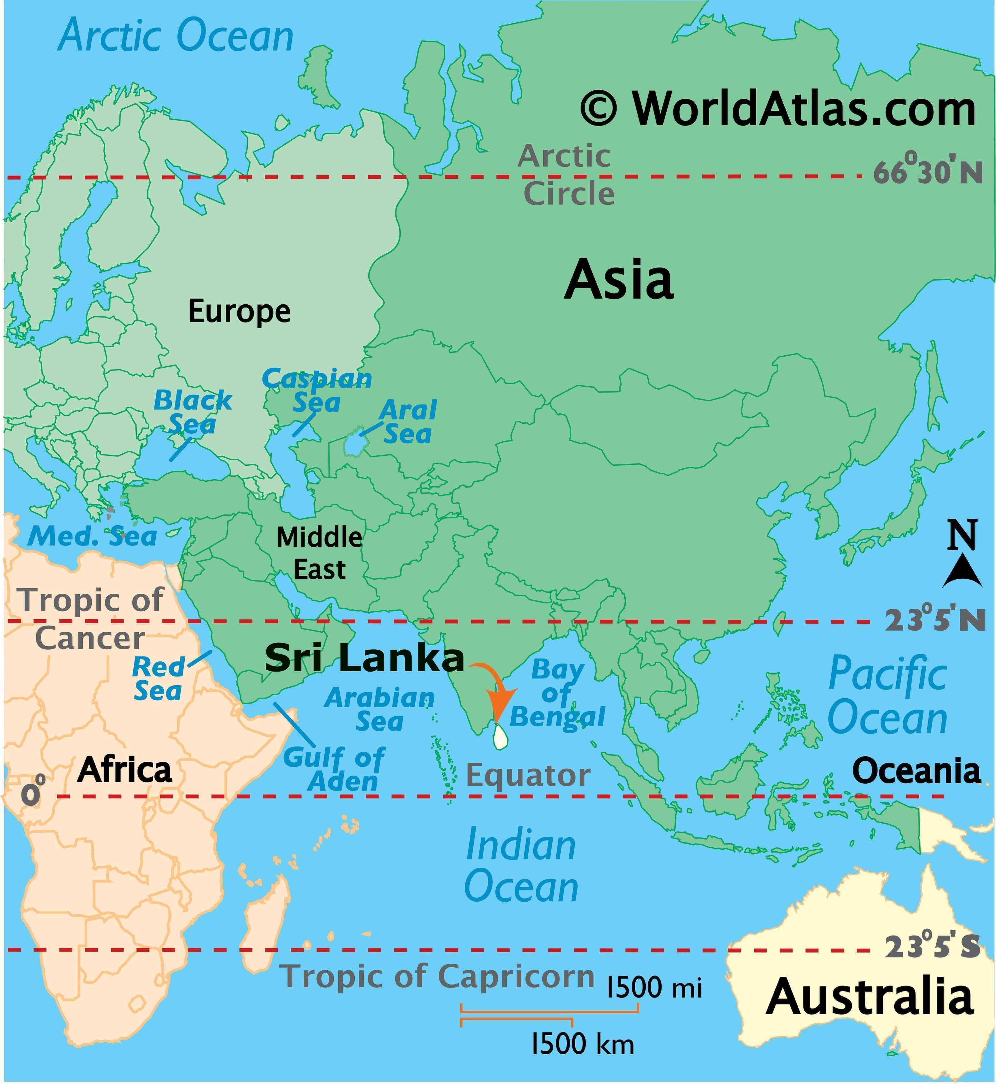
Where is Sri Lanka?
Discovering the Beauty of Sri Lanka
Sri Lanka is an enchanting island located in Southern Asia in the Indian Ocean. It is situated off the coast southeast of India, across from the Palk Strait and the Gulf of Mannar. With its majestic landscapes ranging from sandy beaches to lush green hills, Sri Lanka is a country of wonder and beauty.
The country is divided into two parts – the legislative capital of Sri Jayawardenepura Kotte and the executive and judicial capital of Colombo. Both cities are home to a variety of attractions and activities, making them popular tourist destinations. Other major cities in Sri Lanka include Dehiwala-Mount Lavinia and Moratuwa.
Sri Lanka is situated 750 kilometers (466 mi) away from the Maldives to the west. Tourists can explore the country’s many attractions, such as the picturesque beaches and the stunningly beautiful hills of the interior. With its unique culture and friendly locals, Sri Lanka is the perfect destination for a relaxing vacation.
High Definition Political Map of Sri Lanka
Physical Map of Sri Lanka
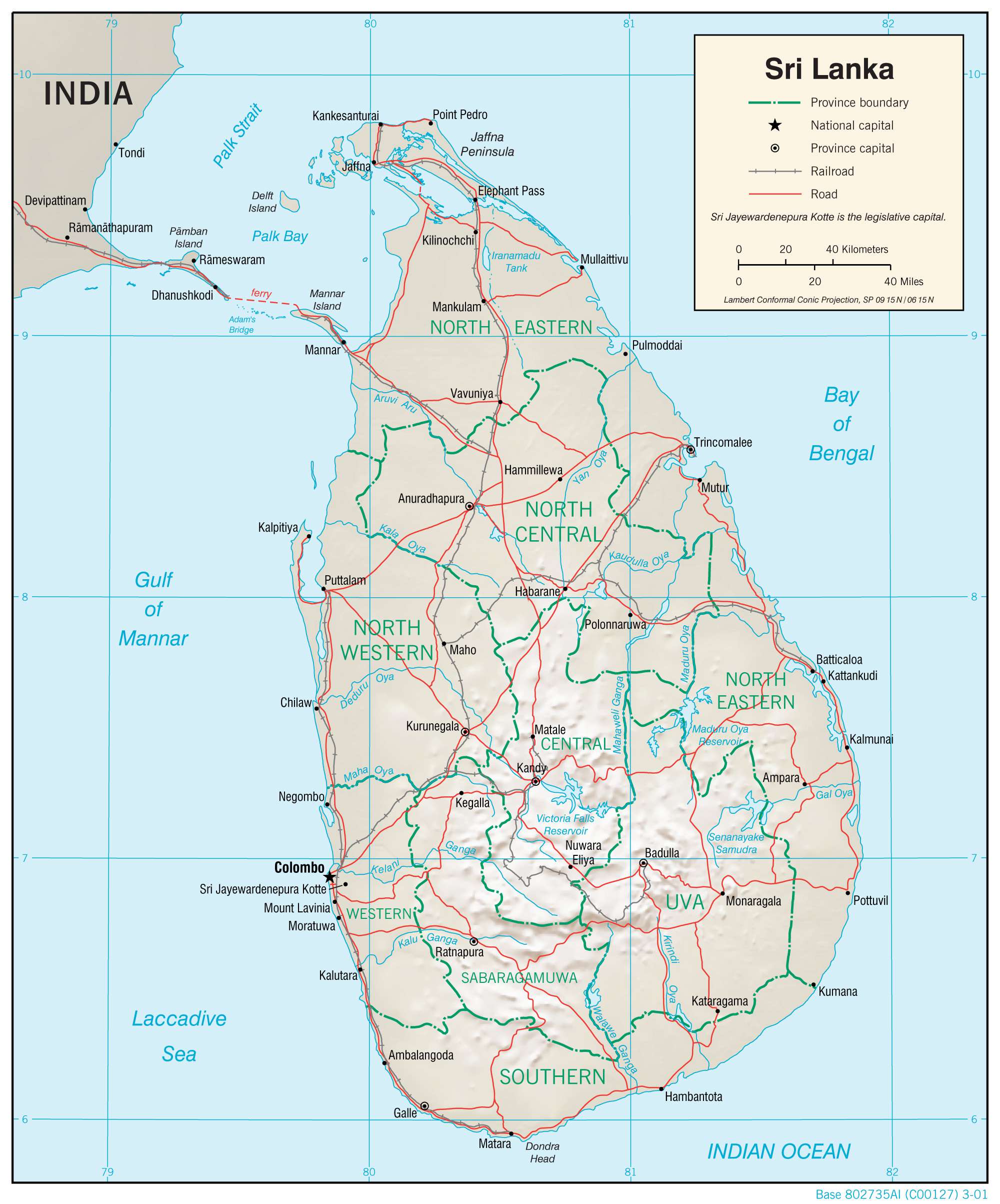
Transportation Map of Sri Lanka
Sri Lanka Satellite Map

Elevation Map