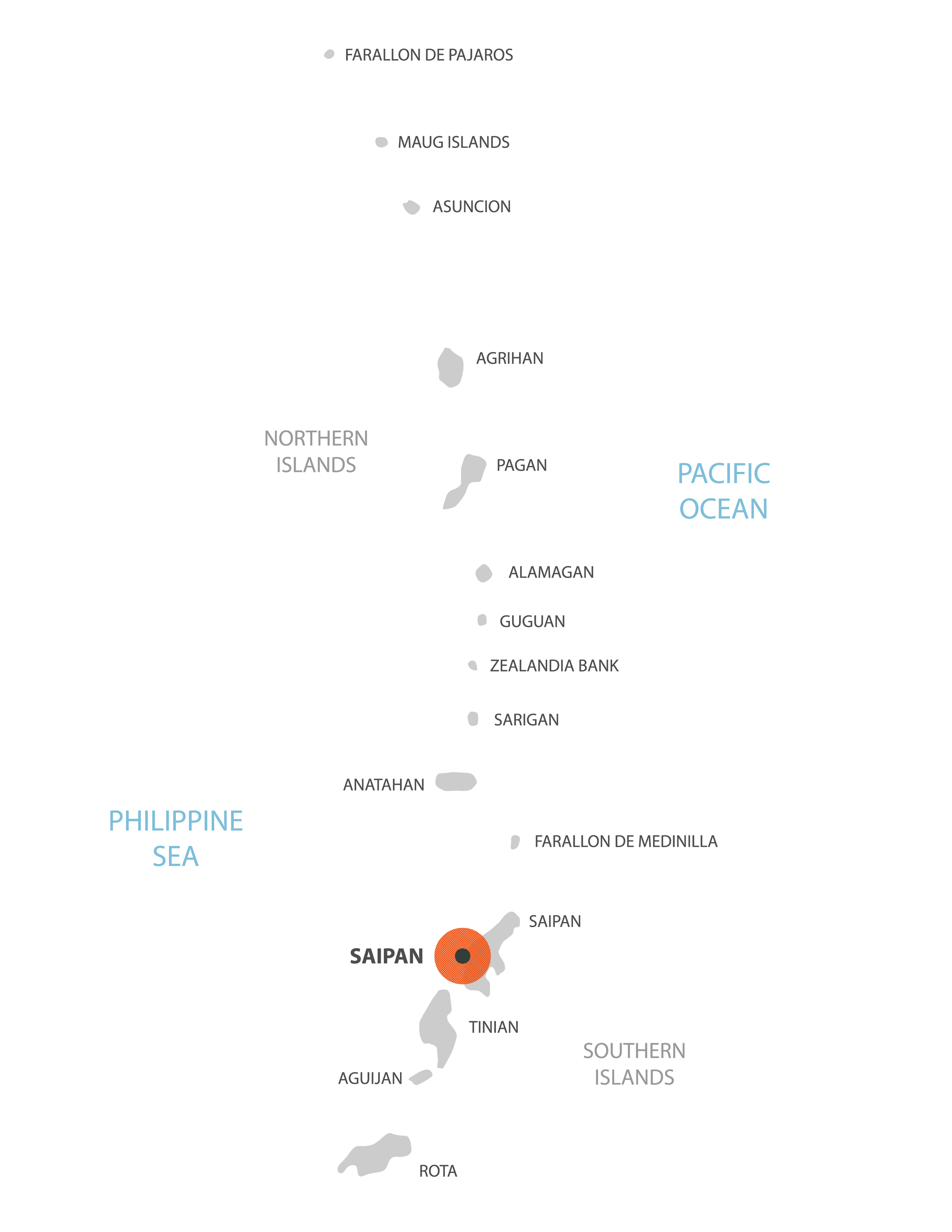
Covering a total land area of 475.26 sq.km (179 sq mi), Northern Mariana Islands is an unincorporated and organized territory of the United States and also a U.S. commonwealth. The territory comprises of 15 islands in the Mariana archipelago situated in the northwestern Pacific Ocean. The Northern islands are volcanic in origin. Several islands like Anatahan, Pagan and Agrihan have active volcanoes. The island territory’s highest point is Mount Agrihan at an elevation of 3,166ft (965m). The Southern Islands are made of limestone and are fringed by coral reefs. These limestone islands have tropical/scrub forests which are found at high elevations while Casuarina trees and coconut palms are found along the coasts. The lowest point is the North Pacific Ocean (0m).
| Flag: | 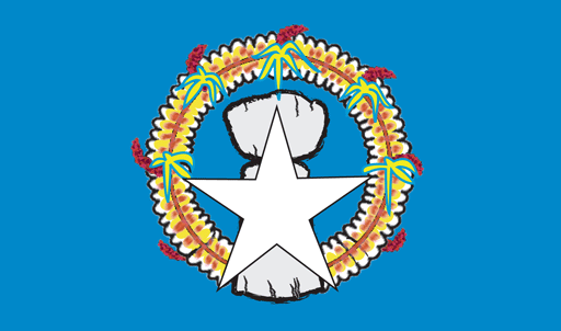 |
|---|---|
| Legal Name: | Commonwealth of the Northern Mariana Islands |
| Capital Value: | Saipan |
| Official languages: |
|
| Demonym(s): | Northern Mariana Islander (formal) Northern Marianan (other) Marianan (diminutive form) Chamorro (colloquial) |
| Government: | Devolved presidential constitutional dependency |
| Legislature: | Commonwealth Legislature |
| Total Area: | 464 km² |
| Land Area: | 464 km² |
| Population: | 57,216 |
| Density: | 113/km (292.7/sq mi) (97th) |
| GDP: | $1.32 Billion |
| GDP Per Capita: | $23,258.68 |
| Currency Value: | US Dollar (USD) |
| Driving side: | right |
| Calling code: | +1-670 |
| Internet TLD: | .mp |
Online Interactive Political Map
Click on ![]() to view map in "full screen" mode.
to view map in "full screen" mode.
Northern Mariana Islands (officially, the Commonwealth of the Northern Mariana Islands [CNMI]) is divided into 4 municipalities. The municipalities are: Northern Islands, Rota, Saipan and Tinian.
Covering a total land area of 475.26 sq.km (179 sq mi), Northern Mariana Islands is an unincorporated and organized territory of the United States and also a U.S. commonwealth. The territory comprises of 15 islands in the Mariana archipelago situated in the northwestern Pacific Ocean.
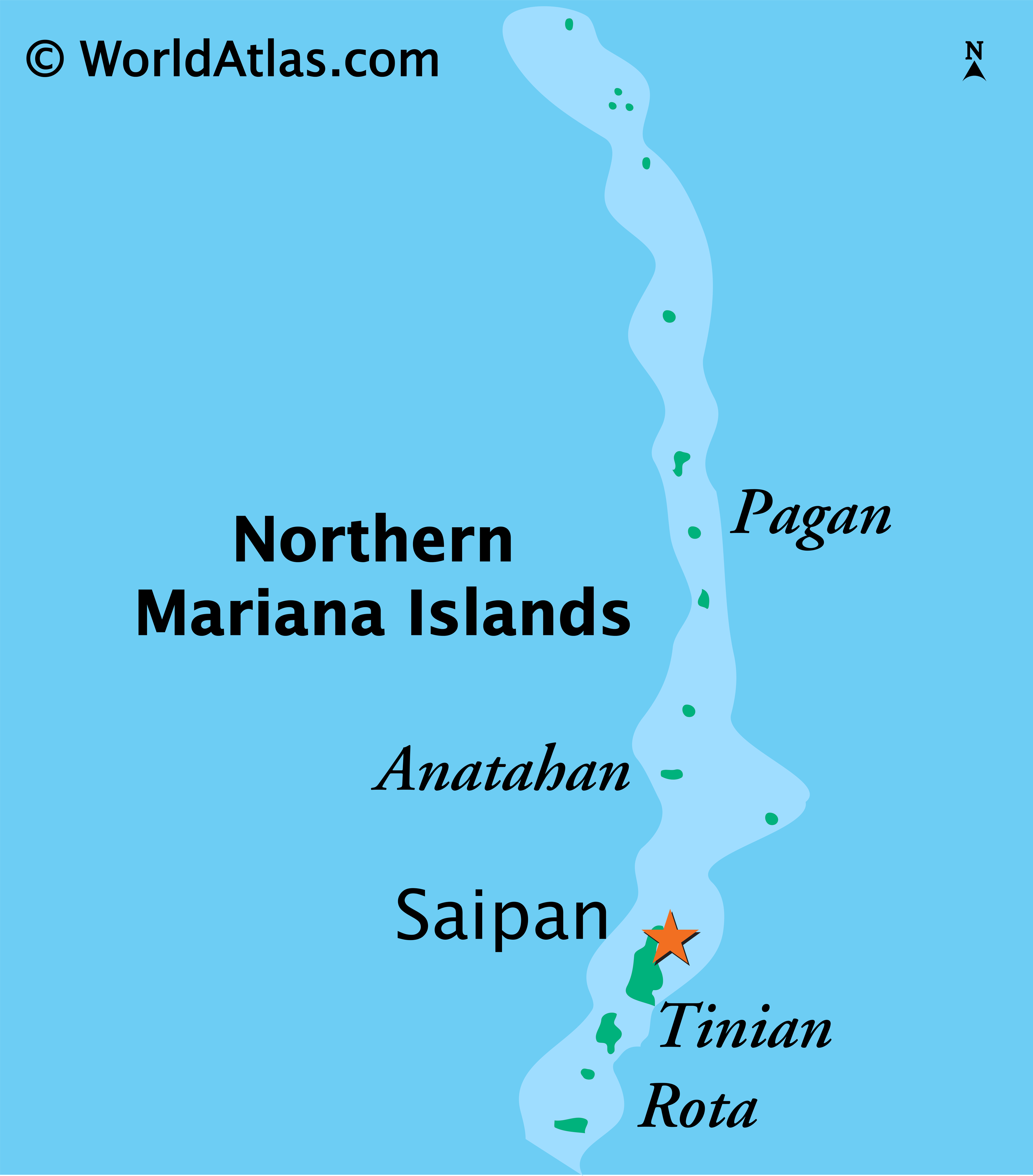
Situated in the north of Guam island is, Saipan – the capital, the largest and the most populous island of CNMI. The Government of Northern Mariana Islands is located on Saipan, in the village of Capitol Hill. Saipan is also the 2nd largest island by area in the Mariana archipelago, after Guam.
Location Maps
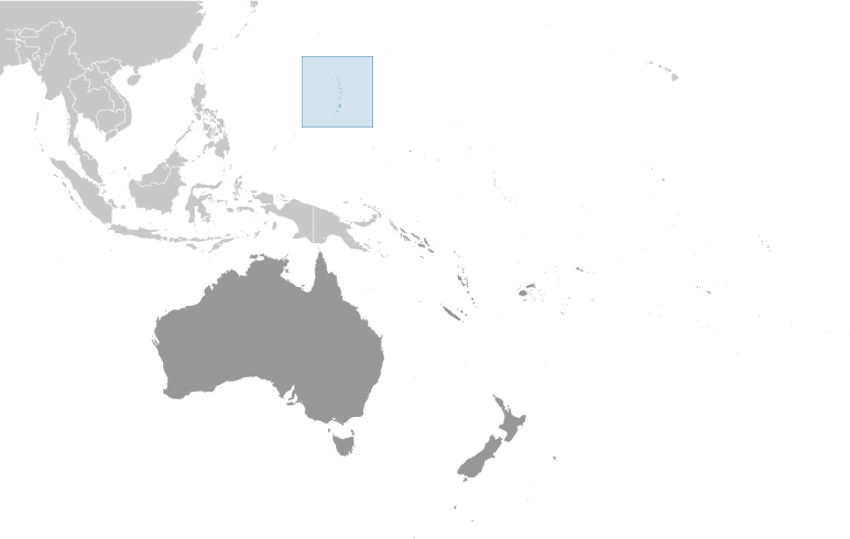
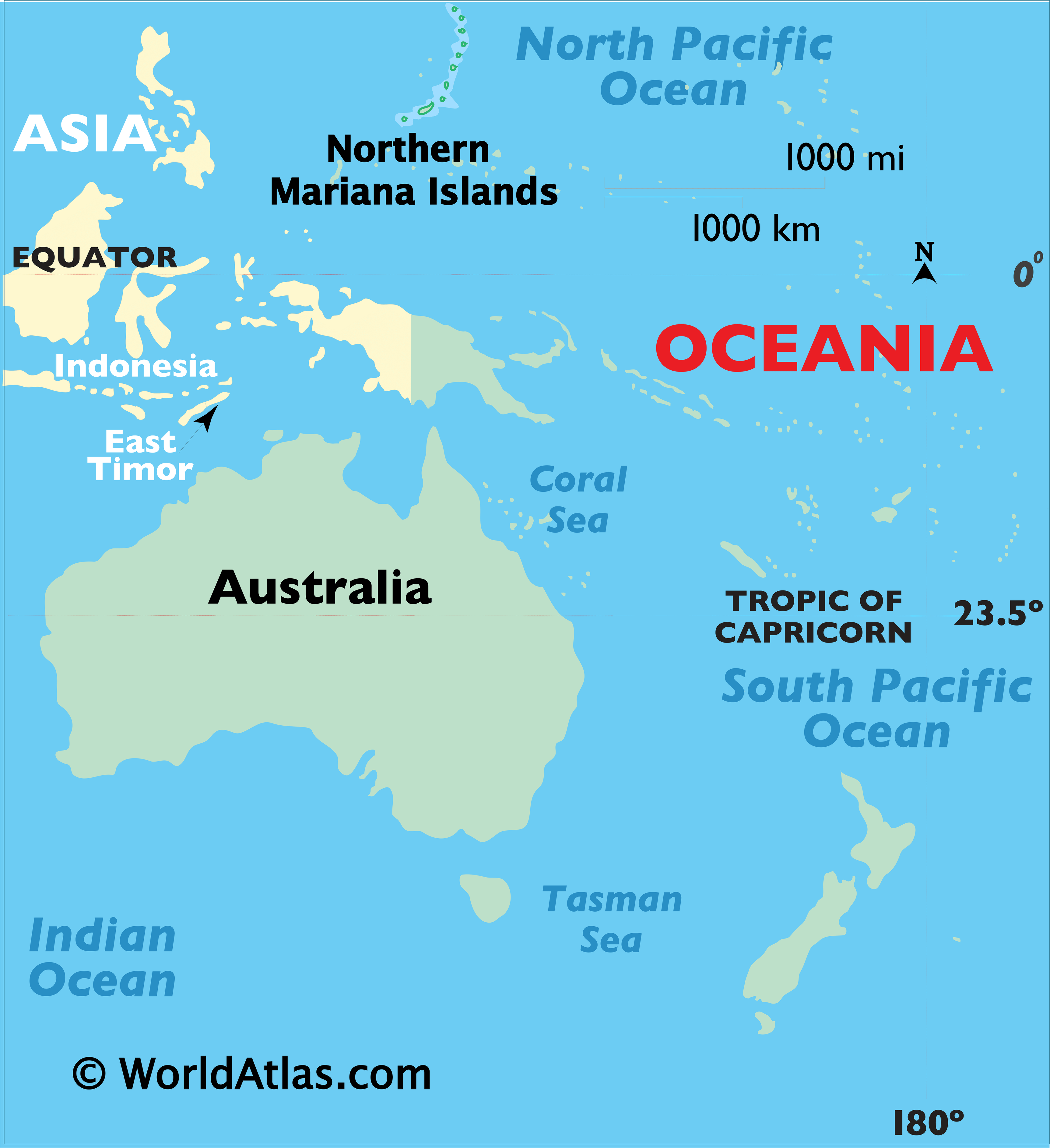
Where is Northern Mariana Islands?
High Definition Political Map of Northern Mariana Islands
History
Arrival of humans
The Mariana Islands were the first islands settled by humans in Remote Oceania. Incidentally it is also the first and the longest of the ocean-crossing voyages of the Austronesian peoples, and is separate from the later Polynesian settlement of the rest of Remote Oceania. They were first settled around 1500 to 1400 BC by migrants departing from the Philippines. This was followed by a second migration from the Caroline Islands by the first millennium AD, and a third migration from Island Southeast Asia (likely the Philippines or eastern Indonesia) by 900 AD.
After first contact with Spaniards, they eventually became known as the Chamorros, a Spanish word similar to Chamori, the name of the indigenous caste system’s higher division.
The ancient people of the Marianas raised colonnades of megalithic capped pillars called latte stones upon which they built their homes. The Spanish reported that by the time of their arrival, the largest of these were already in ruins, and that the Chamorros believed the ancestors who had erected the pillars lived in an era when people possessed supernatural abilities.
In 2013 archaeologists posited that the first people to settle in the Marianas may have made what was at that point the longest uninterrupted ocean-crossing voyage in human history. Archeological evidence indicates that Tinian may have been the first Pacific island to be settled.
Spanish possession
The Portuguese navigator Ferdinand Magellan, sailing under the Spanish flag, arrived in 1521. He and his crew were the first Europeans to arrive in the Mariana Islands. He landed on Guam, the southernmost island of the Marianas, and claimed the archipelago for Spain. The Spanish ships were met offshore by the native Chamorros, who delivered refreshments and then helped themselves to a small boat belonging to Magellan’s fleet. This led to a cultural clash: in Chamorro tradition, little property was private and taking something one needed, such as a boat for fishing, did not count as stealing. The Spanish did not understand this custom and fought the Chamorros until the boat was recovered. Three days after he had been welcomed on his arrival, Magellan fled the archipelago. Spain regarded the islands as annexed and later made them part of the Spanish East Indies in 1565. In 1734, the Spanish built a royal palace, the Plaza de España, in Guam for the governor of the islands. The palace was largely destroyed during World War II, but portions of it remain.
Guam operated as an important stopover between the Philippines and Mexico for Manila galleon carrying trading between Spanish colonies.
In 1668, Father Diego Luis de San Vitores renamed the islands Las Marianas in honor of his patroness the Spanish regent Mariana of Austria (1634–1696), widow of Felipe IV (reigned 1621–1665).
Most of the islands’ native population (90–95%) died from European diseases carried by the Spaniards or married non-Chamorro settlers under Spanish rule. New settlers, primarily from the Philippines and the Caroline Islands, were brought to repopulate the islands. The Chamorro population gradually recovered, and Chamorro, Filipino, and Refaluwasch languages and other ethnic groups remain in the Marianas.
During the 17th century, Spanish colonists forcibly moved the Chamorros to Guam, to encourage assimilation and conversion to Roman Catholicism. By the time they were allowed to return to the Northern Marianas, many Carolinians from present-day eastern Yap State and western Chuuk State had settled in the Marianas. Both languages, as well as English, are now official in the commonwealth.
The Northern Marianas experienced an influx of immigration from the Carolines during the 19th century. Both this Carolinian subethnicity and Carolinians in the Carolines archipelago refer to themselves as the Refaluwasch. The indigenous Chamoru word for the same group of people is gu’palao. They are usually referred to simply as “Carolinians”, though unlike the other two monikers, this can also mean those who actually live in the Carolines and who may have no affiliation with the Marianas.
The conquering Spanish did not focus attempts at cultural suppression against Carolinian immigrants, whose immigration they allowed during a period when the indigenous Chamoru majority was being subjugated with land alienation, forced relocations and internment. Carolinians in the Marianas continue to be fluent in the Carolinian language, and have maintained many of the cultural distinctions and traditions of their ethnicity’s land of ancestral origin.
German possession and Japanese mandate
Following its loss during the Spanish–American War of 1898, Spain ceded Guam to the United States and sold the remainder of the Marianas (i.e., the Northern Marianas), along with the Caroline Islands, to Germany under the German–Spanish Treaty of 1899. The United States could have taken the entire Marianas but beyond Guam saw no need for the group. Germany administered the islands as part of its colony of German New Guinea and did little in terms of development.
Early in World War I, Japan declared war on Germany and invaded the Northern Marianas. In 1919, the League of Nations (LoN) awarded all of Germany’s islands in the Pacific Ocean located north of the Equator, including the Northern Marianas, under mandate to Japan. Under this arrangement, the Japanese thus administered the Northern Marianas as part of the South Seas Mandate. During the Japanese period, sugar cane became the main industry of the islands. Garapan on Saipan was developed as a regional capital, and numerous Japanese (including ethnic Koreans, Okinawan, and Taiwanese) migrated to the islands. In the December 1939 census, the total population of the South Seas Mandate was 129,104, of whom 77,257 were Japanese (including ethnic Taiwanese and Koreans). On Saipan the pre-war population comprised 29,348 Japanese settlers and 3,926 Chamorro and Caroline Islanders; Tinian had 15,700 Japanese settlers (including 2,700 ethnic Koreans and 22 ethnic Chamorro).
World War II
On December 8, 1941, hours after the attack on Pearl Harbor, Japanese forces from the Marianas launched an invasion of Guam. Chamorros from the Northern Marianas, which had been under Japanese rule for more than 20 years, were brought to Guam to assist the Japanese administration. This, combined with the harsh treatment of Guamanian Chamorros during the 31-month occupation, created a rift that would become the main reason Guamanians rejected the referendum on reunification of Guam with the northern marianas approved by the Northern Marianas in the 1960s.
On June 15, 1944, the United States military invaded the Mariana Islands, starting the Battle of Saipan, which ended on July 9. Of the 30,000 Japanese troops defending Saipan, fewer than 1,000 remained alive at the battle’s end. Many civilians were also killed, by disease, starvation, enemy fire, or suicide – about 1,000 civilians killed themselves by jumping off cliffs. U.S. forces then recaptured Guam on July 21, and invaded Tinian on July 24. A year later Tinian was the takeoff point for the Enola Gay, the plane that dropped the atomic bomb on Hiroshima. Rota was left untouched (and isolated) until the Japanese surrender in August 1945, owing to its military insignificance. The story of the holdouts on Anatahan was told in 1953 by Josef von Sternberg in his film The Saga of Anatahan.
The war did not end for everyone with the signing of the armistice. The last group of Japanese holdouts surrendered on Saipan on December 1, 1945. On Guam, Japanese soldier Shoichi Yokoi, unaware that the war had ended, hid in a jungle cave in the Talofofo area until 1972.
Japanese nationals were eventually repatriated to the Japanese home islands.
United Nations trusteeship
After Japan’s defeat in World War II, the Northern Marianas were administered by the United States pursuant to Security Council Resolution 21 as part of the United Nations Trust Territory of the Pacific Islands, which assigned responsibility for defense and foreign affairs to the United States as trustee. Four referendums offering integration with Guam or changes to the islands’ status were held in 1958, 1961, 1963 and 1969. On each occasion, a majority voted in favor of integration with Guam, but this did not happen: Guam rejected integration in a 1969 referendum.
Commonwealth
The people of the Northern Mariana Islands decided in the 1970s not to seek independence, but instead to forge closer links with the United States. Negotiations for commonwealth status began in 1972 and a covenant to establish a commonwealth in political union with the United States was approved in a 1975 referendum. A new government and constitution partially came into effect in on January 9, 1978 after being approved in a 1977 referendum. The United Nations approved this arrangement pursuant to Security Council Resolution 683. The Northern Mariana Islands came under U.S. sovereignty on November 4, 1986, and the islanders became US citizens. Also on November 4, 1986, the Northern Mariana Islands constitution became fully effective under the Covenant.
In May 1981, volcanic eruptions led to evacuation of the island of Pagan. Most residents of Pagan have not yet returned to Pagan.
The Chamorro-Carolinian Language Policy Commission was created in 1982 to carry out policies in support of the Chamorro and Carolinian languages and cultures.
In December 1986, twenty percent of the homes on Saipan were destroyed by Typhoon Kim, trees were stripped of foliage, thousands of coconut trees were knocked down, roads were blocked, and there was no electricity or public water supply for weeks.
In April 1990, the inhabitants of the western coast of Anatahan were evacuated after earthquake swarms and active fumaroles indicated that an eruption might be imminent, but no eruption occurred at that time. A further earthquake swarm occurred in May 1992. The first historical eruption of Anatahan occurred in May 2003, when a large explosive eruption with a VEI of 4 took place forming a new crater inside the eastern caldera and causing an ash plume 12 km (7.5 mi) high which impaired air traffic to Saipan and Guam.
The Northern Mariana Islands does not have voting representation in the United States Congress, but, since 2009, has been represented in the U.S. House of Representatives by a delegate; congressional delegates may participate in debates and serve on congressional committees but may not cast decisive votes on the House floor.
Physical Map of Northern Mariana Islands
Geography
The Northern Mariana Islands, together with Guam to the south, compose the Mariana Islands archipelago. The southern islands are limestone, with level terraces and fringing coral reefs. The northern islands are volcanic, with active volcanoes on several islands, including Anatahan, Pagan, and Agrihan. The volcano on Agrihan, Mount Agrihan, has the highest elevation at 3,166 feet (965 m). An expedition organized by John D. Mitchler and Reid Larson made the first complete ascent to the summit of this peak on June 1, 2018.
Anatahan Volcano is a small volcanic island 80 miles (130 km) north of Saipan. It is about 6 miles (10 km) long and 2 miles (3 km) wide. Anatahan began erupting from its east crater on May 10, 2003. It has since alternated between eruptive and calm periods. On April 6, 2005, an estimated 50,000,000 cubic feet (1,416,000 m) of ash and rock were ejected, causing a large, black cloud to drift south over Saipan and Tinian.
- Northernmost point – Farallon de Pajaros
- Easternmost point – Farallon de Medinilla
- Southernmost point – Puntan Malikok, Rota
- Westernmost point – Farallon de Pajaros
The islands lie in the Marianas tropical dry forests terrestrial ecoregion.
Climate
The Northern Mariana Islands have a tropical rainforest climate (Köppen: Af) moderated by seasonal northeast trade winds, with little seasonal temperature variation. The dry season runs from December to June; the rainy season runs from July to November and can include typhoons. The Guinness Book of World Records has said Saipan has the most equable climate in the world.