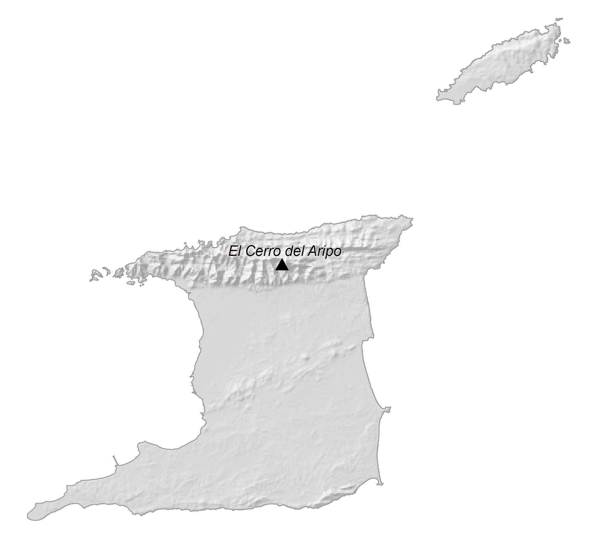
Located just a few miles off the South American continent, Trinidad and Tobago are hilly islands with a few mountains of note. Covering a total area of 5,131 sq.km (1,981 sq mi), the island country of Trinidad and Tobago, consists of two major islands of Trinidad and Tobago, along with many smaller islands.
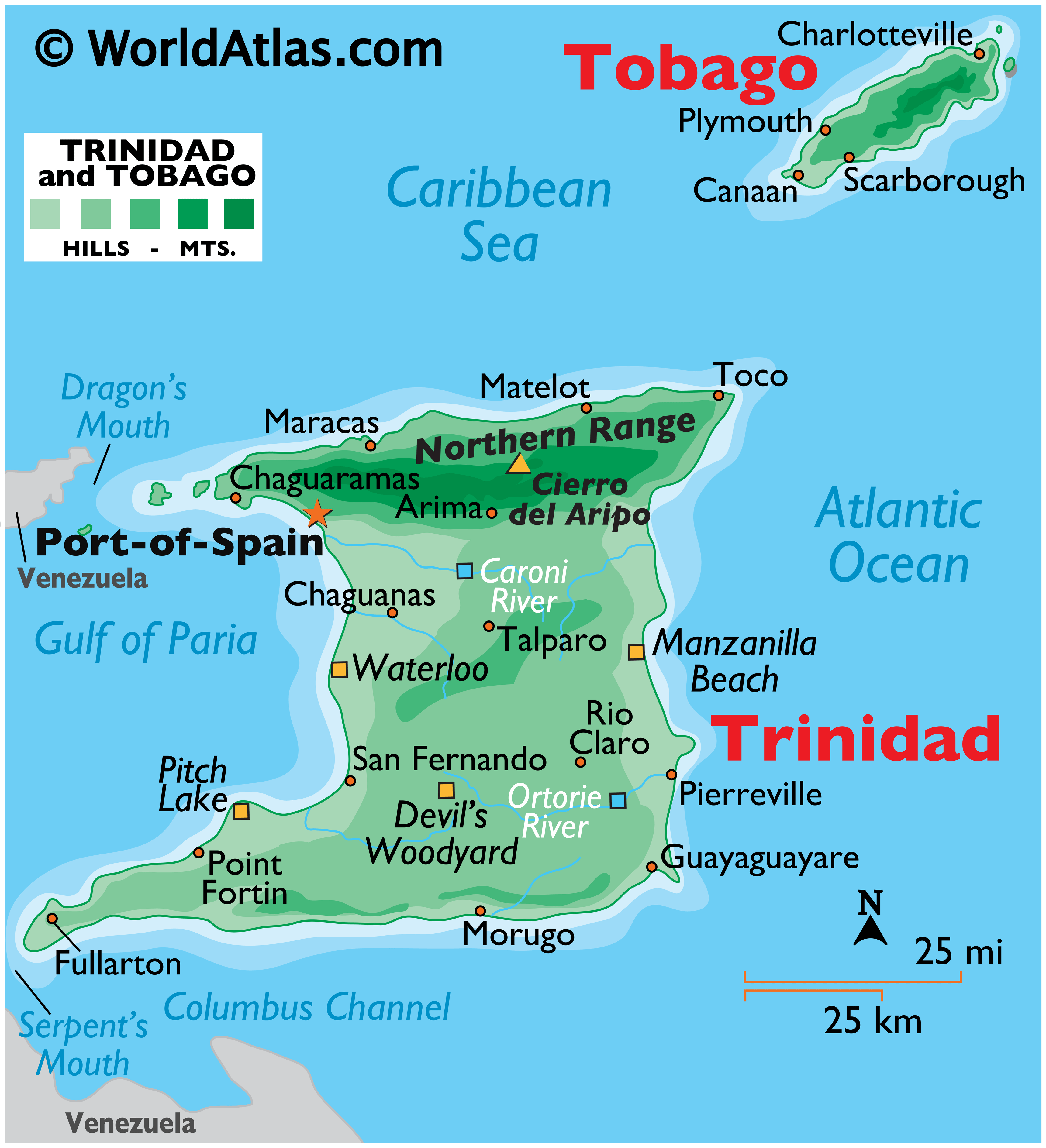
As observed on the physical map of the country above, Trinidad – the larger of the two islands, is crisscrossed by mountain ranges; the most dominant of these is the Northern Range. It is a rugged area of hills and peaks with the country’s highest point being Mount Aripo (El Cero del Aripo) at 940m (3,084ft) high (marked by a yellow triangle on the map).
The lower Central Range spreads across the central area of the island, and in the far south, a scattered group of hills (The Southern Range & Trinity Hills) border the southern coastline.
Trinidad is drained by numerous short rivers and streams, with the Rivers – Caripo (in the north) and Ortoire (in the south), being the most significant. There are also many large swamp areas.
As for Tobago, there is a Central Ridge running down it’s spine, with some elevations exceeding 600m (1,968ft). The islands have numerous small rivers and streams, and it’s coastline is ringed by bays, beaches and a narrow coastal plain that rises into the hills. Tobago has a number of small islands running along it’s eastern coastline.
| Flag: |  |
|---|---|
| Legal Name: | Republic of Trinidad and Tobago |
| Capital Value: | Port of Spain |
| Largest City: |
Port of Spain (544,207) |
| Official languages: | English |
| Demonym(s): |
|
| Government: | Unitary parliamentary republic |
| Legislature: | Parliament |
| Total Area: | 5,128 km² |
| Land Area: | 5,128 km² |
| Population: | 1,394,973 |
| Density: | 264/km (683.8/sq mi) (34th) |
| GDP: | $24.10 Billion |
| GDP Per Capita: | $17,276.47 |
| Currency Value: | Trinidad and Tobago dollars (TTD) |
| Driving side: | left |
| Calling code: | +1 (868) |
| Internet TLD: | .tt |
Explore the beauty of Trinidad and Tobago with this comprehensive map collection! Discover the major cities, towns, roads, highways, lakes, rivers, and mountains that make up this small Caribbean nation. Get a better understanding of the country’s geography with a reference map, satellite imagery, and an elevation map.
Online Interactive Political Map
Click on ![]() to view map in "full screen" mode.
to view map in "full screen" mode.
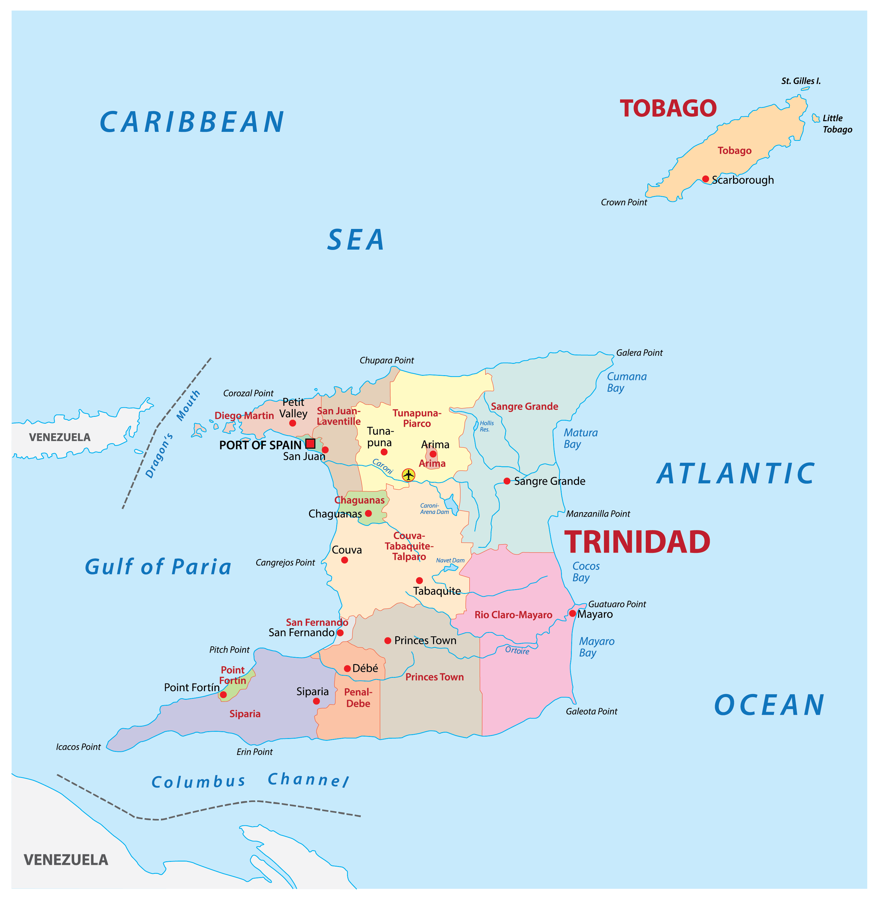
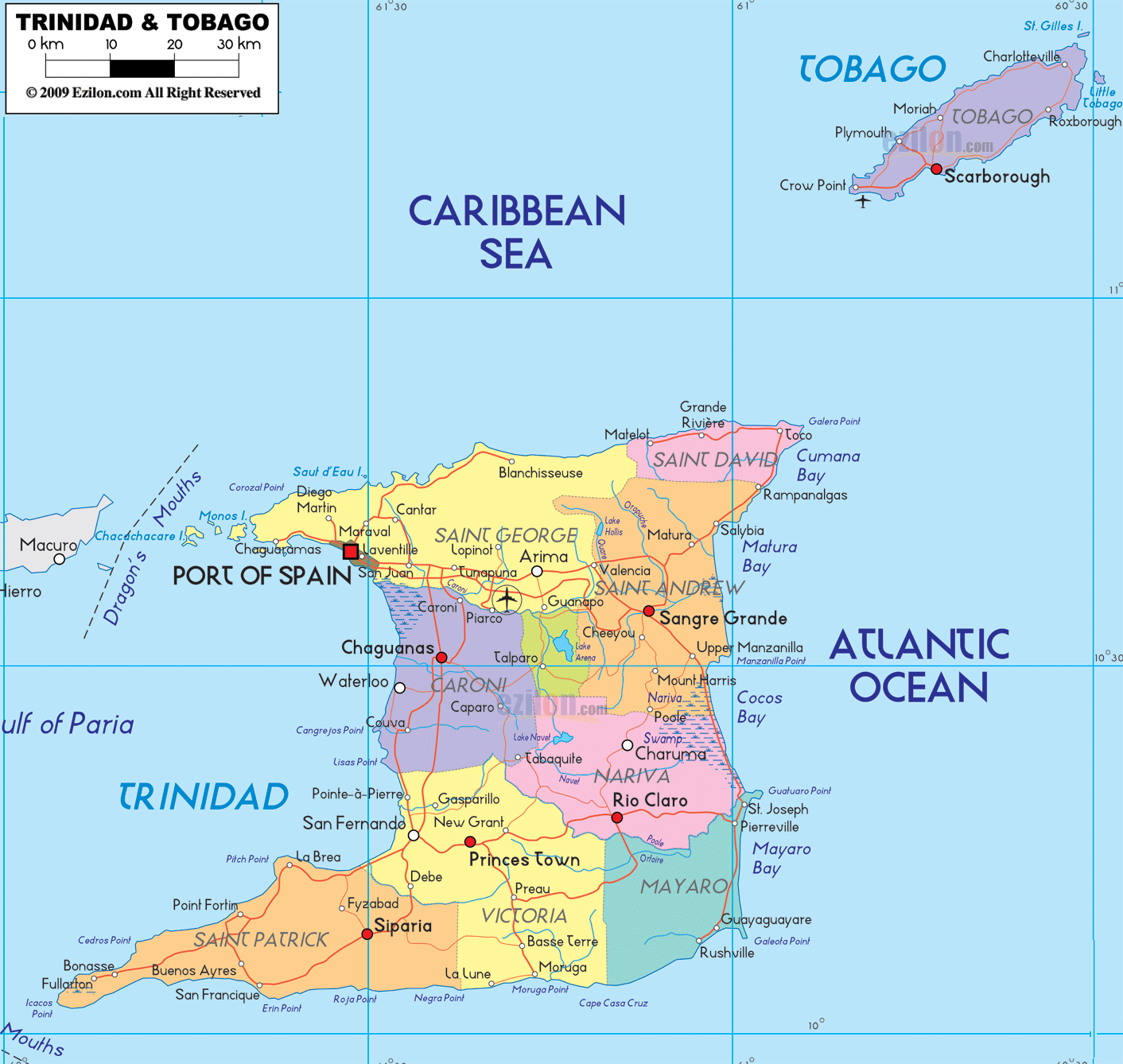
Trinidad and Tobago (officially, the Republic of Trinidad and Tobago) is divided into 9 regions, 5 municipalities (3 boroughs + 2 cities) and 1 ward. The regions are: Couva –Tabaquite -Talparo, Diego Martin, Mayaro – Rio Claro, Penal Debe, Princes Town, Sangre Grande, San Juan Laventille, Siparia, Tunapuna-Piarco. The 3 boroughs are: Arima, Chaguanas and Point Fortin. The 2 cities are: Port of Spain and San Fernando. Tobago is the ward.
Covering a total area of 5,131 sq. km, the island country of Trinidad and Tobago consists of two major islands of Trinidad and Tobago along with many smaller islands. Of these islands, Trinidad occupies an area of 4,768 sq. km, and is the largest and the most populous of the two main islands. Tobago occupies an area of 300 sq. km, and is the smaller one of the two major islands. Trinidad and Tobago is the 5th largest island country in West Indies and the most industrialised and prosperous nation in the Caribbean.
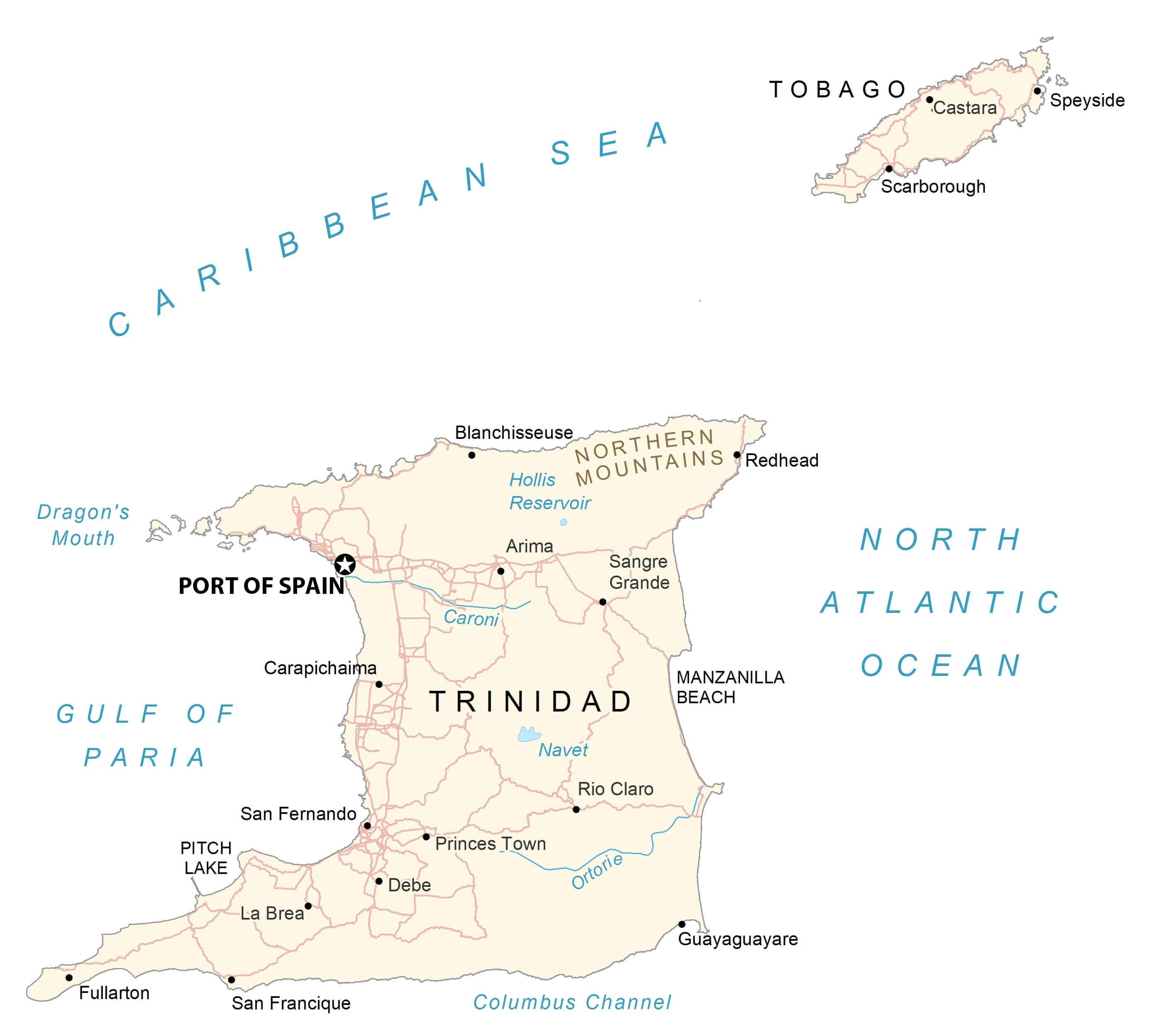
Located on the Gulf of Paria, in the north western coast of the island of Trinidad is Port of Spain – the capital city of Trinidad and Tobago. It is the administrative and financial center and a major port of the island country. Port of Spain is the 2nd largest city in the country, while San Fernando – situated in the south western coast of the island of Trinidad, is the largest and the most populous city in Trinidad and Tobago.
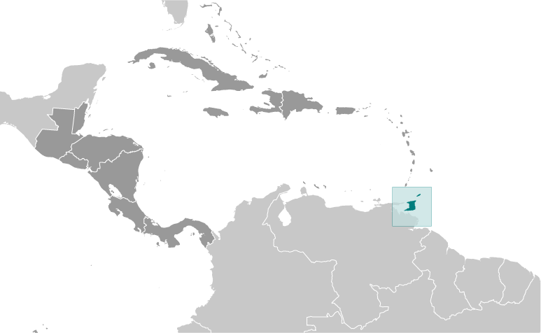
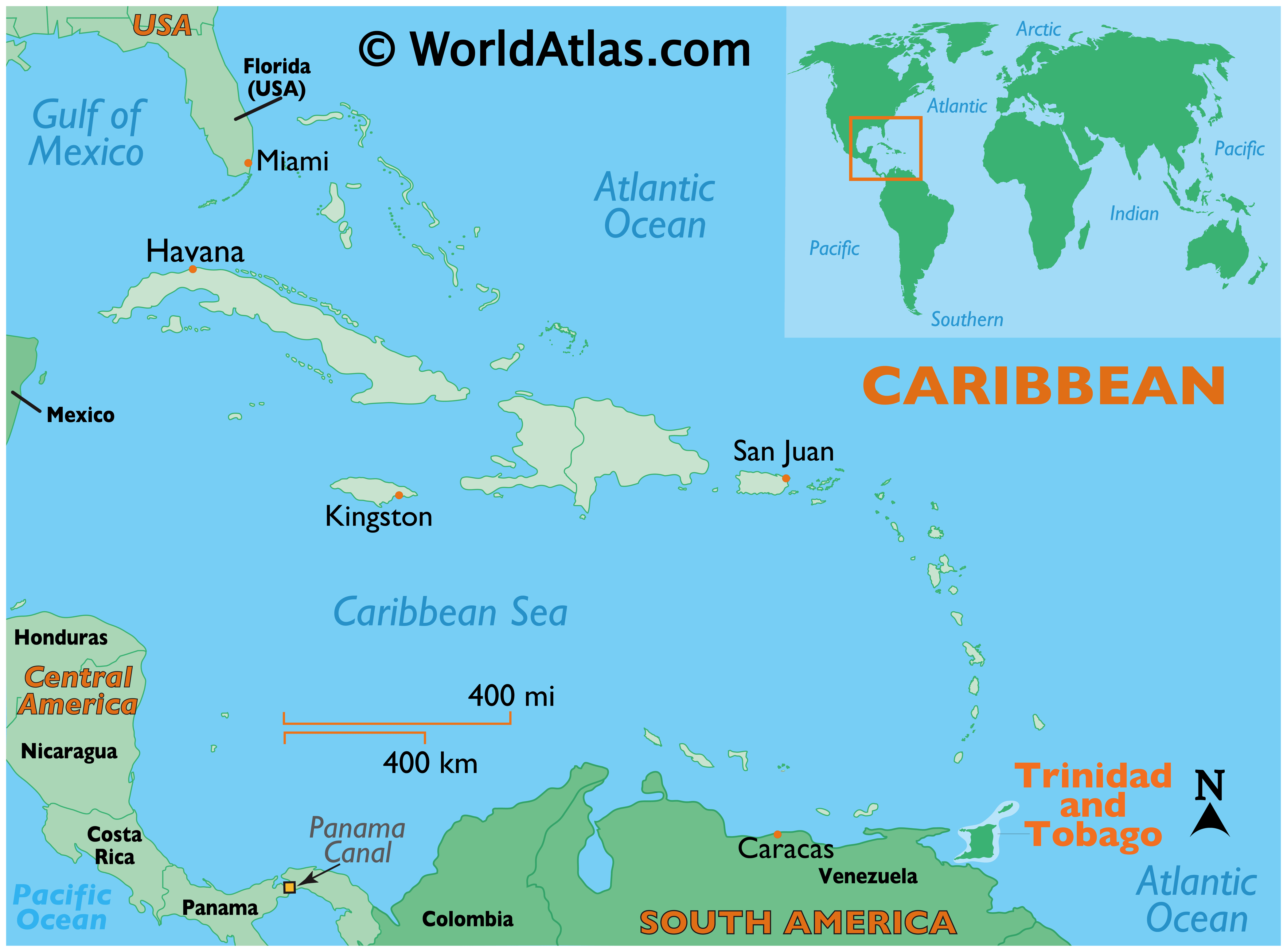
Location Maps
Where is Trinidad & Tobago?
Nestled in the Caribbean Sea, Trinidad and Tobago is the southernmost country in the region. It consists of two islands, Trinidad the larger in the south, and the smaller island of Tobago in the north. Port of Spain is the capital, but Chaguanas is the largest city in Trinidad and Tobago. Other major cities are San Fernando, Mon Repos, and Rio Claro.
Trinidad is just 11 kilometers away from Venezuela to the west, and Grenada is located to the north. This nation is known for its diverse mix of African and Indian culture, Carnival festival, sandy beaches, fossil fuels, and birdwatching.
High Definition Political Map of Trinidad & Tobago
Physical Map of Trinidad & Tobago
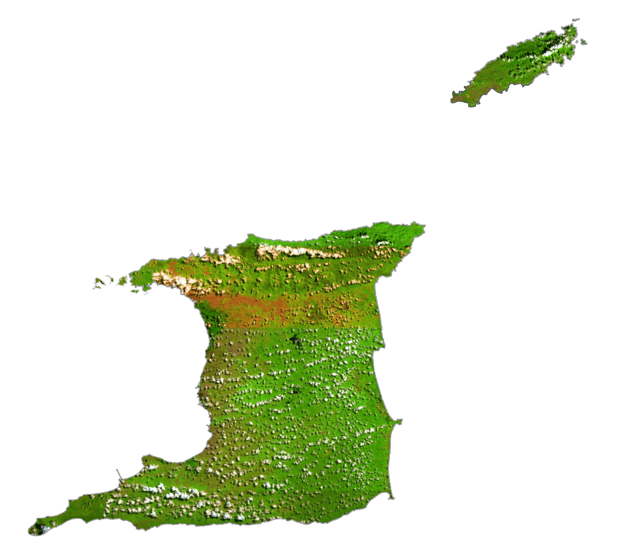
Trinidad & Tobago Satellite Map
Elevation Map