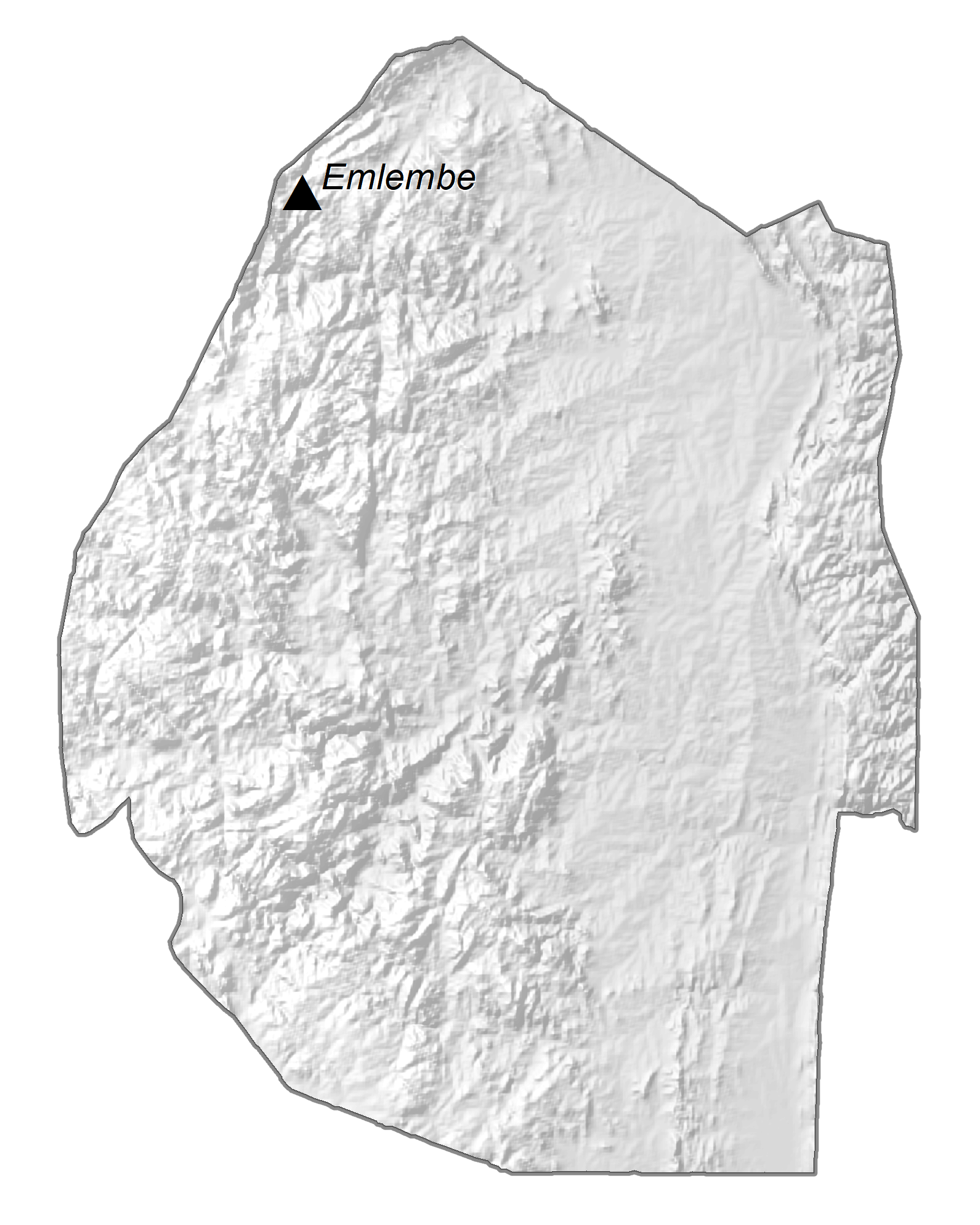
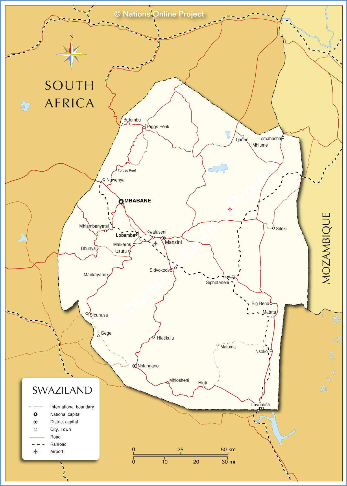
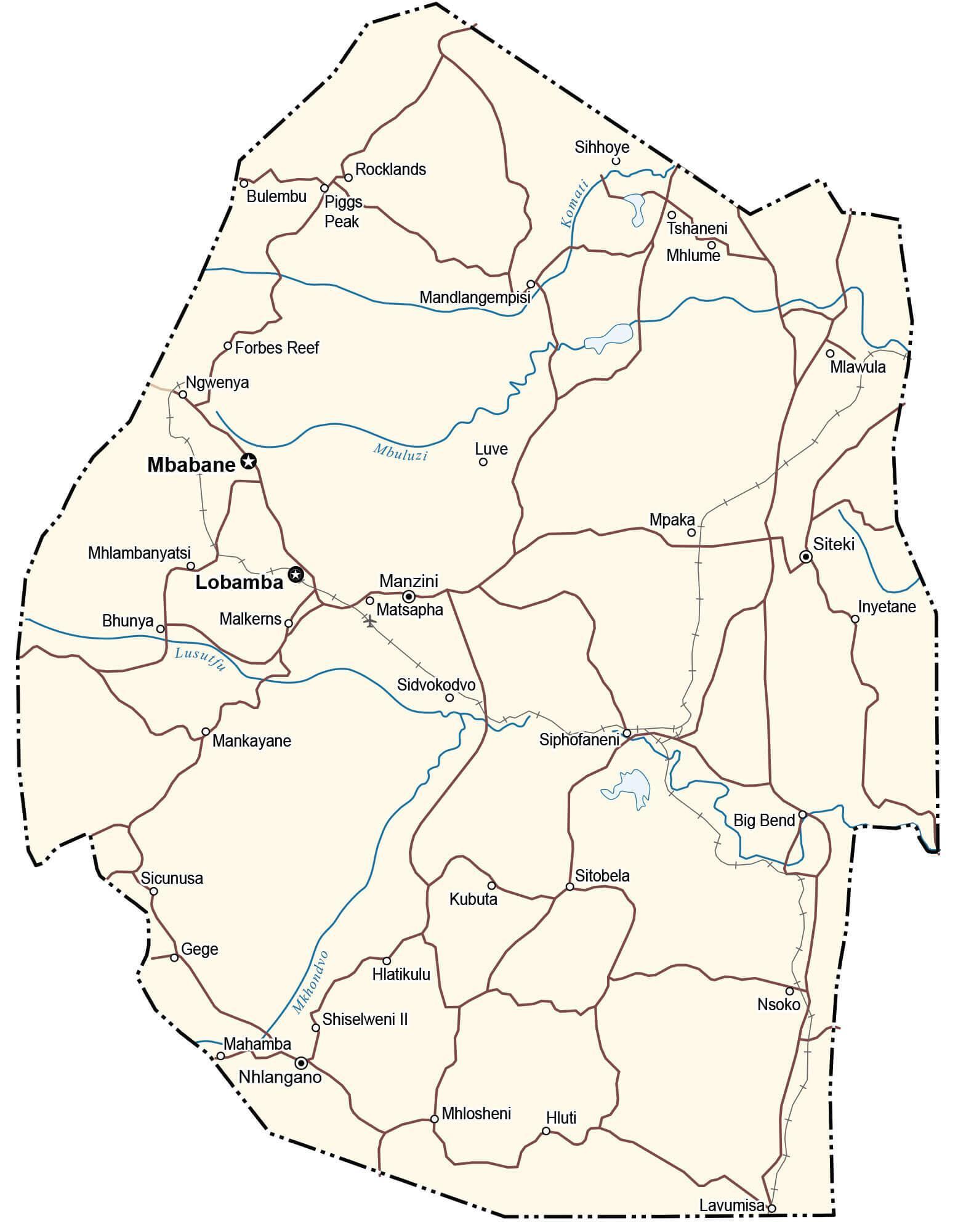
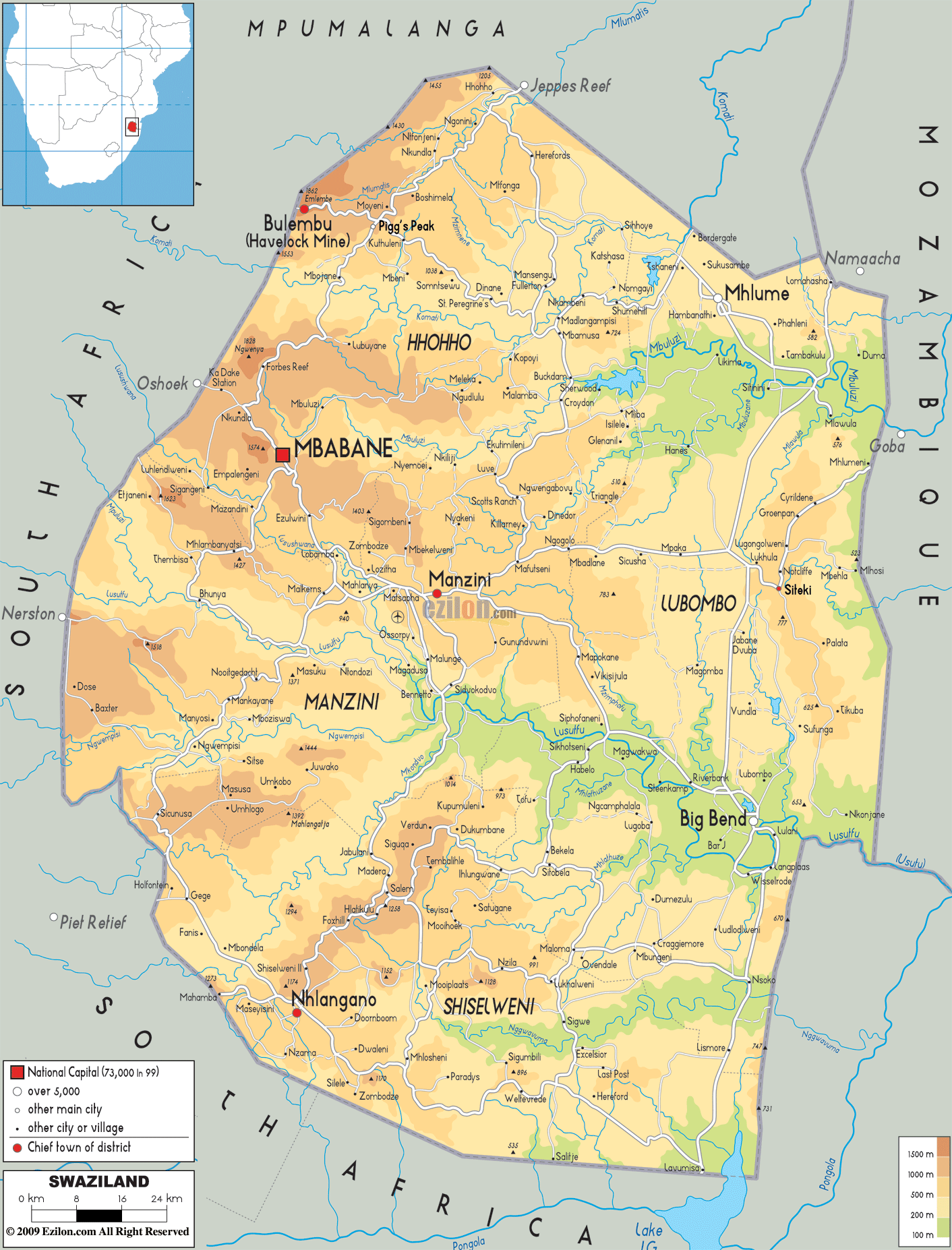
One of the smallest countries in Africa, Eswatini (previously known in English as Swaziland) occupies an area of only 17,364 sq. km. Despite its small size, Eswatini features a variety of landscapes. On the physical map above you see the Lubombo Mountain ridge runs along the country’s border with Mozambique in the northeast. It has an altitude of around 600 m. Three major rivers, Mbuluzi, Usutu, and Ngwavuma, cut the mountains here and flow downstream through deep canyons.
The map shows that along the western border of the country with South Africa, it is rough and rugged being located on the edge of an escarpment called the Drakensberg which is the eastern part of the Great Escarpment. The average altitude here is 1,200 m. Several rivers also cut through this region forming deep gorges. The capital city of Eswatini, Mbabane is located in this Highveld region.
The Highveld region of Eswatini gives way to the Middleveld which has an average elevation of 700 m above sea level. It is the country’s most densely populated region. As you can see from the map, Manzini, the commercial and industrial hub of the country, is located in this region.
Finally, the lowest part of Eswatini, the Lowveld has an average elevation of 250 m. It is populated by grasslands and thorn trees with low human population density. Due to high prevalence of malaria in the region in the early days, the development of Eswatini’s Lowvelg staggered behind the rest of the country.
Eswatini also has several protected areas like the Hlane National Park, Mlawula Nature Reserve, Mlilwane Wildlife Sanctuary, and others that protect the country’s rich biodiversity. The Hlane National Park is the country’s largest protected area and is located around 67 km northeast of Manzini.
| Flag: |  |
|---|---|
| Legal Name: | Kingdom of Eswatini |
| Capital Value: |
|
| Official languages: |
|
| Demonym(s): |
|
| Government: | Unitary absolute monarchy |
| Legislature: | Parliament |
| Total Area: | 17,364 km² |
| Land Area: | 17,204 km² |
| Water Area: | 160 km² |
| Population: | 1,148,130 |
| Density: | 66.8/km (173.0/sq mi) (135th) |
| GDP: | $4.41 Billion |
| GDP Per Capita: | $3,837.03 |
| Currency Value: | Emalangeni |
| Driving side: | left |
| Calling code: | +268 |
| Internet TLD: | .sz |
Explore the Kingdom of Eswatini with this detailed map. With its rich history, diverse culture, and stunning landscapes, Eswatini is a great destination for travelers and adventurers. Discover the country’s major cities, roads, rivers, and lakes with this interactive map. View satellite imagery and an elevation map to get an overview of the topography, including the Drakensberg Mountains and the Lebombo Valley.
Online Interactive Political Map
Click on ![]() to view map in "full screen" mode.
to view map in "full screen" mode.
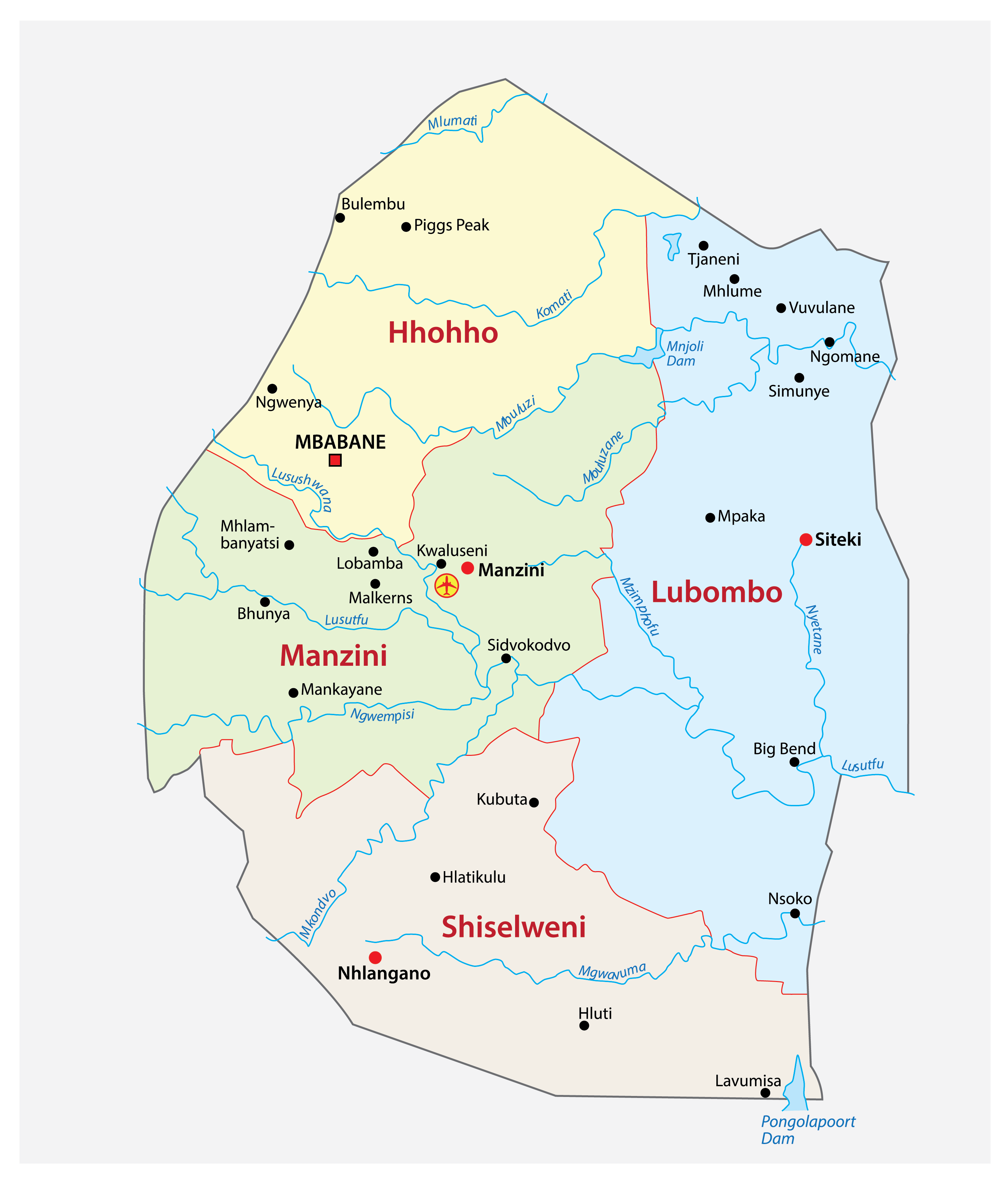
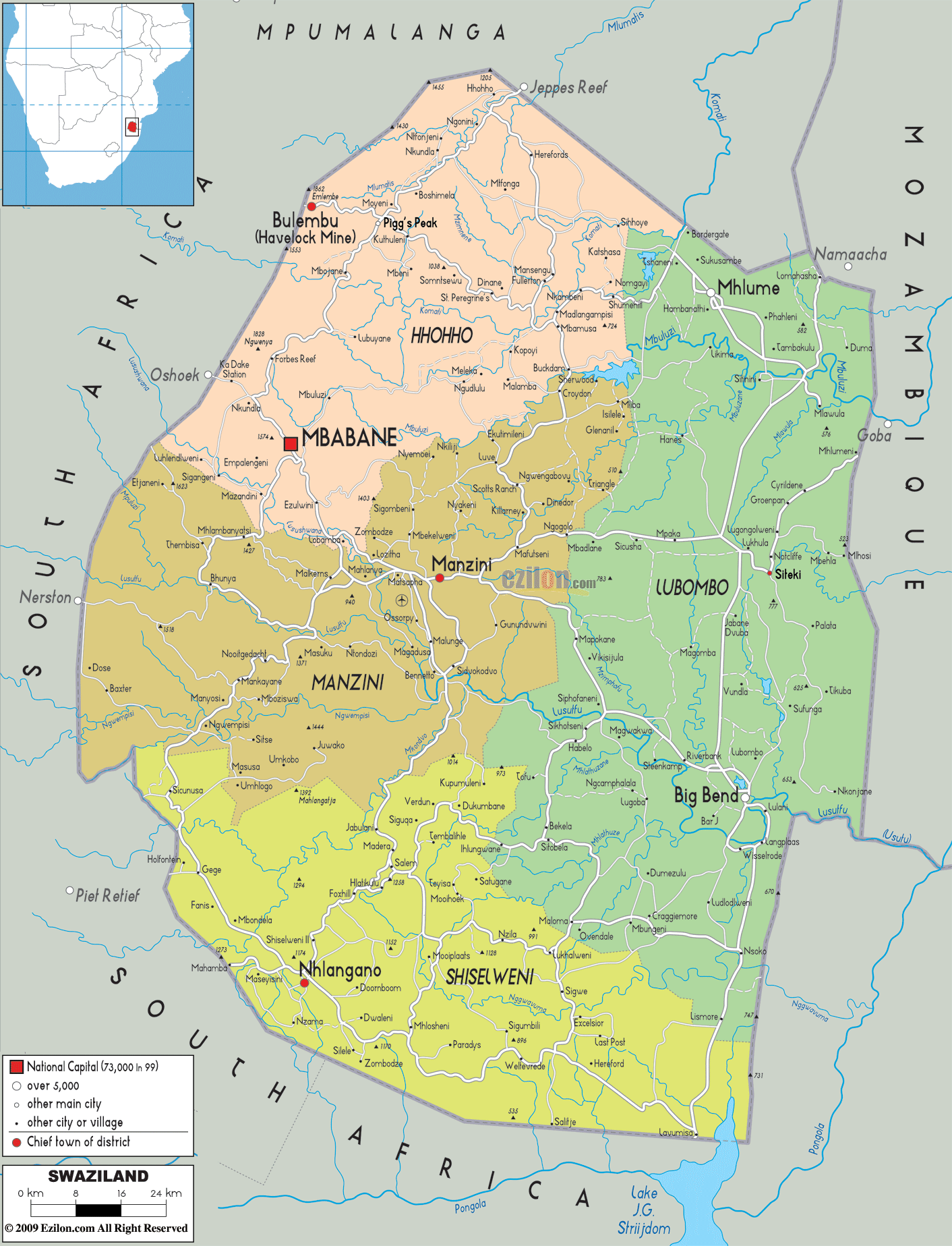
Being a small nation, Eswatini is divided into just four major administrative divisions called regions. These are Hhohho, Lubombo, Manzini, and Shiselweni. With an area of 5,849.11 sq. km, Lubombo is the largest region by area while Manzini is the most populous one. These regions are further subdivided into 55 tinkhundla which are then divided into smaller units called imiphakatsi. Each tinkhundla sends a representative to the House of Assembly of Eswatini. Mbabane is the capital city of the country.
Location Maps
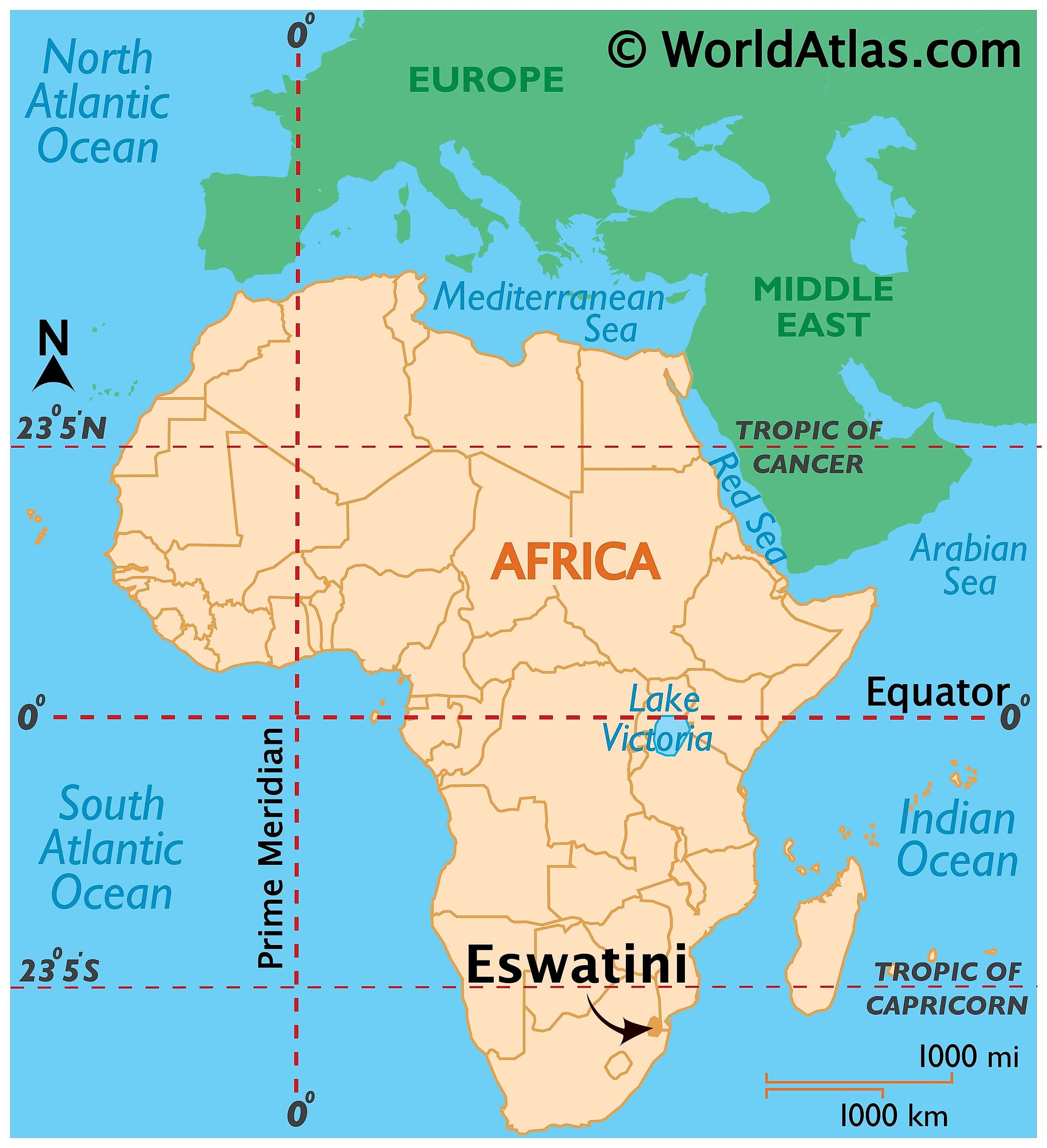
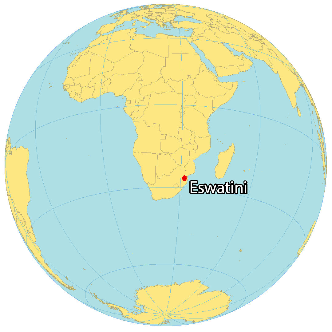
Where is Eswatini?
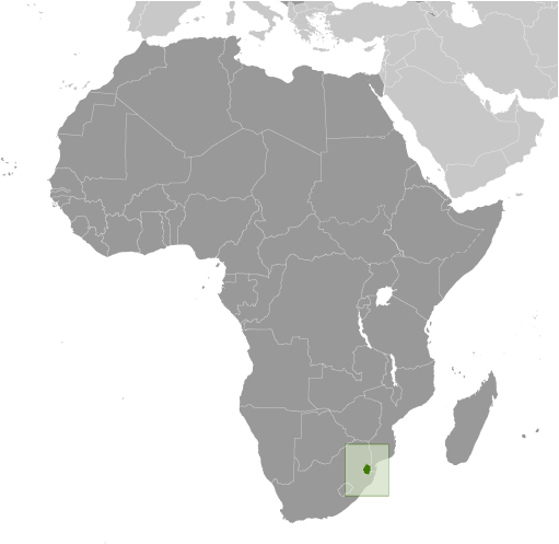
Eswatini is a small, landlocked country found in Southern Africa. It is bordered by two other countries, Mozambique to the east and South Africa to the north, south and southeast. Eswatini is unique as it has two capital cities. Mbabane is the executive capital, while Lobamba, which is just 15 kilometers away, is the royal and legislative capital. The country was formerly known as Swaziland, but in 2018 the official name was changed to Eswatini, which means “place of the Swazi” in the Swazi language.
High Definition Political Map of Eswatini
History
Artefacts have been found indicating human activity dating back to the early Stone Age, around 200,000 years ago. Prehistoric rock art paintings dating from as far back as c. 27,000 years ago to as recently as the 19th century can be found around the country.
The earliest known inhabitants of the region were Khoisan hunter-gatherers. They were largely replaced by the Nguni during the great Bantu migrations. These peoples originated from the Great Lakes region of eastern and central Africa. Evidence of agriculture and iron use dates from about the 4th century. People speaking languages ancestral to the current Sotho and Nguni languages began settling no later than the 11th century.
Swazi settlers (18th and 19th centuries)
The Swazi settlers, then known as the Ngwane (or bakaNgwane) before entering Eswatini, had been settled on the banks of the Pongola River. Before that, they were settled in the area of the Tembe River near present-day Maputo, Mozambique. Continuing conflict with the Ndwandwe people pushed them further north, with Ngwane III establishing his capital at Shiselweni at the foot of the Mhlosheni hills. Under Sobhuza I, the Ngwane people established their capital at Zombodze in the heartland of present-day Eswatini. In this process, they conquered and incorporated the long established clans of the country known to the Swazi as Emakhandzambili (those found ahead).
Eswatini derives its name from a later king named Mswati II. KaNgwane, named for Ngwane III, is an alternative name for Eswatini, the surname of whose royal house remains Nkhosi Dlamini. Nkhosi literally means “king”. Mswati II was the greatest of the fighting kings of Eswatini, and he greatly extended the area of the country to twice its current size. The Emakhandzambili clans were initially incorporated into the kingdom with wide autonomy, often including grants of special ritual and political status. The extent of their autonomy, however, was drastically curtailed by Mswati, who attacked and subdued some of them in the 1850s. With his power, Mswati greatly reduced the influence of the Emakhandzambili while incorporating more people into his kingdom either through conquest or by giving them refuge. These later arrivals became known to the Swazis as Emafikamuva.
The autonomy of the Swazi nation was influenced by British and Dutch rule of southern Africa in the 19th and early 20th centuries. In 1881, the British government signed a convention recognising Swazi independence, despite the Scramble for Africa that was taking place at the time. This independence was also recognised in the London Convention of 1884.
King Mbandzeni created a complex pattern of land ownership by granting many concessions to Europeans. During the concessions some of the King’s senior chiefs like Chief Ntengu Mbokane got permission to relocate to farms towards the Lubombo region, in the modern-day city of Nsoko. Others like Mshiza Maseko relocated to farms towards the Komati River in the place called eLuvalweni. The concessions included grants and leases for agriculture and grazing. In 1890, following the death of Mbandzeni, a Swaziland Convention created a Chief Court to determine disputes about controversial land and mineral rights and other concessions.
Swaziland was given a triumviral administration in 1890, representing the British, the Dutch republics, and the Swazi people. In 1894, a convention placed Swaziland under the South African Republic as a protectorate. This continued under the rule of Ngwane V until the outbreak of the Second Boer War in October 1899.
King Ngwane V died in December 1899, during incwala, after the outbreak of the Second Boer War. His successor, Sobhuza II, was four months old. Swaziland was indirectly involved in the war with various skirmishes between the British and the Boers occurring in the country until 1902.
British indirect rule over Swaziland (1906–1968)
In 1903, after the British victory in the Second Boer War, Swaziland became one of the British “High Commission Territories”, the others being Basutoland (now Lesotho) and Bechuanaland, although a protectorate was not established because terms had not been agreed with the Swazi Queen Regent Labotsibeni Mdluli.
The Swaziland Administration Proclamation of 1904 established a commission with the task of examining all the concessions and defining their boundaries. This work was finished by 1907, and the Swaziland Concessions Partition Proclamation provided for a concessions partition commissioner to be appointed to set aside areas for the sole use and occupation of the Swazis. The commissioner had the power to expropriate up to one third of each concession without compensation, but payment would need to be made if more than a third was taken. In the event, in 1910 he completed his work and set aside 1,639,687 acres, some 38% of Swaziland’s area, for the Swazi. The queen regent then encouraged the Swazi to go to work in the Transvaal to earn money to buy more land from the Europeans.
Much of the early administration of the territory (for example, postal services) was carried out from South Africa until 1906, when the Transvaal Colony was granted self-government. A British high commissioner had some of the functions of a governor, but the Swazis were self-governing on their reserves, and the territory was not deemed to be a British possession. Sobhuza’s official coronation as king was in December 1921 after the regency of Labotsibeni, after which he led an unsuccessful deputation to the Judicial Committee of the Privy Council of the United Kingdom in London in 1922 regarding the issue of the land.
In the period between 1923 and 1963, Sobhuza II established the Swazi Commercial Amadoda which was to grant licences to small businesses on the Swazi reserves and also established the Swazi National School to counter the dominance of the missions in education. His stature grew with time, and the Swazi royal leadership was successful in resisting the weakening power of the British administration and the possibility of the incorporation of Swaziland into the Union of South Africa.
The constitution for independent Swaziland was promulgated by Britain in November 1963 under the terms of which legislative and executive councils were established. This development was opposed by the king’s Swazi National Council (Liqoqo). Despite such opposition, elections took place, and the first Legislative Council of Swaziland was constituted on 9 September 1964. By 1964, the area of the country reserved for occupation by the Swazi had increased to 56%. Changes to the original constitution proposed by the Legislative Council were accepted by Britain and a new constitution providing for a House of Assembly and Senate was drawn up. Elections under this constitution were held in 1967. Following the 1967 elections, Swaziland was a protected state until independence was regained in 1968.
Independence (1968–present)
Following the elections of 1973, the constitution of Swaziland was suspended by King Sobhuza II who thereafter ruled the country by decree until his death in 1982. At that point, Sobhuza II had been king of Swaziland for almost 83 years, making him the longest-reigning monarch in history. A regency followed his death, with Queen Regent Dzeliwe Shongwe as head of state until 1984 when she was removed by the Liqoqo and replaced by Queen Mother Ntfombi Tfwala. Mswati III, the son of Ntfombi, was crowned king in 1986 as king and ngwenyama of Swaziland.
An attempt to transfer neighbouring parts of South Africa, more precisely parts of the Zulu homeland of KwaZulu and parts of the Swazi homeland of KaNgwane, to Swaziland in 1982 was never realized. This would have given land-locked Swaziland access to the sea. The deal was negotiated by the governments of South Africa and Swaziland, but was met by popular opposition in the territory meant to be transferred. The territory had been claimed by Sobhuza II as part of the Swazi monarchs’ traditional realm, and the South African government hoped to use the area as a buffer zone against guerrilla infiltration from Mozambique. (The South African government responded to the failure of the transfer by temporarily suspending the autonomy of KaNgwane.)
The 1990s saw a rise in student and labour protests calling on the king to introduce reforms. Thus, progress towards constitutional reforms began, culminating with the introduction of the current Swazi constitution in 2005. This happened despite objections by political activists. The current constitution does not clearly deal with the status of political parties. The first election under the constitution took place in 2008. Members of Parliament (MPs) were elected from 55 constituencies (also known as tinkhundla). These MPs served five-year terms which ended in 2013. In 2011, Swaziland suffered an economic crisis which was caused by reduced Southern African Customs Union (SACU) receipts. This caused the government to request a loan from neighbouring South Africa. However, they did not agree with the conditions of the loan, which included political reforms.
During this period, there was increased pressure on the Swazi government to carry out more reforms. Public protests by civic organisations and trade unions became more common. Starting in 2012, improvements in SACU receipts eased the fiscal pressure on the Swazi government. A new parliament, the second since the promulgation of the constitution, was elected in 2013. The king then reappointed Sibusiso Dlamini as prime minister for the third time.
On 19 April 2018, Mswati III announced that the Kingdom of Swaziland had been renamed as the Kingdom of Eswatini, reflecting the extant Swazi name for the state eSwatini, to mark the 50th anniversary of Swazi independence. The name Eswatini means “land of the Swazis” in the Swazi language and was partially intended to prevent confusion with the similarly named Switzerland.
Eswatini workers began anti-government protests against low salaries in September 2018. They went on a three-day strike organised by the Trade Union Congress of Eswatini that resulted in widespread disruption. In June 2021, pro-democracy protests broke out across the country, sparking riots, looting, and street skirmishes with police and soldiers. This civil unrest began as a result of years of anger towards the lack of meaningful reforms that would nudge Eswatini in the direction of democracy, as well as the government’s reported banning of the submission of petitions. Numerous buildings said to be connected to King Mswati III were torched by protesters, and police reportedly assaulted and arrested political opponents. The New York Times called the turmoil in the landlocked nation “the most explosive civil unrest in its 53 years of independence”. At least 20 people were killed by state security forces and dozens more injured and detained. The government shut down the internet (with the compliance of mobile providers MTN and Eswatini Mobile) making it difficult to access reliable news from the country. The king was also said to have fled the country, though government officials disputed those claims, also calling for an end to the protests.
Physical Map of Eswatini
Geography
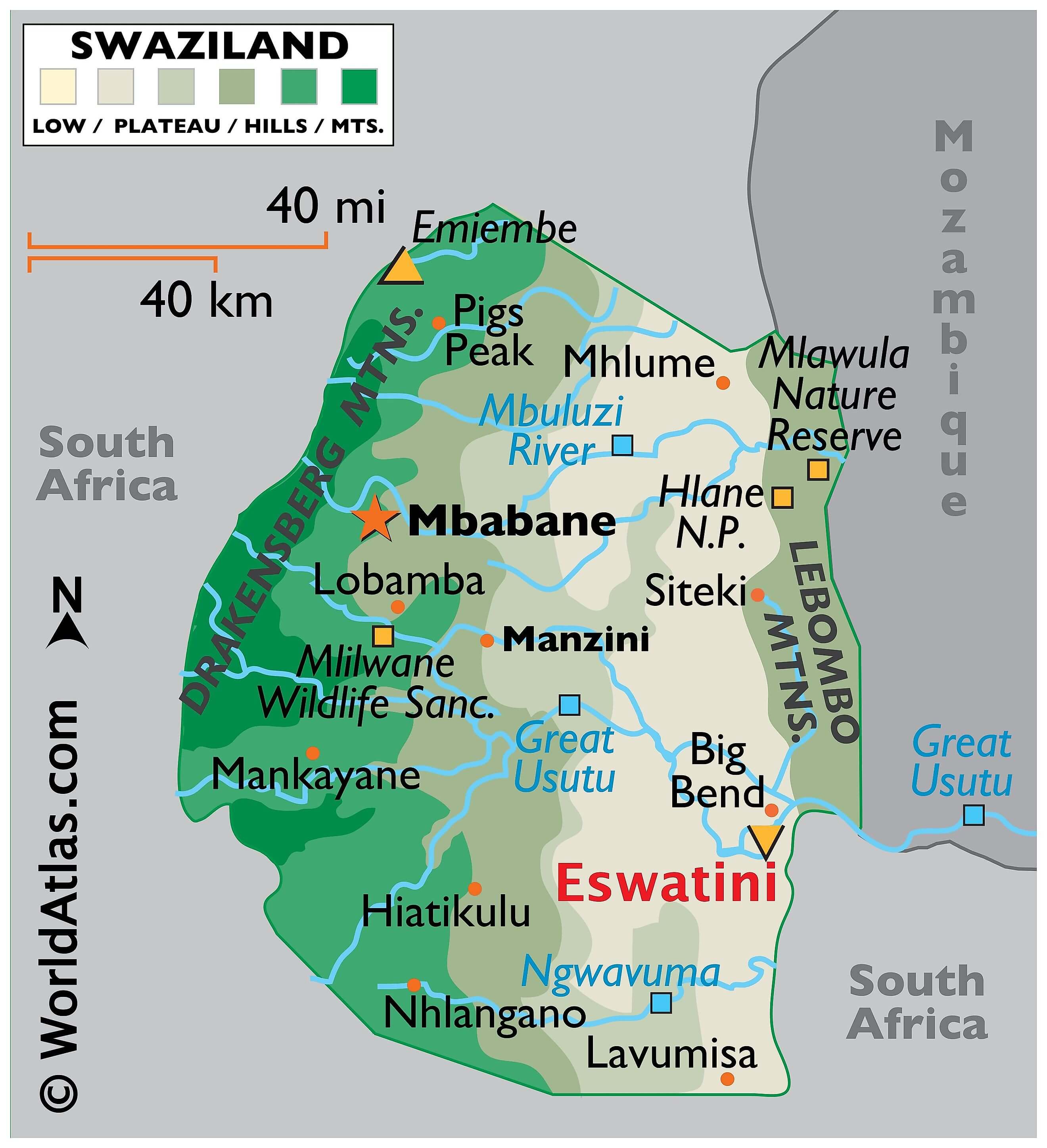
A small landlocked kingdom with an area of 17,364 km (6,704 sq mi), Eswatini is located at approximately 26°30’S, 31°30’E and is bordered in the north, west and south by South Africa and by Mozambique in the east. Along the eastern border with Mozambique is the Lebombo Mountains, a mountain ridge at an altitude of around 600 metres (2,000 ft). The mountains are broken by the canyons of three rivers, the Ngwavuma, the Great Usutu and the Mbuluzi. The western border, with an average altitude of 1,200 metres (3,900 ft), lies on the edge of an escarpment.
Eswatini is separated into four geographical regions. These run from north to south and are determined by altitude. Mbabane, the capital, is on the Highveld. The Middleveld, lying at an average 700 metres (2,300 ft) above sea level is the most densely populated region of Eswatini with a lower rainfall than the mountains. Manzini, the principal commercial and industrial city, is situated in the Middleveld. The Lowveld, at around 250 metres (820 ft), is less populated than other areas and presents a typical African bush country of thorn trees and grasslands. Eswatini contains three ecosystems: Maputaland coastal forest mosaic, Zambezian and mopane woodlands, and Drakensberg montane grasslands. The country had a 2018 Forest Landscape Integrity Index mean score of 4.21/10, ranking it 142nd globally out of 172 countries.
Eswatini is divided into four climatic regions: the Highveld, Middleveld, Lowveld, and Lubombo plateau. Generally speaking, rain falls mostly during the summer months (December to March), often in the form of thunderstorms. Winter is the dry season. Annual rainfall is highest on the Highveld in the west, between 1,000 and 2,000 mm (39.4 and 78.7 in). The further east, the less rain, with the Lowveld recording 500 to 900 mm (19.7 to 35.4 in) per annum. Variations in temperature are also related to the altitude of the different regions. The Highveld temperature is temperate and seldom uncomfortably hot, while the Lowveld may record temperatures around 40 °C (104 °F) in summer.
The average temperatures at Mbabane, according to the season:
The government of Eswatini has expressed concern that climate change is exacerbating existing social challenges such as poverty, a high HIV prevalence, and food insecurity and will drastically restrict the country’s ability to develop, as per Vision 2022. Economically, climate change has already adversely impacted Eswatini. For instance, the 2015–16 drought decreased sugar and soft drink concentrate production export (Eswatini’s largest economic export). Many of Eswatini’s major exports are raw, agricultural products and are therefore vulnerable to a changing climate.
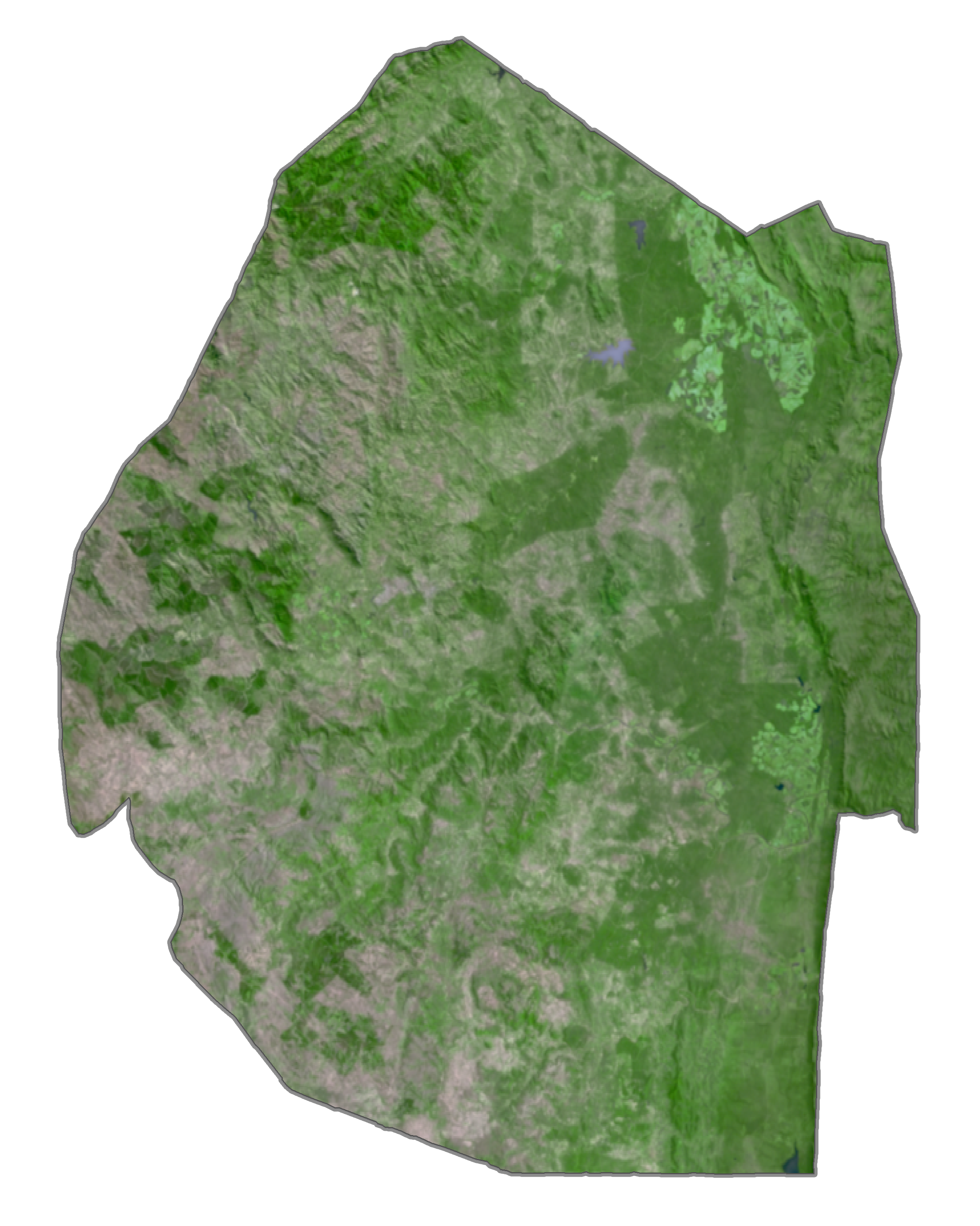
Eswatini Satellite Map
Elevation Map