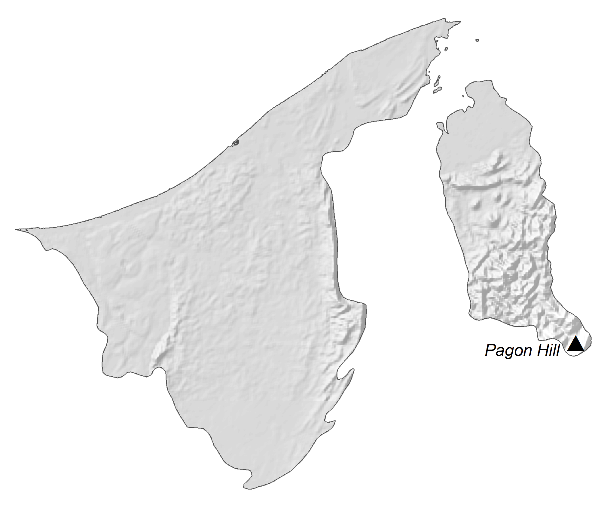
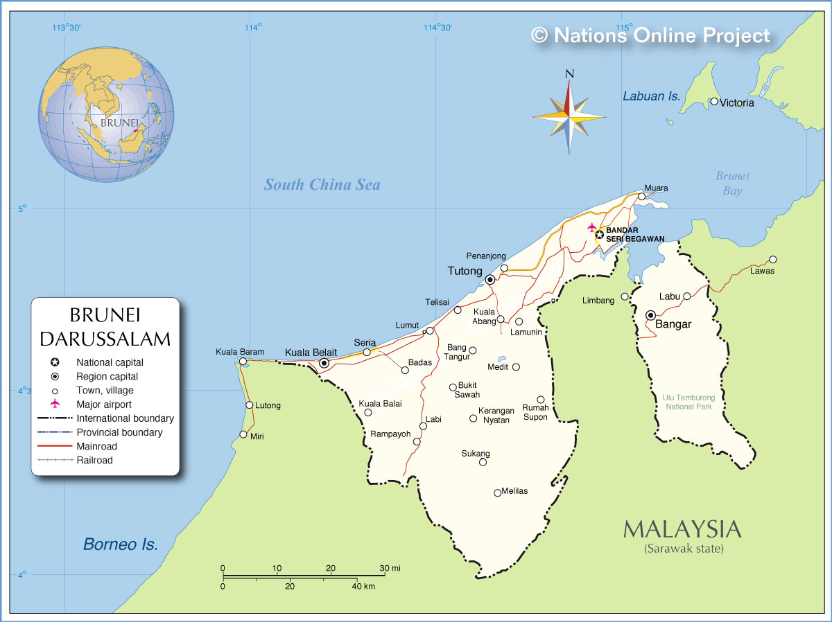
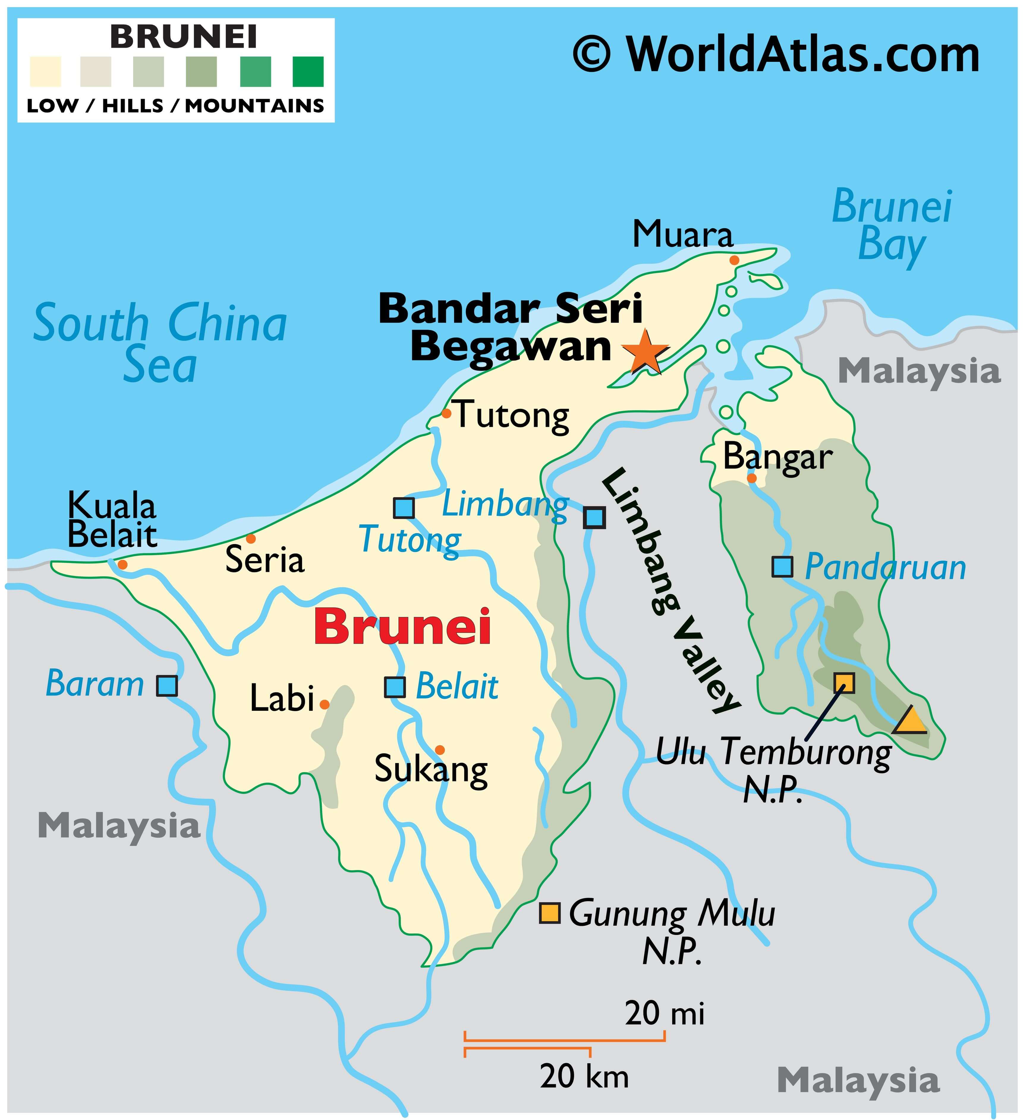
Brunei is a small country that covers an area of 5,765 sq. km (2,226 sq mi) on the island of Borneo. It has a 161 km (100 mi) coastline along the South China Sea. It can be seen on the map above that Brunei is divided into two non-contiguous territories that are separated by the Malaysian State of Sarawak.
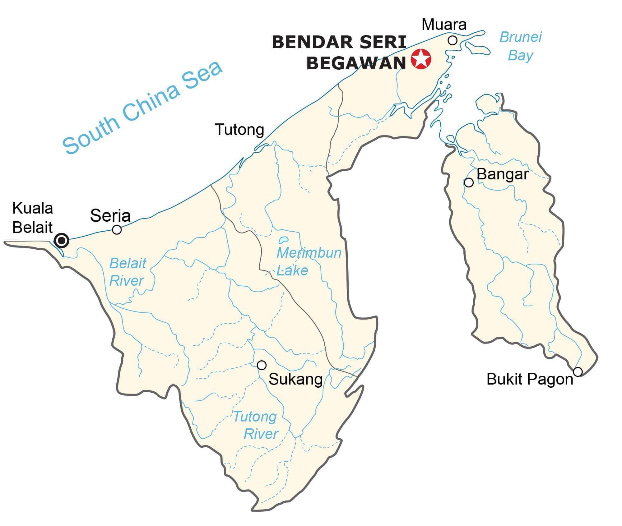
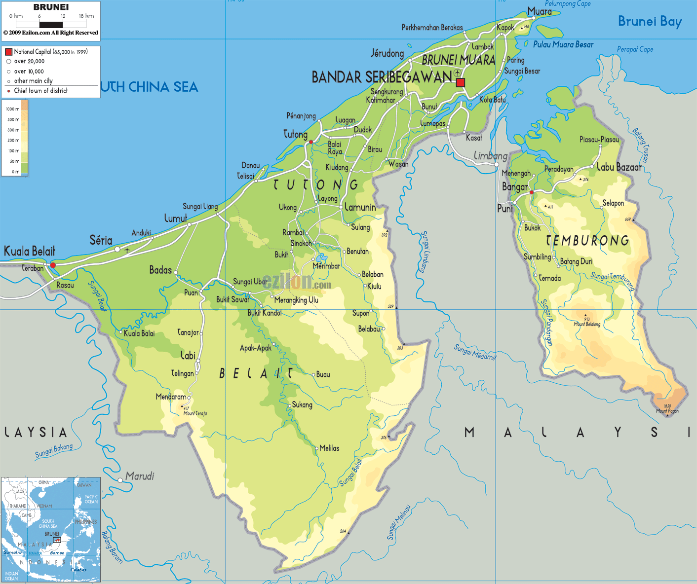
As observed on the physical map of Brunei above, the country is mostly low-lying. The flat coastal plain of the country gradually slopes upwards to mountains in the east and undulating lowlands in the west.
The highest point of the country is Bukit Pagon at 6,069 ft. (1,850 m) along the border with Malaysia in the eastern mountainous region. It has been marked on the map by a yellow upright triangle.
Numerous rivers drain the land, including the Belait, Pandaruan, and Tutong. Subsequently, the coastal areas along the South China Sea are a wide swampy plain.
The lowest point in Brunei is the South China Sea at 0 m.
| Flag: |  |
|---|---|
| Legal Name: | Brunei Darussalam |
| Capital Value: | Bandar Seri Begawan |
| Demonym(s): | Bruneian |
| Government: | Unitary Islamic absolute monarchy |
| Legislature: | none |
| Total Area: | 5,765 km² |
| Land Area: | 5,265 km² |
| Water Area: | 500 km² |
| Population: | 433,285 |
| Density: | 72.11/km (186.8/sq mi) (134th) |
| GDP: | $13.47 Billion |
| GDP Per Capita: | $31,086.75 |
| Currency Value: | Bruneian dollars (BND) |
| Driving side: | left |
| Calling code: | +673 |
| Internet TLD: | .bn |
Explore the beauty of Brunei with this interactive map. See the cities, towns, rivers, and highways of the small country located in Borneo. Get a better understanding of the country’s geography with the elevation map and satellite imagery of Brunei in Southeastern Asia.
Online Interactive Political Map
Click on ![]() to view map in "full screen" mode.
to view map in "full screen" mode.
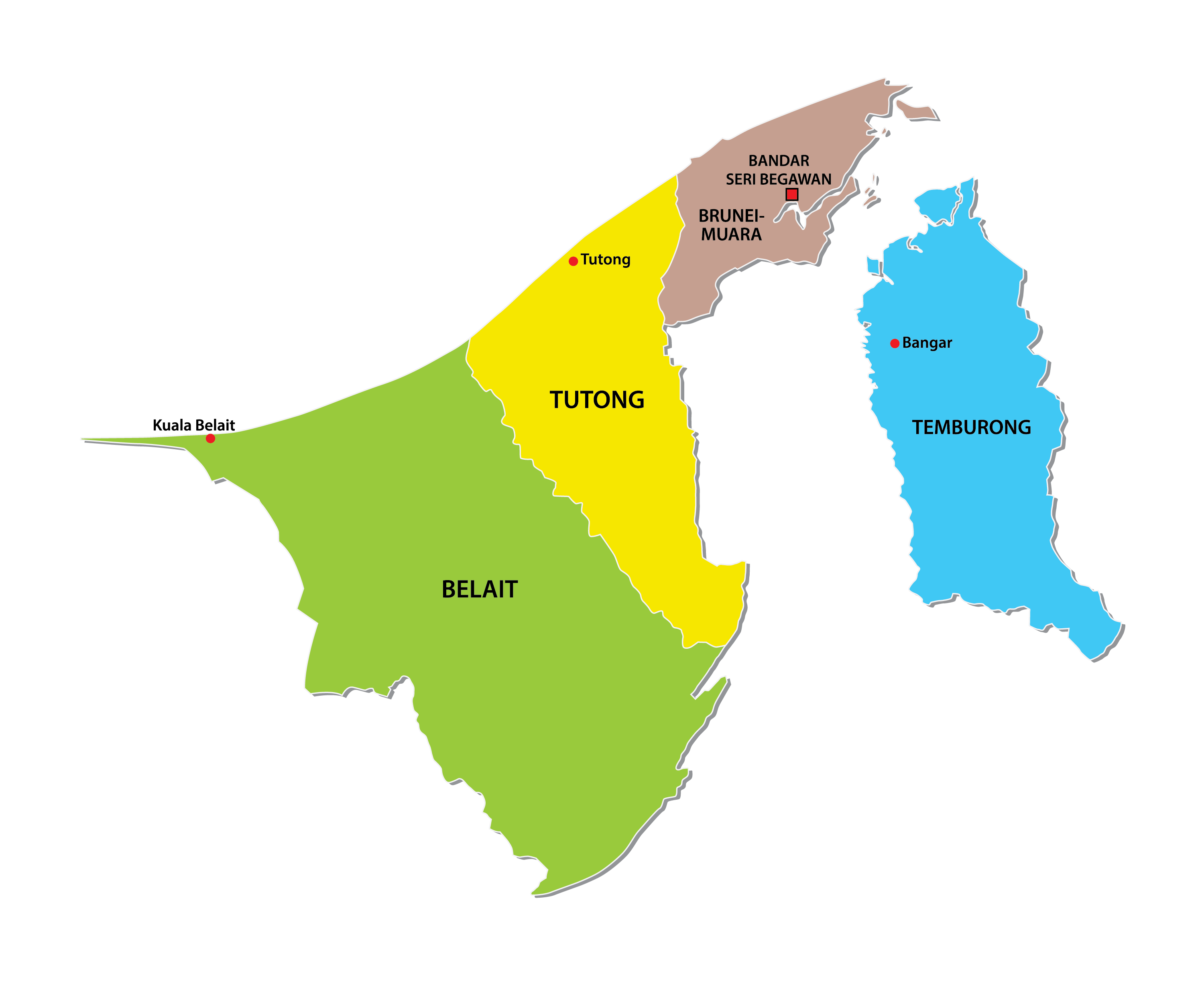
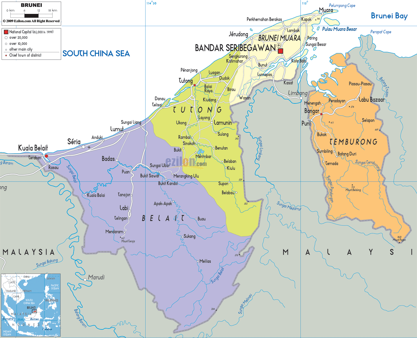
Brunei Darussalam (officially, Nation of Brunei) is divided into 4 districts. In alphabetical order, these districts are: Belait, Brunei dan Muara, Temburong and Tutong. These districts are further divided into 38 sub-districts and several smaller subdivisions of villages (kampong) and municipalities (bandaran).
Located in the north eastern part of the country, on the Northern banks of Brunei River, is Bander Seri Begawan – the capital and largest city of Brunei. About two-thirds of the country’s population is found in the capital city
Location Maps
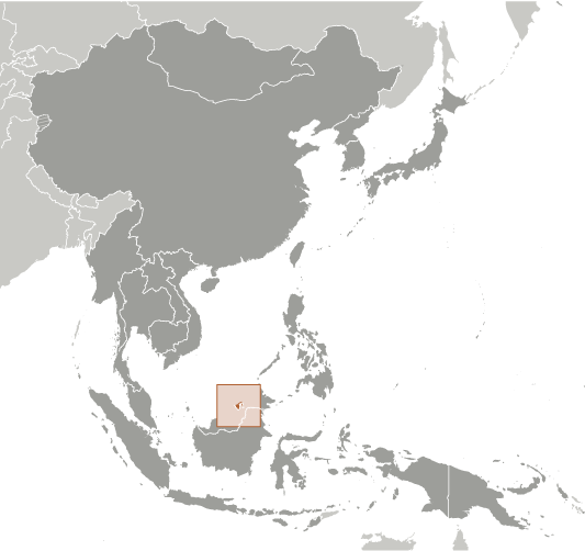
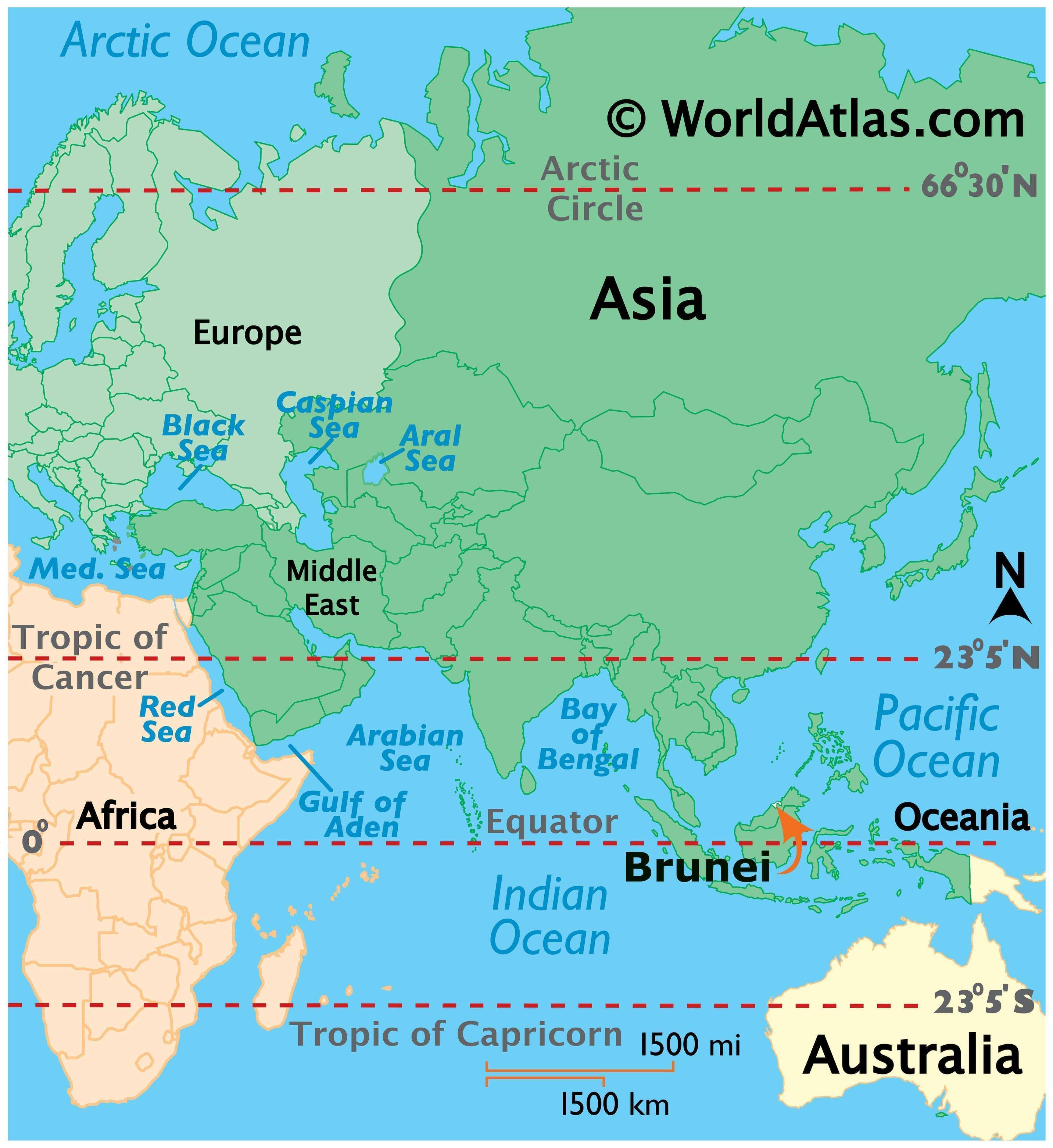
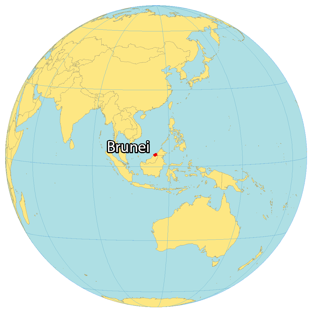
Where is Brunei?
Brunei (Brunei Darussalam) is a small country on the island of Borneo, completely surrounded by Malaysia. It also shares a coastline with the South China Sea to the north for about 161 kilometers (100 mi). Brunei is split into two non-contiguous sections.
First, the western section is more populous and made up of three districts including Belait, Tutong, and Brunei-Muara. Despite having the smallest area, the Brunei-Muara District is the most populous with approximately 70% of people living there. It also contains Brunei’s capital city of Bandar Seri Begawan, situated in the northeast region. Finally, the eastern section of Brunei is the Temburong District.
High Definition Political Map of Brunei
Physical Map of Brunei
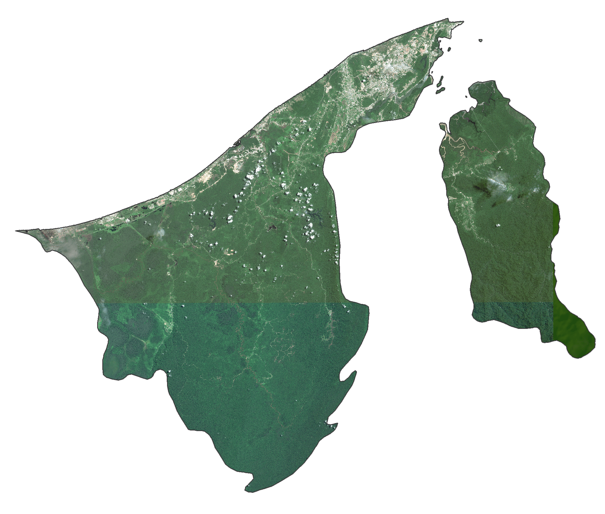
Brunei Satellite Map
Elevation Map