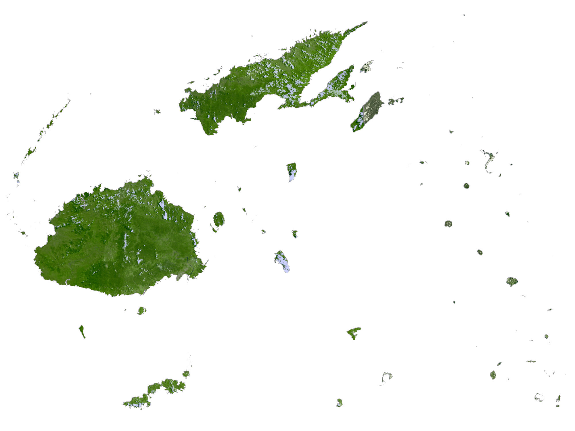
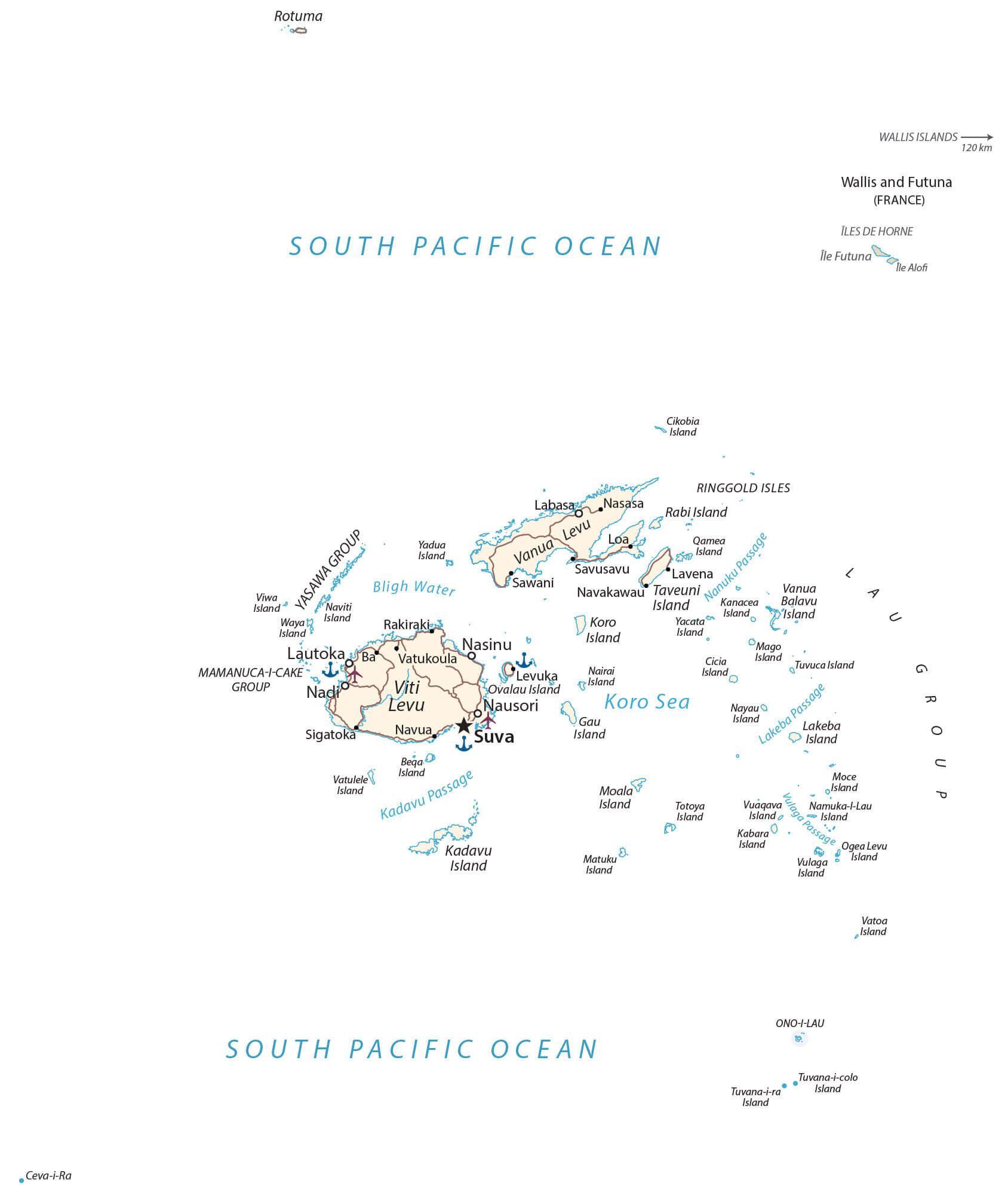
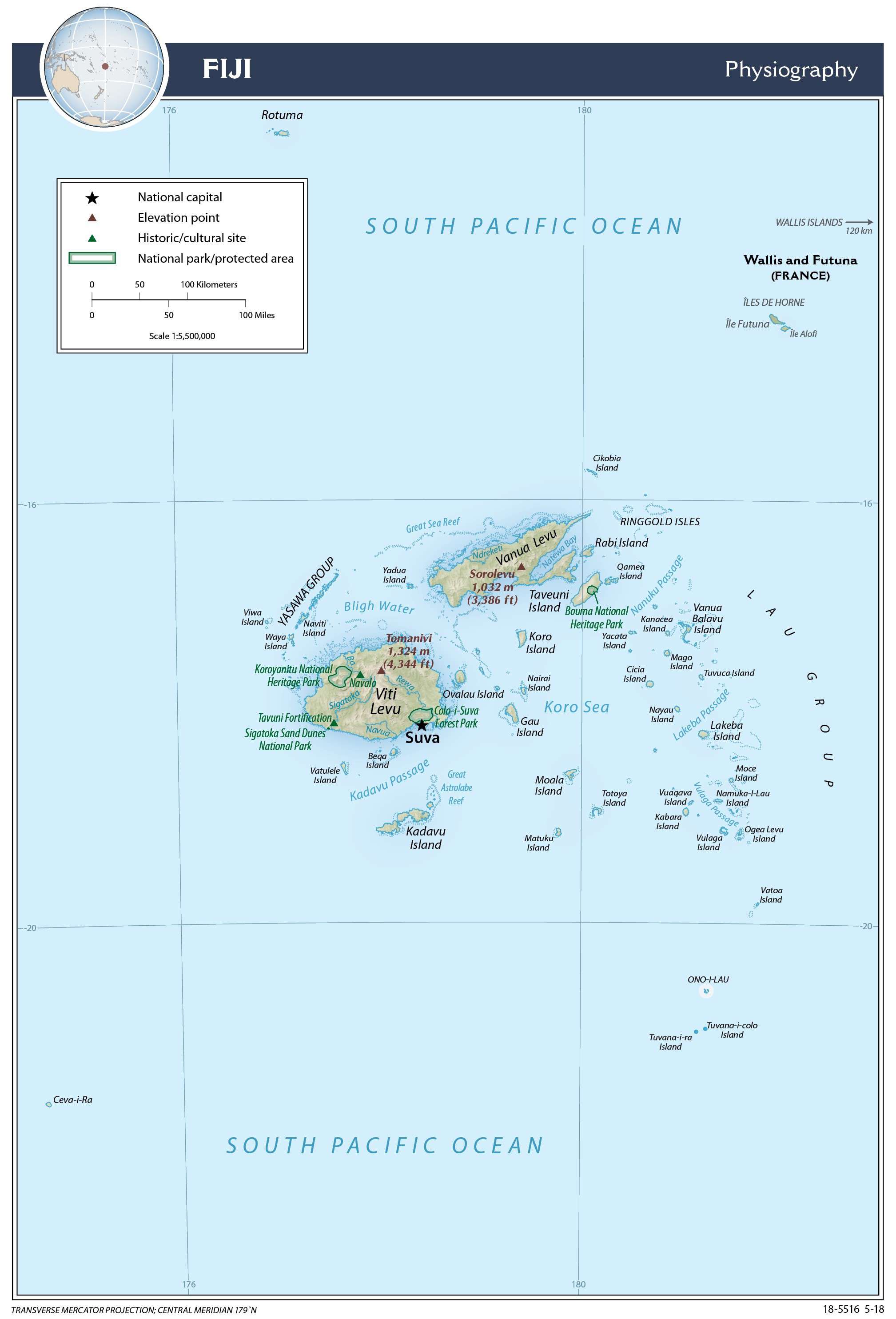
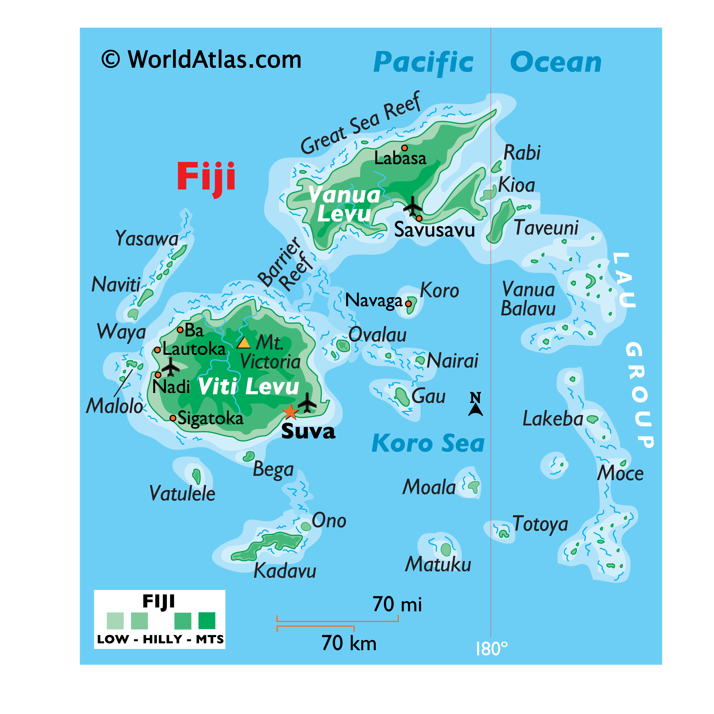
Covering an area of 18,300 sq.km (7,056 sq mi), the island nation of Fiji is located in the South Pacific Ocean, some 1,300 miles (2,000 km) northeast of New Zealand’s North Island; comprising of more than 332 islands of which 110 are inhabited, along with an additional 500 islets.
The two largest islands as shown on the physical map of Fiji are Viti Levu and Vanua Levu, which make up 87% of Fiji’s total landmass. These mountainous islands were formed around 150 million years ago through volcanic activity, and are subsequently covered in thick tropical forests.
Most of Fiji’s mountains are dormant or extinct volcanoes. Mount Tomanivi, located on the main island of Viti Levu, is the highest point of Fiji, at an elevation of 4,341ft (1,324m) and the lowest point is the Pacific Ocean (0m). Due to the mountainous terrain of these islands, there are several streams and waterfalls.
Perhaps what Fiji is most famous for, however, are its crystal clear waters, coral reefs, shallow lagoons and white sand beaches that draw in thousands of tourists annually.
| Flag: |  |
|---|---|
| Legal Name: | Republic of Fiji |
| Capital Value: | Suva (on Viti Levu) |
| Official languages: |
|
| Demonym(s): | Fijian |
| Government: | Unitary parliamentary republic |
| Legislature: | Parliament |
| Total Area: | 18,274 km² |
| Land Area: | 18,274 km² |
| Population: | 889,953 |
| Density: | 46.4/km (120.2/sq mi) (148th) |
| GDP: | $5.54 Billion |
| GDP Per Capita: | $6,220.05 |
| Currency Value: | Fijian dollars (FJD) |
| Driving side: | left |
| Calling code: | +679 |
| Internet TLD: | .fj |
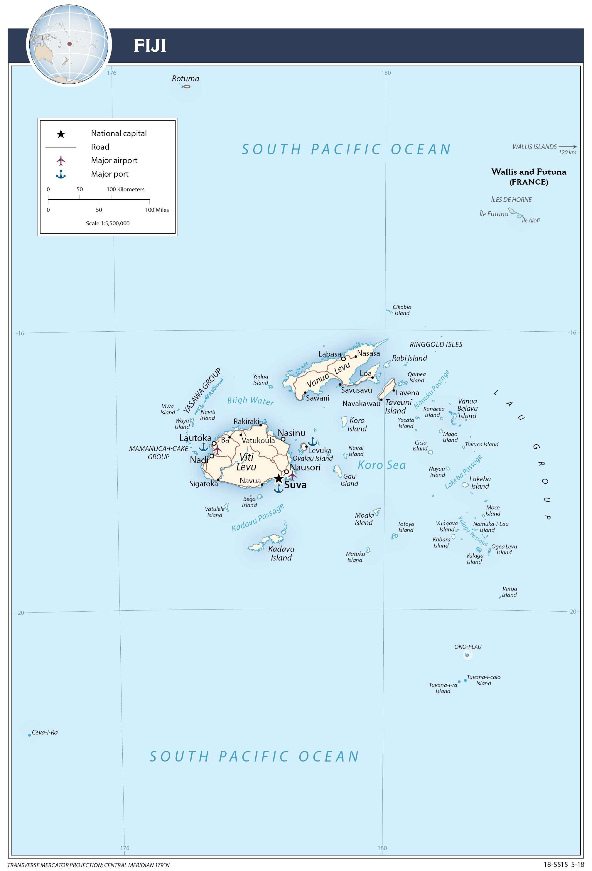
Discover the beauty of Fiji with this detailed map, highlighting its islands, major cities, towns, roads, rivers, lakes, and provinces. Get a bird’s eye view of the country with satellite imagery and explore the topography of Fiji with its physical map.
Online Interactive Political Map
Click on ![]() to view map in "full screen" mode.
to view map in "full screen" mode.
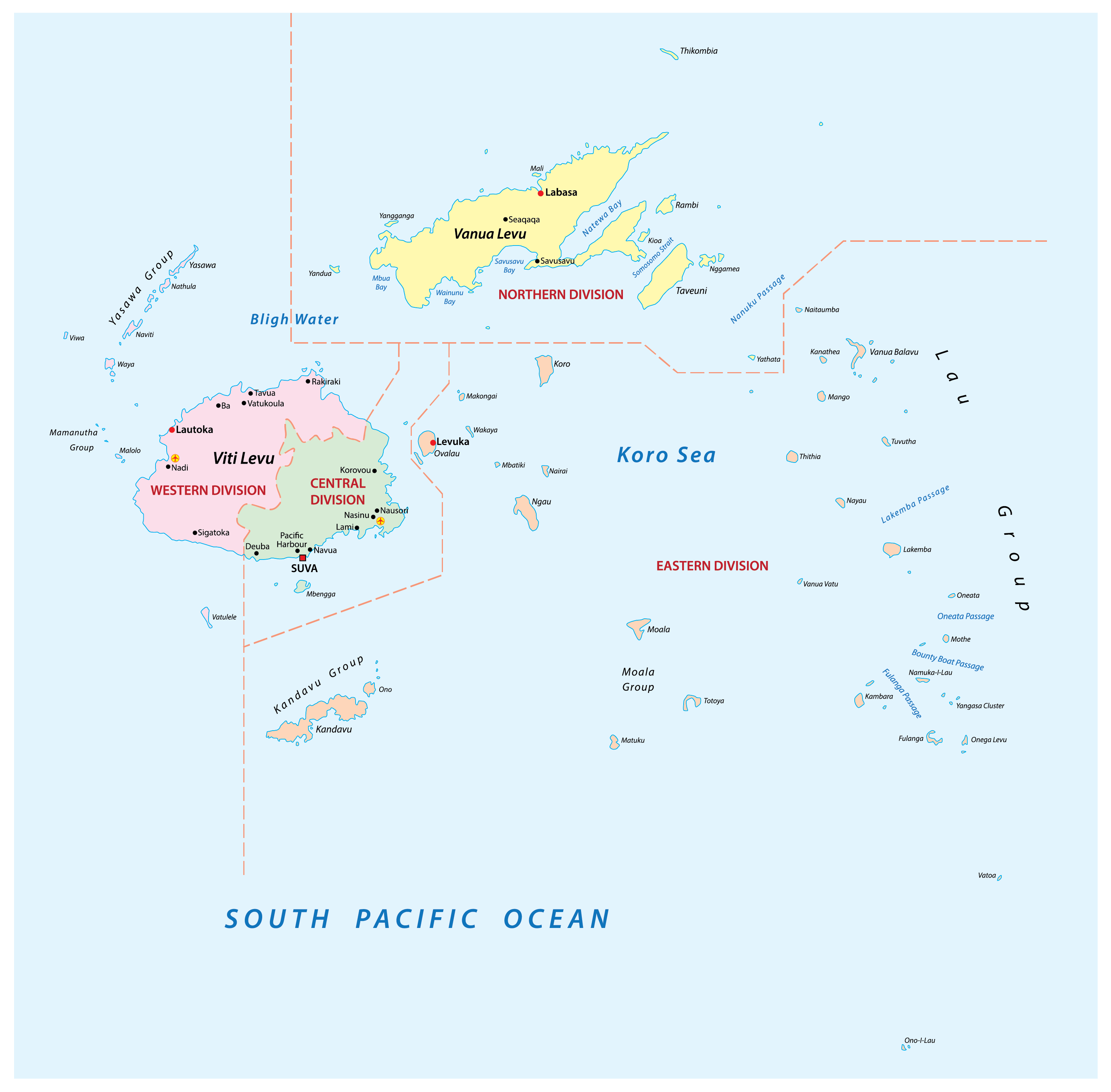
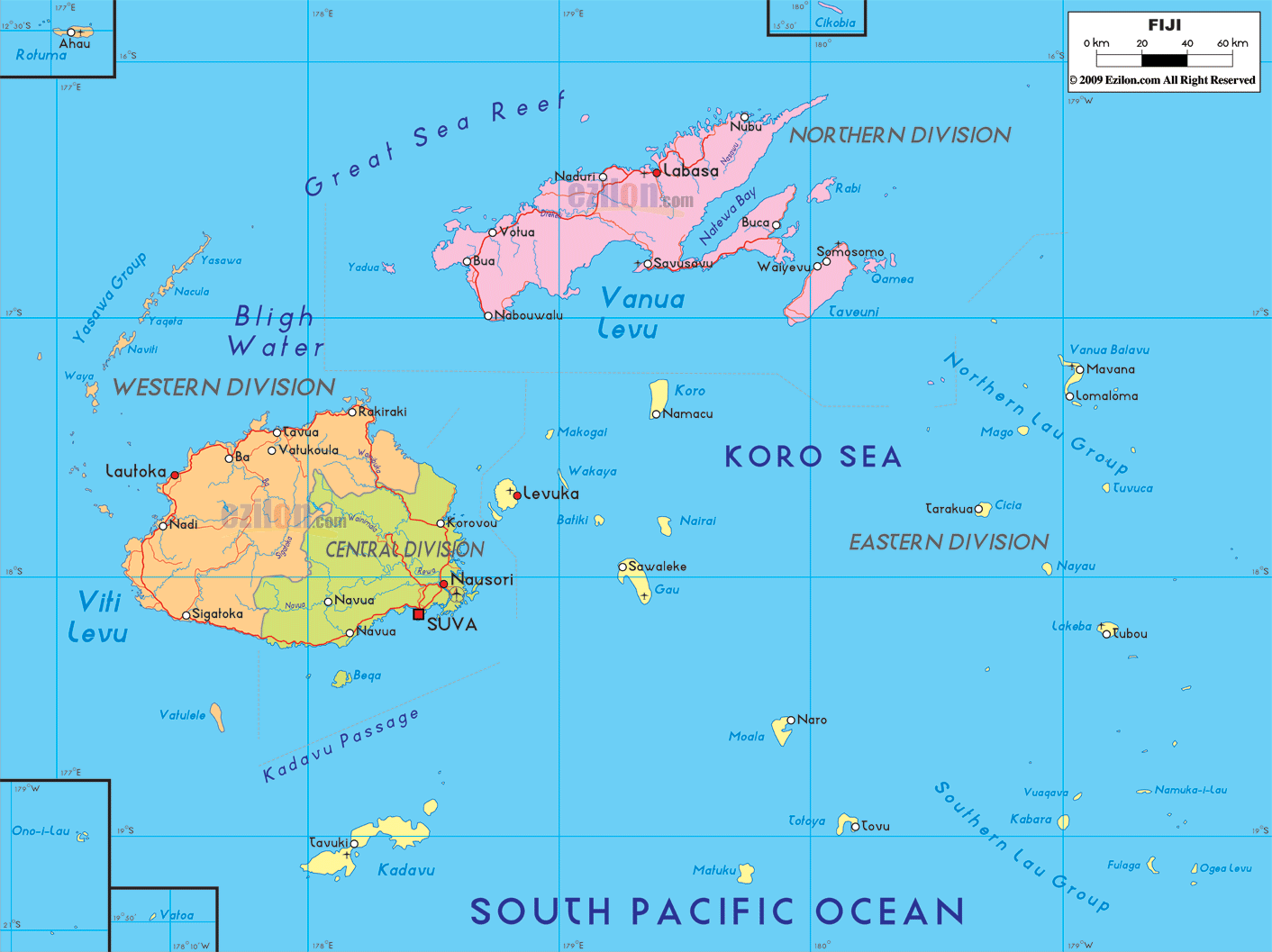
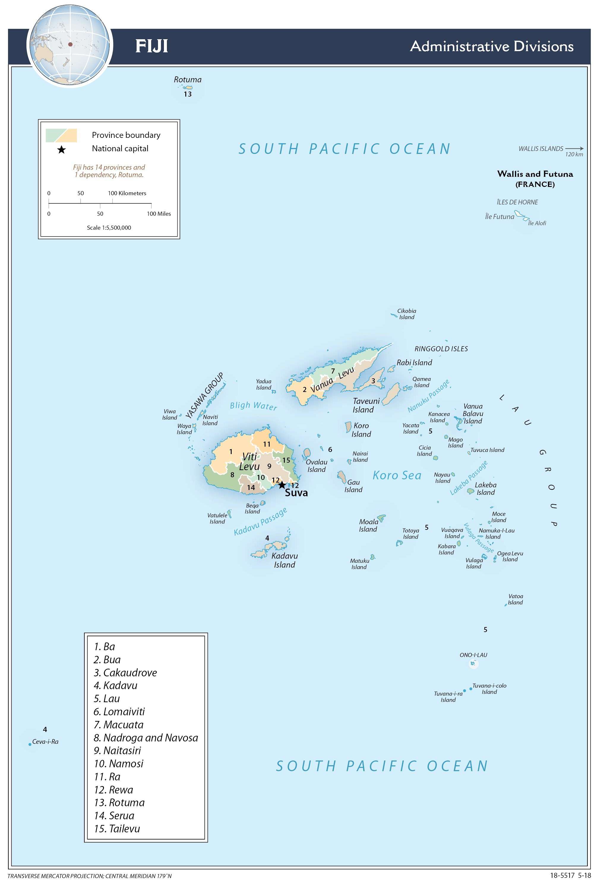
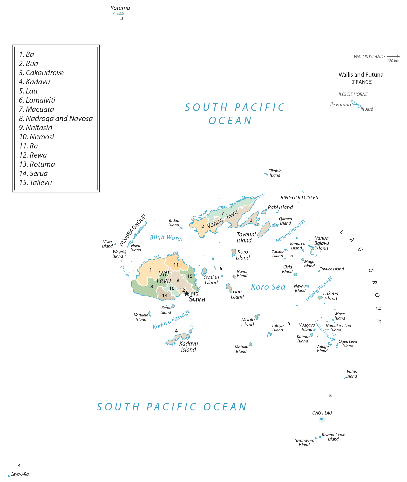
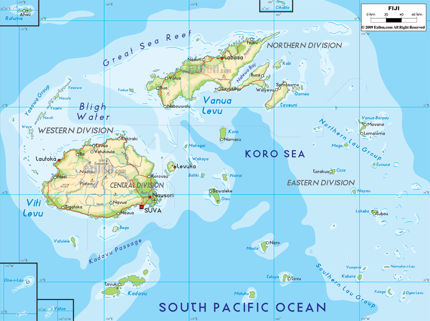
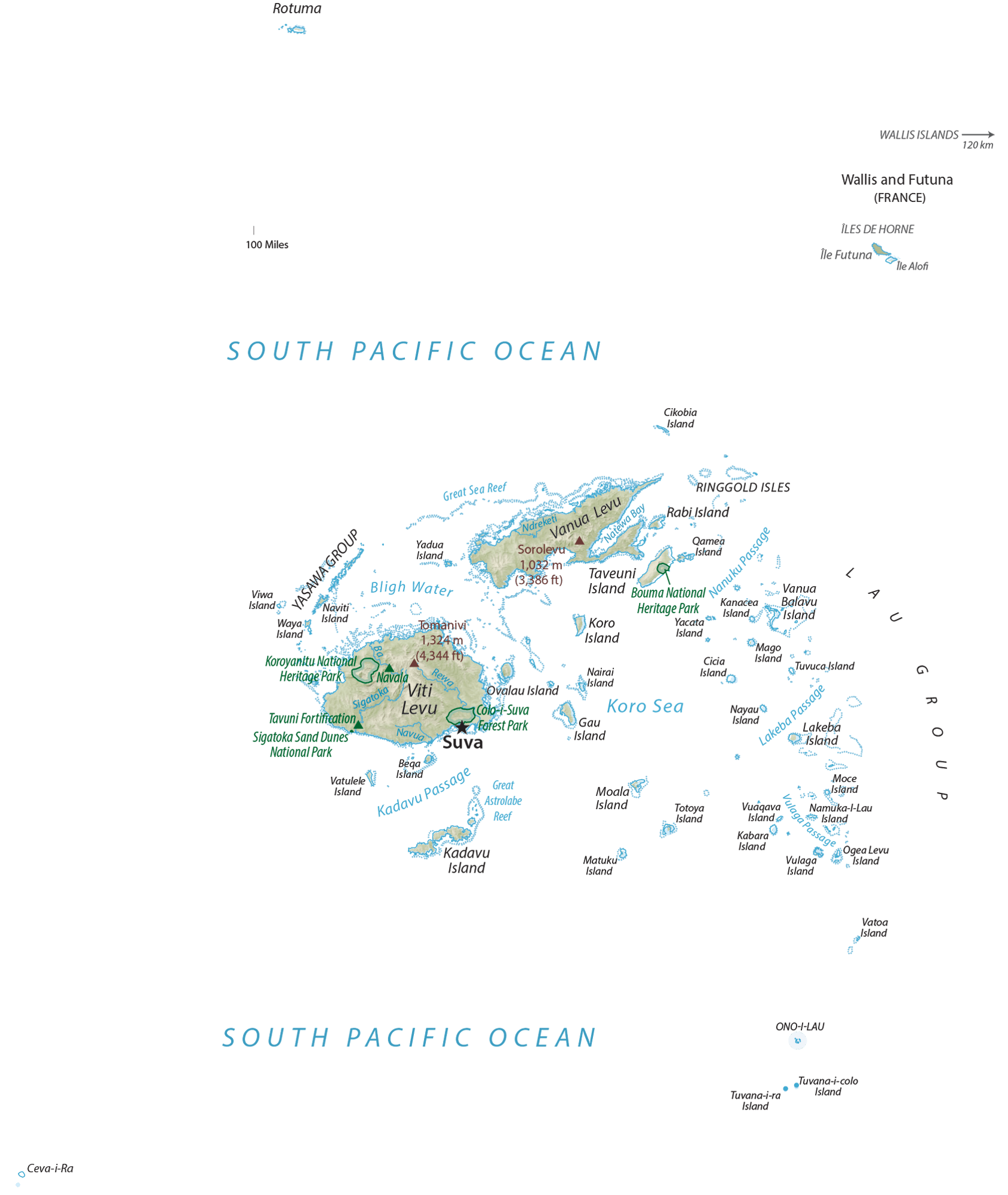
Fiji (officially, the Republic of Fiji) is administratively divided into 4 divisions which are further subdivided into 14 provinces and 1 self-governing dependency. The 4 divisions are: Central Division, Northern Division, Eastern Division and Western Division. In alphabetical order, the provinces are: Ba, Bua, Cakaudrove, Kadavu, Lau, Lomaiviti, Macuata, Nadroga and Navosa, Naitasiri, Namosi, Ra, Rewa, Serua and Tailevu. Rotuma is a self-governing dependency. The provinces are further divided into 17 districts and 5 sub-districts.
Covering an area of 18,300 sq.km, the island nation of Fiji is an archipelago of more than 330 islands and 500 islets; with Viti Levu and Vanua Levu being the two largest and the most populated islands. Located on the southeastern coast of Viti Levu (Fiji’s principal island) is Suva – the capital and the largest city of Fiji, as well as one of the largest urban centers in the South Pacific islands. Suva is also the chief port and the administrative, cultural, economic and commercial center of the country. Lautoka is the 2nd largest city in Fiji.
Location Maps
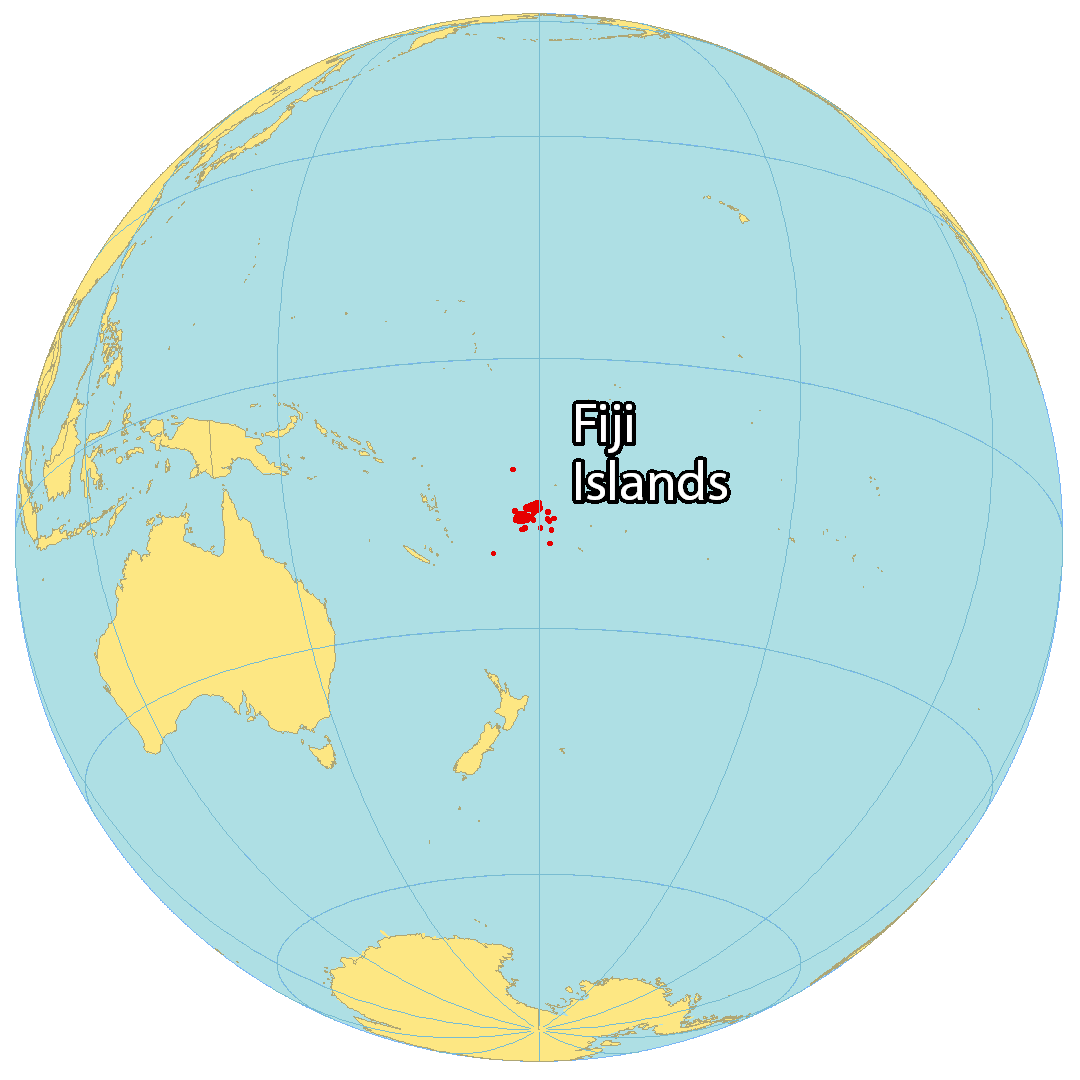
Where is Fiji?
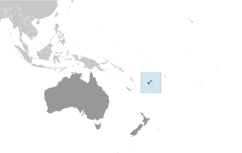
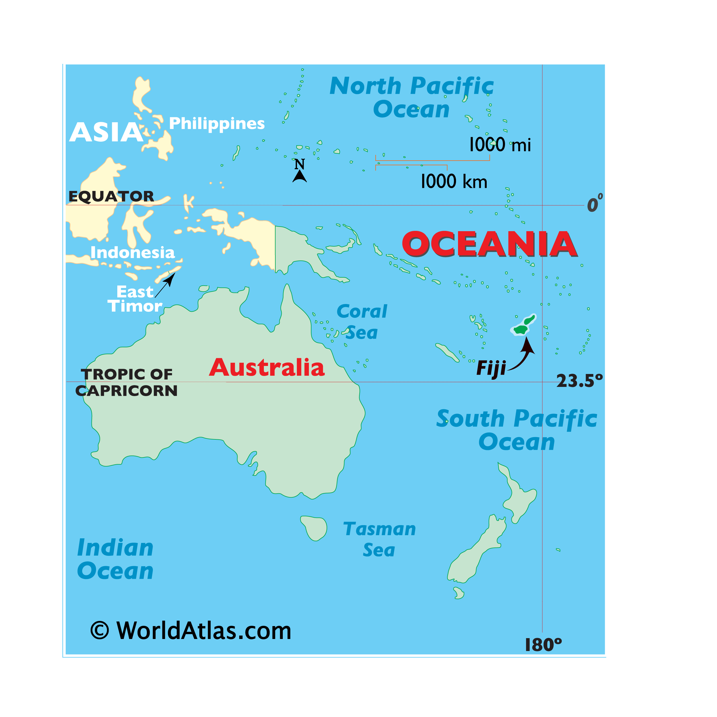
Fiji is a group of 332 islands located in Oceania in the South Pacific Ocean. Just over 100 of these islands are inhabited, but most of them are uninhabited. The majority of the population resides on the two major islands of Viti Levu and Vanua Levu. This archipelago is situated southeast of Papua New Guinea, north of New Zealand, and east of Australia. The islands of Hawaii are located 5,100 km (3,200 mi) away from the Fiji Islands. Suva is the capital and largest city of Fiji, and the international date line runs through the country at the 180° meridian, yet it is bent to maintain a consistent time throughout the country.
The geography of the Fiji Islands is quite diverse, boasting white sand beaches, coral reefs, rainforests, mountains, and rivers. Viti Levu is the largest and most populous island in the nation, with the capital city of Suva located there. Viti Levu is also home to many of Fiji’s most popular tourist destinations, such as the Mamanuca Islands and the Yasawa Islands.
High Definition Political Map of Fiji
Fiji Administrative Map
Physical Map of Fiji
Transportation Map of Fiji
Fiji Satellite Map