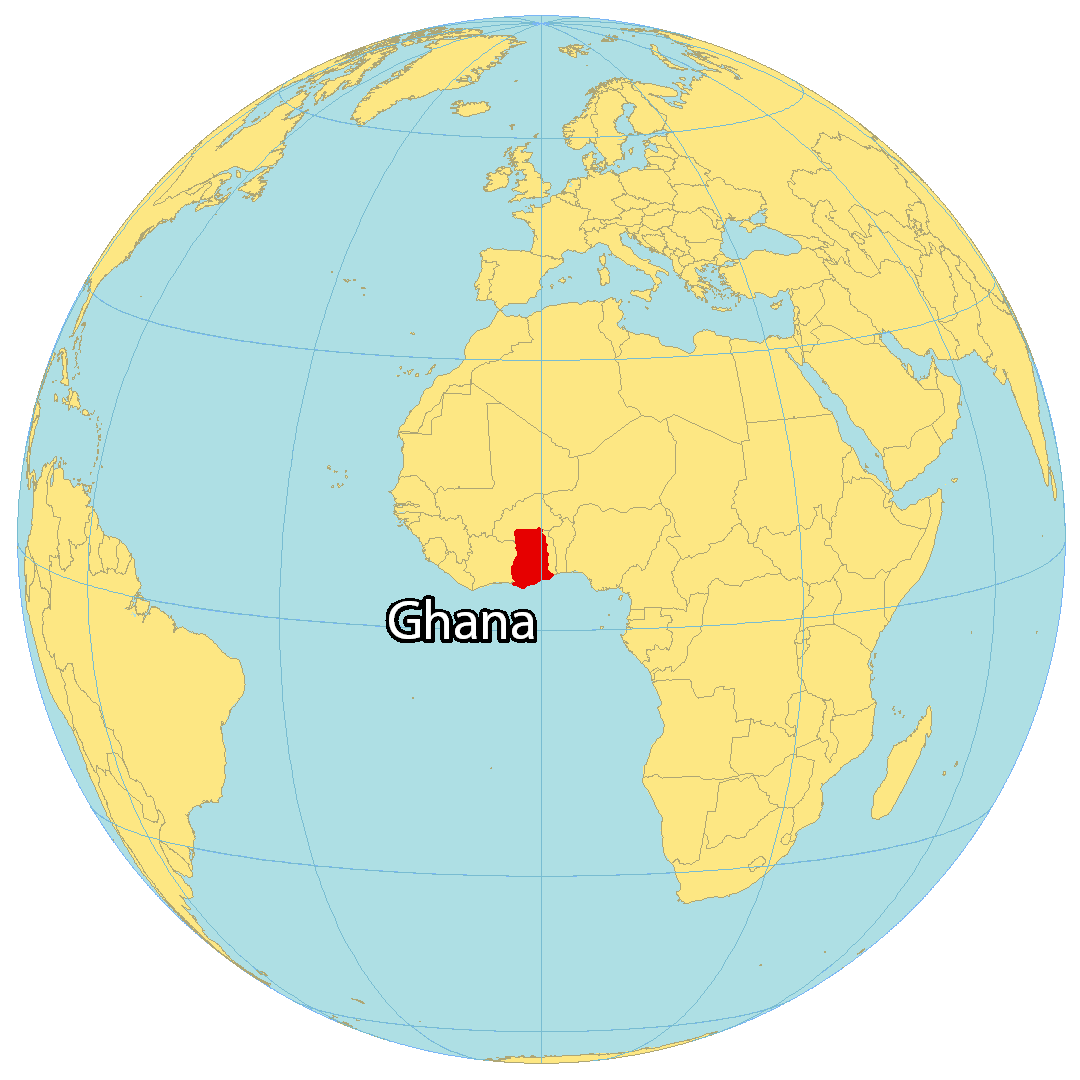
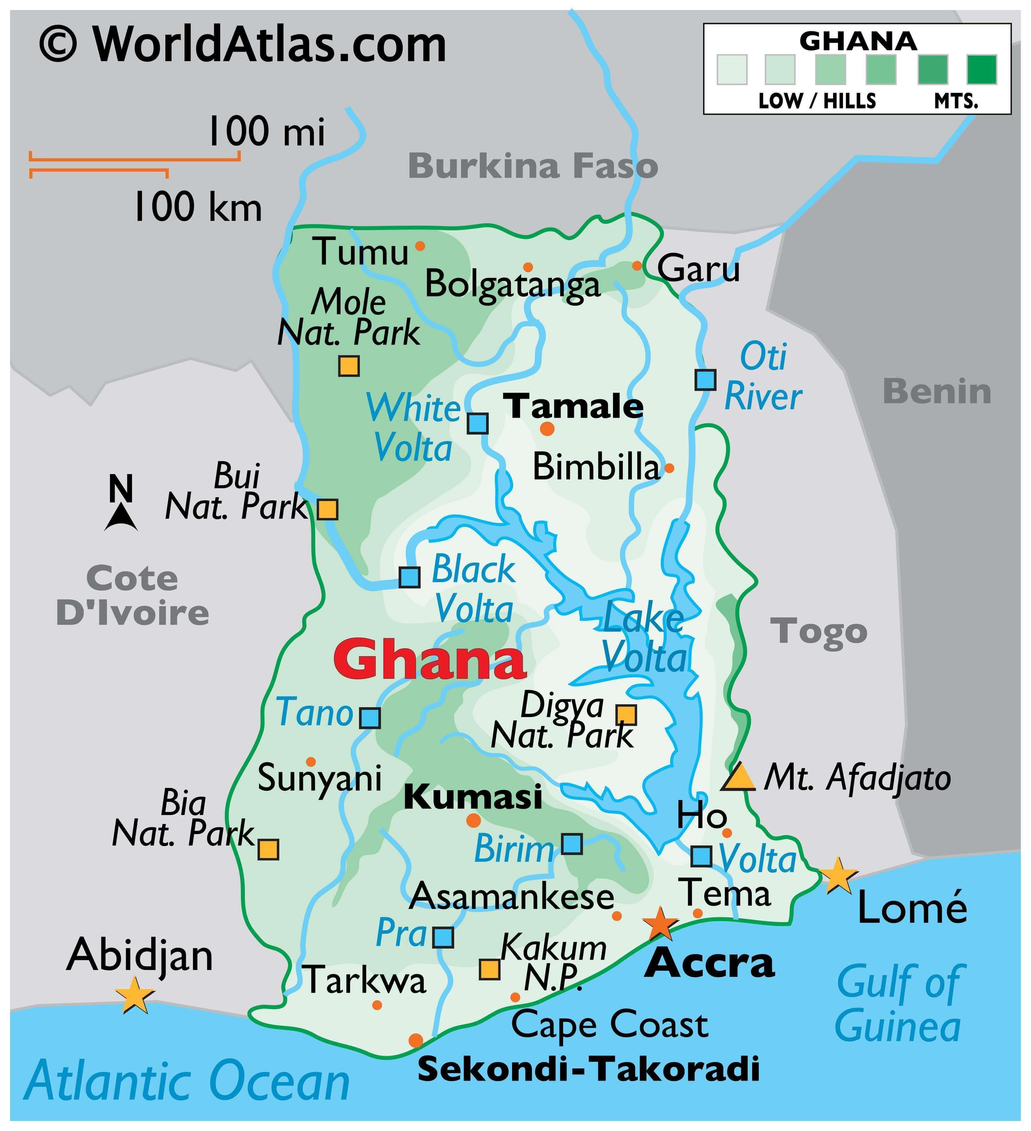
Ghana is a West African country with a coastline on the Gulf of Guinea and occupies a total area of 239,567 sq. km.
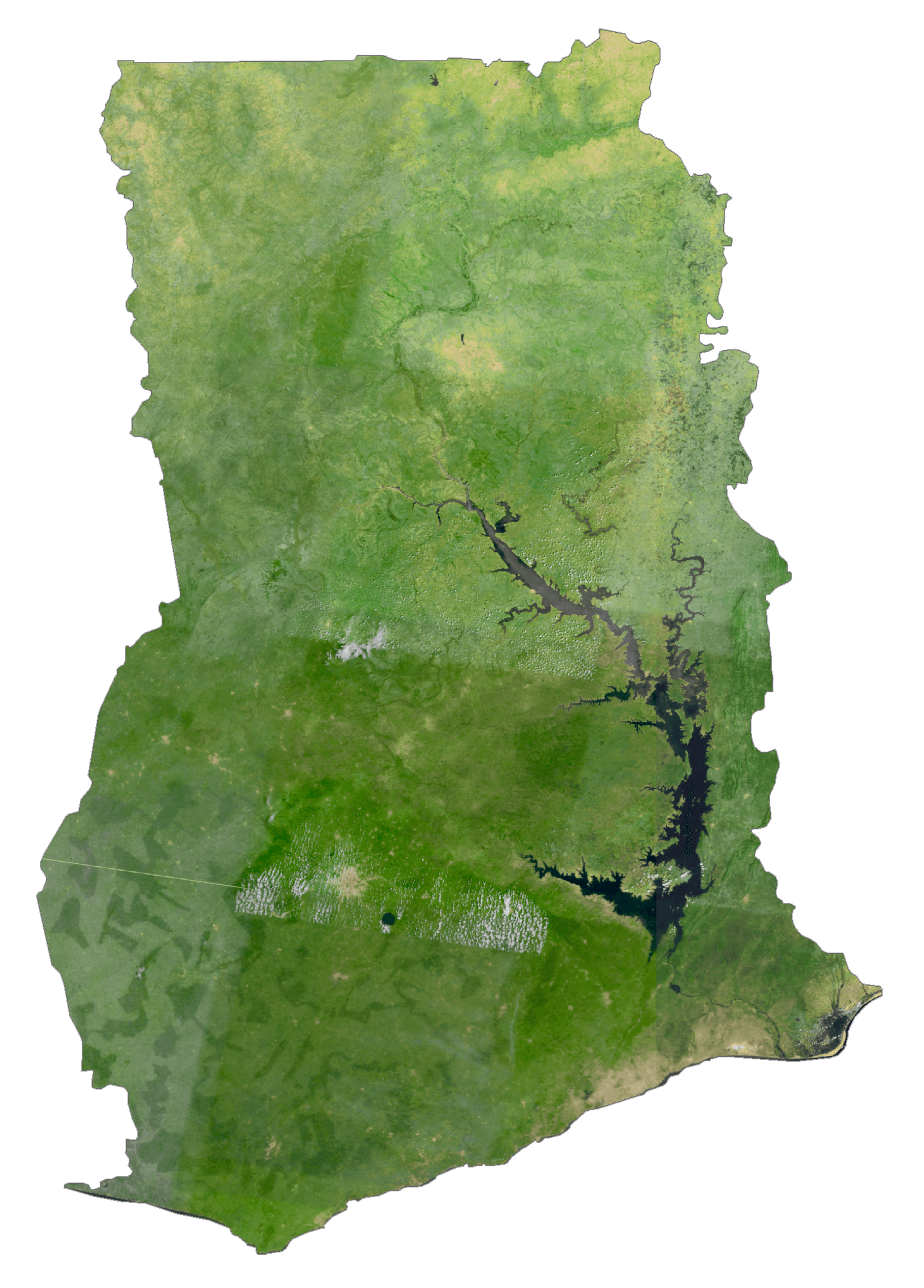
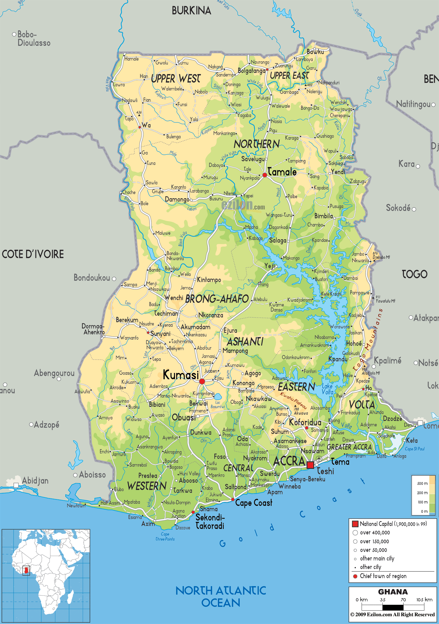
As observed on the map above, Ghana is dissected by the largest artificial lake on the planet (Lake Volta), nearly 50% of Ghana lies less than 152 meters above sea level.
The country’s highest point, Mount Afadjato as marked on the map to the southeast of the country with a yellow upright triangle. It rises only 880 m. The lowest point is the Gulf of Guinea at 0 m.
Ghana’s coastline is low and sandy, backed by plains and scrub and intersected by several rivers and streams, most of which are navigable only by canoe.
A tropical rain forest belt (central and east) broken by heavily forested hills and many streams and rivers, extends northward from the coastline.
To the north of this region, the topography varies from 91 to 396 m above sea level and is covered by low bush, park-like savanna, and scattered grassy plains.
Formed by the Akosombo Dam, and completed in 1965, Lake Volta is the largest reservoir by surface area in the world and the fourth largest one by water volume. It is located completely within Ghana, and it has a surface area of about 8,502 square km.
In the north, the Oti and the Black Volta and White Volta rivers drain into Lake Volta, which then flows south towards the sea.
| Flag: | 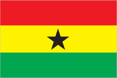 |
|---|---|
| Legal Name: | Republic of Ghana |
| Capital Value: | Accra |
| Official languages: | English |
| Demonym(s): | Ghanaian |
| Government: | Unitary presidential republic |
| Legislature: | Parliament |
| Total Area: | 238,533 km² |
| Land Area: | 227,533 km² |
| Water Area: | 11,000 km² |
| Population: | 30,417,856 |
| Density: | 101.5/km (262.9/sq mi) (103rd) |
| GDP: | $66.98 Billion |
| GDP Per Capita: | $2,202.12 |
| Currency Value: | Cedis (GHC) |
| Driving side: | right |
| Calling code: | +233 |
| Internet TLD: | .gh |
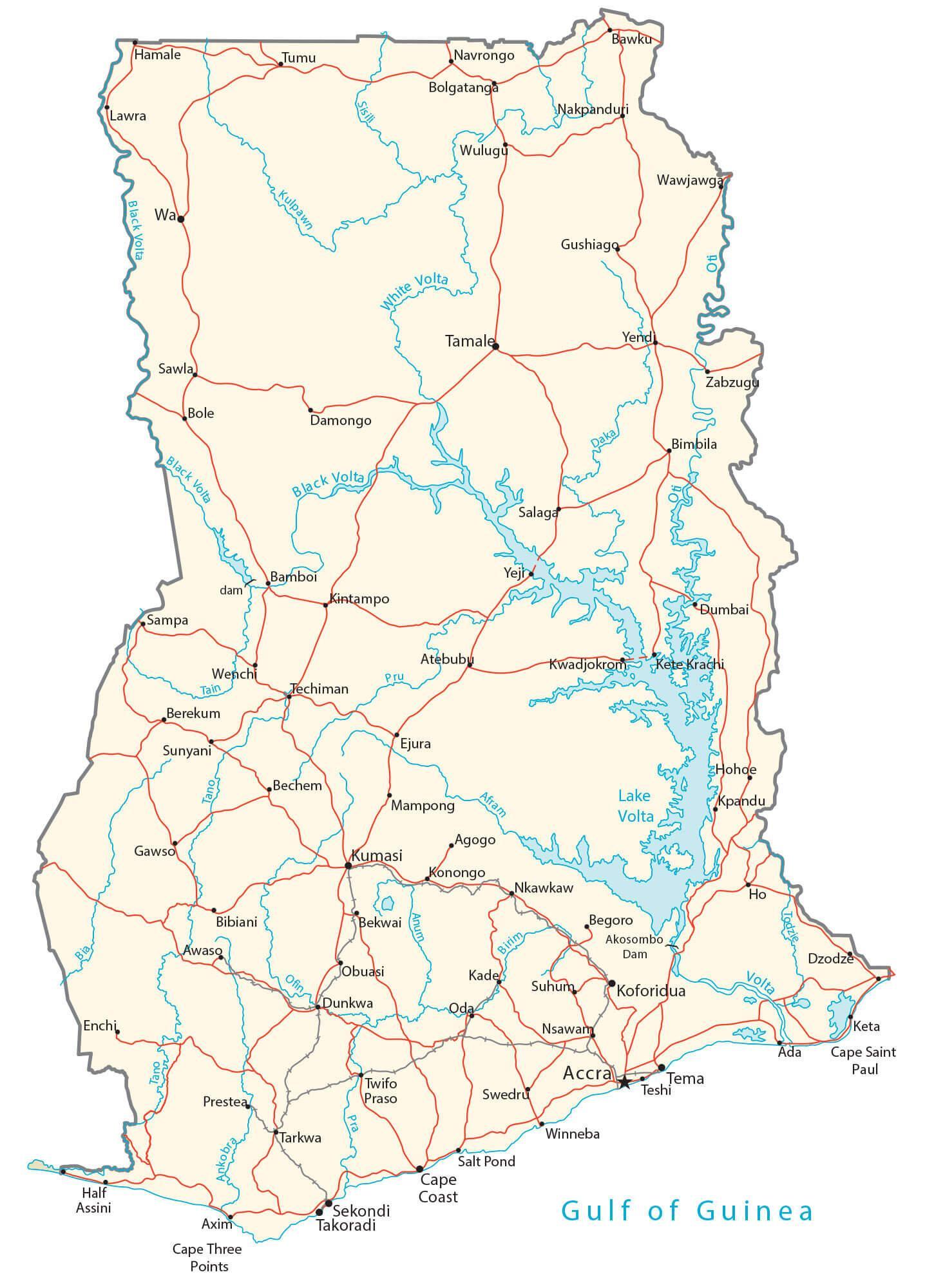
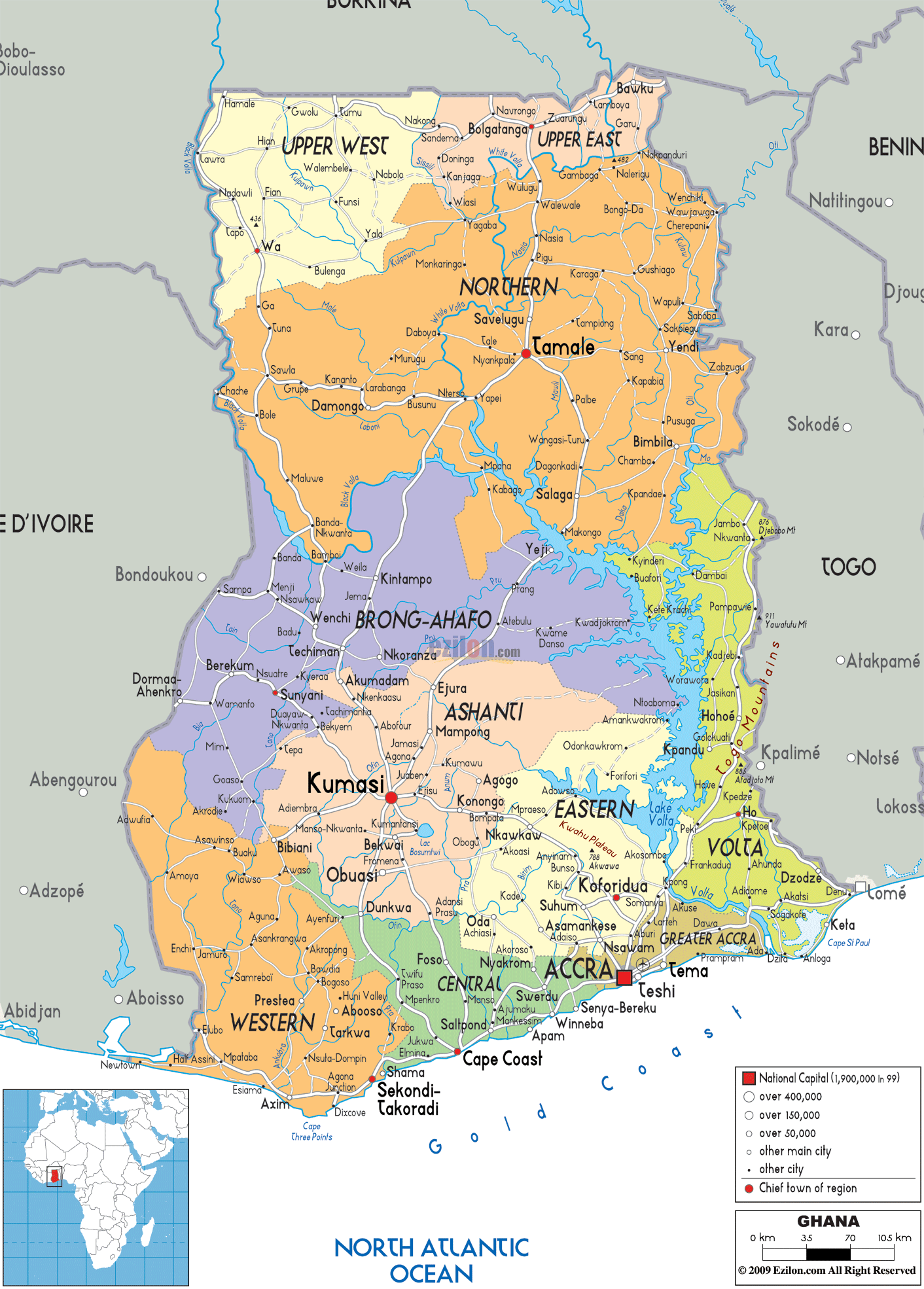
Explore Ghana with this interactive map! Discover major cities and towns, lakes, rivers, railroads, and highways, as well as satellite imagery and an elevation map to get a better understanding of the topography of the country. Get an up-close and personal look at Ghana with this detailed map!
Online Interactive Political Map
Click on ![]() to view map in "full screen" mode.
to view map in "full screen" mode.
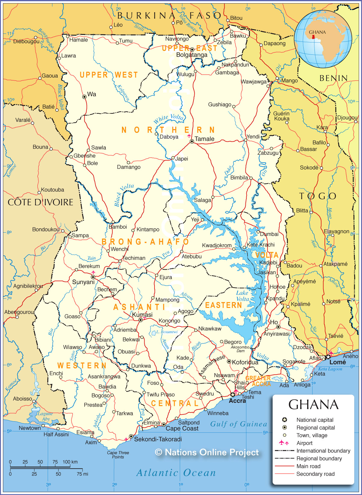
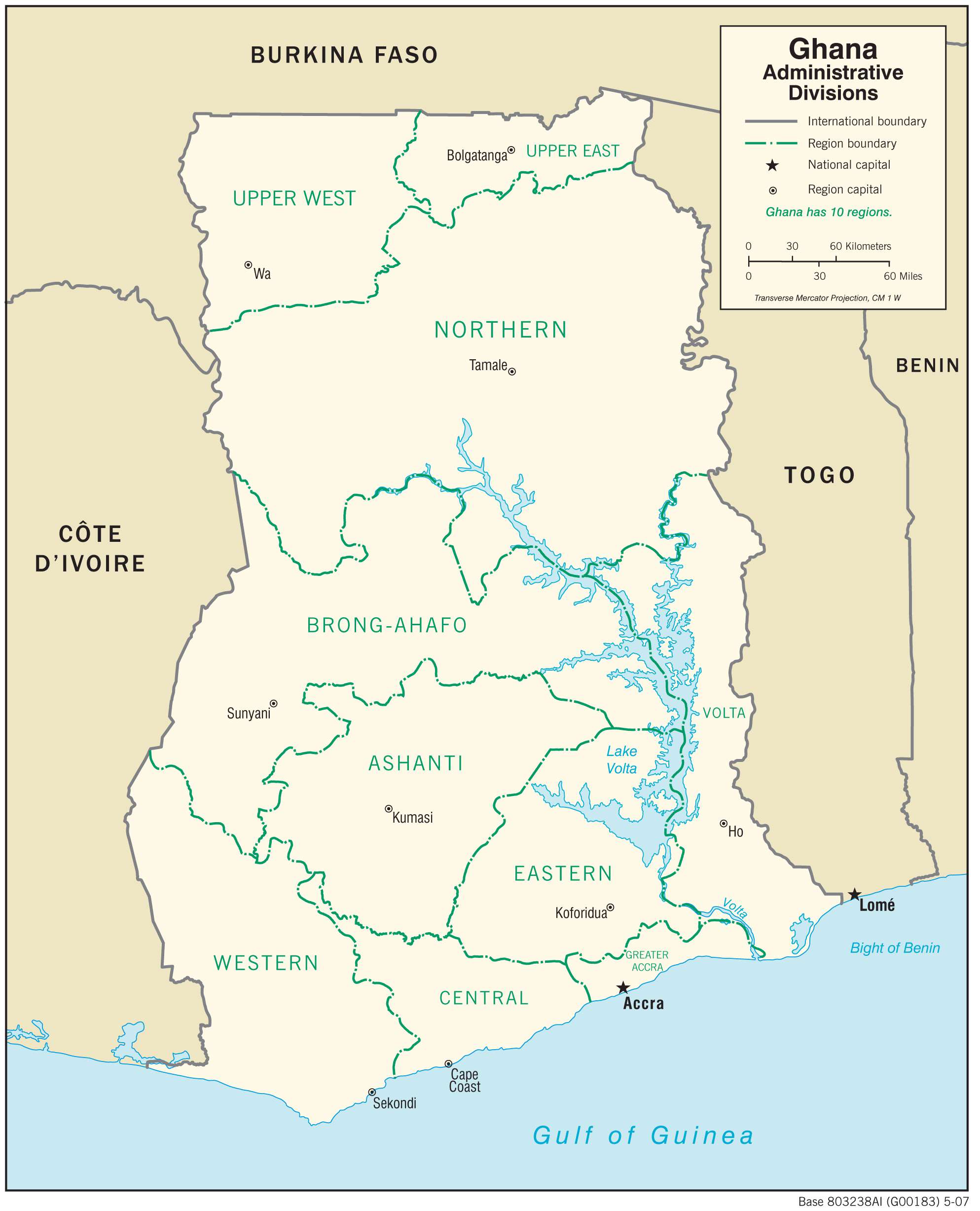
Ghana is divided into 16 regions that are further subdivided into 212 districts and then into councils and unit committees.
The 16 regions of Ghana are Ahafo, Ashanti, Bono, Bono East, Central, Eastern, Greater Accra, North East, Northern, Oti, Savannah, Upper East, Upper West, Volta, Western, and Western North.
The national capital of Accra is located in the Greater Accra Region.
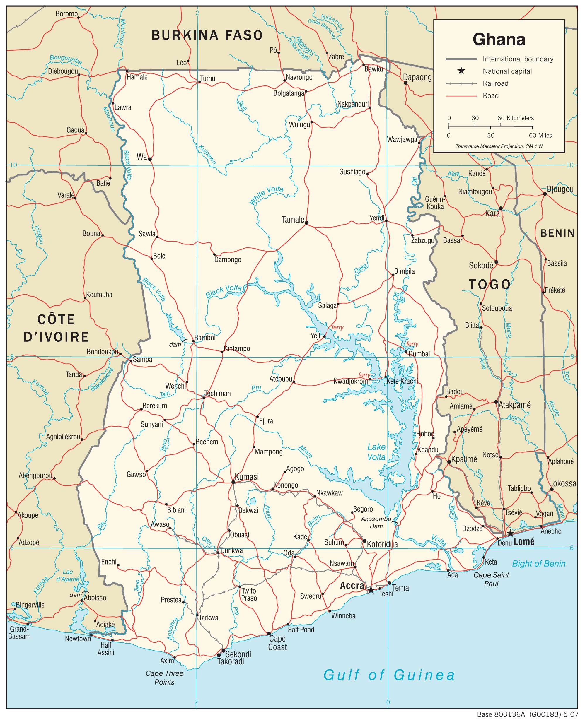
Location Maps
Where is Ghana?
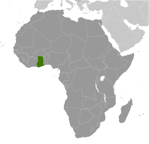
Ghana is located in Western Africa, along the Gulf of Guinea. It borders three African countries: Ivory Coast to the west, Burkina Faso to the north, and Togo to the east. It is considered one of the more stable African countries and is the largest producer of gold in Africa.
Accra is the capital and largest city in Ghana, with over 85% of people living in the Greater Accra Region. Other major cities in the country include Kumasi, Tamale, and Sekondi-Takoradi.
High Definition Political Map of Ghana
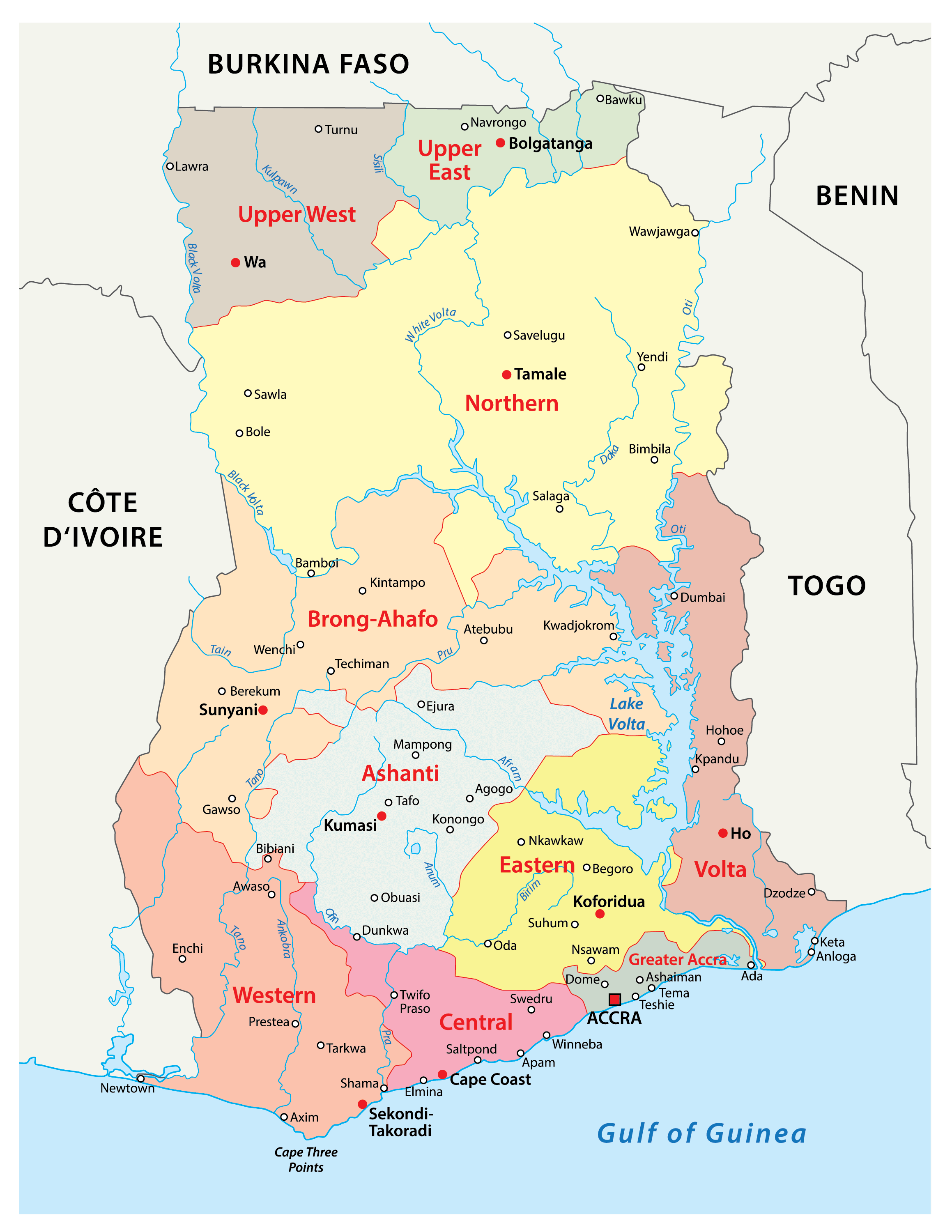
Ghana Administrative Map
History
Medieval kingdoms
Most of what is now Ghana was inhabited in the Middle Ages and the Age of Discovery by different ethnic groups. The earliest known kingdoms to emerge in modern Ghana were the Mole-Dagbani states. The Mole-Dagomba came on horseback from present-day Burkina Faso under a single leader, Naa Gbewaa. With their advanced weapons and based on a central authority, they easily invaded and occupied the lands of the local people ruled by the tendamba (land god priests), established themselves as the rulers over the locals, and made Gambaga their capital. The death of Naa Gbewaa caused seccession among his children, some of whom broke off and founded separate states including Mamprugu and Nanung. While Gbewaa was still alive, his daughter Yennenga travelled north and founded the Mossi Kingdoms, who constitute the majority of present day Burkina Faso. Other kingdoms that emerged from Dagbon include the Bouna Kingdom of Ivory Coast, and the Dagaaba states of the Upper West Region.
Although the area of present-day Ghana has experienced many population movements, the Akan-speaking peoples began to move into it toward the end of the 15th century. By the early 16th century, the Akans were firmly established in the Akan state called Bonoman, for which the Brong-Ahafo region was named. From the 17th century, Akans emerged from what is believed to have been the Bonoman area, to create several Akan states, mainly based on gold trading. These states included Bonoman (Brong-Ahafo region), Ashanti (Ashanti Region), Denkyira (Western North region), Mankessim Kingdom (Central region), and Akwamu (Eastern region). By the 19th century, the territory of the southern part of Ghana was included in the Kingdom of Ashanti, one of the influential states in sub-Saharan Africa prior to the onset of colonialism. The government of the Ashanti Empire operated first as a loose network and eventually as a centralised kingdom with an advanced, highly specialised bureaucracy centred in the capital city of Kumasi. Prior to Akan contact with Europeans, the Akan people created an advanced economy based on principally gold and gold bar commodities then traded with the states of Africa.
The Ga-Dangme and Ewe migrated westward from south-western Nigeria due to pressure from incessant tribal wars in Yoruba areas. The Ewe migrated from Oyo area with their Gbe-speaking kinsmen (Adja, Fon, Phera Gun)and in transition, settled in Ketou in Benin Republic, Tado in Togo and with Nortsie in Togo as their final dispersal point. Their dispersal from Nortsie was necessitated by the high handed rule of King Agorkorli (Agor Akorlie). The Ga- Dangme occupy the Greater Accra Region and parts of the Eastern Region, while the Ewe are found in the Volta Region as well as the neighbouring Togo, Benin Republic and Nigeria ( around Badagry area).
European contact and colonialism
Akan trade with European states began after contact with the Portuguese in the 15th century. Early European contact by the Portuguese people, who came to the Gold Coast region in the 15th century to trade and then established the Portuguese Gold Coast (Costa do Ouro), focused on the extensive availability of gold. The Portuguese built a trading lodge at a coastal settlement called Anomansah (the perpetual drink) which they renamed São Jorge da Mina. In 1481, King John II of Portugal commissioned Diogo de Azambuja to build the Elmina Castle, which was completed in three years. By 1598, the Dutch had joined the Portuguese in the gold trade, establishing the Dutch Gold Coast (Nederlandse Bezittingen ter Kuste van Guinea) and building forts at Fort Komenda and Kormantsi. In 1617, the Dutch captured the Elmina Castle from the Portuguese and Axim in 1642 (Fort St Anthony).
Other European traders had joined in gold trading by the mid-17th century, most notably the Swedes, establishing the Swedish Gold Coast (Svenska Guldkusten), and Denmark–Norway, establishing the Danish Gold Coast (Danske Guldkyst or Dansk Guinea). In addition to the gold trade, European traders participated in the Atlantic slave trade in this area. More than 30 forts and castles were built by the merchants. The Germans also established the Brandenburger Gold Coast or Groß Friedrichsburg). In 1874, Great Britain established control over some parts of the country, assigning these areas the status of the British Gold Coast. Many military engagements occurred between the British colonial powers and the various Akan nation-states. The Kingdom of Ashanti defeated the British a few times in the 100-year-long Anglo-Ashanti wars but eventually lost with the War of the Golden Stool in 1900.
Transition to independence
In 1947, the newly formed United Gold Coast Convention led by “The Big Six” called for “self-government within the shortest possible time” following the 1946 Gold Coast legislative election. Kwame Nkrumah, a Ghanaian nationalist who led Ghana from 1957 to 1966 as the country’s first prime minister and president, formed the Convention People’s Party in 1949 with the motto “self-government now”. The party initiated a “positive action” campaign involving non-violent protests, strikes and non-cooperation with the British authorities. Nkrumah was arrested and sentenced to one year imprisonment during this time. In the Gold Coast’s 1951 general election, he was elected to Parliament and was released from prison; he became prime minister in 1952 and began a policy of Africanization.
On 6 March 1957 at midnight, the Gold Coast, Ashanti, the Northern Territories, and British Togoland were unified as one single independent dominion within the British Commonwealth under the name Ghana. This was done under the Ghana Independence Act 1957. The current flag of Ghana, consisting of the colours red, gold, green, and a black star, dates back to this unification. It was designed by Theodosia Okoh; the red represents the blood that was shed towards independence; the gold represents the industrial minerals wealth of Ghana; the green symbolises the rich grasslands of Ghana, and the black star is the symbol of the Ghanaian people and African emancipation.
On 1 July 1960, following the Ghanaian constitutional referendum and Ghanaian presidential election, Nkrumah declared Ghana a republic and assumed the presidency. 6 March is the nation’s Independence Day, and 1 July is celebrated as Republic Day. At the time of independence Nkrumah declared, “My first objective is to abolish from Ghana poverty, ignorance, and disease. We shall measure our progress by the improvement in the health of our people; by the number of children in school, and by the quality of their education; by the availability of water and electricity in our towns and villages; and by the happiness which our people take in being able to manage their own affairs. The welfare of our people is our chief pride, and it is by this that my government will ask to be judged.”.
Nkrumah led an authoritarian regime in Ghana, as he repressed political opposition and conducted elections that were not free and fair. In 1964, a constitutional amendment made Ghana a one-party state, with Nkrumah as president for life of both the nation and its party.
Nkrumah was the first African head of state to promote the concept of Pan-Africanism, which he had been introduced to during his studies at Lincoln University, Pennsylvania in the United States, at the time when Marcus Garvey was popular for his “Back to Africa Movement”. Nkrumah merged the teachings of Garvey, Martin Luther King Jr. and the naturalised Ghanaian scholar W. E. B. Du Bois into the formation of 1960s Ghana. Osagyefo Dr. Kwame Nkrumah, as he became known, played an instrumental part in the founding of the Non-Aligned Movement, and in establishing the Kwame Nkrumah Ideological Institute to teach his ideologies of communism and socialism. His life achievements were recognised by Ghanaians during his centenary birthday celebration, and the day was instituted as a public holiday in Ghana (Founders’ Day).
Operation Cold Chop and aftermath
The government of Nkrumah was subsequently overthrown by a coup by the Ghana Armed Forces codenamed “Operation Cold Chop”. This occurred while Nkrumah was abroad with Zhou Enlai in the People’s Republic of China, on a fruitless mission to Hanoi in Vietnam to help end the Vietnam War. The coup took place on 24 February 1966, led by Colonel Emmanuel Kwasi Kotoka and Brigadier Akwasi Afrifa. The National Liberation Council was formed, chaired by Lieutenant General Joseph A. Ankrah.
A series of alternating military and civilian governments, often affected by economic instabilities, ruled Ghana from 1966 to 1981, ending with the ascension to power of Flight Lieutenant Jerry John Rawlings of the Provisional National Defence Council in 1981. These changes resulted in the suspension of the Constitution of Ghana in 1981 and the banning of political parties. The economy soon declined, so Rawlings negotiated a structural adjustment plan, changing many old economic policies, and economic growth recovered during the mid-1980s. A new constitution restoring multi-party system politics was promulgated in the presidential election of 1992; Rawlings was elected as president of Ghana then, and again in the general election of 1996.
At least 1,000 and as many as 2,000 people were killed during the conflict between the Konkomba and other ethnic groups such as the Nanumba, Dagomba and Gonja, while 150,000 people were displaced as part of the tribal war in Northern Ghana in 1994.
21st century
Winning the 2000 general election, John Kufuor of the New Patriotic Party was sworn into office as president of Ghana on 7 January 2001 and attained the presidency again in the 2004 election, thus also serving two terms (the term limit) as president of Ghana and thus marking the first time under the fourth republic that power was transferred from one legitimately elected head of state and head of government to another.
Nana Akufo-Addo, the ruling party candidate, was defeated in a very close election by John Atta Mills of the National Democratic Congress following the 2008 general election. Mills died of natural causes and was succeeded by Vice President John Mahama on 24 July 2012. Following the 2012 general election, Mahama became president, and Ghana was a stable democracy. As a result of the 2016 general election, Nana Akufo-Addo became president on 7 January 2017. He was re-elected after a tightly contested election in 2020.
On 11 June 2021, Ghana inaugurated Green Ghana Day in an aim of planting 5 million trees in a concentrating effort to preserve the country’s cover of rainforest to combat deforestation.
Physical Map of Ghana
Geography
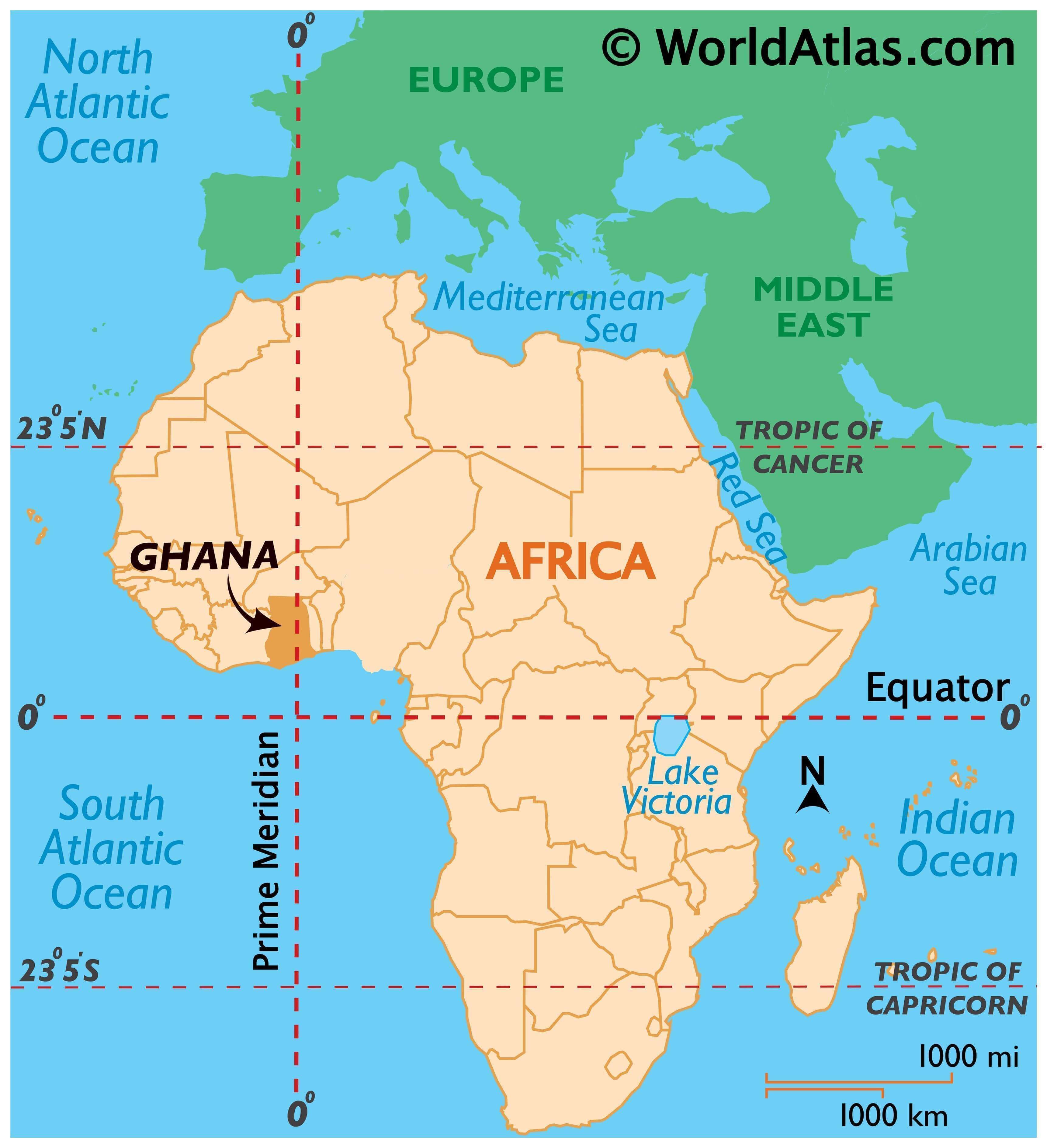
Ghana is located on the Gulf of Guinea, only a few degrees north of the Equator, therefore giving it a warm climate. Ghana spans an area of 238,535 km (92,099 sq mi) and has an Atlantic coastline that stretches 560 kilometres (350 miles) on the Gulf of Guinea in the Atlantic Ocean to its south. Dodi Island and Bobowasi Island are near the south coast. It lies between latitudes 4°45’N and 11°N, and longitudes 1°15’E and 3°15’W. The prime meridian passes through Ghana, specifically through Tema. Ghana is geographically closer to the “centre” of the Earth than any other country, since the notional centre, (0°, 0°) is located in the Atlantic Ocean approximately 614 km (382 mi) off the south-east coast of Ghana.
Grasslands mixed with south coastal shrublands and forests dominate Ghana, with forest extending northward from the coast 320 kilometres (200 miles) and eastward for a maximum of about 270 kilometres (170 miles) with several locations for mining of industrial minerals and timber. Ghana is home to five terrestrial ecoregions: Eastern Guinean forests, Guinean forest–savanna mosaic, West Sudanian savanna, Central African mangroves, and Guinean mangroves. It had a 2018 Forest Landscape Integrity Index mean score of 4.53/10, ranking it 112th globally out of 172 countries.
The White Volta River and its tributary Black Volta, flow south through Ghana to Lake Volta, the world’s third-largest reservoir by volume and largest by surface area, formed by the hydroelectric Akosombo Dam, completed in 1965. The Volta flows out of Lake Volta into the Gulf of Guinea. The northernmost part of Ghana is Pulmakong and the southernmost part of Ghana is Cape Three Points.
Volta Region: Longest mountain range in Ghana-Akwapim Togo ranges
Mt Afadja- highest mountain in Ghana
Wli waterfall- the highest waterfall in Ghana
Amedzofe- Mt Gemi- waterfall and canopy walk.
Golden sandy beaches stretching from Anyanui to Aflao
Aflao: the eastern gateway to Ghana and bordering Lome, the Togolese capital
Keta- Fort Prizenstein, the former Danish slave trading post. Site of proposed Keta Port. The town with the most promising and expanding tourism potential in Ghana
Climate
The climate of Ghana is tropical, and there are two main seasons: the wet season and the dry season. Ghana sits at the intersection of three hydro-climatic zones. Changes in rainfall, weather conditions and sea-level rise affect the salinity of coastal waters. This is expected to negatively affect both farming and fisheries. The national economy stands to suffer from the impacts of climate change because of its dependence on climate-sensitive sectors such as agriculture, energy, and forestry. Moreover, access to fresh water is expected to become more challenging, and reduced water supply will have a negative impact on hydropower, which provides 54% of the country’s electricity capacity. Additionally, Ghana will probably see more cases of malaria and cholera, since both are impacted by changes in water conditions.
In 2015, the government produced a document titled “Ghana’s Intended Nationally Determined Contribution.” Following that, Ghana signed the Paris Climate Agreement in 2016.
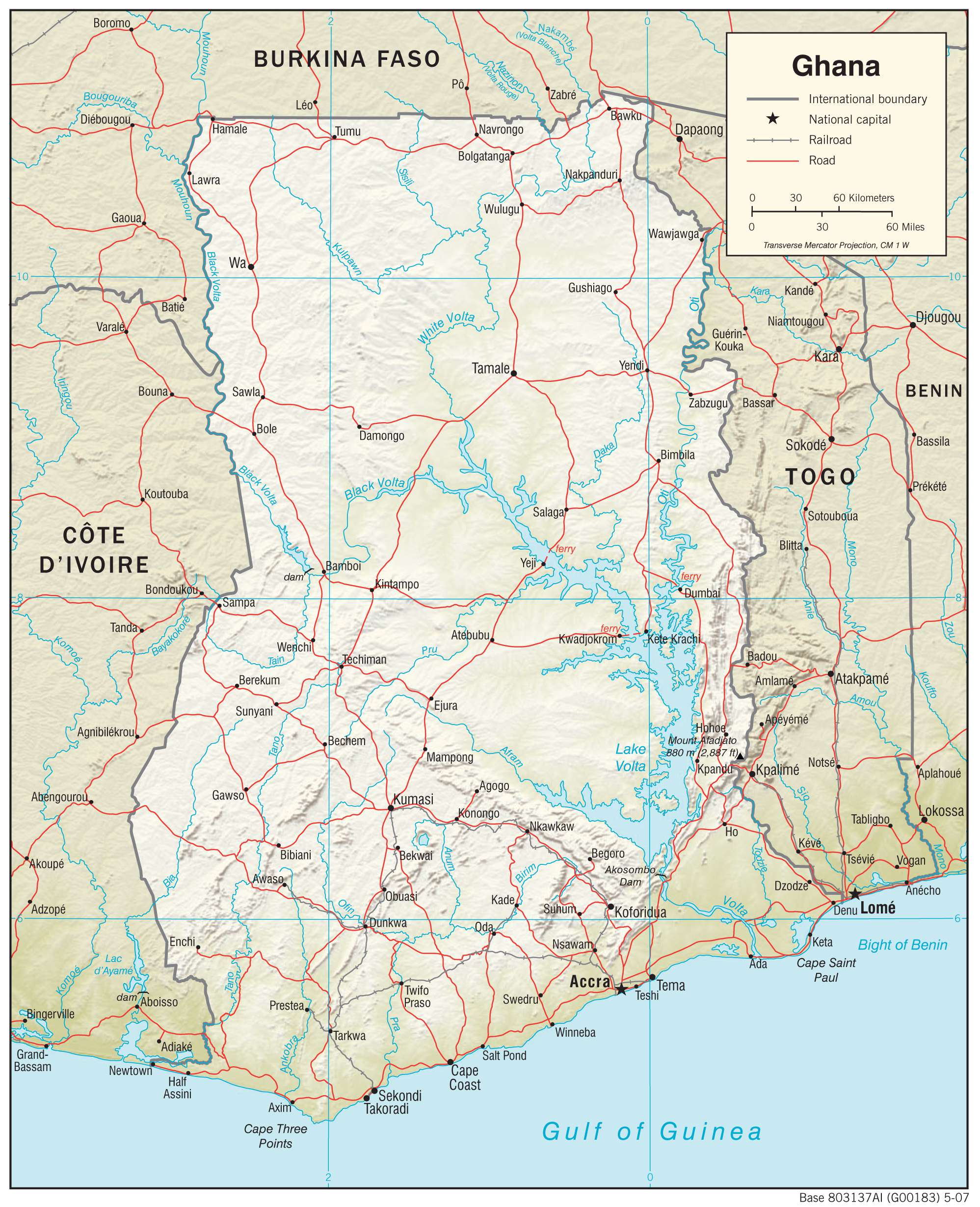
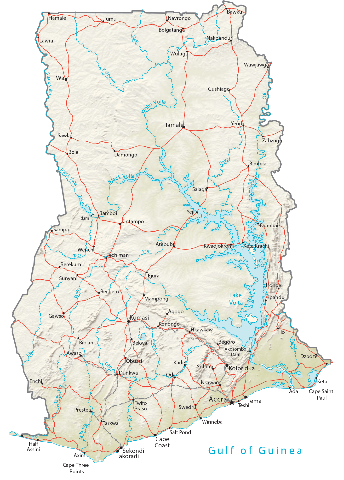
Transportation Map of Ghana
Ghana Satellite Map